
Dangerous and extreme heat will remain across portions of the southern U.S. this week. Heavy rainfall may bring significant flash flooding across portions of the Mid-Atlantic and Northeast through the night, and additional flash flooding concerns across New England on Wednesday. Monsoonal thunderstorms will bring a flash flood risk to the Four Corners region, especially in burn scar areas Read More >
| Hurricane Laura | ||
| August 20-29, 2020 | ||
|
|
||
| Wind and Pressure Reports | ||||
| Wind and Pressure Table (Ranked by Maximum Wind Gust) | ||||
| Wind and Pressure Table (Ranked by Lowest Pressure) | ||||
| Estimated 3-second wind speed gusts (MPH) at 10 meter (~33 feet) above ground | ||||
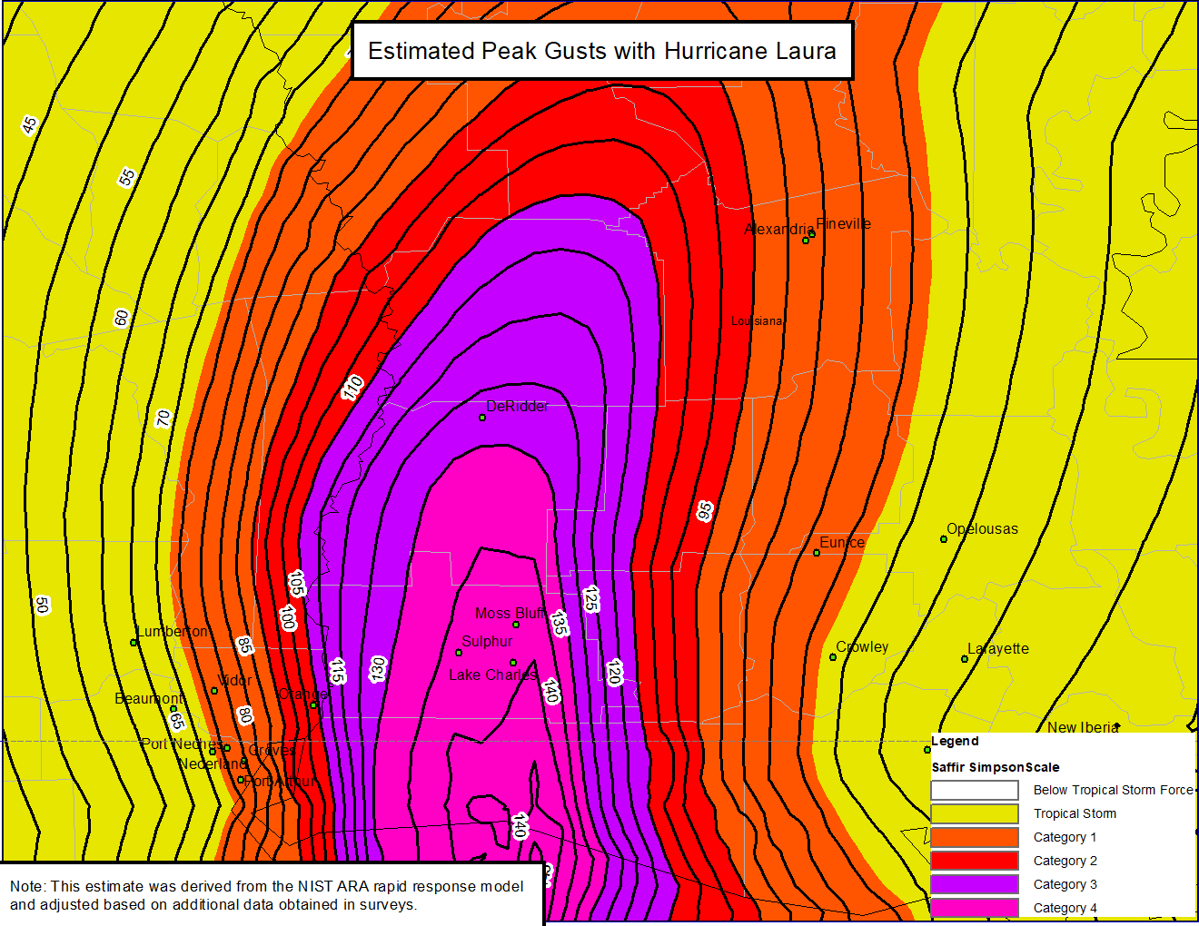 5 MPH Contour |
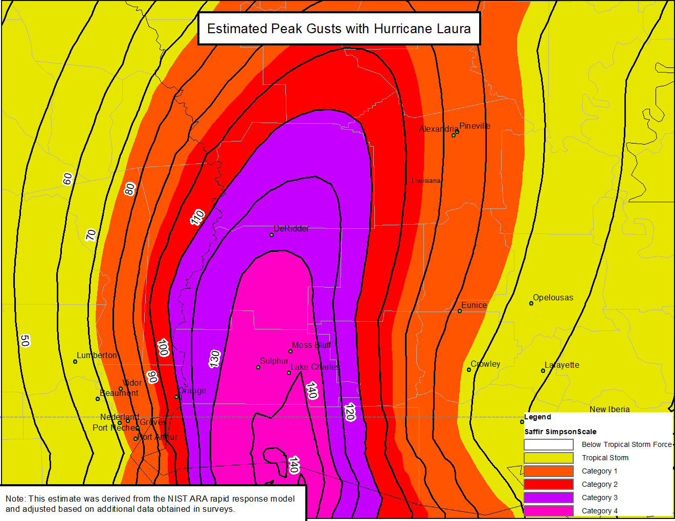 10 MPH Contour |
|||
| StEER, Reconnaissance, Hurricane, Hurricane Laura, Damage Assessment | ||||
|
ASOS & AWOS METAR Observations for August 26-27, 2020 |
||||
| *Abbeville, LA (KIYA) | *August 26 | *August 27 | ||
| *Alexandria Esler Field, LA (KESF) | August 26 | *August 27 | ||
| Alexandria, LA (KAEX) | August 26 | August 27 | ||
| *De Quincy, LA (K5R8) | August 26 | *August 27 | ||
| De Ridder, LA (KDRI) | August 26 | August 27 | ||
| *Fort Polk Fullerton, LA (KBKB) | August 26 | *August 27 | ||
| Fort Polk, LA (KPOE) | August 26 | August 27 | ||
| Jennings, LA (K3R7) | August 26 | August 27 | ||
| Lafayette, LA (KLFT) | August 26 | August 27 | ||
| *Lake Charles Chennault, LA (KCWF) | August 26 | *August 27 | ||
| *Lake Charles Regional Airport, LA (KLCH) | August 26 | *August 27 | ||
| New Iberia, LA (KARA) | August 26 | August 27 | ||
| *Oakdale, LA (KACP) | August 26 | *August 27 | ||
| Opelousas, LA (KOPL) | August 26 | August 27 | ||
| Patterson, LA (KPTN) | August 26 | August 27 | ||
| *Salt Point, LA (KP92) | August 26 | *August 27 | ||
| *Carlyss, LA (KUXL) | *August 26 | *August 27 | ||
| Beaumont Southeast Regional Airport, TX (KBPT) | August 26 | August 27 | ||
| Beaumont, TX (KBMT) | August 26 | August 27 | ||
| *Jasper, TX (KJAS) | August 26 | *August 27 | ||
| *Orange, TX (KORG) | August 26 | *August 27 | ||
| South Marsh 268 Oil Platform, LA (KSCF) | August 26 | August 27 | ||
| Eugene Island Oil Platform, LA (KEIR) | August 26 | August 27 | ||
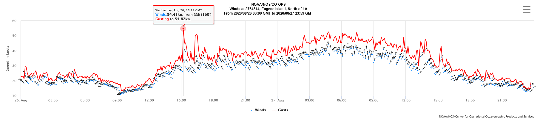
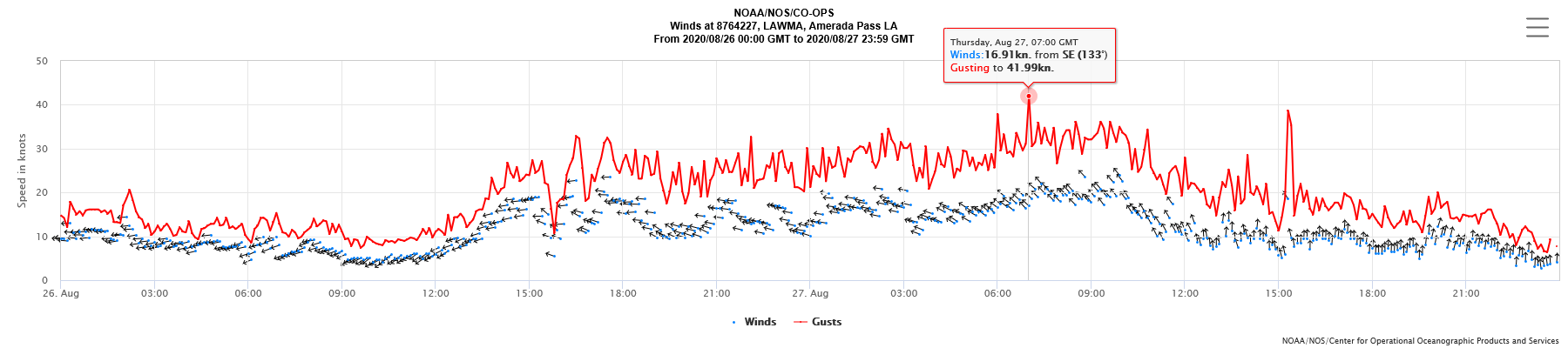
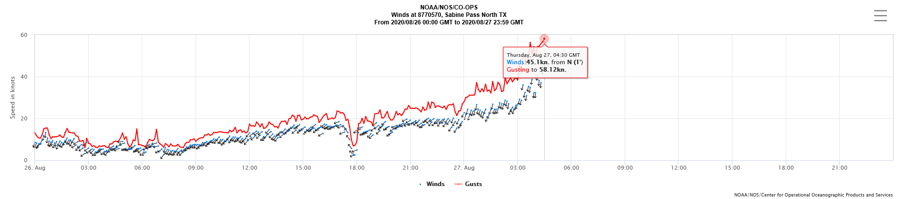
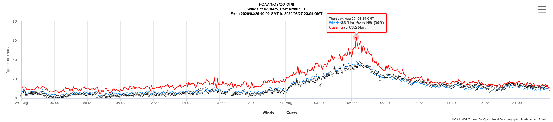
| NOS Wind Graphs | ||||
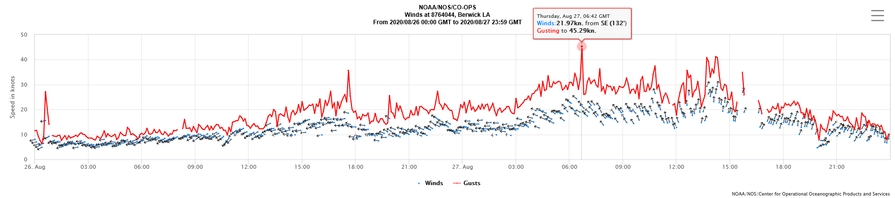
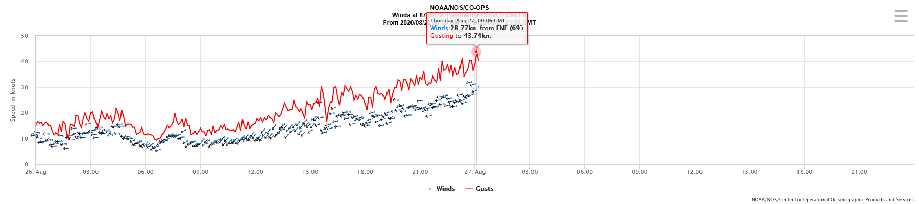
| Eugene Island, LA | Amerada Pass, LA | Berwick, LA | Freshwater Canal Locks, LA (I) | |
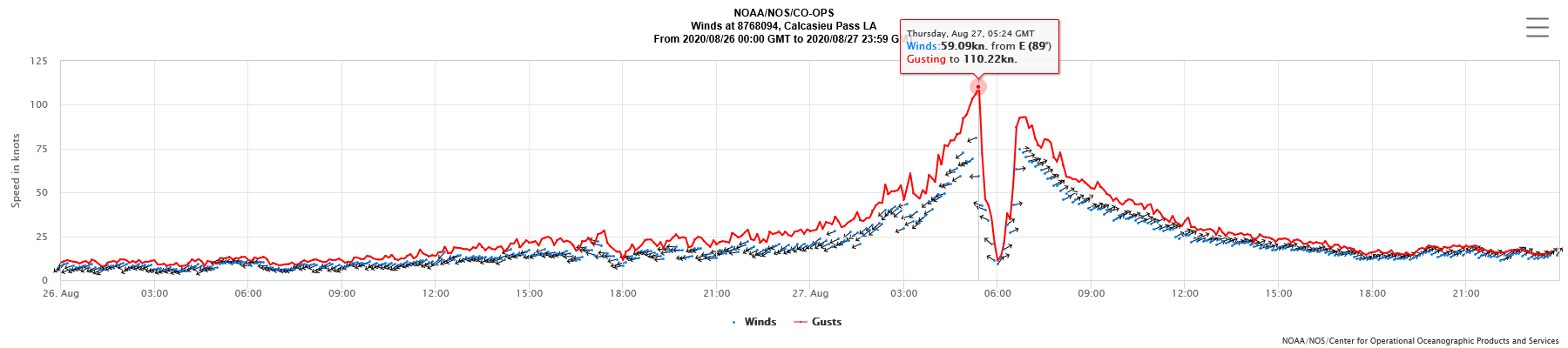
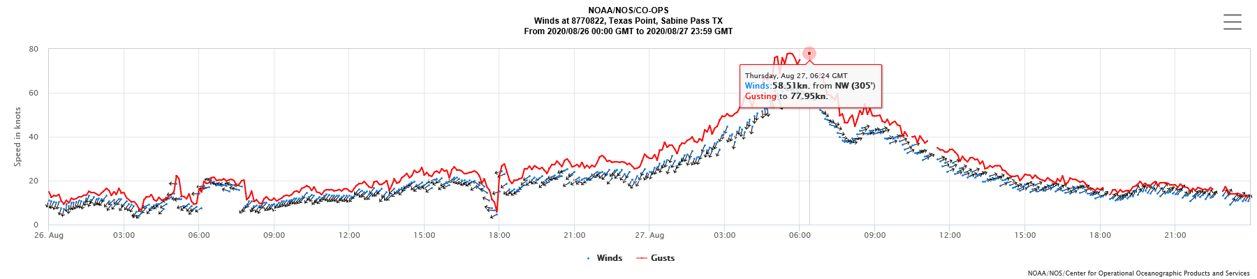
| Calcasieu Pass, LA | Texas Point, Sabine Pass, TX | Sabine Pass North, TX (I) | Port Arthur, TX | |
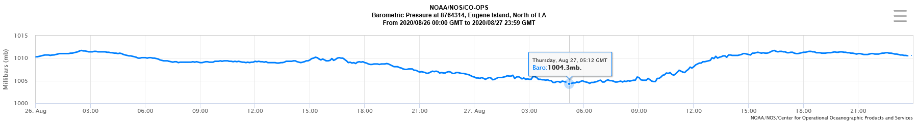
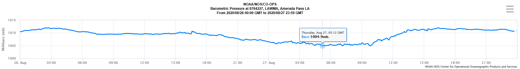
| NOS Pressure Graphs | ||||
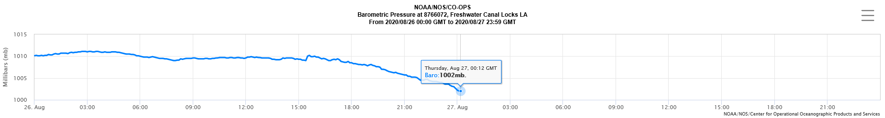
| Eugene Island, LA | Amerada Pass, LA | Berwick, LA (M) | Freshwater Canal Locks, LA (I) | |
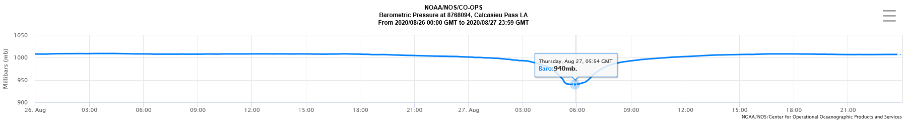
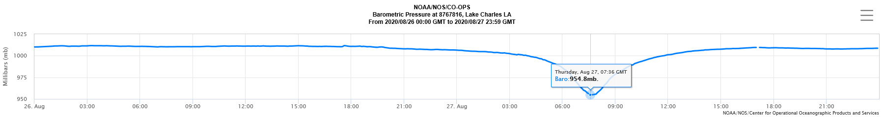
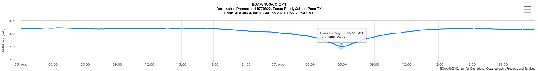
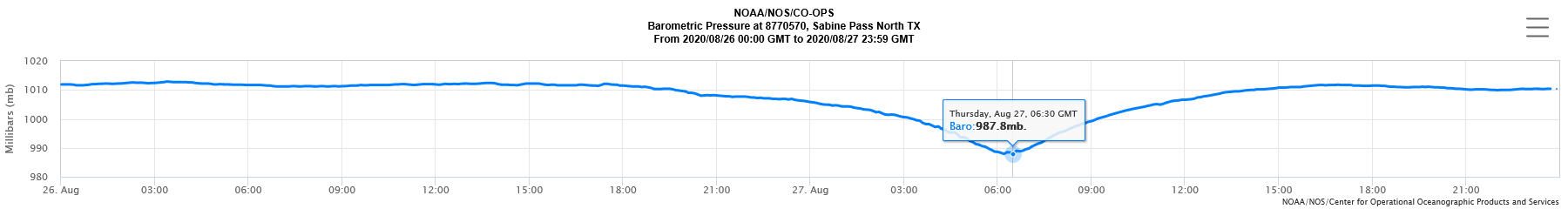
| Calcasieu Pass, LA | Lake Charles, LA | Texas Point, Sabine Pass, TX | Sabine Pass North, TX | |
M = Missing Data
I = Incomplete Data

