|

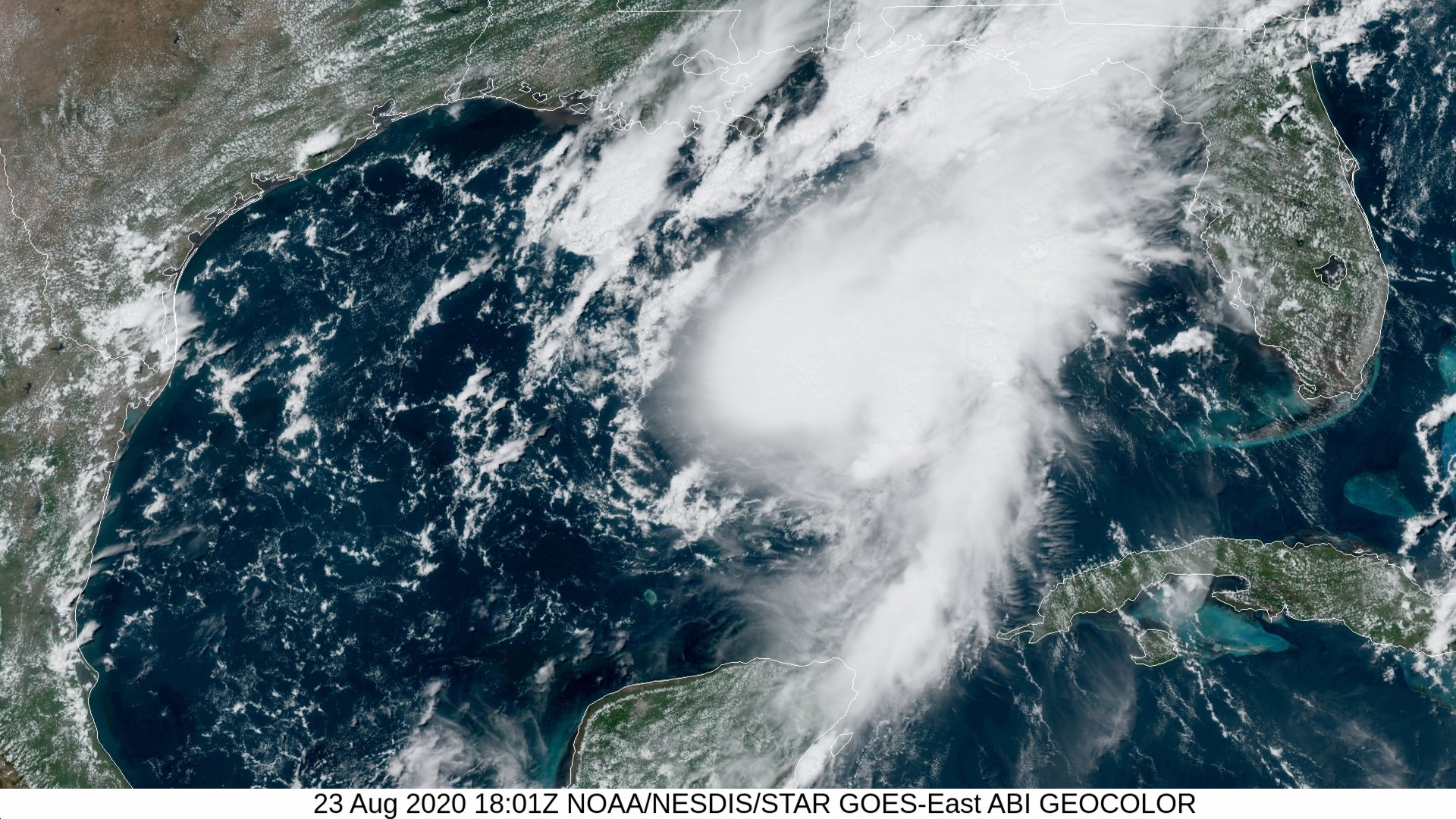
Above: GOES 16 GeoColor Satellite Image of Hurricane Marco across the Central Gulf at 1:01 PM CDT on August 23, 2020.
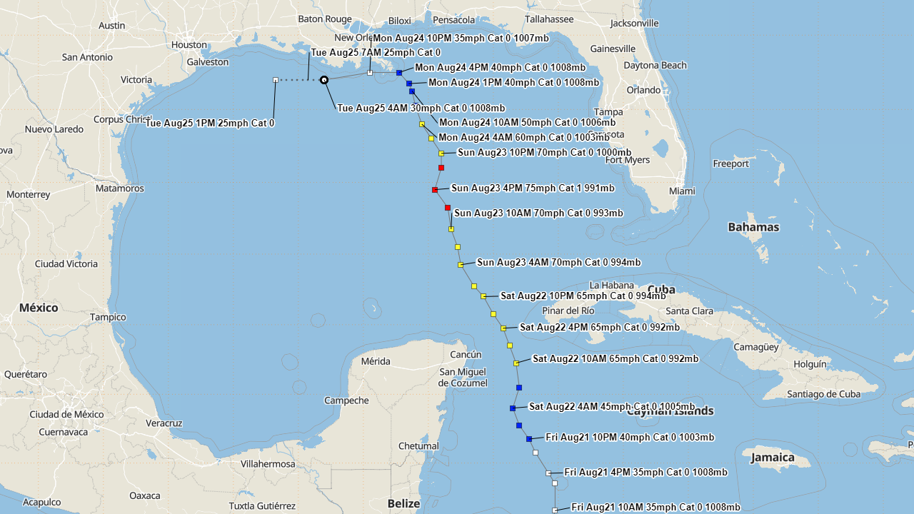
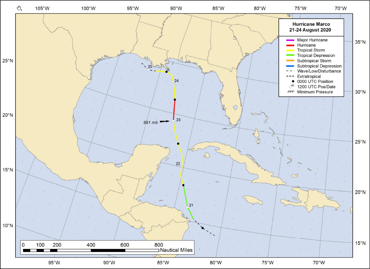
Marco developed from a fast-moving tropical south of Jamaica on the morning of August 20th, and was upgraded to a tropical storm during the evening of August 21st. Marco continued to move north northwestward and briefly intensified into a minimum hurricane on August 23rd. Marco quickly weakened later that evening due to increased wind shear.
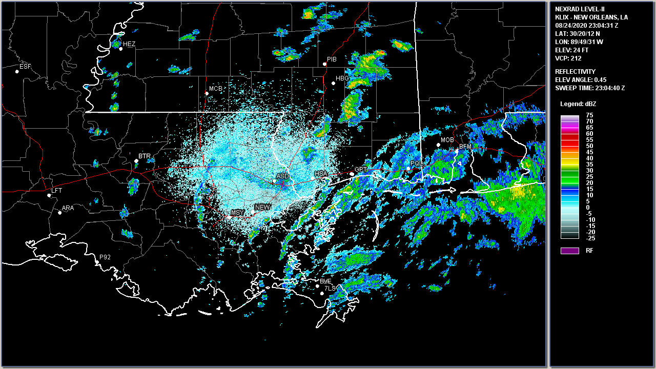
As Marco turned westward, it passed just south of the mouth of the Mississippi River around 6 PM CDT August 24th as a weak tropical storm. Marco weakened to a remnant low early on August 25th south of Morgan City, LA.
Scattered showers across Southern Louisiana and Southeast Texas, along with much higher humidity, resulted as the remnant low of Marco passed south of the Louisiana coast on August 25th, with no other storm effects noted.

Above: New Orleans, LA WSR-88D radar image of Tropical Storm Marco Landfall at 2304 UTC (6:04 PM CDT) on August 24, 2020.

Above: Hurrevac track of Hurricane Marco from operational National Hurricane Center public advisories.

Above: National Hurricane Center best track of Hurricane Marco.
Listed below are post-storm reports and meteorological data gathered. All data is considered preliminary, and is subject to change at any time. Additional information will continue to be added to this page in the future.
Webpage design by: Donovan Landreneau
Content by: NWS Lake Charles staff, other sources as noted above.
|