|
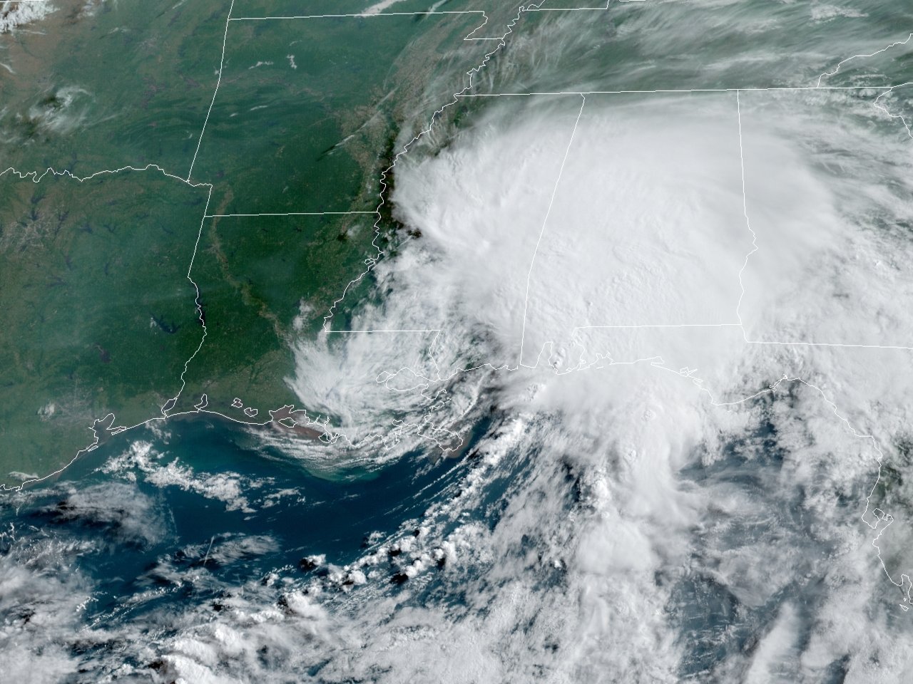
Above: GOES 16 GeoColor Satellite Image of Tropical Storm Claudette at 1301 UTC (8:01 AM CDT) on June 19, 2021.
On June 11th, the National Hurricane Center began monitoring a tropical disturbance in the Bay of Campeche. For the next several days, it meandered, gradually forming a broad and elongated area of low pressure. By 4 PM CDT on June 17th, the National Hurricane Center started issuing advisories on Potential Tropical Cyclone Three. The disturbance produced tropical storm force winds, but was not named yet since it lacked a defined low level circulation. By 7 PM CDT June 18th, the National Hurricane Center post storm analysis revealed enough of a closed circulation to be designated a tropical storm. Tropical Storm Claudette made landfall a few hours later across Terrebonne Parish, Louisiana at 11:30 PM CDT.
Claudette continued northeast across Southeast Louisiana and Southern Mississippi before weakening to a tropical depression upon entering Alabama by the evening of June 19th. Tropical Depression Claudette continued east northeast across the remainder of Alabama, Georgia, South Carolina through June 20th. Claudette began strengthening across it passage through North Carolina, and strengthened back to a tropical storm across Eastern North Carolina early on June 21st, a rather rare occurrence after being inland for a few days. Claudette exited the North Carolina and Virginia coastal waters later that morning, heading out to sea.
All of the effects of Claudette were felt east of the Atchafalaya River across Southeastern Louisiana, Mississippi, Alabama, Georgia and the Carolinas. No reports of tropical storm force winds, coastal flooding, or even significant rainfall were reported across South Central Louisiana or adjacent coastal waters.
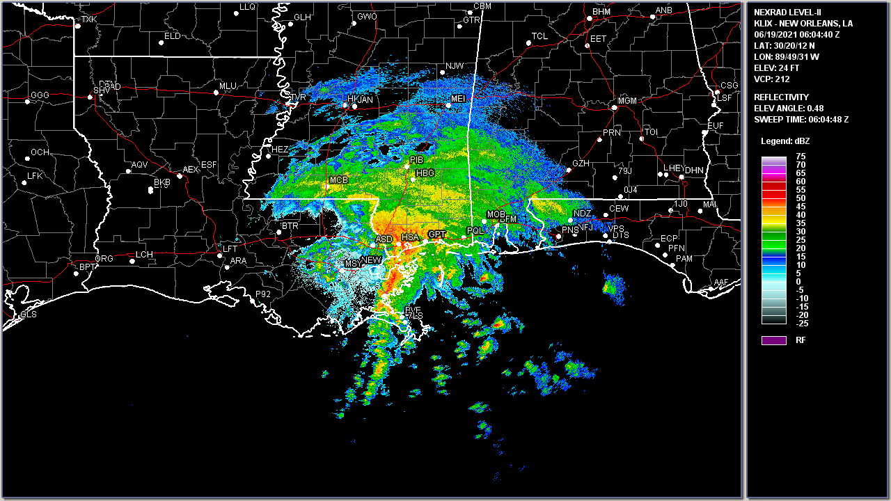
Above: New Orleans, LA WSR-88D radar image of Tropical Storm Claudette inland at 1:04 AM CDT on June 19, 2021.
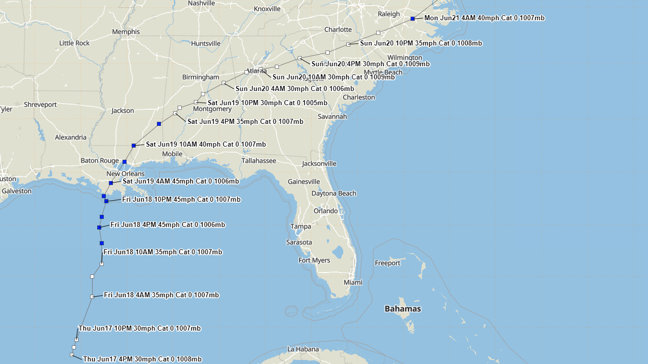
Above: Hurrevac track of Tropical Storm Claudette from operational National Hurricane Center public advisories.
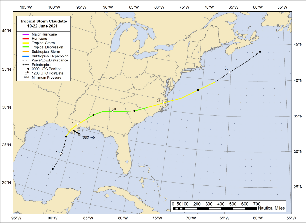
Above: National Hurricane Center best track of Tropical Storm Claudette.
Listed below are post-storm reports and meteorological data gathered. All data is considered preliminary, and is subject to change at any time. Additional information will continue to be added to this page in the future.
Webpage design by: Donovan Landreneau
Content by: NWS Lake Charles staff, other sources as noted above.
|


