
Dangerous and extreme heat will remain across portions of the southern U.S. this week. Heavy rainfall may bring significant flash flooding across portions of the Mid-Atlantic and Northeast through the night, and additional flash flooding concerns across New England on Wednesday. Monsoonal thunderstorms will bring a flash flood risk to the Four Corners region, especially in burn scar areas Read More >
Lake Charles, LA
Weather Forecast Office
February 6th and 11-12th Ice and Snow
Minor snow accumulations of around half an inch or less occurred from Northern Jasper and Newton Counties to across Central Louisiana during the morning of February 6th. Temperatures warmed during the afternoon melting the snow, however some minor road closures still occurred. This was the 3rd time wintery precipitation accumulated in the area during the 2013-2014 winter.
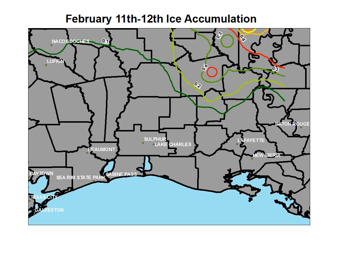
While small hail and rain occurred across far South Louisiana freezing rain was accumulating in Central Louisiana. Numerous power outages occurred in Rapides and Avoyelles Parishes where one quarter to just less than half an inch of ice occurred from February 11th into the 12th. This was the 4th winter weather event in the area of the 2013-2014 winter season.
Forecasts
Wet Bulb Globe Temps
Aviation Weather
Activity Planner
Mardi Gras Decision Support
Marine Forecasts
Local Products
Model Data
Forecaster's Discussion
Fire Weather
Graphical Forecasts
Other Links
National Hurricane Ctr
Storm Prediction Ctr
Weather Prediction Ctr
Other Links
Office History
LCH StoryMap
Hazards
Severe Weather
Tropical Weather
National Outlooks
Local Storm Reports
Tropical Cyclone Reports
Current
Satellite Data
Observations
Tide Data
Hydrology
Calcasieu Par. Network
Jefferson Co. DD6 Network
River/Lake Forecasts
Radar
Shreveport (SHV)
New Orleans (LIX)
Fort Polk (POE)
Houston/Galveston (HGX)
Lake Charles (LCH)
Probabilistic Pages
Probabilistic Snowfall
Probabilistic Rainfall
Probabilistic DSS
US Dept of Commerce
National Oceanic and Atmospheric Administration
National Weather Service
Lake Charles, LA
500 Airport Boulevard
Lake Charles, LA 70607
(337) 477-5285 M-F 8a to 4p only
Comments? Questions? Please Contact Us.

