
Dangerous and extreme heat will remain across portions of the Central U.S. this week, persisting across the Mid to Lower Mississippi Valleys, Gulf Coast, Southern Plains and portions of Texas. A heat wave over the Southwest will intensify late this week. Severe thunderstorms and flash flooding will spread from the Great Lakes/Ohio Valley to the Mid-Atlantic and Northeast the next few days. Read More >
Lake Charles, LA
Weather Forecast Office
|
FEBRUARY 21 2008 SEVERE WEATHER |
| Overview |
| A very busy month for severe weather continued across Southeast Texas and Southwest Louisiana as severe thunderstorms impacted the region again on February 21st. One long-track supercell developed near Sabine Pass, TX and moved northeastward across Cameron, Calcasieu, Jeff Davis, Allen, Evangeline, St. Landry, and Avoyelles Parishes for several hours. 4 tornadoes, several funnel clouds, large hail, and flooding were all produced by this single thunderstorm. Other severe thunderstorms dropped large hail and brought damaging winds to parts of the area as well. |
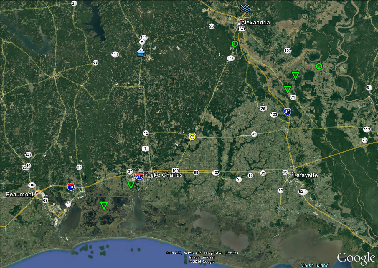
| Google Map Legend | |||||
|
Tornadoes |
EF0 |
EF1 |
EF2 |
||
|
Hail |
<1" |
1"+ |
2"+ |
3"+ |
4"+ |
| T'storm Wind |
|
||||
Forecasts
Aviation Weather
Activity Planner
Mardi Gras Decision Support
Marine Forecasts
Local Products
Model Data
Forecaster's Discussion
Fire Weather
Graphical Forecasts
Wet Bulb Globe Temps
Other Links
National Hurricane Ctr
Storm Prediction Ctr
Weather Prediction Ctr
Other Links
Office History
LCH StoryMap
Hazards
Severe Weather
Tropical Weather
National Outlooks
Local Storm Reports
Tropical Cyclone Reports
Current
Observations
Tide Data
Satellite Data
Hydrology
Calcasieu Par. Network
Jefferson Co. DD6 Network
River/Lake Forecasts
Radar
Shreveport (SHV)
New Orleans (LIX)
Fort Polk (POE)
Houston/Galveston (HGX)
Lake Charles (LCH)
Probabilistic Pages
Probabilistic Snowfall
Probabilistic Rainfall
Probabilistic DSS
US Dept of Commerce
National Oceanic and Atmospheric Administration
National Weather Service
Lake Charles, LA
500 Airport Boulevard
Lake Charles, LA 70607
(337) 477-5285 M-F 8a to 4p only
Comments? Questions? Please Contact Us.

