Flash flooding threatens areas from the Tennessee Valley to the Carolinas as storms repeat along a stalled front. Monsoonal storms may trigger flooding in the Southwest. Dangerous heat expands across the Desert Southwest, Plains, mid-Mississippi Valley and Southern Tier. Critical fire weather for interior Pacific Northwest. Cooler, drier air brings brief relief to the Great Lakes and Northeast. Read More >
|
MARCH 2 1999 TORNADO OUTBREAK |
|
research by Robert B. Darby, forecaster & Roger Erickson, Warning Coordination Meteorologist |
| Map of all tornadoes in the outbreak |
 |
| Local Storm Reports |
OVERVIEW
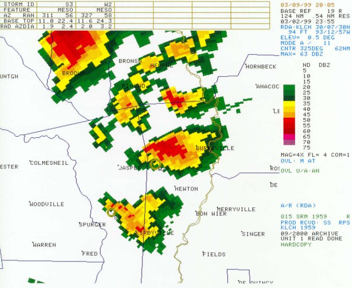
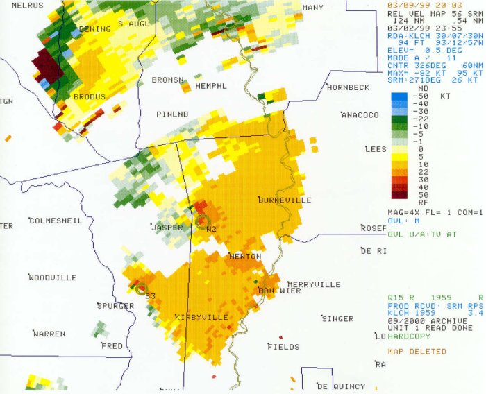
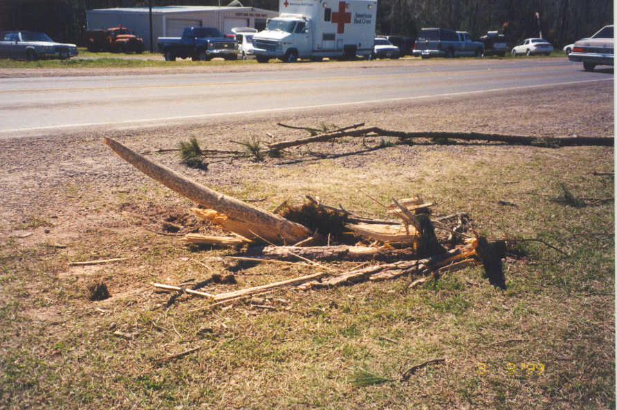
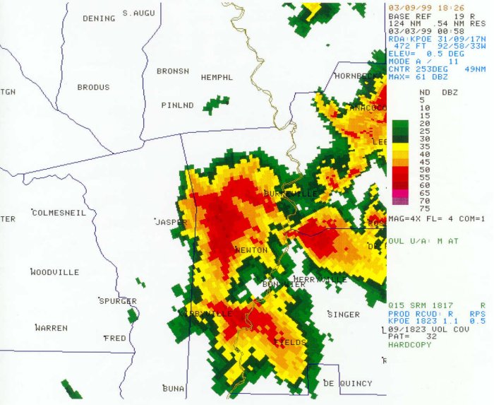
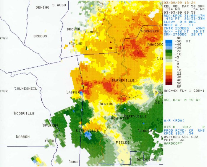
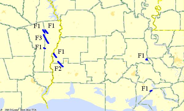
On March 2, 1999, eight tornadoes touched down during the evening hours over Southeast Texas and Southern Louisiana. The strongest tornado occurred in the small community of Holly Springs, Texas in Jasper County. This tornado was later classified as an F3 on the Fujita scale.
Below is a map of the tornado damage tracks across the Lake Charles warning area. Each tornado track is also listed, and includes a high resolution map of the areas impacted with associated pictures and radar imagery. (The star symbols on the high resolution maps indicate where damage occurred from the tornado.)
Click here to see news articles about this tornado outbreak, and click here to see tornado warnings issued during the outbreak.
|
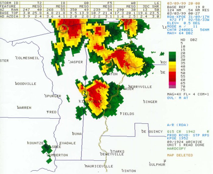
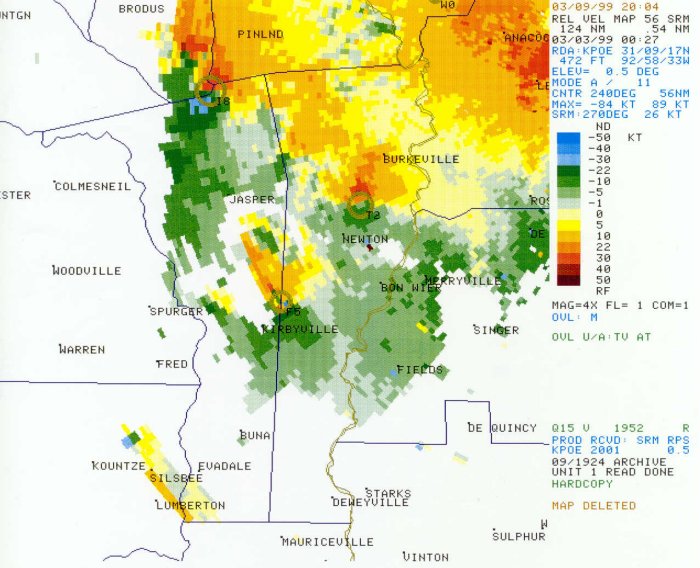
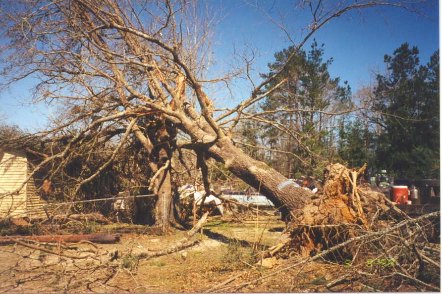
Newton Tornado |
|||
 |
|||
| DATE: 3/2/99 | RATING: F1 | ||
| TIME: 552 PM | PATH LENGTH: 5 miles | ||
| PARISH: Newton | PATH WIDTH: 50 yards | ||
| STATE: Texas | DAMAGE: $50,000 | ||
| TORNADO WARNING: 608 PM | FATALITIES: 0 | ||
| LEAD TIME: none | INJURIES: 0 | ||
|
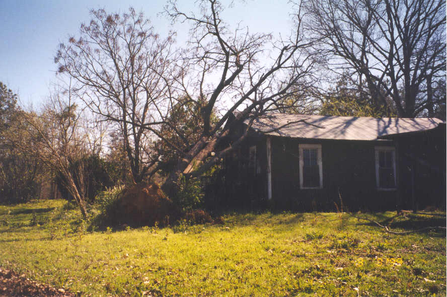
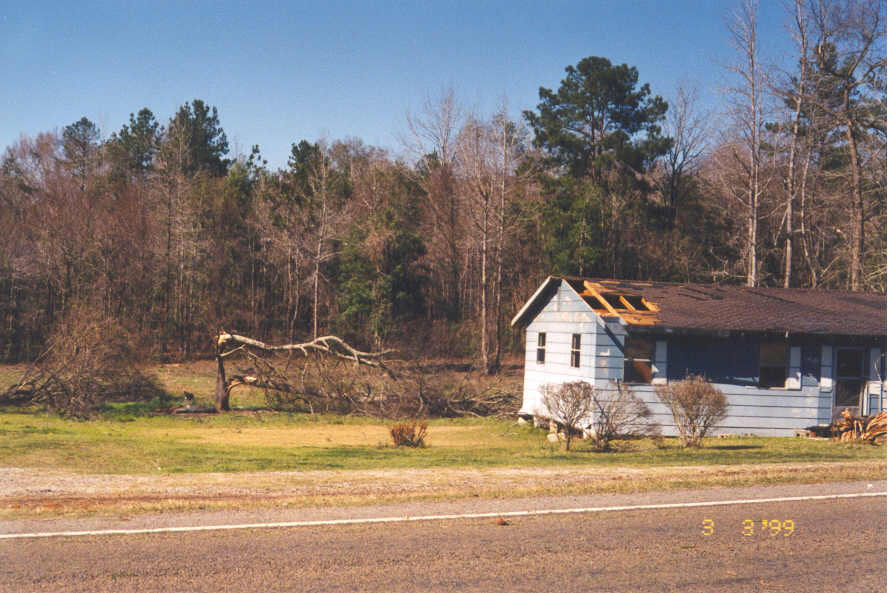
DESCRIPTION: A large, rotating thunderstorm moving southeast at 40 mph produced an F1 tornado in northwestern Newton County. At least three homes received roof damage, mainly along Highway 63 about one mile east of the Jasper County line. Hail as large as golfballs were reported to the Newton County Sheriffs Department. |
|||
|
|
|
|
|
|
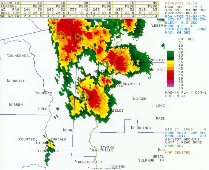
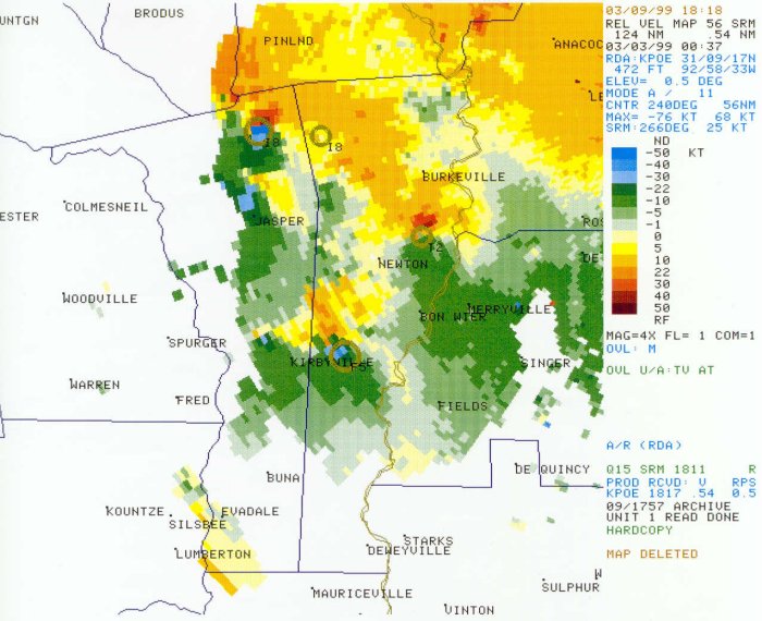
Kirbyville Tornado |
|||
|
|||
| DATE: 3/2/99 | RATING: F0 | ||
| TIME: 620 PM | PATH LENGTH: 3 miles | ||
| COUNTIES: Jasper/Newton | PATH WIDTH: 50 yards | ||
| STATE: Texas | DAMAGE: $70,000 | ||
| TORNADO WARNING: 615 PM | FATALITIES: 0 | ||
| LEAD TIME: 5 minutes | INJURIES: 0 | ||
|
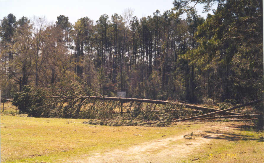
DESCRIPTION: A weak tornado touched down two miles north of Kirbyville on Highway 96. Moving southeast at 15 mph, the tornado damaged the roofs fo several buildings north of Kirbyville and blew down trees along FM 363 east of town. Several eyewitnesses saw the tornado. This tornado moved into Newton County and dissipated just over the county line, but not before blowing down several trees and damaging a couple of barns. |
|||
|
|
|
|
|
|
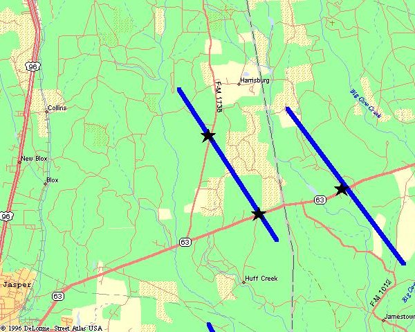
JasperTornado |
|
|
|
| DATE: 3/2/99 | RATING: F1 |
| TIME: 645 PM | PATH LENGTH: 5 miles |
| COUNTY: Jasper | PATH WIDTH: 20 yards |
| STATE: Texas | DAMAGE: $10,000 |
| TORNADO WARNING: 615 PM | FATALITIES: 0 |
| LEAD TIME: 30 minutes | INJURIES: 0 |
|
DESCRIPTION: The same thunderstorm that damaged a marina on Sam Rayburn Lake produced a tornado 7 miles east of Jasper on FM 1738 and Highway 63. Moving southeast at 30 mph, this weak tornado blew down trees in its path. Hail bigger than golfballs pounded the area, stripping some trees of their weaker branches. Eyewitnesses in the Harrisburg area reported this tornado to the Jasper County Sheriff Department. |
|
|
|
|
|
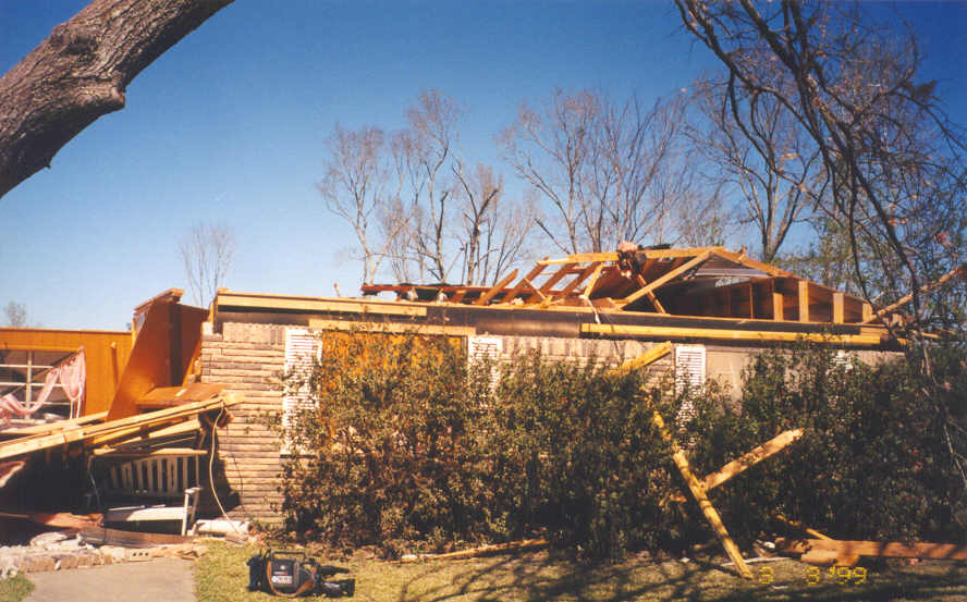
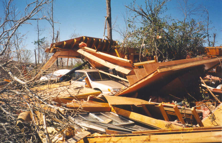
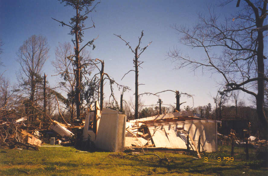
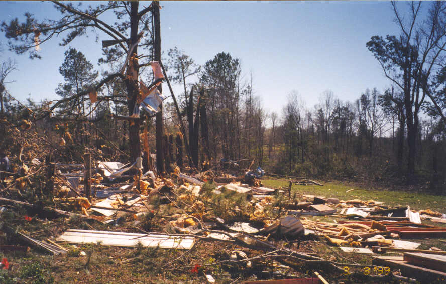
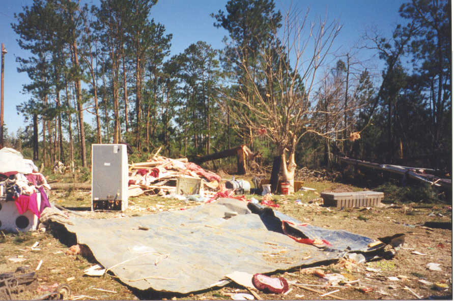
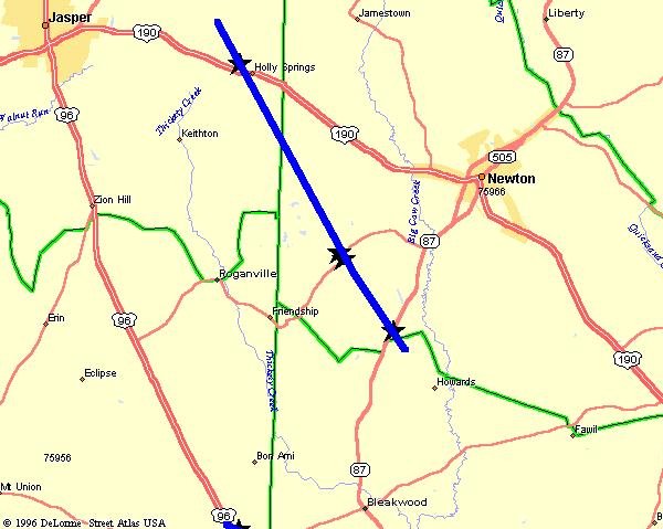
Holly Springs Tornado |
|||
 |
|||
| DATE: 3/2/99 | RATING: F3 | ||
| TIME: 655 PM | PATH LENGTH: 12 miles | ||
| COUNTIES: Jasper/Newton | PATH WIDTH: 500 yards | ||
| STATE: Texas | DAMAGE: $750,000 | ||
| TORNADO WARNING: 615 PM | FATALITIES: 1 | ||
| LEAD TIME: 40 minutes | INJURIES: 6 | ||
|
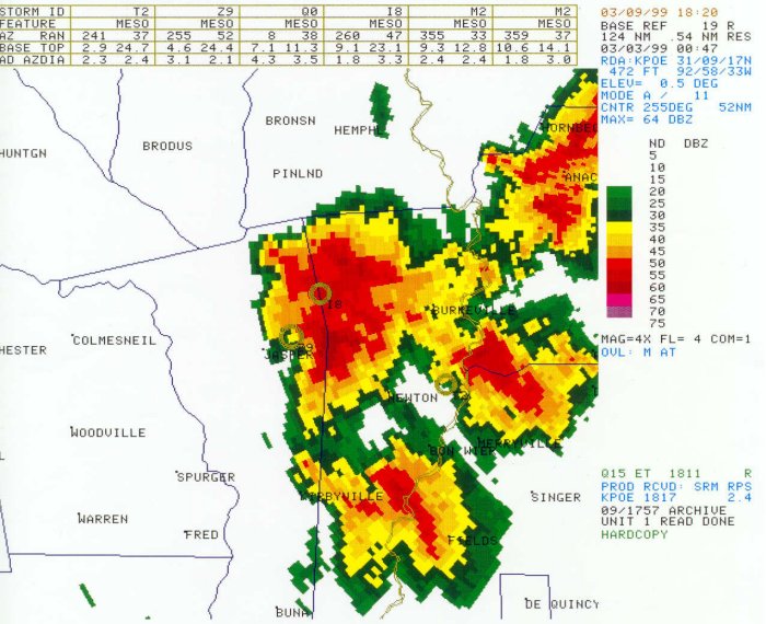
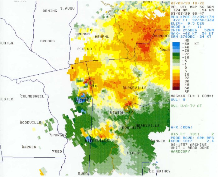
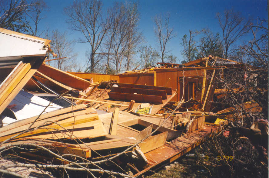
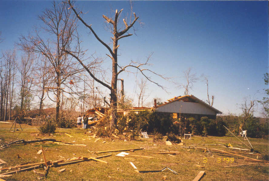
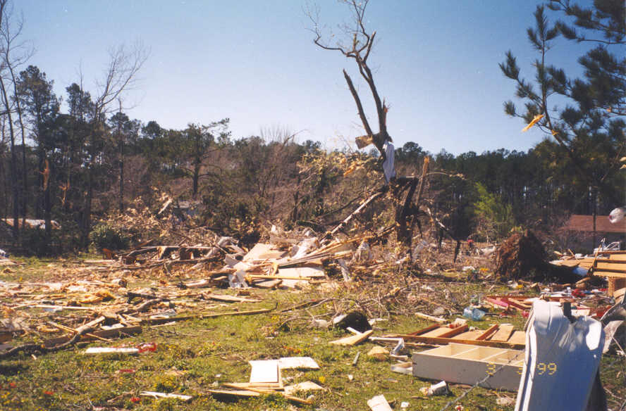
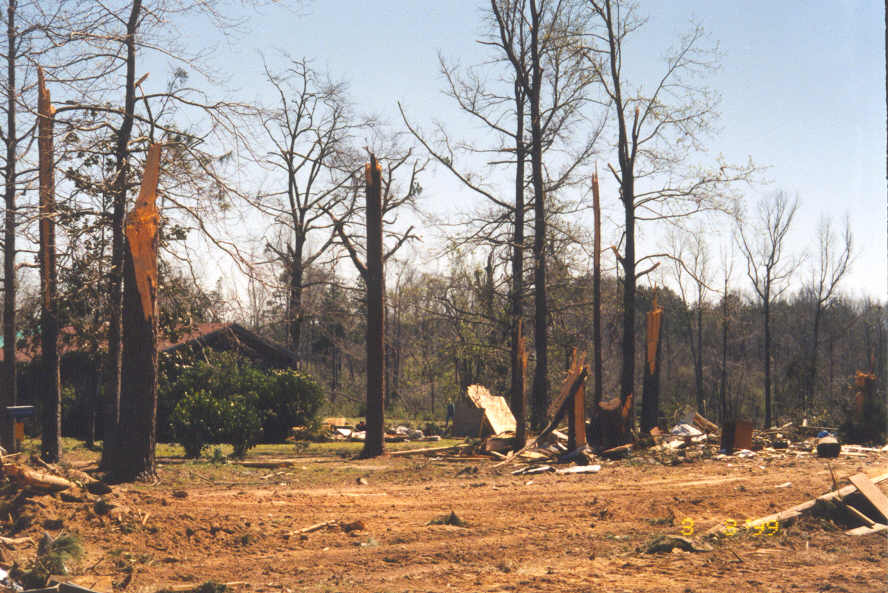
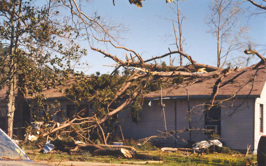
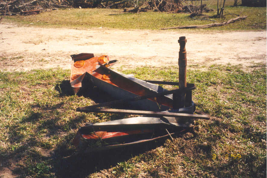
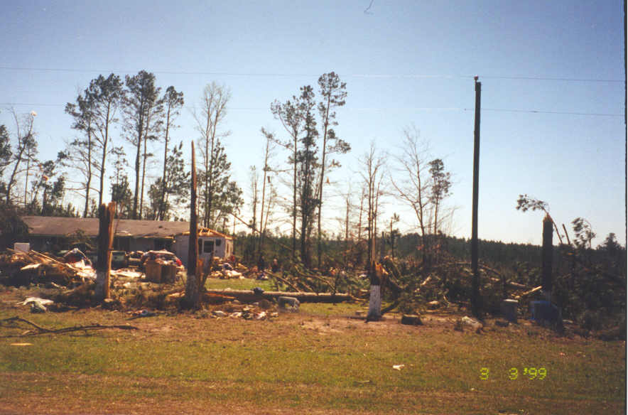
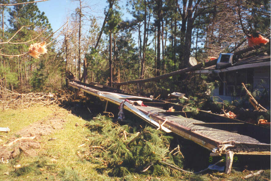
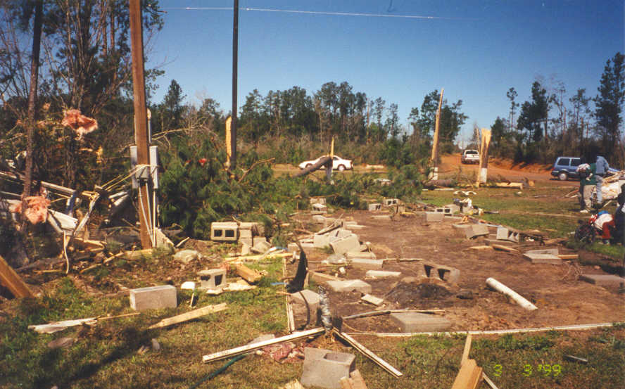
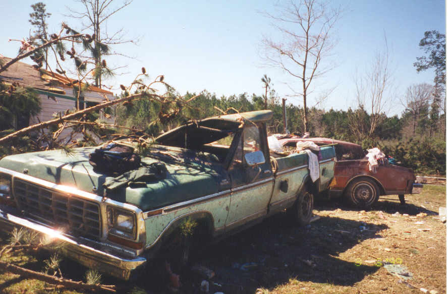
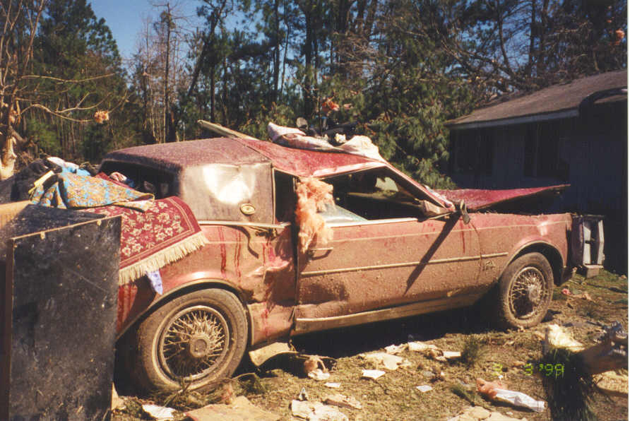
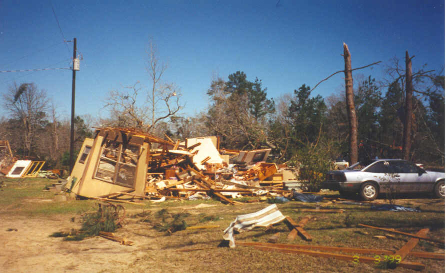
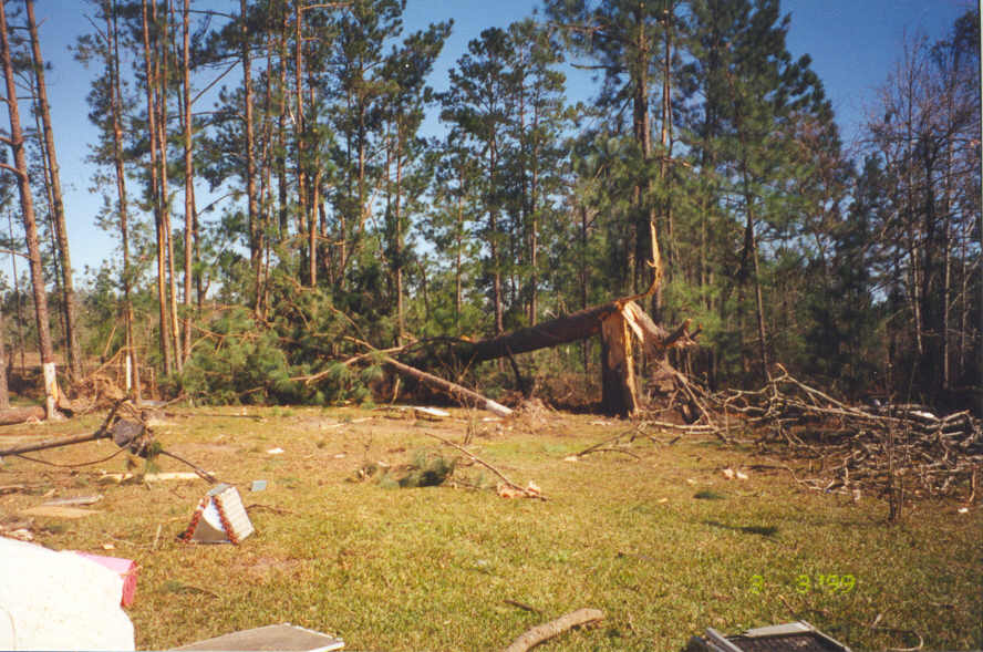
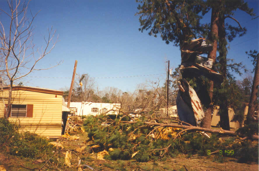
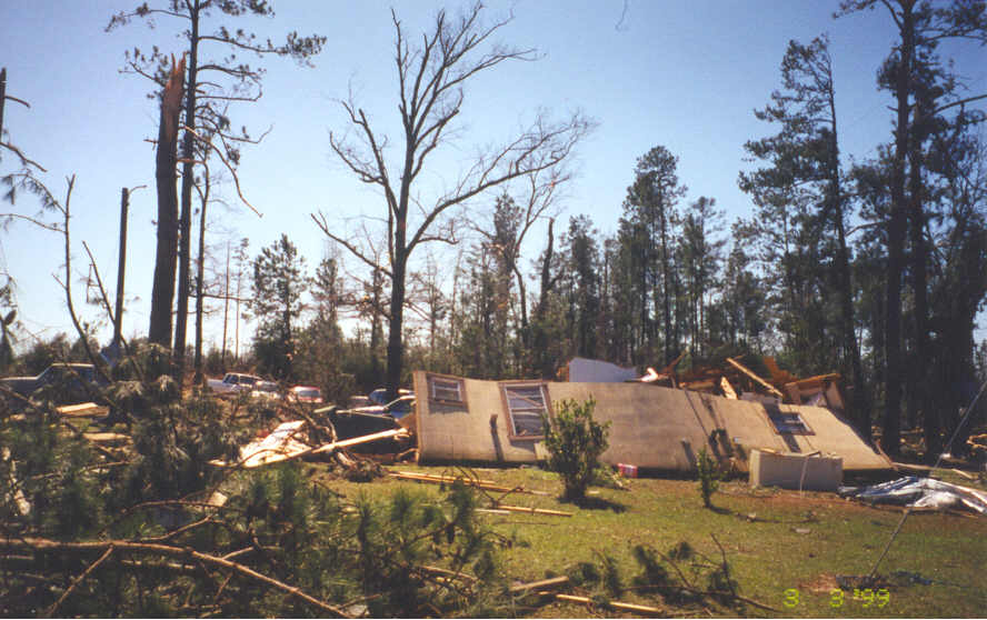
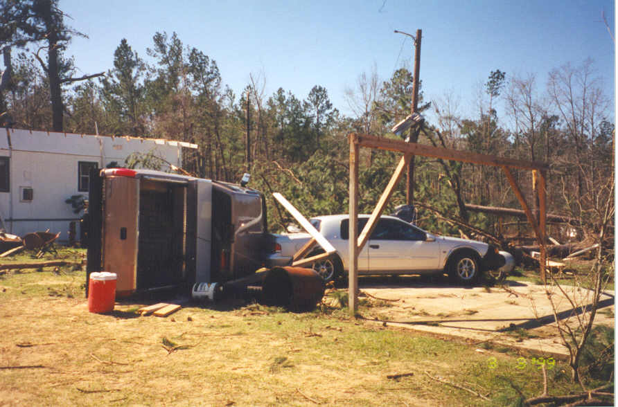
DESCRIPTION: The strongest tornado of the evening developed a mile northwest of Holly Springs. Moving southeast at 50 mph, this fast moving storm damaged or destroyed over 25 homes and a church. The worst damage was done in Holly Springhs, where a brick home lost its roof and portions of two walls. This is where an elderly woman was fatally injured. Several vehicles were picked up and rolled over. The Holly Springs tornado moved into Newton County, tearing up the Baptist Encampment community. A mobile home was flipped over 100 feet, ejecting three people. One young girl escaped with no injuries after being thrown over 50 feet from the home. Two trucks were flipped over in their driveways and a car was moved at least 15 feet. One couple sitting on the couch in the TV watched their wood-framed home fall apart around them, and miraculously walk away. |
|||
|
|
|
|
|
|
|
|
|
|
|
|
|
|
|
|
|
|
|
|
|
|
|
|
|
|
|
|
|
|
|
|
|
||
|
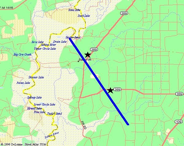
Bancroft Tornado |
|||
 |
|||
| DATE: 3/2/99 | RATING: F1 | ||
| TIME: 718 PM | PATH LENGTH: 6 miles | ||
| PARISH: Beauregard | PATH WIDTH: 200 yards | ||
| STATE: Louisiana | DAMAGE: $50,000 | ||
| TORNADO WARNING: 635 PM | FATALITIES: 0 | ||
| LEAD TIME: 43 minutes | INJURIES: 0 | ||
|
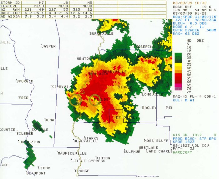
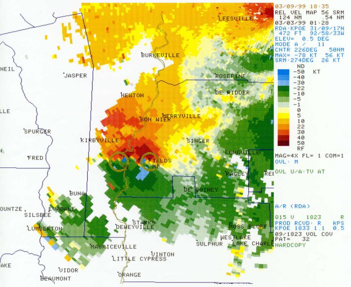
DESCRIPTION: The same storm that hit the Kirbyville and Bleakwood areas in East Texas redeveloped in western Beauregard Parish. Moving southeast at 50 mph, this fast moving tornado damaged the roof to one home in the Bancrroft area. Many trees were blown down in this rural section of the parish. Trees were across Highway 389 around 4 miles west of Fields. |
|||
|
|
|
|
|
|
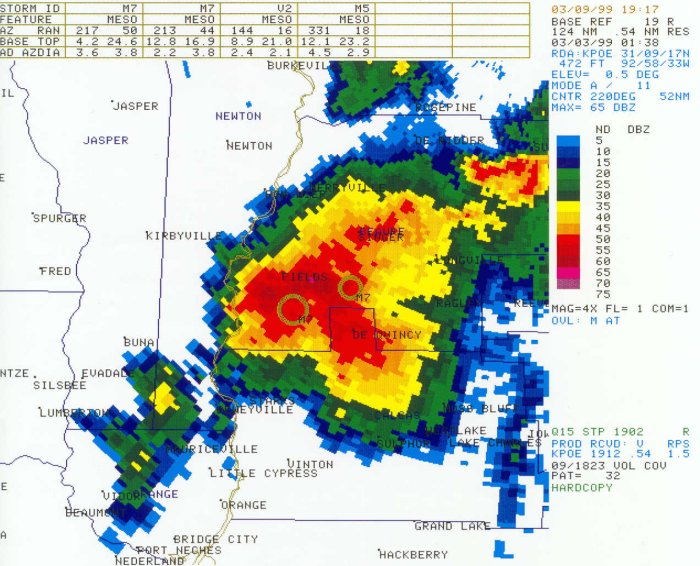
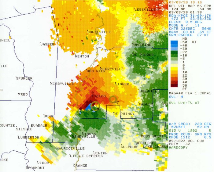
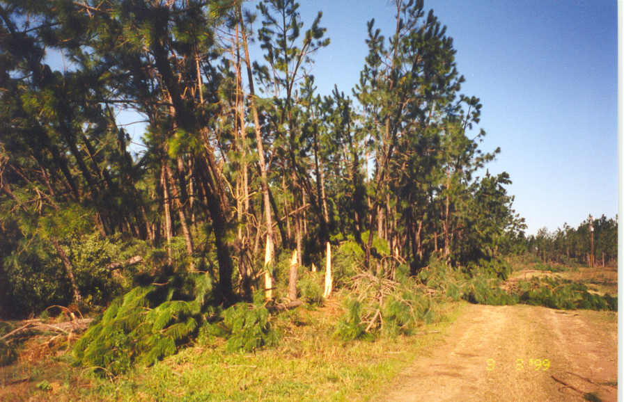
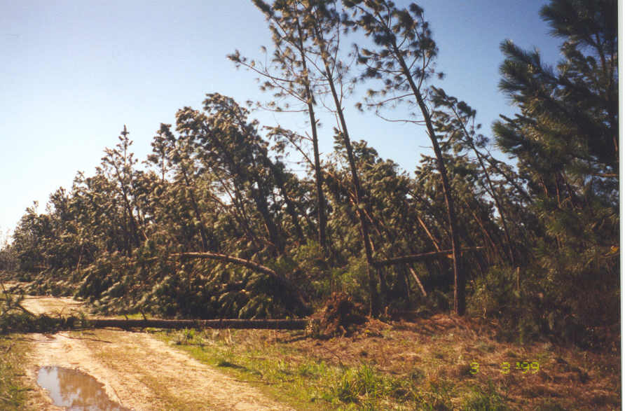
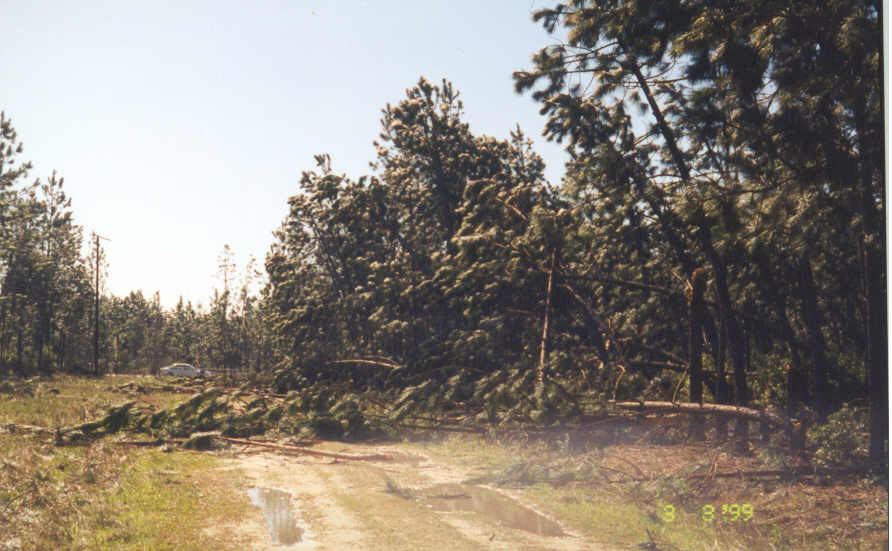
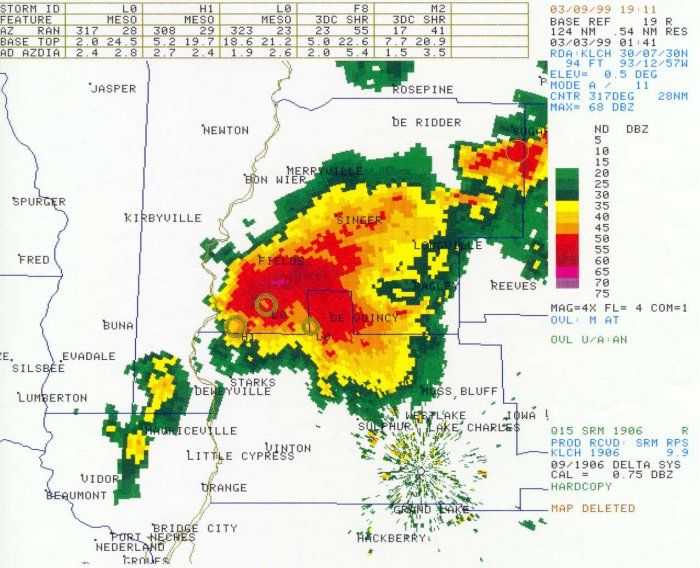
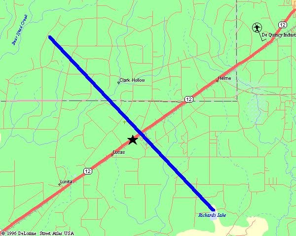
Dequincy Tornado |
|||
 |
|||
| DATE: 3/2/99 | RATING: F2 | ||
| TIME: 745 PM | PATH LENGTH: 8 miles | ||
| PARISHES: Beauregard/Calcasieu | PATH WIDTH: 100 yards | ||
| STATE: Louisiana | DAMAGE: $100,000 | ||
| TORNADO WARNING: 726 PM | FATALITIES: 0 | ||
| LEAD TIME: 19 minutes | INJURIES: 0 | ||
|
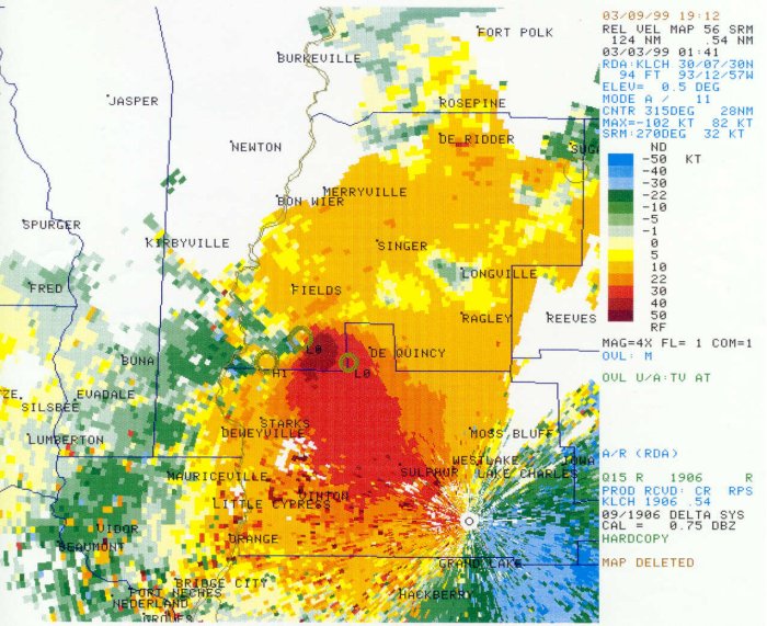
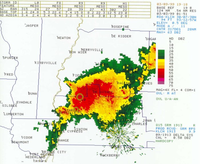
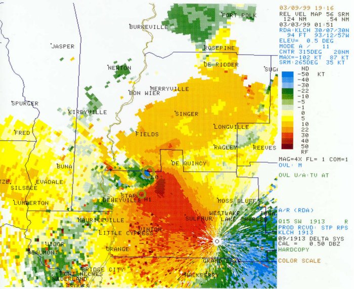
DESCRIPTION: A tornado developed when two large thunderstorms merged over southwestern Beauregard Parish. Moving southeast at 20 mph, this tornado missed DeQuincy and dissipated in rural Calcasieu Parish. A large swath of trees were blown down between DeQuincy and Starks, along the Beauregard-Calcasieu parish line. At least one home was destroyed 12 miles northwest of Sulphur. |
|||
|
|
|
|
|
|
|
|
|
|
|
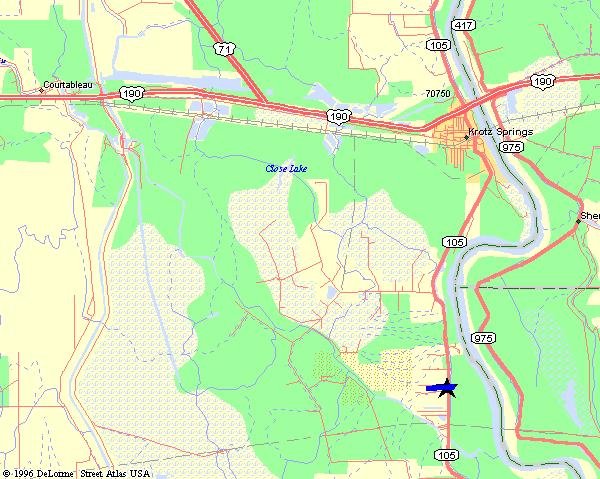
Krotz Springs Tornado |
|
 |
|
| DATE: 3/2/99 | RATING: F1 |
| TIME: 915 PM | PATH LENGTH: 1 miles |
| PARISH: St. Landry | PATH WIDTH: 20 yards |
| STATE: Louisiana | DAMAGE: $100,000 |
| TORNADO WARNING: none | FATALITIES: 0 |
| LEAD TIME: none | INJURIES: 0 |
|
DESCRIPTION: A weak tornado developed six miles south of Krotz Springs on Highway 105, damaging four homes. Several vehicles, including a school bus, were damaged. |
|
|
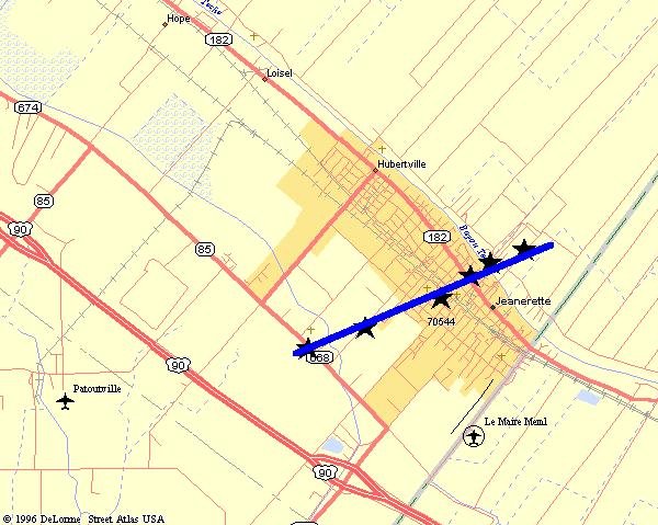
Jeanerette Tornado |
|||
 |
|||
| DATE: 3/2/99 | RATING: F1 | ||
| TIME: 925 PM | PATH LENGTH: 2 miles | ||
| PARISH: Iberia | PATH WIDTH: 50 yards | ||
| STATE: Louisiana | DAMAGE: $2,000,000 | ||
| TORNADO WARNING: none | FATALITIES: 0 | ||
| LEAD TIME: none | INJURIES: 2 | ||
|
DESCRIPTION: This tornado travelled on the ground for two miles, slicing through the center of Jeanerette. Over twenty buildings were destroyed and an additional 75 buildings were damaged. The mayor reported one-third of the town was damaged. Two minor injuries occurred when two cars had a head-on collision during the tornado. Over two million dollars worth of damage occurred. |
|||