
Dangerous and extreme heat will remain across portions of the southern U.S. this week. Heavy rainfall may bring significant flash flooding across portions of the Mid-Atlantic and Northeast through the night, and additional flash flooding concerns across New England on Wednesday. Monsoonal thunderstorms will bring a flash flood risk to the Four Corners region, especially in burn scar areas Read More >
Lake Charles, LA
Weather Forecast Office
| MARCH 27 2009 SEVERE WEATHER |
| Overview |
| The third day in a row of severe weather impacted Southeast Texas and Southwest Louisiana. Numerous multicell and supercell thunderstorms moving across the area spawned one confirmed tornado and widespread large hail. One intense supercell thunderstorm developed north of Houston, TX, and tracked for hundreds of miles across southeast Texas, through southwest Louisiana, into Mississippi, with dozens of reports of large hail received. This supercell thunderstorm produced hail up to grapefruit size in Allen Parish, which was the largest known hail in southwest Louisiana since 2003. |
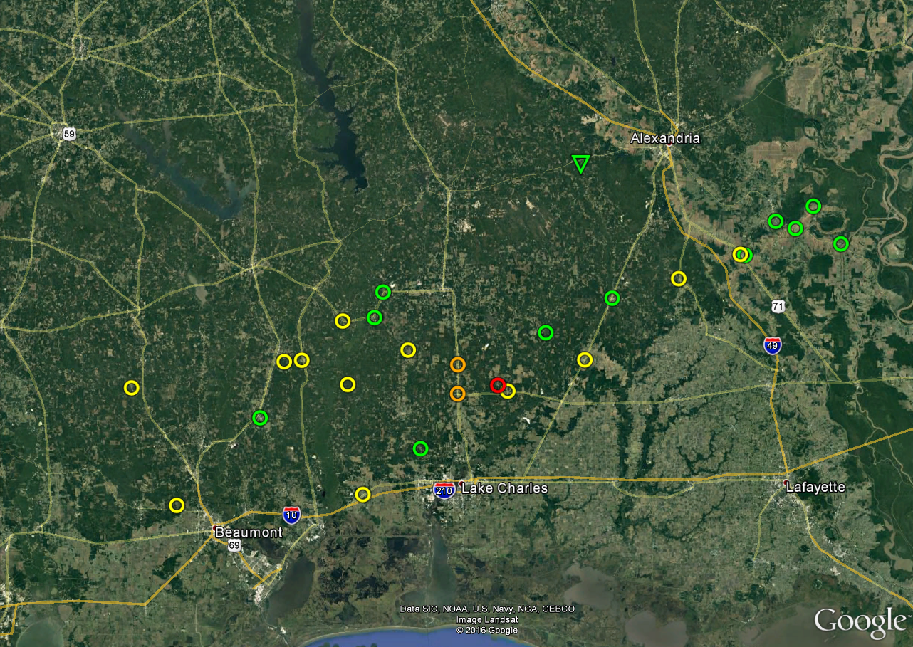
| Google Map Legend | |||||
|
Tornadoes |
EF0 |
EF1 |
EF2 |
||
|
Hail |
<1" |
1"+ |
2"+ |
3"+ |
4"+ |
| T'storm Wind |
|
||||
Forecasts
Aviation Weather
Activity Planner
Mardi Gras Decision Support
Marine Forecasts
Local Products
Model Data
Forecaster's Discussion
Fire Weather
Graphical Forecasts
Wet Bulb Globe Temps
Other Links
National Hurricane Ctr
Storm Prediction Ctr
Weather Prediction Ctr
Other Links
Office History
LCH StoryMap
Hazards
Severe Weather
Tropical Weather
National Outlooks
Local Storm Reports
Tropical Cyclone Reports
Current
Observations
Tide Data
Satellite Data
Hydrology
Calcasieu Par. Network
Jefferson Co. DD6 Network
River/Lake Forecasts
Radar
Shreveport (SHV)
New Orleans (LIX)
Fort Polk (POE)
Houston/Galveston (HGX)
Lake Charles (LCH)
Probabilistic Pages
Probabilistic Snowfall
Probabilistic Rainfall
Probabilistic DSS
US Dept of Commerce
National Oceanic and Atmospheric Administration
National Weather Service
Lake Charles, LA
500 Airport Boulevard
Lake Charles, LA 70607
(337) 477-5285 M-F 8a to 4p only
Comments? Questions? Please Contact Us.

