
Dangerous and extreme heat will remain across portions of the Central U.S. this week, persisting across the Mid to Lower Mississippi Valleys, Gulf Coast, Southern Plains and portions of Texas. A heat wave over the Southwest will intensify late this week. Severe thunderstorms and flash flooding will spread from the Great Lakes/Ohio Valley to the Mid-Atlantic and Northeast the next few days. Read More >
Bunkie Supercell
April 5, 2012
During the early morning hours of April 5, 2012, an upper level low pressure area was centered over Central Oklahoma where it had been meandering for the previous couple of days. Extending South from this low was a weak cold front which was draped across Southeast Texas and had been producing light showers and thunderstorms during the evening of April 4. As the front pushed slowly to the East, it collided with a swath of very unstable air located across Avoyelles, Vernon and Rapides parishes. Just before midnight, a few thunderstorm cells began to develop across this area. By 12:20 AM on the morning of the 5th, only a single, although intensifying, thunderstorm cell remained.
At 12:50 AM, the thunderstorm began to exhibit a classic supercellular appearance on radar. National Weather Service meteorologists issued a severe thunderstorm warning at 12:55 AM for Western Avoyelles, North Central Evangeline, and Southeastern Rapides parishes. The warning emphasized that the storm would produce damaging hail capable of extensive property damage and serious injury.
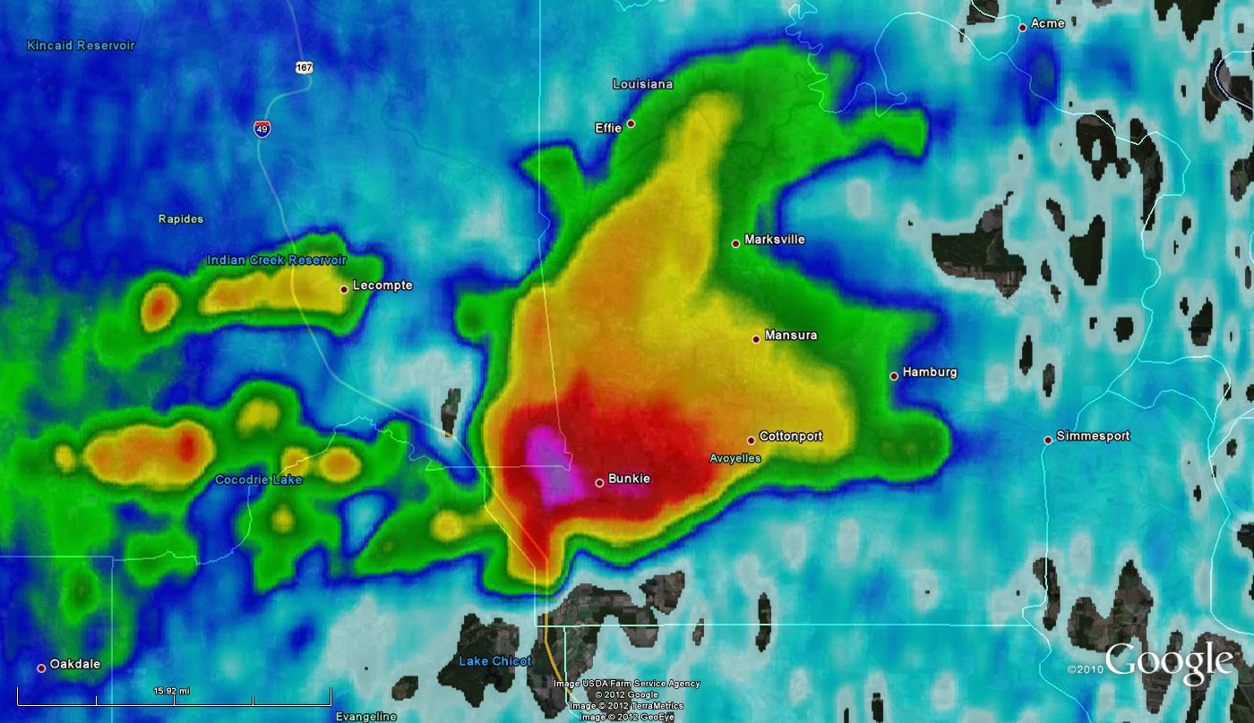
KPOE radar reflectivity near Bunkie, LA at 1:04 AM April 5, 2012
The first report of hail (marble size, two miles Northeast of Bunkie) was received by the NWS at 1:11 AM through its Facebook page. Moments later, the Bunkie Fire Department reported Golf ball size hail in the city of Bunkie. Several more reports were received over the next 20 minutes with the size of reported hail getting larger. Eventually, reports of Baseball to Softball size hail, which had damaged numerous windows, vehicles and homes were coming in from the Bunkie police department as well as the general public.
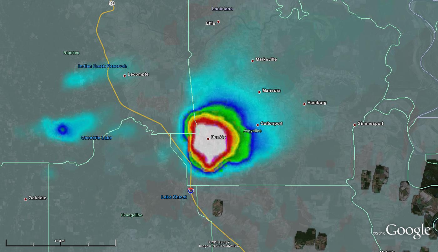
Vertically Integrated Liquid (VIL) from KPOE at 1:04 AM April 5, 2012. White areas indicate possible hail development.
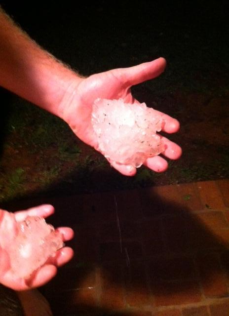
Photo Courtesy: KALB and Candace Bain
As the storm continued to the East, hail reports were received from the towns of Evergreen (Golf ball, 1:18 AM) and Cottonport (Golf ball 1:24 AM).
At 1:40 AM, the supercell thunderstorm began to display an appendage on radar indicative of possible tornado development. NWS meteorologists issued a tornado warning for the storm at 1:44 AM for South Central Avoyelles and North Central St Landry parishes.
At 1:55 AM, after coordination with local area offices, the Storm Prediction Center issued Tornado Watch 141 for Vernon, Rapides, Avoyelles, Allen, Evangeline and St Landry parishes. This watch would later be extended to the south to cover the Atchafalaya basin and the coast.
Additional thunderstorms developed across St Mary parish around 3:30 AM on the morning of the 5th which warranted an additional Severe Thunderstorm Warning at 3:37 AM. Several reports of quarter size hail were received across Morgan City, Patterson and Amelia, but as the airmass was slightly more stable across southern portions of the area, the hail was not able to develop to the size seen across Avoyelles and Rapides parishes. Eventually this activity pushed east into Southeastern Louisiana where it dissipated.
A NWS Storm Survey team was dispatched to determine the official cause of the damage being reported. After investigation, it was determined that despite the issuance of both a tornado watch and warning, no tornado actually touched down. All reported damage was caused by a combination of very large hail and strong straight line winds. The summary of the team's findings can be found below.

Photo Courtesy: Felix Navejar, NWS LCH Science and Operations Officer

Photo Courtesy: Felix Navejar, NWS LCH Science and Operations Officer

Photo Courtesy: Felix Navejar, NWS LCH Science and Operations Officer

Photo Courtesy: Felix Navejar, NWS LCH Science and Operations Officer

Photo Courtesy: Felix Navejar, NWS LCH Science and Operations Officer. Ice still on the ground nine hours after the event.
NWS Storm Survey Results: Up to Baseball size hail fell in Bunkie within a two mile wide area resulting in numerous business and vehicle windows broken. Winds estimated at 65 MPH with gusts up to 70 MPH resulted in a few trees uprooted as well as several large branches taken down. Some of the fallen trees and large branches fell onto homes which caused moderate to severe damage.
Local Storm Reports received during the Bunkie event:
1:11 AM - Public reports via Facebook, marble size hail near Longbridge.
1:12 AM - Public reports via Facebook, quarter size hail near Bunkie.
1:13 AM - Public reports Golf ball size hail near Bunkie.
1:13 AM - Bunkie fire department reports Golf ball size hail near Bunkie.
1:18 AM - Public reports via Facebook, Golf ball size hail between Bunkie and Evergreen.
1:24 AM - Public reports via Facebook, Golf ball size hail near Cottonport.
1:25 AM - KLFY TV relays a public report of wind damage to the windows, roof and porch of a house in Bunkie.
1:29 AM - Public reports via facebook, dime size hail between Cottonport and Plaucheville.
Local Storm Reports received after the Bunkie event (Times estimated by radar):
1:06 AM - Bunkie police report trees and powerlines down in Bunkie possibly related to a tornado. Some trees fell into residences.
1:06 AM - Public reports via facebook, Baseball size hail near Bunkie.
1:06 AM - Bunkie PD reports Baseball size hail near Bunkie.
Additional Hail Photos
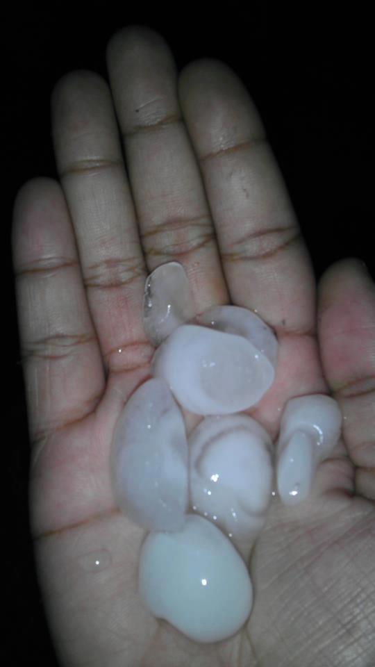
Photo Courtesy: KALB and Maranda Drummer
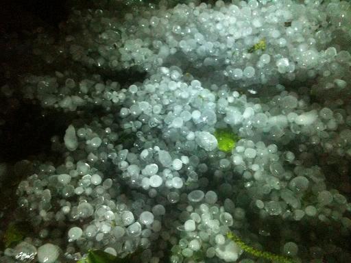
Photo Courtesy: KALB and Angell Duplechain
Page created by Donald Jones

