
Severe thunderstorms and showers pose a risk for excessive rain, localized flash flooding, strong gusts and/or large hail across portions of the northern and central Plains, the Lower Missouri to Lower Ohio Valleys, and across the Mid-Atlantic this afternoon and evening. Extreme heat is ongoing over the Desert Southwest and the Southeast U.S.. Read More >
Lake Charles, LA
Weather Forecast Office
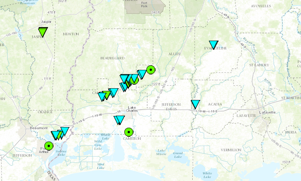
| October 31 2013 TORNADOES |
| Local Storm Reports |
| SPC Storm Reports for October 31 2013 |
| Location | Start/ End Time |
Event Type | Fatalities/ Injuries |
Path Length | Path Width |
| Jasper County 5.3 S Jasper to 4.4 SSE Jasper |
6:00 am - |
EF-1 Tornado |
none | 1 mile | 50 yards |
| Jefferson County Groves |
9:30 am - 9:35 am |
Thunderstorm Wind Damage |
none | 1.1 miles | 100 yards |
| Orange County 2.1 NW Bridge City to 1.5 W West Orange |
9:39 am - 9:47 am |
EF-1 Tornado |
none | 6.6 miles | 200 yards |
| Calcasieu Parish 7.5 S Dequincy to 8 SE Dequincy |
9:46 am - |
EF-1 Tornado |
none | 7 miles | 150 yards |
| Beauregaurd Parish 7 SW Ragley to 3.9 ESE Ragley |
10:00 am - 10:09 am |
EF-1 Tornado |
none | 7.9 miles | 150 yards |
| Beauregaurd Parish 3 SW Ragley to 1.6 S Ragley |
10:00 am - 10:02 am |
EF-0 Tornado |
none | 2.6 miles | 75 yards |
| Allen Parish 2.3 W Reeves to 1.6 W Reeves |
10:14 am - 10:14 am |
EF-0 Tornado |
none | 0.8 miles | 75 yards |
| Calcasieu Parish 5 NW of LCH Lake Charles Regional Airport |
10:30 am - 10:35 am |
EF-0 Tornado |
none | 1.4 miles | 30 yards |
| Evangeline Parish Easton to 0.5 E Easton |
11:21 am - 11:22 am |
EF-0 Tornado |
none | 0.5 miles | 75 yards |
| Acadia Parish 1.4 NNW Evangeline to 1.6 N Evangeline |
11:41 am - 11:42 am |
EF-0 Tornado |
none | 0.5 miles | 70 yards |
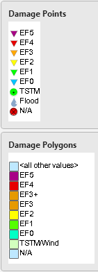
Map of the Surveyed Damage
Forecasts
Aviation Weather
Activity Planner
Mardi Gras Decision Support
Marine Forecasts
Local Products
Model Data
Forecaster's Discussion
Fire Weather
Graphical Forecasts
Wet Bulb Globe Temps
Other Links
National Hurricane Ctr
Storm Prediction Ctr
Weather Prediction Ctr
Other Links
Office History
LCH StoryMap
Hazards
Severe Weather
Tropical Weather
National Outlooks
Local Storm Reports
Tropical Cyclone Reports
Current
Observations
Tide Data
Satellite Data
Hydrology
Calcasieu Par. Network
Jefferson Co. DD6 Network
River/Lake Forecasts
Radar
Shreveport (SHV)
New Orleans (LIX)
Fort Polk (POE)
Houston/Galveston (HGX)
Lake Charles (LCH)
Probabilistic Pages
Probabilistic Snowfall
Probabilistic Rainfall
Probabilistic DSS
US Dept of Commerce
National Oceanic and Atmospheric Administration
National Weather Service
Lake Charles, LA
500 Airport Boulevard
Lake Charles, LA 70607
(337) 477-5285 M-F 8a to 4p only
Comments? Questions? Please Contact Us.

