
Dangerous and extreme heat will remain across portions of the central U.S. this week, persisting across the mid to lower Mississippi Valley, Gulf Coast, southern Plains and portions of Texas. A heat wave over the Southwest U.S. will peak this weekend. Heavy to excessive rainfall may produce flash flooding from the Delmarva Peninsula north into the Hudson Valley today and tonight. Read More >
Lake Charles, LA
Weather Forecast Office
November 23, 2014 Coastal Flooding along the Southeast Texas & Southwest Louisiana Coast
Donovan Landreneau, Senior Meteorologist
Kent Kuyper, Senior Meteorologist
.png)
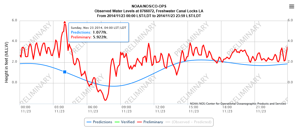
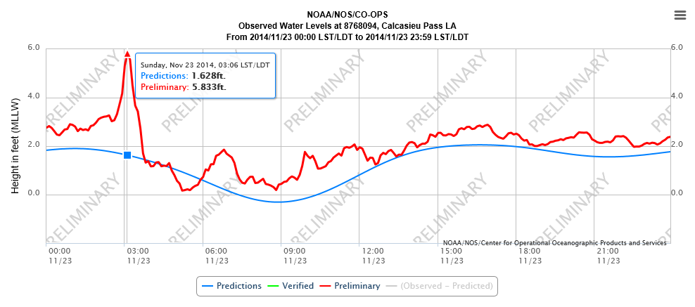
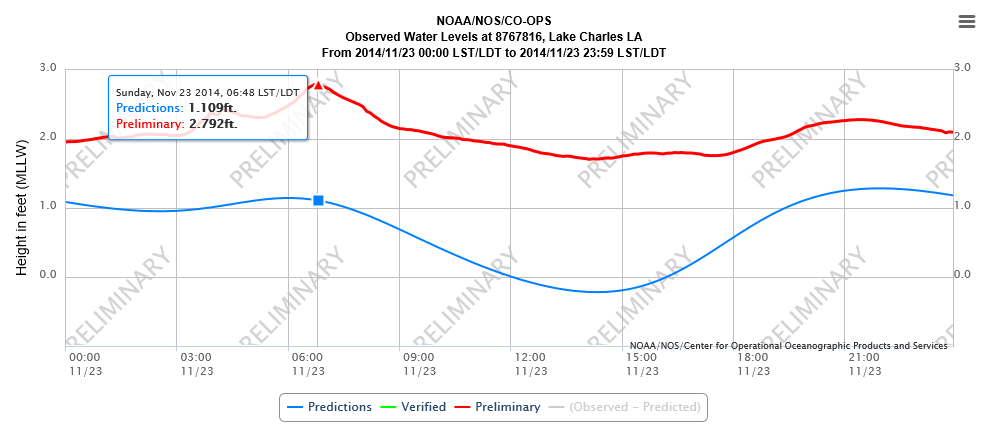
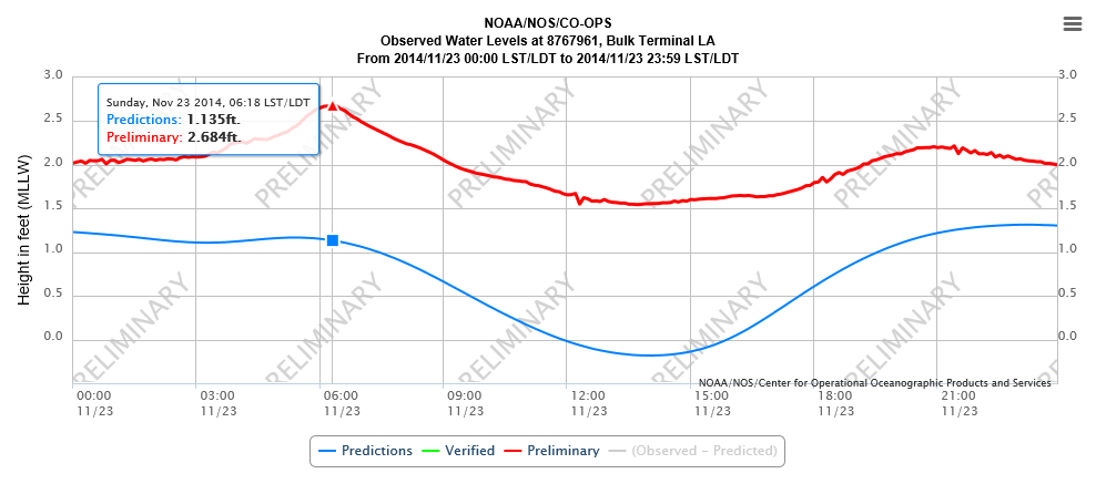
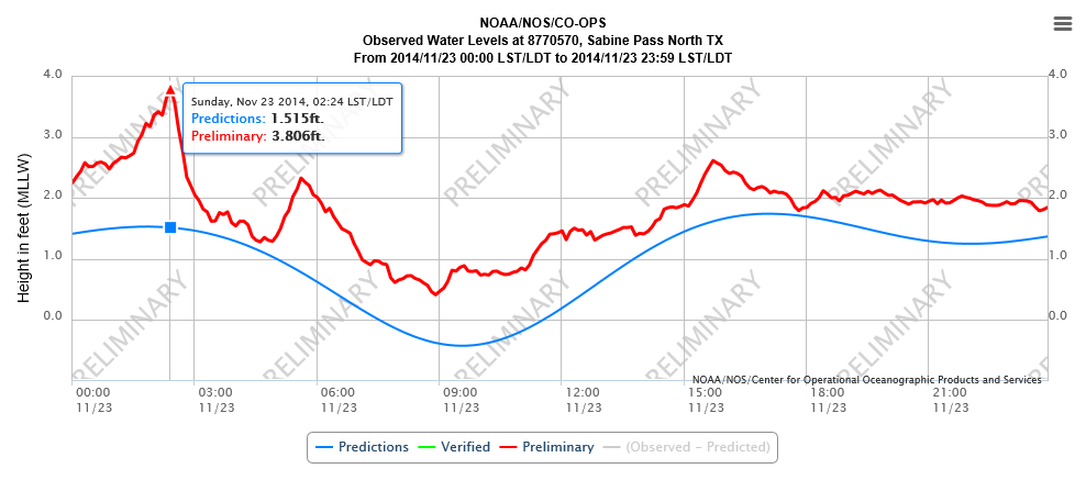
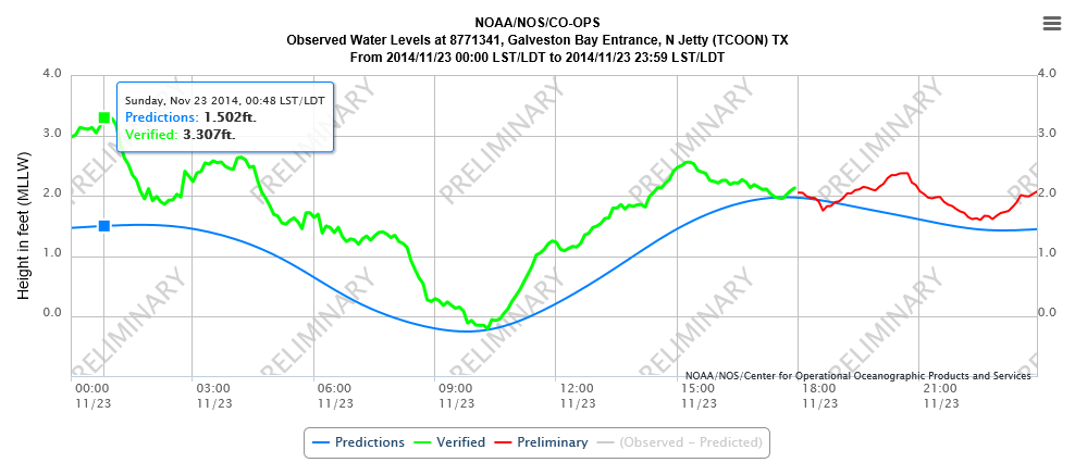
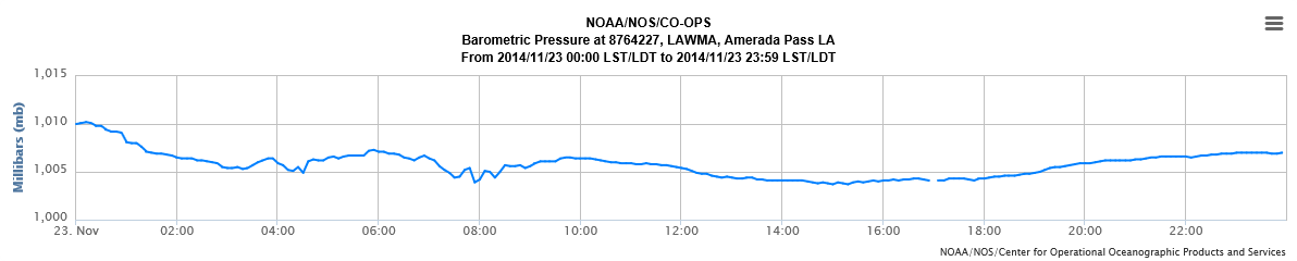
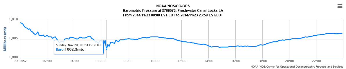
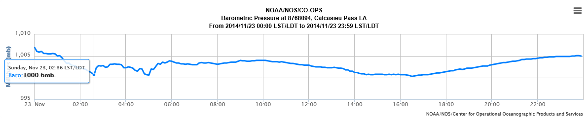
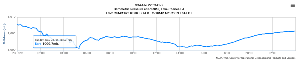
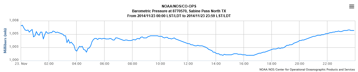
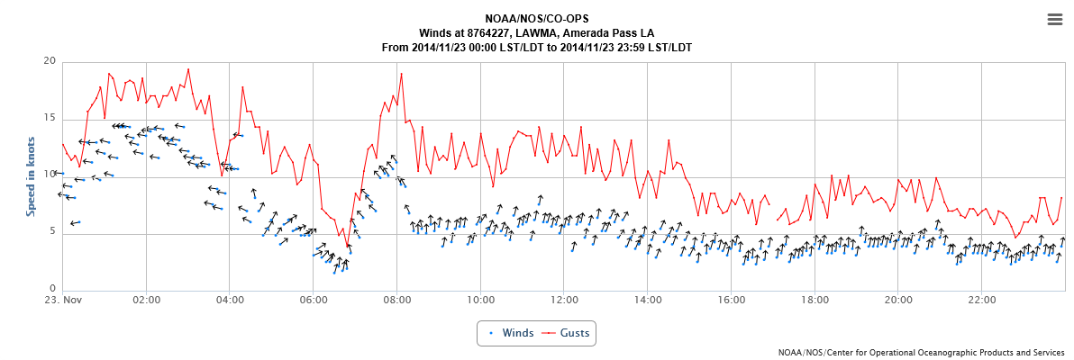
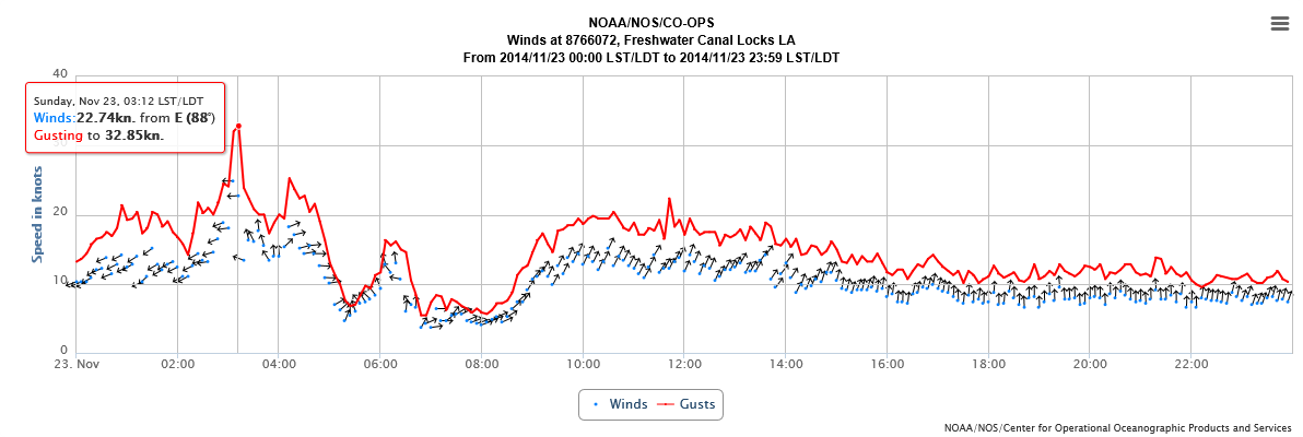
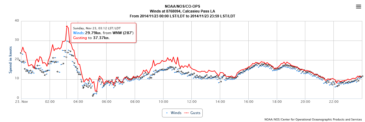
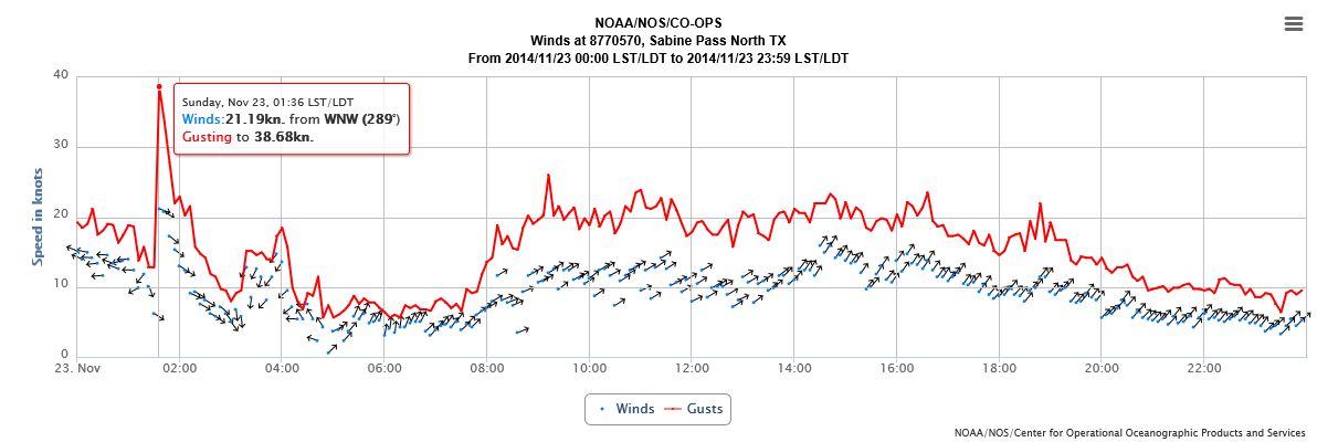
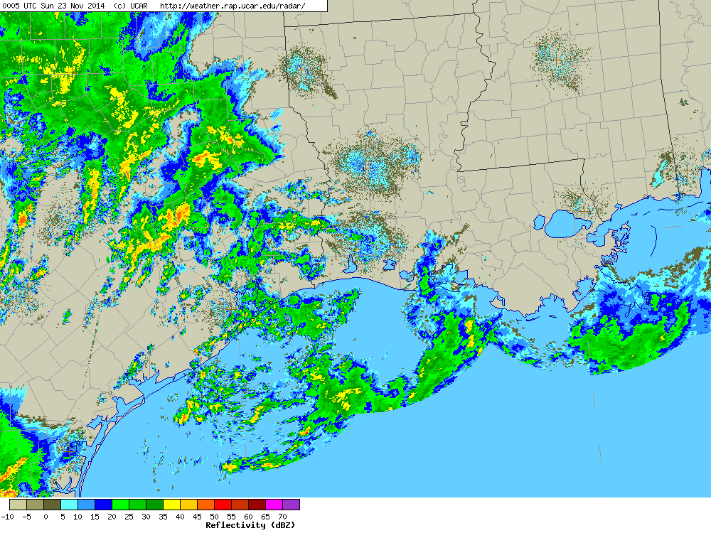
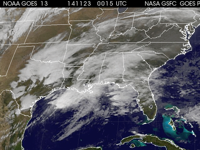
During the late evening hours of November 22, 2014, a mesoscale convective complex of thunderstorms rolled through the northwestern Gulf of America which led to a quick jump in tide levels along the coast, and subsequent minor flooding of coastal areas.
Click here for a study of this event presented at the 2016 AMS Annual Meeting
| NOS Tidal Water Level Graphs | ||||
| Amerada Pass, LA | Freshwater Canal Locks, LA | Calcasieu Pass, LA | Lake Charles, LA | |
| Bulk Terminal, LA | Sabine Pass North, TX | Galveston, TX | ||
| NOS Pressure Graphs | ||||
| Amerada Pass, LA | Freshwater Canal Locks, LA | Calcasieu Pass, LA | Lake Charles, LA | |
| Sabine Pass North, TX | ||||
| NOS Wind Gust Graphs | ||||
| Amerada Pass, LA | Freshwater Canal Locks, LA | Calcasieu Pass, LA | Sabine Pass North, TX | |
|
Radar and Satellite Animated Imagery
(Animated Gif) |
|||
|
|||
Webpage by: Donovan Landreneau & Kent Kuyper
Data collection by: Donovan Landreneau, Jonathan Brazzell, Kent Kuyper
Forecasts
Forecaster's Discussion
Fire Weather
Graphical Forecasts
Wet Bulb Globe Temps
Aviation Weather
Activity Planner
Mardi Gras Decision Support
Marine Forecasts
Local Products
Model Data
Other Links
National Hurricane Ctr
Storm Prediction Ctr
Weather Prediction Ctr
Other Links
Office History
LCH StoryMap
Hazards
Severe Weather
Tropical Weather
National Outlooks
Local Storm Reports
Tropical Cyclone Reports
Current
Tide Data
Satellite Data
Observations
Hydrology
River/Lake Forecasts
Calcasieu Par. Network
Jefferson Co. DD6 Network
Radar
Shreveport (SHV)
New Orleans (LIX)
Fort Polk (POE)
Houston/Galveston (HGX)
Lake Charles (LCH)
Probabilistic Pages
Probabilistic DSS
Probabilistic Snowfall
Probabilistic Rainfall
US Dept of Commerce
National Oceanic and Atmospheric Administration
National Weather Service
Lake Charles, LA
500 Airport Boulevard
Lake Charles, LA 70607
(337) 477-5285 M-F 8a to 4p only
Comments? Questions? Please Contact Us.

