A heat wave over the Southwest will intensify late week, peaking and expanding into the Intermountain West and northern High Plains this weekend. Severe thunderstorms and heavy rain are expected over portions of the Plains and Mississippi Valley tonight, which will shift to parts of the Upper Midwest and mid-Mississippi Valley Friday. Monsoonal showers and flooding persist in the Desert Southwest. Read More >
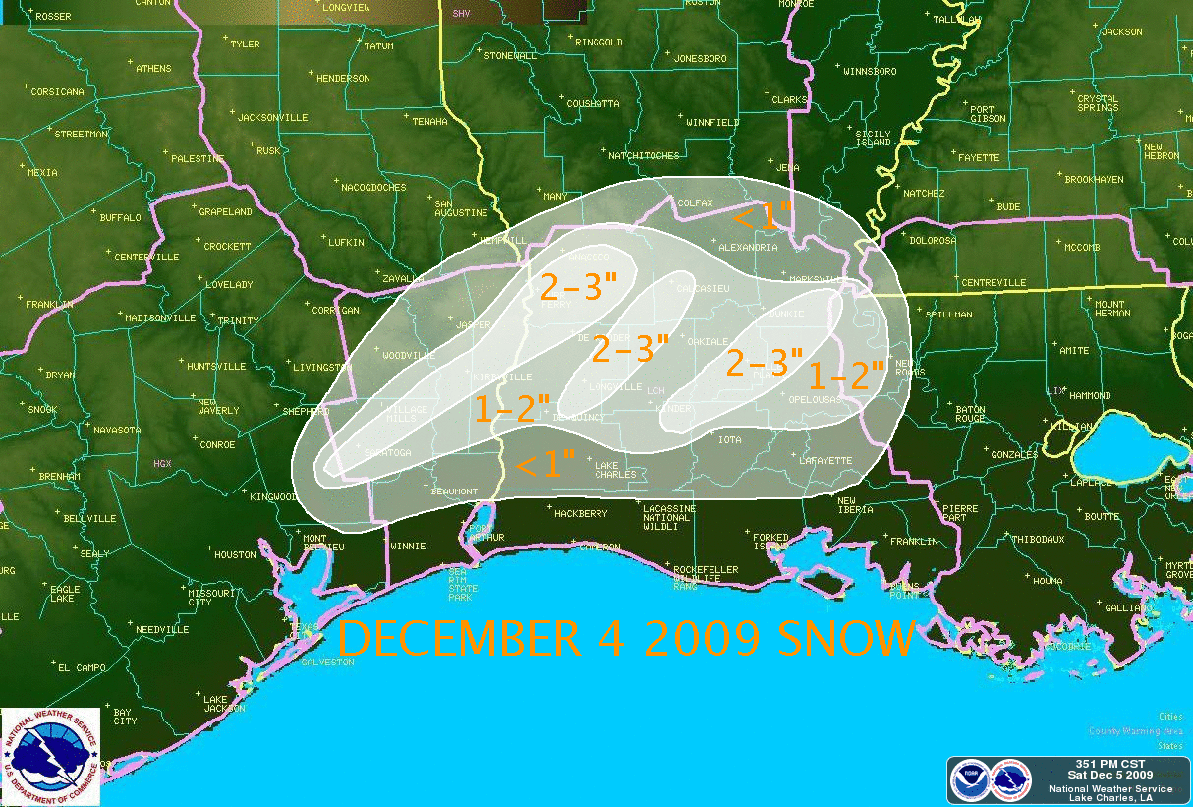
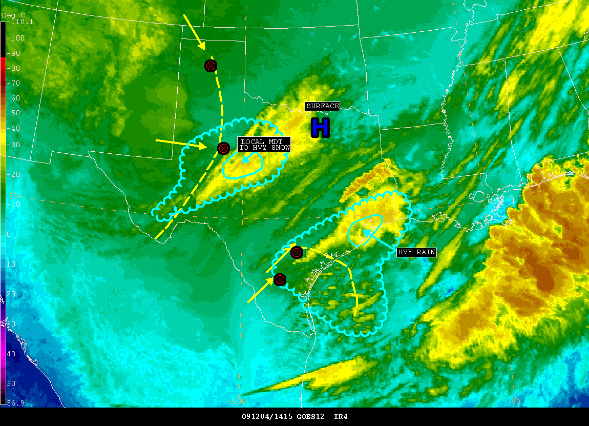
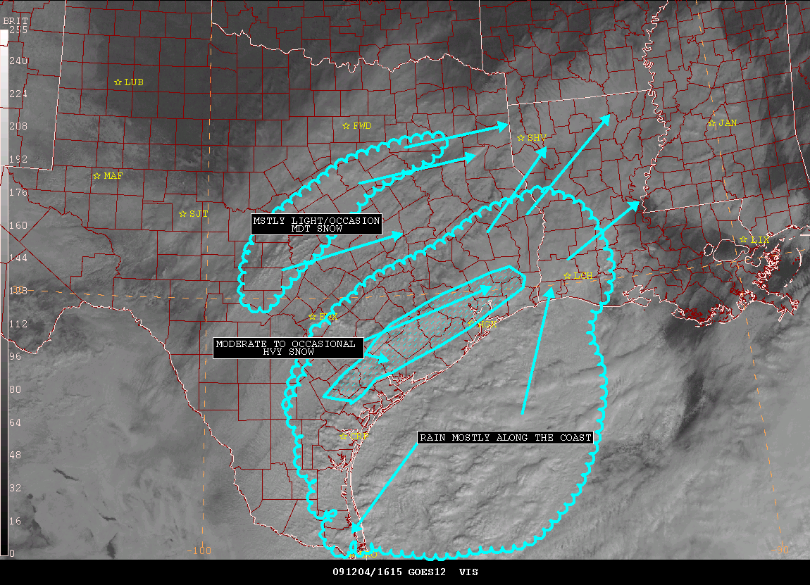
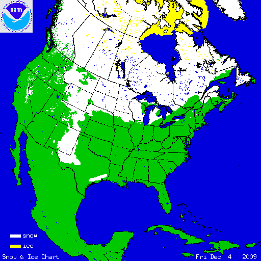
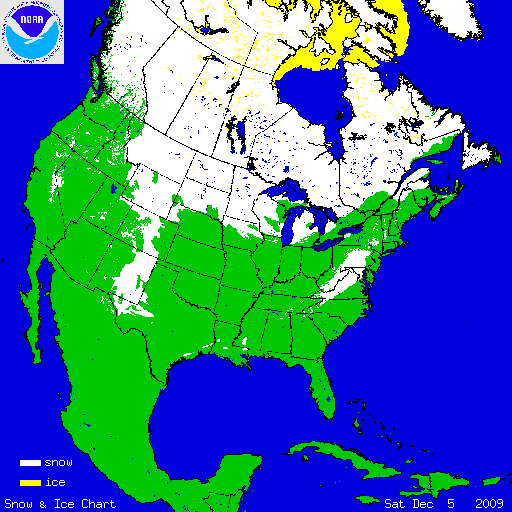
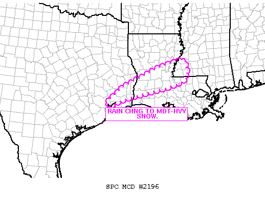
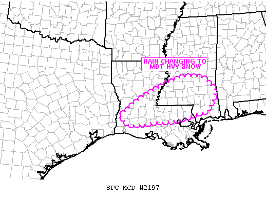
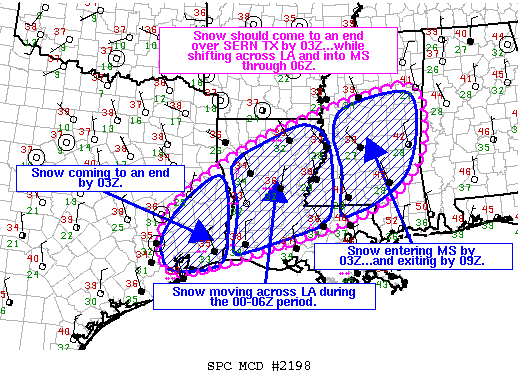
A powerful and deep upper level trough of low pressure moved quickly across Texas and Louisiana on Friday, December 4, 2009. At the same time, a strong area of surface low pressure developed in the western Gulf of America. Meanwhile, a cold Arctic airmass filtered southward through the southern United States. All of these factors combined to produce a large area of rain along the Texas coast during the morning of December 4, 2009, which then spread northeastward across Southeast Texas into Central and Southern Louisiana during the late morning and afternoon hours. As temperatures gradually cooled during the afternoon and evening, the rain began to mix with and eventually change over to snow from west to east across the area. Snow fell only briefly near the immediate Gulf Coast, but snow was seen for many hours across inland areas of Southeast Texas and Southwest Louisiana. As the winter weather event ended on Friday evening, December 4, totals snow accumulations ranged from just a dusting up to 3 inches. Since any snowfall is rare across Southeast Texas and Southwest Louisiana, this event set several snowfall records: Alexandria
Lake Charles
Lafayette
|
||||||||||||||||||||||||||||||||||||||||||||||||||||||||||||||||||||||||||||||||||||||||||||||||||||||||||||||||||||||||||||||||||||||||||||||||||||||||||||
Historic snowfall event in the Gulf Coast regionCourtesy of CIMMS Satellite Blog |
||||||||||||||||||||||||||||||||||||||||||||||||||||||||||||||||||||||||||||||||||||||||||||||||||||||||||||||||||||||||||||||||||||||||||||||||||||||||||||