
Widespread life-threatening flash and urban flooding will continue to pose a significant threat to life and property in south-central Texas. Catastrophic fiver flooding, with rapid rises on small streams, arroyos, and typically dry washes, is expected. Monsoonal showers persist across the Great Basin and Southwest with greatest flash flooding in southern Arizona. Read More >
|
CHRISTMAS EVE 2009 TORNADO OUTBREAK |
| Overview |
|
A powerful upper level storm system moved across the Southern Plains and Lower Mississippi Valley from Wednesday, December 23, 2009, through Thursday, December 24, 2009. Numerous showers and elevated thunderstorms, including some supercells, repeatedly developed and moved northward across much of southwest Louisiana and the northern Gulf of America from late Wednesday evening into Thursday morning. As the main upper level system approached Louisiana early Thursday morning, a squall line developed across east Texas and moved rapidly eastward across Louisiana, causing several reports of wind damage in southern Louisiana. Meanwhile, some of the elevated supercells became surface-based and tracked north-northeastward across south-central and east-central Louisiana, spawning at least a dozen tornadoes. In addition, the widespread rainfall caused flooding in some of these same areas. |
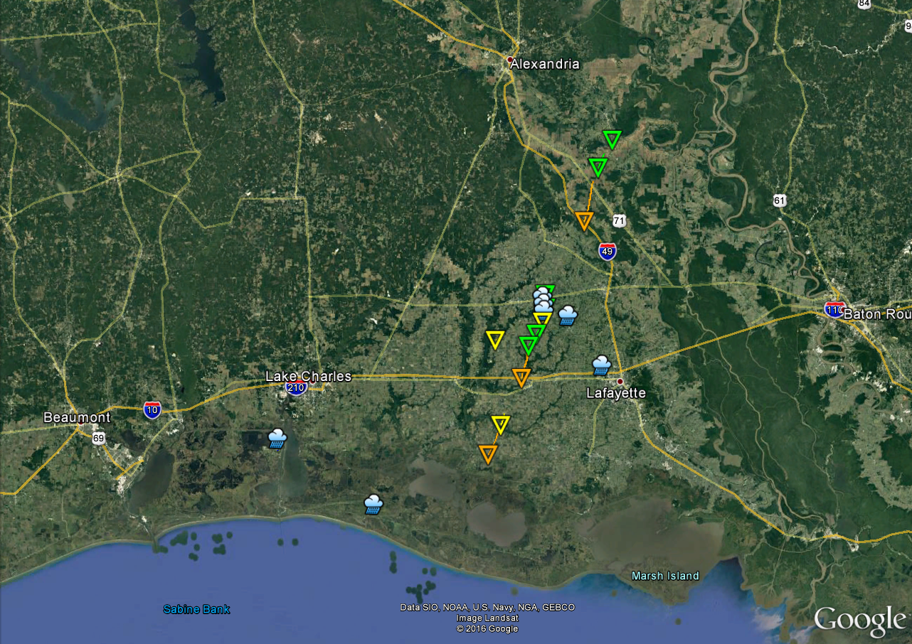
| Google Map Legend | |||||
|
Tornadoes |
EF0 |
EF1 |
EF2 |
||
|
Hail |
<1" |
1"+ |
2"+ |
3"+ |
4"+ |
| T'storm Wind |
|
||||

