Dangerous and extreme heat will remain across portions of the central U.S. this week, persisting across the mid to lower Mississippi Valley, Gulf Coast, southern Plains and portions of Texas. A heat wave over the Southwest U.S. will peak this weekend. Heavy to excessive rainfall may produce flash flooding from the Delmarva Peninsula north into the Hudson Valley today and tonight. Read More >
Lake Charles, LA
Weather Forecast Office
| December 27 2014 TORNADOES |
| Local Storm Reports |
| SPC Storm Reports for December 27 2014 Preliminary Tyler County Report Preliminary Jasper County Report |
Event Summary
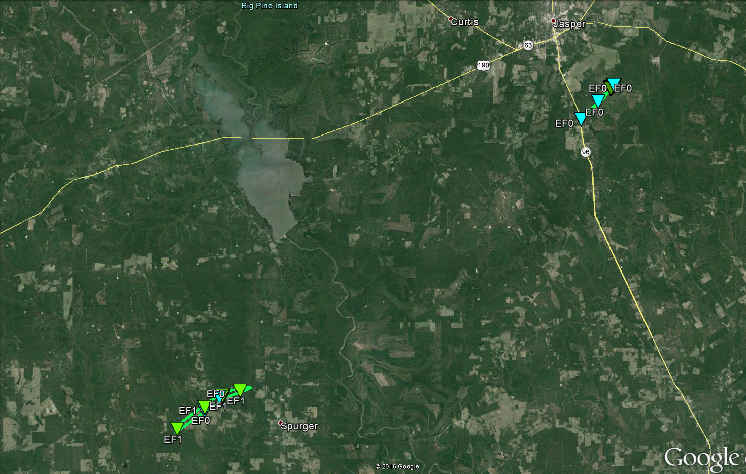
Conditions became favorable for a long lived strong to severe storm to track along the intersection of a warm front and cold front (triple point low) across southeast Texas andwestern Louisiana. This storm produced at least two tornadoes in Tyler and JasperCounties.
| Location | Start/ End Time |
Event Type | Fatalities/ Injuries |
Path Length | Path Width |
| Tyler County 4 W Spurger to 2 NW Spurger |
2:00 pm - |
EF-1 Tornado |
none | 4 miles | 50 yards |
| Jasper County 4 SSE Jasper to 4 SE Jasper |
2:35 pm - 2:39 pm |
EF-1 Tornado |
none | 2 miles | 150 yards |
Map of the Surveyed Damage
Radar Imagery
|
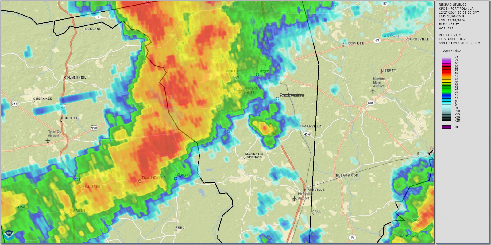
Radar image near the time of the tornado in Tyler County at 2:05 PM. (Click for a larger image) |
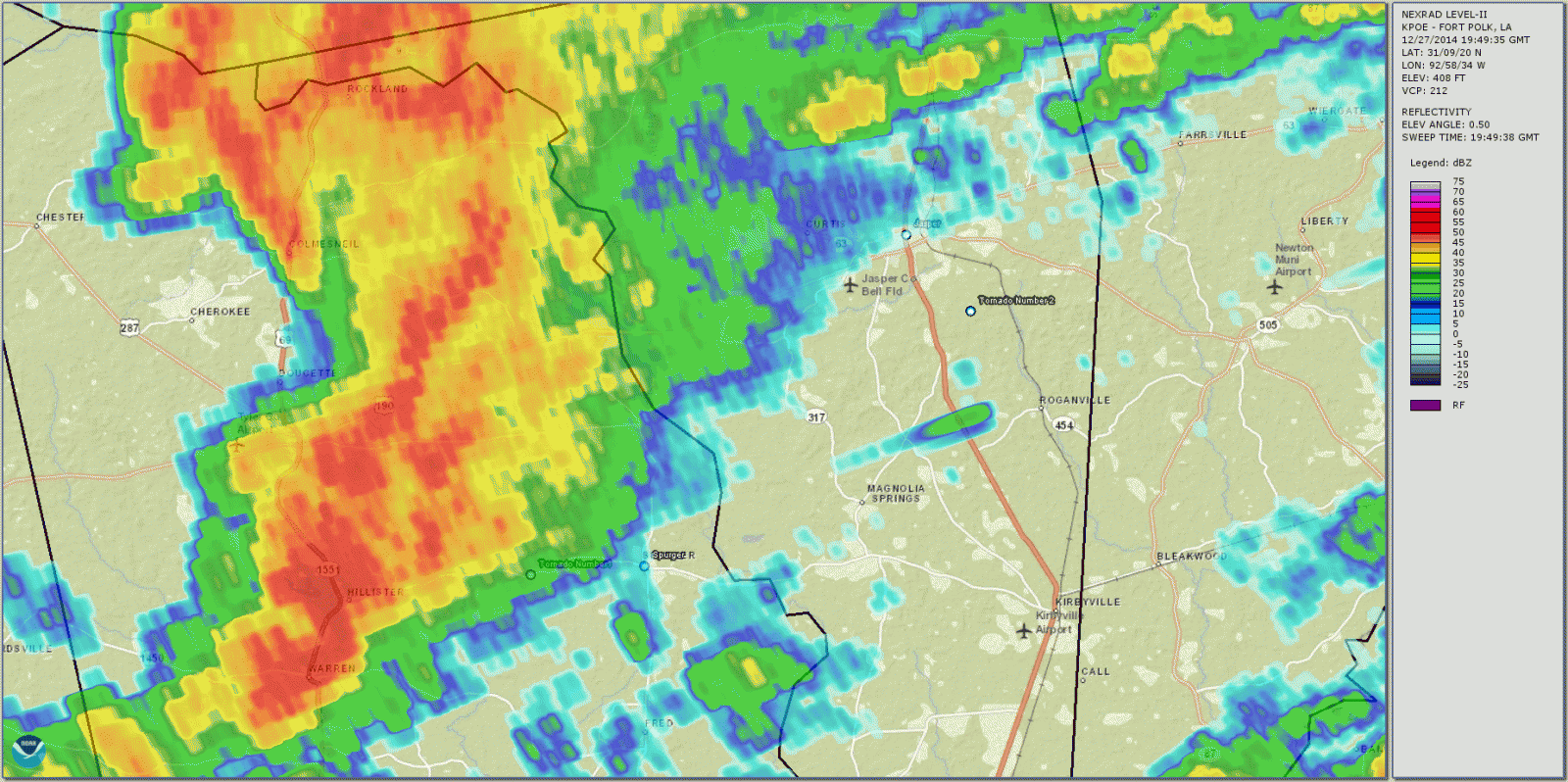
Radar image near the time of the tornado in Jasper County at 2:37 PM. (Click for a larger image) |
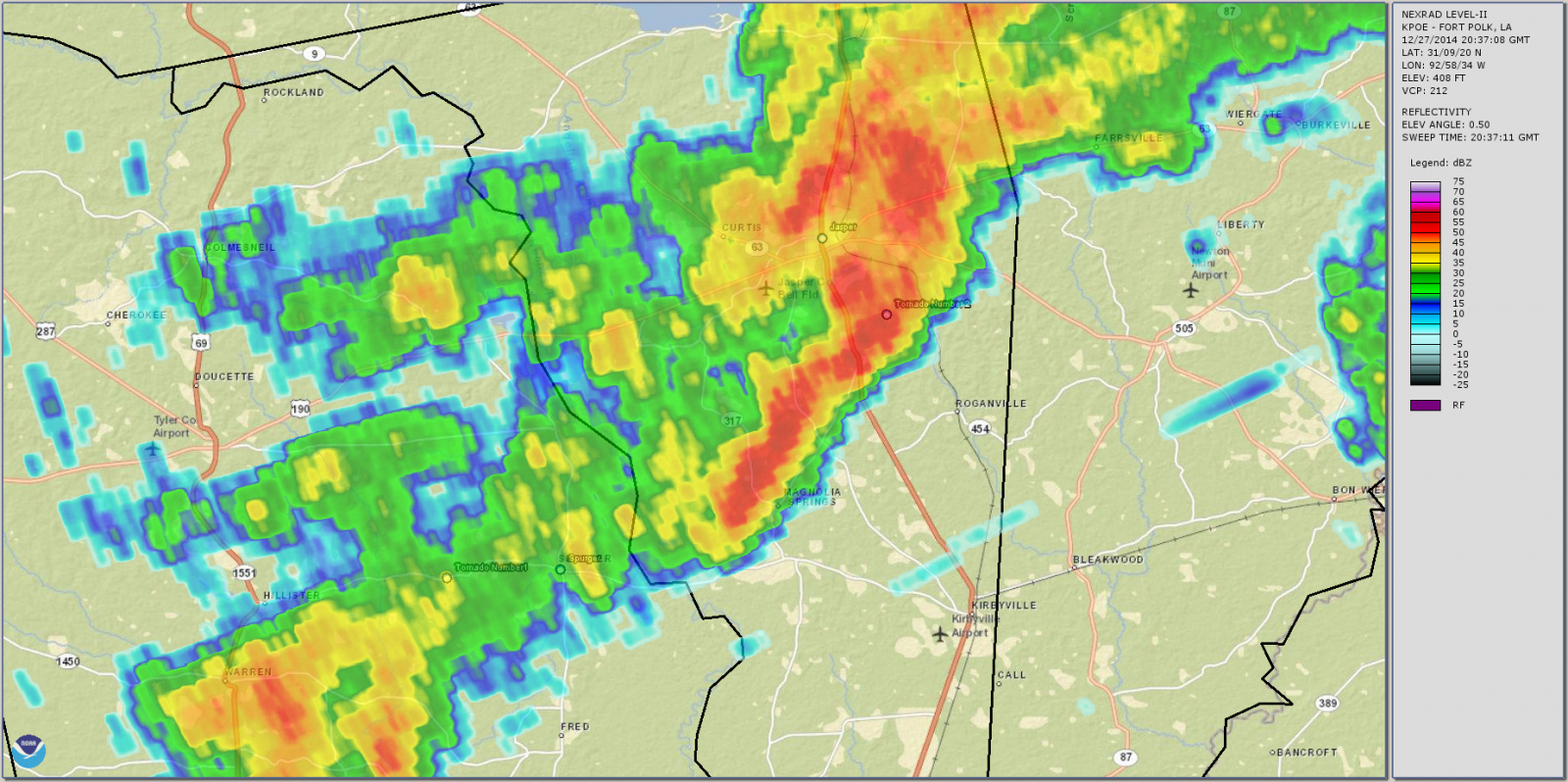
Radar animation of the storm progression from 1:49 PM to 2:42 PM. (Click for a larger image) |
Forecasts
Marine Forecasts
Local Products
Model Data
Forecaster's Discussion
Fire Weather
Graphical Forecasts
Wet Bulb Globe Temps
Aviation Weather
Activity Planner
Mardi Gras Decision Support
Other Links
National Hurricane Ctr
Storm Prediction Ctr
Weather Prediction Ctr
Other Links
Office History
LCH StoryMap
Hazards
Severe Weather
Tropical Weather
National Outlooks
Local Storm Reports
Tropical Cyclone Reports
Current
Tide Data
Satellite Data
Observations
Hydrology
Jefferson Co. DD6 Network
River/Lake Forecasts
Calcasieu Par. Network
Radar
Shreveport (SHV)
New Orleans (LIX)
Fort Polk (POE)
Houston/Galveston (HGX)
Lake Charles (LCH)
Probabilistic Pages
Probabilistic Rainfall
Probabilistic DSS
Probabilistic Snowfall
US Dept of Commerce
National Oceanic and Atmospheric Administration
National Weather Service
Lake Charles, LA
500 Airport Boulevard
Lake Charles, LA 70607
(337) 477-5285 M-F 8a to 4p only
Comments? Questions? Please Contact Us.