
Dangerous and extreme heat will remain across portions of the Central U.S. this week, persisting across the Mid to Lower Mississippi Valleys, Gulf Coast, Southern Plains and portions of Texas. A heat wave over the Southwest will intensify late this week. Severe thunderstorms and flash flooding will spread from the Great Lakes/Ohio Valley to the Mid-Atlantic and Northeast the next few days. Read More >
Lake Charles, LA
Weather Forecast Office
| Late April/Early May Severe Weather and Flooding |
| Event Overview |
|
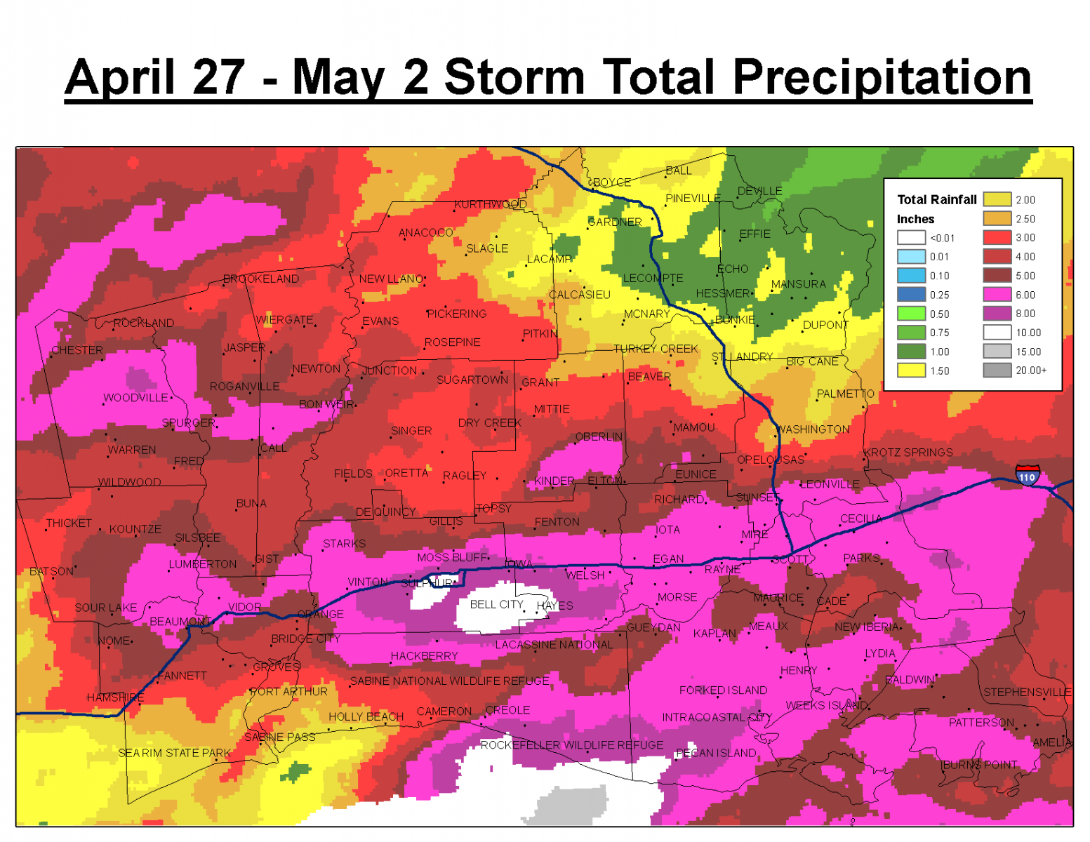
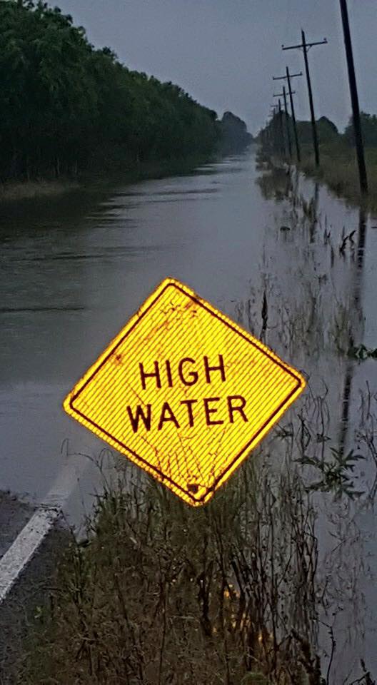
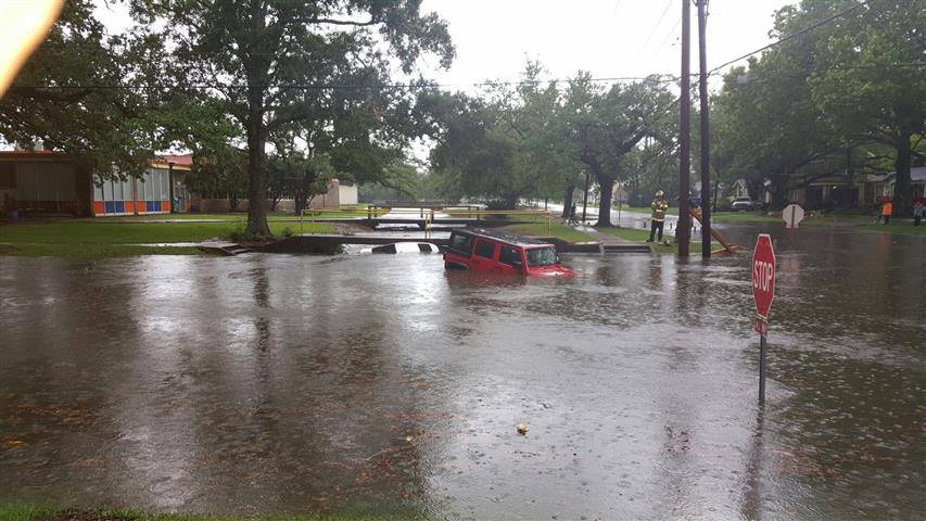
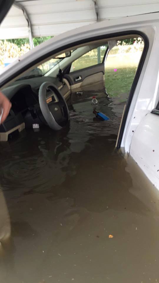
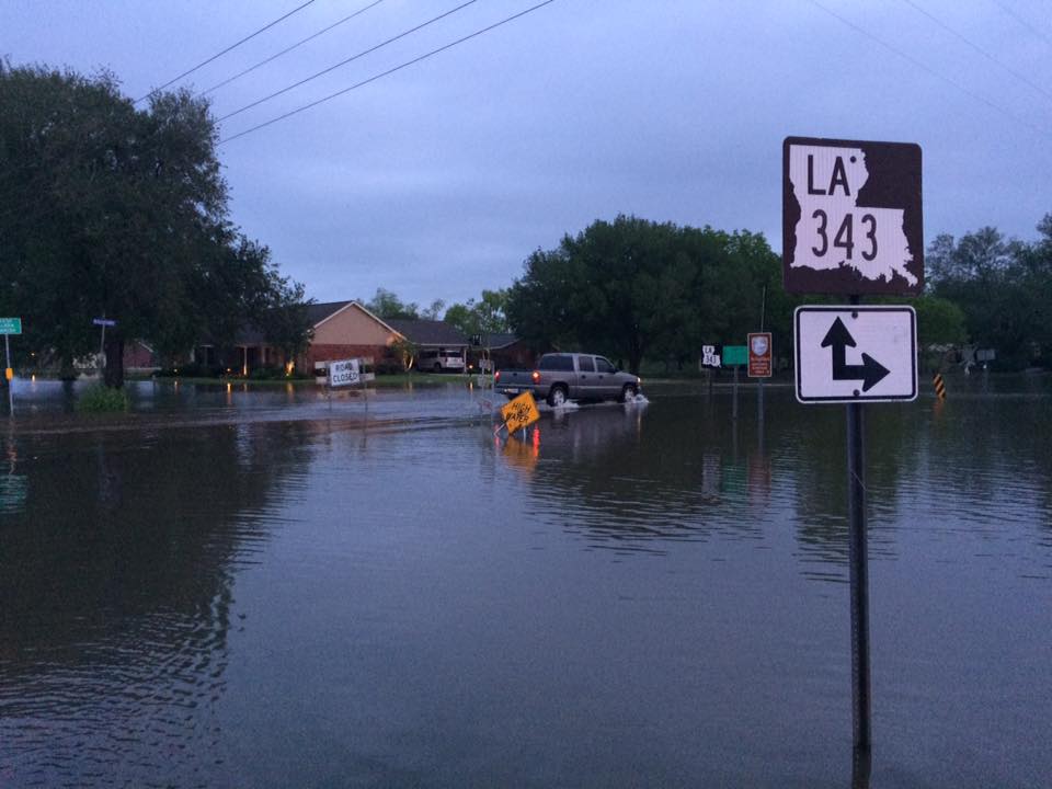
A slow moving storm system resulted in severe lines of thunderstorms moving across southeast Texas and southwest Louisiana between April 26th and May 2nd. This resulted in all forms severe weather including hail, damaging winds, and 4 tornadoes. The multiple rounds of thunderstorms brought heavy rainfall which culminated in flash flooding on May 1st along much of the Interstate 10 corridor. In addition to the flooding on many area roads, Interstate 49 was closed for several hours due to flash flooding. |
Tornado Table
| Time | Location | Strength | Killed | Injuries | Path Length | Max Path Width | Path |
| April 27 5:58 AM | Woodville, TX | EF-1 | 0 | 0 | 0.7 Miles | 50 Yards | 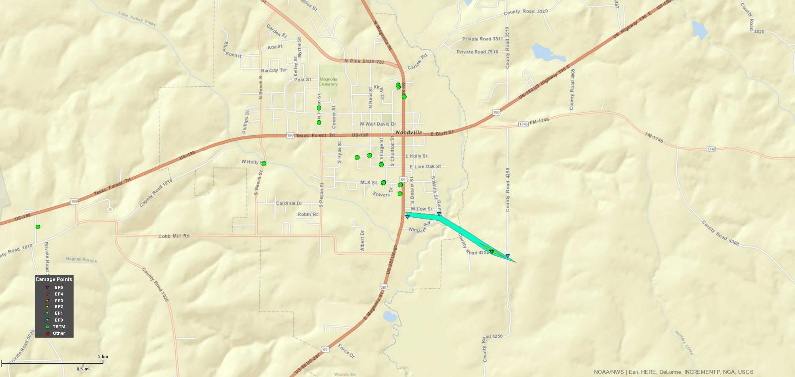 |
| April 27 6:22 AM | Magnolia Springs, TX | EF-1 | 0 | 0 | 2.7 Miles | 50 Yards | 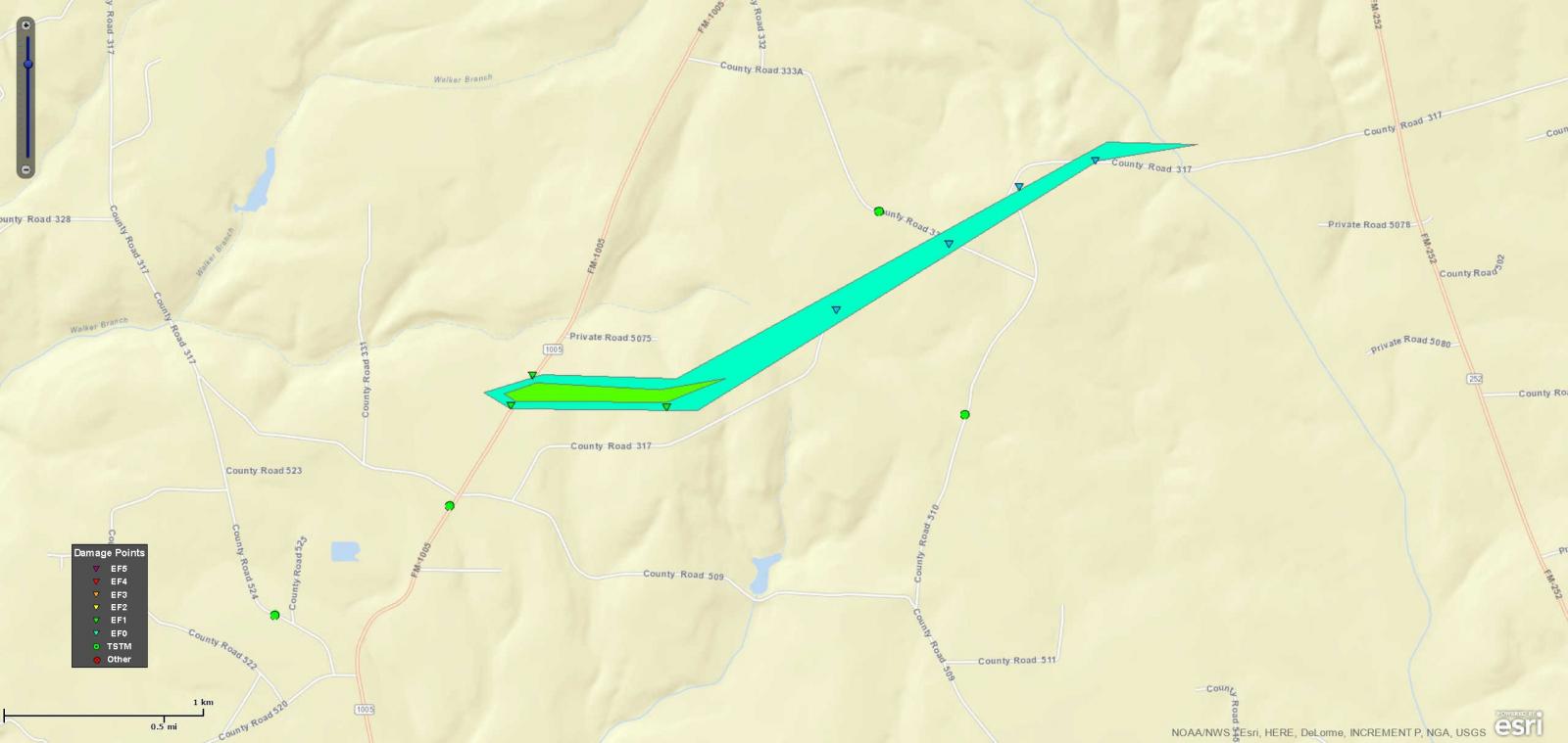 |
| April 30 6:08 AM | Call, TX | EF-2 | 0 | 3 | 10.15 Miles | 500 Yards | 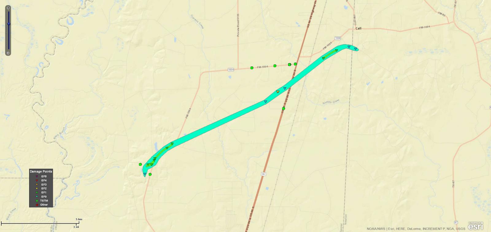 |
| April 30 11:25 AM | Big Cane, LA | UNK | 0 | 0 | UNK | UNK | 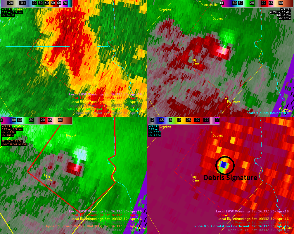 |
Lake Charles, KPLC |
Lake Charles, KPLC |
Cankton, KLFY |
Scott, KATC |
Forecasts
Forecaster's Discussion
Fire Weather
Graphical Forecasts
Wet Bulb Globe Temps
Aviation Weather
Activity Planner
Mardi Gras Decision Support
Marine Forecasts
Local Products
Model Data
Other Links
National Hurricane Ctr
Storm Prediction Ctr
Weather Prediction Ctr
Other Links
Office History
LCH StoryMap
Hazards
Severe Weather
Tropical Weather
National Outlooks
Local Storm Reports
Tropical Cyclone Reports
Current
Tide Data
Satellite Data
Observations
Hydrology
River/Lake Forecasts
Calcasieu Par. Network
Jefferson Co. DD6 Network
Radar
Shreveport (SHV)
New Orleans (LIX)
Fort Polk (POE)
Houston/Galveston (HGX)
Lake Charles (LCH)
Probabilistic Pages
Probabilistic DSS
Probabilistic Snowfall
Probabilistic Rainfall
US Dept of Commerce
National Oceanic and Atmospheric Administration
National Weather Service
Lake Charles, LA
500 Airport Boulevard
Lake Charles, LA 70607
(337) 477-5285 M-F 8a to 4p only
Comments? Questions? Please Contact Us.

