Dangerous and extreme heat will remain across portions of the Central U.S. this week, persisting across the Mid to Lower Mississippi Valleys, Gulf Coast, Southern Plains and portions of Texas. A heat wave over the Southwest will intensify late this week. Severe thunderstorms and flash flooding will spread from the Great Lakes/Ohio Valley to the Mid-Atlantic and Northeast the next few days. Read More >
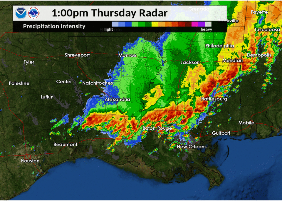
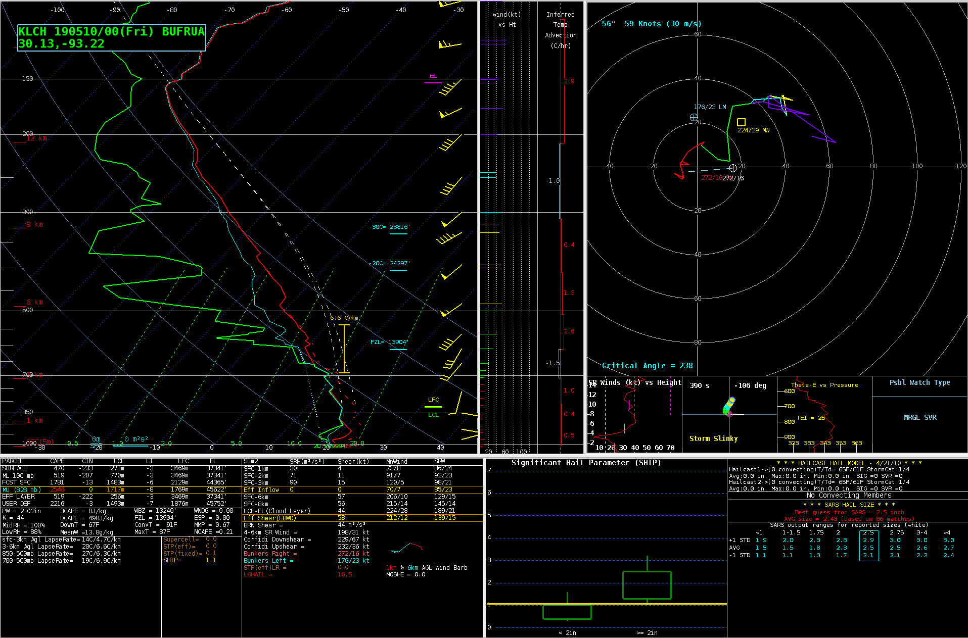
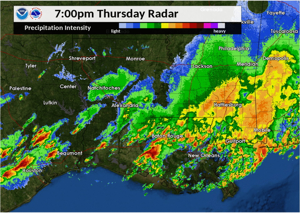
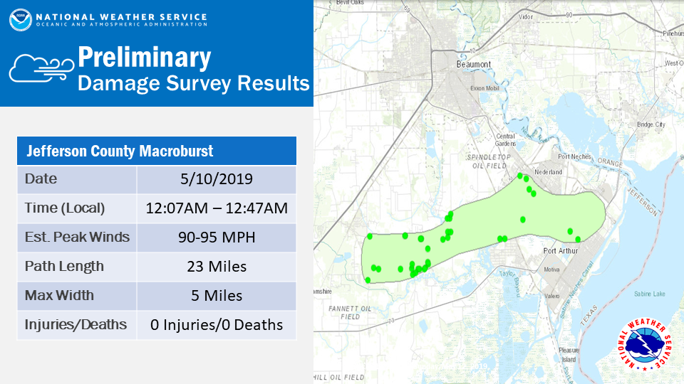
Outflow from showers and thunderstorms earlier in the day and a slowly moving cold front produced several rounds of severe thunderstorms through the evening hours into the overnight hours of May 9th and 10th. Several supercell thunderstorms produced significant hail in excess of two inches across Southeast Texas and Southwest Louisiana. A squall line then moved through the region during the overnight hours and produced significant straight line winds across Southeast Texas.
|
Meteorological Overview
Hail Swaths
Jefferson County Macroburst
|
|||||||||||||
| Back to Top | |||||||||||||