
Dangerous heat will build across the Southwest U.S. through the end of the week with daytime highs of 110-115°F. Isolated to widely scattered severe storms are expected across parts of the central and southern High Plains, Great Lakes into the Ohio Valley, and parts of the Ozarks to Lower Mississippi Valley today. Read More >
Lake Charles, LA
Weather Forecast Office
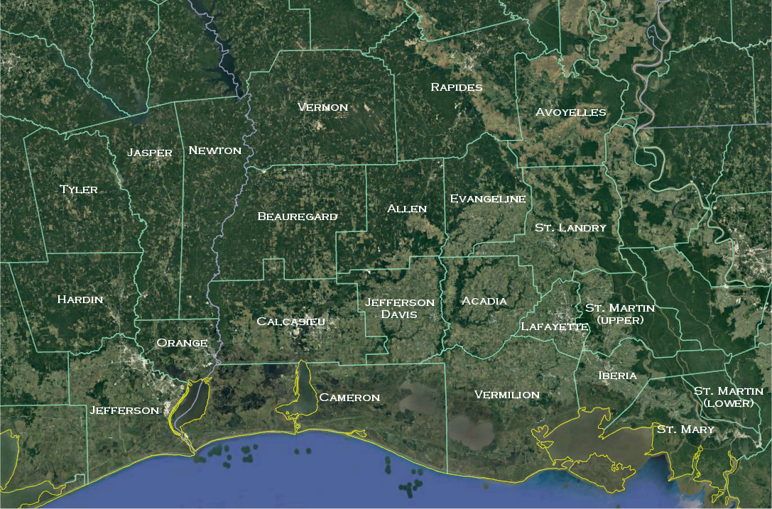
The National Weather Service office in Lake Charles serves the parishes and counties depicted in the map at the bottom of this page.
For life-threatening and imminent severe weather threats, please contact local law enforcement immediately (even if you also contact us by social media or email) and ask that they relay your report to the National Weather Service.
You can report significant weather on social media:
When posting weather reports to social media, it is helpful to include the hashtag #lawx for our parishes in Louisiana and #txwx for our counties in Texas.
When timeliness is not an issue, you may send weather reports and photos to our webmaster at SR-LCH.webmaster@noaa.gov. From time to time, we receive weather photos that would enhance our severe weather training, outreach, and other education efforts. If we may use the photos that you send us for non-profit purposes, please let us know. We strive to include photo credits whenever possible.
To view storm reports from our area from the past 24 hours (or greater), click here.
 |
 |
Forecasts
Aviation Weather
Activity Planner
Mardi Gras Decision Support
Marine Forecasts
Local Products
Model Data
Forecaster's Discussion
Fire Weather
Graphical Forecasts
Wet Bulb Globe Temps
Other Links
National Hurricane Ctr
Storm Prediction Ctr
Weather Prediction Ctr
Other Links
Office History
LCH StoryMap
Hazards
Severe Weather
Tropical Weather
National Outlooks
Local Storm Reports
Tropical Cyclone Reports
Current
Observations
Tide Data
Satellite Data
Hydrology
Calcasieu Par. Network
Jefferson Co. DD6 Network
River/Lake Forecasts
Radar
Shreveport (SHV)
New Orleans (LIX)
Fort Polk (POE)
Houston/Galveston (HGX)
Lake Charles (LCH)
Probabilistic Pages
Probabilistic Snowfall
Probabilistic Rainfall
Probabilistic DSS

US Dept of Commerce
National Oceanic and Atmospheric Administration
National Weather Service
Lake Charles, LA
500 Airport Boulevard
Lake Charles, LA 70607
(337) 477-5285 M-F 8a to 4p only
Comments? Questions? Please Contact Us.


 Follow us on X
 Follow us on Facebook
 Follow us on YouTube
 LCH RSS Feed