
A strong Pacific storm continues to track across the Great Basin. Heavy snow is expected across the higher elevations and heavy rain across lower terrain. Strong gusty winds will make for additional hazards for travelers. These winds will bring increasing fire weather concerns for the southern High Plains. Then we will closely watch for severe thunderstorms across the central Plains on Monday. Read More >
Overview
|
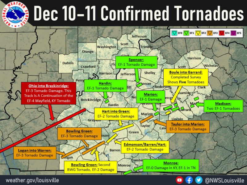
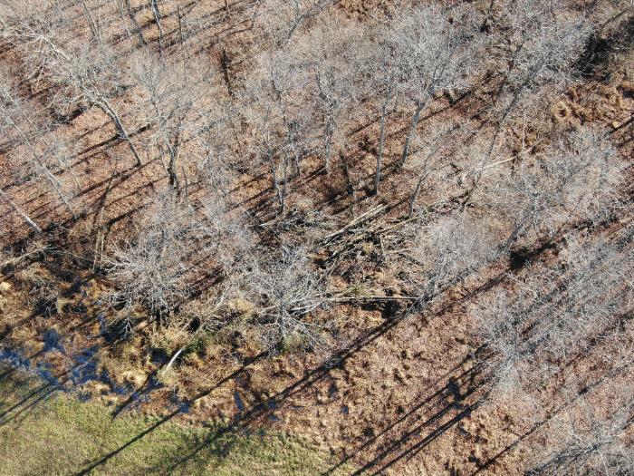
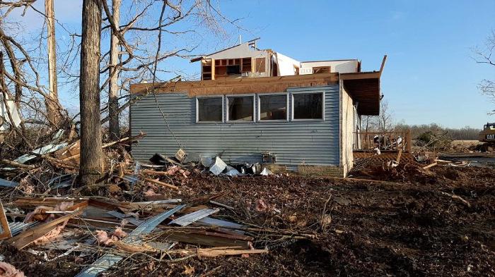
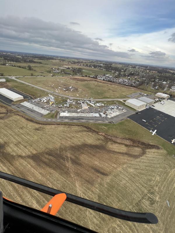
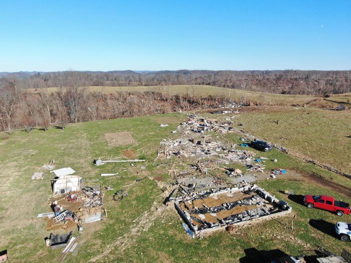
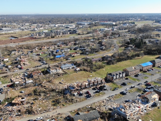
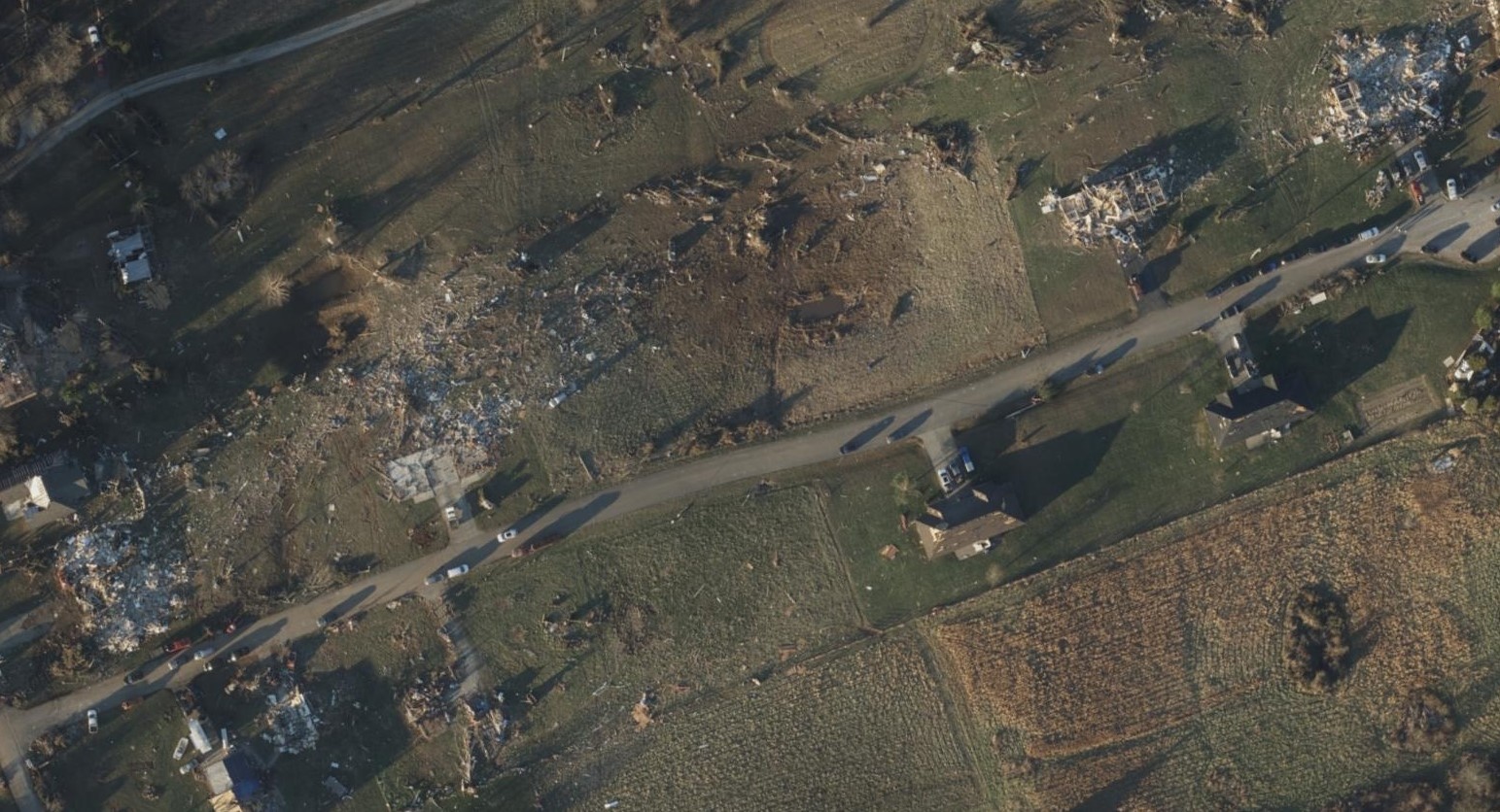
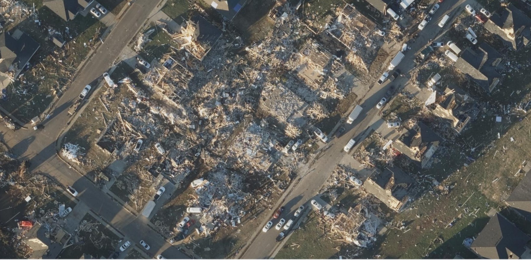
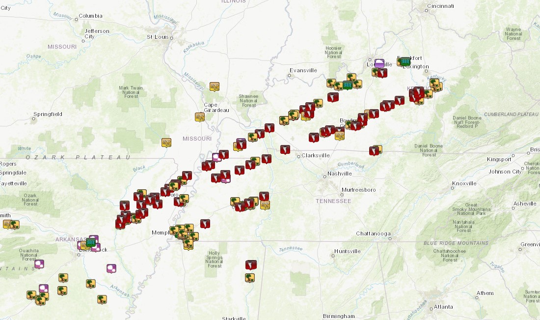
A potent storm system moved across the central United States on December 10-11, 2021 resulting in widespread severe weather. Numerous tornadoes occurred with storms that traveled through Kentucky Friday evening into Saturday morning (Dec 10-11) including a significant long track tornado that devastated Mayfield, KY. This tornado began near Woodland Mills, Tennessee, and stayed on the ground all the way to Falls of Rough, Kentucky; a distance of 165.7 miles!
The map to the right gives the most recent depiction of damage paths.
|
 |
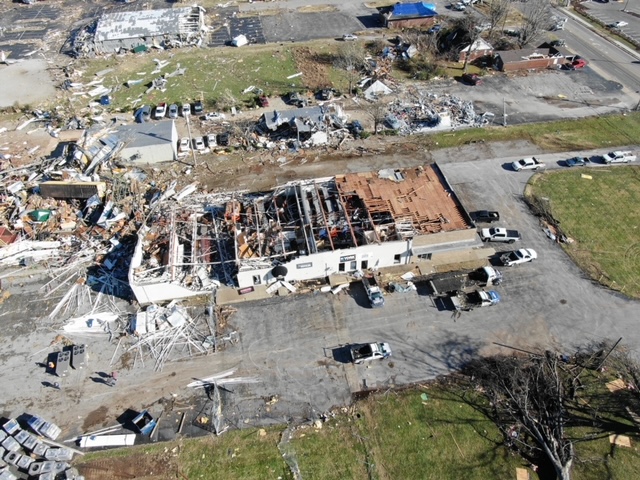
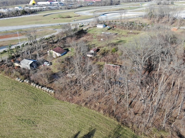
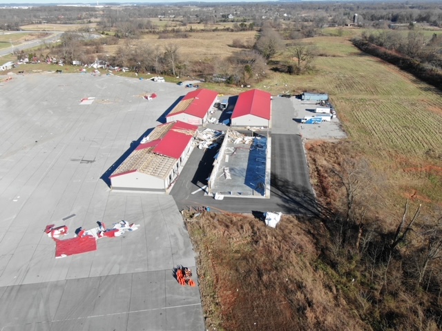
Tornado Damage Areas:
Interactive Damage Survey Map - Zoom in and click the points to see damage information and pictures. All damage points are preliminary at this time. Performance of this map may be slow due to heavy internet traffic.

|
Tornado - Centertown to Rough River Dam, KY
Track Map 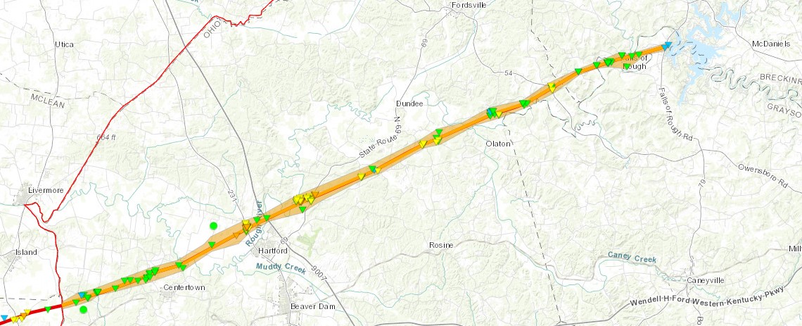
|
||||||||||||||||
|
Tornado - Big Spring, KY
Track Map 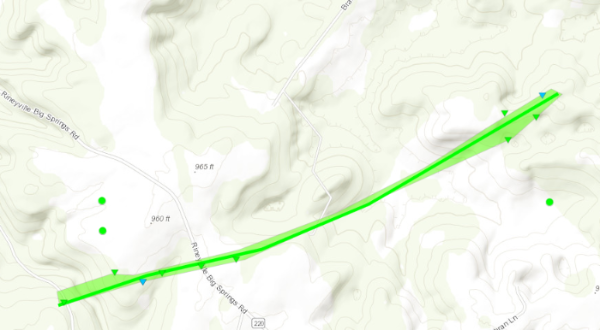
|
||||||||||||||||
|
Tornado - Mt Washington, KY
Track Map 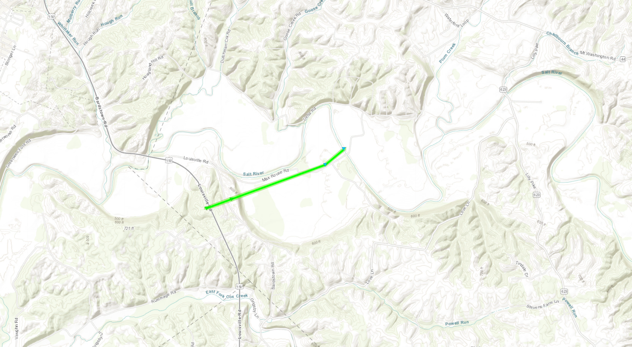
|
||||||||||||||||
|
Tornado - Gordonsville to Hadley, KY
Track Map 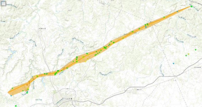
|
||||||||||||||||
|
Tornado - Bowling Green, KY
Track Map 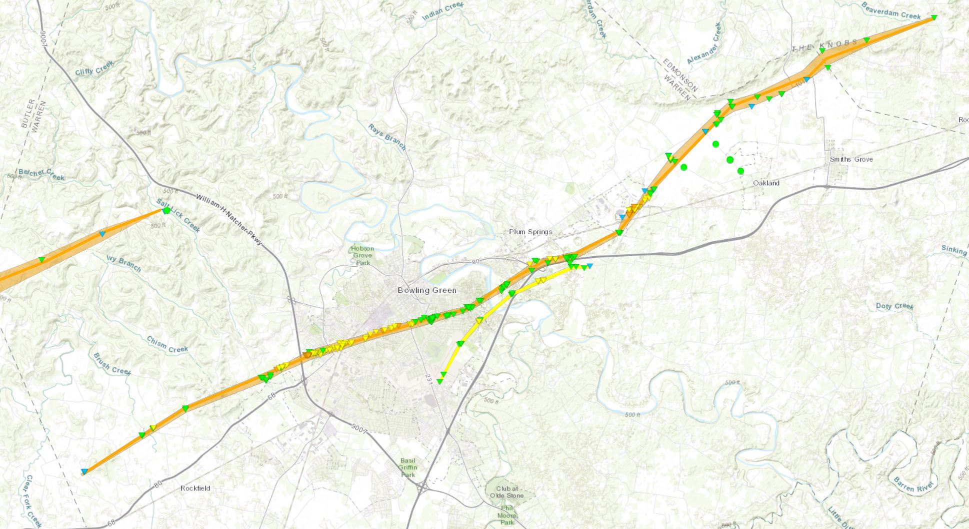
|
||||||||||||||||
|
Tornado - Bowling Green, KY
Track Map 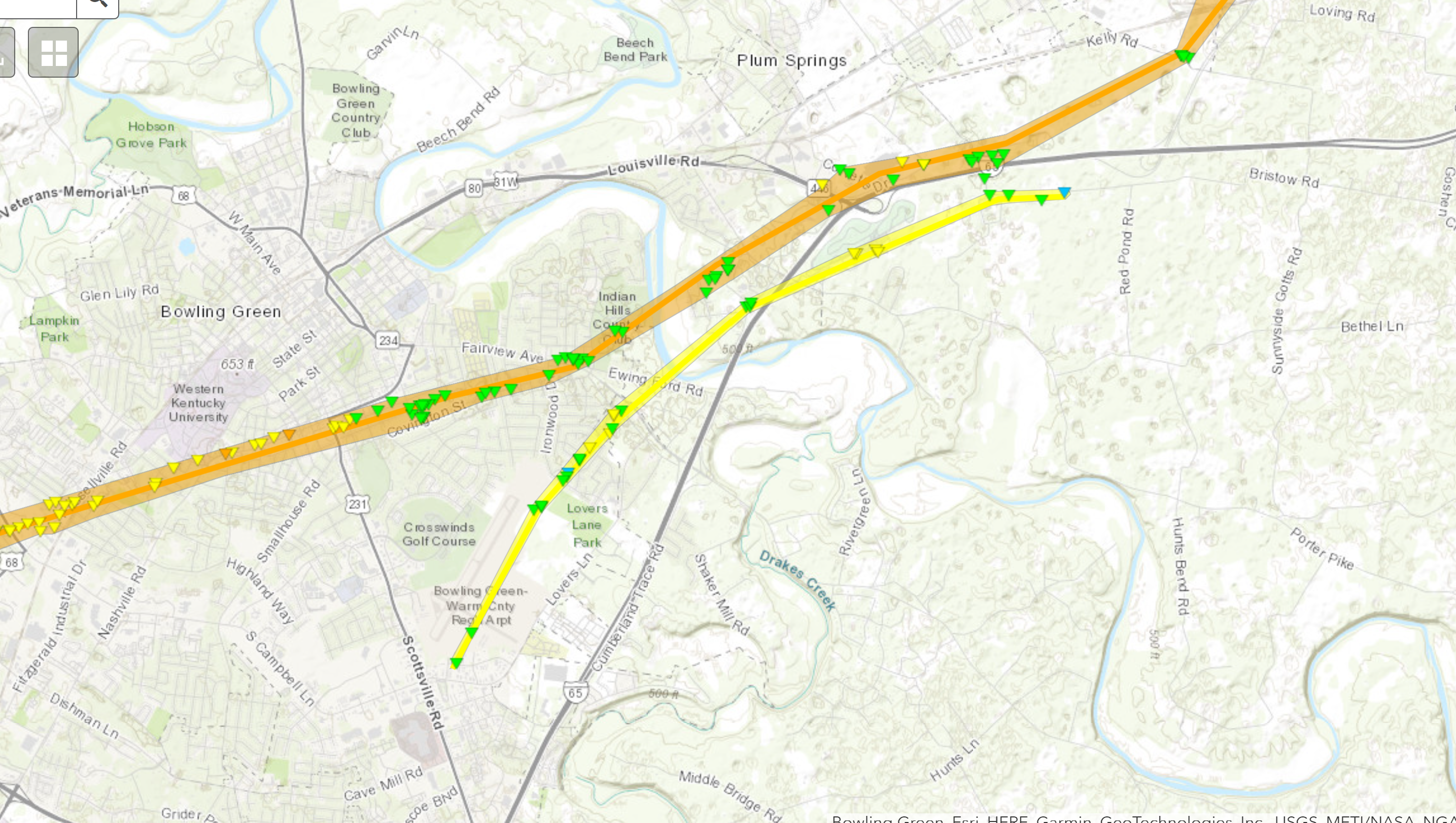
|
||||||||||||||||
|
Tornado - Rocky Hill to Horse Cave, KY
Track Map 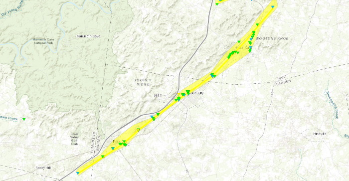
|
||||||||||||||||
|
Tornado - West of Hardyville to Summersville, KY
Track Map 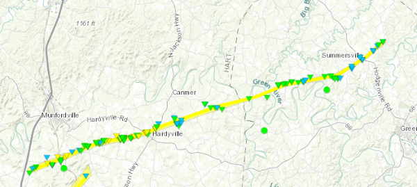
|
||||||||||||||||
|
Tornado - Saloma to west of Bradfordsville, KY
Track Map 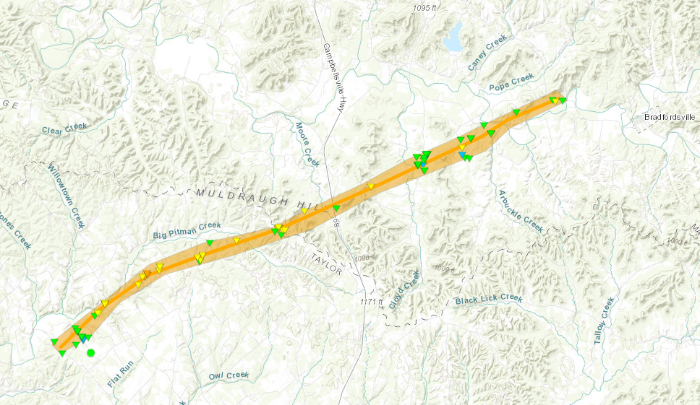
|
||||||||||||||||
|
Tornado - Bradfordsville, KY
Track Map 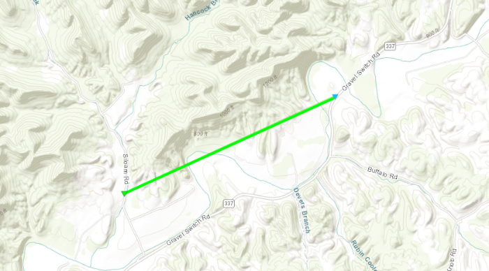
|
||||||||||||||||
|
Tornado - Junction City, KY
Track Map 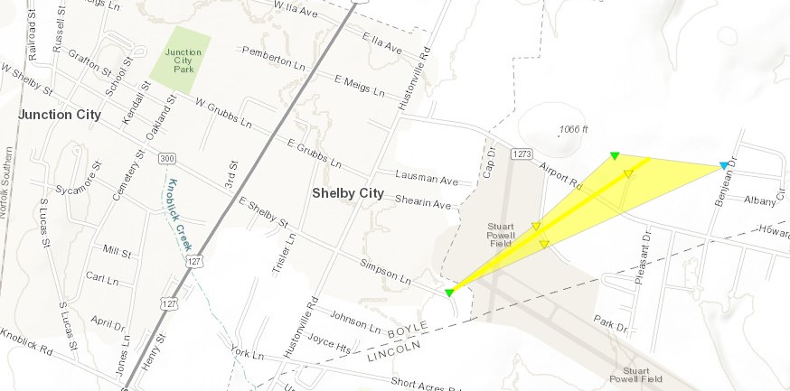
|
||||||||||||||||
|
Tornado - Danville, KY
Track Map 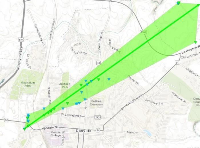
|
||||||||||||||||
|
Tornado - Bryantsville, KY
Track Map 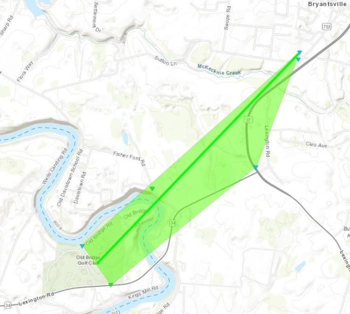
|
||||||||||||||||
|
Tornado - Hedgeville, KY
Track Map 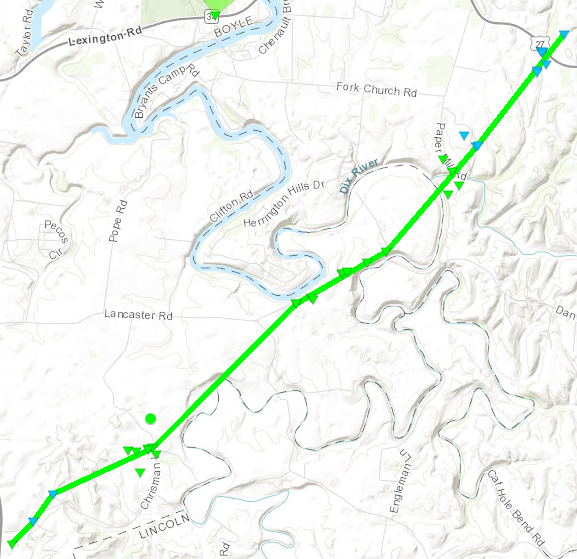
|
||||||||||||||||
|
Tornado - Marksbury, KY
Track Map 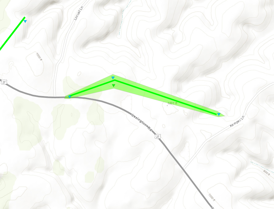
|
||||||||||||||||
|
Tornado - Kirksville, KY
Track Map 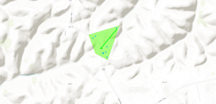
|
||||||||||||||||
|
Tornado - North of Richmond, KY
Track Map 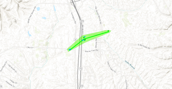
|
||||||||||||||||
|
Tornado - Hestand, KY
Track Map 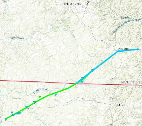
|
||||||||||||||||
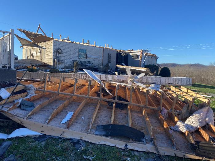
The Enhanced Fujita (EF) Scale classifies tornadoes into the following categories:
| EF0 Weak 65-85 mph |
EF1 Moderate 86-110 mph |
EF2 Significant 111-135 mph |
EF3 Severe 136-165 mph |
EF4 Extreme 166-200 mph |
EF5 Catastrophic 200+ mph |
 |
|||||
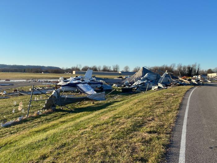
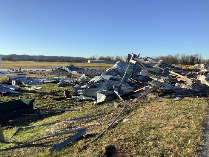
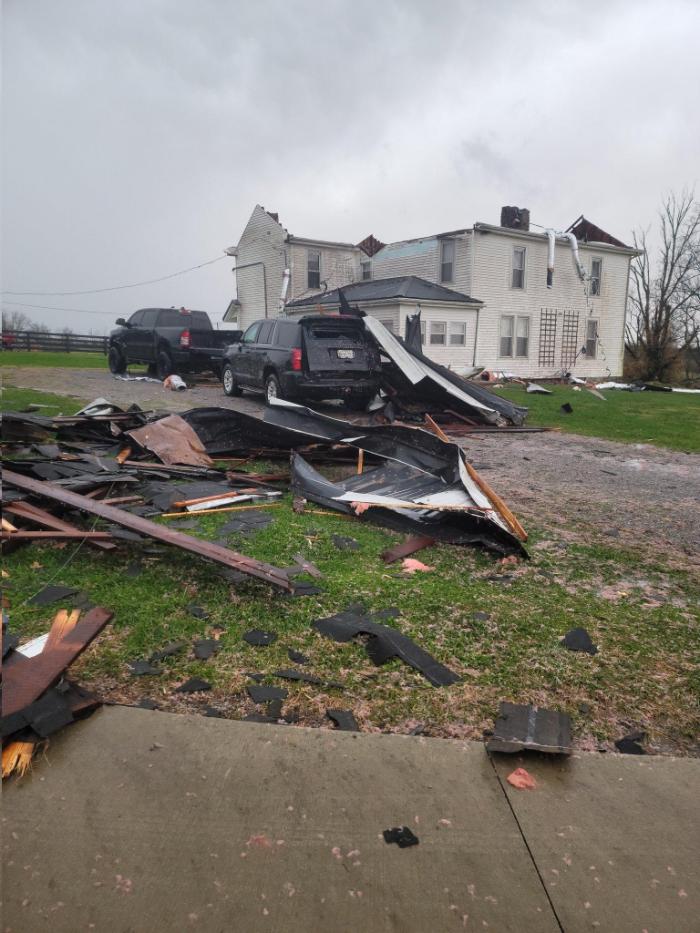
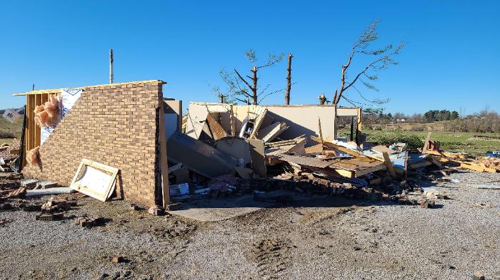
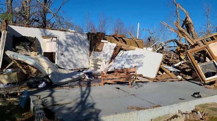
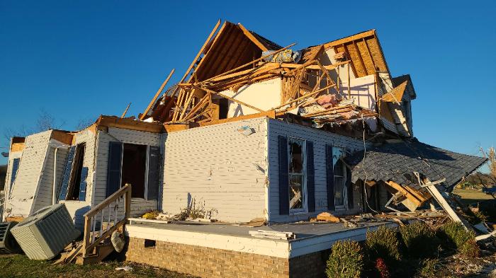
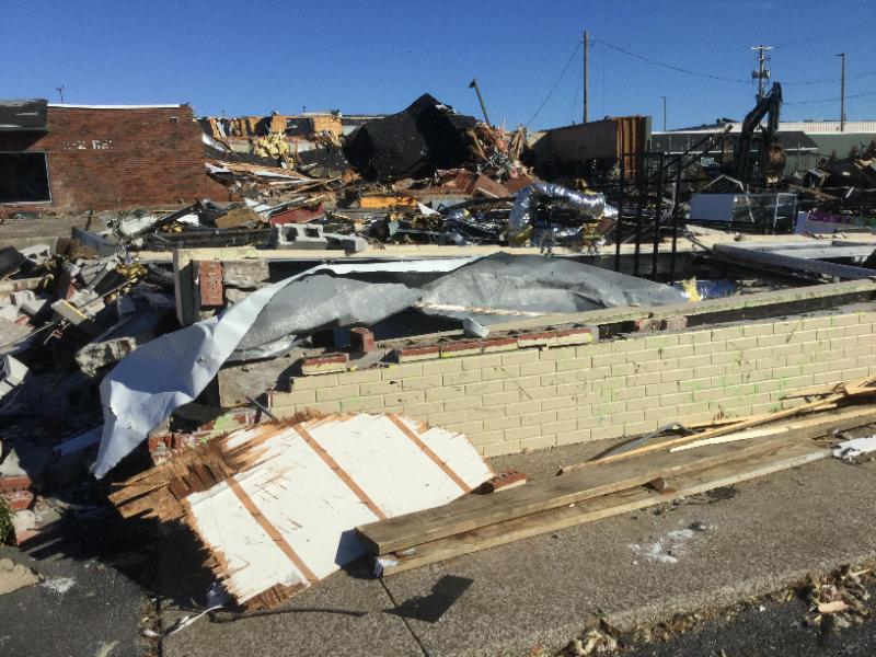
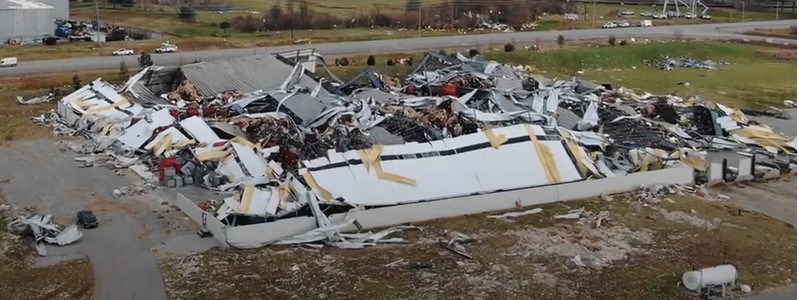
EF-3 Damage in Bowling Green (Tornado 1):
EF-2 Damage in Bowling Green (Tornado 2):
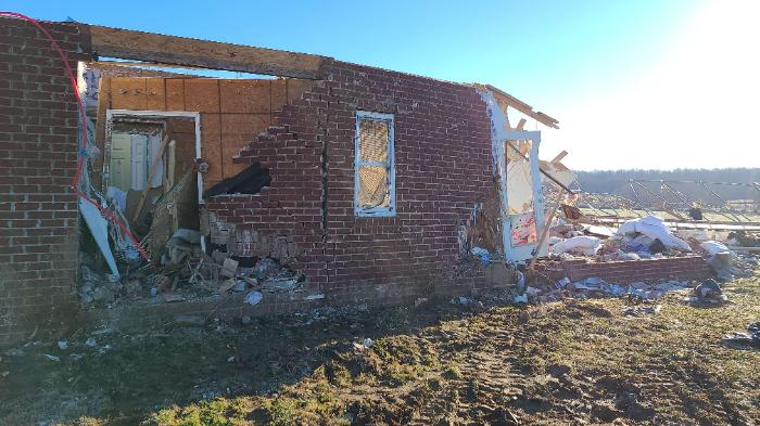
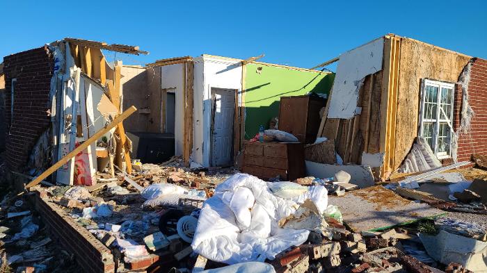
EF-3 Damage in Taylor County near Saloma:
Hart County Tornado Damage:
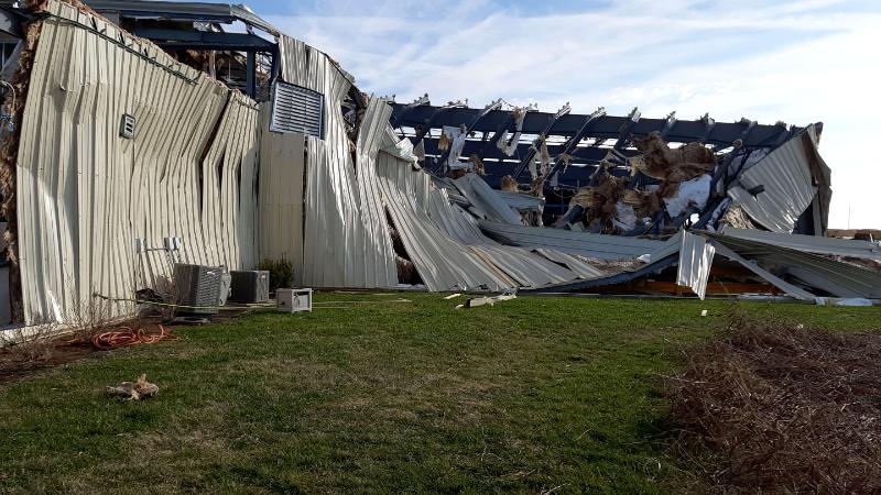
EF-3 Damage in Ohio County:
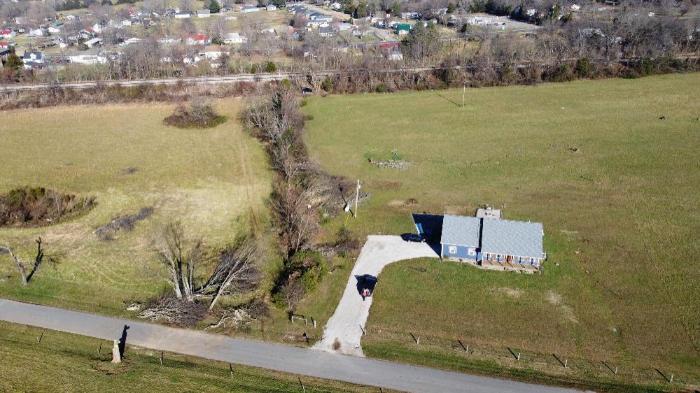
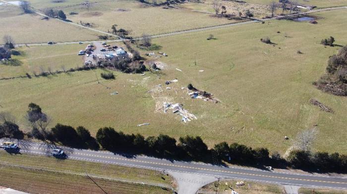
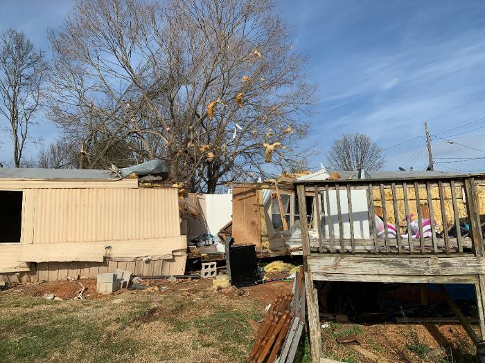
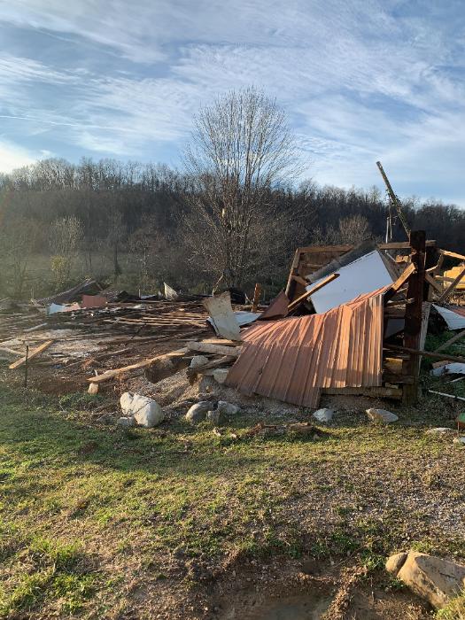
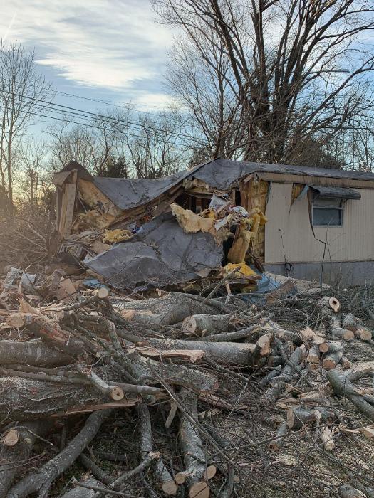
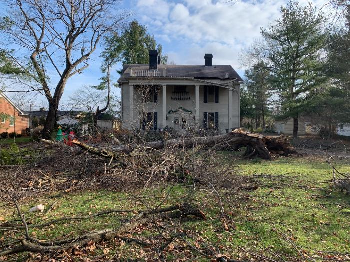
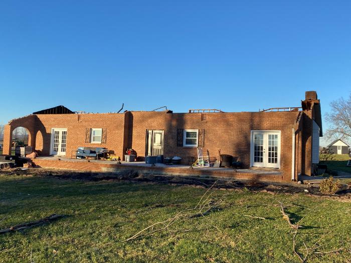
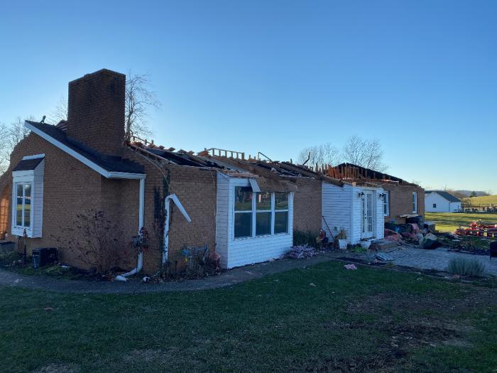
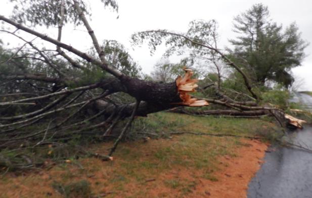
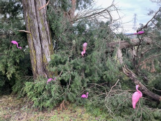
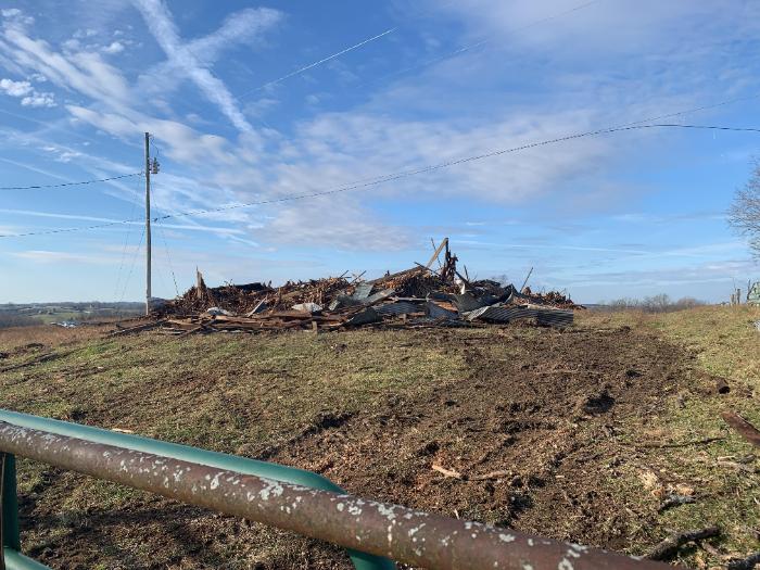
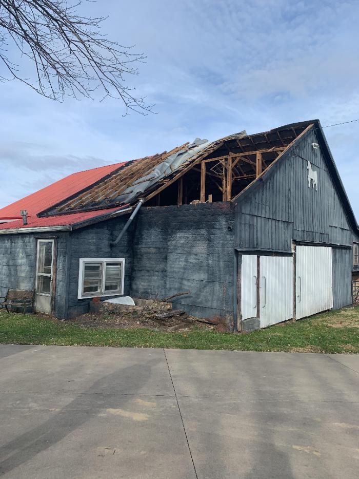
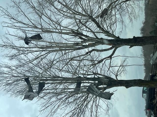
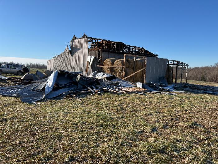
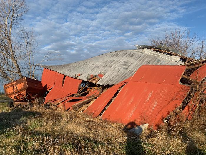
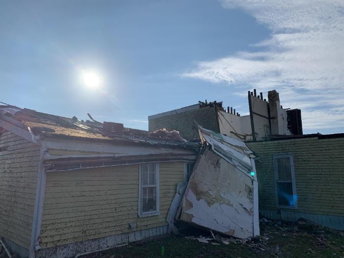
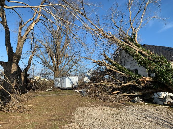
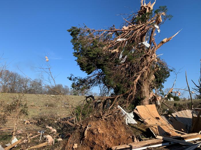
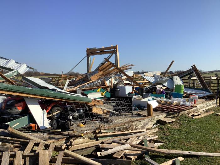
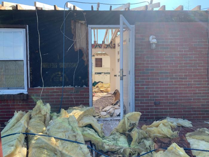
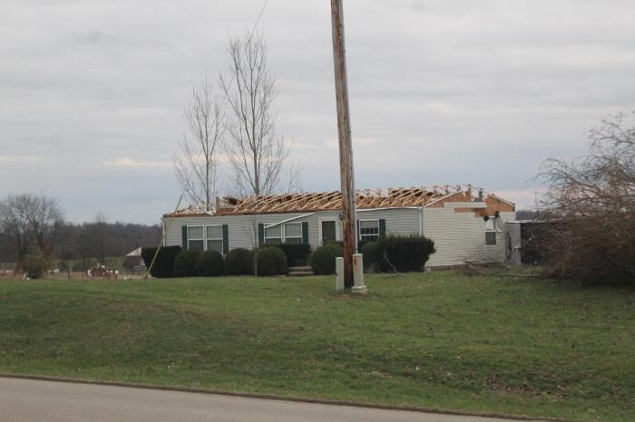
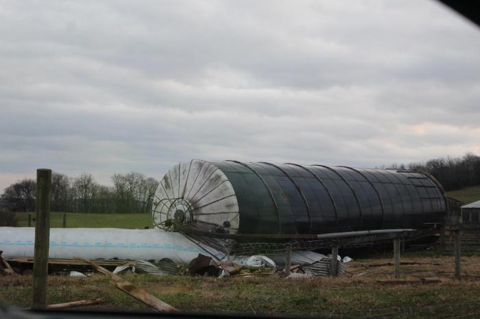
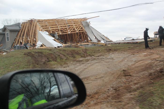
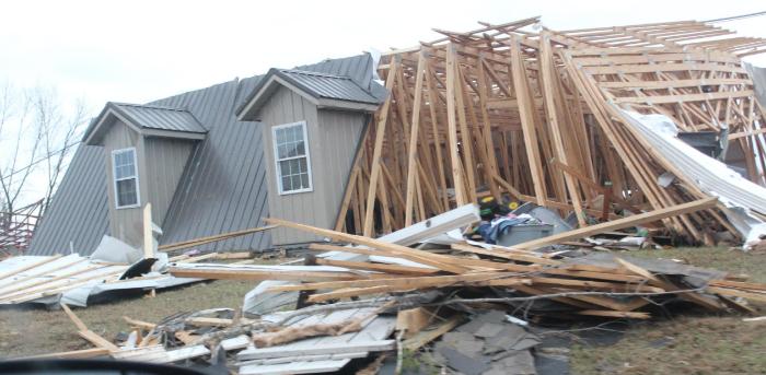
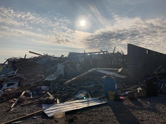
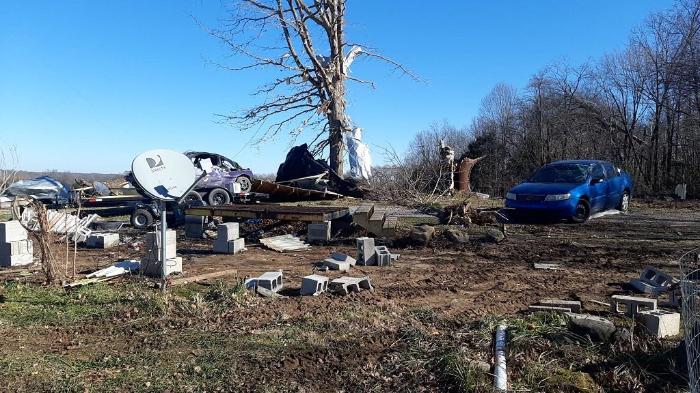
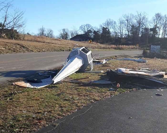
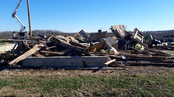
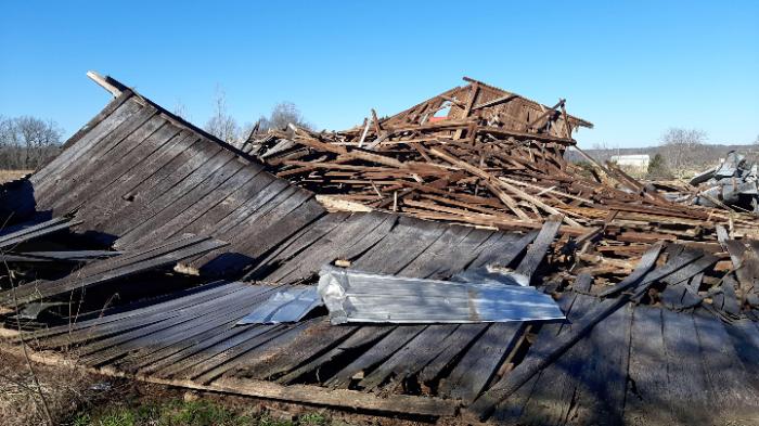
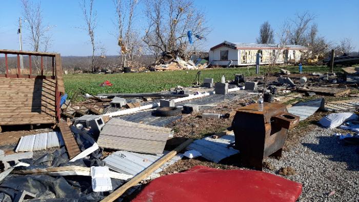
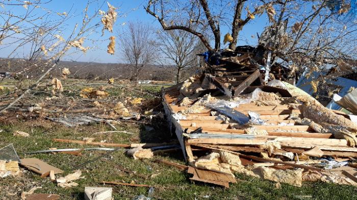
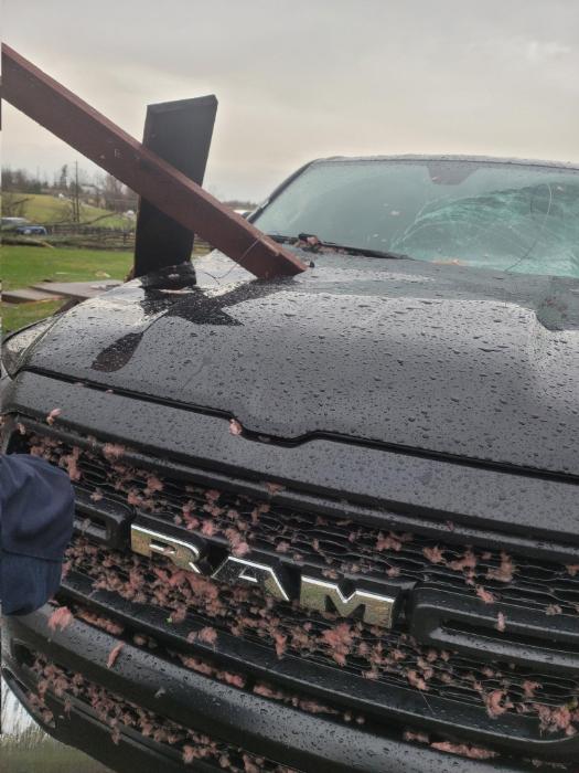
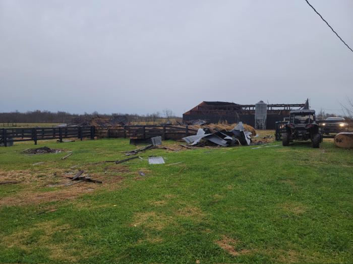
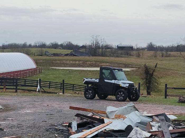
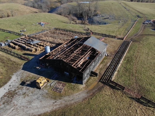
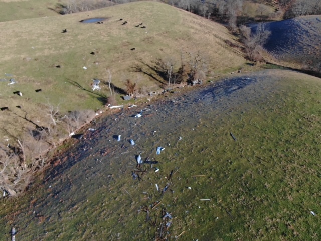
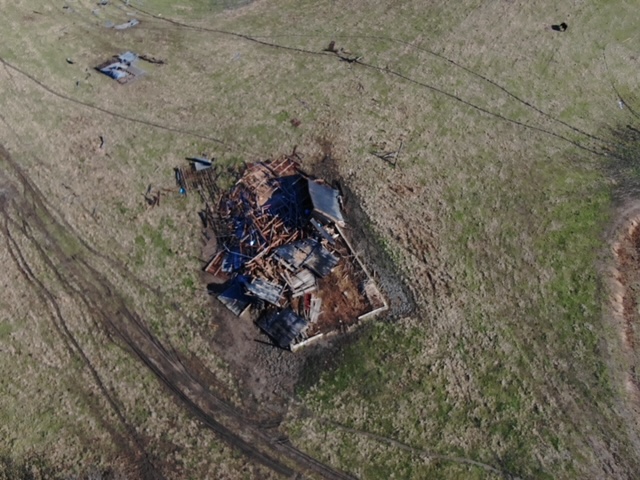
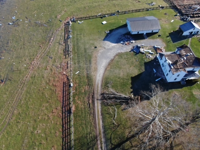
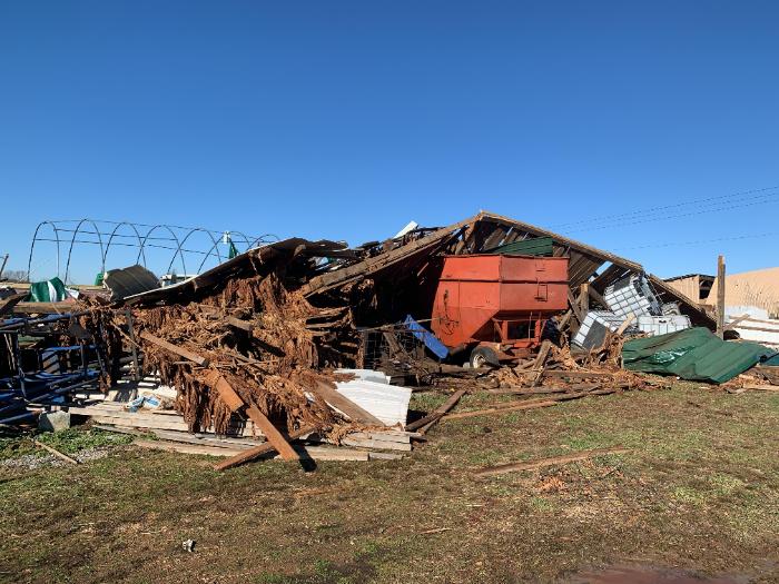
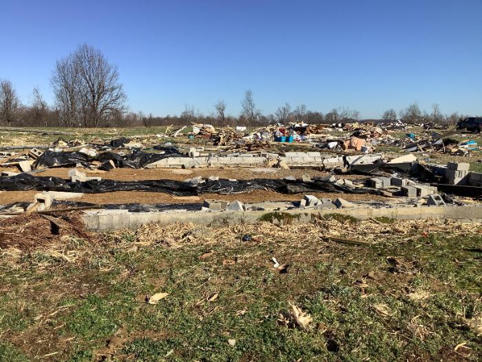
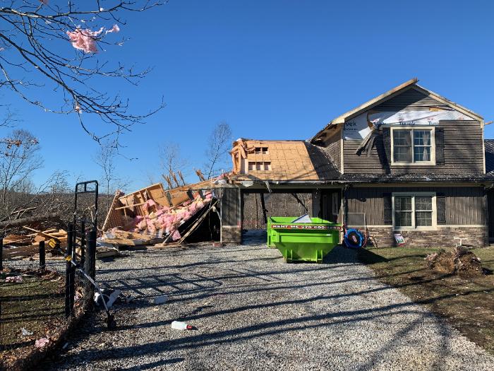
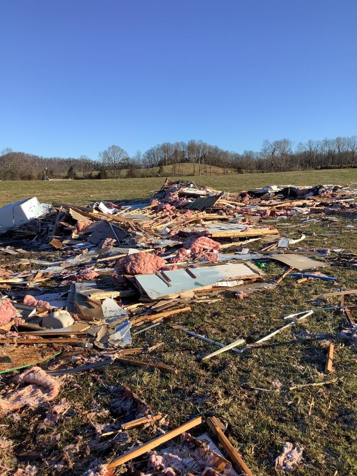
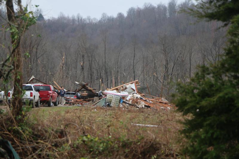
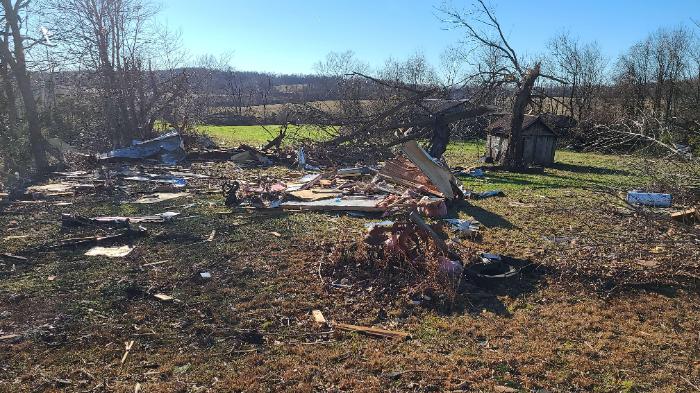
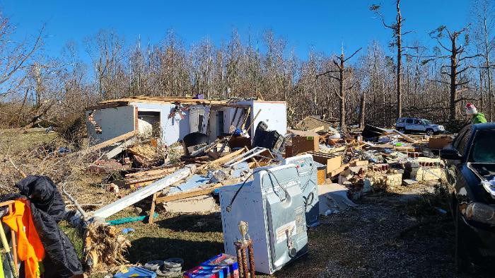
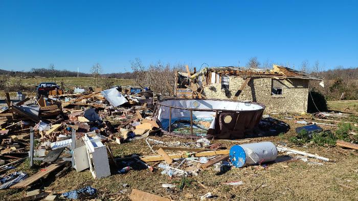
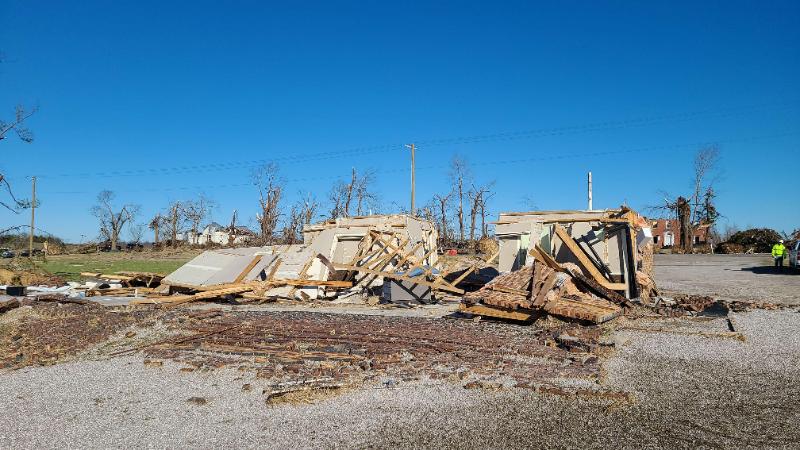
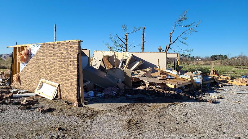
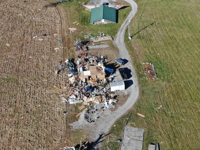
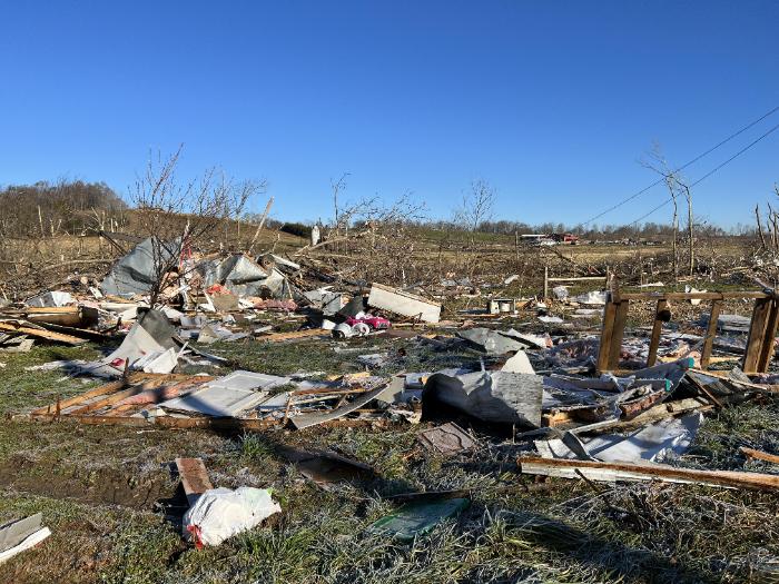
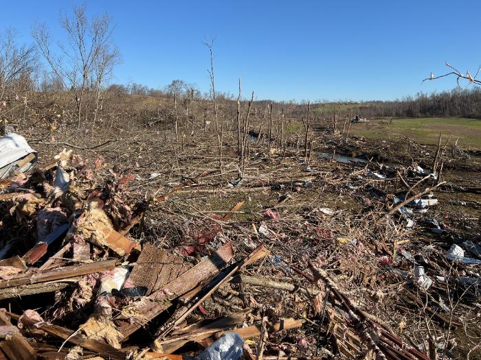
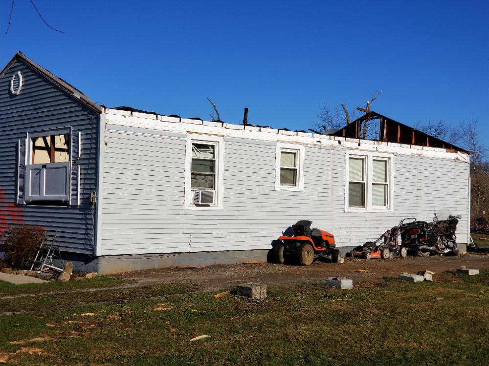
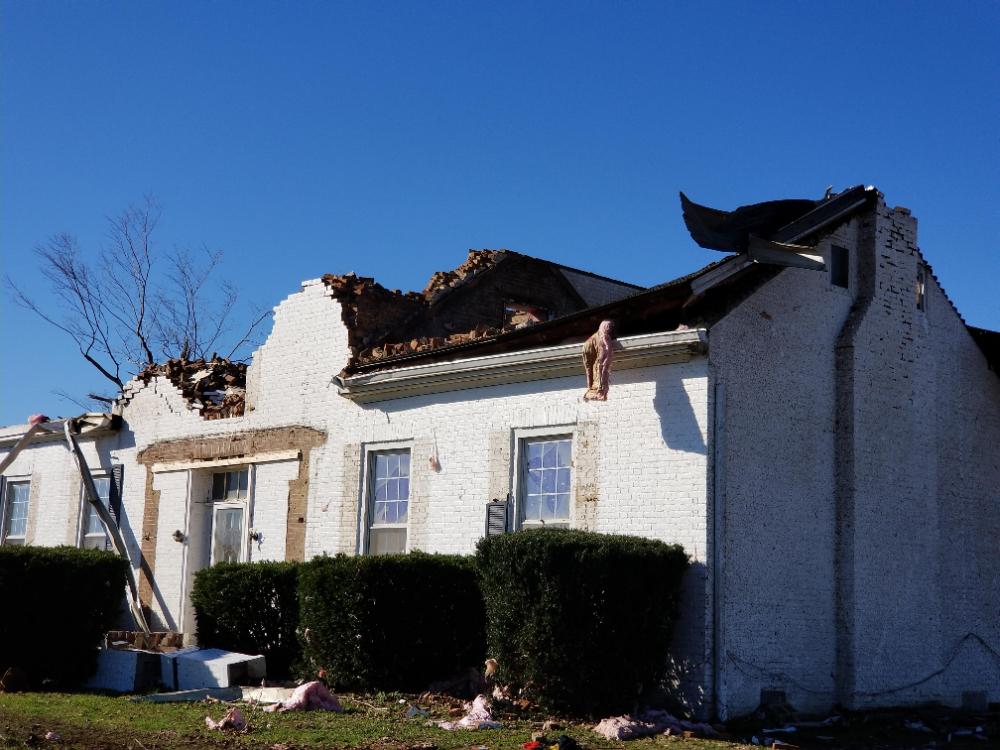
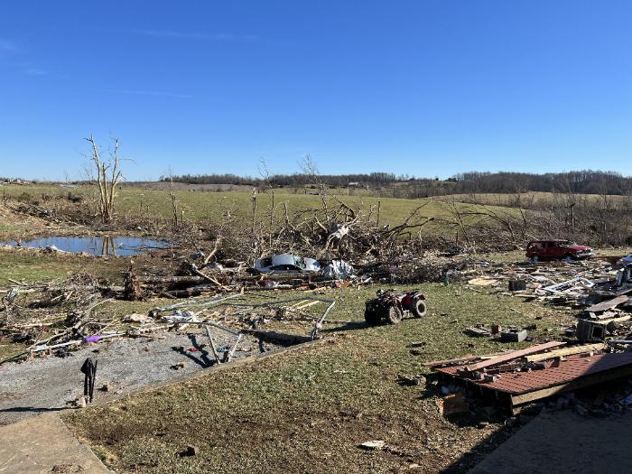
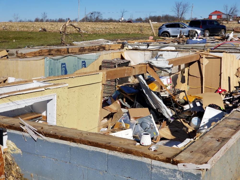
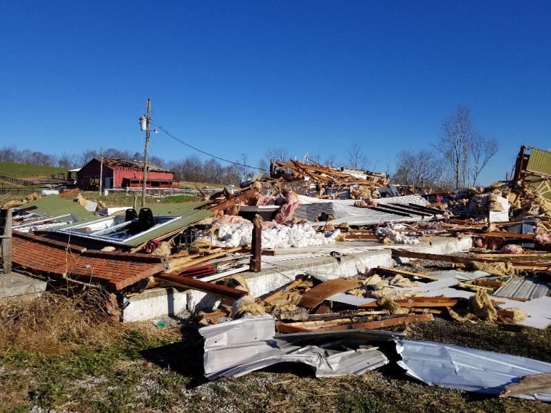
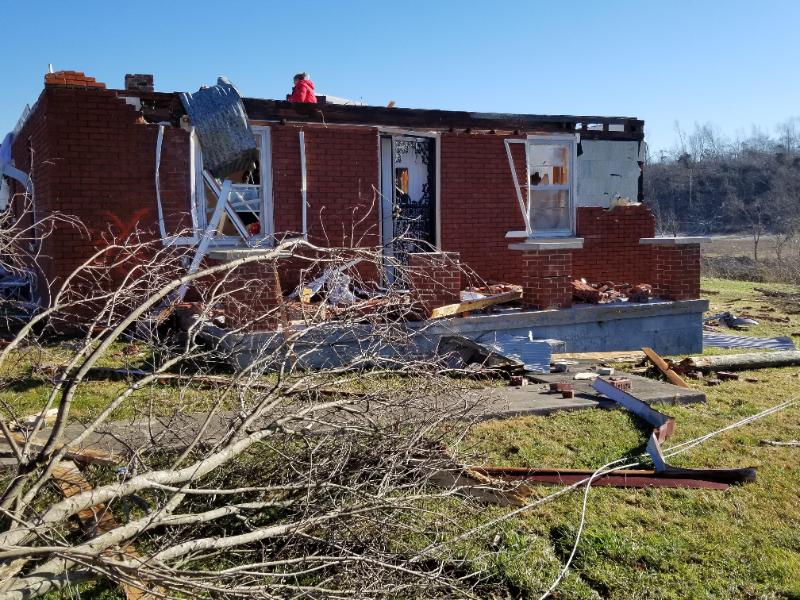
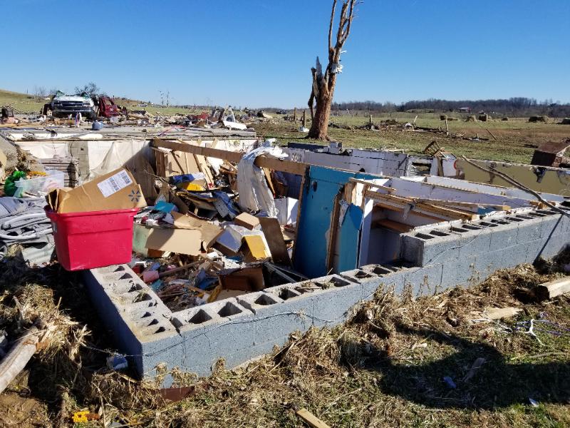
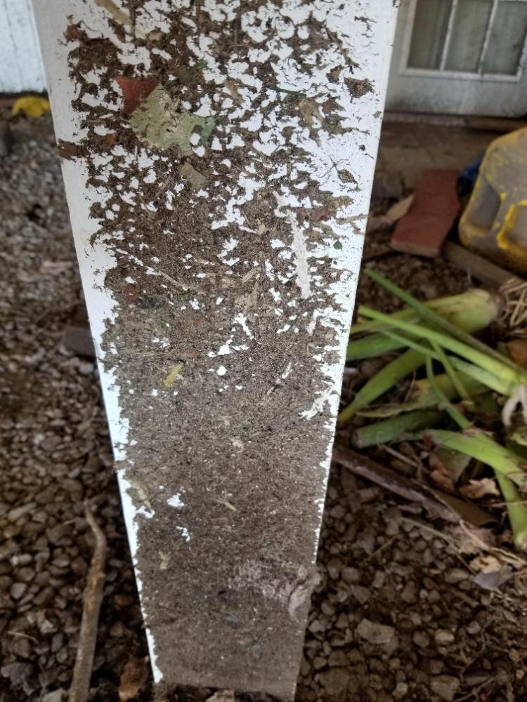
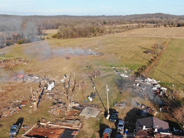
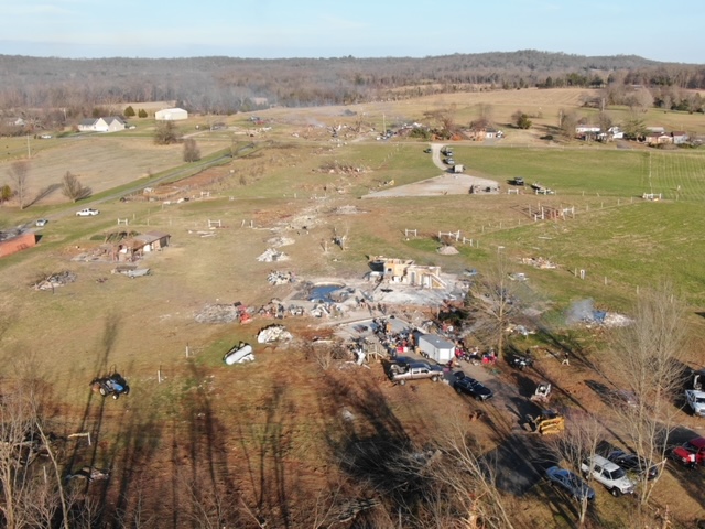
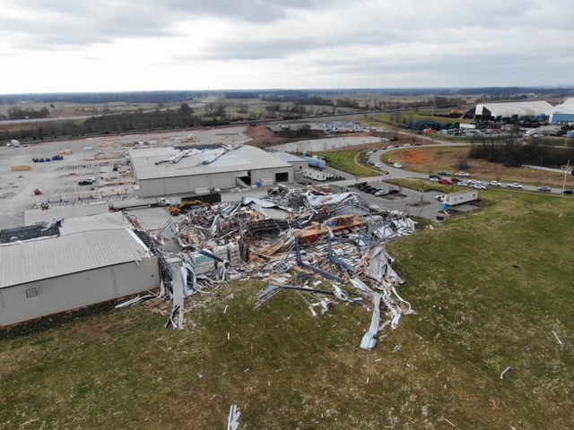
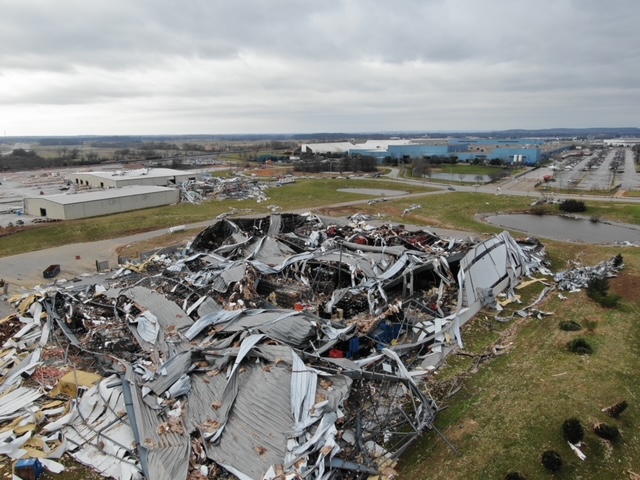
Photos and Videos
See our YouTube December 11 Playlist for drone videos!
Barren County
 |
 |
 |
 |
| Courtesy of EM Tracy Shirley | Courtesy of EM Tracy Shirley | Courtesy of EM Tracy Shirley | Courtesy of EM Tracy Shirley |
 |
 |
 |
|
| Courtesy of NWS Storm Survey | Courtesy of NWS Storm Survey | Courtesy of NWS Storm Survey |
Boyle County
 |
 |
 |
 |
| Courtesy of NWS Storm Survey | Courtesy of NWS Storm Survey | Courtesy of NWS Storm Survey | Courtesy of NWS Storm Survey |
 |
 |
||
| Courtesy of NWS Storm Survey | Courtesy of Nick Parker |
Garrard County
 |
 |
 |
 |
| Courtesy of Cara Joy Keplar | Courtesy of NWS Storm Survey | Courtesy of NWS Storm Survey | Courtesy of NWS Storm Survey |
Green County
 |
 |
 |
 |
| Courtesy of NWS Storm Survey | Courtesy of NWS Storm Survey | Courtesy of NWS Storm Survey | Courtesy of NWS Storm Survey |
 |
|||
| Gabe, KY |
Hardin County
 |
 |
||
| Courtesy of NWS Storm Survey | Courtesy of NWS Storm Survey |
Hart County
 |
 |
 |
 |
| Courtesy of NWS Storm Survey | Courtesy of NWS Storm Survey | Courtesy of NWS Storm Survey | Courtesy of NWS Storm Survey |
 |
 |
 |
 |
| Courtesy of NWS Storm Survey | Courtesy of NWS Storm Survey | Courtesy of Mistie Bush | Courtesy of Mistie Bush |
 |
 |
||
| Courtesy of Mistie Bush | Courtesy of Mistie Bush |
Logan County
 |
 |
 |
 |
| Dairy Farm Milton Sharpe Rd, NWS Storm Survey | Home off Milton Sharpe Rd, NWS Storm Survey | Mobile Home on Homer Rd, NWS Storm Survey | Chandlers Chapel Methodist Church, NWS Storm Survey |
 |
 |
 |
 |
| Courtesy of NWS Storm Survey | Courtesy of NWS Storm Survey | Courtesy of NWS Storm Survey | Courtesy of NWS Storm Survey |
Madison County
 |
 |
 |
 |
| Kirksville, from Twitter via Adam Burniston | Kirksville, from Twitter via Adam Burniston | Kirksville, from Twitter via Adam Burniston | Kirksville, from Twitter via Adam Burniston |
 |
 |
 |
 |
| Courtesy of NWS Storm Survey | Courtesy of NWS Storm Survey | Courtesy of NWS Storm Survey | Courtesy of NWS Storm Survey |
Marion County
 |
 |
 |
 |
| Courtesy of NWS Storm Survey | Courtesy of NWS Storm Survey | Courtesy of NWS Storm Survey | Courtesy of NWS Storm Survey |
 |
 |
 |
|
| Courtesy of Denis House and the Lebanon Enterprise | Courtesy of Joe Sullivan | Courtesy of NWS Storm Survey |
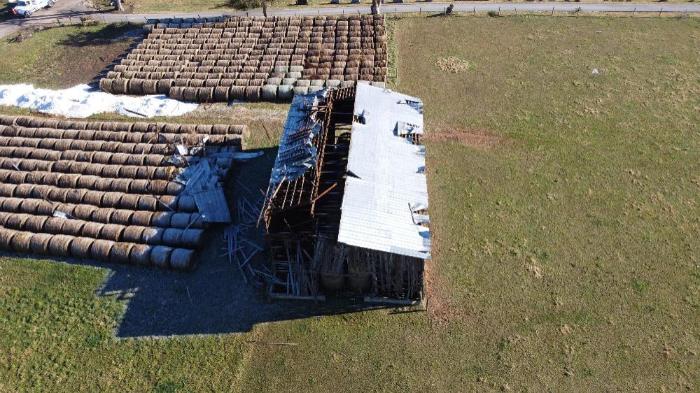
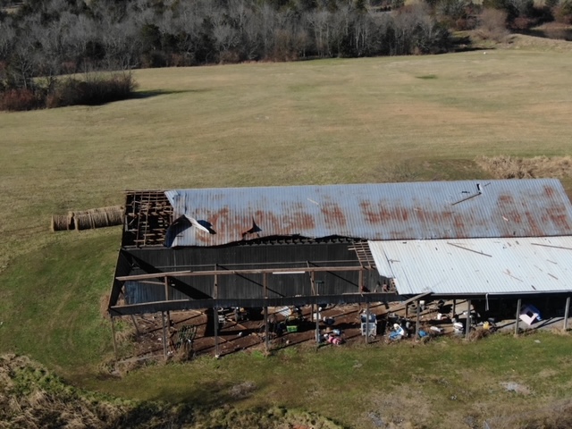
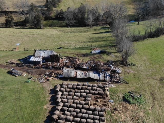
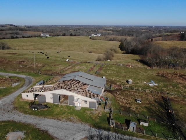
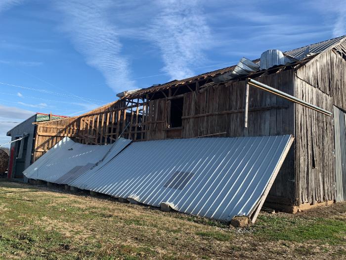
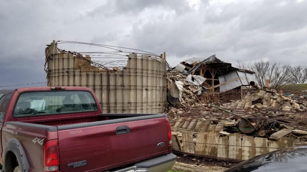
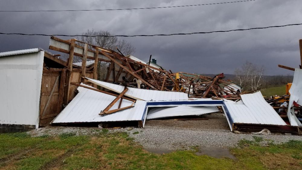
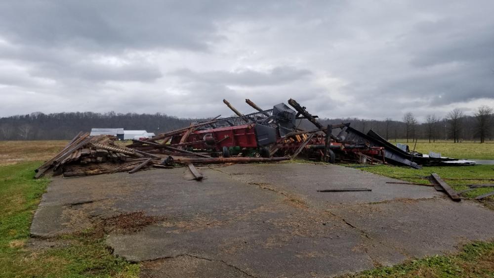
Ohio County
 |
 |
 |
 |
| Courtesy of NWS Storm Survey | Courtesy of NWS Storm Survey | Courtesy of NWS Storm Survey | Courtesy of NWS Storm Survey |
 |
 |
 |
 |
| Courtesy of NWS Storm Survey | Courtesy of NWS Storm Survey | Courtesy of NWS Storm Survey | Courtesy of NWS Storm Survey |
 |
|
||
| Courtesy of NWS Storm Survey | Courtesy of NWS Storm Survey |
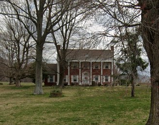
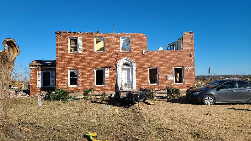
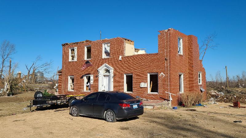
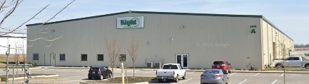
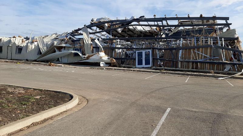
Ohio County Before and After
 |
 |
 |
|
| US 231 north of Hartford (Google Street View) | NWS Storm Survey | NWS Storm Survey |
 |
 |
 |
|
| US 231 north of Hartford (Google Street View) | NWS Storm Survey | NWS Storm Survey |
Spencer County
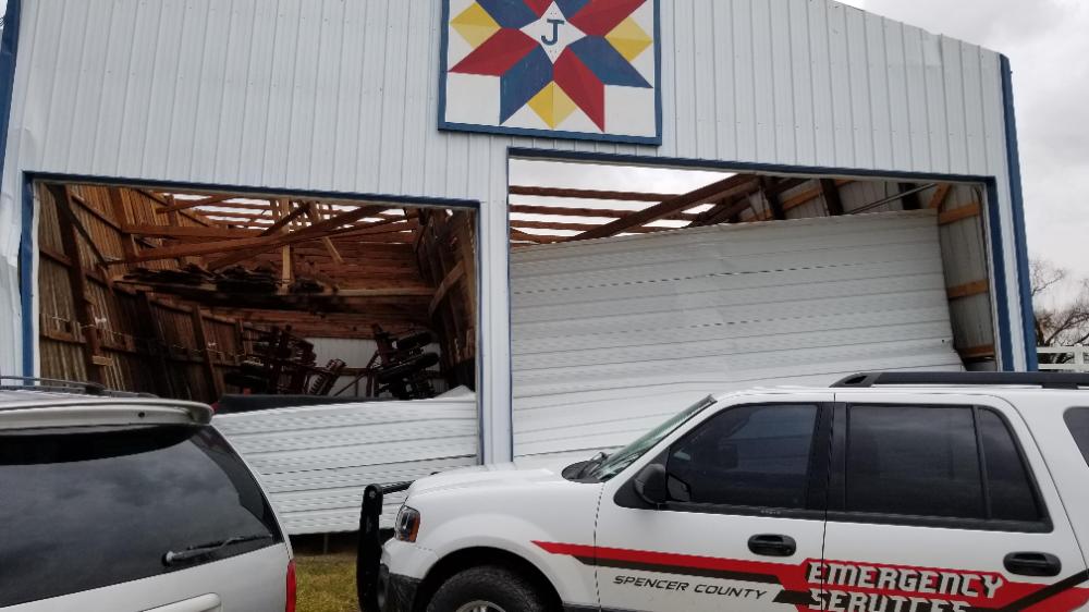 |
 |
 |
 |
| Courtesy of NWS Storm Survey | Courtesy of NWS Storm Survey | Courtesy of NWS Storm Survey | Courtesy of NWS Storm Survey |
Taylor County
 |
 |
 |
 |
| Courtesy of NWS Storm Survey | Courtesy of NWS Storm Survey | Courtesy of NWS Storm Survey | Courtesy of NWS Storm Survey |
 |
 |
 |
 |
| Courtesy of NWS Storm Survey | Courtesy of NWS Storm Survey | Courtesy of NWS Storm Survey | Courtesy of NWS Storm Survey |
 |
 |
 |
 |
| Courtesy of NWS Storm Survey | Courtesy of NWS Storm Survey | Courtesy of NWS Storm Survey | Courtesy of NWS Storm Survey |
Warren County
 |
 |
 |
 |
| Courtesy of NWS Storm Survey | Courtesy of NWS Storm Survey | Courtesy of NWS Storm Survey | Courtesy of NWS Storm Survey |
 |
 |
 |
 |
| Courtesy of NWS Storm Survey | Courtesy of NWS Storm Survey | Courtesy of NWS Storm Survey | Courtesy of NWS Storm Survey |
Warren County Before and After
 |
 |
 |
 |
| Nashville Rd and 15th Ave (Google Street View) | Nashville Rd and 15th Ave, NWS Storm Survey | Glasgow Road and Cosma Drive (Google Street View) | NWS Storm Survey drone footage |
 |
 |
 |
 |
| Cosma Drive (Google Street View) | Cosma Drive, NWS Storm Survey | Cosma Drive (Google Street View) | Cosma Drive, NWS Storm Survey |
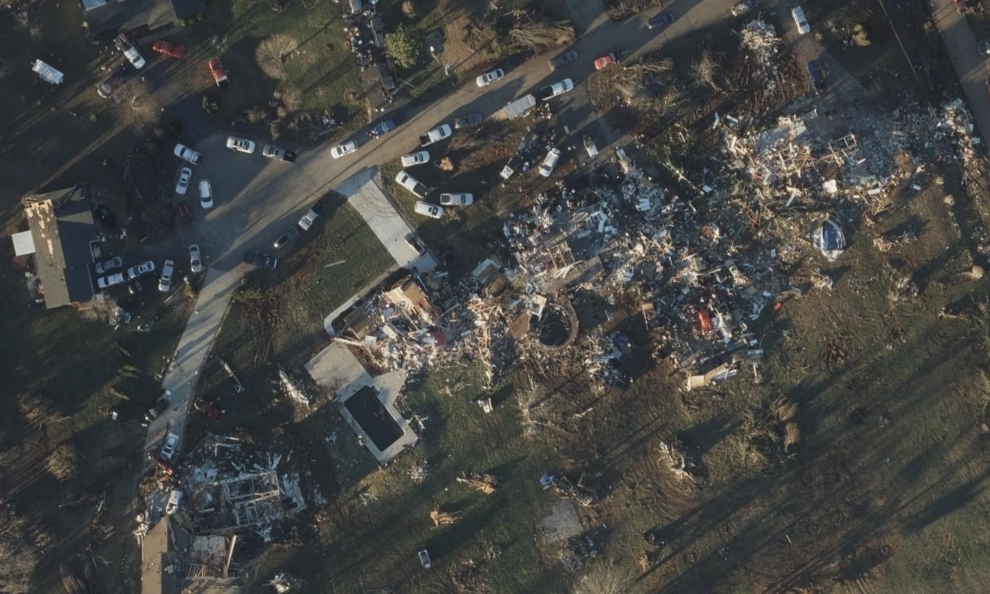
Warren County Satellite Images
from the Geospatial Insurance Consortium
 |
 |
 |
|
| Rembrandt Court | Powell Street | Moss Creek Avenue | |
Radar
 |
 |
 |
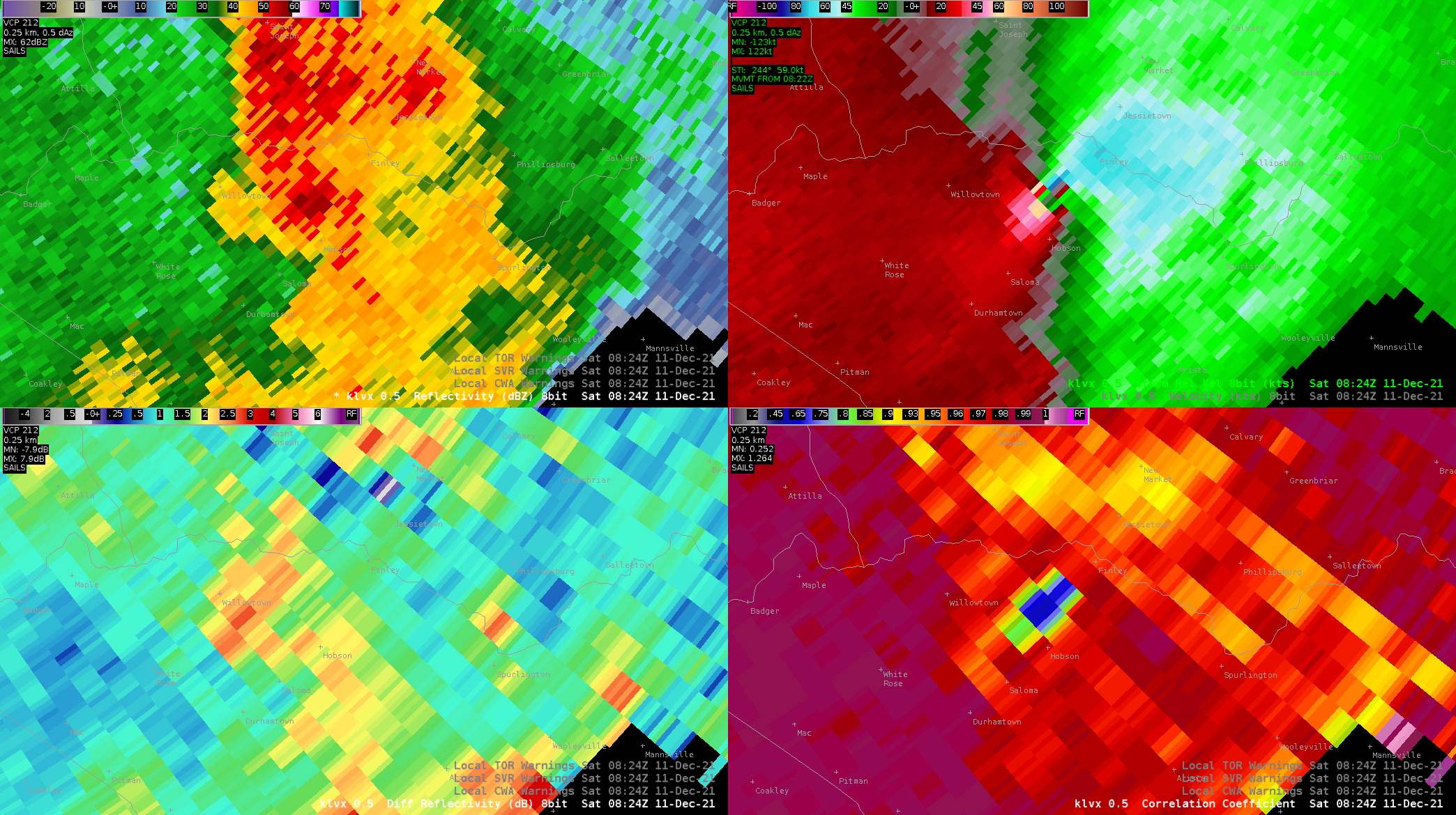 |
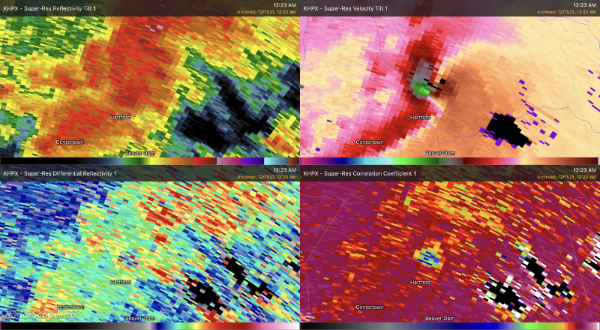
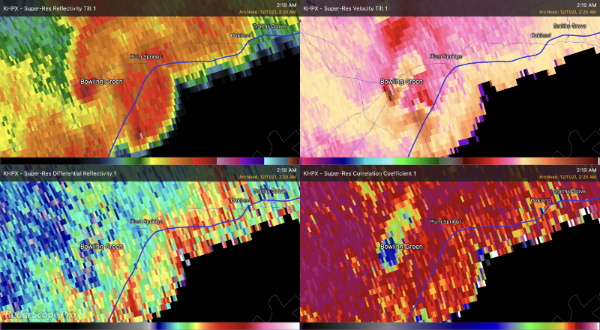
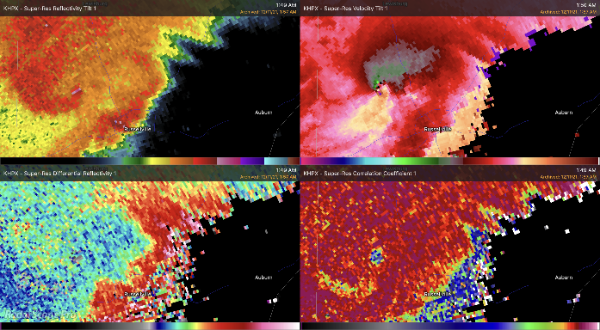
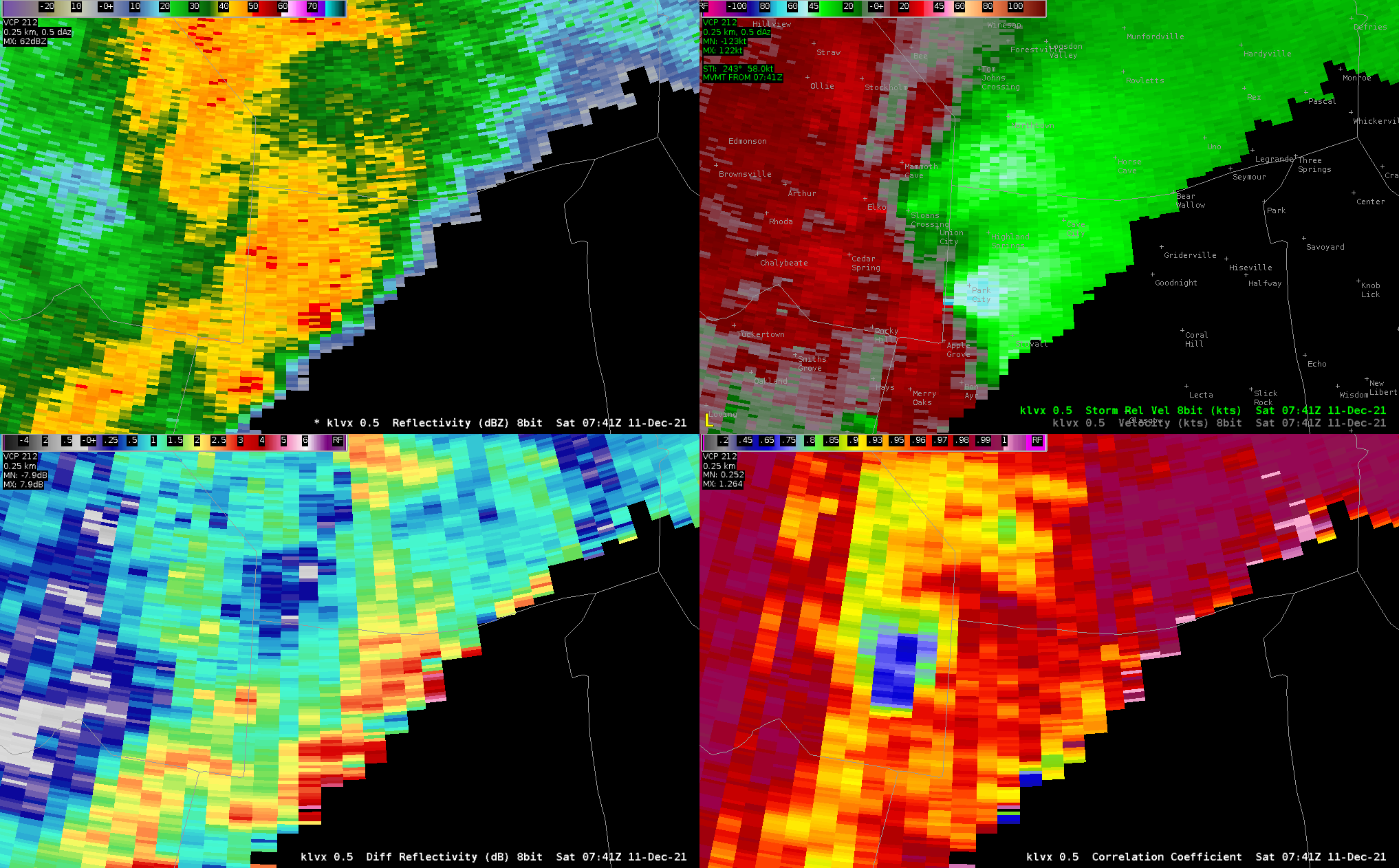
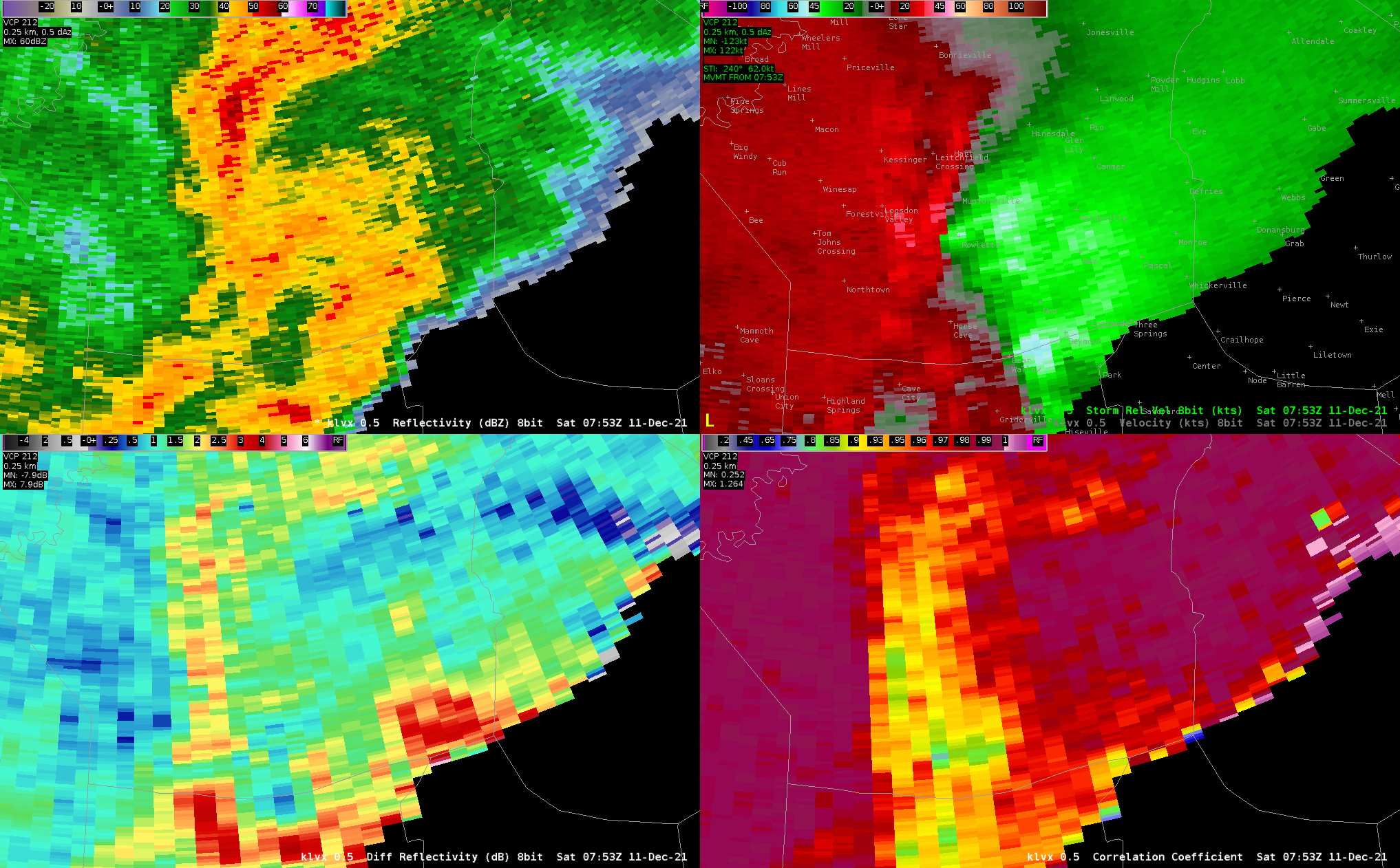
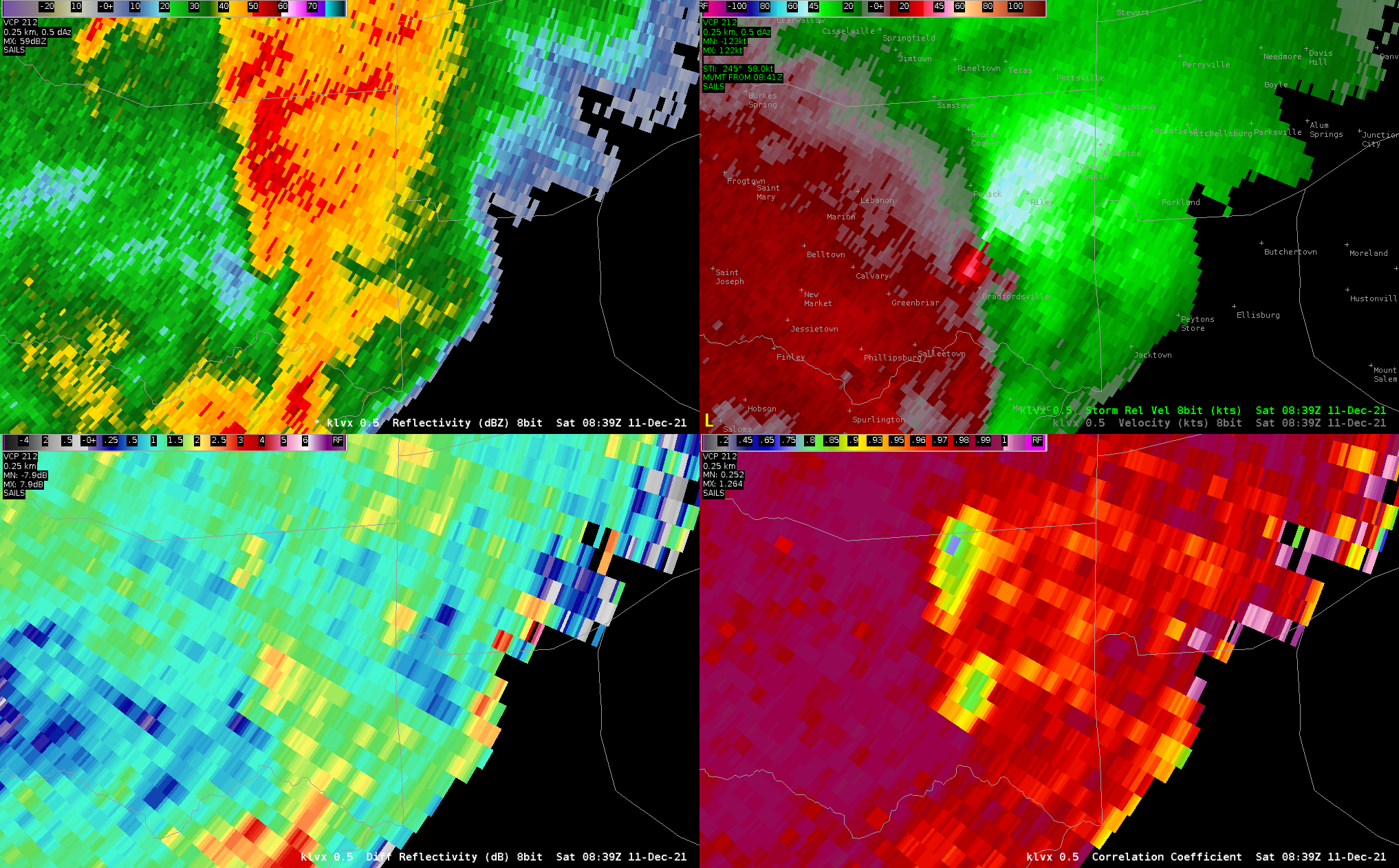
| Ohio County. Upper right shows a strong circulation. Blue and green colors in the middle of the lower right panel are a tornado debris signature (TDS). Beam height here is around 5000 ft. | Bowling Green. The tornado is moving through the city at this time. Note the significant TDS in the lower right panel. | Logan County. Strong circulation in the storm northwest of Russellville, where a tornado was occurring. TDS in lower right panel. Hook echo in upper left panel. | Taylor County. Very strong circulation over Finley, sharp TDS, hook. Beam height is around 4000 ft. |
 |
 |
 |
.png) |
| Tornado forming near Park City, KY. This tornado would eventually track through Edmonson, Barren, and Hart counties for nearly 17 miles. | Tornado forming north of Horse Cave, KY. This tornado would eventually track through Hart and Green counties for 24 miles. | Tornado forming north of Bradsfordville, KY. This tornado would stay on the ground in Marion County for 2 miles. | Multiple tornadoes forming near Danville, KY. The radar angle is fairly high up (>4000ft AGL) so circulations are hard to see |
Radar loop of the outbreak (from UCAR/College of DuPage):
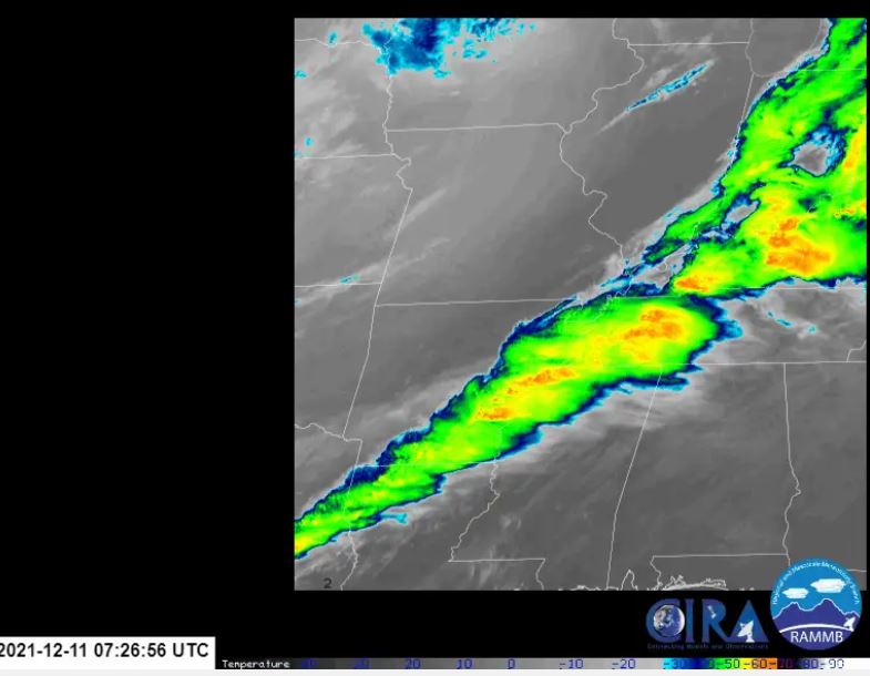
Satellite image loop of the event (click on image to see the data). Data are every 8 minutes, to fit within post size limits.
Environment
A very anomalous storm system produced winter weather across the Rockies, Upper Midwest, and Great Lakes region and severe weather across the mid-Mississippi and Ohio Valley regions. The combination of a warm and moist environment in place across the Ohio Valley region and a cold front that moved in from the west led to widespread thunderstorm development as the cold front pushed eastward through Missouri, Illinois and Kentucky. Additionally, a strong low level jet and low level wind shear contributed to strong thunderstorms developing that were favorable for tornadoes.
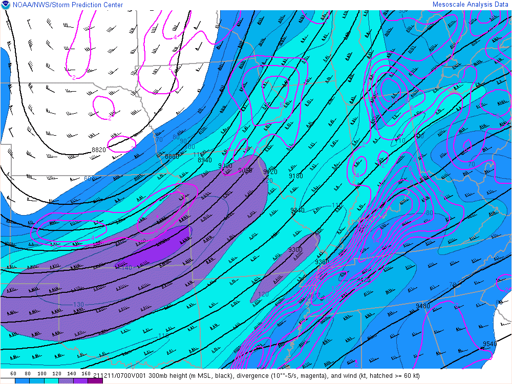
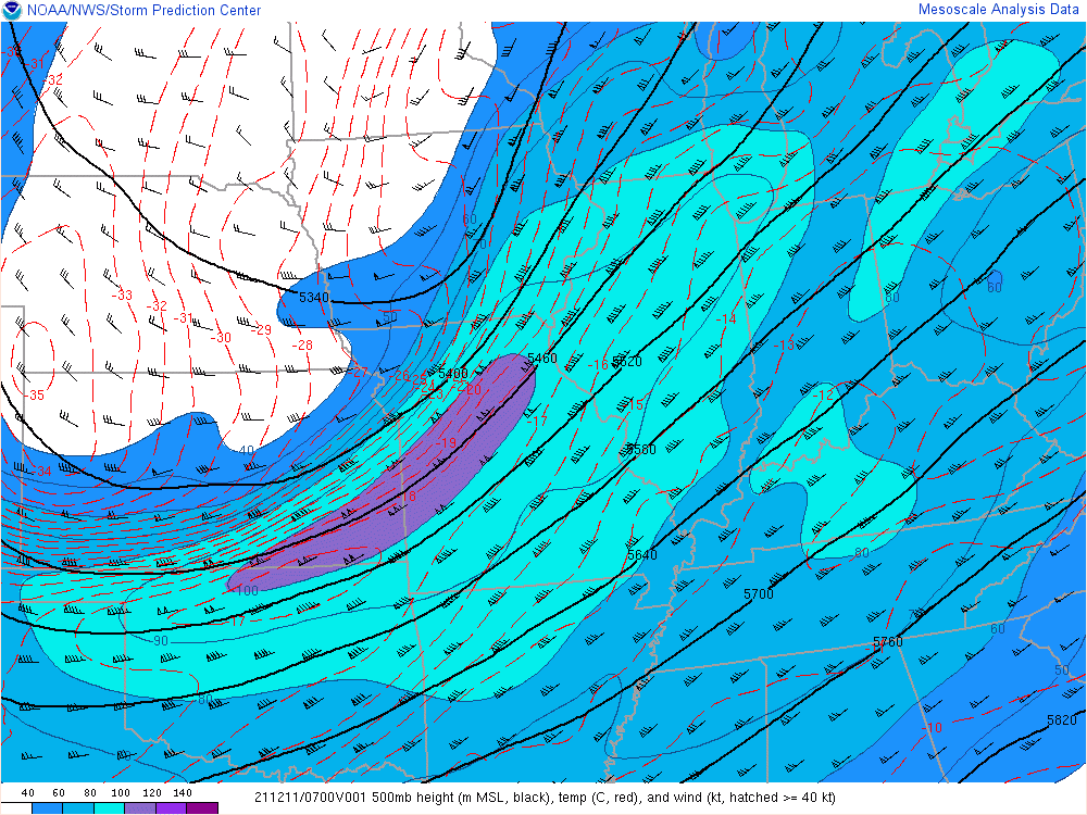
The following maps show the state of the atmosphere at 1am CST/2am EST, just before Bowling Green was struck by a strong EF-3 tornado.
Surface
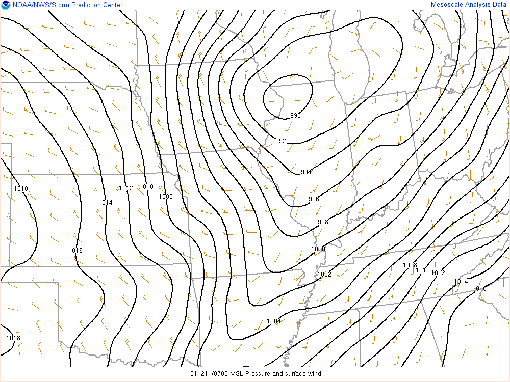 |
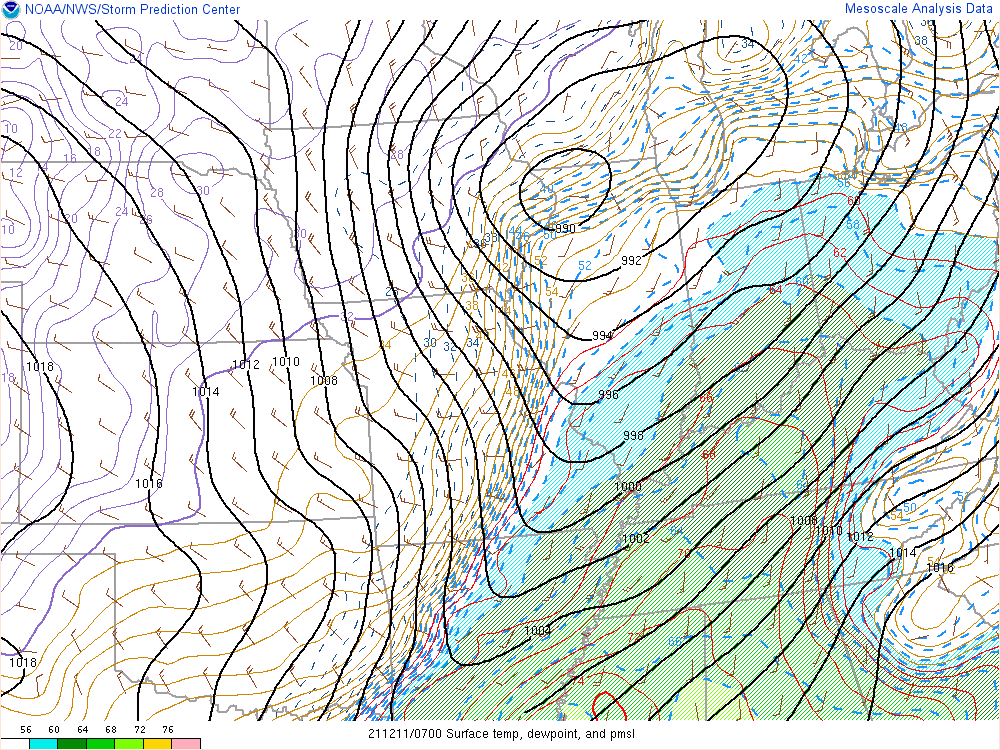 |
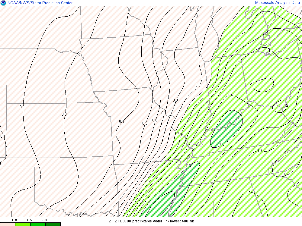 |
| Surface chart. Contours show low pressure west of Chicago with a cold front dropping south into Arkansas. | Temperatures, dew points, mean sea level pressure. Red contours and shading depict warm, moist air flowing north ahead of the cold front. | Precipitable water. This is a measure of atmospheric moisture, and on this map we can see very humid air in green shading. |
Upper Air
 |
 |
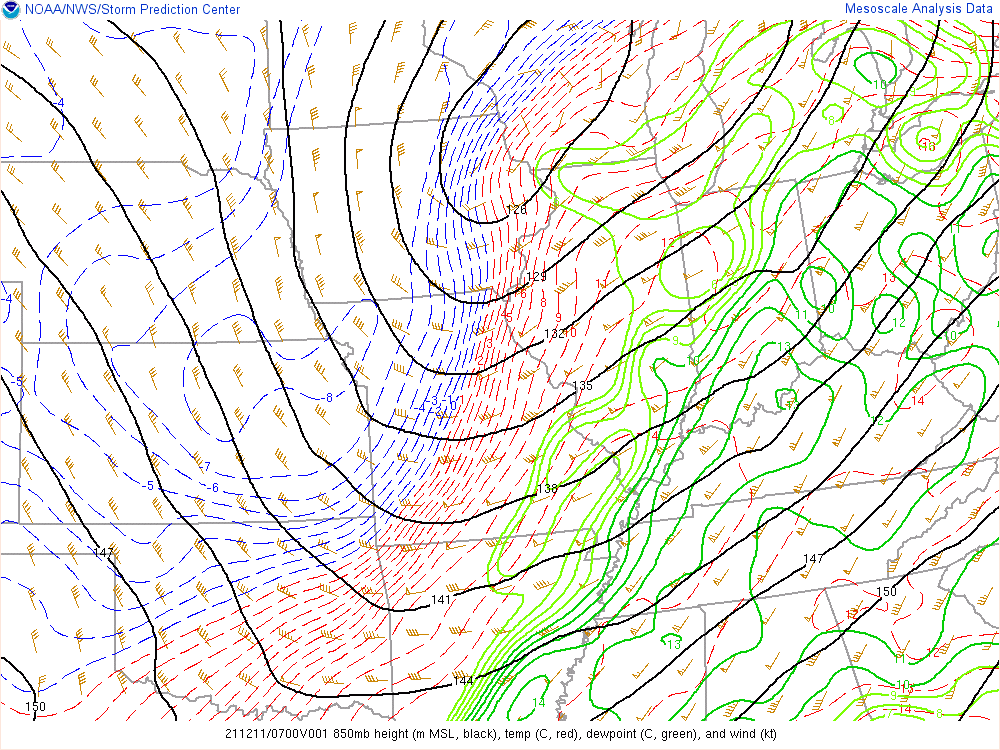 |
| 300mb chart. A powerful upper jet shown from the southern Plains to the Great Lakes. 140kt over Kansas. | 500mb chart. Strong winds depicted to our west and overhead. | 850mb chart. Green contours show rich moisture, flags depict 60-70kt winds from the Tennessee Valley into the Ohio Valley. |
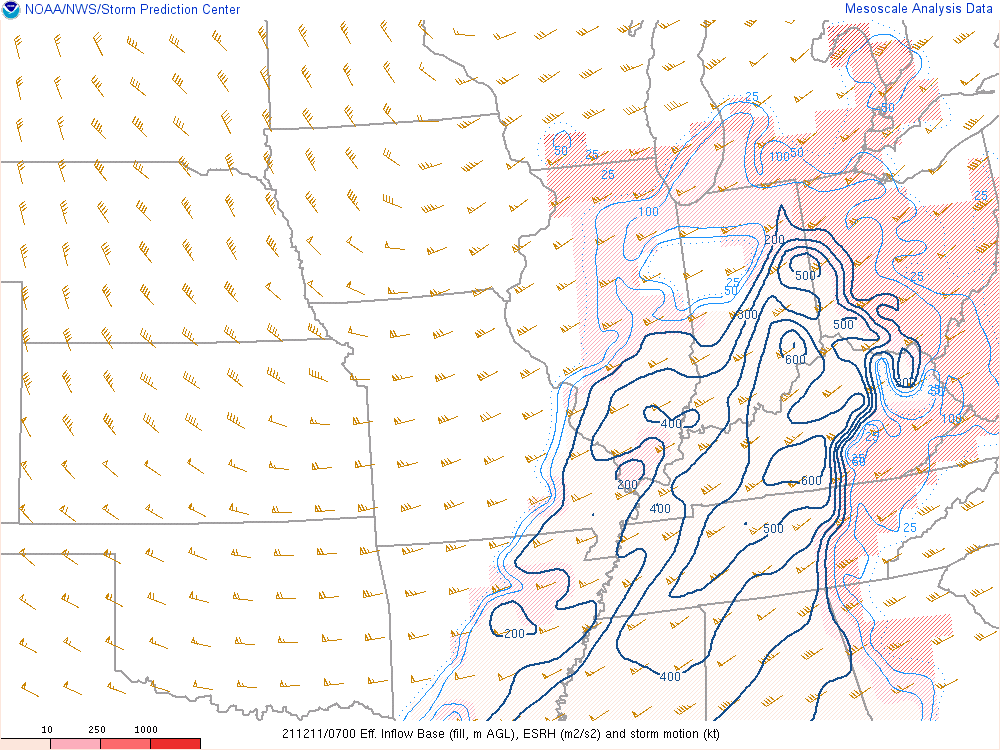
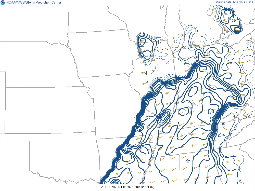
Wind Shear
 |
 |
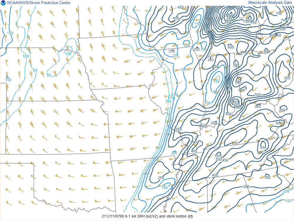 |
| Effective Storm Relative Helicity (ESRH) and storm motion. This map indicates extremely strong shear. | Effective bulk shear. Values greater than 25kt are significant. This map shows values around 70kt in the Bowling Green area. | 0-1km storm relative helicity and storm motion. Values greater than 100 m2/s2 are significant for the possibility of tornadoes. This map shows values around 550 m2/s2. |
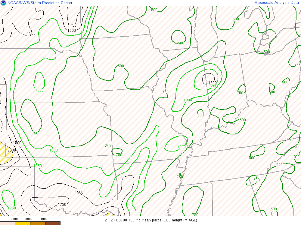
Thermodynamics
 |
 |
 |
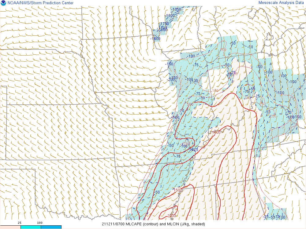
| Lifted Condensation Level. Values below 1500m support tornado activity. Values here are around 500m. | Mixed layer CAPE shown in the red contours, giving a measure of instability. Values around 1000 J/kg are quite high (unstable) for December. | Most unstable CAPE. Values around 1000 J/kg are quite high (unstable) for December. |
Composite Indices
 |
 |
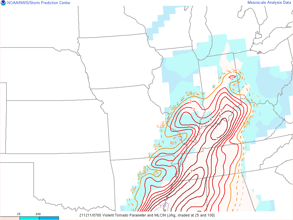 |
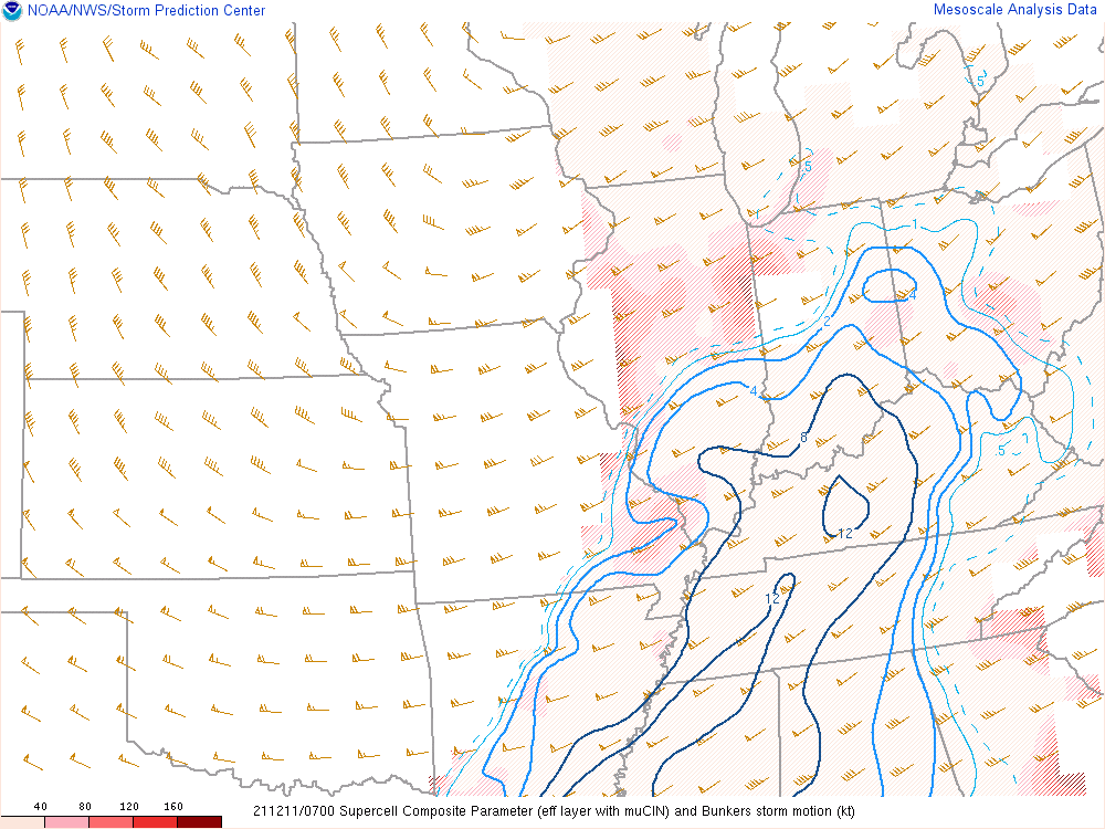
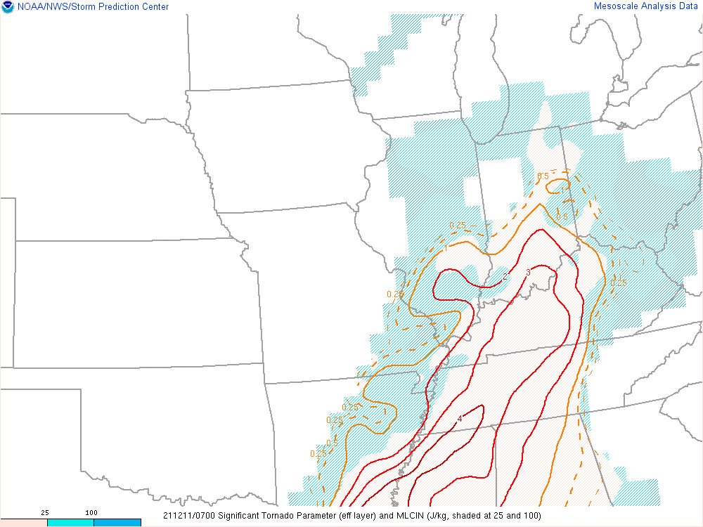
| Supercell Composite Parameter. Values greater than 1 are significant. This analysis shows values around 12. | Significant Tornado Parameter (STP). A majority of EF-2+ tornadoes have been associated with STP > 1. This map shows values > 3. | Violent Tornado Parameter. Values greater than 1 are significant. This map shows values around 7. |
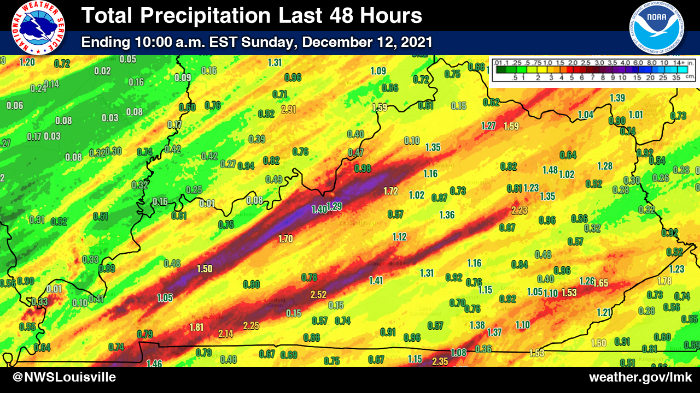
Flooding
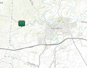
0417 AM     FLASH FLOOD      5 NE GRAEFENBURG        38.21N 84.97W
12/11/2021                   FRANKLIN           KY   EMERGENCY MNGR

            *** 1 FATAL ***
            A 62-YEAR-OLD MALE DROVE HIS VEHICLE INTO
            HIGH WATER ON DEVILS HOLLOW ROAD AND WAS
            WASHED DOWNSTREAM IN NORTH BENSON CREEK.
            TIME ESTIMATED BASED ON NEARBY HOME
            SURVEILLANCE FOOTAGE.
Products
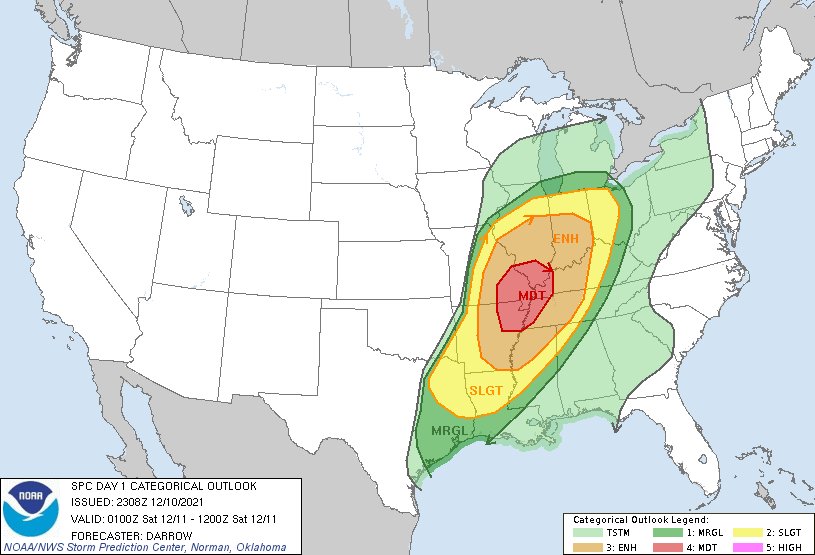 |
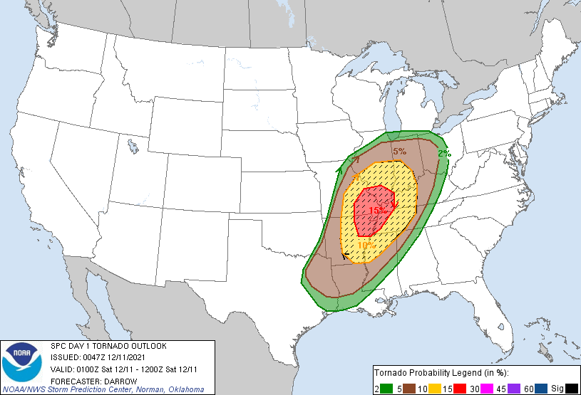 |
 |
|
| Day One SPC Outlook | Day One SPC Tornado Outlook | Verification | |
 |
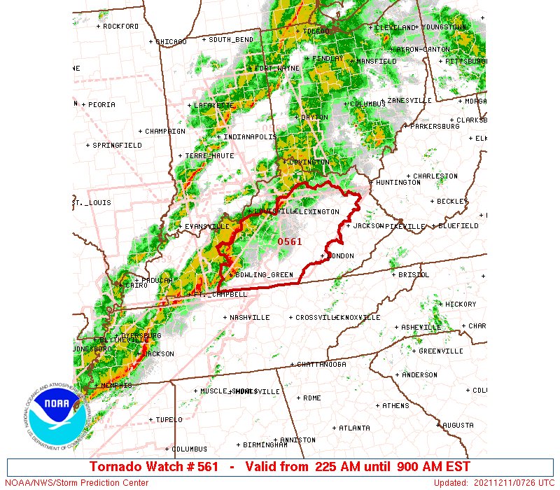 |
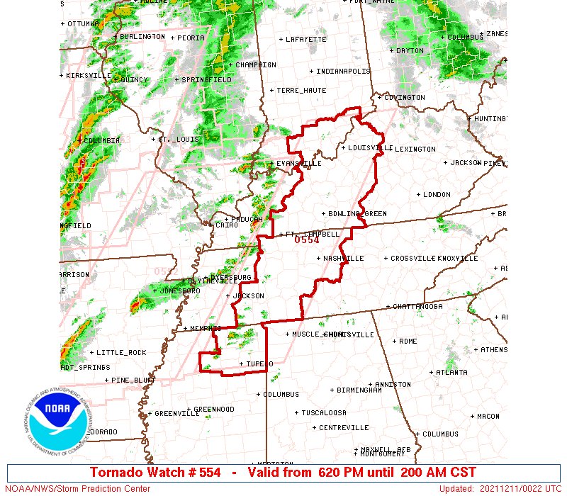
||
| Tornado Watch 554 | Tornado Watch 561 |
Tornado Warnings
 |
 |
 |
 |
|
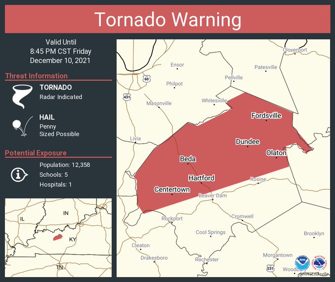
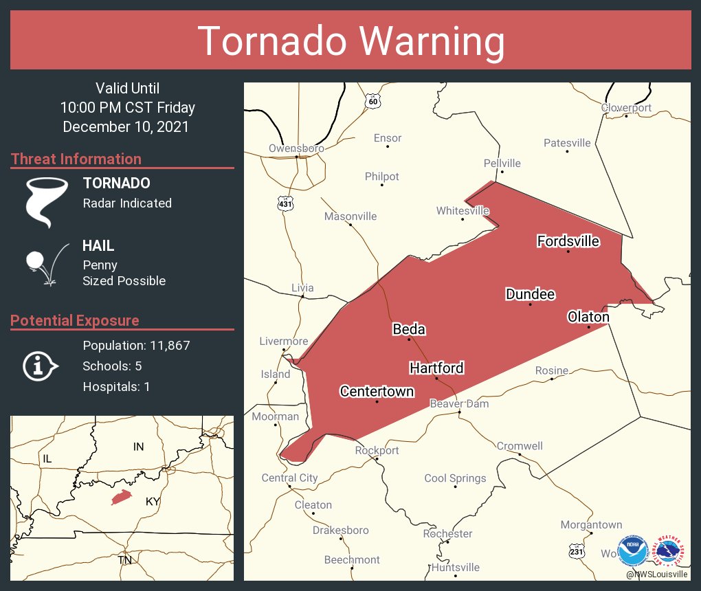
Tornado Warning for Ohio County 8:45pm CST |
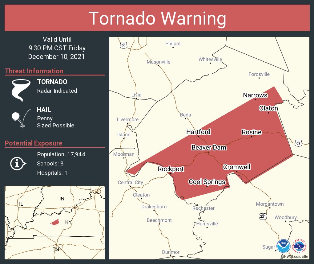
Tornado Warning for Ohio County 9:30pm CST |
Tornado Warning for Ohio County 10pm CST |
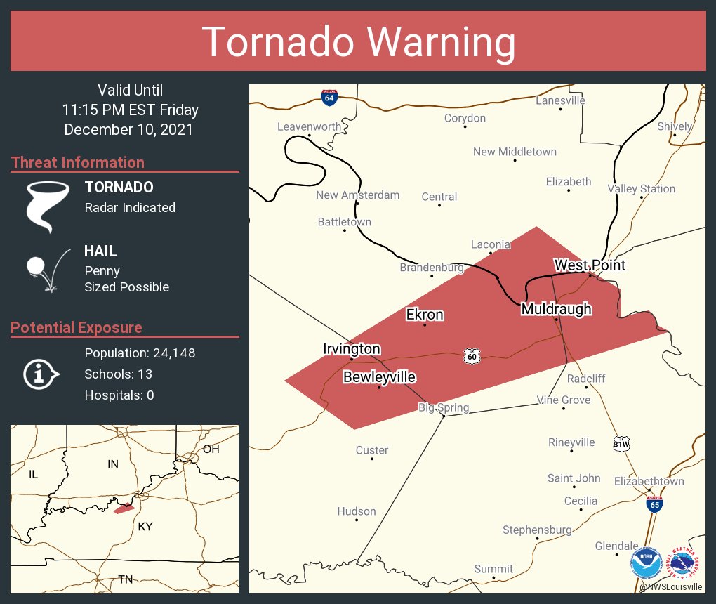
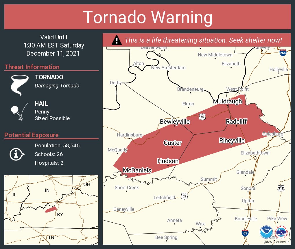
Tornado Warning for Breckinridge, Meade, Hardin, and Harrison IN counties 11:15pm EST |
 |
 |
 |
 |
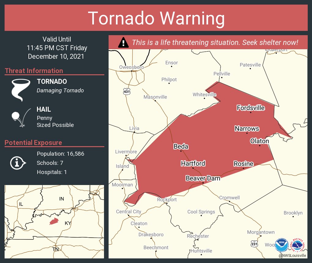
| Tornado Warning for Ohio County 11:45pm CST |
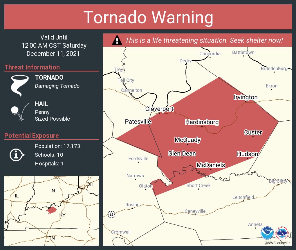
Tornado Warning for Hancock, Grayson, and Breckinridge counties Midnight CST |
Tornado Warning for Breckinridge, Hardin, and Meade counties 1:30am EST |
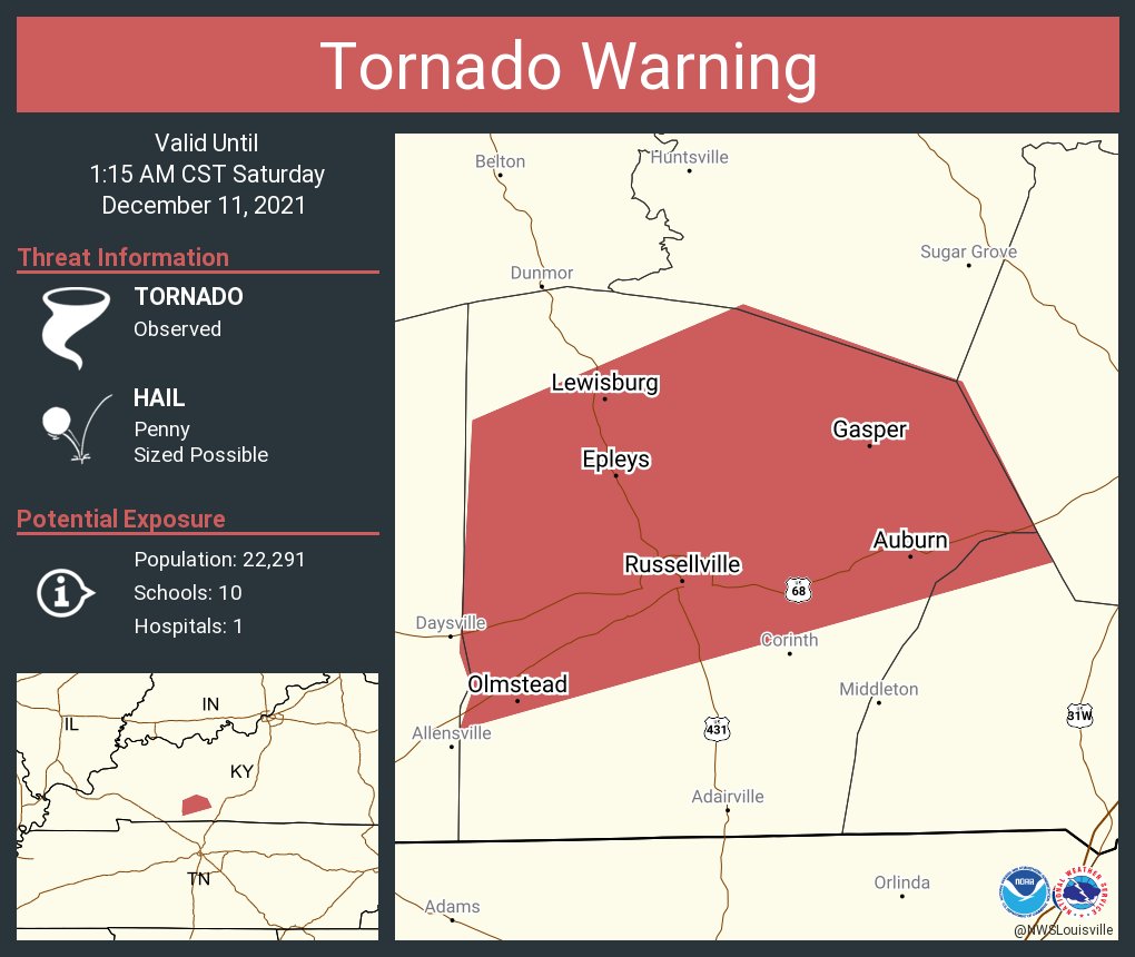
Tornado Warning for Logan and Simpson counties 1:15am CST |
 |
 |
 |
 |
|
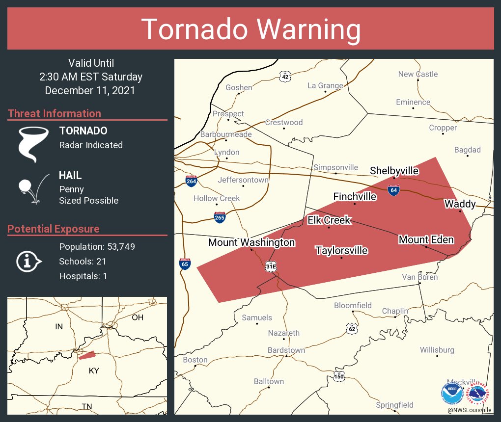
Tornado Warning for Bullitt, Spencer, Nelson, and Shelby counties 2:30am EST |
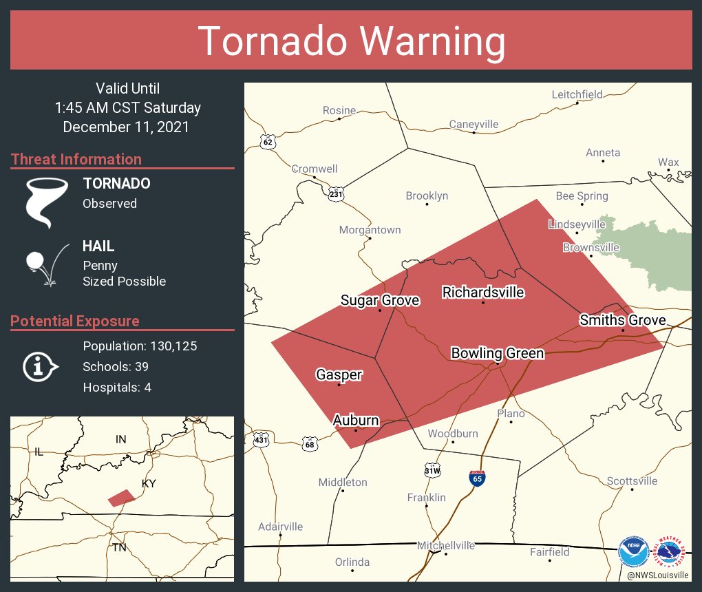
Tornado Warning for Logan, Simpson, Butler, Warren, Edmonson counties 1:45am CST |
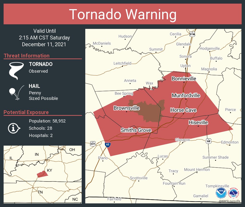
Tornado Warning for Warren, Barren, Edmonson, Hart, and Metcalfe counties 2:15am CST |
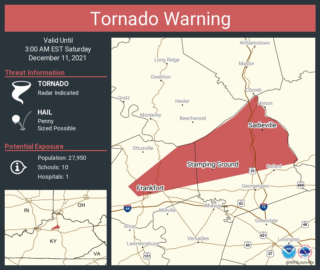
Tornado Warning for Franklin and Scott counties 3am EST |
 |
 |
 |
 |
|
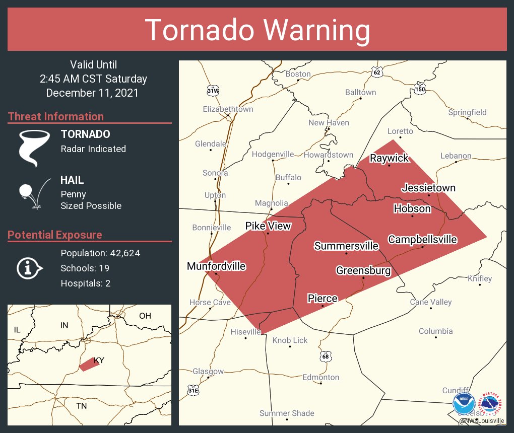
Tornado Warning for Barren, Hart, Metcalfe, Green, LaRue, Taylor, and Marion counties 2:45am CST |
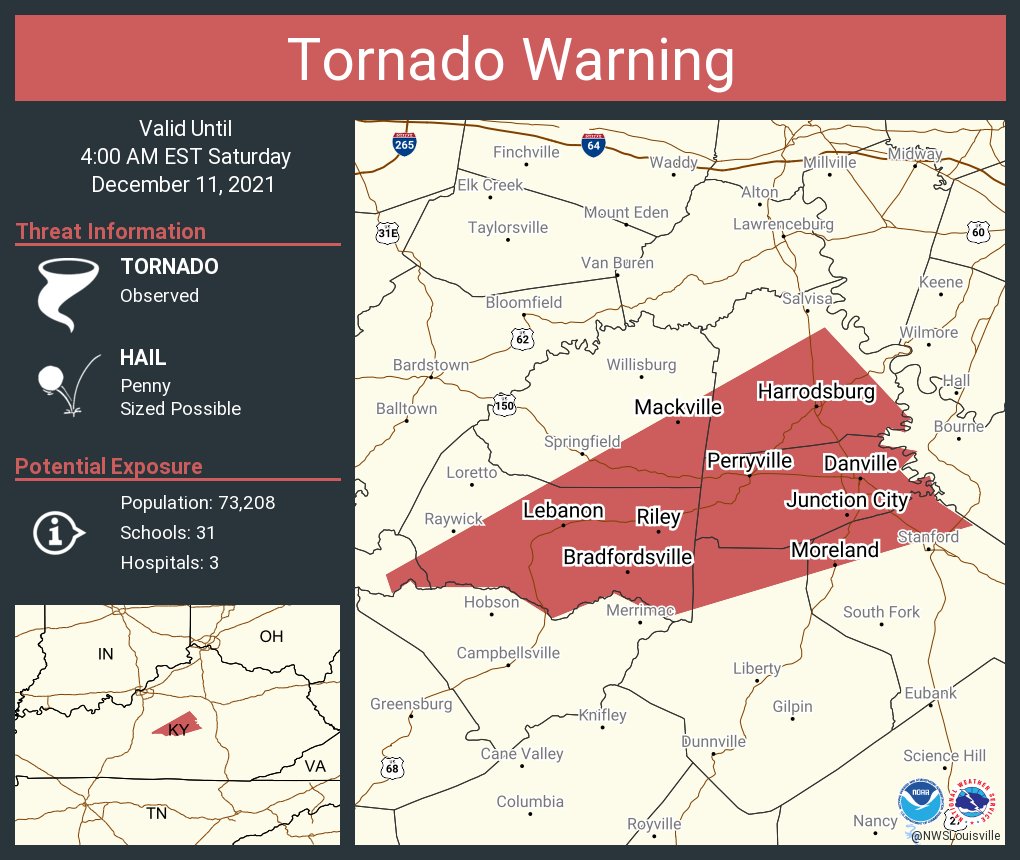
Tornado Warning for LaRue, Marion, Washington, Casey, Lincoln, and Boyle counties. 4am EST |
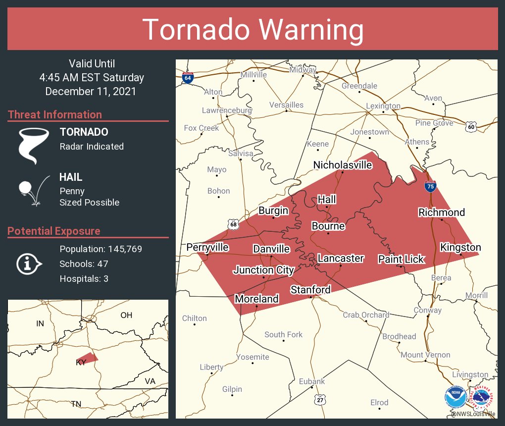
Tornado Warning for Casey, Boyle, Mercer, Lincoln, Garrard, Jessamine, and Madison counties 4:45am EST |
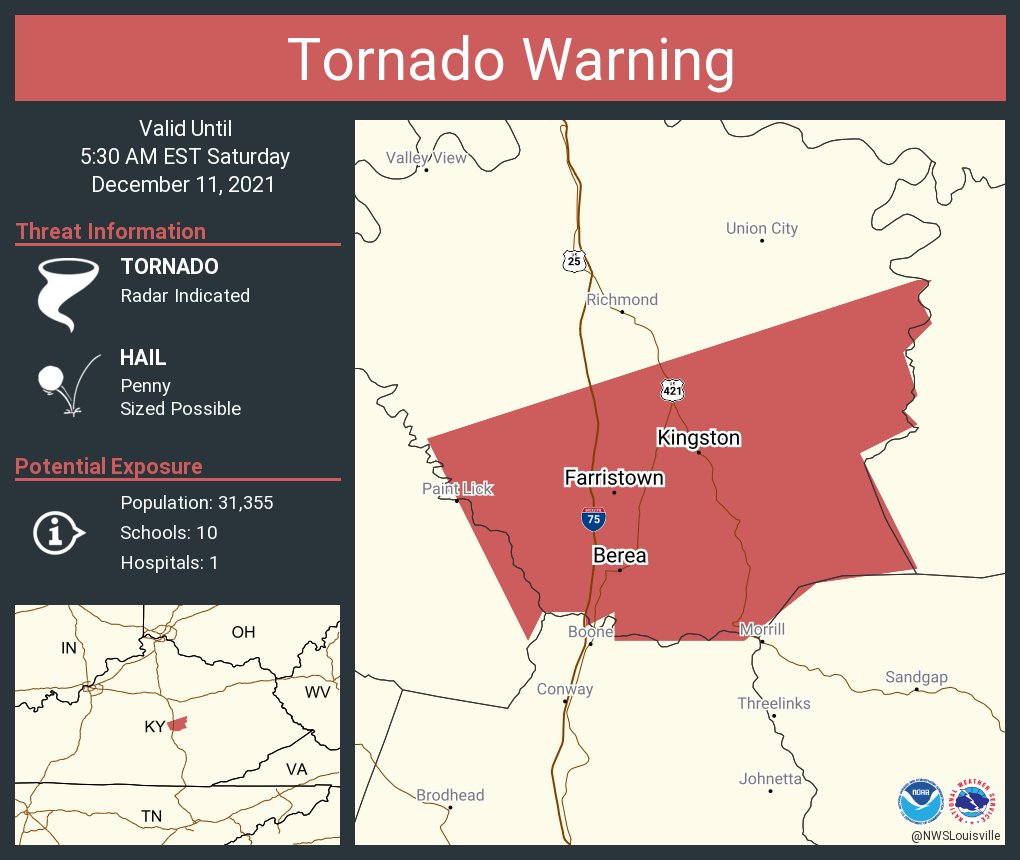
Tornado Warning for Madison and Garrard counties 5:30am EST |
 |
 |
 |
|
|
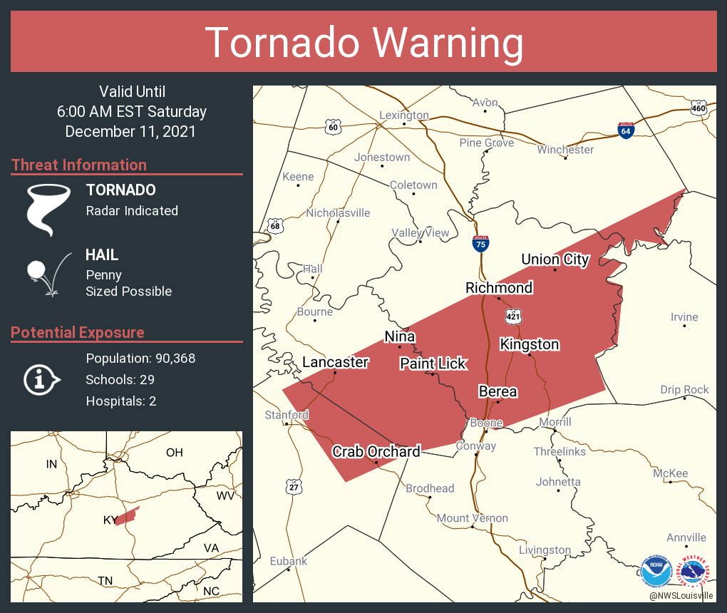
Tornado Warning for Lincoln, Garrard, Madison, and Clark counties 6am EST |
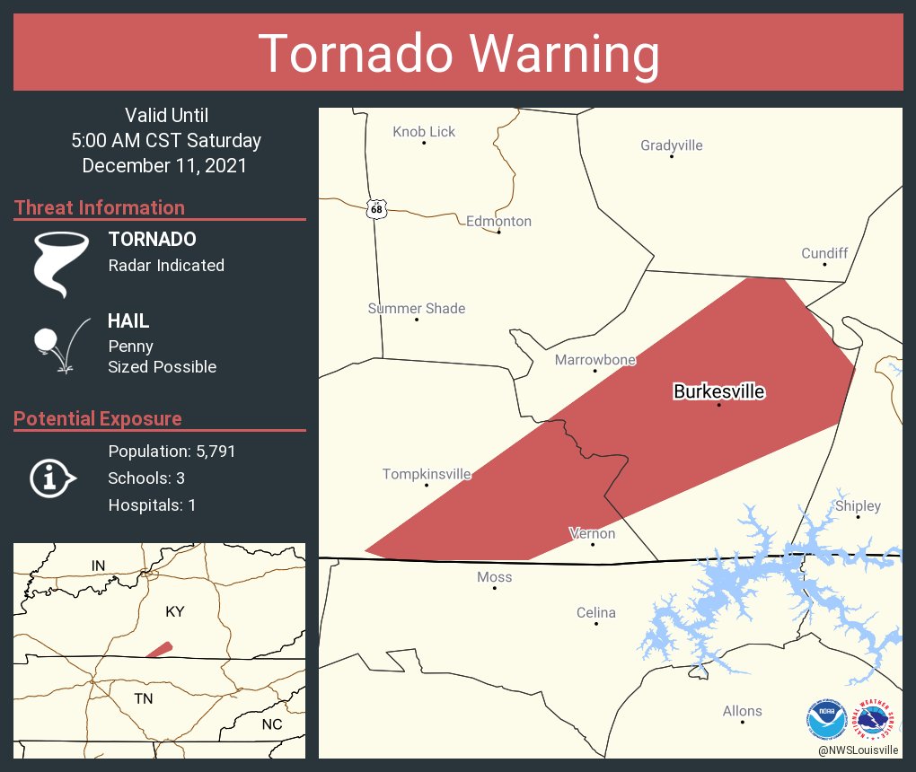
Tornado Warning for Monroe and Cumberland counties 5am CST |
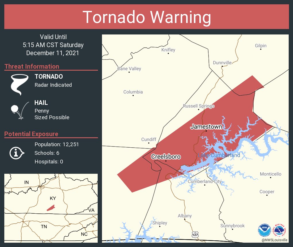
Tornado Warning for Cumberland, Clinton, Ruddell, and Casey counties 5:15am CST |
|
 |
Media use of NWS Web News Stories is encouraged! Please acknowledge the NWS as the source of any news information accessed from this site. |
|


 Weather Story
 Weather Map
 Local Radar
 Follow us on YouTube