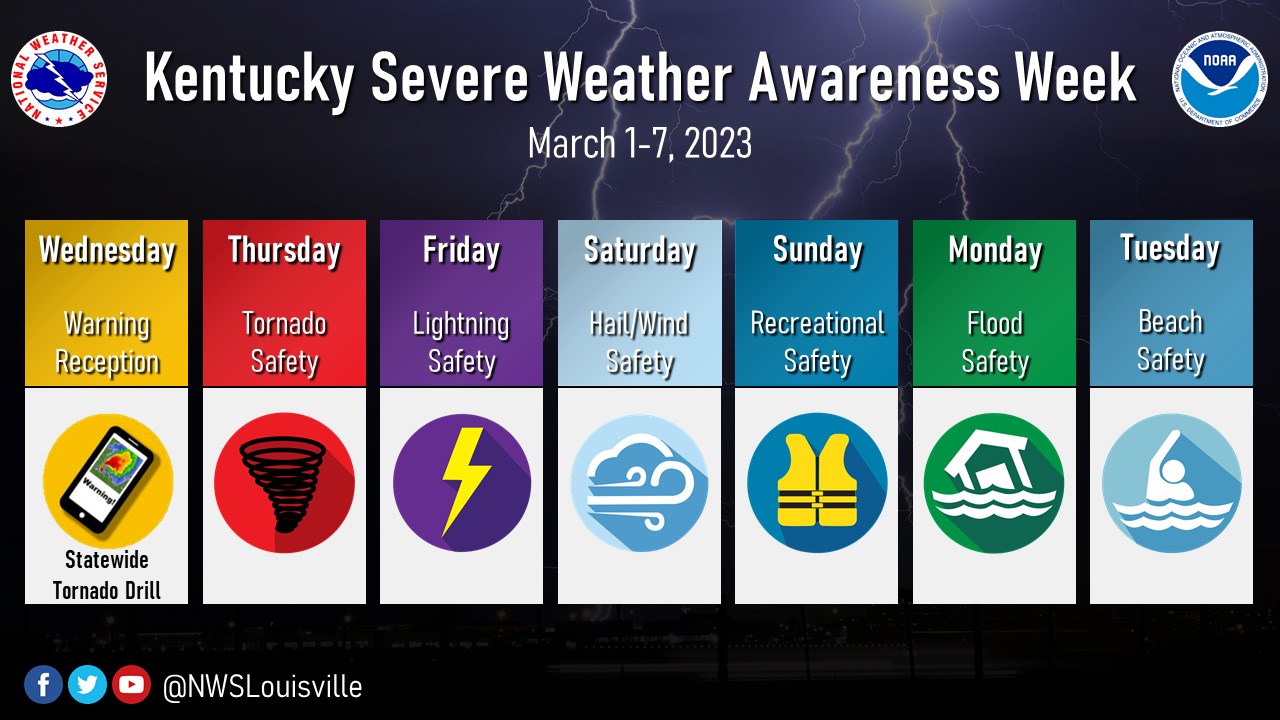
March 1-7, 2023 is Severe Weather Awareness Week in Kentucky. Severe weather can occur anytime of the year, and can bring many different hazards and impacts to the region. Severe Weather Awareness week is your reminder that you need to be Weather Ready for all types of hazards, such as tornadoes, severe thunderstorms, large hail, lightning, heavy rain, flooding, and high winds. New for 2023, NWS Louisville will feature a day dedicated to Beach Safety. Many people from our state travel for Spring Break and Summer Vacation to the beach, and may not be as prepared for severe weather or beach hazards as the locals are. All week long, the National Weather Service office in Louisville, KY will be sharing information on how to prepare for severe weather, which will be viewable on our social media platforms (Facebook and Twitter). Please Share/Retweet to share this knowledge with others.
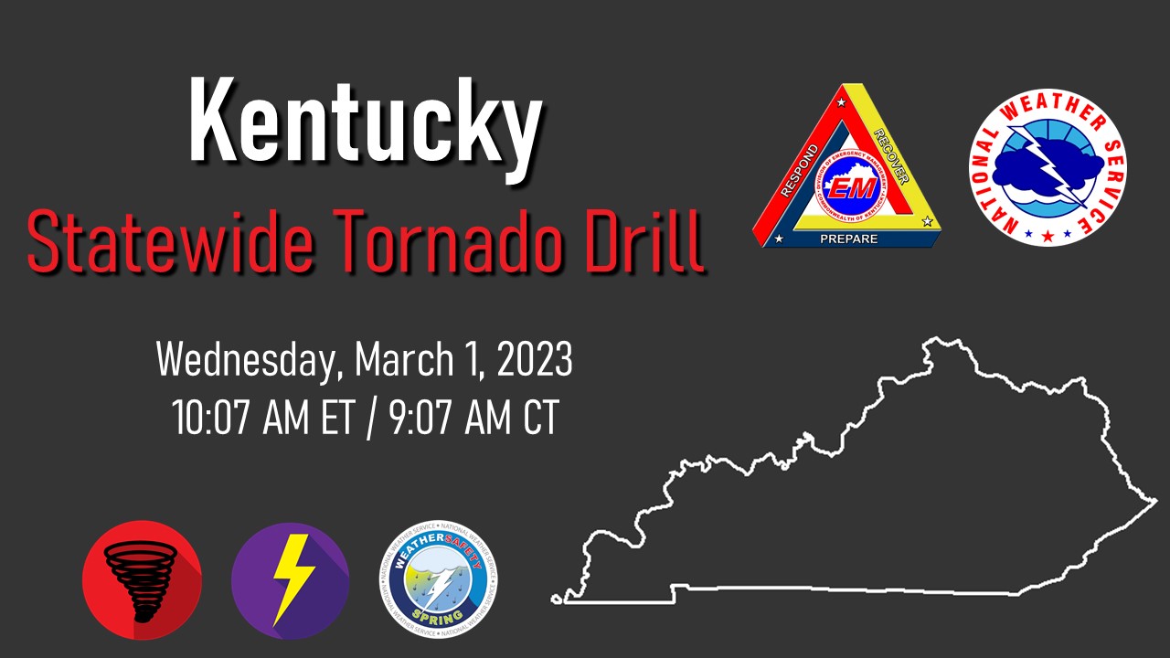
Kentucky Statewide Tornado Drill Info
Know Before You Go!
Don't let impactful weather sneak up on you. Check the latest NWS forecast for your zip code at weather.gov before you head out the door each day. Get the information you need, either in the detailed forecast that outlines the next several days, or in the hour-by-hour forecast if you need finer detailed weather information.

Warning Reception
Do you have a way to receive weather alerts when severe weather strikes? How about two ways to receive alerts? Having multiple ways to receive weather alerts can save your life, or someone you love. The mission of the National Weather Service is to protect life and property, and we do that by being the official agency to issue all weather watches, warnings, and advisories for the United States.
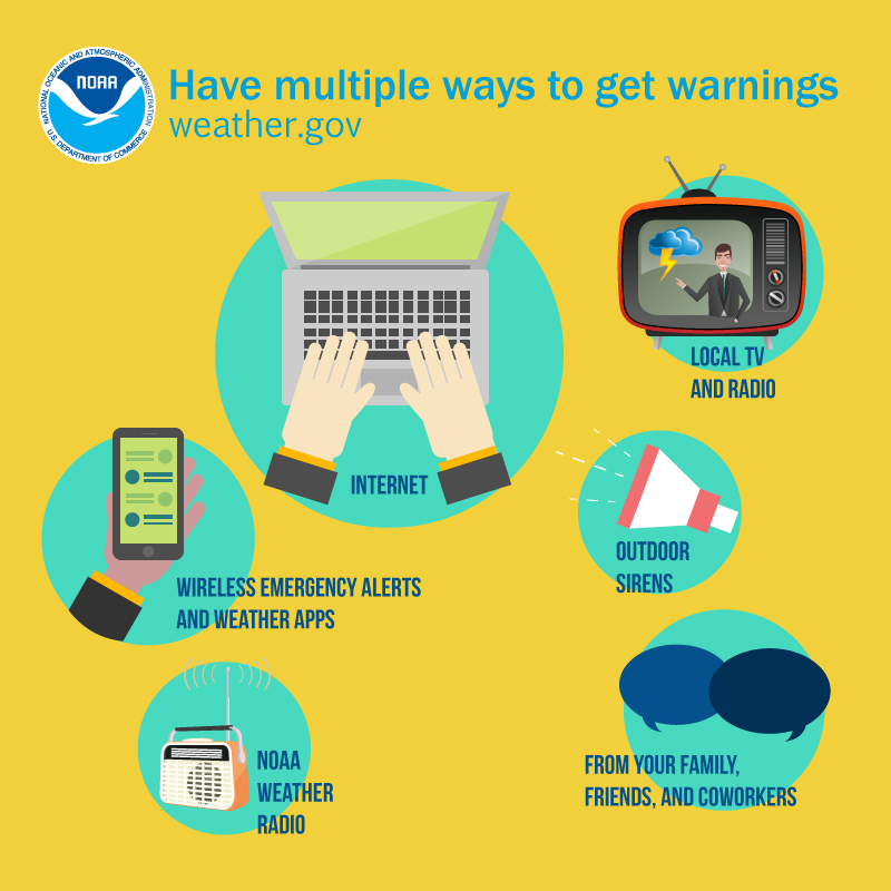
You can receive weather alerts for your location from smartphone apps or the Wireless Emergency Alert (WEA) system, a NOAA Weather Radio, the internet, or from local broadcast media. It is important to get your weather alerts from well-known, trusted, and official weather sources, such as the NWS, local broadcast media, or Kentucky Emergency Management (KYEM).
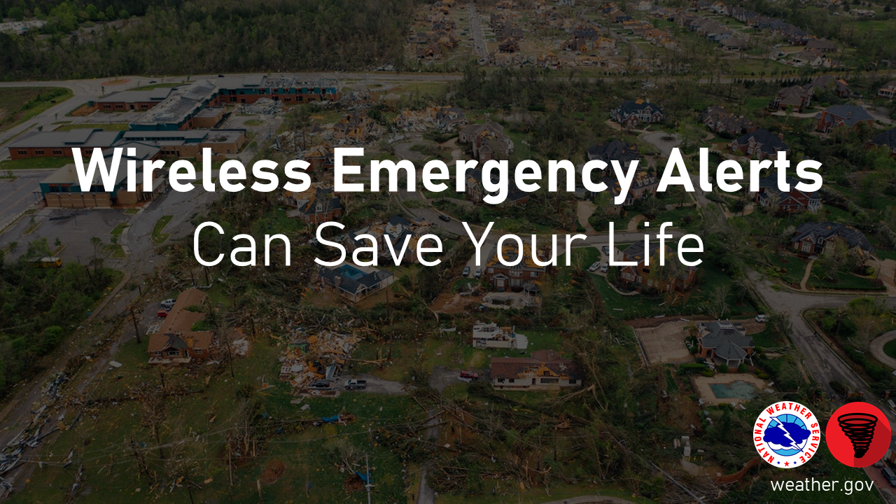
Wireless Emergency Alerts (WEA) can save your life! They are emergency messages send by authorized government agencies through your mobile carrier. WEA Alerts can be sent to your mobile device when you may be in harm's way, without the need to download an app or subscribe to a service. To learn much more about WEA, you can visit https://www.weather.gov/crp/wea.
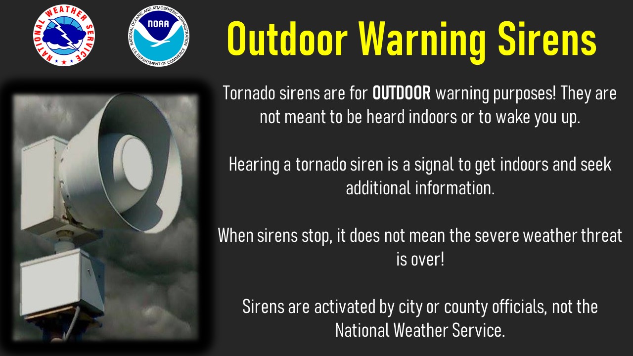
Important Information and Common Misunderstandings About Outdoor Sirens
You may also hear sirens when severe weather is coming, but outdoor sirens should never be your only source of weather alerts!
Warning sirens are for outdoor warning purposes, and are not meant to be heard indoors or to wake you up at night!
Outdoor sirens are activated by local city or county officials, NOT the National Weather Service!
When outdoor sirens stop, it does not mean the severe weather threat is over! Always check official sources to know when the severe weather threat is over.
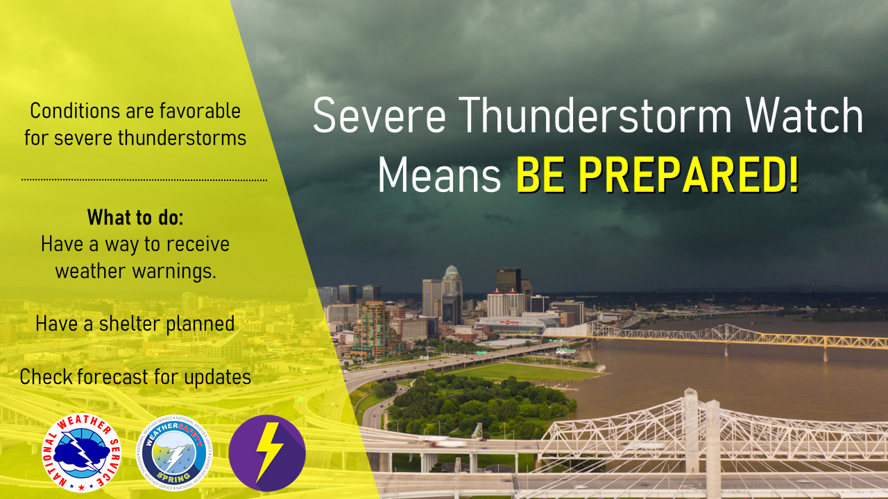
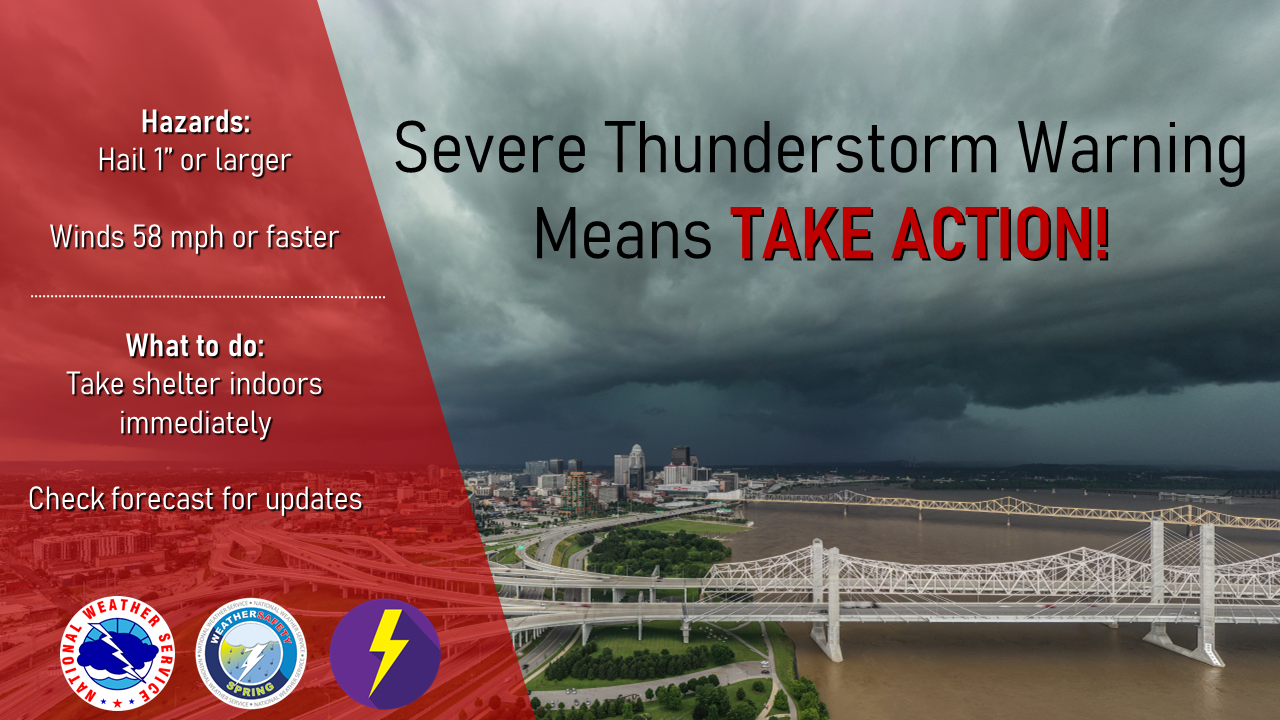
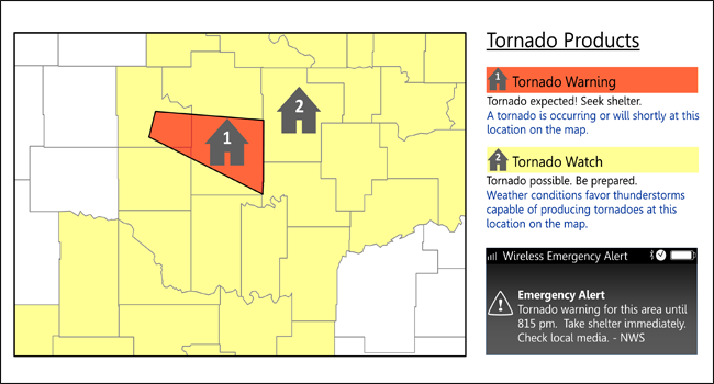
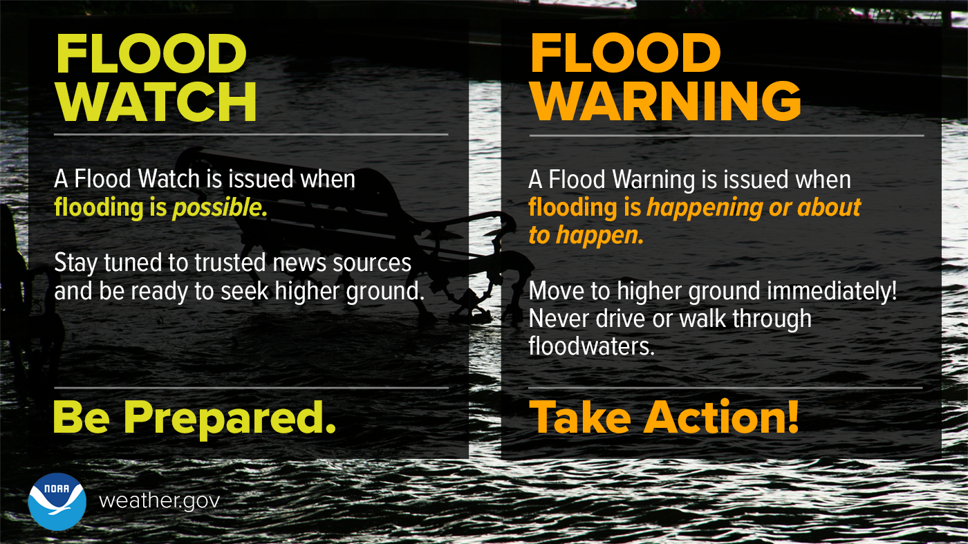
Do you know the difference between WATCH and a WARNING?
Severe Weather Products Issued by NWS Louisville
Hazardous Weather Outlook (HWOLMK): Issued around 4 AM and 4 PM EDT/EST daily, and more often as needed. The HWO highlights any expected hazardous weather conditions over the next seven days.
Tornado Warning (TORLMK): Issued for expected tornadic activity over a county or a portion of a county. A Warning may be issued based on Doppler Radar indications of a tornado, reports of a funnel cloud, or observed tornado sightings. Tornado Warnings are typically valid for 45 minutes or less.
Severe Thunderstorm Warning (SVRLMK): Issued for storms which are producing or are expected to produce winds of 58 mph, hail 1 inch or greater diameter, or both. These are issued for counties or portions of counties, and typically are valid for an hour or less.
Severe Weather Statement (SVSLMK): This is used to disseminate follow-up information on severe thunderstorms and tornado warnings. This can include actual severe weather reports, current radar information, and towns expected to be in the the path of the storms. This statement is also used to cancel warnings, and give follow-up information after a warning has expired.
Special Weather Statement (SPSLMK): This is used to highlight significant short-term weather conditions that are not covered in a watch or warning product, such as a line of strong, but not severe thunderstorms, moving into an area.
Watch Outline Update (MKCWOU#): The Watch Outline Update (# signifies the Watch number) is issued by the Storm Prediction Center in Norman, Oklahoma. It is issued at the beginning and end of severe thunderstorm and tornado watches, and indicates which counties are specifically included in the watch. This product includes all NWS offices affected by the particular watch.
Watch County Notification (WCNLMK): This product is issued by the local NWS office based on the Storm Prediction Center's Watch Outline Update. The WCN lists the counties and cities included in the Severe Weather Watch within the NWS office's area of responsibility. The product is reissued each time a change is made to the list of counties in the Watch.
Flash Flood Warning (FFWLMK): Issued when life or property-threatening, short-term flooding is imminent. This can include flooding due to heavy rainfall or due to a dam break. Flash Flood Warnings may be valid for up to 6 hours, and can be extended as necessary.
Flash Flood Statement (FFSLMK): Issued to update the status of short-term flash flood situations. It can contain information on reported rainfall, radar estimates of rain, and forecast amounts of rain in the future.
Flood Watch (FFALMK): Issued when heavy rainfall is forecast to cause significant or widespread flooding. This is usually issued at least 6 hours in advance of the expected event, and on occasion as much as a day or two in advance in high confidence situations. Updates to an ongoing flood watch are also issued under the FFA product.
Local Storm Report (LSRLMK): Product gives a detailed listing of observed severe weather across the NWS Louisville area of responsibility. It is often issued during a severe weather event, one report or a few reports at a time, and is also issued after an event has ended containing a summary of all reports.
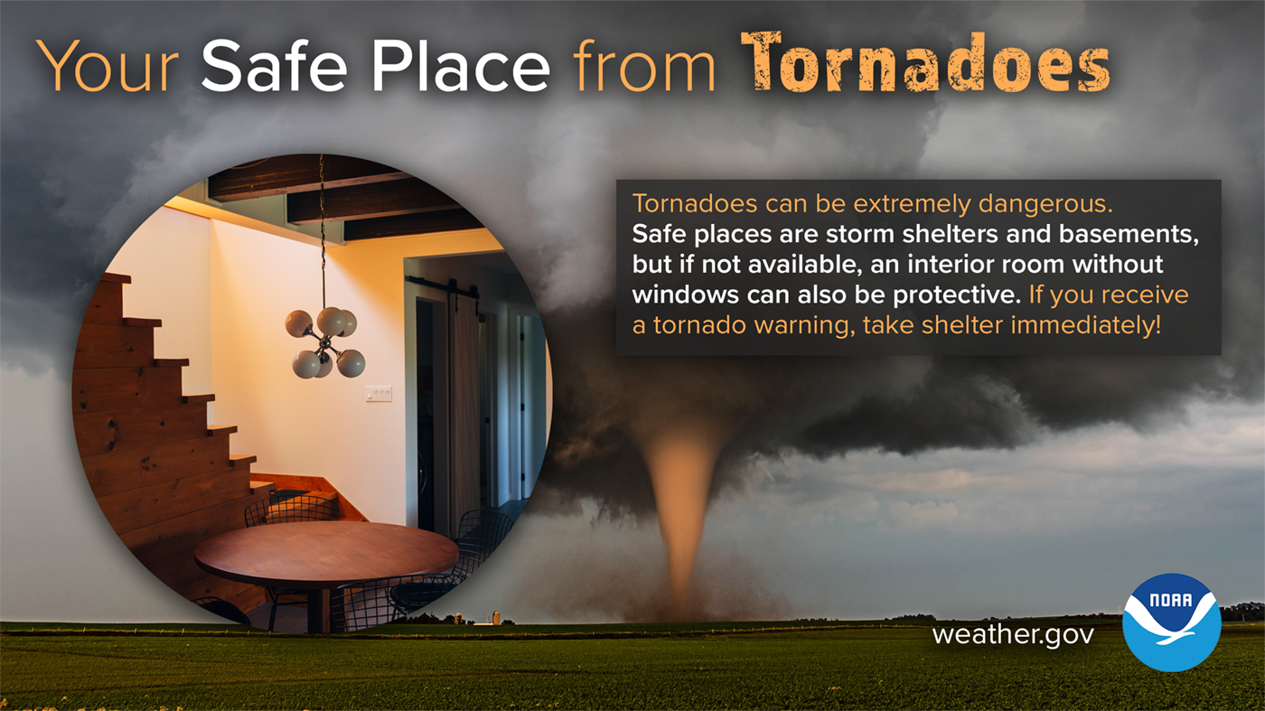
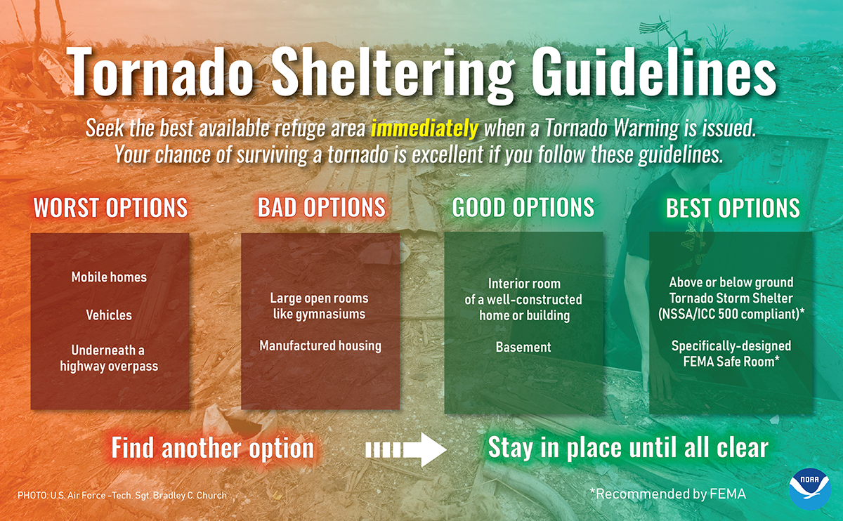
Tornado Safety
A tornado is a violently rotating column of air extending from the base of a thunderstorm down to the ground. Tornadoes are capable of completely destroying well-made structures, uprooting trees, and hurling objects through the air like deadly missiles. Tornadoes can occur at any time of day or night and at any time of the year. Although tornadoes are most common in the Central Plains and the southeastern United States, they have been reported in all 50 states.
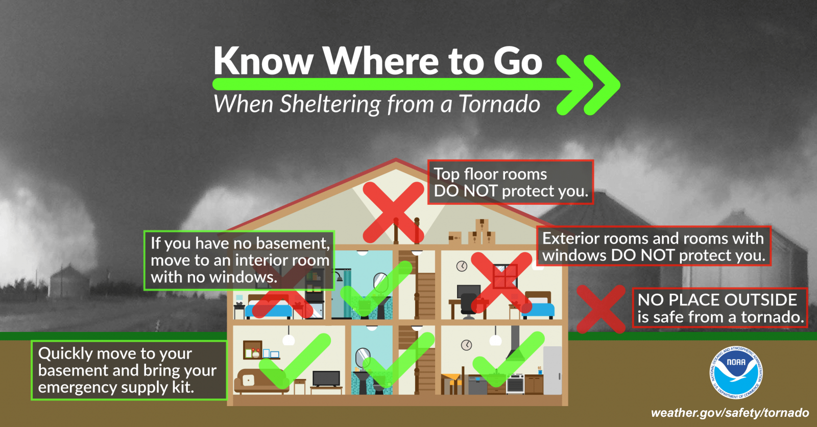
Do you know where your safe place is at home? What about at school, work, or church? Take the time now to make sure you know where to go if there was ever a tornado coming for your location. Get to the lowest level possible, away from all windows and doors, and try to get to the most interior room possible.
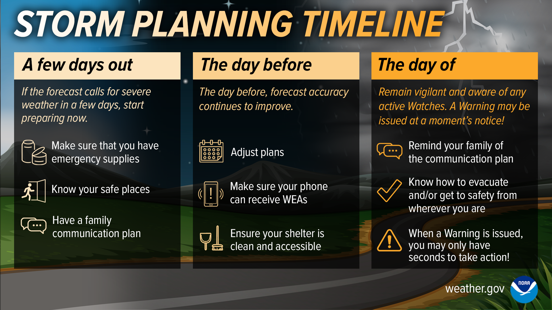
Don't let severe weather sneak up on you and catch you off guard! If the forecast calls for severe weather in a few days, start preparing as soon as possible. Leading up the day of severe weather, you should be monitoring the forecast for any changes, and making sure you have multiple ways to receive those life-saving warnings. On the day of expected severe weather, stay aware of the weather and be ready to act if severe weather strikes!
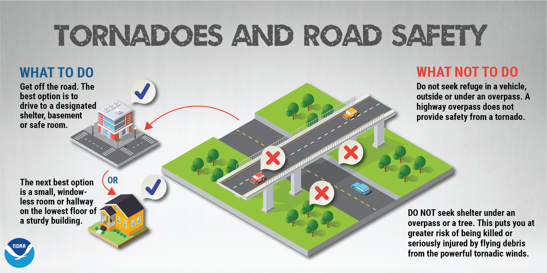
Do you know where to go if there's a tornado? Here's what to do if you're caught in a life-threatening situation.
Lightning Safety
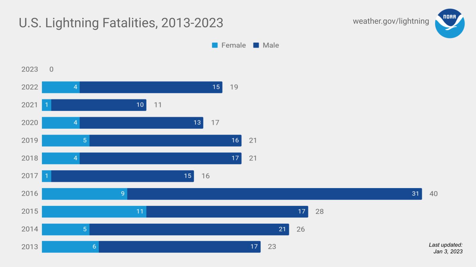
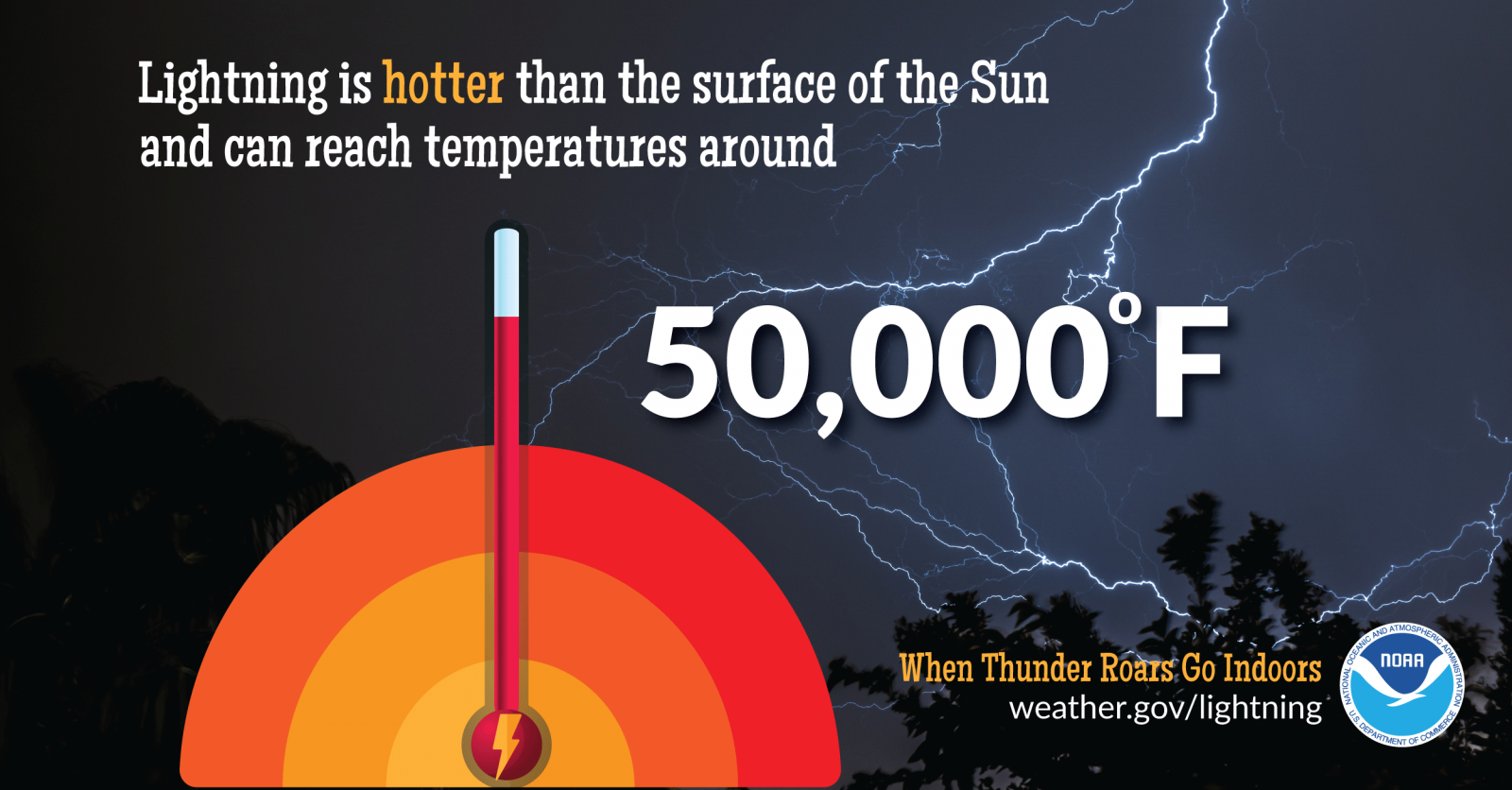
Lightning strikes the United States about 25 million times a year. Although most lightning occurs in the summer, people can be struck at any time of year. Lightning kills about 20 people in the United States each year, and hundreds more are severely injured. In 2022, 19 people lost their life from lightning strikes, and 15 of those were males.
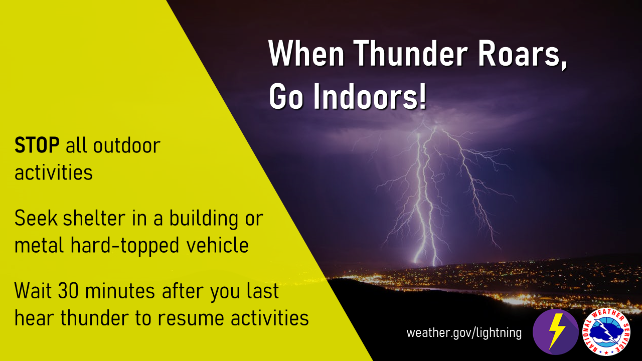
There is no safe place outside when thunderstorms are in the area. If you hear thunder, you are likely within striking distance of the storm. Just remember, When Thunder Roars, Go Indoors. Too many people wait far too long to get to a safe place when thunderstorms approach. Unfortunately, these delayed actions lead to many of the lightning deaths and injuries in the United States
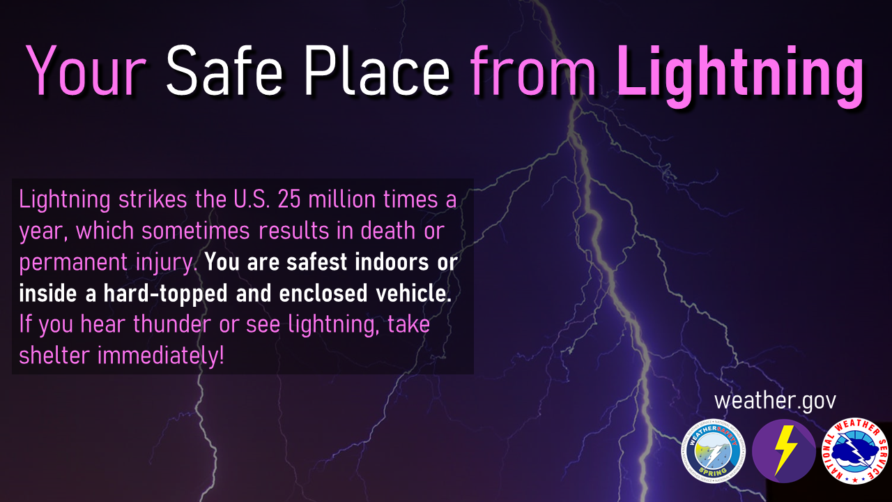
The best way for you to protect yourself from lightning is to avoid the threat. You simply don’t want to be caught outside in a storm. Have a lightning safety plan, and cancel or postpone activities early if thunderstorms are expected. Monitor weather conditions and get to a safe place before the weather becomes threatening. Substantial buildings and hard-topped vehicles are safe options. Rain shelters, small sheds, and open vehicles are not safe.
Hail and Wind Safety
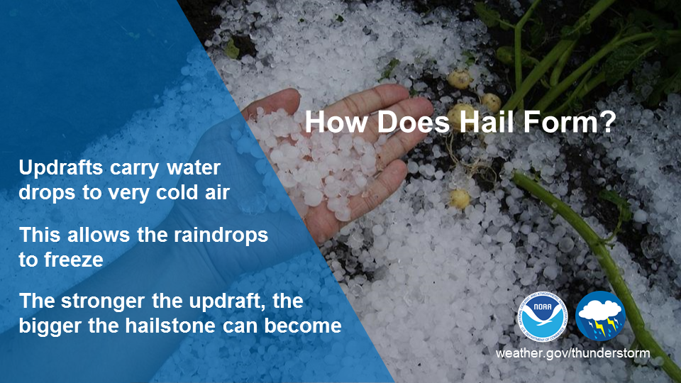
Severe thunderstorms are officially defined as storms that are capable of producing hail that is an inch or larger or wind gusts over 58 mph. Hail this size can damage property such as plants, roofs and vehicles. Wind this strong is able to break off large branches, knock over trees or cause structural damage to trees. Some severe thunderstorms can produce hail larger than softballs or winds over 100 mph, so please pay attention to the weather so you know when severe storms are possible.
Storms that produce hailstones the size of dimes or larger can result in dents on cars, damage to roofs, break windows, and perhaps cause casualties. Large hailstones can fall at speeds faster than 100 mph. Severe thunderstorms producing large hail cause nearly one billion dollars in damage to property and crops annually.
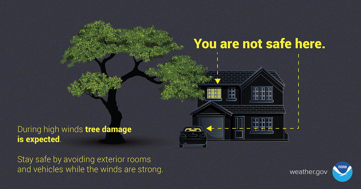
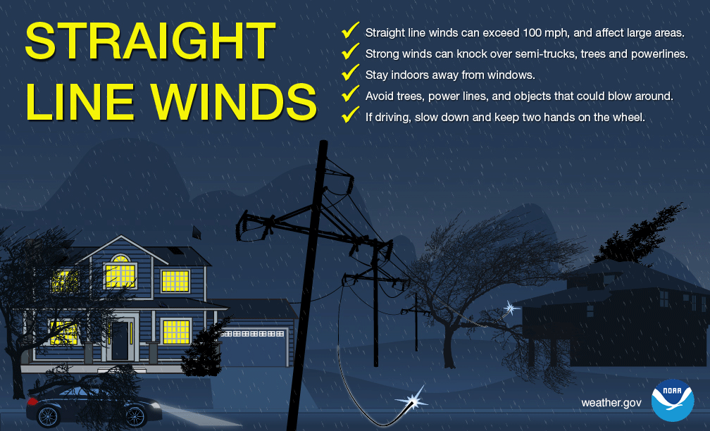
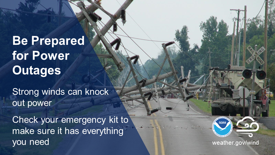
During high winds, falling trees and broken branches can become dangerous objects. Stay safe by avoiding exterior rooms and windows and by using caution when driving. Prevent damage to your property by trimming loose branches and parking away from trees. During strong thunderstorms, straight line wind speeds can exceed 100 mph and can cause damage similar to a tornado, knocking over semi-trucks, trees, and powerlines. Stay indoors and away from windows. Powerful storms can pack a windy punch. Don’t wait until you’re in the dark! Check your emergency kit now to ensure you have plenty of batteries and other essential supplies on hand.

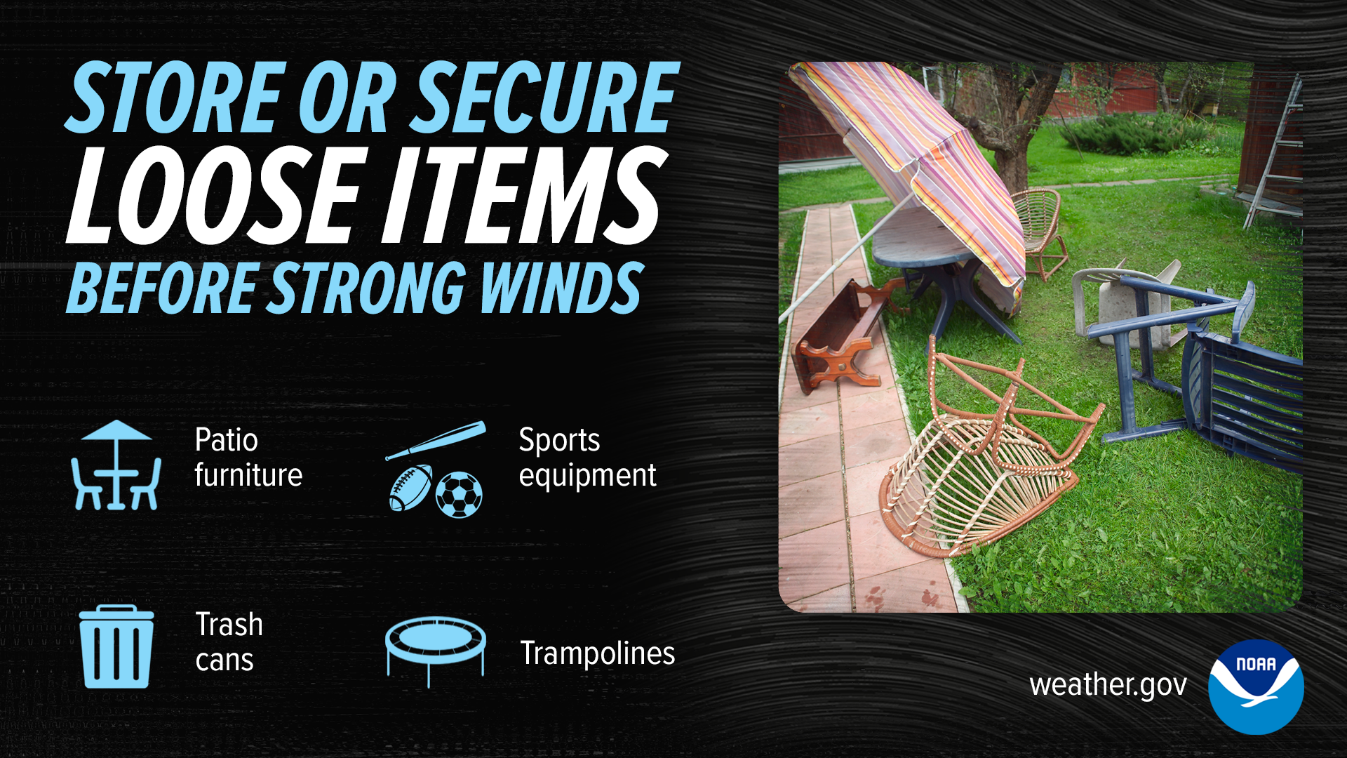
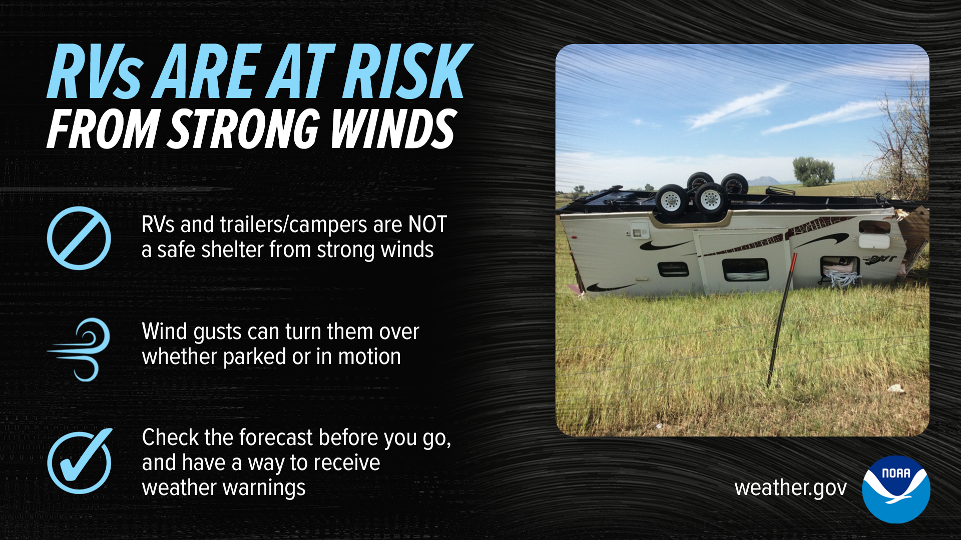
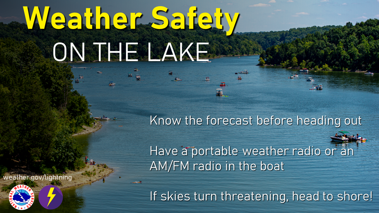
Even the most common items become dangerous objects when picked up and carried by the wind! When a High Wind Watch or a Severe Thunderstorm Watch is issued, secure outdoor items such as patio furniture, sports equipment and trash cans. Recreational vehicles and trailers/campers are NOT a safe shelter from strong winds. Wind gusts can turn them over whether parker or in motion. If high winds are forecast, consider rescheduling your trip. If caught on the road during straight line winds, slow down and keep two hands on the wheel. Wind can be dangerous for those out on the water as well, because strong winds create large waves and can damage your boat, push you off course, or even cause you to capsize. If high winds are forecast, stay off the water and stow your vessel before conditions become hazardous.

Recreational Safety
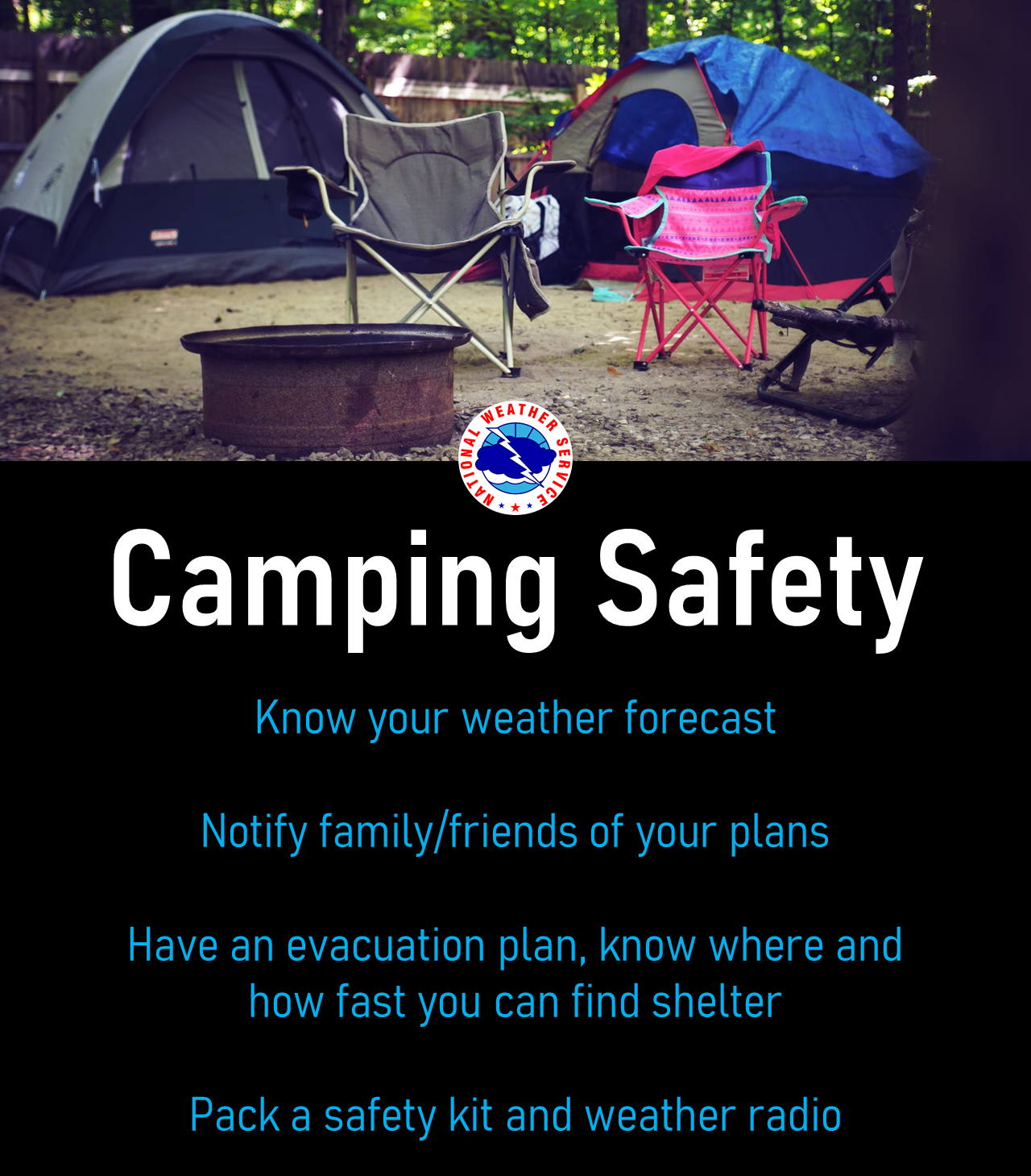
Recreational activity ramps up in the spring, but so do the chances for daily thunderstorms. No matter the outdoor activity, it's best to check the forecast before heading out the door. Each year in the United States, thunderstorms produce 20-25 million lightning flashes that strike the ground, killing an average of 20+ people and injuring hundreds more - often in devastating and permanent ways.
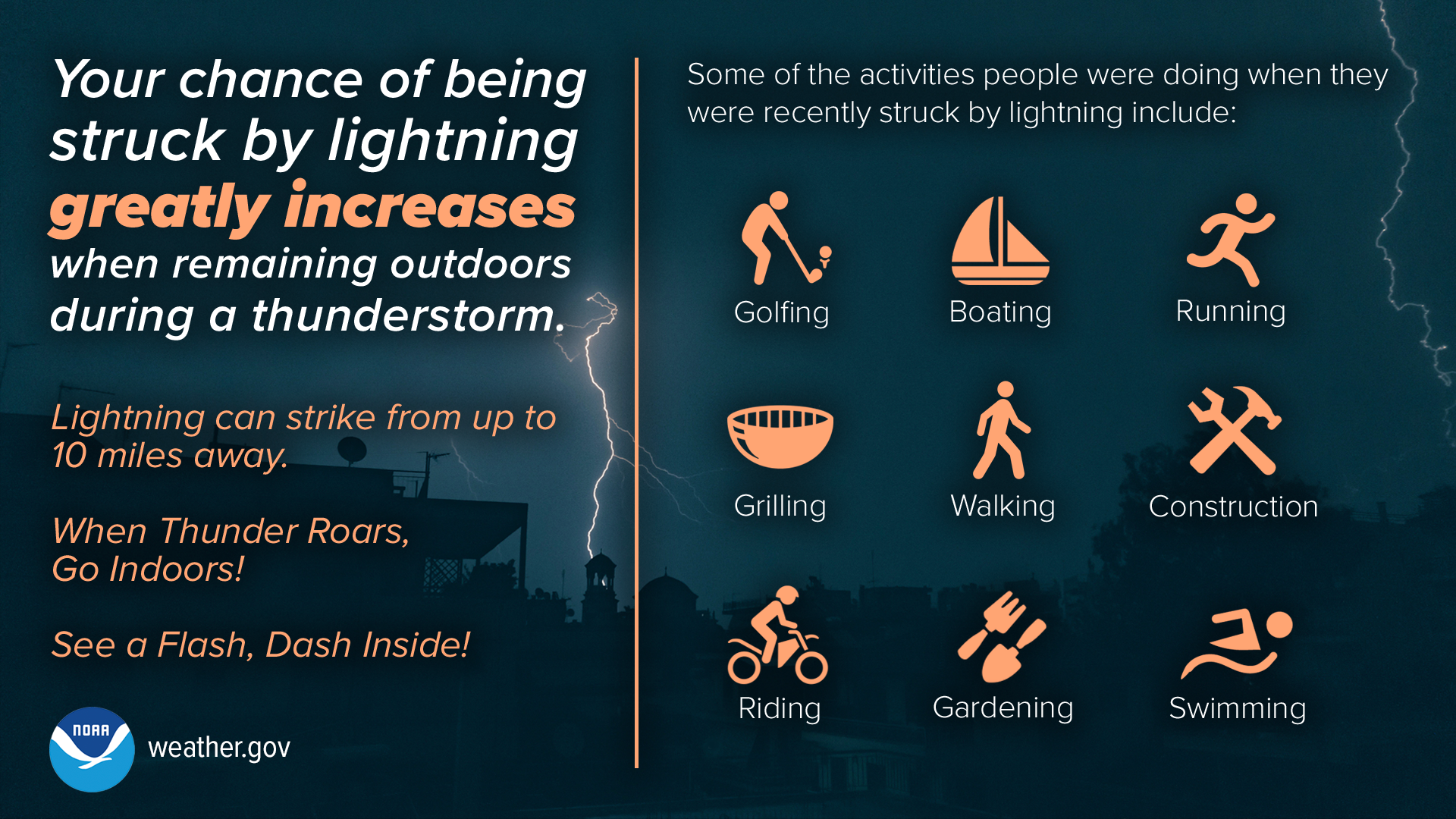
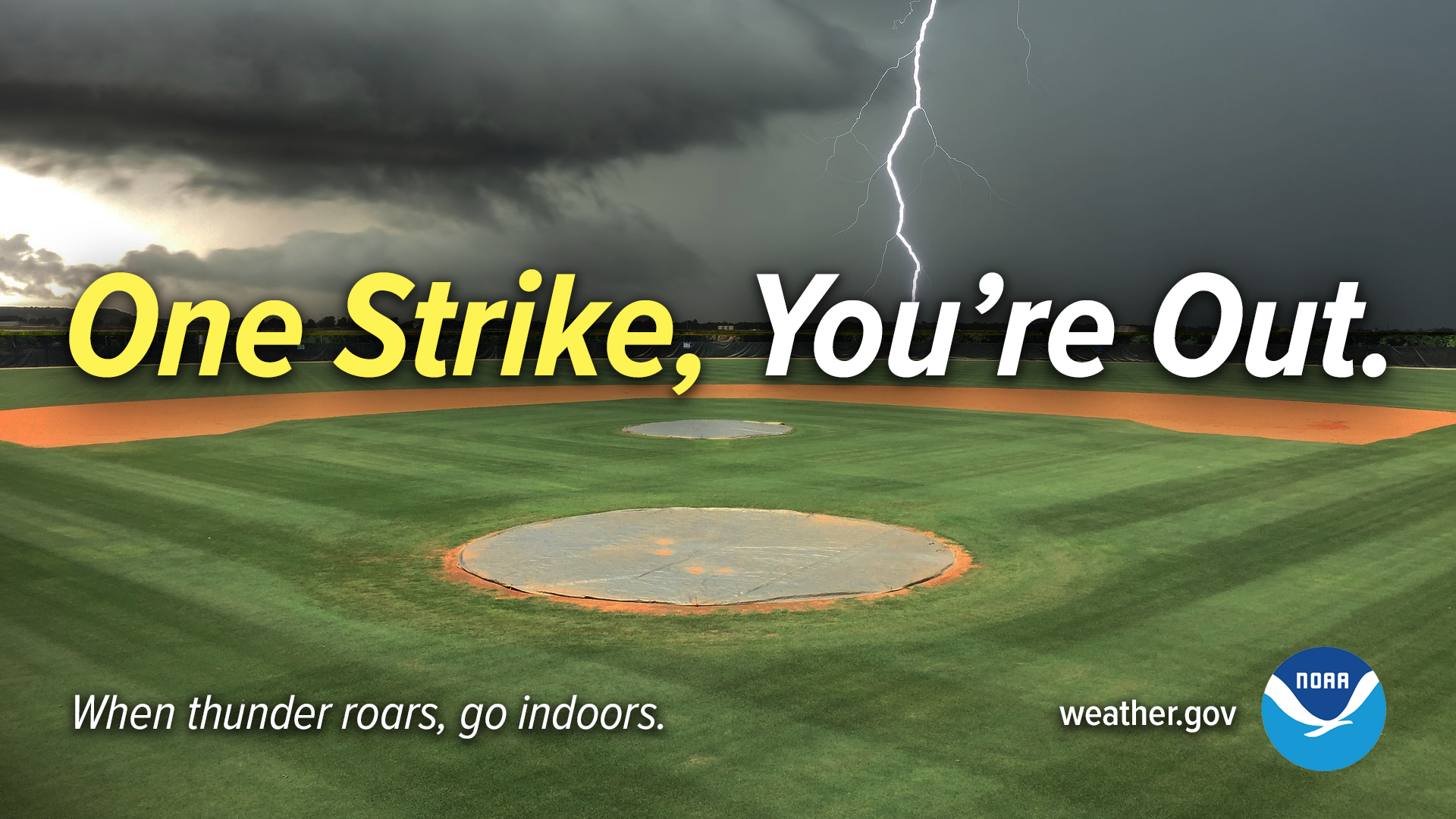
Whether you're enjoying the day on the lake, or spending time at the ballpark, always seek shelter when any thunderstorm approaches. Lightning is your biggest threat, and a severe thunderstorm is not dictated by how much lightning there is! Many storms may not be considered severe, but have tons of lightning! All it takes is one strike, and you're out.
We know that stopping an outdoor activity not on your schedule can be frustrating. But, a significant lightning threat extends outward from the base of a thunderstorm cloud about 6 to 10 miles. It’s important to account for the time it will take for everyone to get to safety. Here are some criteria that could be used to stop activities.
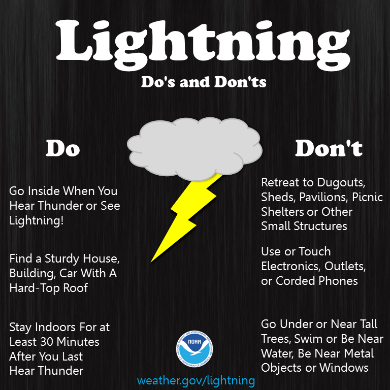
There is no place outside that is safe when a thunderstorm is in the area. Stop the activity immediately and get to a safe place immediately. Substantial buildings with wiring and plumbing provide the greatest amount of protection. Office buildings, schools, and homes are examples of buildings that would offer good protection. Once inside, stay away from windows and doors and anything that conducts electricity such as corded phones, wiring, plumbing, and anything connected to these. Note that small outdoor buildings including dugouts, rain shelters, sheds, etc., are NOT SAFE. In the absence of a substantial building, a hard-topped metal vehicle with the windows closed provides good protection.
Because electrical charges can linger in clouds after a thunderstorm has seemingly passed, experts agree that people should wait at least 30 minutes after the last thunder before resuming outdoor activities.
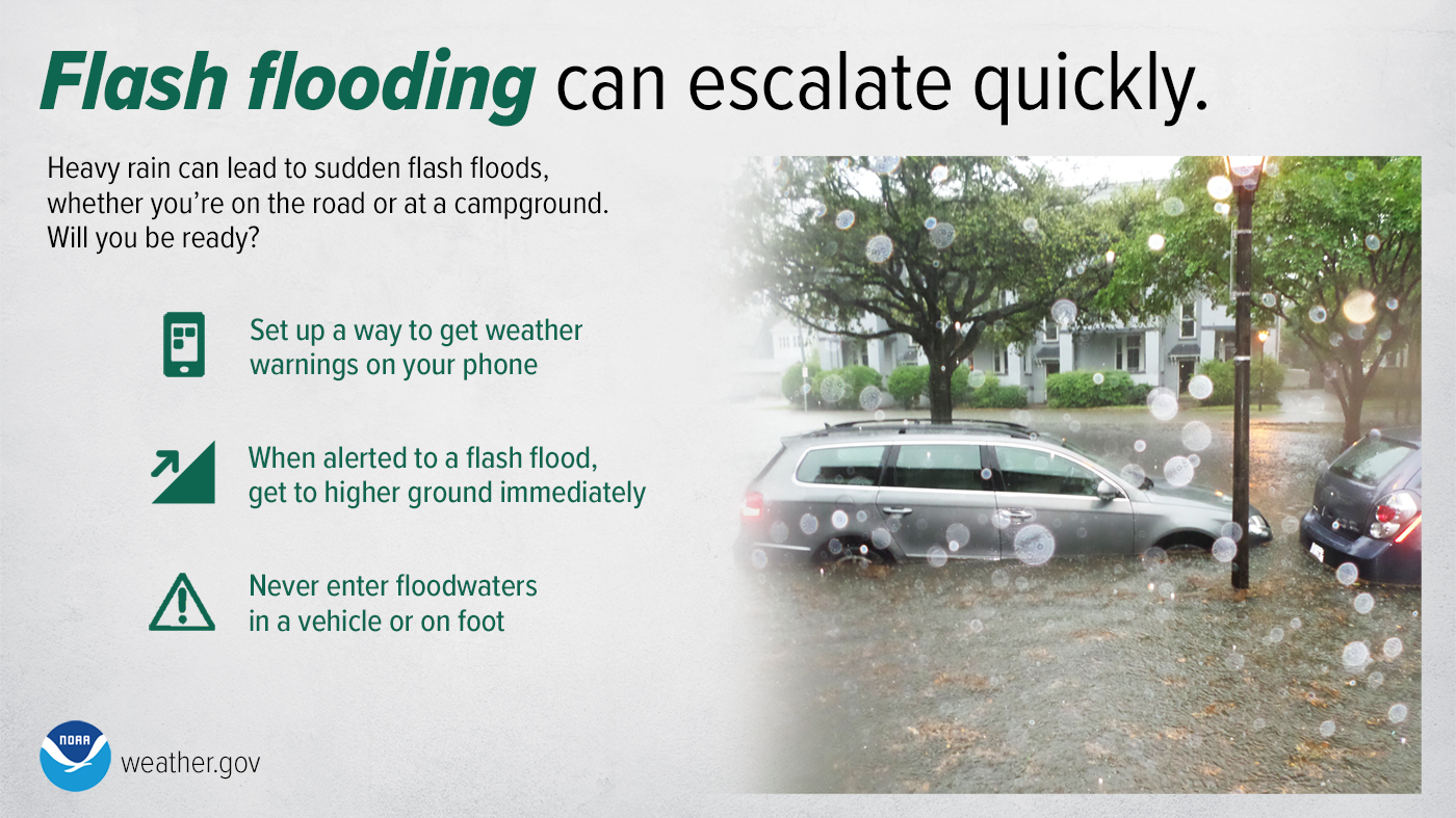
Flood Safety
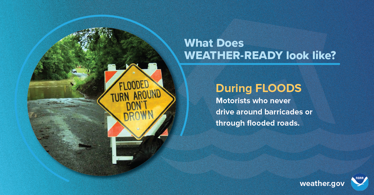
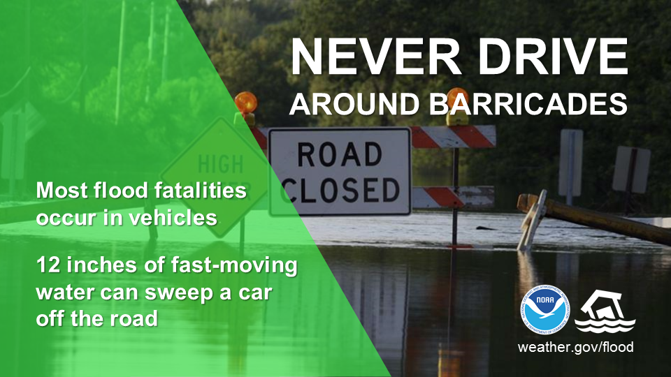
What does being Weather-Ready look like? When it comes to flood safety, it means knowing to never drive around barricades or through flooded roads, which are the cause of most flood fatalities.
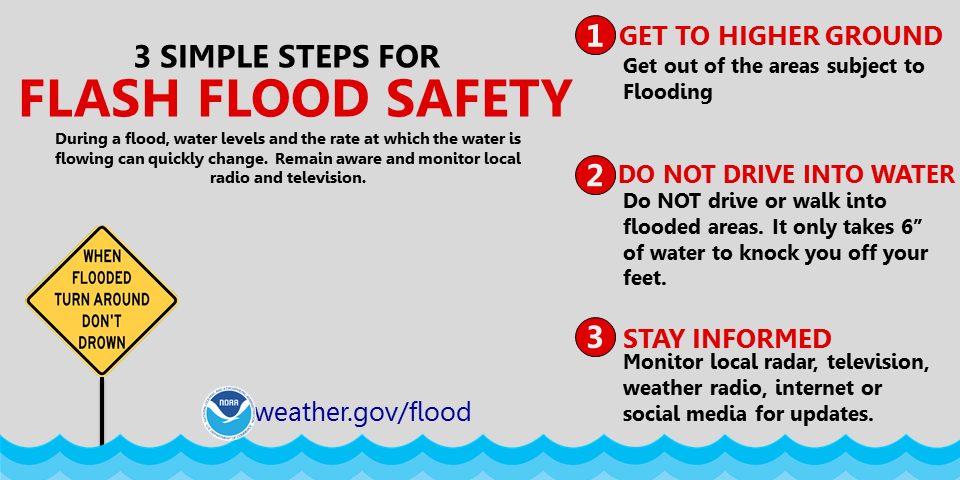
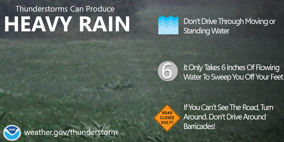
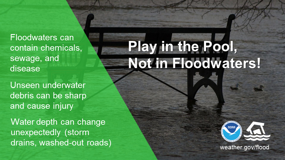
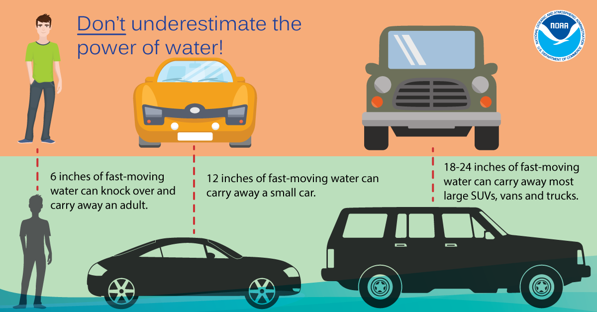
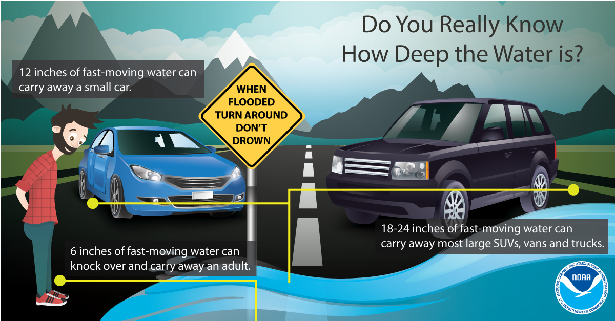
During a flood, water levels and the rate at which the water is flowing can quickly change. Get to higher ground. Do not drive or walk into water. It only takes 6 inches of water to knock you off your feet. Stay informed by monitoring local radio and television for updates.
Most flood fatalities occur in vehicles, and it only takes 12 inches of water to sweep a car away. Sometimes, the difference between life and death is small decisions. During a flood, small decisions like turning around and not driving through a flooded roadway, not driving around barricades, and delaying travel until conditions improve, can make a big impact on whether you keep your car...or even your life. Turn Around, Don’t Drown.
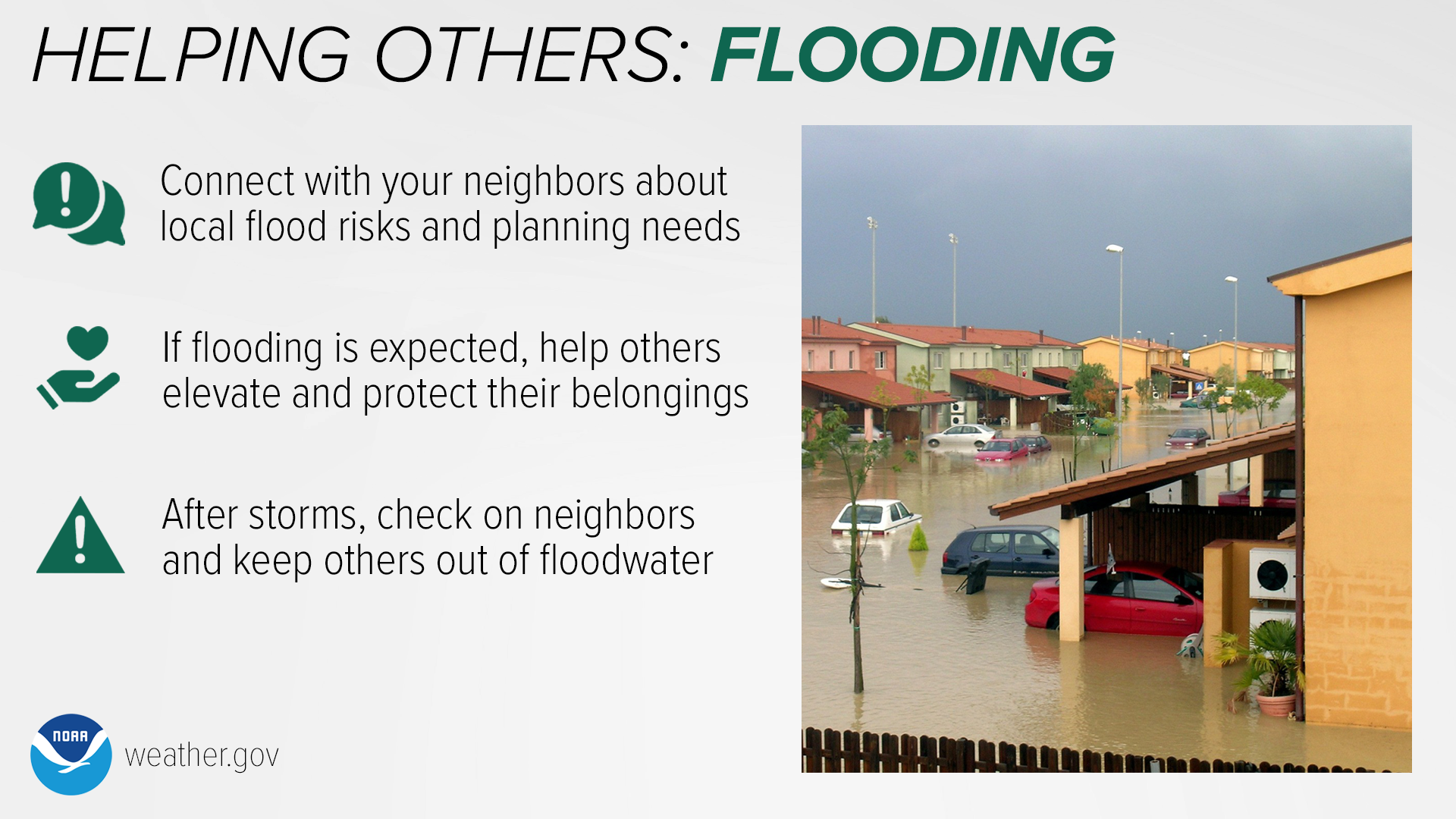
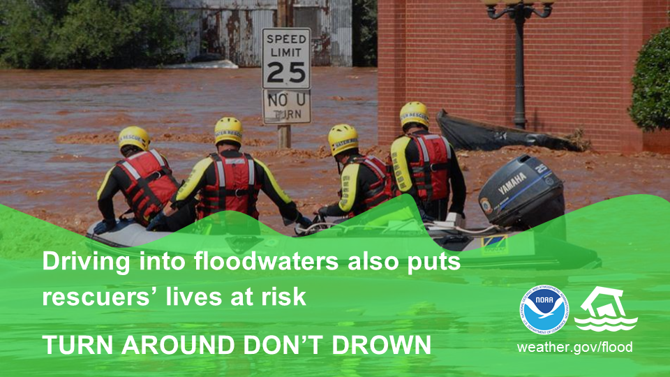
If flooding occurs while you’re outdoors, immediately get to higher ground, and NEVER enter flood waters in a vehicle or on foot. During a flood, water levels and the rate at which water is flowing can quickly change. You are safest staying indoors, or seeking higher ground if shelter isn’t available. If you’re stuck outside when a flash flood occurs, do not attempt to cross flood waters by vehicle or on foot.
More than 50% of all flood fatalities are vehicle related. NEVER drive around barricades into floodwaters! You never know if the road is even below that muddy water anymore. When you drive into floodwaters, you’re not only putting your own life at risk, but also the lives of your rescuers. It’s far better to be late and remain safe than to take a risk and possibly lose your life. Turn around, don't drown!
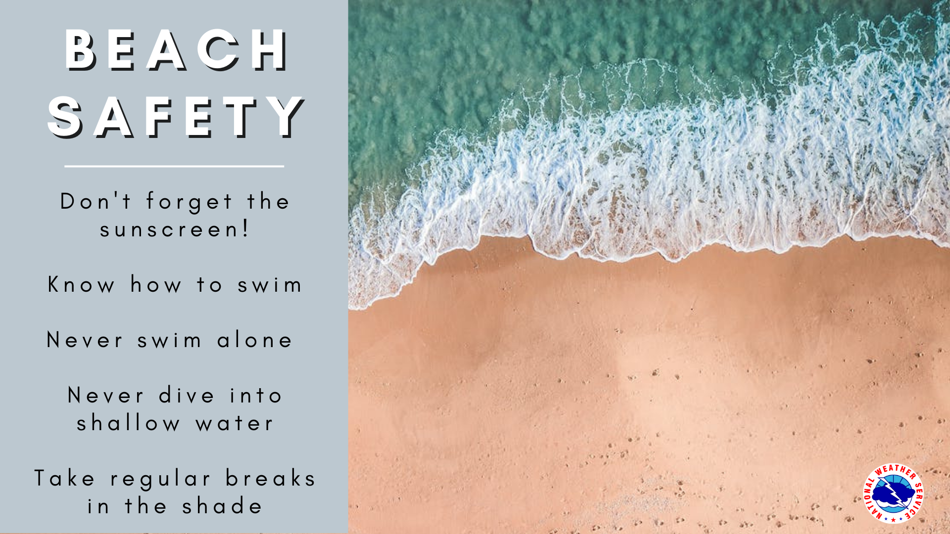
Beach Safety
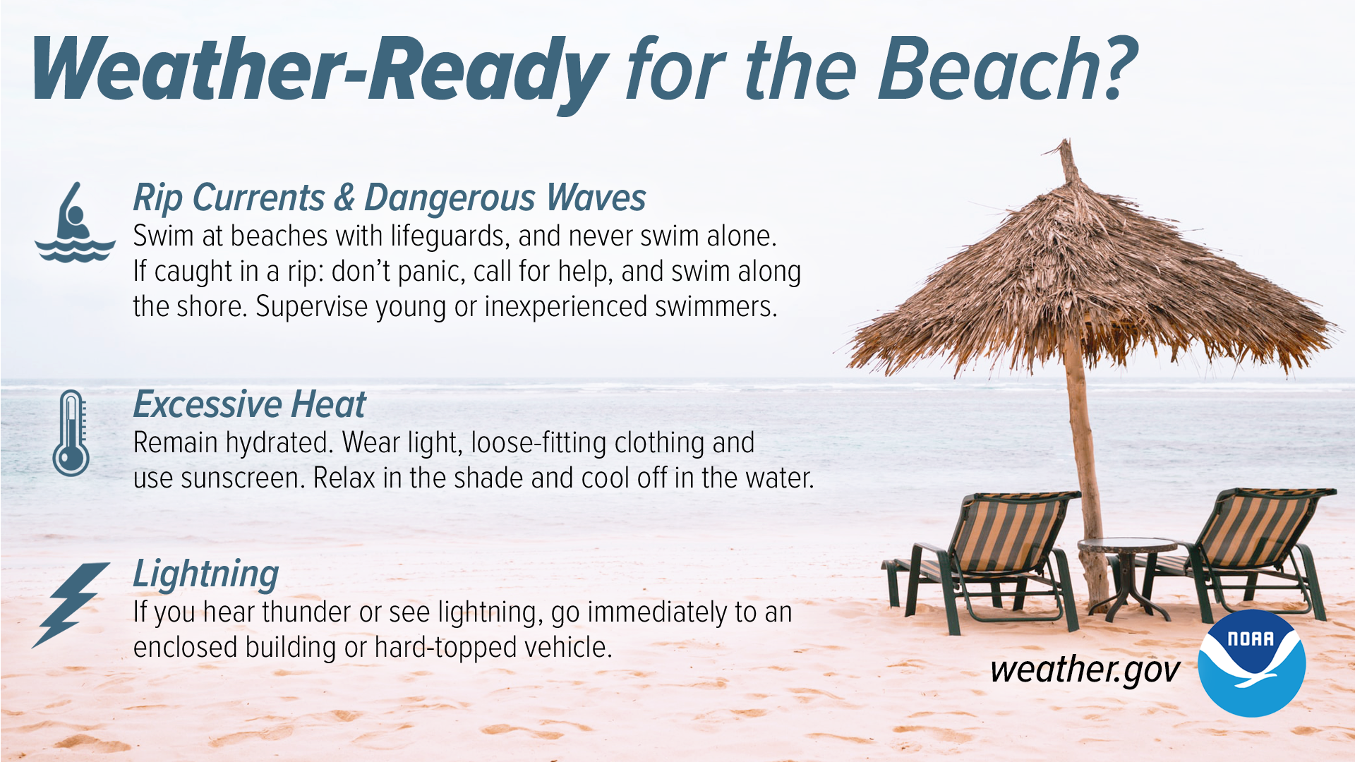
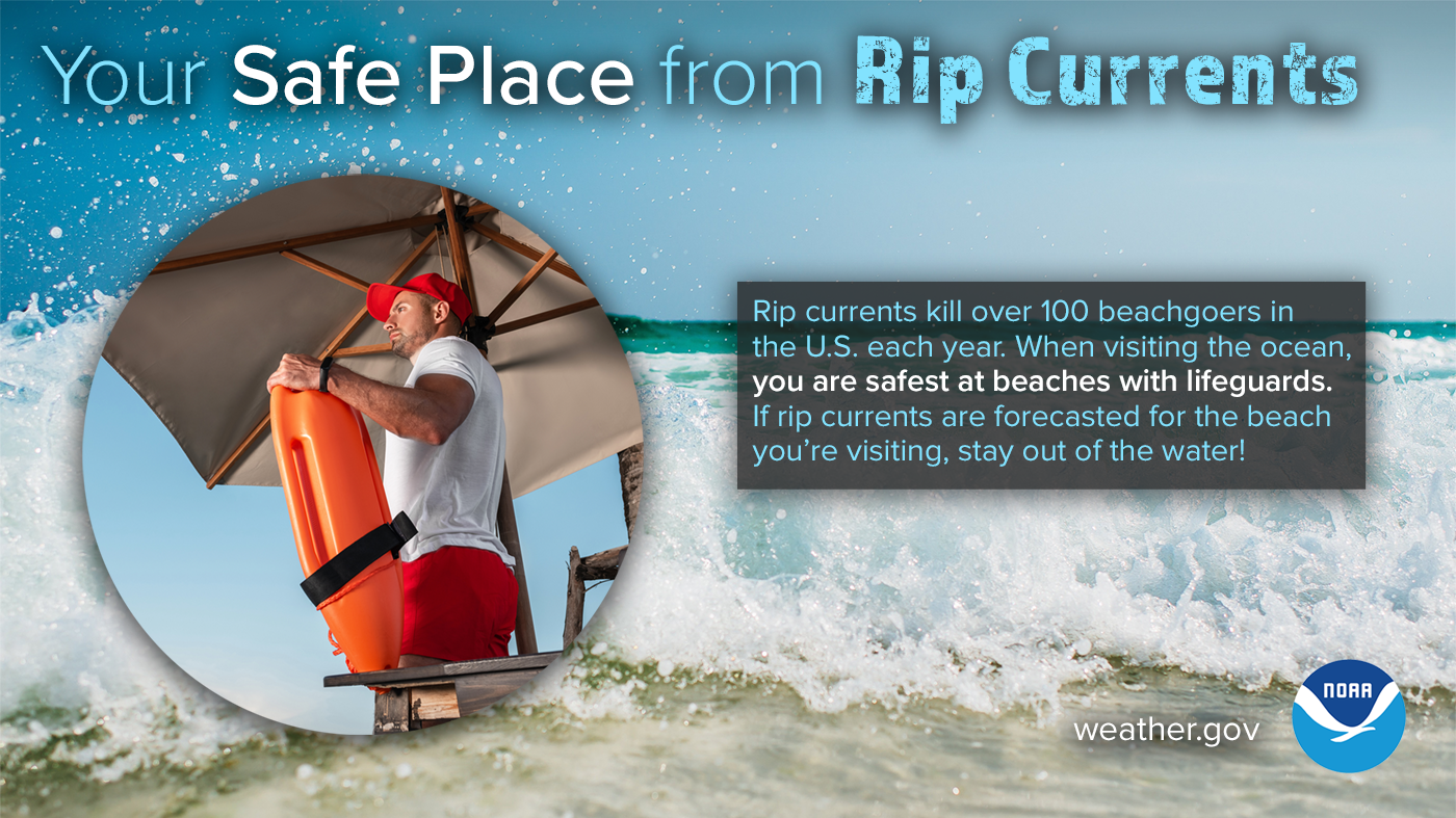
Heading to the beach for spring break or summer vacation this year? We want you to have a safe trip to the beach! A trip to the beach should be fun. Unfortunately, many people are injured or killed each year along our nation's beaches by dangerous waves and currents
When you visit the beach, you need to know about the hazards you may face. Staying aware and alert is what will help to keep you safe in the dynamic conditions found on every beach. Be mindful of rip currents, excessive heat and sunburns, and lightning.
Shorebreak – waves which quickly peak and break onshore to a relatively sharply sloping beach; also known as: inside break, insiders. Shorebreak occurs where you have a relatively sharply sloping beach so that incoming waves, rather than breaking gradually as they find bottom, instead break quickly and steeply onshore. The primary hazard of shorebreak is trauma injuries, notably neck injuries. The hazard typically increases as wave height increases.
“High surf” is a terminology used by the NWS for conditions characterized by much larger than normal waves breaking in the surf zone with sufficient energy to erode beaches, move large logs, wash over jetties or exposed rocks. It will always be very dangerous to people in the water or along the immediate beach. High surf can rush up quickly and well above the typical high tide waterline. It can knock people over into the pull of the rough churning currents and result in drowning.
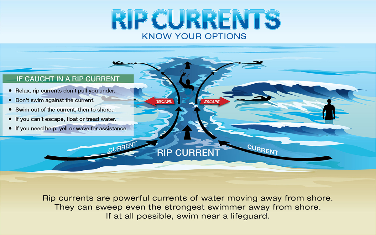
Rip currents are channelized currents of water flowing away from shore at surf beaches. They typically form at breaks in sandbars, and also near structures such as jetties and piers, and are common on all surf beaches. Rip cu8rrents are dangerous because they carry people away from shore! If you find yourself in a rip current, try to relax and do not try to swim against the current. Try to escape by swimming out the current in a direction following the shoreline.
How You Can Help Your Community
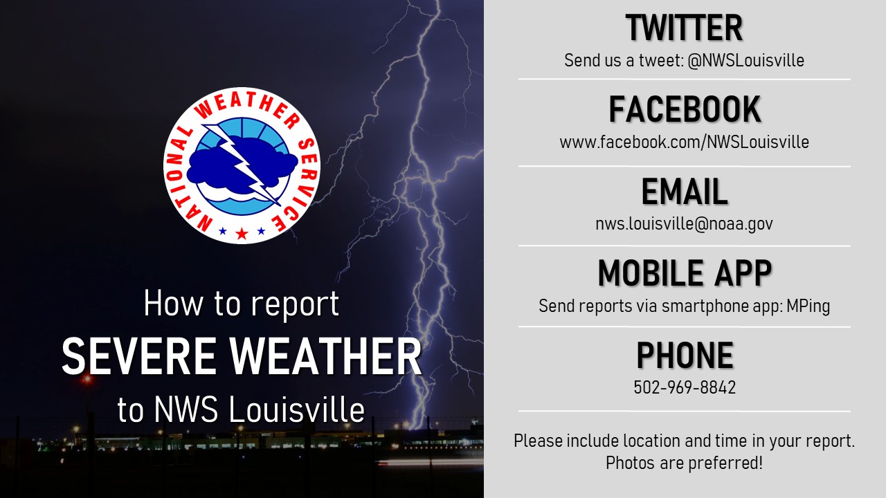
When severe weather strikes, we'll need your help! If you see severe weather such as hail or a tornado, we need to know about it to help protect other communities in the path. We also need to know if you see any damage, such as to buildings, trees, or power lines. We have multiple ways to send reports to us, but be sure to include any images, location, and time of your report.
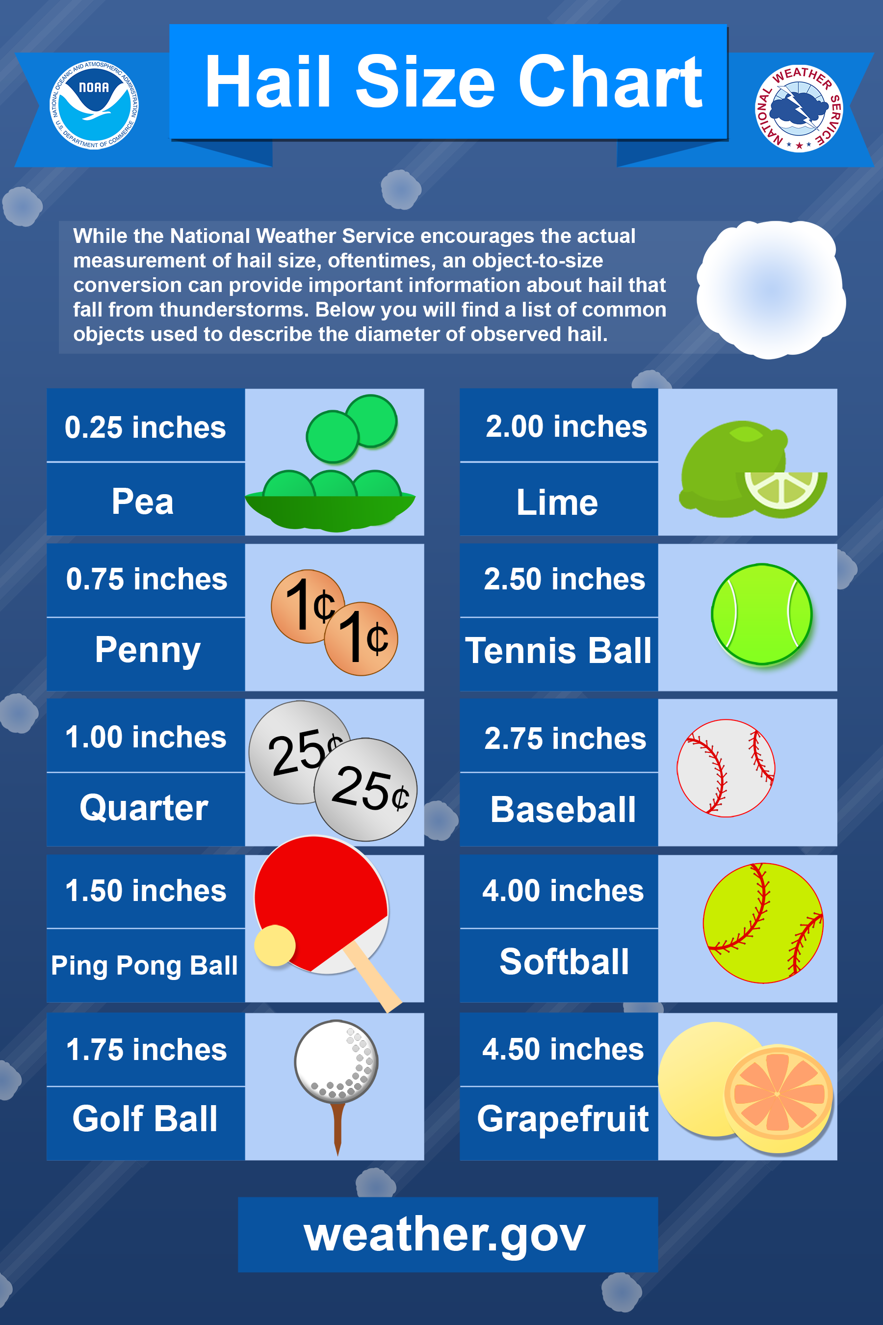
Got Hail? We'd like to know about it. Save this chart for the future, and use it as a guide to describe how big the hail is. You can also use a ruler measure the size of the hailstones. Never describe hail as marbles, because marbles come in all shapes and sizes!


Deaf and Hard of Hearing
Having a plan is important in times of emergency, and this includes building an emergency preparedness kit before a disaster. Learn how with this video in American Sign Language.
With our region experiencing moderate to severe drought, burning can quickly get out of control. Wildfires quickly consume everything in their paths. Learn how to prepare NOW with this video in American Sign Language.
Severe weather can occur anytime of the year across our region. Just because it is winter does not mean you should not forget basic thunderstorm safety. This PSA for the deaf & hard of hearing community covers the basics of severe thunderstorm safety, explains Watches & Warnings, and touches on the various hazards that thunderstorms can bring.
Bonus Day: Earthquake Safety
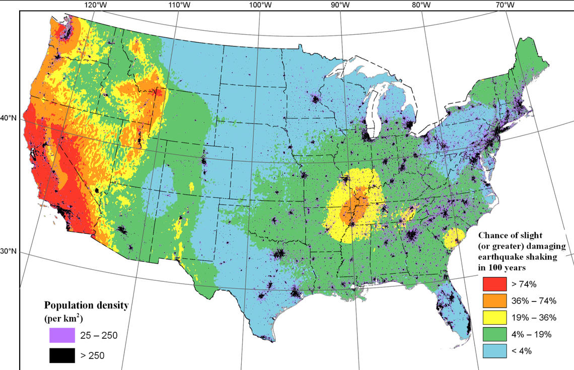
While most of the earthquakes in the United States occur in Alaska, Hawaii, or along the west coast, an area near the convergence of the Ohio and Mississippi Rivers experiences a localized maximum in earthquake activity. This area, known as the New Madrid Seismic Zone, experiences a magnitude 7 to 8 earthquake approximately once every 500 years. Recorded earthquakes of note include the 1895 Charleston, Missouri earthquake and the 1811-1812 New Madrid earthquakes, both of which produced extensive damage across the lower Ohio and mid-Mississippi valleys. While earthquakes are still an infrequent occurrence in this part of the world, it is important to be prepared in case one occurs.
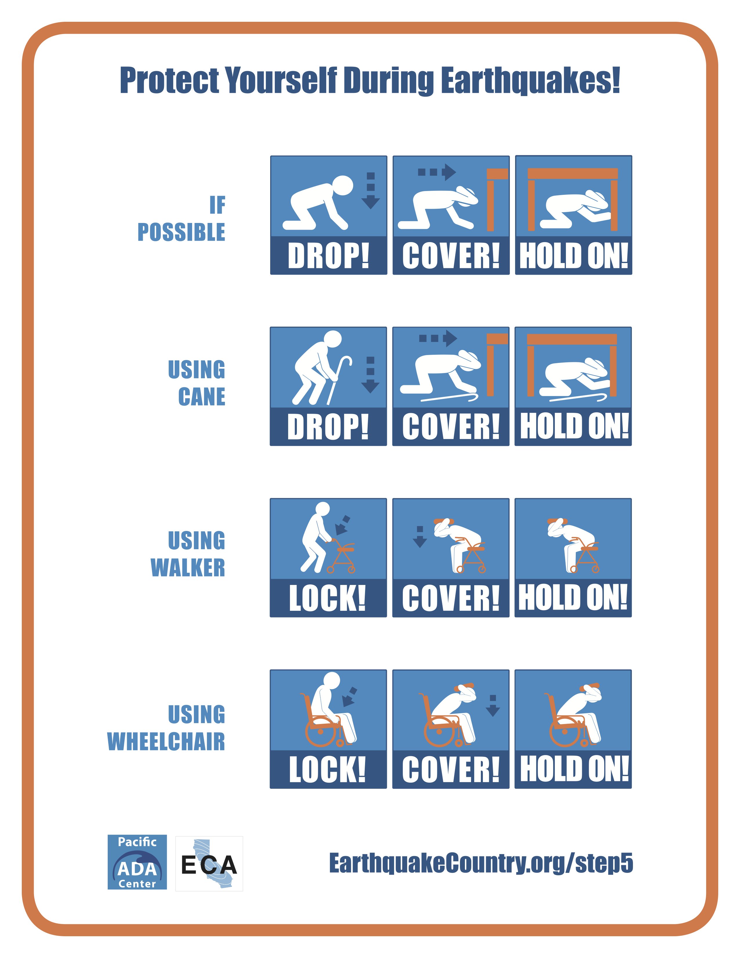
Here are some safety tips from the U.S. Geological Survey for what you should do when an earthquake strikes:
For more information on the New Madrid Seismic Zone, check out this article from the U.S. Geological Survey: https://www.usgs.gov/programs/earthquake-hazards/new-madrid-seismic-zone
 |
Media use of NWS Web News Stories is encouraged! Please acknowledge the NWS as the source of any news information accessed from this site. |
|


 Weather Story
 Weather Map
 Local Radar