Louisville, KY
Weather Forecast Office
Shortly after midnight early on August 7 a severe squall line pushed across southern Indiana and the Louisville metro. Six weak tornadoes spun up as the line of storms moved through, with most of the damage occurring along IN 56 from north of Jasper to Salem where tornado winds up to 107 mph were estimated.
The only other significant severe weather event of the month took place on the evening of the 25th when severe storms developed over north central Kentucky and far southern Indiana, including the Louisville metro once again. There were many reports of tree and power line damage associated with wet microbursts, and the Kentucky Mesonet station near Waddy in Shelby County reported a wind gust of 83 mph!
A heat wave swept the region from the 21st to 26th with highs each day well into the 90s. The sweltering heat peaked on the 25th with many locations hitting the upper 90s with heat index readings over 110 degrees.
| Average Temperature | Departure from Normal | Precipitation | Departure from Normal | |
| Bowling Green | 77.5° | -1.0° | 5.93" | +2.04" |
| Frankfort | 75.1° | -1.0° | 2.82" | -0.33" |
| Lexington | 76.3° | +0.6° | 2.40" | -1.31" |
| Louisville Ali | 78.3° | -0.6° | 3.54" | -0.17" |
| Louisville Bowman | 75.6° | -2.0° | 4.19" | +0.66" |
Records
6th: Warm low of 75° at Lexington
24th: Warm low of 78° at Louisville
25th: Warm low of 77° at Bowling Green
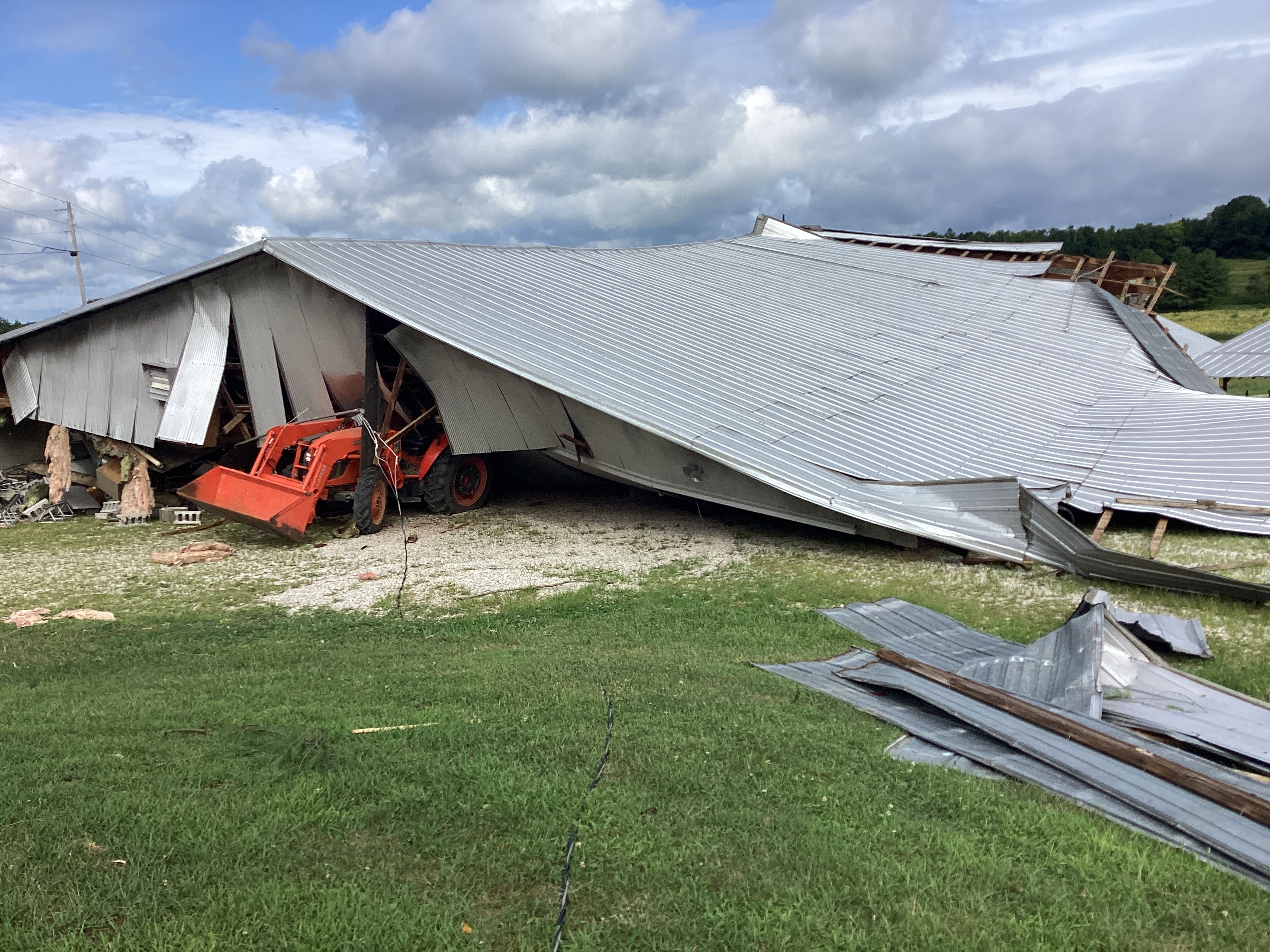
Tornado damage in northern Dubois County on the 7th. NWS Storm Survey
Current Hazards
Hazardous Weather Outlook
Storm Prediction Center
Submit a Storm Report
Advisory/Warning Criteria
Radar
Fort Knox
Evansville
Fort Campbell
Nashville
Jackson
Wilmington
Latest Forecasts
El Nino and La Nina
Climate Prediction
Central U.S. Weather Stories
1-Stop Winter Forecast
Aviation
IDSS Forecast Points
Air Quality
Fire Weather
Recreation Forecasts
1-Stop Drought
Event Ready
1-Stop Severe Forecast
Past Weather
Climate Graphs
1-Stop Climate
CoCoRaHS
Local Climate Pages
Tornado History
Past Derby/Oaks/Thunder Weather
Football Weather
Local Information
About the NWS
Forecast Discussion
Items of Interest
Spotter Training
Regional Weather Map
Decision Support Page
Text Products
Science and Technology
Outreach
LMK Warning Area
About Our Office
Station History
Hazardous Weather Outlook
Local Climate Page
Tornado Machine Plans
Weather Enterprise Resources
US Dept of Commerce
National Oceanic and Atmospheric Administration
National Weather Service
Louisville, KY
6201 Theiler Lane
Louisville, KY 40229-1476
502-969-8842
Comments? Questions? Please Contact Us.


 Weather Story
 Weather Map
 Local Radar