Louisville, KY
Weather Forecast Office
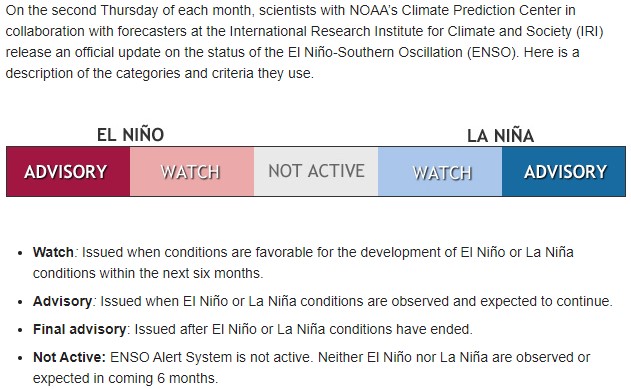
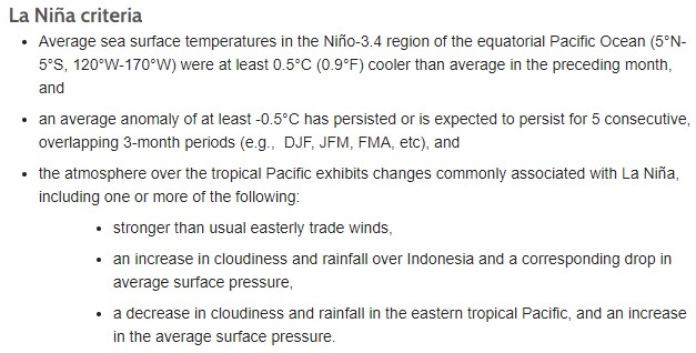
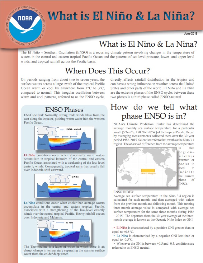
La Niña conditions have developed in the tropical Pacific and are expected to persist through the winter. As a result, a La Niña Advisory has been issued.
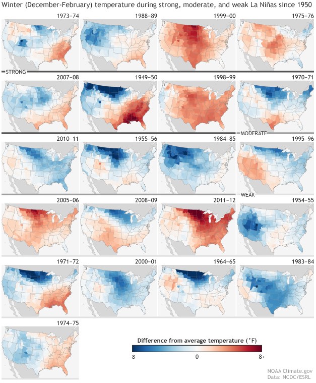
Below is a map of the typical effect La Niña has on the November-March temperatures in the United States. The yellow and orange colors indicate areas where temperatures often average warmer than normal during a La Niña winter:
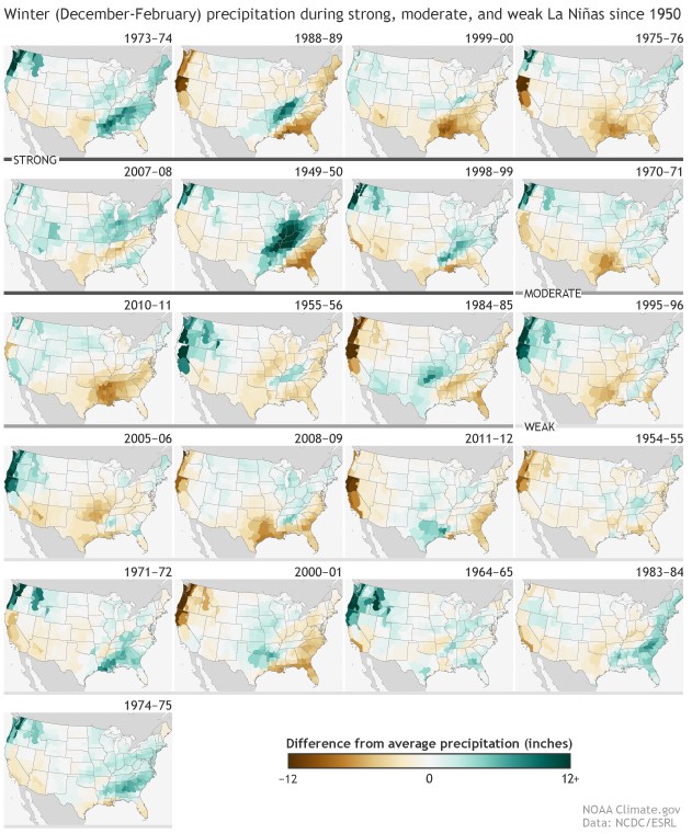
Here is a map showing the typical effect La Niña has on November-March precipitation. The blue and green colors in the Ohio Valley indicate a tendency toward wetter than normal conditions:
It is important to remember:
For more information click on the links below:
 |
|
 |
|
 |
|
 |
|
Current Hazards
Hazardous Weather Outlook
Storm Prediction Center
Submit a Storm Report
Advisory/Warning Criteria
Radar
Fort Knox
Evansville
Fort Campbell
Nashville
Jackson
Wilmington
Latest Forecasts
El Nino and La Nina
Climate Prediction
Central U.S. Weather Stories
1-Stop Winter Forecast
Aviation
IDSS Forecast Points
Air Quality
Fire Weather
Recreation Forecasts
1-Stop Drought
Event Ready
1-Stop Severe Forecast
Past Weather
Climate Graphs
1-Stop Climate
CoCoRaHS
Local Climate Pages
Tornado History
Past Derby/Oaks/Thunder Weather
Football Weather
Local Information
About the NWS
Forecast Discussion
Items of Interest
Spotter Training
Regional Weather Map
Decision Support Page
Text Products
Science and Technology
Outreach
LMK Warning Area
About Our Office
Station History
Hazardous Weather Outlook
Local Climate Page
Tornado Machine Plans
Weather Enterprise Resources
US Dept of Commerce
National Oceanic and Atmospheric Administration
National Weather Service
Louisville, KY
6201 Theiler Lane
Louisville, KY 40229-1476
502-969-8842
Comments? Questions? Please Contact Us.


 Weather Story
 Weather Map
 Local Radar