Louisville, KY
Weather Forecast Office
March roared in like a lion when we experienced our largest tornado outbreak in 5 years on the first day of the month. Between midnight and 8:30am nine tornadoes spun across the area. Six of them were north of Interstate 64, with the remaining three in the Bowling Green region. The strongest was an EF2 a few minutes after midnight in Ireland, Indiana. Fortunately there were no fatalities in any of the storms, though there were 4 injuries. Three of the injuries were in a mobile home that was rolled by an EF1 tornado with 105mph winds in Scott County, Indiana.
The month was bookended with severe weather as more rough storms plowed through the region on the 27th and 30th. The event on the 27th spawned a brief EF1 tornado in Metcalfe County.
In between the severe weather outbreaks there was quite a cold snap from the 11th to the 19th. Freezing temperatures damaged vegetation that had begun to grow in the extremely warm temperatures we experienced in February.
| Average Temperature | Departure from Normal | Precipitation | Departure from Normal | Snowfall | Departure from Normal | |
| Bowling Green | 50.8° | +2.4° | 3.79" | -0.62" | T | -1.1" |
| Frankfort | 47.7° | +2.8° | 5.09" | +0.71" | ||
| Lexington | 47.8° | +2.3° | 3.28" | -0.79" | T | -1.4" |
| Louisville Bowman | 49.6° | +2.6° | 3.45" | -0.71" | ||
| Louisville International | 50.3° | +2.5° | 3.68" | -0.49" | T | -1.4" |
Records
1st: Rainfall of 1.94" at Frankfort
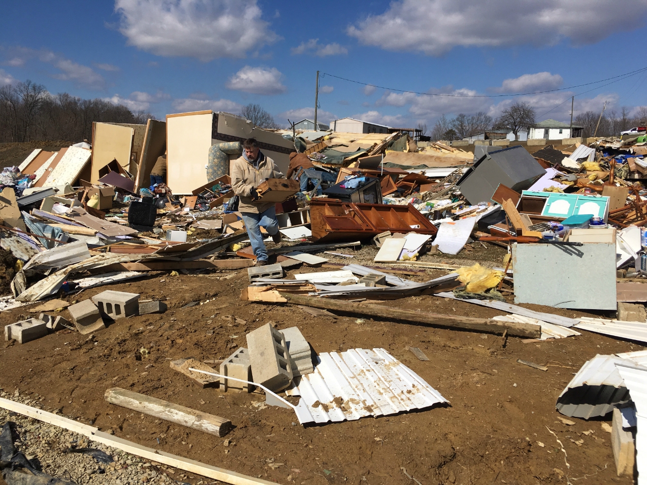
The results of an EF1 tornado in Scott County, Indiana, on the 1st.
Current Hazards
Hazardous Weather Outlook
Storm Prediction Center
Submit a Storm Report
Advisory/Warning Criteria
Radar
Fort Knox
Evansville
Fort Campbell
Nashville
Jackson
Wilmington
Latest Forecasts
El Nino and La Nina
Climate Prediction
Central U.S. Weather Stories
1-Stop Winter Forecast
Aviation
IDSS Forecast Points
Air Quality
Fire Weather
Recreation Forecasts
1-Stop Drought
Event Ready
1-Stop Severe Forecast
Past Weather
Climate Graphs
1-Stop Climate
CoCoRaHS
Local Climate Pages
Tornado History
Past Derby/Oaks/Thunder Weather
Football Weather
Local Information
About the NWS
Forecast Discussion
Items of Interest
Spotter Training
Regional Weather Map
Decision Support Page
Text Products
Science and Technology
Outreach
LMK Warning Area
About Our Office
Station History
Hazardous Weather Outlook
Local Climate Page
Tornado Machine Plans
Weather Enterprise Resources
US Dept of Commerce
National Oceanic and Atmospheric Administration
National Weather Service
Louisville, KY
6201 Theiler Lane
Louisville, KY 40229-1476
502-969-8842
Comments? Questions? Please Contact Us.


 Weather Story
 Weather Map
 Local Radar