Overview
|
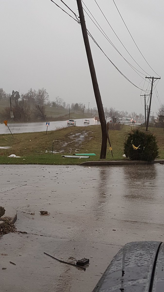
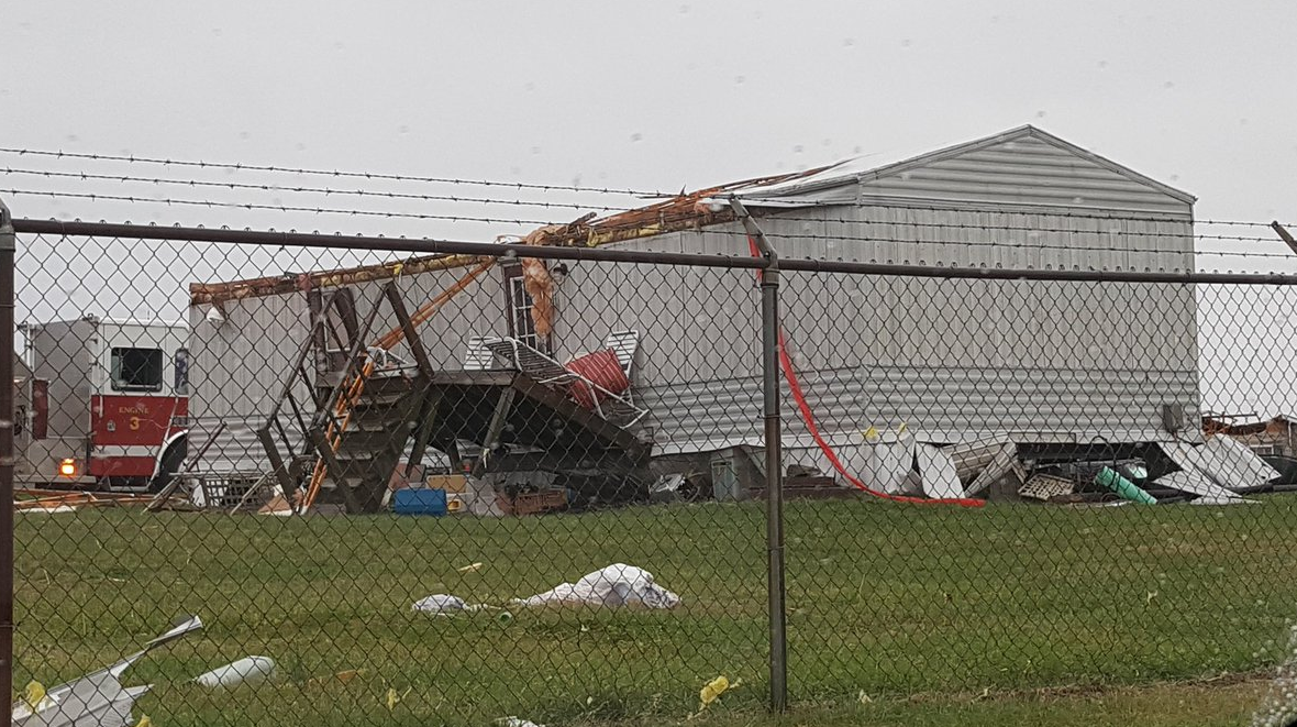
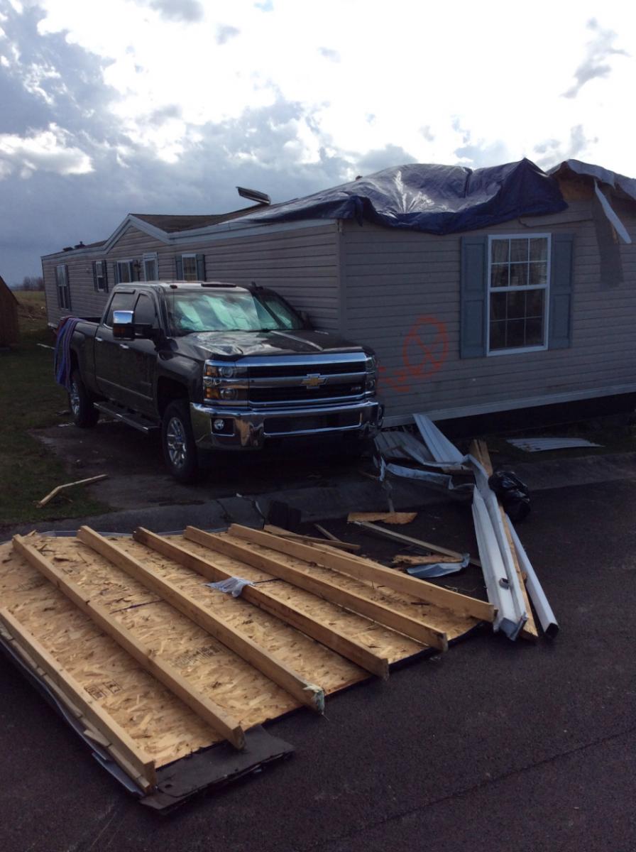
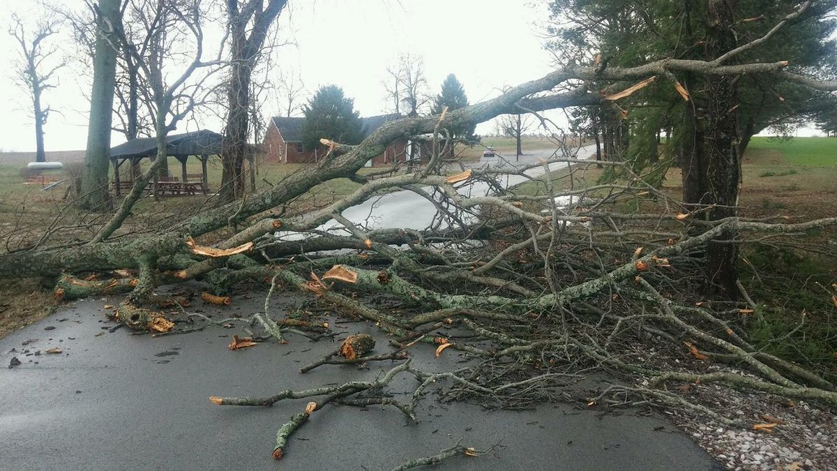
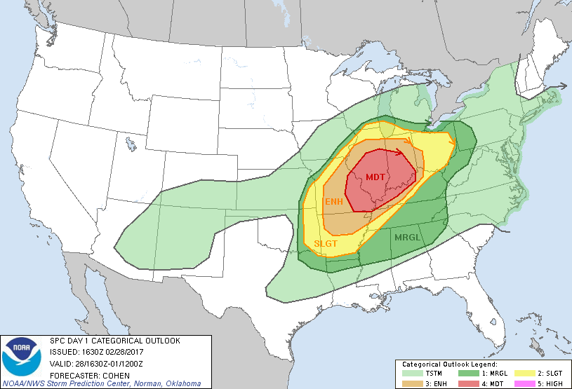
A powerful storm system crossed the lower Ohio Valley the evening of Tuesday February 28 and the early morning hours Wednesday March 1. Multiple rounds of thunderstorms brought large hail, damaging winds, and tornadoes. Event summaries from neighboring NWS offices: |
.png) Timeline of March 1st, 2017 Tornadoes |
 |
 |
 |
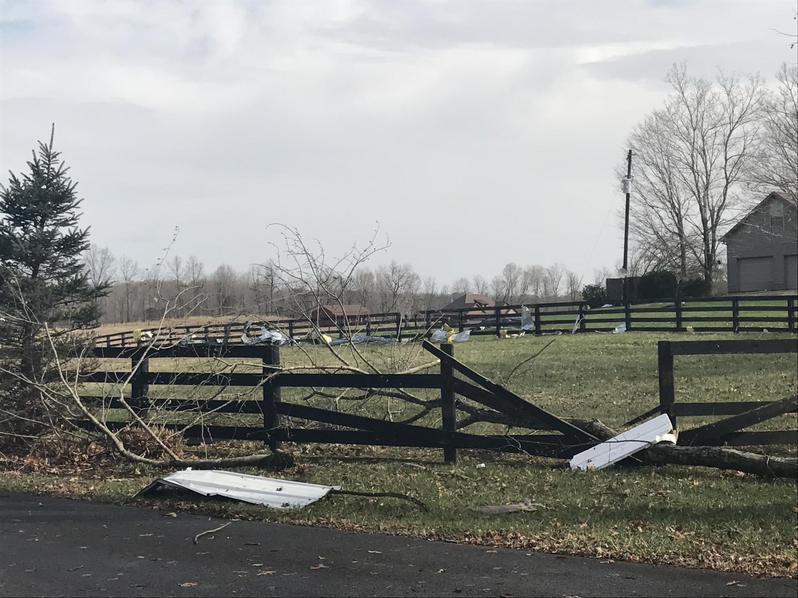
| Scott County, KY (Credit: John Gordon, NWS Louisville) | Dubois County, Indiana (Credit: Joe Sullivan, NWS Louisville) | Warren County, KY (Credit: Nick Williams, Twitter) |
Tornadoes:
|
|
||||||||||
|
||||||||||
|
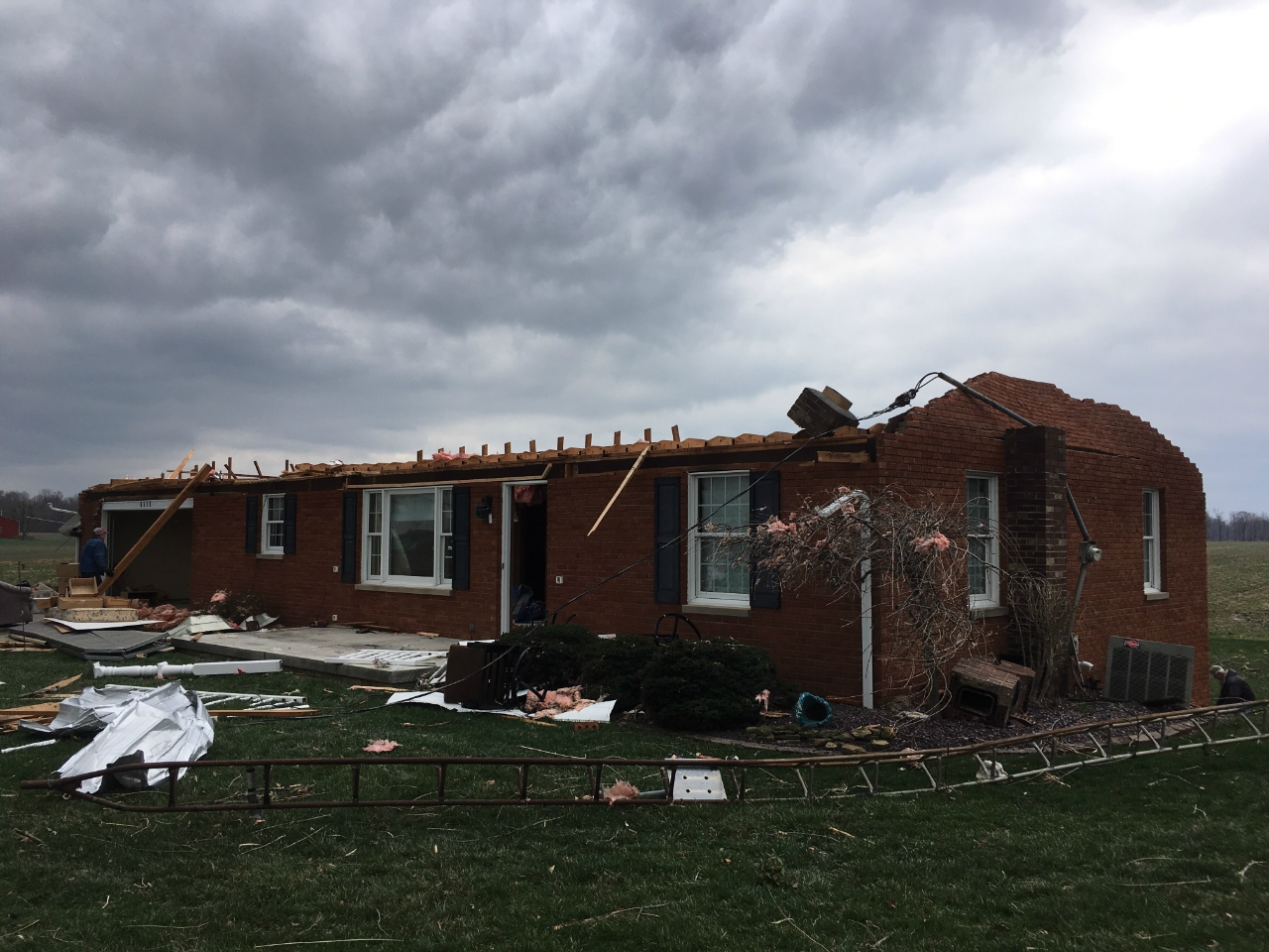
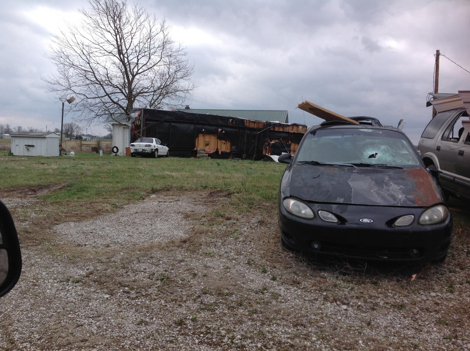
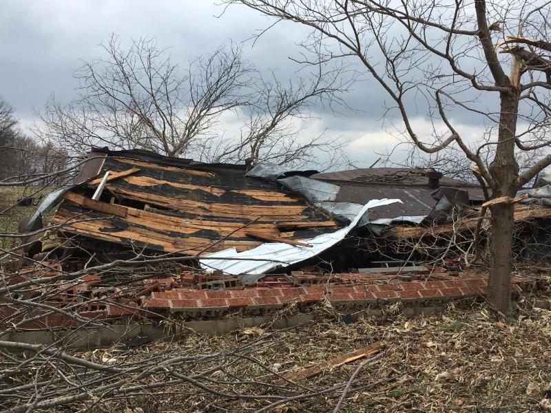
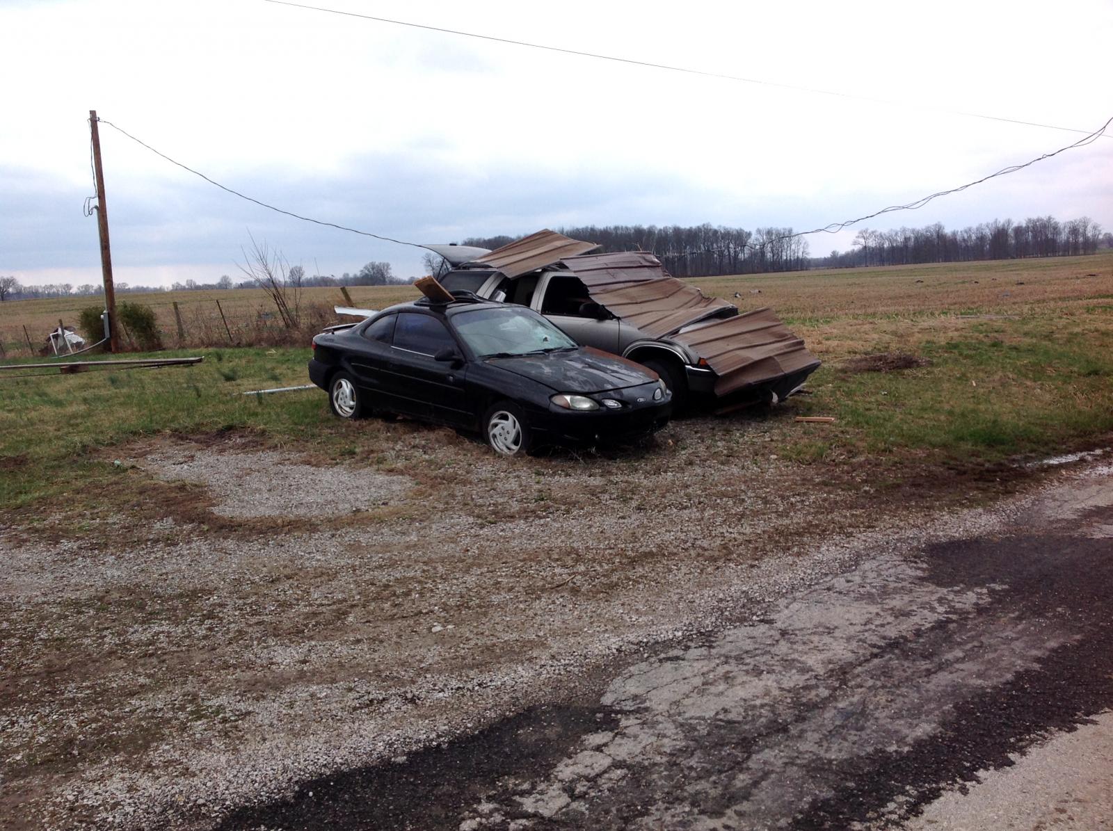
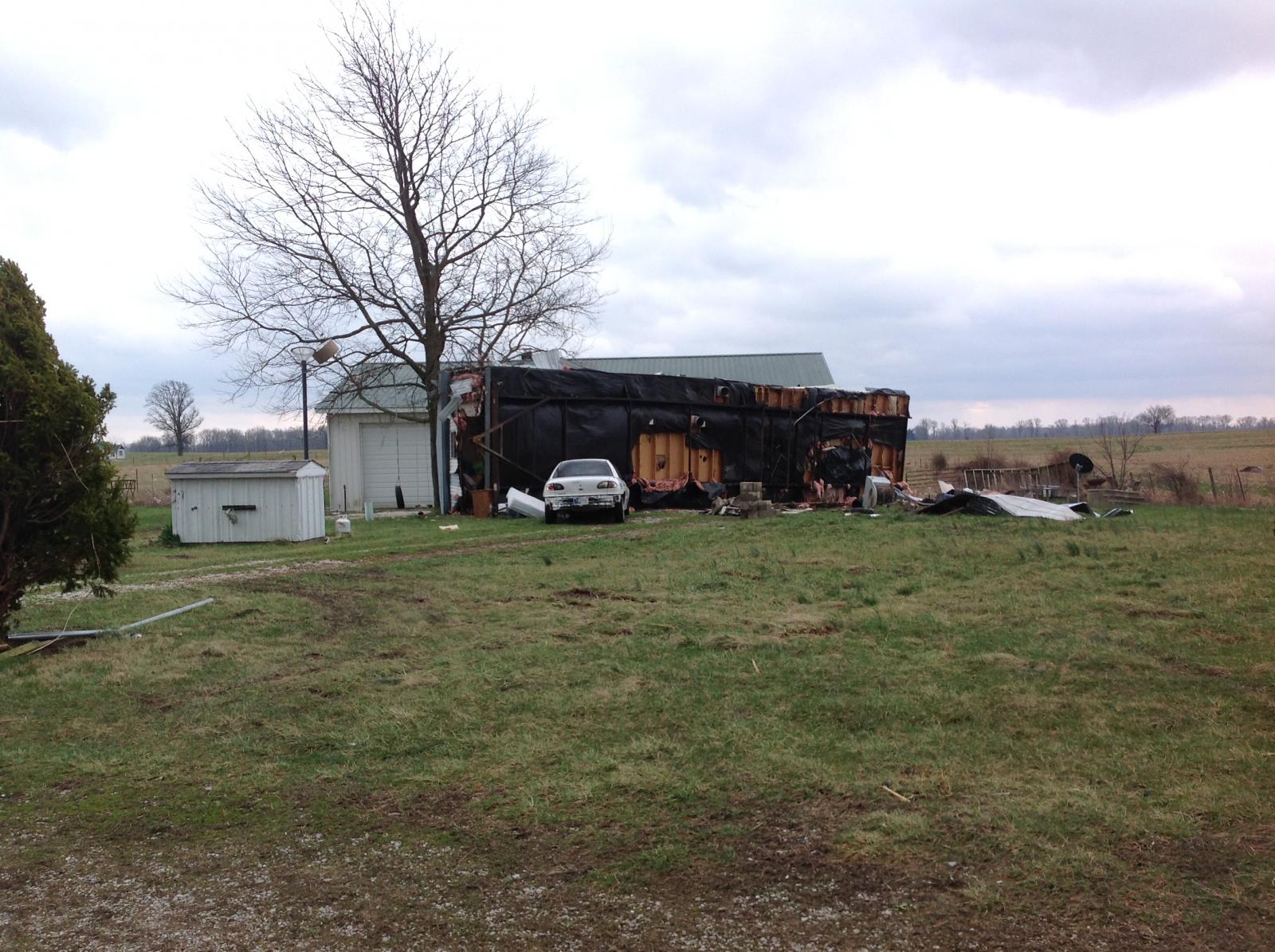
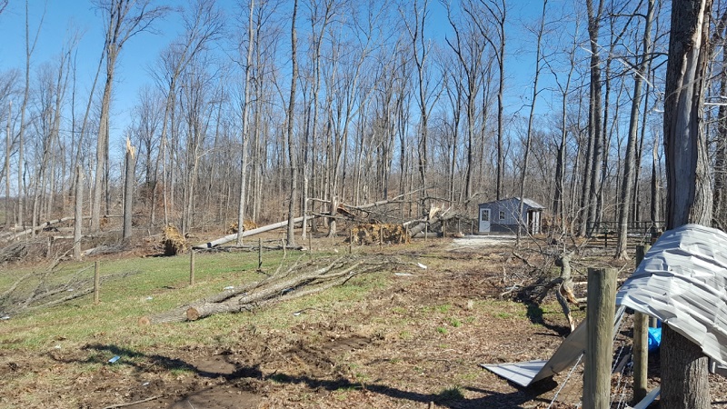
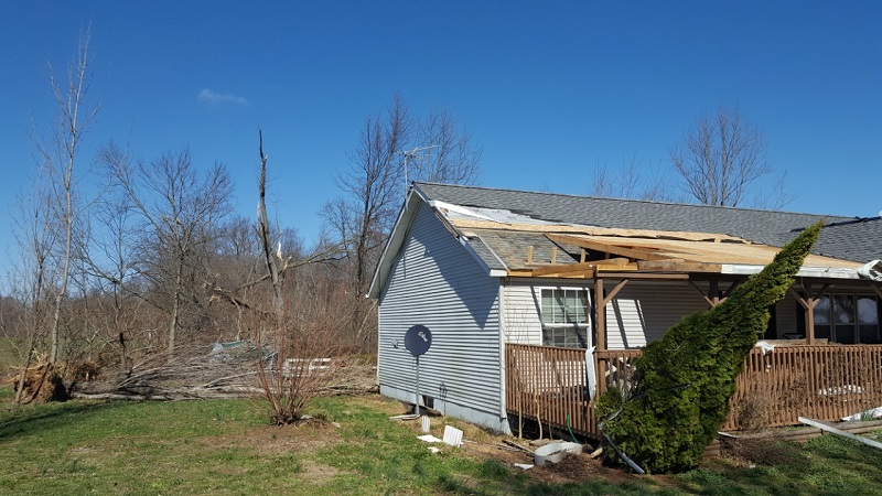
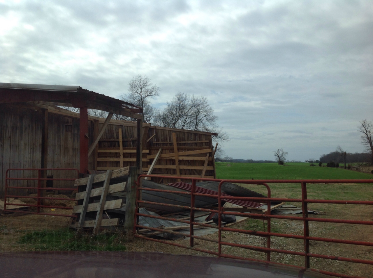
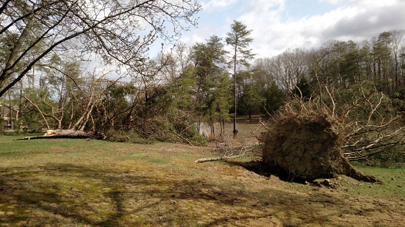
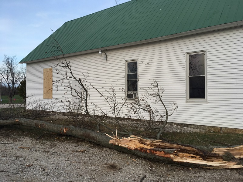
Tornado - Ireland, Indiana
Track Map 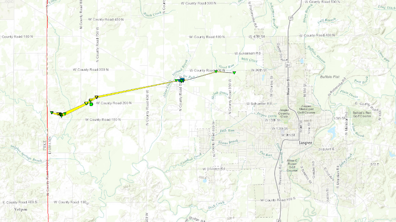 
|
||||||||||||||||
For more pictures click here |
||||||||||||||||
|
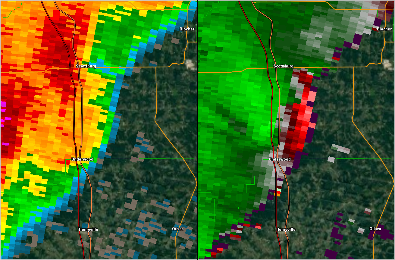
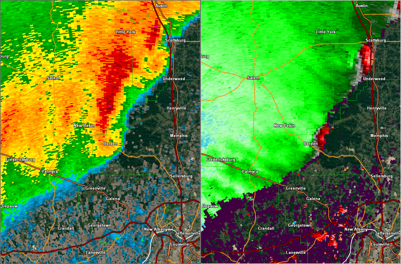
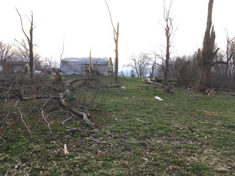
Tornado - Near Scottsburg, Indiana
Track Map 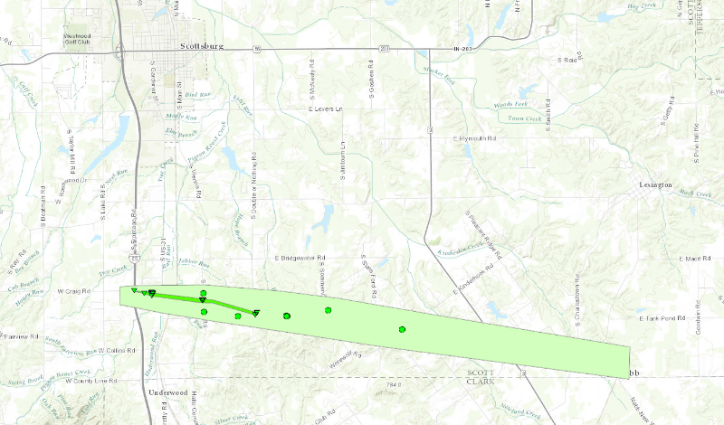
|
||||||||||||||||
|
||||||||||||||||
|
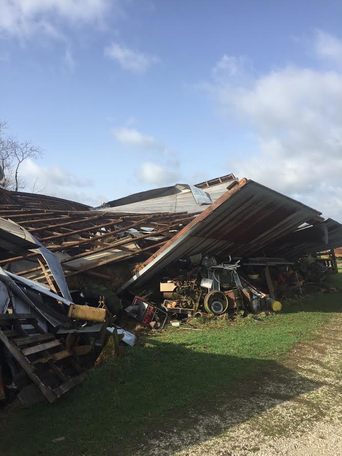
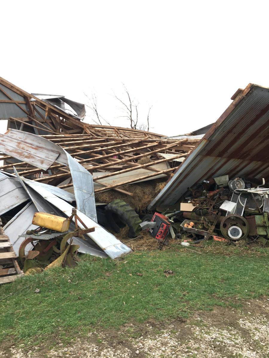
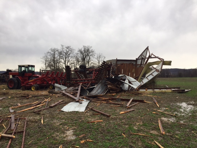
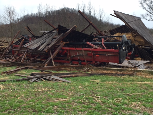
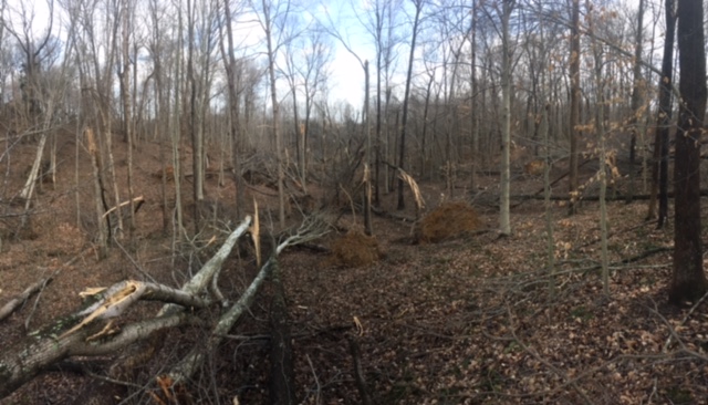
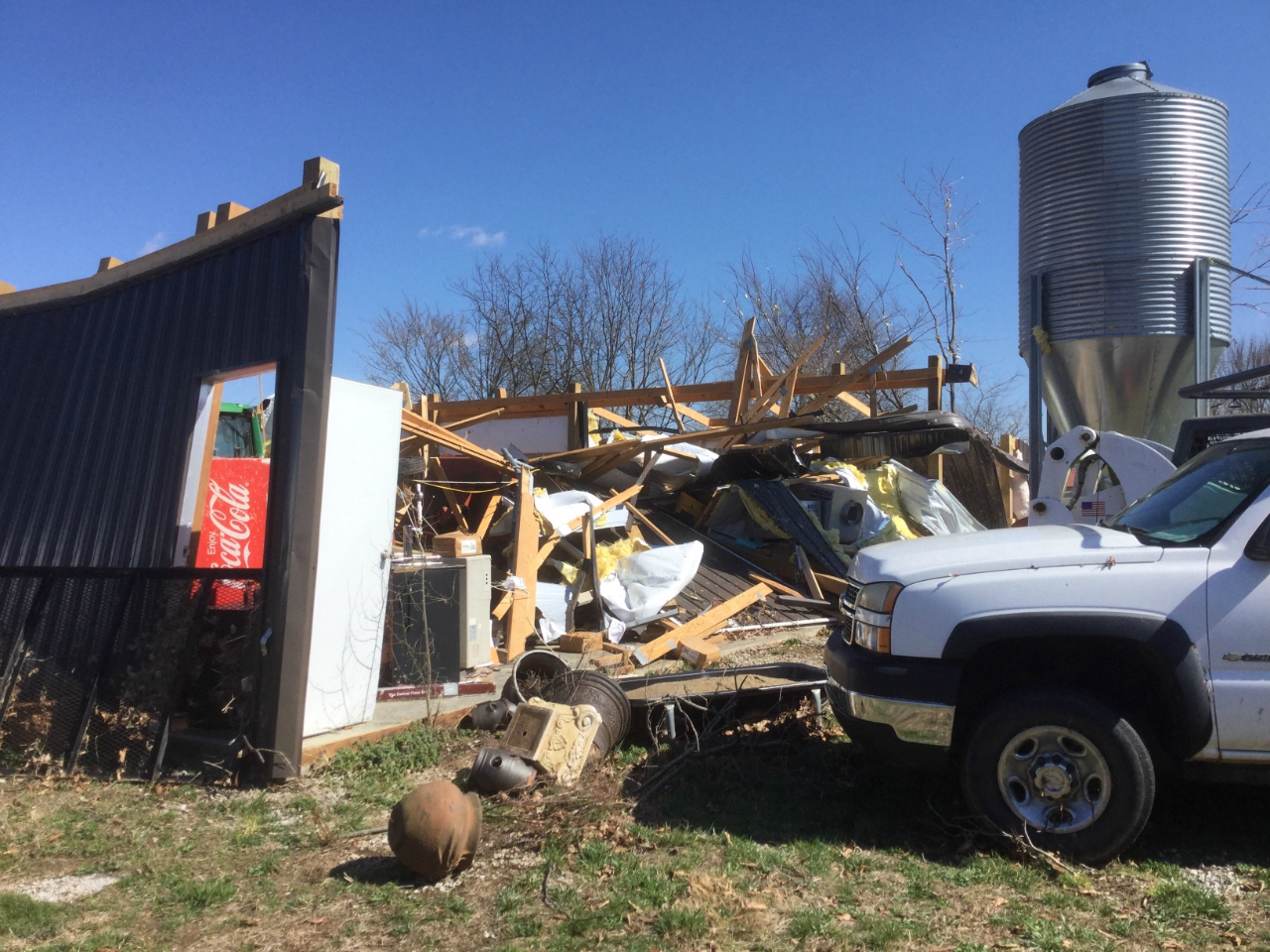
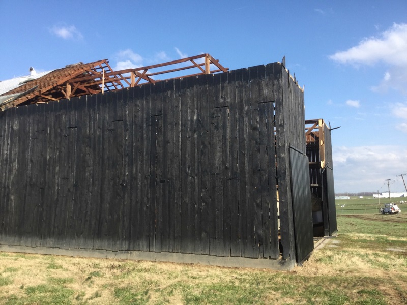
Tornado - SW Butler County, Kentucky
Track Map 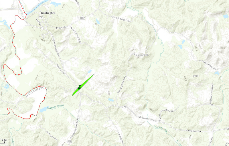
|
||||||||||||||||
For more pictures click here |
||||||||||||||||
|
Tornado - Claypool, Kentucky
Track Map 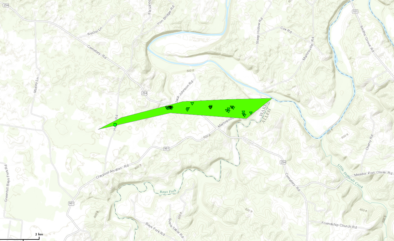
|
||||||||||||||||
For more pictures click here |
||||||||||||||||
|
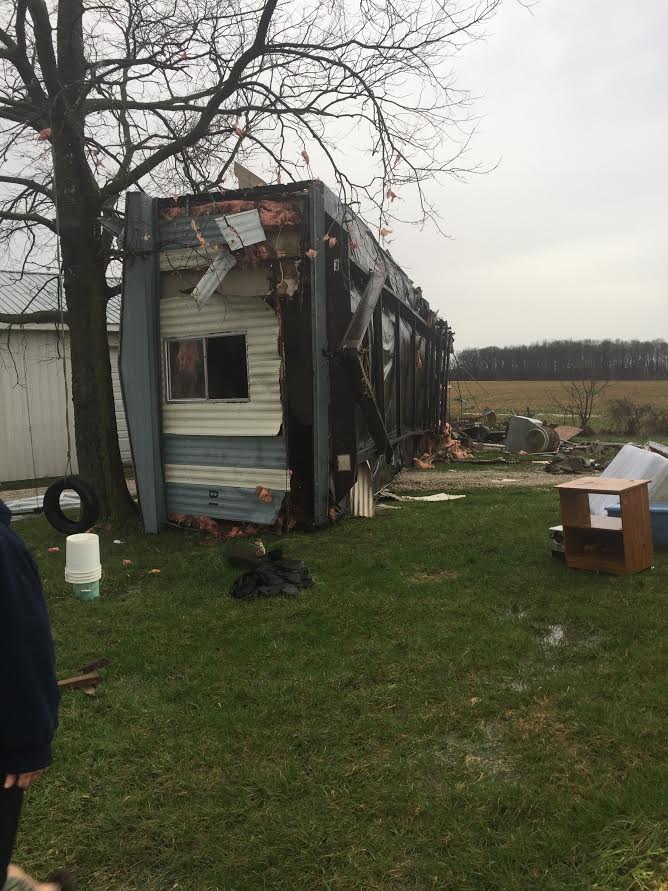
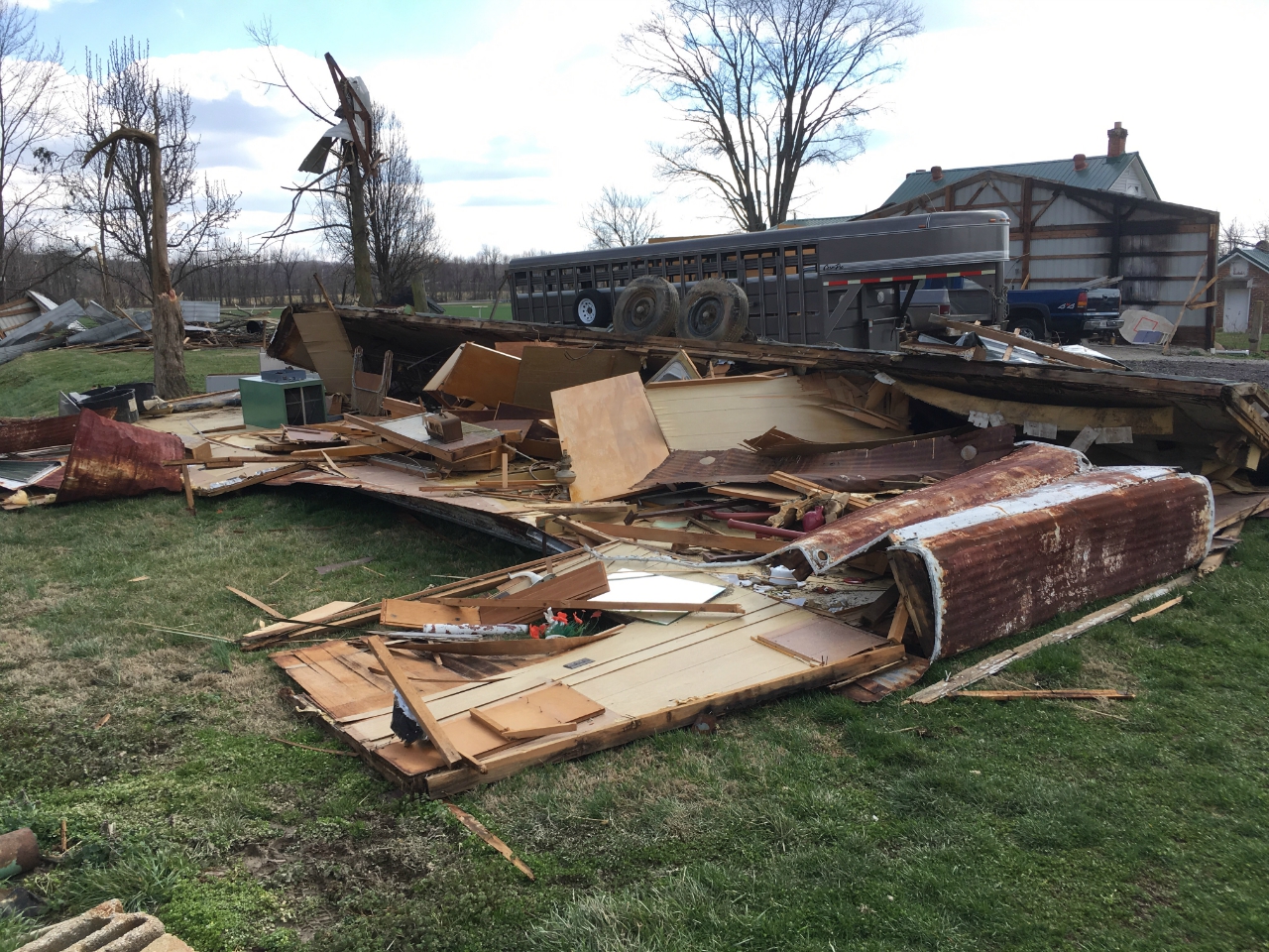
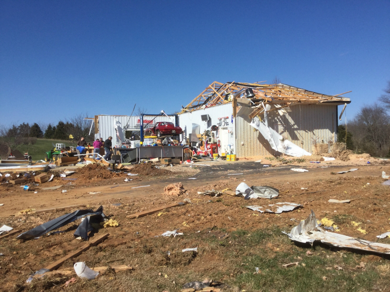
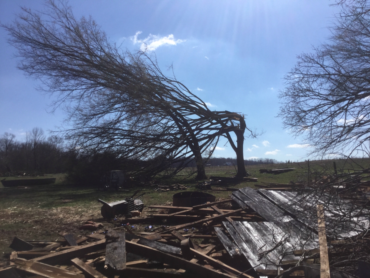
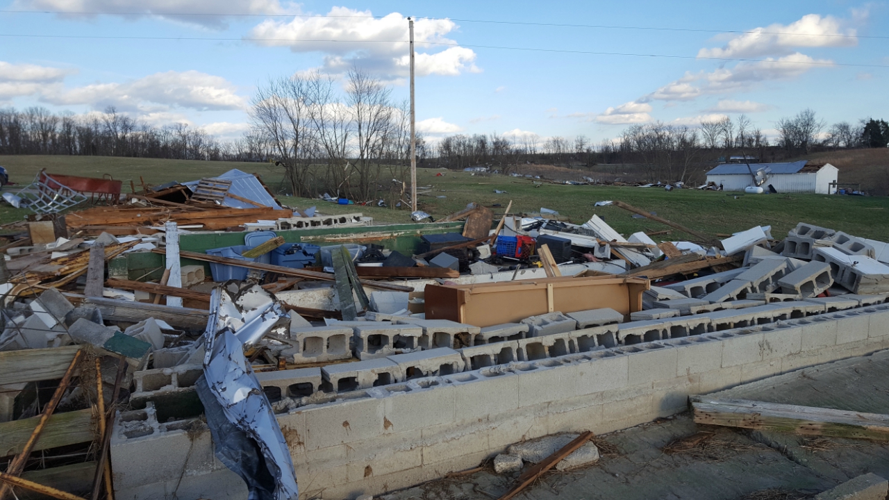
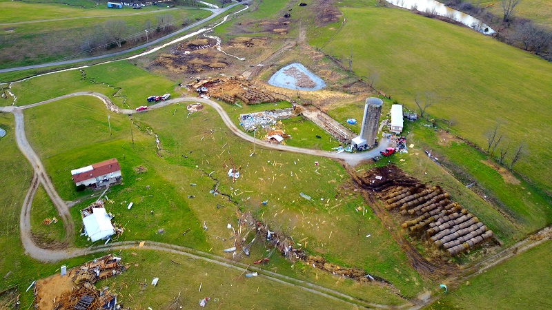
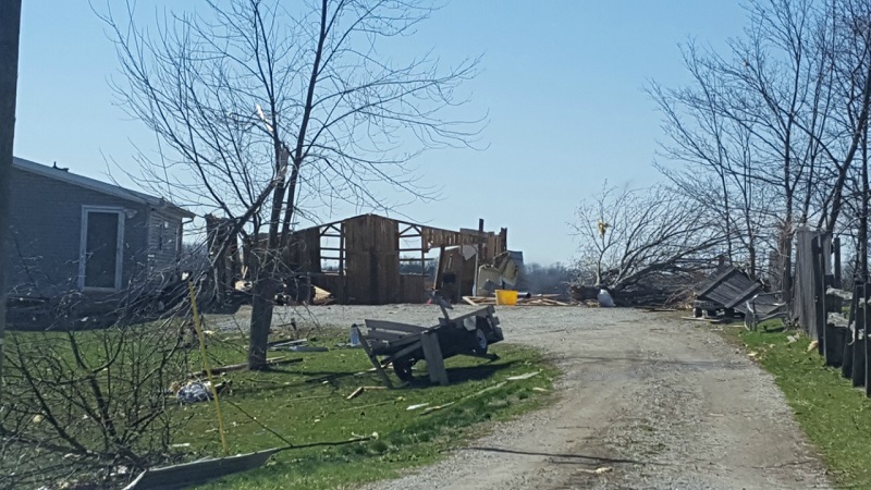
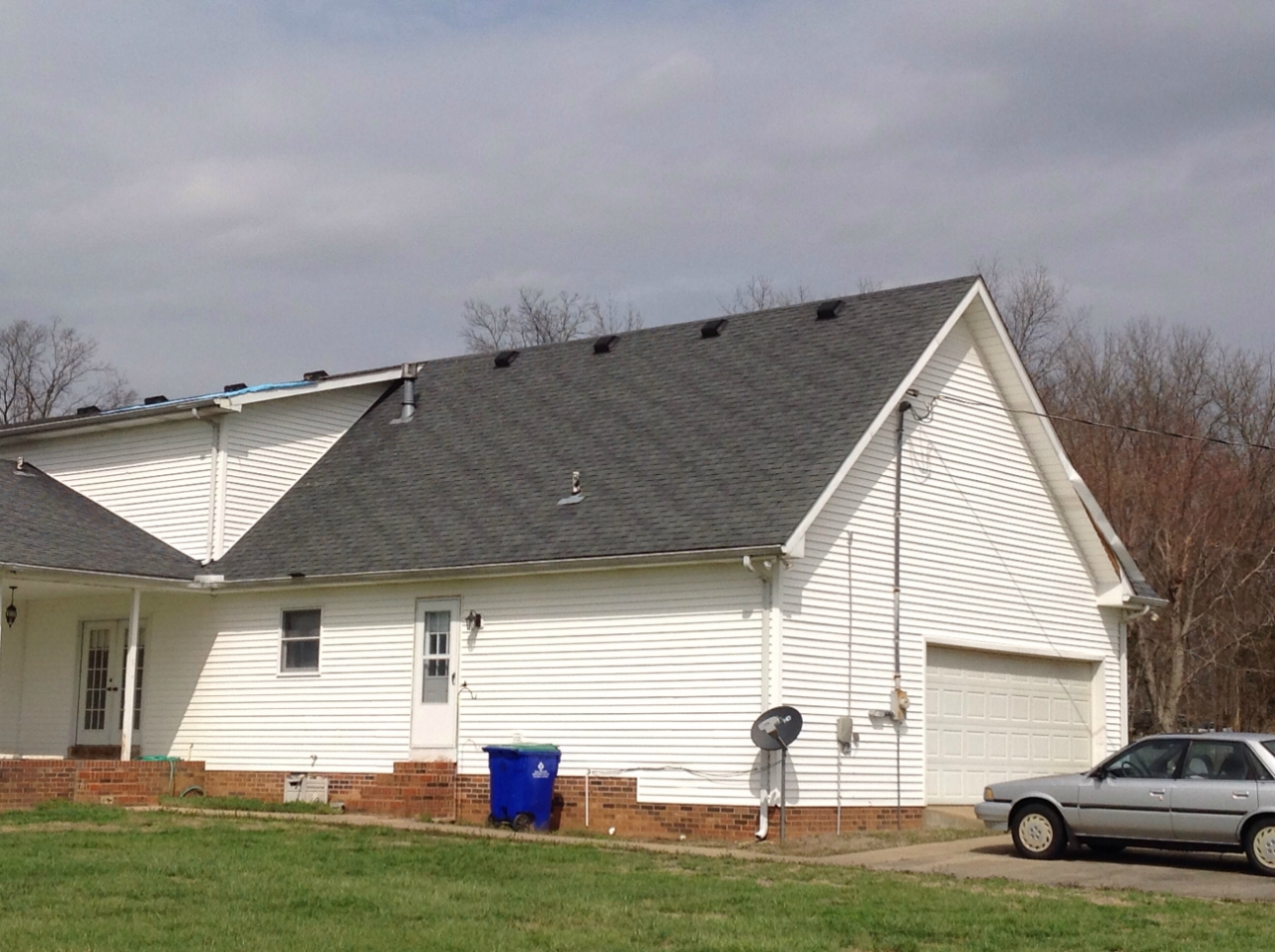
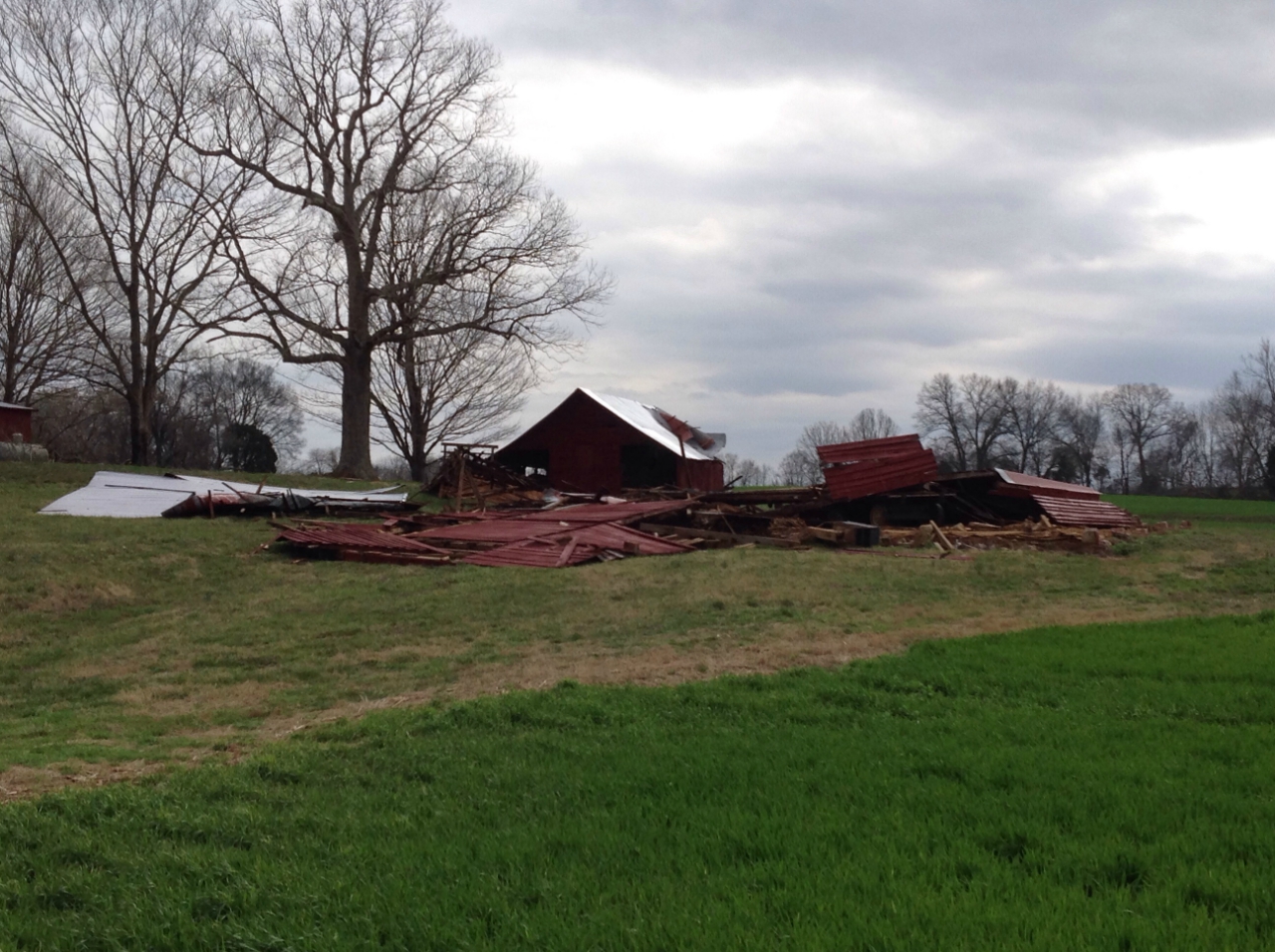
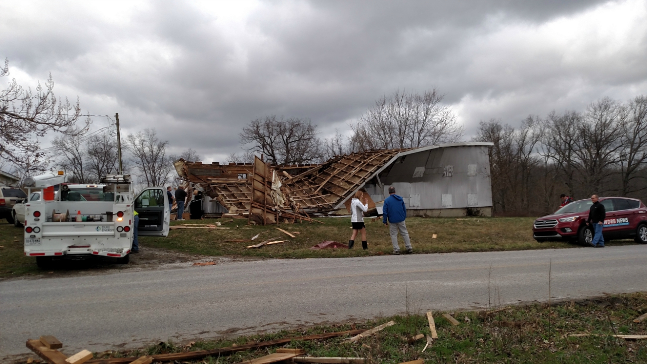
Tornado - Campbellsburg, Kentucky
Track Map 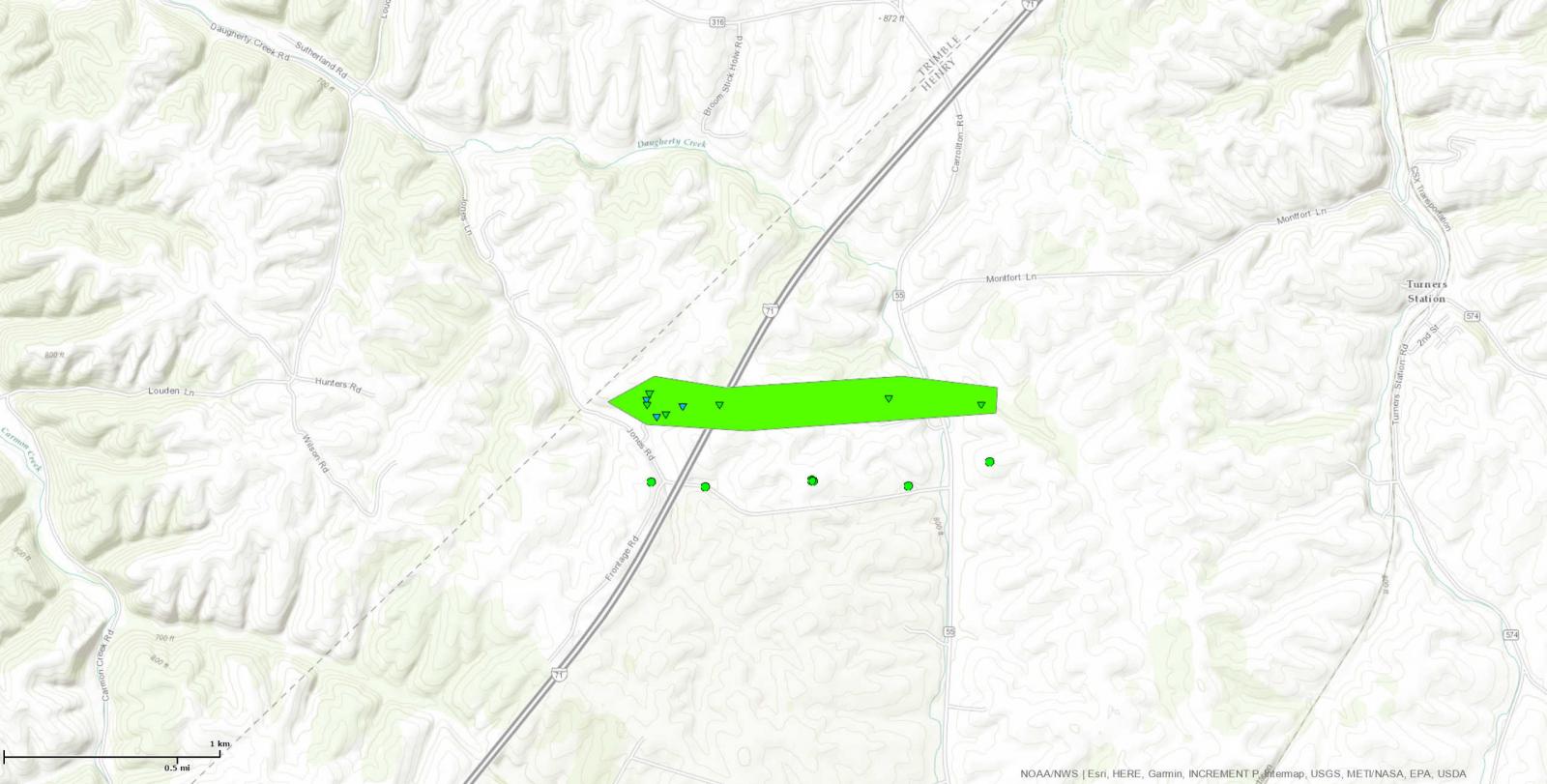
|
||||||||||||||||
For more pictures click here |
||||||||||||||||
|
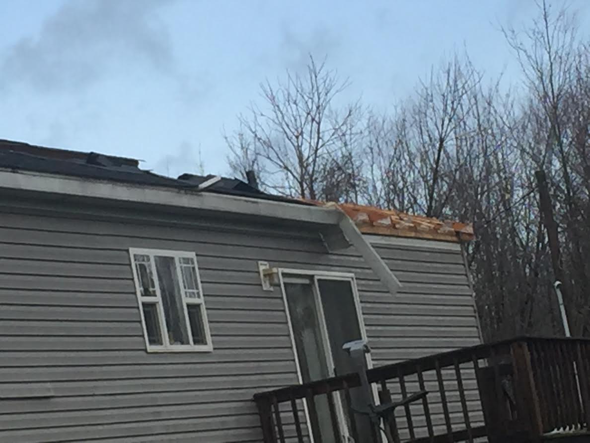
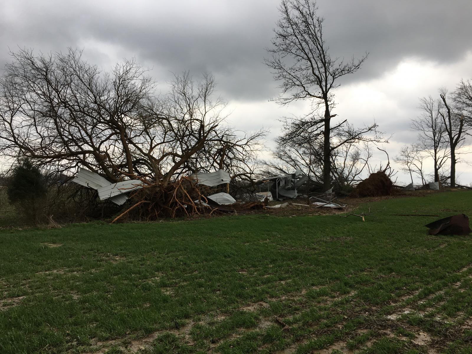
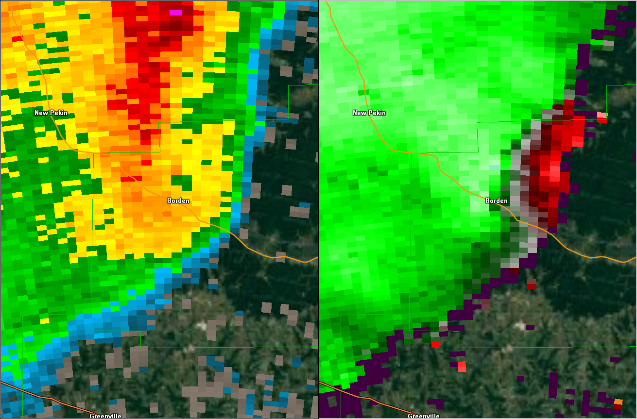
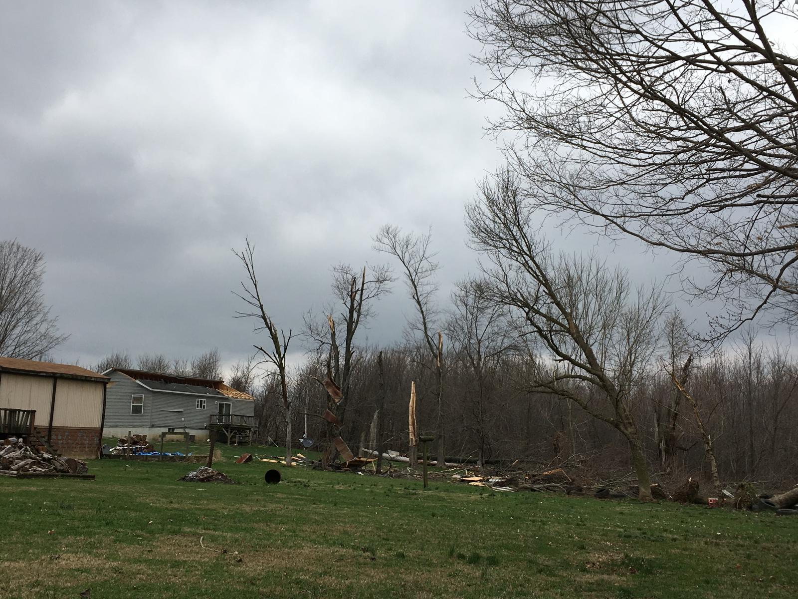
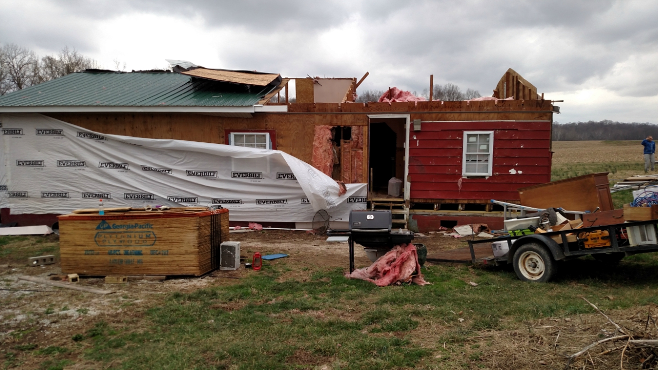
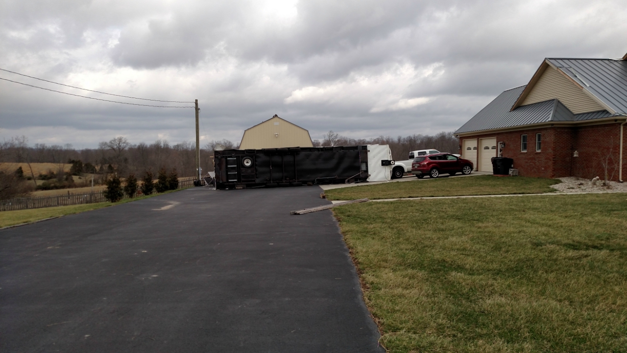
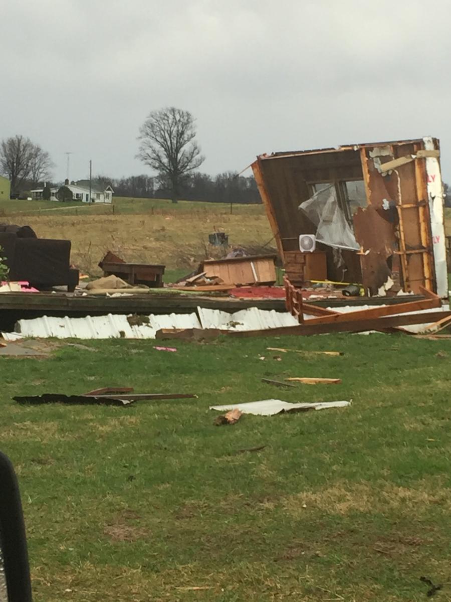
Tornado - Borden, Indiana
Track Map 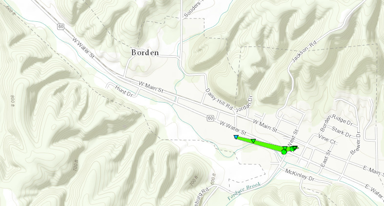
|
||||||||||||||||
|
||||||||||||||||
|
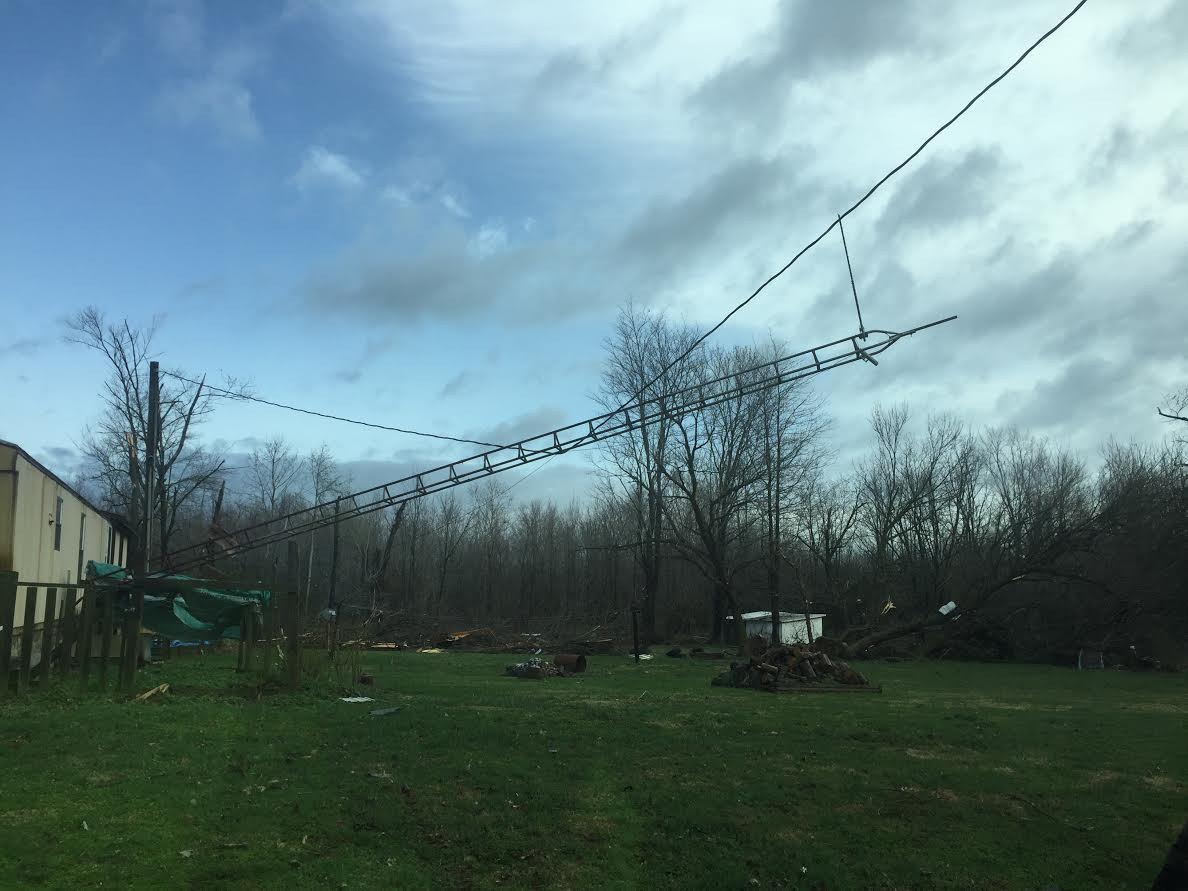
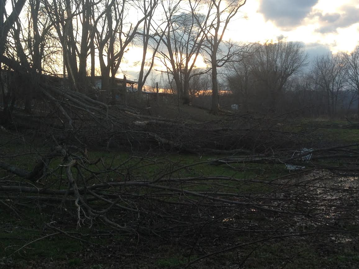
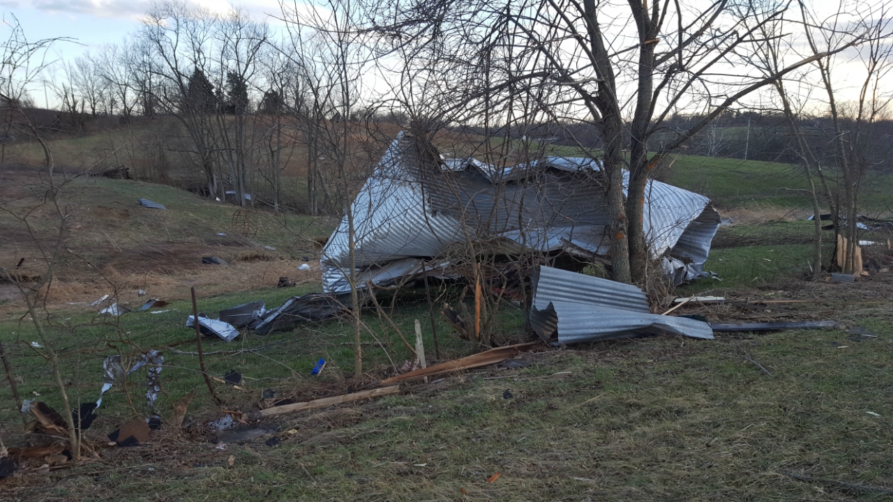
Tornado - Leipsic, Indiana
Track Map 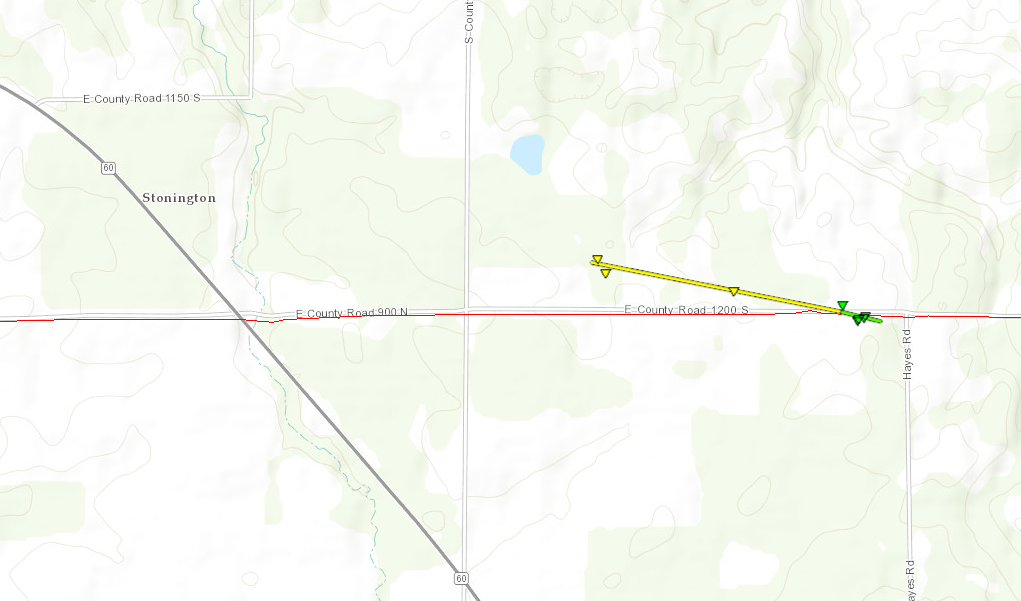 |
||||||||||||||||
|
||||||||||||||||
|
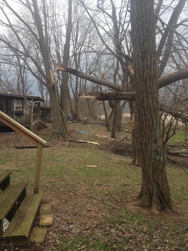
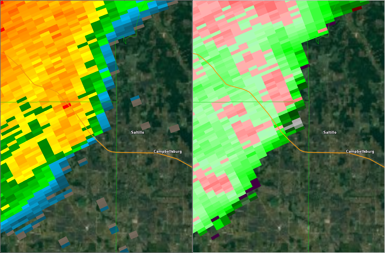
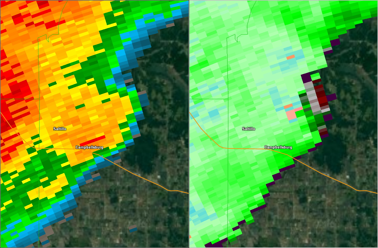
Tornado - Saltillo, Indiana
Track Map
|
||||||||||||||||
|
||||||||||||||||
|
Tornado - Adairville, Kentucky
Track Map  |
||||||||||||||||
|
||||||||||||||||
The Enhanced Fujita (EF) Scale classifies tornadoes into the following categories:
| EF0 Weak 65-85 mph |
EF1 Moderate 86-110 mph |
EF2 Significant 111-135 mph |
EF3 Severe 136-165 mph |
EF4 Extreme 166-200 mph |
EF5 Catastrophic 200+ mph |
 |
|||||
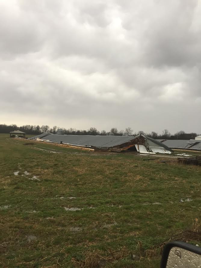
Straight Line Winds:
|
Straight Line Wind Damage Survey - Whitfield, KY
Damage Points Map 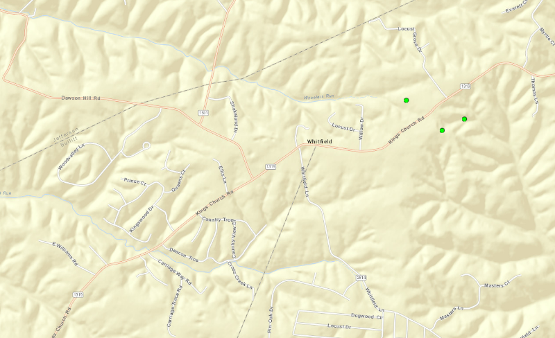
|
||||||||||||||
|
||||||||||||||
|
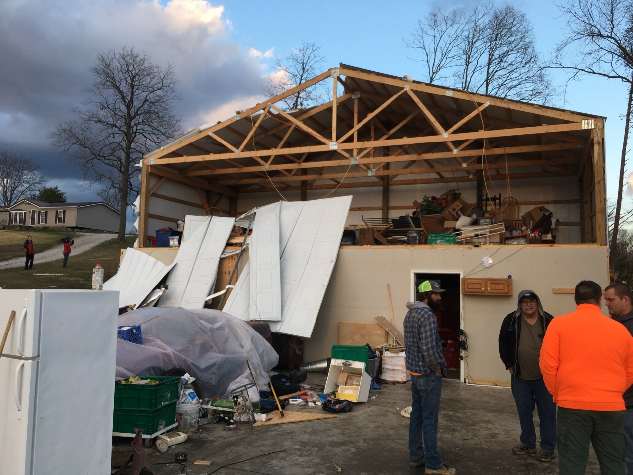
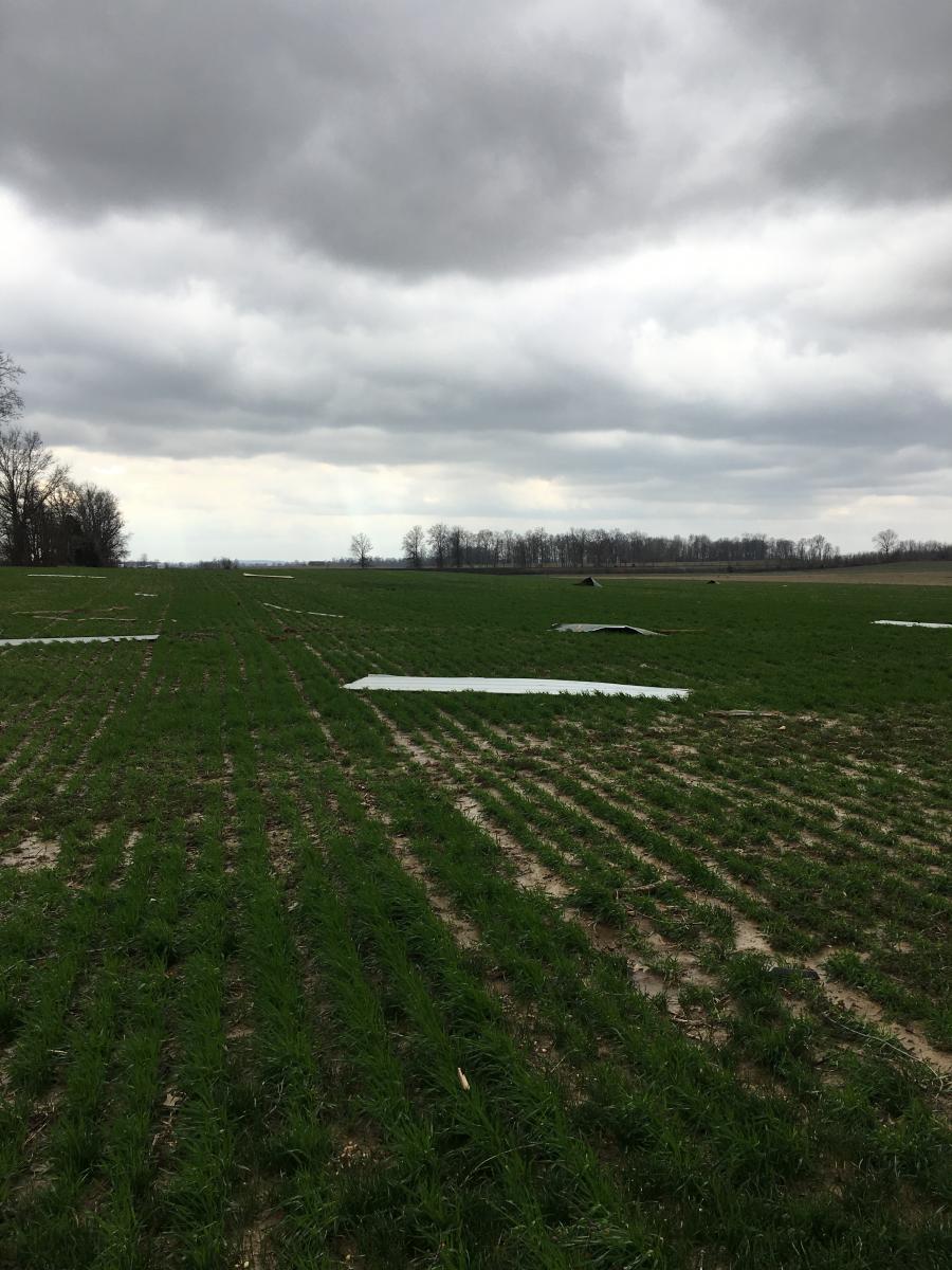
Straight Line Wind Damage Survey (Pekin, Borden and Bennettsville, IN)
Damage Points Map 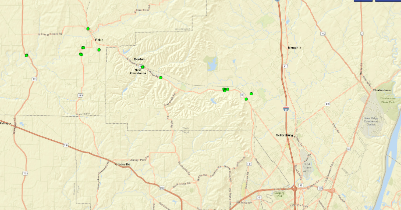
|
||||||||||||||||||||
|
||||||||||||||||||||
|
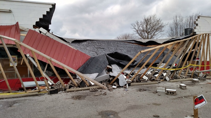
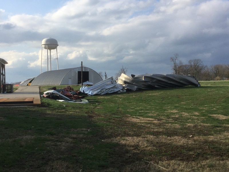
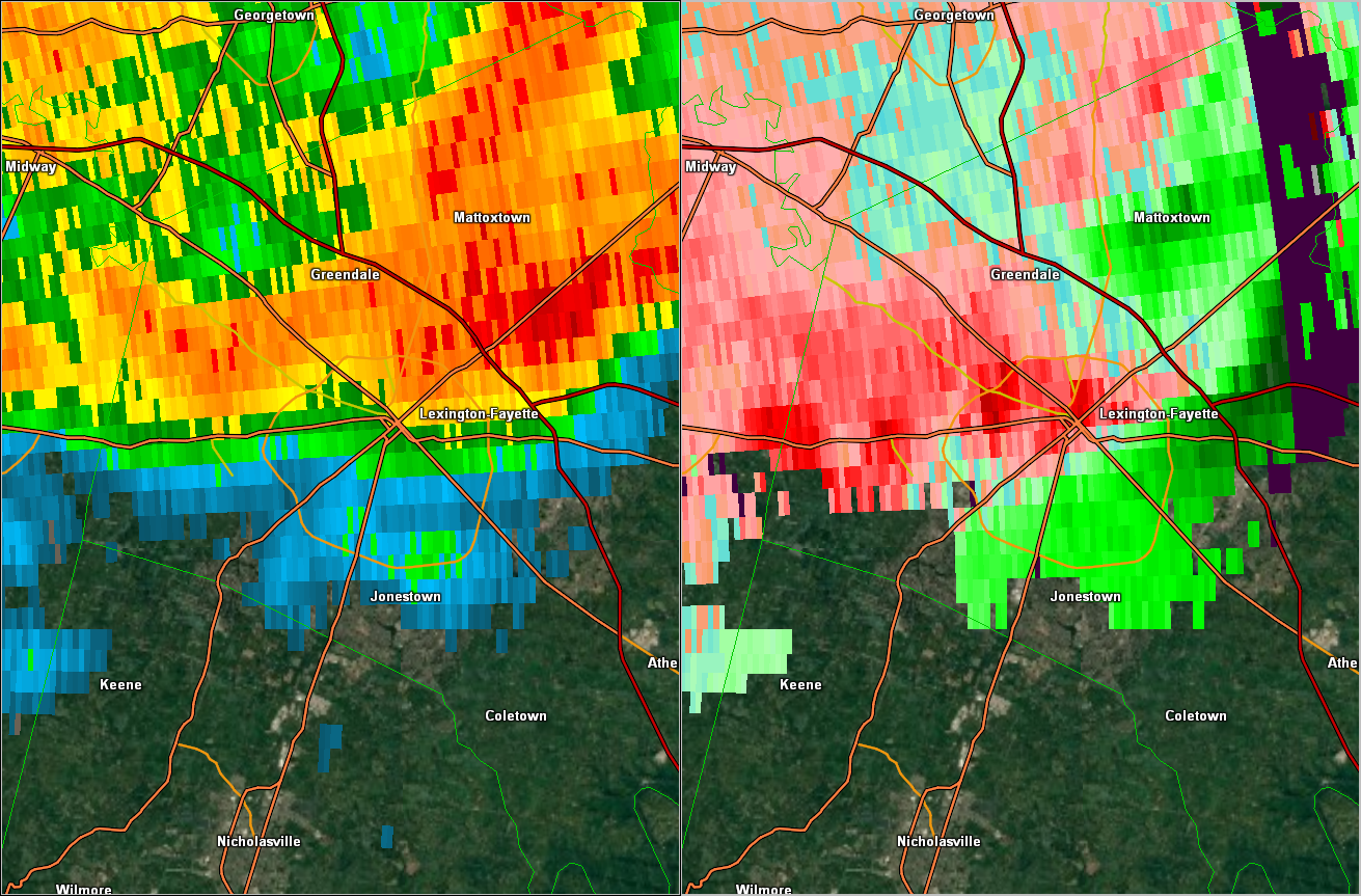
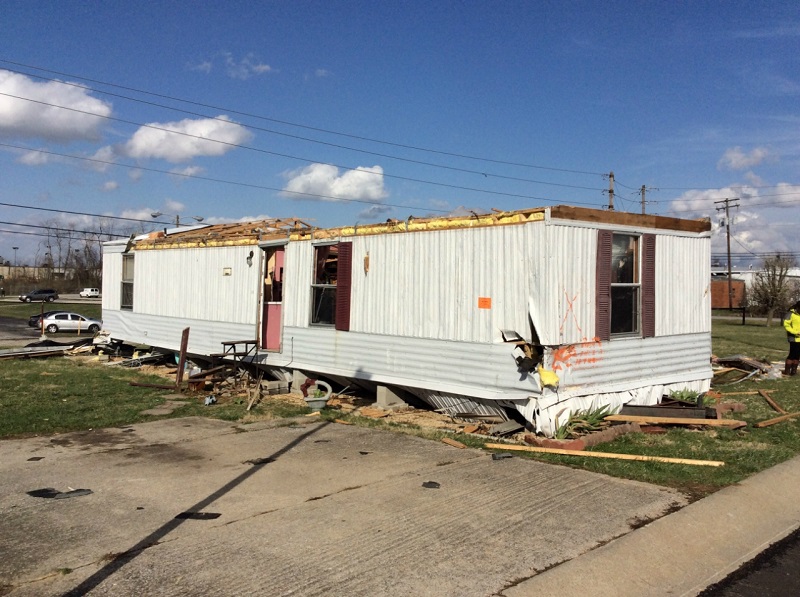
Straight Line Wind Damage Survey - Lexington, KY
Damage Points Map 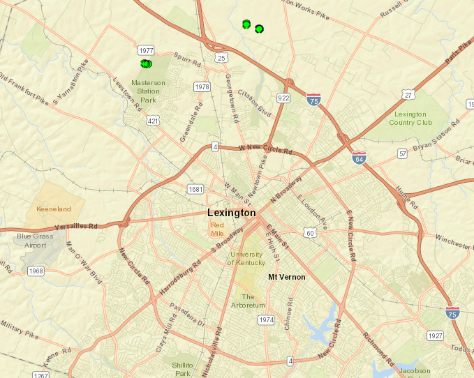
|
||||||||||||||
|
||||||||||||||
|
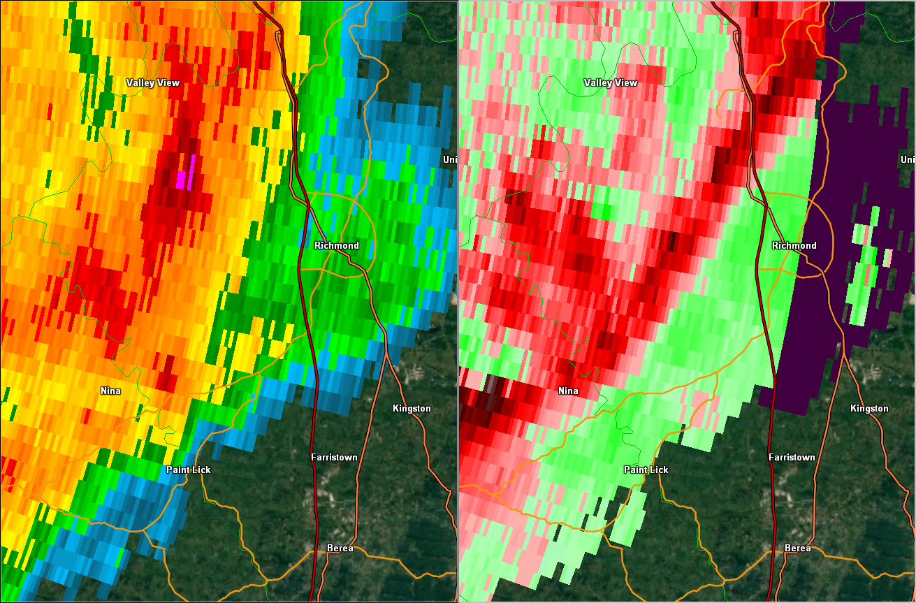
Straight Line Wind Damage Survey Richmond, Kentucky
Damage Points Map 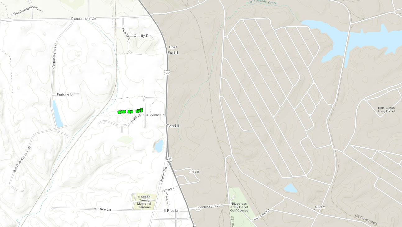
|
||||||||||||||
|
||||||||||||||
|
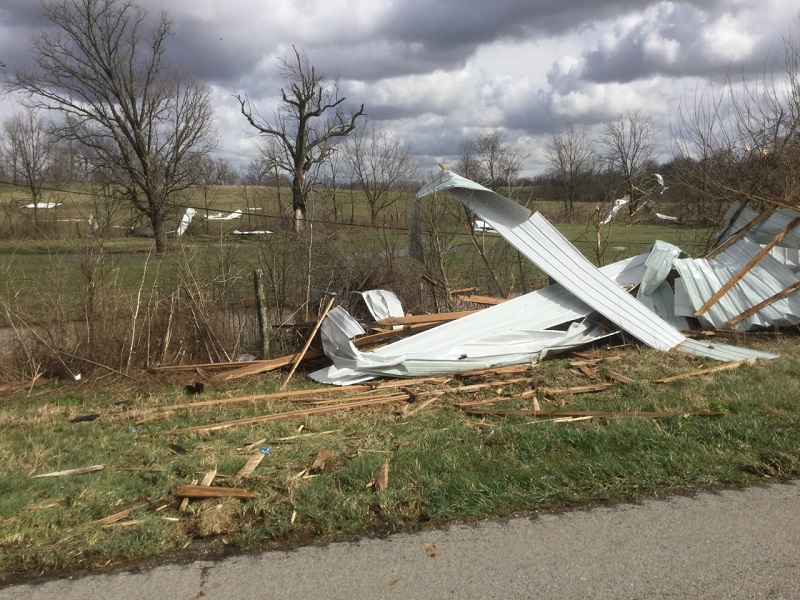
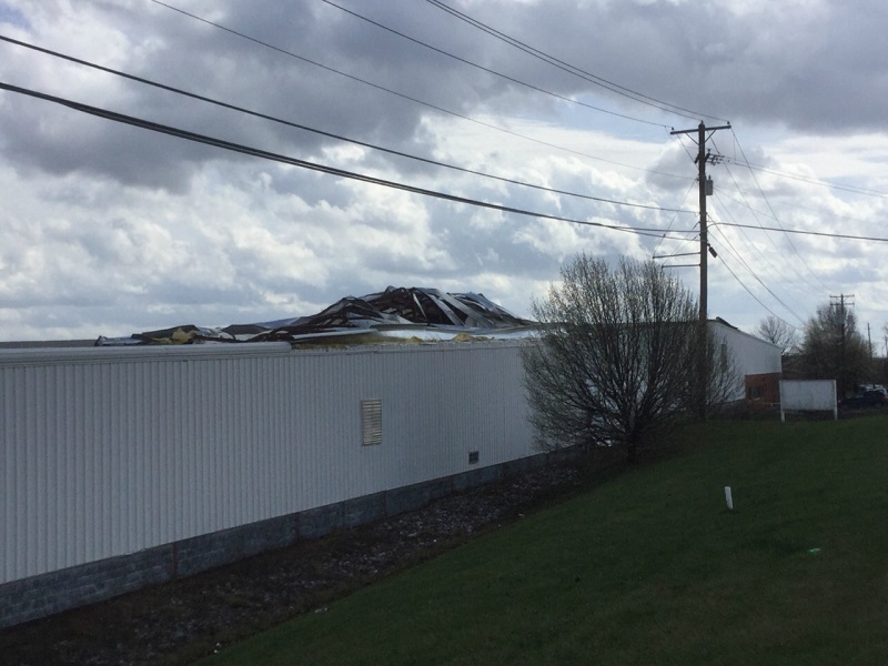
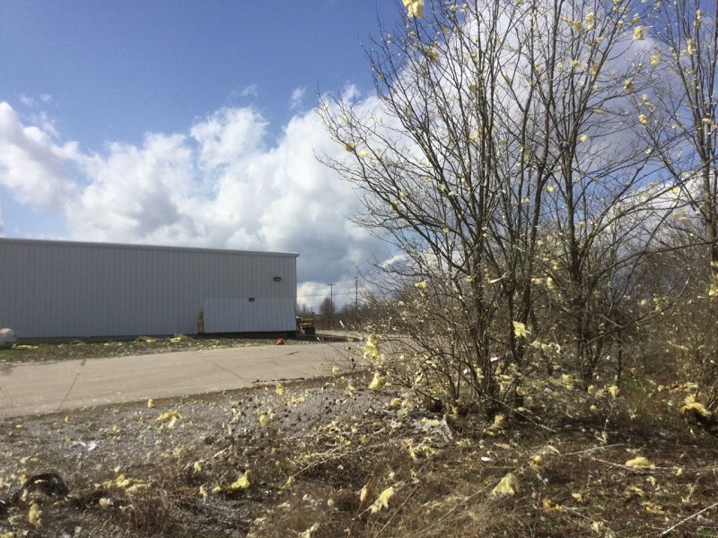
Straight Line Wind Damage Survey - Stamping Ground, Kentucky
Damage Survey Map 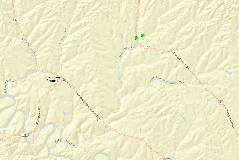
|
||||||||||||||
|
||||||||||||||
|
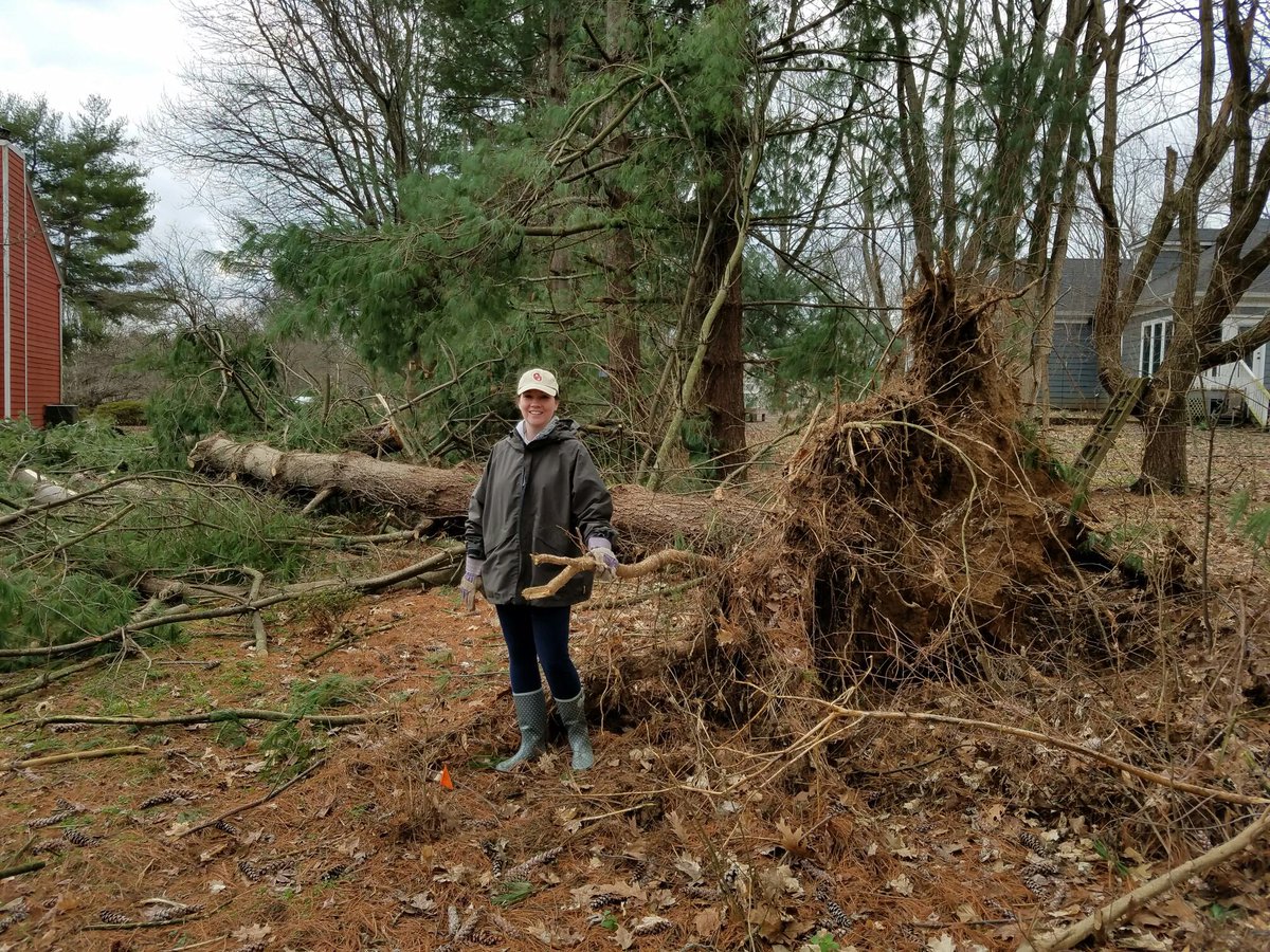
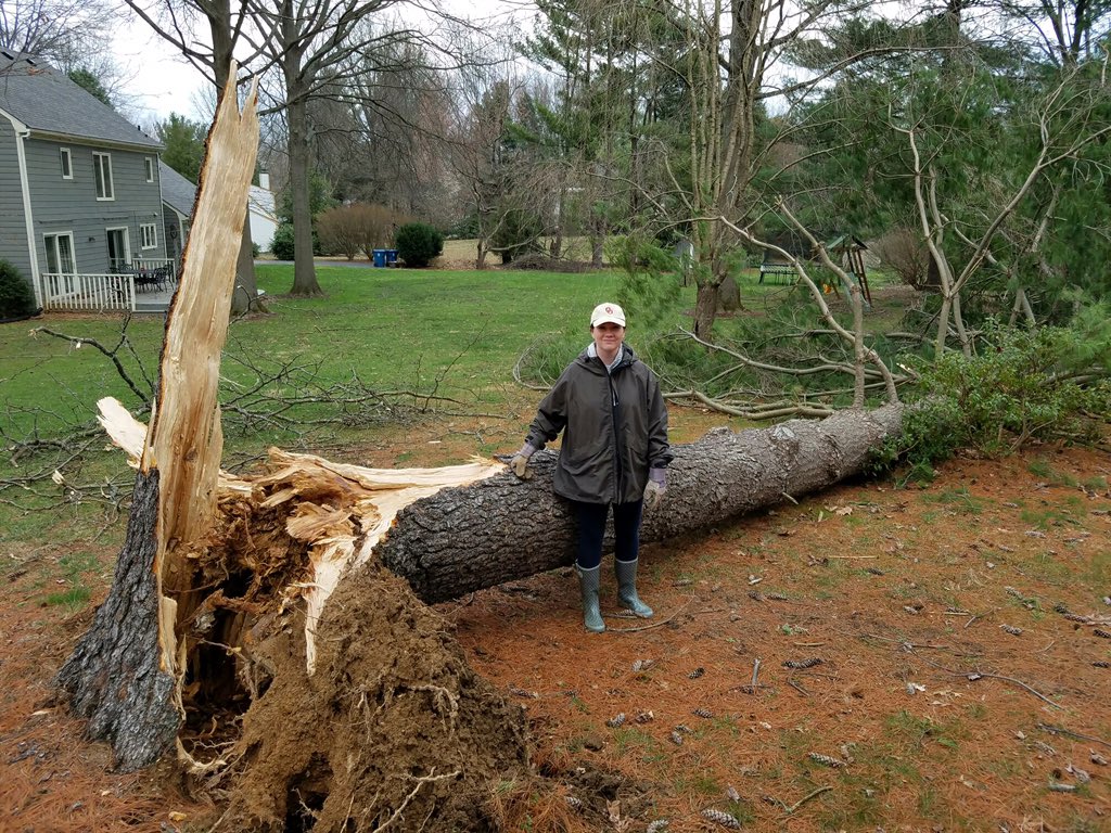
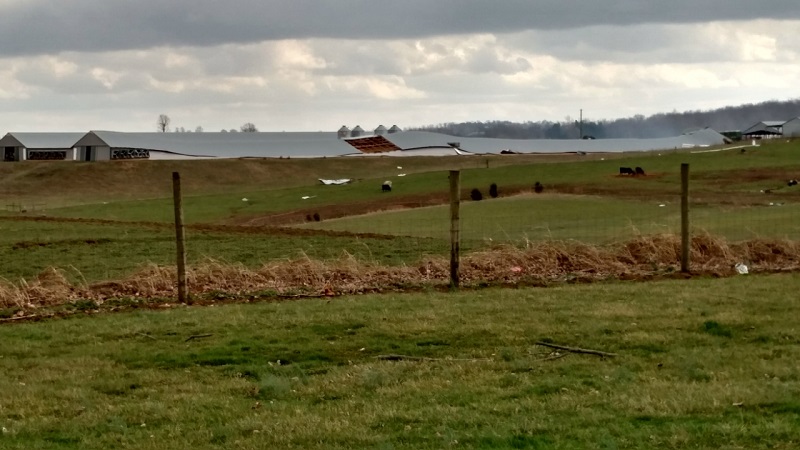
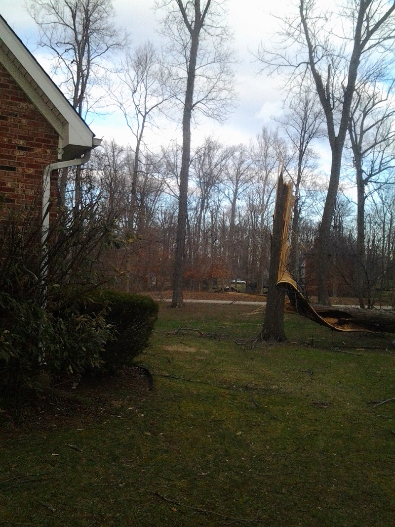
Straight Line Wind Damage Survey - Goshen, Kentucky
Damage Survey Map 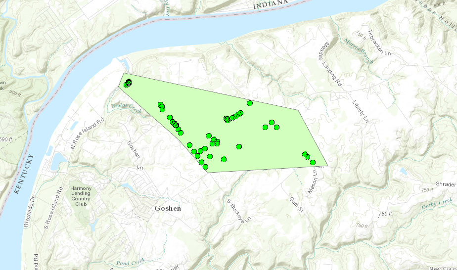 |
||||||||||||||
|
||||||||||||||
|
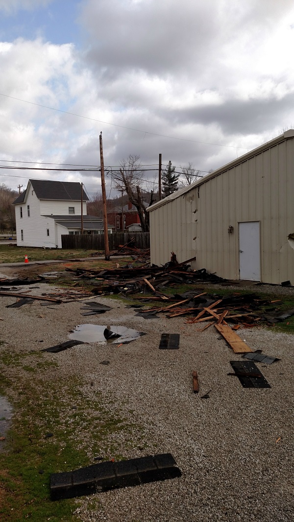
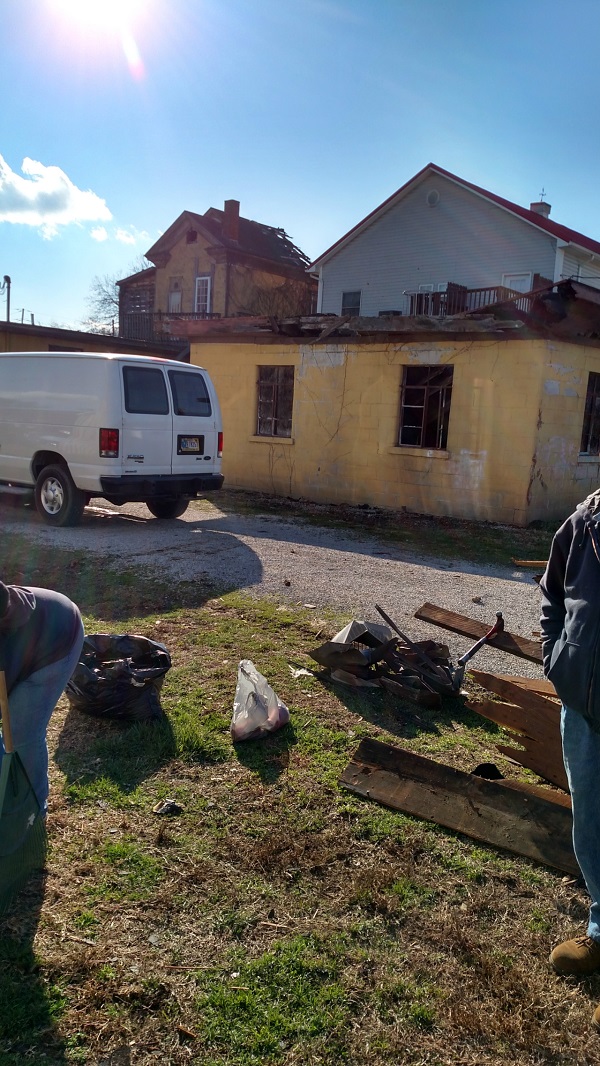
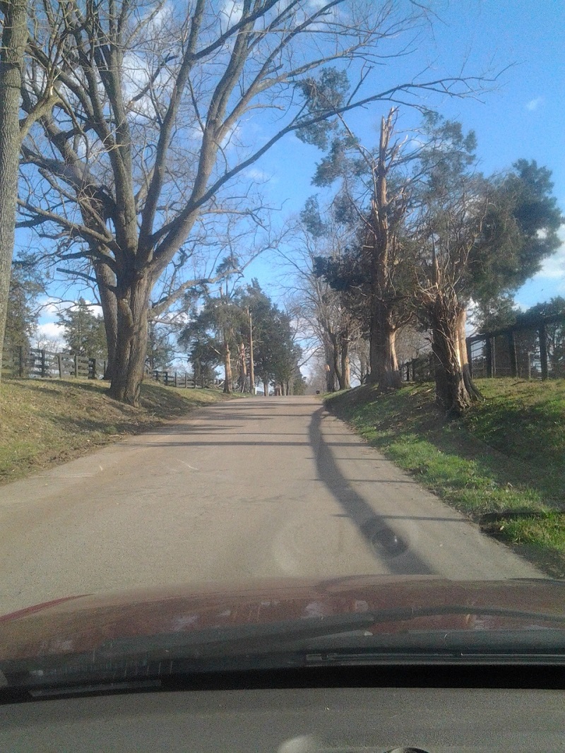
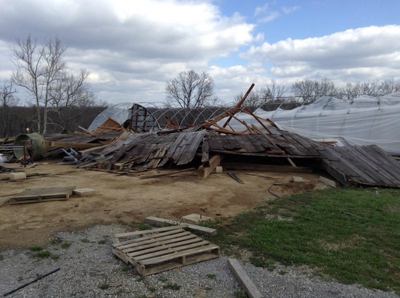
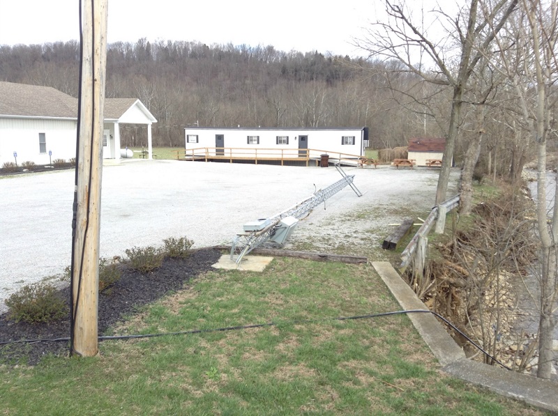
Straight Line Wind Damage Survey - Bedford, Kentucky
Damage Survey Map 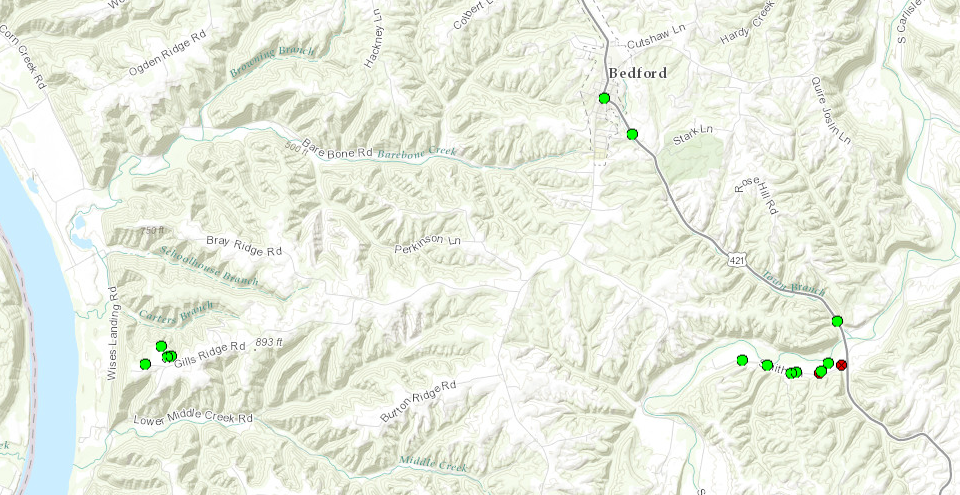 |
||||||||||||||
|
||||||||||||||
|
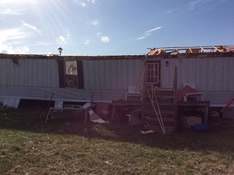
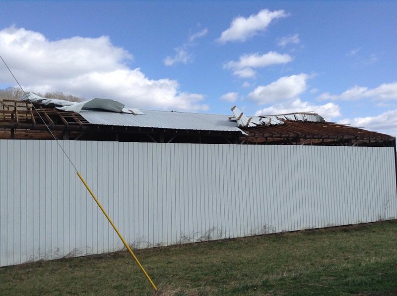
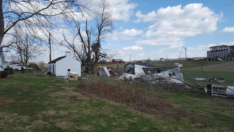
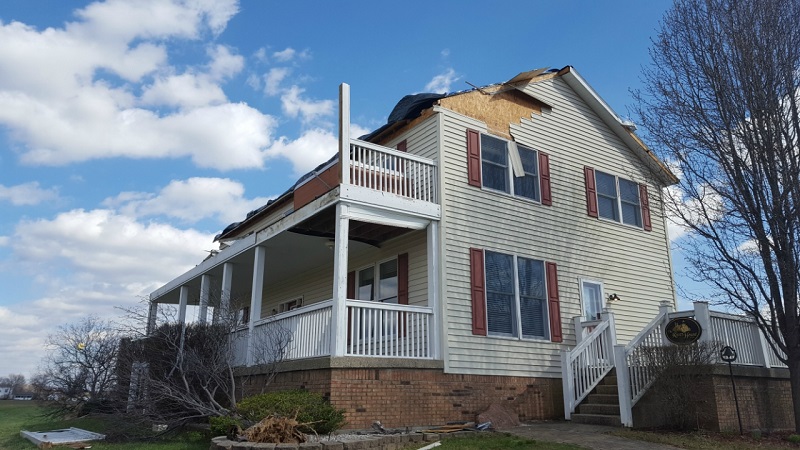
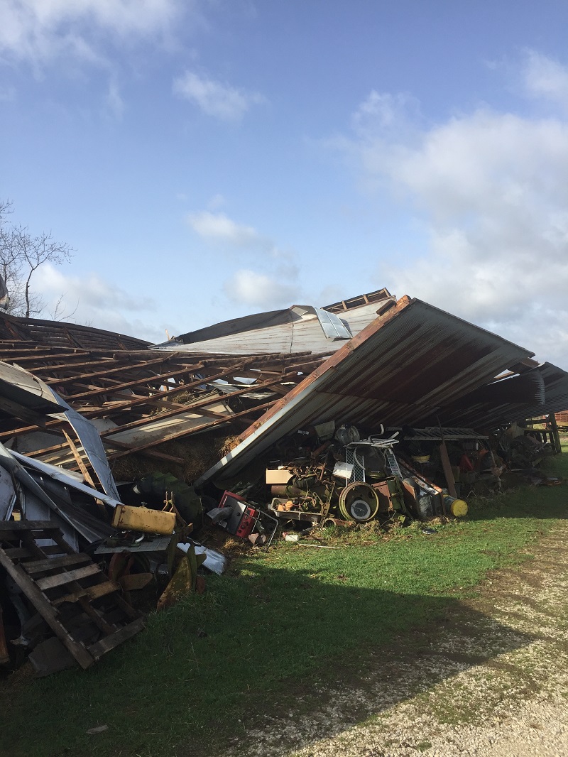
Straight Line Wind Damage Survey - Milton, Kentucky
Damage Survey Map 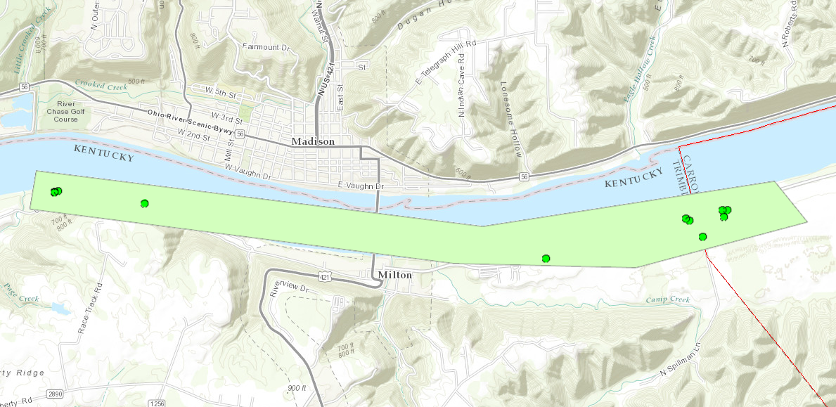 |
||||||||||||||
|
||||||||||||||
|
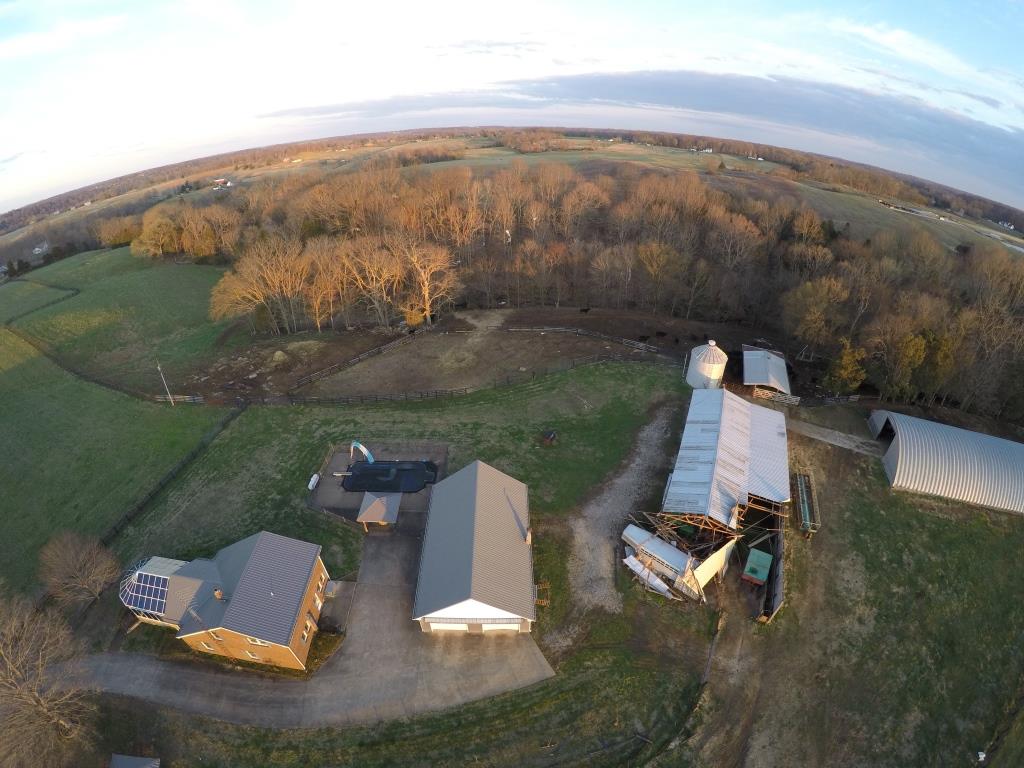
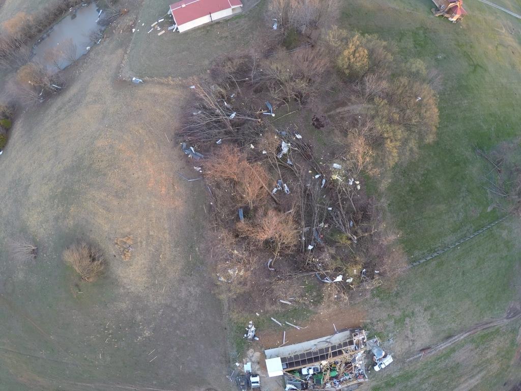
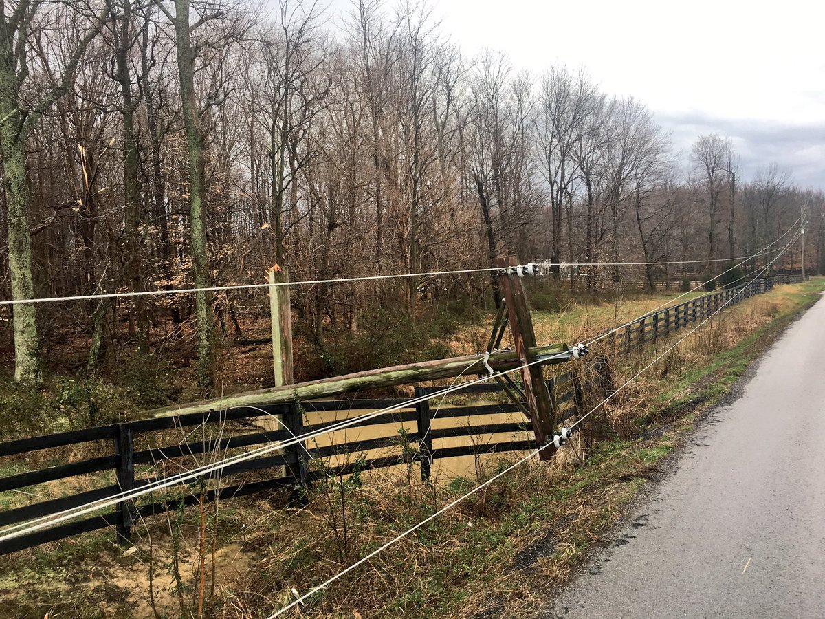
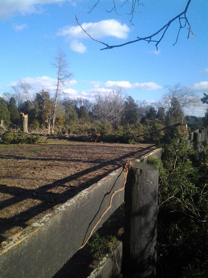
Straight Line Wind Damage Survey - Leipsic, Indiana
Damage Survey Map 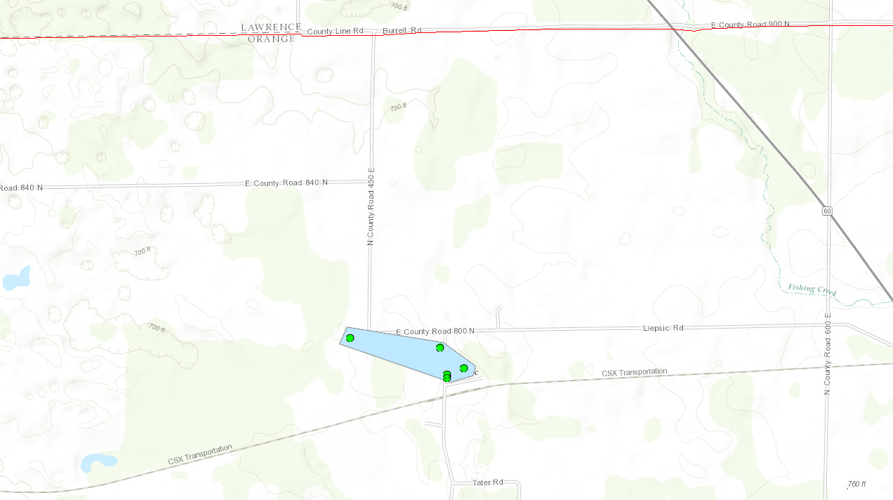 |
||||||||||||||||||||||||||||||||
|
||||||||||||||||||||||||||||||||
|
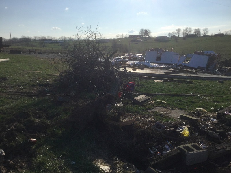
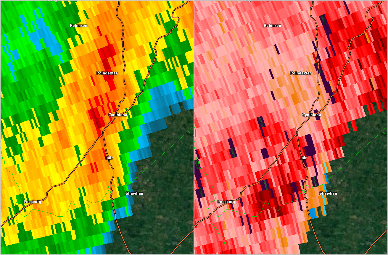
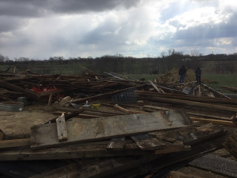
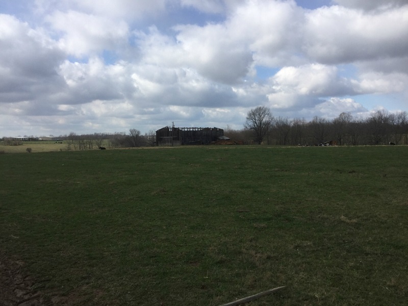
Straight Line Wind Damage Survey - Cynthiana, Kentucky
Damage Survey Map 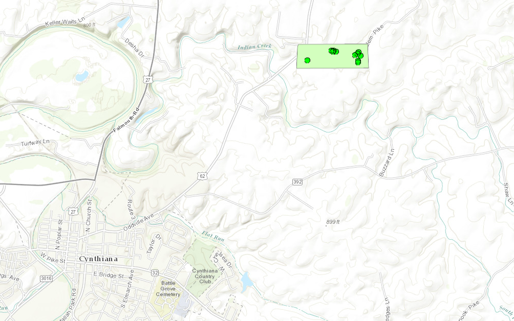 |
||||||||||||||
|
||||||||||||||
|
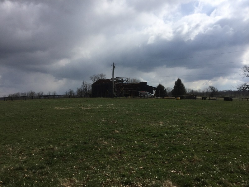
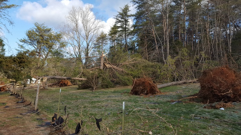
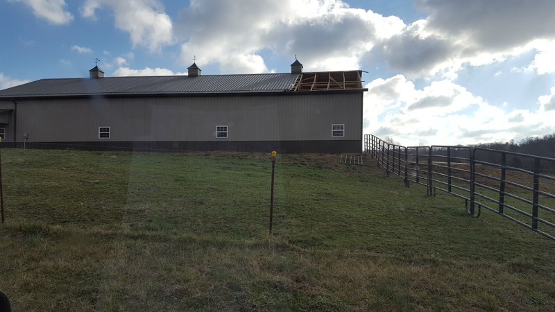
Straight Line Wind Damage Survey - Paris, Kentucky
Damage Survey Map 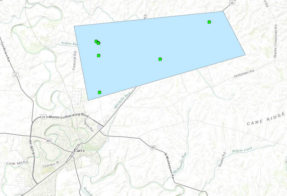 |
||||||||||||||
|
||||||||||||||
|
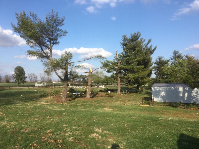
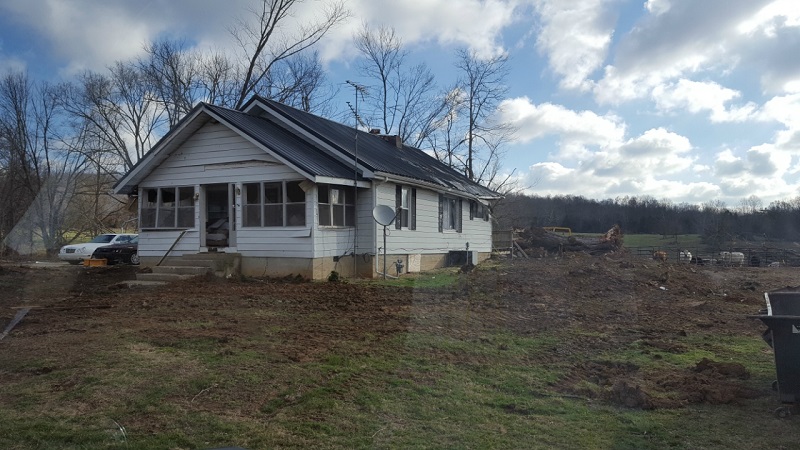
Straight Line Wind Damage Survey - Southeast of Paoli, Indiana
Damage Survey Map  |
||||||||||||||
|
||||||||||||||
The Enhanced Fujita (EF) Scale classifies tornadoes into the following categories:
| EF0 Weak 65-85 mph |
EF1 Moderate 86-110 mph |
EF2 Significant 111-135 mph |
EF3 Severe 136-165 mph |
EF4 Extreme 166-200 mph |
EF5 Catastrophic 200+ mph |
|
|||||
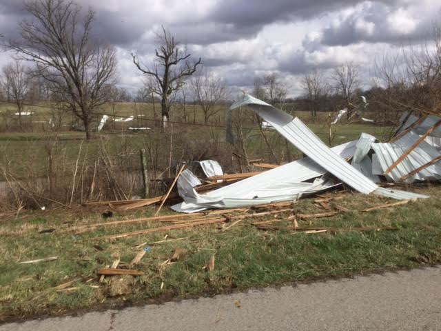
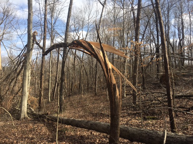
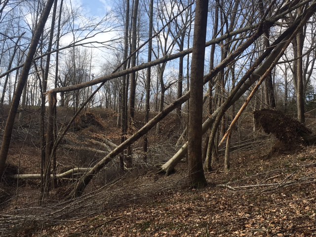
Photos:
Dubois County, Indiana
 |
 |
 |
 |
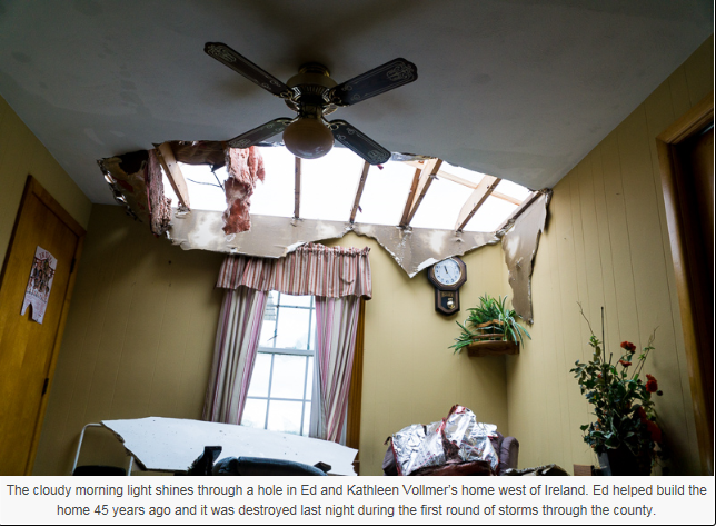
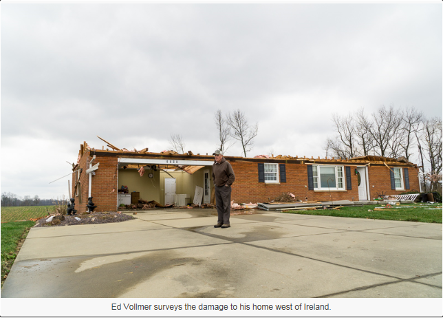
| Home in Ireland, IN (Dubois County Free Press) |
Home in Ireland, IN (Dubois County Free Press) |
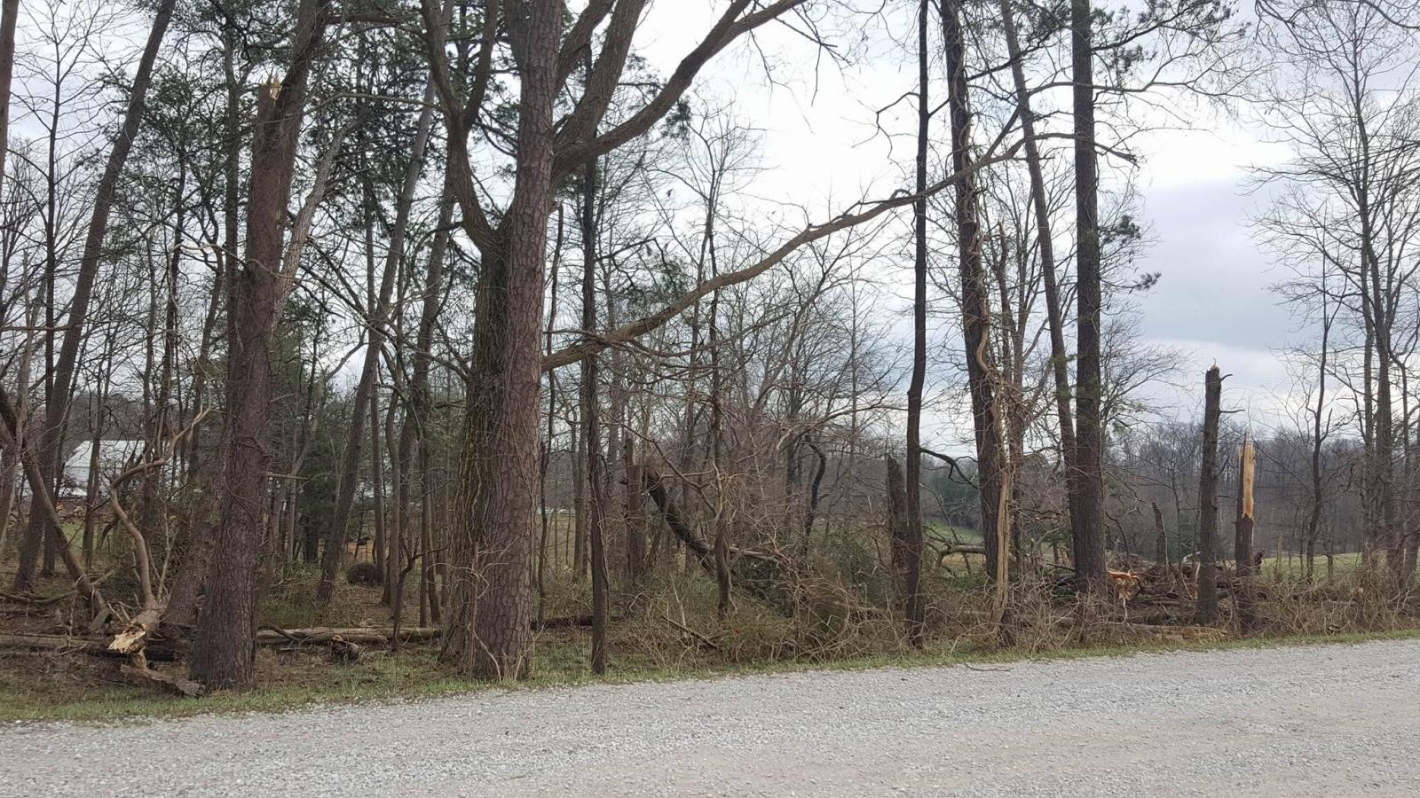
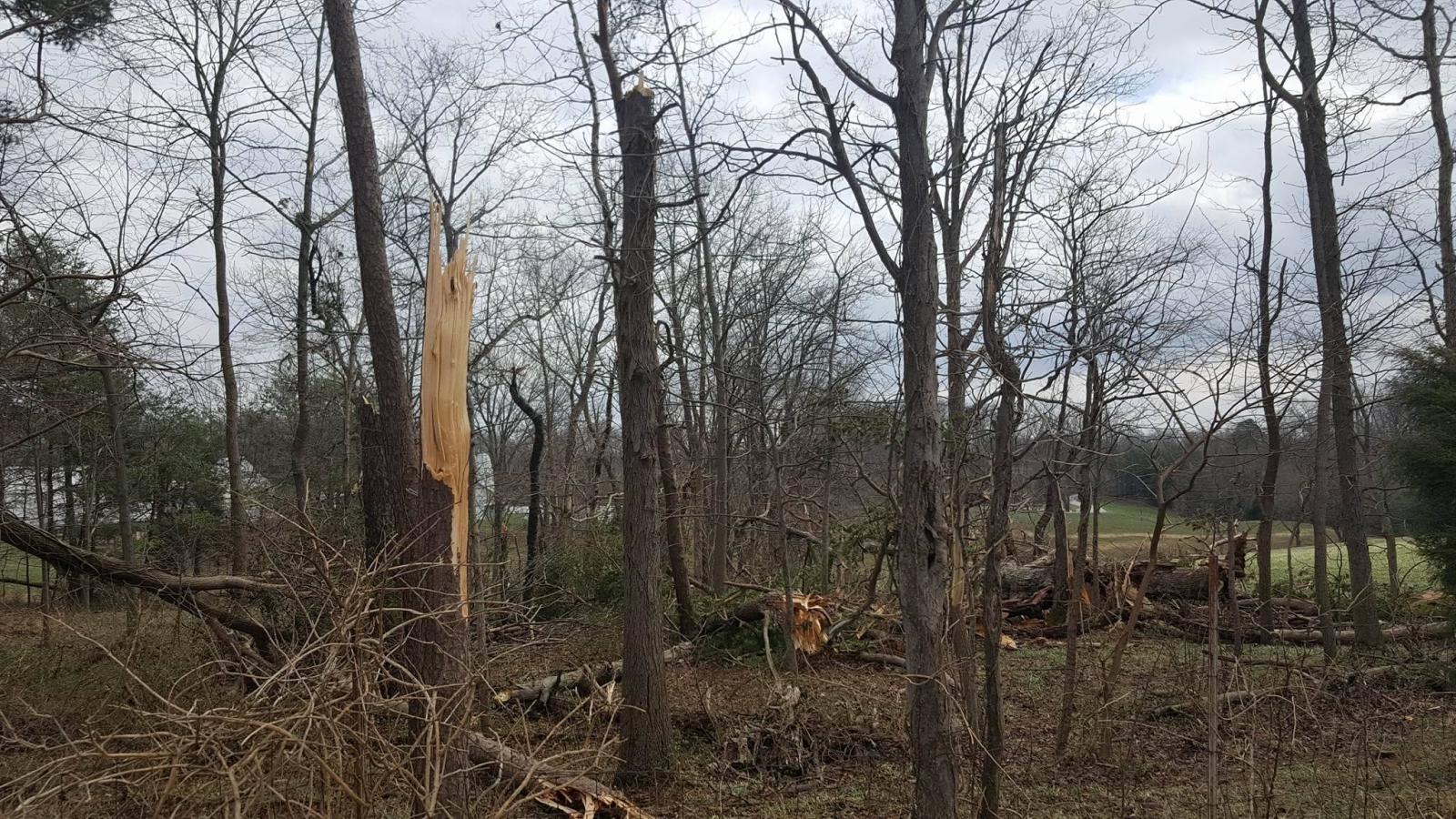
Trees down Dubois County, IN (Rob Kramer, Facebook) |
Trees down Dubois County, IN (Rob Kramer, Facebook) |
Orange County, Indiana
 |
 |
 |
 |
| Courtesy Rick Emerick | Courtesy Rick Emerick | Courtesy Rick Emerick | Courtesy Rick Emerick |
 |
 |
 |
| Courtesy NWS Indianapolis | Courtesy NWS Indianapolis | Courtesy NWS Indianapolis |
Trimble County, Kentucky
 |
 |
 |
| Milton, Kentucky (Courtesy Denise Crane) | Milton, Kentucky (Courtesy Denise Crane) | Milton, Kentucky (Courtesy Denise Crane) |
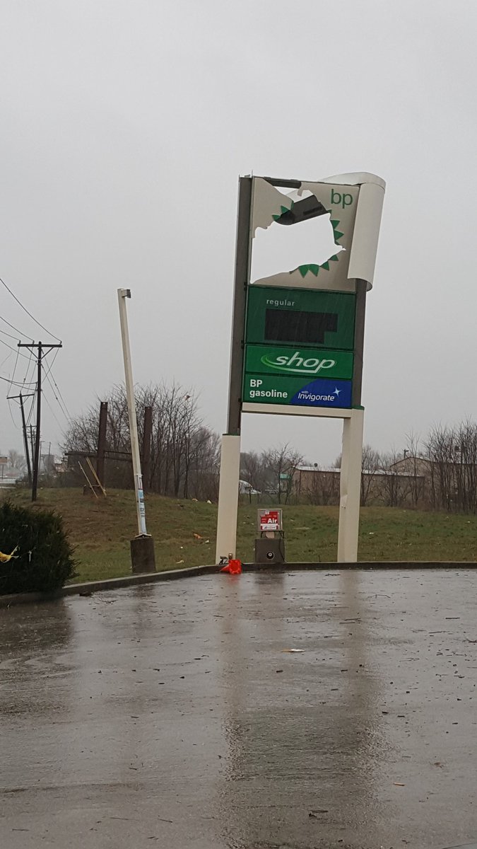
Warren County, Kentucky
 |
 |
 |
 |
| Courtesy Melissa Moore | Courtesy Melissa Moore | Hays Rd (Courtesy Landon Hampton) | Martinsville Ford Rd (Courtesy Melissa Moore) |
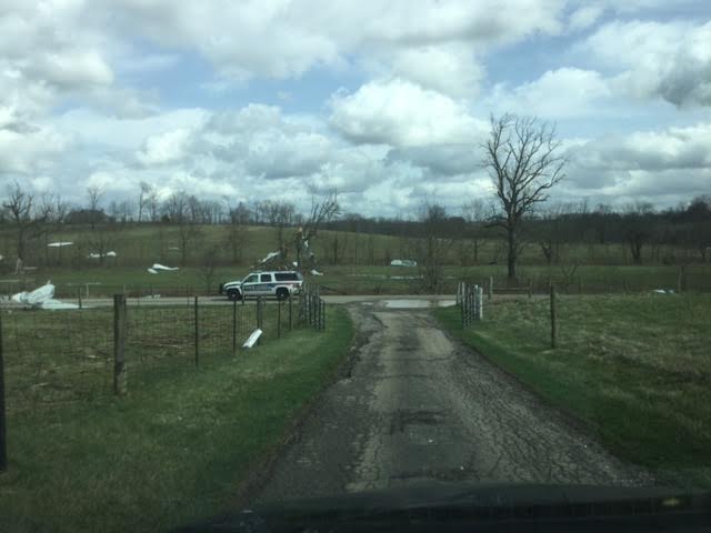
Scott County, Kentucky
 |
 |
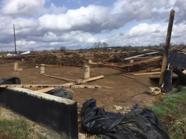 |
| Courtesy John Gordon, NWS | Courtesy John Gordon, NWS | Courtesy John Gordon, NWS |
Madison County, Kentucky
 |
 |
 |
| MadisonCounty, Kentucky (Courtesy WeatherDude, Twitter) | Madison County, Kentucky (Courtesy WeatherDude, Twitter) | Madison County, Kentucky (Courtesy Twitter) |
 |
 |
 |
| Madison County, KY (Courtesy NWS Jackson KY) | Madison County, KY (Courtesy NWS Jackson KY) | Madison County, KY (Courtesy NWS Jackson KY) |
Other Areas in Central Kentucky
 |
 |
 |
 |
| Jefferson County, Kentucky (Courtesy Steven Peak, NWS Student Volunteer) | Simpson County, Kentucky (Courtesy Simpson County EM) | Marion County, Kentucky (Courtesy Hayden Johnson) | Marion County, Kentucky (Courtesy Hayden Johnson) |
 |
 |
 |
| Oldham County, Kentucky (Courtesy Laura Niemann, Twitter) | Oldham County, Kentucky (Courtesy Laura Niemann Twitter) | Oldham County, Kentucky (Courtesy Laura Niemann Twitter) |
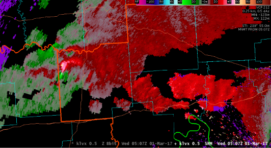
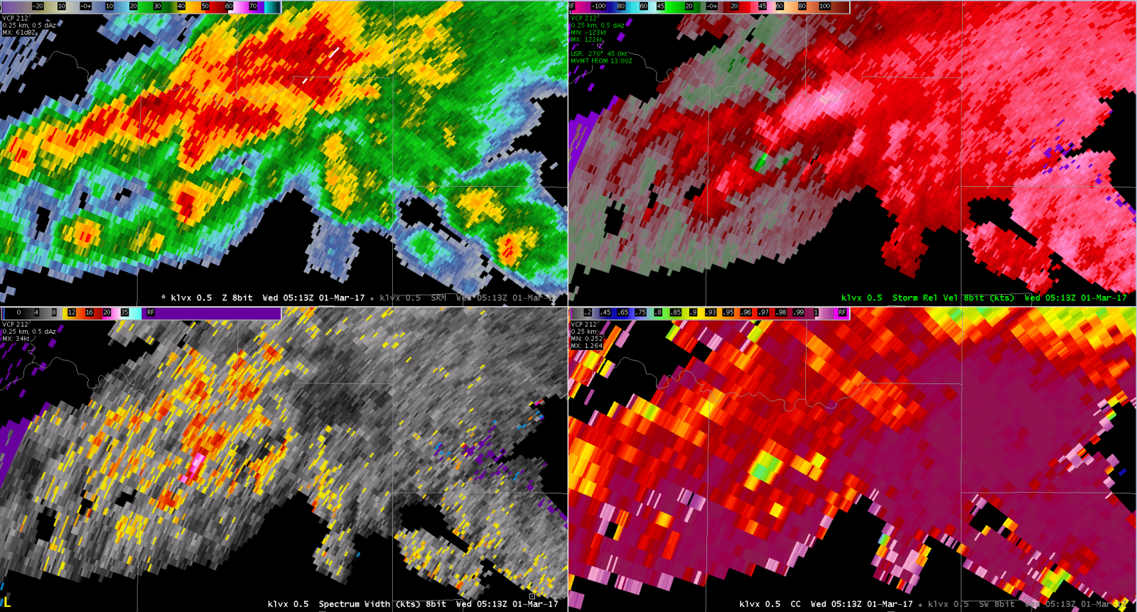
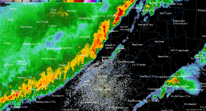
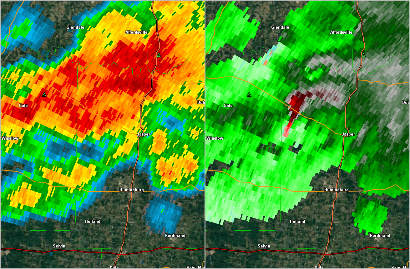
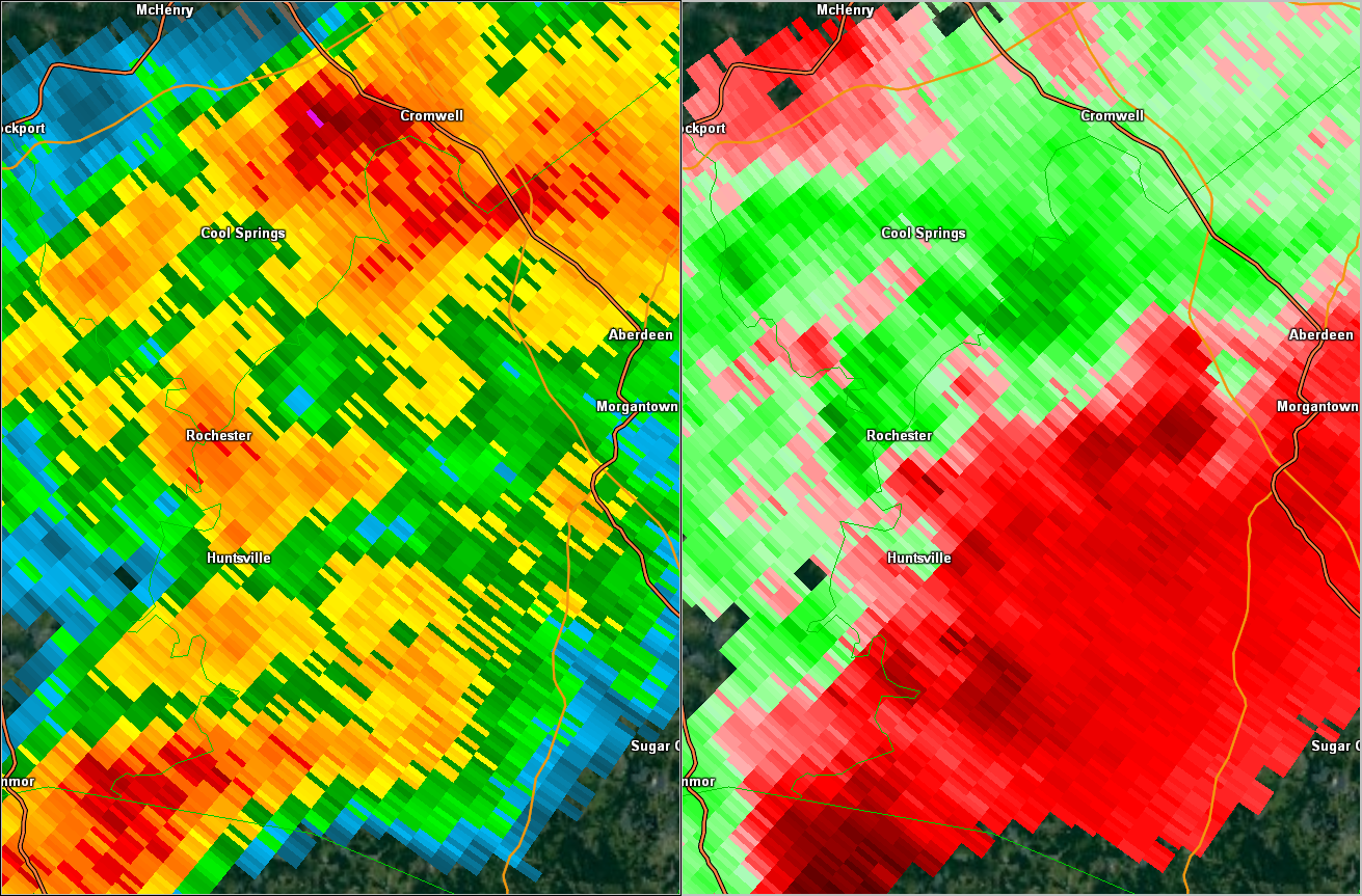
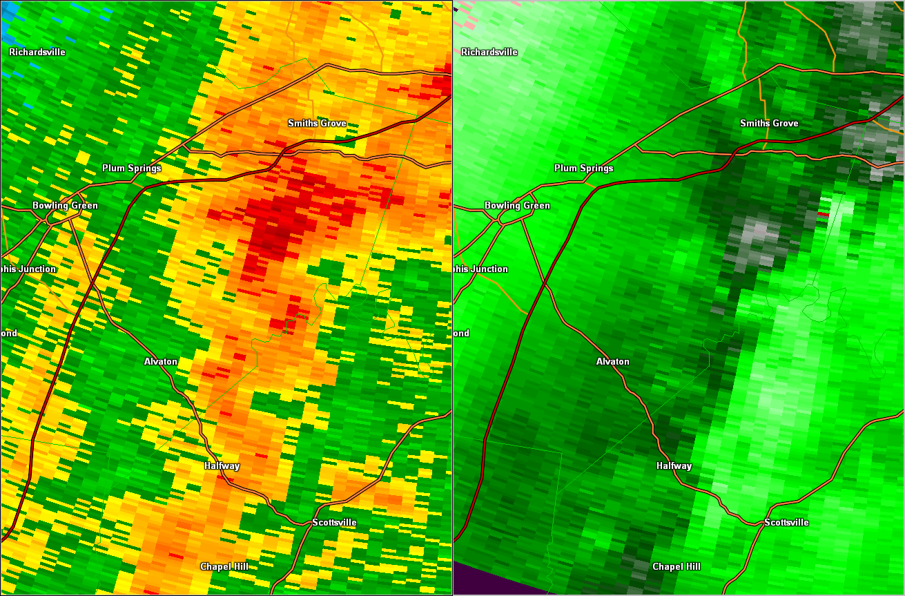
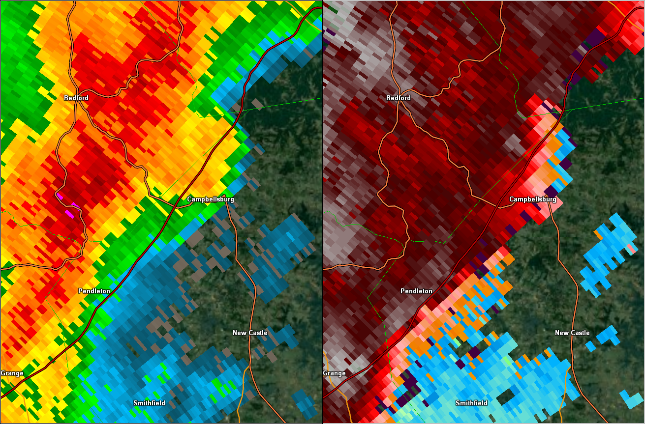
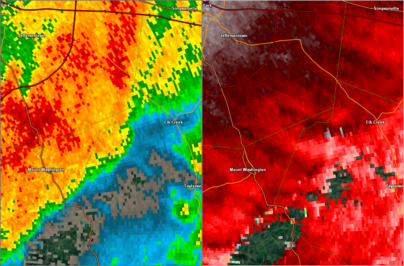
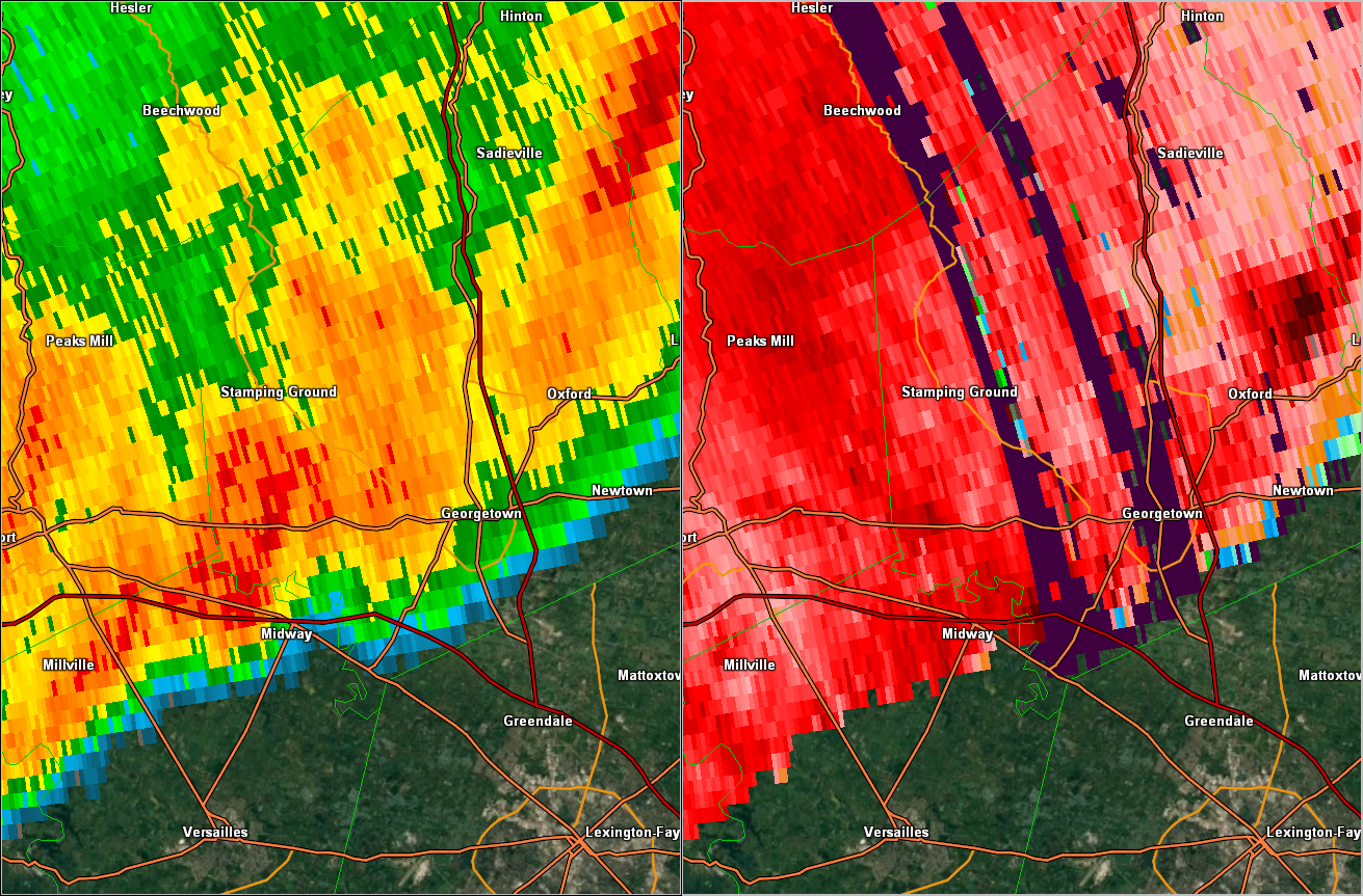
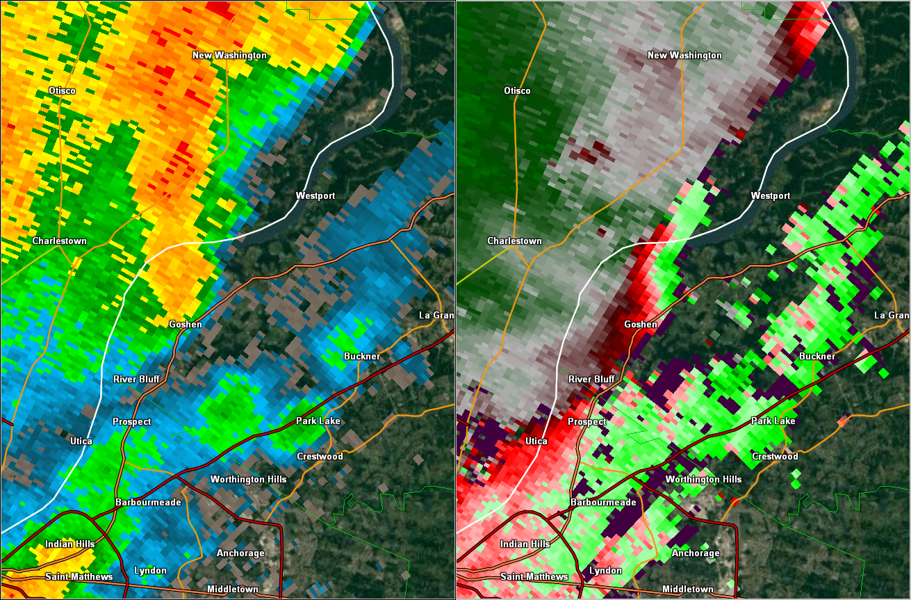
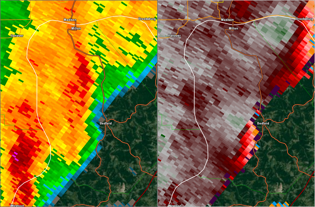
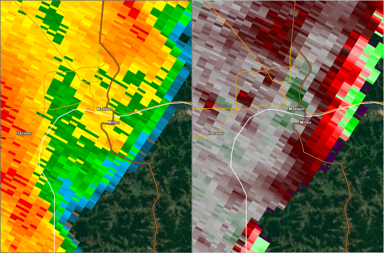
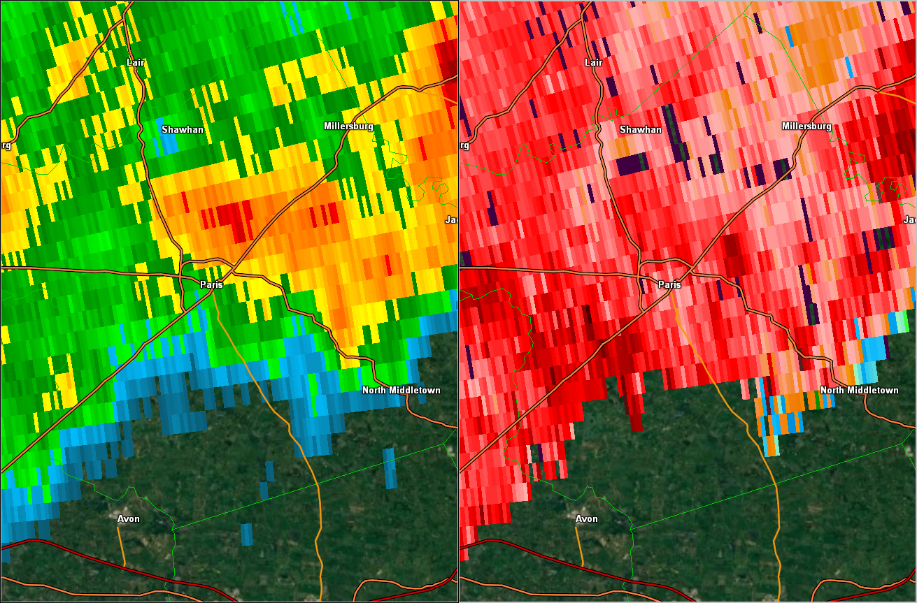
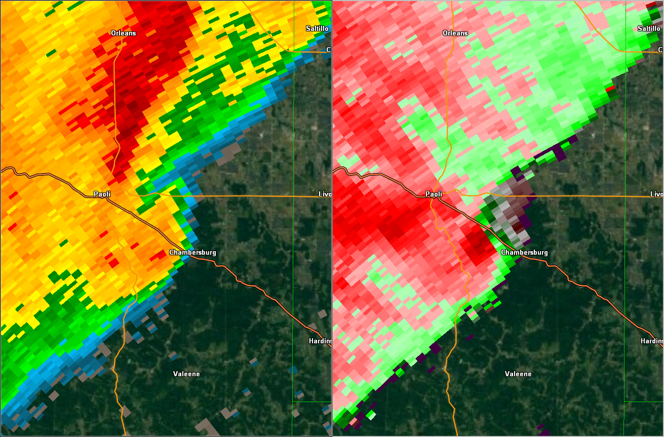
Radar:
Radar Images:
 |
 |
 |
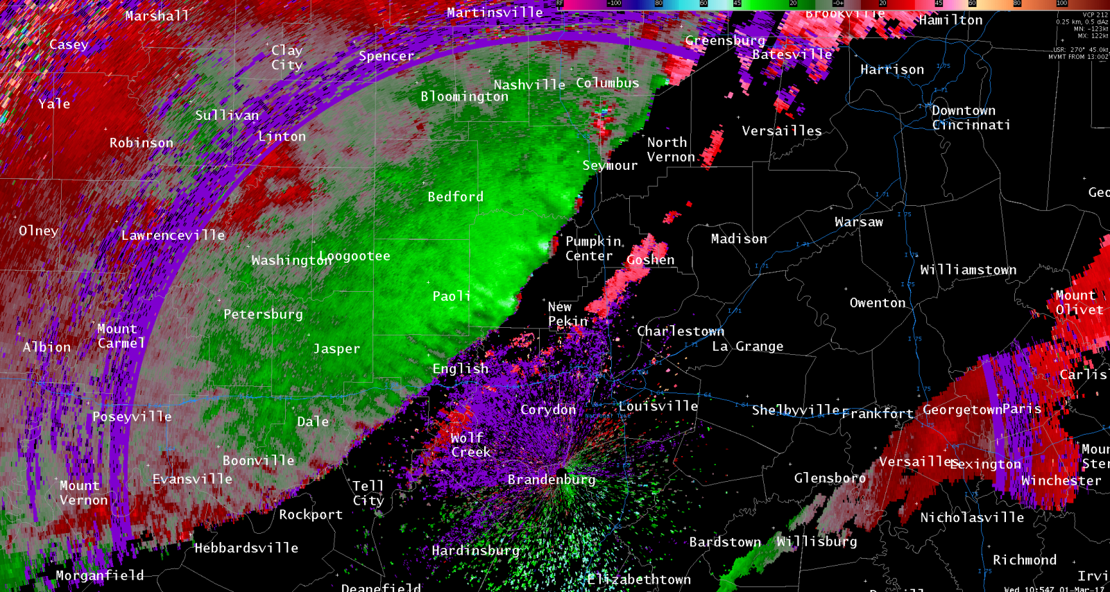 |
| 0.5 degree KLVX Storm Relative Velocity over Dubois County, Indiana at 507z Mar 1 | 4-panel image of 0.5 degree KLVX from 12:13 AM EST over Dubois County. Legend: Top left (reflectivity) Top right (SRM), Bottom Left (Spectrum Width), Bottom right (Correlation Coefficient) | 554 AM EST Squall Line Reflectivity | 554 AM EST Squall Line Storm Relative Velocity |
Storm Reports
 |
.gif) |
| SPC Day 1 Outlook | SPC Day 1 Outlook, with preliminary verification reports |
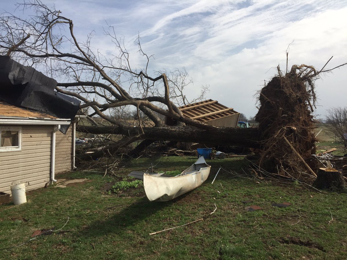
PRELIMINARY LOCAL STORM REPORT...SUMMARY NATIONAL WEATHER SERVICE LOUISVILLE KY 1132 AM EST SAT MAR 4 2017 ..TIME... ...EVENT... ...CITY LOCATION... ...LAT.LON... ..DATE... ....MAG.... ..COUNTY LOCATION..ST.. ...SOURCE.... ..REMARKS.. 1203 AM TORNADO IRELAND 38.42N 87.00W 03/01/2017 DUBOIS IN NWS STORM SURVEY AN EF-2 TORNADO WITH MAXIMUM WIND SPEEDS OF 130 MPH TOUCHED DOWN 4.1 MILES WSW OF IRELAND INDIANA. INITIALLY...A LARGE POLE BARD WAS DESTROYED ALONG WITH DAMAGE TO SEVERAL HOMES. THE TORNADO THEN TRAVELED A MILE NE WHERE IT DAMAGED SEVERAL HOMES...INCLUDING 1 HOME THAT LOST ITS ROOF AND HAD PARTIAL COLLAPSE OF WALLS. THE TORNADO THEN TRAVELED ALMOST DUE EAST TOWARD IRELAND WHERE IT DAMAGED MORE HOMES BEFORE LIFTING NEAR THE INTERSECTION OF DUBLIN AND CHURCH ST. THE MAXIMUM PATH WIDTH WAS 200 YARDS AND IT WAS ON THE GROUND FOR 4 TO 5 MINUTES. THE DURATION OF THE TORNADO EVENT WAS 4 MINUTES. 1210 AM TSTM WND DMG IRELAND 38.42N 87.00W 03/01/2017 DUBOIS IN LAW ENFORCEMENT NUMEROUS DOWNED TREES BLOCKING ROADS AND A LARGE DOWNED TREE ON A HOME. 0101 AM HAIL CAMPBELLSBURG 38.65N 86.26W 03/01/2017 E0.75 INCH WASHINGTON IN LAW ENFORCEMENT . 0105 AM TSTM WND DMG 2 S RUSH CREEK VALLEY 38.67N 86.17W 03/01/2017 WASHINGTON IN BROADCAST MEDIA NUMEROUS TREES DOWN WHERE N. HIGHLAND ROAD BECOMES N. RUSH CREEK ROAD. TIME ESTIMATED. 0120 AM NON-TSTM WND GST 4 ENE HOWE VALLEY 37.70N 86.02W 03/01/2017 M52 MPH HARDIN KY MESONET . 0127 AM TSTM WND DMG IRELAND 38.42N 87.00W 03/01/2017 DUBOIS IN PUBLIC SHINGLES BLOWN OFF HOME. FENCE BLOWN DOWN. 0130 AM NON-TSTM WND GST CECILIA 37.67N 85.95W 03/01/2017 M57 MPH HARDIN KY MESONET . 0135 AM TSTM WND DMG 1 SSE ROCHESTER 37.19N 86.88W 03/01/2017 BUTLER KY EMERGENCY MNGR STRUCTURAL DAMAGE TO BOAT DOCK ON POND. ALSO HAVE LARGE DIAMETER TREES SNAPPED AND UPROOTED ALONG HWY 70 AND WITAKER RD. TIME BASED ON FIRST WAVE ON RADAR, BUT NO EYEWITNESSES AND COULD HAVE BEEN THE SECOND WAVE LATER IN THE MORNING. 0135 AM TORNADO 2 SSE ROCHESTER 37.18N 86.88W 03/01/2017 BUTLER KY NWS STORM SURVEY AN EF-1 TORNADO WITH MAXIMUM WINDS OF 86 MPH TOUCHED DOWN IN FAR WESTERN BUTLER COUNTY. MOST OF THE DAMAGE WAS SNAPPED, TWISTED, OR UPROOTED TREES. ONE BUILDING WAS DAMAGED NEAR THE TOUCHDOWN POINT. THE PATH LENGTH WAS 1 MILE WITH A WIDTH OF 90 YARDS. THE DURATION OF THE TORNADO EVENT WAS 2 MINUTES. 0145 AM HAIL 2 NNW JOHNSBURG 38.25N 86.96W 03/01/2017 E1.00 INCH DUBOIS IN TRAINED SPOTTER QUARTER SIZE HAIL 2S HUNTINGBURG. OBSERVER ALSO REPORTED A MEASURED 60 MPH WIND GUST. CORRECTED HAIL SIZE. 0147 AM TSTM WND DMG 2 W BRETZVILLE 38.30N 86.91W 03/01/2017 DUBOIS IN PUBLIC TREE DOWN ACROSS HIGHWAY 64. CORRECTION FOR TIME OF OCCURRENCE. 0154 AM HAIL 2 S HUNTINGBURG 38.27N 86.96W 03/01/2017 M1.00 INCH DUBOIS IN TRAINED SPOTTER WITH 60 MPH WIND SPEEDS MEASURED WITH ANEMOMETER. . 0207 AM TSTM WND DMG LEITCHFIELD 37.48N 86.29W 03/01/2017 GRAYSON KY PUBLIC TREE BLOWN DOWN. . 0218 AM NON-TSTM WND DMG 2 SSE FORT KNOX 37.86N 85.95W 03/01/2017 HARDIN KY AMATEUR RADIO TREES DOWN NEAR WILSON ROAD. . 0230 AM TSTM WND DMG COXS CREEK 37.90N 85.47W 03/01/2017 NELSON KY TRAINED SPOTTER DELAYED REPORT. UTILITY POLES DOWN. TIME ESTIMATED FROM RADAR. 0240 AM TSTM WND DMG 1 ESE ELIZABETHTOWN 37.70N 85.86W 03/01/2017 HARDIN KY NEWSPAPER DELAYED REPORT. SEVERAL TREES DOWN. 0256 AM TSTM WND DMG 2 NE LOUISVILLE 38.24N 85.72W 03/01/2017 JEFFERSON KY BROADCAST MEDIA TREE LIMBS APPROXIMATELY 12 INCHES IN DIAMETER FELL ON A VEHICLE. 0257 AM TSTM WND GST 4 S LOUISVILLE 38.17N 85.74W 03/01/2017 M52 MPH JEFFERSON KY ASOS ASOS STATION LOUISVILLE INTL-STANDIFORD FIELD AP /SDF/. THE DURATION OF THE TSTM WND GST EVENT WAS 1 HOUR. 0328 AM TSTM WND DMG 3 NNE LOUISVILLE 38.27N 85.71W 03/01/2017 JEFFERSON KY BROADCAST MEDIA 2 TREES DOWN ON MELLWOOD AVE EAST OF DOWNTOWN. 0337 AM HAIL 1 W FRANKFORT 38.19N 84.88W 03/01/2017 M1.00 INCH FRANKLIN KY EMERGENCY MNGR QUARTER SIZE HAIL. 0400 AM TSTM WND DMG 5 SSW NEW ZION 38.13N 84.52W 03/01/2017 FAYETTE KY NWS STORM SURVEY THE NATIONAL WEATHER SERVICE IN CONJUNCTION WITH THE UNIVERSITY OF KENTUCKY COLLEGE OF AGRICULTURE FOOD AND ENVIRONMENT DETERMINED 70-80 MPH STRAIGHT LINE WINDS ACROSS THE SPINDLETOP AREA OF NORTHERN FAYETTE COUNTY. VERY STRONG WINDS ABOUT 50 FEET OFF THE GROUND HIT OVER 10 AGRICULTURAL BARNS CAUSING SIGNIFICANT DAMAGE TO ROOFS AND SIDE PANELS. THE DEBRIS PATTERN WAS SPREAD DOWNWIND AND EASTWARD AT LEAST A HALF MILE. SEVERAL POWER POLES WERE KNOCKED OVER AND SEVERAL TREES SNAPPED AND UPROOTED. THE MAJORITY OF THE DAMAGE ORIGINATED ON THE SOUTHWEST CORNERS OF THE BARNS AND PUSHED OUT TO THE NORTHEAST. THE OVERALL DAMAGE PATH EXTENDED 3 MILES AND WAS A MAXIMUM OF A HALF MILE WIDE. THE DURATION OF THE TSTM WND DMG EVENT WAS 3 MINUTES. 0400 AM TSTM WND DMG 7 WNW LEXINGTON 38.10N 84.56W 03/01/2017 FAYETTE KY NWS STORM SURVEY AN NWS SURVEY TEAM OBSERVED DAMAGE AT MASTERSON STATION NEAR THE BLACKBURN CORRECTIONAL FACILITY WHERE OVER 50 TREES WERE SNAPPED OR UPROOTED, MANY OF WHICH WERE CEDARS OR OTHER CONIFERS. ALL DAMAGE WAS FROM THE WEST-SOUTHWEST TO EAST-NORTHEAST. ON THE PRISON PROPERTY, A METAL OUTBUILDING DOOR AND PART OF THE ROOF SUSTAINED DAMAGE. STRAIGHT LINE WINDS WERE ESTIMATED AT 60 TO 70 MPH. 0400 AM TSTM WND DMG 6 NW LEXINGTON 38.11N 84.54W 03/01/2017 FAYETTE KY 911 CALL CENTER DAMAGE TO ROOF, TREES, AND TRANSFORMERS ON YARNALLTON PIKE. DAMAGE TO SIDING ON WINDING OAK TRAIL. . 0402 AM TSTM WND DMG 6 SSW NEW ZION 38.11N 84.53W 03/01/2017 FAYETTE KY PUBLIC TWO LARGE TREES DOWN, A FENCE SNAPPED AT THE POSTS, AND SIDING DAMAGE. 0415 AM TSTM WND DMG 4 NNW LEXINGTON 38.10N 84.48W 03/01/2017 FAYETTE KY COUNTY OFFICIAL OUTBUILDINGS BELONGING TO THE UNIVERSITY OF KENTUCKY WERE DAMAGED AT NEWTOWN PIKE AND INTERSTATE 75. CORRECTED TIME. 0417 AM TSTM WND DMG PARIS 38.21N 84.25W 03/01/2017 BOURBON KY EMERGENCY MNGR THREE TREES DOWN. 0418 AM TSTM WND DMG 2 NE PARIS 38.22N 84.24W 03/01/2017 BOURBON KY EMERGENCY MNGR OLD BARN DESTROYED. 0425 AM TSTM WND DMG 6 NE NORTH MIDDLETOWN 38.20N 84.04W 03/01/2017 BOURBON KY EMERGENCY MNGR BARN DESTROYED. 0435 AM TSTM WND GST 3 SE MILLERSBURG 38.28N 84.10W 03/01/2017 M55 MPH NICHOLAS KY MESONET MESONET STATION 2 ESE MILLERSBURG /CLSL/. THE DURATION OF THE TSTM WND GST EVENT WAS 6 HOURS. 0528 AM TSTM WND DMG 2 N HOLLAND 38.27N 87.04W 03/01/2017 DUBOIS IN PUBLIC LARGE TREES BLOWN DOWN AND SNAPPED. ALL FACING EAST. 0532 AM TSTM WND GST 2 N JOHNSBURG 38.25N 86.96W 03/01/2017 M61 MPH DUBOIS IN ASOS . 0538 AM TORNADO 2 NW SALTILLO 38.69N 86.33W 03/01/2017 ORANGE IN NWS STORM SURVEY *** 1 INJ *** THIS IS AN EXTENSION OF THE LAWRENCE COUNTY EF-2 TORNADO THAT BRIEFLY CROSSED INTO ORANGE COUNTY BEFORE LIFTING. THE TORNADO PRODUCED EF-1 LEVEL DAMAGE IN ORANGE COUNTY, DESTROYING TWO MOBILE HOMES. ONE MOBILE HOME ROLLED OVER ONTO A NEW VEHICLE WHERE THREE OCCUPANTS WERE UNHURT. THE CAR ENDED UP INSIDE THE LIVING ROOM OF THE MOBILE HOME. THE OTHER MOBILE HOME TOOK A DIRECT HIT, TAKING THE ROOF OFF AND BLOWING THE WALLS OUT OF HALF OF THE HOME. AN OCCUPANT OF THE HOME WAS BLOWN INTO THE FIELD WITH HOME DEBRIS, WHILE LEAVING LIVING ROOM FURNITURE IN PLACE. THE RESIDENT RECEIVED ONLY MINOR INJURIES. THE DURATION OF THE TORNADO EVENT WAS 1 MINUTE. 0538 AM TSTM WND DMG 1 NW LEIPSIC 38.67N 86.37W 03/01/2017 ORANGE IN NWS STORM SURVEY STRAIGHT-LINE WINDS DESTROYED AN OUTBUILDING ABOUT 0.5 MILES NW OF LEIPSIC, SCATTERING DEBRIS INTO THE COMMUNITY THAT DAMAGED SEVERAL HOMES. A MICROBURST TORE PART OF THE ROOF OFF ONE HOME, FANNING DEBRIS OUT TO THE EAST. THE DURATION OF THE TSTM WND DMG EVENT WAS 1 MINUTE. 0540 AM TSTM WND DMG 2 WNW CHAMBERSBURG 38.53N 86.42W 03/01/2017 ORANGE IN NWS STORM SURVEY AN NWS STORM SURVEY IN CONJUNCTION WITH ORANGE COUNTY EMERGENCY MANAGEMENT CONCLUDED THAT STRAIGHT LINE WINDS IMPACTED A NEARLY 2 MILE STRETCH ALONG US 150 SE OF PAOLI, IN. SPORADIC TREE DAMAGE WAS NOTED ACROSS THE COUNTY, HOWEVER A LOCALIZED AREA OF INTENSE DAMAGE STARTED 3.2 MILES SE OF PAOLI WHERE MINOR DAMAGE TO ROOFS AND NUMEROUS SOFTWOOD TREES WERE UPROOTED AND SNAPPED. THE STRAIGHT LINE WINDS SUBSIDED AFTER TAKING SUBSTANTIAL ROOF PANELING OFF OF A LARGE POLE BARN AND UPROOTING SEVERAL MORE TREES AT A RESIDENCE. A TRUCK WAS COMPLETELY SMASHED BY A DOWNED TREE, ALONG WITH ROOF AND FOUNDATION DAMAGE TO A HOUSE FROM A FALLEN TREE. MAX WINDS WERE ESTIMATED AT 75 TO 80 MPH ALONG THE SPORADIC HALF MILE WIDE PATH. 0541 AM TORNADO 1 NE SALTILLO 38.68N 86.28W 03/01/2017 WASHINGTON IN NWS STORM SURVEY AN NWS STORM SURVEY IN CONJUNCTION WITH WASHINGTON COUNTY EMERGENCY MANAGEMENT CONCLUDED THAT AN EF-1 TORNADO TOUCHED DOWN, AND WAS EMBEDDED IN A LARGER FIELD OF STRAIGHT-LINE WINDS. THE TORNADO MAY HAVE BEEN AN EXTENSION OF THE LAWRENCE/ORANGE COUNTY EF-2(1), AND FURTHER WORK IS BEING DONE TO CONFIRM THE EXTENSION OF THE PATH. PRELIMINARY PATH LENGTH IS 5 MILES WITH A MAX WIDTH OF 100 YARDS FOR THE TORNADO, HOWEVER THE OVERALL STRAIGHT LINE WIND PATH WIDTH WAS CLOSE TO A MILE WIDE IN SPOTS. THE MOST INTENSE TORNADO DAMAGE HAPPENED SHORTLY AFTER TOUCHDOWN WHERE OVER 50 HEALTHY HARDWOOD TREES HAD SNAPPED TRUNKS WITH NO FOLIAGE. IN ADDITION, AN OUTBUILDING LOST PART OF A ROOF, AND DEBRIS STRUCK A RESIDENCE CAUSING CRACKED MASONRY AND DENTED DRYWALL ON THE INSIDE OF THE STRUCTURE. MAXIMUM WIND SPEEDS OF 100 MPH WERE ESTIMATED IN THE AREA. THE TORNADO CONTINUED EASTWARD WHERE MORE HOMES EXPERIENCED MINOR ROOF DAMAGE, TREES WERE UPROOTED, AND A LARGE OUTBUILIDNG WAS NEARLY DESTROYED. AFTER CROSSING CAVE RIVER VALLEY RD AND WHITE RIVER RD, THE TORNADO TOOK OUT NEARLY 50 SOFTWOOD TREES. FURTHER EAST, OVER 100 HARDWOOD AND SOFTWOOD TREES WERE UPROOTED AND SNAPPED, AND NOTABLE CONVERGENCE WAS OBSERVED. AFTER DRIVING A 4 X 6 POST THROUGH THE ROOF OF A HOME NEAR HUNTER RD, THE TORNADO CONTINUED EAST TO PROWSVILLE RIDGE RD WHERE AN UPTICK TO 90-95 MPH INTENSITY WAS NOTED. ANOTHER STAND OF NEARLY 50 HARDWOOD TREES WERE UPROOTED AND SNAPPED, ALONG WITH SIGNIFICANT DAMAGE TO A PORCH AND ROOF OF A HOME. TORNADIC DAMAGE CEASED EAST OF COX FERRY RD, HOWEVER SOME INSTANCES OF STRAIGHT LINE WINDS WERE NOTED ALL THE WAY TO DELANEY PARK RD. IT WAS ALSO NOTED THAT STRAIGHT-LINE WINDS WERE SURVEYED SOUTH OF THE TORNADO DAMAGE PATH FROM SALTILLO EASTWARD TO WEST WASHINGTON SCHOOL ROAD. EYEWITNESS ACCOUNTS PUT THIS DAMAGE AT SLIGHTLY EARLIER TIMES THAN WHEN THE TORNADO DAMAGE OCCURRED. THE STRAIGHT-LINE WIND DAMAGE RANGED FROM 60 TO 80 MPH. 0559 AM TSTM WND DMG AUSTIN 38.74N 85.81W 03/01/2017 SCOTT IN BROADCAST MEDIA 5 INCH DIAMETER BRANCH FELL OR THROWN THROUGH ROOF INTO BATHROOM IN A HOME. . 0600 AM TSTM WND DMG 1 WNW BORDEN 38.48N 85.97W 03/01/2017 CLARK IN PUBLIC FLAG POLE BENT AND ROOF SHINGLES OFF A HOUSE. 0600 AM TORNADO BORDEN 38.47N 85.95W 03/01/2017 CLARK IN NWS STORM SURVEY A SMALL TORNADO TOUCHED DOWN IN THE BACKYARD OF A HOME ABOUT A QUARTER MILE WEST OF THE CAUTION LIGHT ON IN 60 AND UPROOTED TREES AND CAUSED ROOF DAMAGE TO A HOME. THE TORNADO MOVED ALONG MUDDY FORK AND SNAPPED OR UPROOTED NUMEROUS TREES. THE TORNADO THEN CROSSED IN 60 WHERE IT WAS WITNESSED BY PEOPLE IN THE BUCKBOARD DINER. NEXT, THE TORNADO REMOVED THE ROOF OF THE OLDER BUILDING NEXT TO THE CAFE AND A GARAGE BEHIND THE CAFE. IT THREW DEBRIS INTO A SMALL CHURCH AND REMOVED SOME OF ITS ROOF. NO OTHER DAMAGE IN THE NARROW PATH WAS SEEN BEYOND THIS POINT. 0601 AM TSTM WND DMG NEW PEKIN 38.50N 86.02W 03/01/2017 WASHINGTON IN BROADCAST MEDIA MOBILE HOME FLIPPED IN PEKIN, IN. 0604 AM TSTM WND DMG MARTINSBURG 38.45N 86.03W 03/01/2017 WASHINGTON IN PUBLIC BARN DAMAGED IN MARTINSBURG . 0604 AM TSTM WND DMG 1 WNW BORDEN 38.47N 85.96W 03/01/2017 CLARK IN AMATEUR RADIO WIDESPREAD AREA OF TREE DAMAGE WITH BUILDING MATERIALS IN THE STREETS. 0604 AM TORNADO BORDEN 38.47N 85.95W 03/01/2017 CLARK IN NWS STORM SURVEY CORRECTED TIME. A SMALL TORNADO TOUCHED DOWN IN THE BACKYARD OF A HOME ABOUT A QUARTER MILE WEST OF THE CAUTION LIGHT ON IN 60 AND UPROOTED TREES AND CAUSED ROOF DAMAGE TO A HOME. THE TORNADO MOVED ALONG MUDDY FORK AND SNAPPED OR UPROOTED NUMEROUS TREES. THE TORNADO THEN CROSSED IN 60 WHERE IT WAS WITNESSED BY PEOPLE IN THE BUCKBOARD DINER. NEXT, THE TORNADO REMOVED THE ROOF OF THE OLDER BUILDING NEXT TO THE CAFE AND A GARAGE BEHIND THE CAFE. IT THREW DEBRIS INTO A SMALL CHURCH AND REMOVED SOME OF ITS ROOF. NO OTHER DAMAGE IN THE NARROW PATH WAS SEEN BEYOND THIS POINT. THE DURATION OF THE TORNADO EVENT WAS 1 MINUTE. 0605 AM TSTM WND DMG 1 WNW BORDEN 38.48N 85.97W 03/01/2017 CLARK IN NWS STORM SURVEY AN NWS STORM SURVEY TEAM CONCLUDED THAT INTERMITTENT POCKETS OF STRAIGHT LINE WINDS OCCURRED ALONG A 16 MILE PATH BETWEEN SE WASHINGTON COUNTY AND W CLARK COUNTY. A ROOF WAS REMOVED FROM A HOUSE ALONG IN 135 9 MILES SOUTH OF SALEM. CONTINUING ESE, THERE WERE MANY LOCATIONS WITH SPORADIC TREE AND BARN DAMAGE, THE WORST ALONG VOYLES ROAD 3 MILES SOUTH OF NEW PEKIN. THE ROOF WAS REMOVED IN TWO ABANDONED BUILDINGS IN DOWNTOWN PEKIN AND BORDEN. THE SPORADIC DAMAGE CONTINUED EAST ALONG AND NEAR IN 60 PAST BENNETTSVILLE. PEAK WIND SPEEDS WERE ESTIMATED BETWEEN 60 AND 90 MPH DEPENDENT ON LOCATION. 0605 AM TSTM WND DMG 1 WNW SCOTTSBURG 38.70N 85.80W 03/01/2017 SCOTT IN PUBLIC TREE DOWN. 0605 AM TORNADO 2 SSW VIENNA 38.63N 85.78W 03/01/2017 SCOTT IN NWS STORM SURVEY *** 3 INJ *** AN EF-1 TORNADO WITH 105 MPH MAXIMUM WINDS TOUCHED DOWN ON I-65 AT APPROXIMATELY MILE MARKER 25.5. IT SKIPPED EAST DESTROYING OUTBUILDINGS AND DAMAGING MOBILE HOMES. 3 PEOPLE RECEIVED MINOR INJURIES WHEN THEIR MOBILE HOME ROLLED OVER. THE PATH LENGTH WAS APPROX. 2 MILES AND MAX WIDTH WAS 100 YARDS. THE DURATION OF THE TORNADO EVENT WAS 2 MINUTES. 0606 AM TSTM WND DMG 2 SSE CURBY 38.22N 86.37W 03/01/2017 CRAWFORD IN NWS EMPLOYEE MATURE CEDAR TREE SNAPPED NEAR THE BASE OF ITS TRUNK AND BLOCKING STATE ROAD 66. 0606 AM TSTM WND DMG 1 WSW VIENNA 38.65N 85.78W 03/01/2017 SCOTT IN BROADCAST MEDIA TREES BLOWN ONTO INTERSTATE 65 JUST SOUTH OF SCOTTSBURG, IN. 0608 AM TSTM WND DMG 1 NNW CARWOOD 38.46N 85.87W 03/01/2017 CLARK IN BROADCAST MEDIA GLASS AND SCREEN COVERED PORCH BLOWN OFF THE BACK OF A HOUSE AT DEAM LAKE NEAR BORDEN. 0609 AM TSTM WND DMG 2 SW MEMPHIS 38.46N 85.79W 03/01/2017 CLARK IN BROADCAST MEDIA LARGE TREE LIMBS DOWN AT EBENEZER CHURCH ROAD AND COLUMBUS MANN ROAD. 0611 AM TSTM WND DMG 1 SSE WAKEFIELD 38.77N 85.55W 03/01/2017 JEFFERSON IN PUBLIC BRICK HOME NEAR ROGERS ROAD AND CHICKEN RUN ROAD IS COMPLETELY MISSING ITS ROOF. THE HOUSE NEXT DOOR HAS HALF ITS ROOF MISSING. TREES IN THE AREA ARE DAMAGED. . 0611 AM TSTM WND DMG BENNETTSVILLE 38.43N 85.80W 03/01/2017 CLARK IN LAW ENFORCEMENT TREE ON A HOUSE. TIME ESTIMATED FROM RADAR. 0614 AM TSTM WND DMG CHARLESTOWN 38.45N 85.67W 03/01/2017 CLARK IN PUBLIC VINYL SIDING OFF A BUILDING. 0615 AM TSTM WND DMG SCOTTSBURG 38.69N 85.78W 03/01/2017 SCOTT IN EMERGENCY MNGR AT LEAST 15 HOMES WERE DAMAGED. MINOR INJURIES TO 23 PEOPLE. MANY TREES AND POWER LINES DOWN. SEVEN ROADS CLOSED DUE TO DEBRIS. DAMAGE OCCURRED IN TWO SEPARATE AREAS OF THE COUNTY. 0615 AM TSTM WND DMG 2 NNW SOLON 38.52N 85.55W 03/01/2017 CLARK IN TRAINED SPOTTER TREES SNAPPED OR UPROOTED. 0618 AM TSTM WND DMG 2 SSE MEMPHIS 38.46N 85.75W 03/01/2017 CLARK IN BROADCAST MEDIA MULTIPLE LARGE TREES EITHER UPROOTED OR TRUNKS SPLIT. 0620 AM TSTM WND DMG 2 NW MILTON 38.73N 85.41W 03/01/2017 TRIMBLE KY NWS STORM SURVEY STRAIGHT-LINE WINDS OCCURRED INTERMITTENTLY JUST SOUTH OF THE OHIO RIVER FROM 2 MILES WEST OF MILTON TO 2.5 MILES EAST OF MILTON. A MOBILE HOME PARK WAS DAMAGED WITH MULTIPLE HARDWOOD TREES SNAPPED, AND A FEW UNANCHORED MOBILE HOMES SLID OFF THEIR PIERS. WINDS WERE ESTIMATED AT 70-75 MPH AT THIS LOCATION. EAST OF MILTON, THE DAMAGE WAS MORE SIGNIFICANT WITH LARGE OUTBUILDINGS EITHER HEAVILY DAMAGED OR DESTROYED. LARGE HARDWOOD TREES WERE SNAPPED AND UPROOTED. DEBRIS WAS SCATTERED 200-300 YARDS DOWNWIND. MAXIMUM WIND SPEEDS WERE ESTIMATED TO BE 80-90 MPH. 0622 AM TSTM WND DMG 1 NNE RAMSEY 38.33N 86.14W 03/01/2017 HARRISON IN TRAINED SPOTTER ROOF WAS BLOWN OFF A CONCRETE BLOCK DUGOUT AT A YOUTH SOFTBALL FIELD BEHIND NORTH HARRISON HIGH SCHOOL. 0622 AM TSTM WND DMG 2 N GOSHEN 38.44N 85.59W 03/01/2017 OLDHAM KY NWS STORM SURVEY NUMEROUS TREES WERE SNAPPED OVER A FAIRLY WIDE AREA, THOUGH THE SWATH OF DAMAGE WAS RIDDLED WITH MANY TREES THAT WITHSTOOD THE WIND. THE MOST CONCENTRATED DAMAGE WAS ALONG BUCKHORN LN WHERE A ROW OF TREES LINING THE ROAD WERE FELLED. ANOTHER CONCENTRATED AREA WAS AT THE END OF SECRETARIAT DR, NEXT TO WIDE-OPEN FIELD, WHERE SEVERAL TREES FELL AROUND A PROPERTY. ONE TREE FELL INTO A GARAGE DOOR, CAUSING BOTH A BRANCH TO POKE THROUGH SECOND-FLOOR SIDING INTO THE HOUSE AND DAMAGING THE BACK SIDE OF A CAR, WHICH AT THE TIME WAS PARKED OUTSIDE OF THE GARAGE. DECIDED ON A MICROBURST FOR THIS DAMAGE, GIVEN THE SPREADING OUT OF THE DAMAGE PATH FROM ITS INITIAL POINT CLOSE TO THE RIVER AND WITH THE LACK OF A FOCUSED DAMAGE PATH. THE DURATION OF THE TSTM WND DMG EVENT WAS 4 MINUTES. 0625 AM TSTM WND DMG 1 WSW SKYLIGHT 38.43N 85.55W 03/01/2017 OLDHAM KY PUBLIC SEVERAL TREES DOWN AND POWER IS OFF ON SHILOH LANE. 0625 AM TSTM WND DMG 1 E GOSHEN 38.41N 85.57W 03/01/2017 OLDHAM KY PUBLIC SEVERAL LARGE TREES DOWN AT A RESIDENCE. 0627 AM TSTM WND DMG 1 S MADISON 38.74N 85.38W 03/01/2017 JEFFERSON IN PUBLIC LARGE TREE SPLIT IN HALF. 0630 AM TSTM WND GST 1 SSW WESTPORT 38.46N 85.47W 03/01/2017 M60 MPH OLDHAM KY MESONET MESONET STATION 1 SSW WESTPORT /LGRN/. THE DURATION OF THE TSTM WND GST EVENT WAS 1 HOUR. 0632 AM TSTM WND DMG 3 SSE BEDFORD 38.56N 85.29W 03/01/2017 TRIMBLE KY EMERGENCY MNGR ALMOST EVERY HOUSE ON SMITH LANE WAS DAMAGED. MOST OF THE COUNTY IS WITHOUT POWER. ELSEWHERE IN THE COUNTY, GREENHOUSES AND MOBILE HOMES WERE DAMAGED. 0636 AM TORNADO 2 N CAMPBELLSBURG 38.55N 85.21W 03/01/2017 HENRY KY NWS STORM SURVEY AN EF-1 TORNADO TOUCHED DOWN 2 MILES NORTH OF CAMPBELLSBURG, KY, TRAVELED 1 MILE (CROSSING I-71 AND OVERTURNING A TRUCK), AND THEN LIFTED 2.2 MILES NORTHEAST OF CAMPBELLSBURG. THE MOST SIGNIFICANT DAMAGE OCCURRED ON JONES LN, WHERE 100 MPH WINDS COMPLETELY DESTROYED A COUPLE OF LARGE BARNS, ALONG WITH OTHER SMALL OUTBUILDINGS. IN ADDITION, A LARGE GRAIN BIN WAS DEMOLISHED, AND AN ANCHORED MOBILE HOME WAS PUSHED OFF ITS FOUNDATION ON THE NORTH SIDE OF THE DAMAGE PATH. A LARGE DEBRIS FIELD WAS SCATTERED 200-300 YARDS DOWNWIND. EAST OF I-71, THE TORNADO DAMAGED MORE OUTBUILDINGS AND SNAPPED TREES. AFTER DESTROYING ANOTHER OLDER BARN, THE TORNADO ENDED JUST EAST OF HIGHWAY 55 WHERE NUMEROUS SOFTWOOD TREES WERE SNAPPED AND UPROOTED. VERY STRONG CONVERGENCE WAS NOTED IN THE DAMAGE. ALSO OF NOTE WERE SEVERAL INSTANCES OF STRAIGHT-LINE WIND DAMAGE FEEDING INTO THE MAIN CIRCULATION FROM THE SOUTH. THESE WIND SPEEDS WERE ESTIMATED AT 70-80 MPH. 0636 AM TSTM WND DMG 1 N IRVINGTON 37.89N 86.28W 03/01/2017 BRECKINRIDGE KY BROADCAST MEDIA UTILITY POLE AND POWER LINES DOWN ON HIGHWAY 79 JUST NORTH OF IRVINGTON. . 0637 AM TSTM WND DMG 1 SSW LOUISVILLE 38.21N 85.75W 03/01/2017 JEFFERSON KY TRAINED SPOTTER POWER POLES BENT OVER ALONG CRITTENDEN DRIVE. 0638 AM TSTM WND GST 4 S LOUISVILLE 38.17N 85.74W 03/01/2017 M59 MPH JEFFERSON KY ASOS . 0638 AM TSTM WND DMG 2 NNE CAMPBELLSBURG 38.55N 85.20W 03/01/2017 HENRY KY FIRE DEPT/RESCUE SEVERAL BARNS WITH DAMAGE, BARNS DESTROYED, MAJOR ROOF DAMAGE ON NEWER CONSTRUCTION HOMES, LARGER UPROOTED TREES. HIGH CONCENTRATION OF DAMAGE ON JONES ROAD NEAR STATE ROAD 55. . 0650 AM TSTM WND GST 2 S EMINENCE 38.33N 85.17W 03/01/2017 M68 MPH SHELBY KY MESONET MESONET STATION 2 S EMINENCE /CROP/. THE DURATION OF THE TSTM WND GST EVENT WAS 1 HOUR. 0653 AM TSTM WND DMG 1 SW VINE GROVE 37.80N 85.99W 03/01/2017 HARDIN KY NWS EMPLOYEE DELAYED REPORT. OFF-DUTY NWS EMPLOYEE REPORTED 3 TELEPHONE POLES SNAPPED ALONG CRUME ROAD. 0658 AM TSTM WND DMG 4 W ELK CREEK 38.10N 85.44W 03/01/2017 SPENCER KY NWS STORM SURVEY STRAIGHT LINE WIND DAMAGE OF APPROXIMATELY 50-60 MPH WAS SURVEYED JUST EAST OF WHITFIELD, KY ON THE BULLITT/SPENCER COUNTY LINE AND EAST INTO SPENCER COUNTY. DAMAGE TO AN RV SHED AND RV WAS OBSERVED IN BULLITT COUNTY. IN SPENCER COUNTY, A ROOF WAS BLOWN OFF OF AN OLDER BARN, AND AN OLDER SHED WAS MOVED OFF ITS PIERS. IN ADDITION, NUMEROUS CEDAR TREES WERE BLOWN OVER AND LARGE BRANCHES OF HARDWOOD TREES WERE BROKEN OFF. OVERALL, DAMAGE EXTENDED 1.25 MILES EAST OF WHERE IT BEGAN ON THE SPENCER/BULLITT COUNTY LINE. THE DURATION OF THE TSTM WND DMG EVENT WAS 1 MINUTE. 0658 AM TSTM WND DMG 5 NNW WATERFORD 38.10N 85.46W 03/01/2017 BULLITT KY EMERGENCY MNGR DAMAGE TO BARN AND OUTBUILDINGS. GAS PUMP DAMAGED. 0700 AM HAIL 2 N MOUNT WASHINGTON 38.07N 85.55W 03/01/2017 E1.00 INCH BULLITT KY PUBLIC . 0700 AM TSTM WND DMG 1 ESE TYRONE 38.03N 84.83W 03/01/2017 ANDERSON KY TRAINED SPOTTER TREES SNAPPED OR UPROOTED IN VARIOUS PARTS OF THE COUNTY. 0704 AM TSTM WND DMG 1 WSW TAYLORSVILLE 38.03N 85.35W 03/01/2017 SPENCER KY EMERGENCY MNGR TREES DOWN ACROSS THE COUNTY ON HIGHWAY 44, LILLY PIKE, AND STEVENS LANE. . 0710 AM TSTM WND DMG 5 NW SWITZER 38.30N 84.81W 03/01/2017 FRANKLIN KY NWS STORM SURVEY THE NWS IN CONJUNCTION WITH 911 OPERATOR DERON RAMBO FOUND INTERMITTENT STRAIGHT LINE WIND DAMAGE AROUND PEAK`S MILL. THE MOST CONCENTRATED AREA OF DAMAGE WAS NEAR THE 7500 BLOCK OF PEAK`S MILL RD. A 15` BY 10` POLE BARN WAS KNOCKED OVER ALONG WITH SEVERAL TREES AND SOME DAMAGE TO ROOF SHINGLES. ESTIMATED WINDS WERE 55 TO 60 MPH WITH A HALF MILE PATH OF DAMAGE AT A MAX WIDTH OF 200 YARDS. 0715 AM TSTM WND DMG 5 NW SWITZER 38.30N 84.81W 03/01/2017 FRANKLIN KY EMERGENCY MNGR SHEDS BLOWN DOWN. 0720 AM TSTM WND DMG 4 SSW SADIEVILLE 38.34N 84.57W 03/01/2017 SCOTT KY EMERGENCY MNGR SEMI OVERTURNED ON INTERSTATE 75 AT MILE MARKER 129. OUTBUILDINGS FLATTENED. SEVERAL TREES DOWN. 0722 AM TSTM WND DMG BARDSTOWN 37.81N 85.47W 03/01/2017 NELSON KY BROADCAST MEDIA LIMBS STRIPPED OFF TREES AROUND A HOUSE. 0722 AM TSTM WND GST 2 WNW OXFORD 38.28N 84.57W 03/01/2017 M62 MPH SCOTT KY AMATEUR RADIO . 0725 AM TSTM WND DMG BLOOMFIELD 37.92N 85.32W 03/01/2017 NELSON KY PUBLIC TREE UPROOTED. 0730 AM TSTM WND DMG 1 NE OXFORD 38.28N 84.52W 03/01/2017 SCOTT KY AMATEUR RADIO STRUCTURAL DAMAGE TO A BUSINESS. 0730 AM TSTM WND DMG 2 WNW OXFORD 38.28N 84.57W 03/01/2017 SCOTT KY EMERGENCY MNGR TREE ON POWER LINES NEAR THE COUNTY EMERGENCY OPERATIONS CENTER. 0730 AM TSTM WND DMG 4 WNW SWITZER 38.27N 84.81W 03/01/2017 FRANKLIN KY EMERGENCY MNGR MULTIPLE ROOFS OFF HOMES AND DAMAGE TO FARM STRUCTURES IN THE PEAKS MILL COMMUNITY. 0730 AM TSTM WND DMG 2 NW OXFORD 38.29N 84.56W 03/01/2017 SCOTT KY AMATEUR RADIO TREE ON A HOME. 0730 AM TSTM WND DMG 3 NE STAMPING GROUND 38.29N 84.64W 03/01/2017 SCOTT KY NWS STORM SURVEY THE NATIONAL WEATHER SERVICE IN CONJUNCTION WITH SCOTT COUNTY EMERGENCY MANAGEMENT FOUND SIGNIFICANT STRAIGHT LINE WIND DAMAGE 2 MILES NORTHEAST OF STAMPING GROUND, KY. MAXIMUM ESTIMATED WINDS WERE 80 MPH. A LARGE 100` X 100` WELL BUILT BARN WAS PICKED UP AND DESTROYED. THE SHEET METAL FROM THE BARN WAS THROWN NEARLY HALF A MILE DOWNWIND TO THE EAST. SEVERAL TREES WERE SNAPPED OR UPROOTED, ESPECIALLY AT LONG LICK RD. SEVERAL WOOD PIECES OF THE BARN WERE THROWN SEVERAL HUNDRED YARDS AND IMPALED THE GROUND. THE SURVEY CONTINUED INTO GEORGETOWN TO TRIPOINT RD. A FACTORY WAREHOUSE HAD SIGNIFICANT ROOF AND SIDING DAMAGE FROM 65 TO 70 MPH WINDS. OVERALL PATH LENGTH WAS 1 MILE AND THE MAX WIDTH WAS A THIRD OF A MILE. 0730 AM TSTM WND DMG UPTON 37.47N 85.89W 03/01/2017 LARUE KY BROADCAST MEDIA METAL ROOF DAMAGE. 0730 AM TSTM WND DMG OXFORD 38.27N 84.54W 03/01/2017 SCOTT KY AMATEUR RADIO BUSINESS LOST A ROOF. 0733 AM TSTM WND DMG 3 SW ODDVILLE 38.42N 84.26W 03/01/2017 HARRISON KY NWS STORM SURVEY *** 1 INJ *** CORRECTED FOR TIME. THE NATIONAL WEATHER SERVICE IN CONJUNCTION WITH HARRISON COUNTY EMERGENCY MANAGEMENT DETERMINED THE AREA NORTHEAST OF CYNTHIANA ALONG SALEM PIKE HAD 70-80 MPH WIND DAMAGE. BESIDES TREES BEING SPLIT AND UPROOTED, A DOUBLE-WIDE TRAILER WAS PICKED UP OFF BLOCKS AND THROWN 75 YARDS. A LARGE DECK STRUCTURE ON THE FRONT OF THE DOUBLE-WIDE WAS THROWN 40-50 YARDS TO THE EAST. THERE WAS 1 MINOR INJURY. FURTHER EAST FROM THE TRAILER WAS A LARGE METAL OUTBUILDING THAT HAD ROOF AND DOORS BLOWN OFF. SEVERAL MORE TREES WERE UPROOTED OR SPLIT. ONE HOME HAD ROOF AND SIDING DAMAGE, ANOTHER RESIDENCE HAD THEIR GARAGE BLOWN IN, AND A POWER POLE WAS SPLIT AND BENT SEVERELY TOWARDS THE EAST. A SINGLE FAMILY RESIDENCE`S FRONT PORCH PILLARS WERE BLOWN IN. ALL OTHER THE DEBRIS IN THIS AREA WAS BLOWN 1/4 MILE. PEAK WINDS WERE 80 MPH. THE DURATION OF THE TSTM WND DMG EVENT WAS 5 MINUTES. 0745 AM TSTM WND DMG 2 NW OXFORD 38.28N 84.56W 03/01/2017 SCOTT KY AMATEUR RADIO OVERTURNED SEMI NEAR MILE MARKER 129 ON I-75 . 0750 AM TSTM WND DMG 3 SSE RUDDELS MILLS 38.26N 84.22W 03/01/2017 BOURBON KY NWS STORM SURVEY CORRECTED FOR TIME. THE NATIONAL WEATHER SERVICE CONDUCTED A STORM SURVEY IN NORTHERN BOURBON COUNTY AND DETERMINED TWO CONCENTRATED AREAS OF STRAIGHT-LINE WIND DAMAGE. THE FIRST AREA WAS ALONG THE 700-800 BLOCK OF RUDDLES MILL ROAD. SEVERAL BARNS SUSTAINED SIGNIFICANT DAMAGE WITH DEBRIS BEING THROWN A 1000 YARDS EAST. SEVERAL TREES WERE SPLIT OR UPROOTED ALSO. MOST OF THE BARNS THAT SUSTAINED DAMAGE WERE ON HILLY SURFACES. AT HILLCROFT FARM, 1818 MILLERSBURG ROAD, A LARGE METAL BARN SUSTAINED SIGNIFICANT ROOFING DAMAGE. FURTHER SOUTH ON HWY 68 AT ALDER NEST FARMS, A ROOF ON A METAL BARN COLLAPSED. DURING THE SURVEY, SPORADIC TREE DAMAGE COULD BE SEEN ALONG HWY 68 AND 27. THE DURATION OF THE TSTM WND DMG EVENT WAS 3 MINUTES. 0750 AM TSTM WND GST 2 ESE SHAKERTOWN 37.81N 84.83W 03/01/2017 M52 MPH MERCER KY MESONET KENTUCKY MESONET SITE. 0753 AM TSTM WND DMG 1 S MAMMOTH CAVE 37.19N 86.10W 03/01/2017 EDMONSON KY PARK/FOREST SRVC TREES REPORTED DOWN AT MAMMOTH CAVE NATIONAL PARK. 0755 AM TSTM WND GST 1 SE CANMER 37.27N 85.77W 03/01/2017 M52 MPH HART KY PUBLIC KENTUCKY MESONET SITE. 0755 AM TSTM WND DMG 2 SSW ODDVILLE 38.42N 84.24W 03/01/2017 HARRISON KY EMERGENCY MNGR *** 2 INJ *** MOBILE HOME DESTROYED. 2 MINOR INJURIES. ANOTHER MOBILE HOME AND BARN WITH ROOFS OFF. TREES DOWN. UTILITY POLES DOWN. . 0755 AM TSTM WND GST 2 E SHAKERTOWN 37.81N 84.83W 03/01/2017 M64 MPH MERCER KY MESONET KENTUCKY MESONET SITE. 0757 AM TSTM WND DMG 2 NE BURGIN 37.78N 84.74W 03/01/2017 MERCER KY TRAINED SPOTTER LARGE TREE LIMBS DOWN. 0757 AM TSTM WND DMG 2 SW WILMORE 37.84N 84.68W 03/01/2017 JESSAMINE KY EMERGENCY MNGR MANY TREES DOWN ON THE ROADWAY. ROOF BLOWN OFF A SUN ROOM. . 0759 AM TSTM WND DMG 2 E ADAIRVILLE 36.66N 86.82W 03/01/2017 LOGAN KY PUBLIC APPROXIMATELY 30 LARGE TREES DOWN...2 BUILDINGS PLUS A HAY BARN DAMAGED. . 0800 AM TSTM WND DMG 3 E NEW MARKET 37.51N 85.26W 03/01/2017 MARION KY EMERGENCY MNGR MULTIPLE BARNS DESTROYED. SHEET METAL IN TREES. . 0800 AM FLASH FLOOD 4 NNE PELLVILLE 37.81N 86.80W 03/01/2017 HANCOCK KY PUBLIC HIGHWAY 2181 WAS CLOSED DUE TO FLOODING BETWEEN MILE MARKERS 4 AND 5. 0804 AM TSTM WND DMG 3 ENE CAMPBELLSVILLE 37.37N 85.30W 03/01/2017 TAYLOR KY COUNTY OFFICIAL POWER LINES DOWNED ON A HOUSE IN NORTH CENTRAL TAYLOR COUNTY. 0805 AM FLOOD MADISON 38.76N 85.38W 03/01/2017 JEFFERSON IN PUBLIC SOME DOWNTOWN STREETS FLOODED IN MADISON. 0810 AM TSTM WND GST 2 SW GOLD CITY 36.73N 86.48W 03/01/2017 E60 MPH SIMPSON KY TRAINED SPOTTER POWER IS OUT AND SPOTTER ESTIMATES 55-60 MPH WINDS. 0810 AM TSTM WND DMG 1 N RICHMOND 37.75N 84.29W 03/01/2017 MADISON KY NWS STORM SURVEY A STORM SURVEY CONDUCTED BY NWS JACKSON CONCLUDED THAT TWO AREAS OF STRAIGHT LINE WIND DAMAGE OCCURRED NEAR RICHMOND, KY. THE MOST SIGNIFICANT DAMAGE OCCURRED JUST SOUTH OF RICHMOND WHERE PEAK WINDS REACHED AN ESTIMATED 85 MPH AS A MOBILE HOME PARK WAS DAMAGED. AN ANCHORED MOBILE HOME WAS DAMAGED AND SLID OFF ITS FOUNDATION. THE SECOND AREA OF STRAIGHT LINE WINDS WAS JUST NORTH OF RICHMOND AND YIELDED MAXIMUM ESTIMATED WINDS OF 65 MPH. . 0810 AM TSTM WND GST 3 ENE PROVIDENCE 36.68N 86.61W 03/01/2017 M56 MPH SIMPSON KY MESONET KENTUCKY MESONET SITE. 0811 AM TSTM WND DMG 4 W RAPIDS 36.67N 86.54W 03/01/2017 SIMPSON KY EMERGENCY MNGR MULTIPLE POWER POLES DOWN TYREE CHAPEL ROAD AT HENDRICKS ROAD. 0811 AM TSTM WND DMG 1 WNW ROCKFIELD 36.91N 86.56W 03/01/2017 WARREN KY PUBLIC BARN FLATTENED. 0812 AM TSTM WND DMG 1 NNW RAPIDS 36.68N 86.47W 03/01/2017 SIMPSON KY EMERGENCY MNGR LARGE TREE ACROSS ROUND POND RD. 0816 AM TSTM WND DMG 2 NE BOWLING GREEN 36.99N 86.42W 03/01/2017 WARREN KY BROADCAST MEDIA MULTIPLE STRUCTURES DAMAGED ON CEMETERY ROAD. 0817 AM TSTM WND DMG 1 W RICHMOND 37.74N 84.31W 03/01/2017 MADISON KY PUBLIC TREES SNAPPED AND ROOF DAMAGE. 0819 AM TSTM WND DMG 3 NNW KINGSTON 37.69N 84.26W 03/01/2017 MADISON KY PUBLIC GAS STATION DAMAGE ON BEREA RD. 0820 AM TSTM WND DMG 1 N CLAYPOOL 36.91N 86.25W 03/01/2017 WARREN KY PUBLIC TREES DOWN, HOUSES DAMAGED ON JACK JOHNSON ROAD. 0820 AM TSTM WND DMG 1 SW THREE FORKS 36.94N 86.21W 03/01/2017 WARREN KY PUBLIC MULTIPLE STRUCTURES DAMGED NEAR 292 MARTINSVILLE RD. 0820 AM TSTM WND DMG ROCKFIELD 36.90N 86.55W 03/01/2017 WARREN KY BROADCAST MEDIA BARN DESTROYED, TIME ESTIMATED. 0821 AM TSTM WND DMG OAKLAND 37.04N 86.25W 03/01/2017 WARREN KY PUBLIC MULTIPLE STRUCTURES DAMAGED. 0824 AM TORNADO 1 NNW CLAYPOOL 36.91N 86.26W 03/01/2017 WARREN KY NWS STORM SURVEY THE NWS IN CONJUNCTION WITH WARREN COUNTY EMERGENCY MANAGEMENT AGENCY DETERMINED A HIGH END EF-1 TORNADO TOUCHED DOWN IN SOUTHEASTERN WARREN COUNTY, EAST OF I-65 NEAR CLAYPOOL COMMUNITY. SEVERAL STRUCTURES, RESIDENCES, AND BARNS SAW EXTENSIVE DAMAGE ALONG CEMETERY RD AND MARTINSVILLE FORD ROAD. THE TORNADO TRACKED FOR APPROXIMATELY 3 MILES, WAS 125 YARDS AT ITS WIDEST POINT, AND HAD PEAK ESTIMATED WIND SPEED OF 110 MPH. THE DURATION OF THE TORNADO EVENT WAS 4 MINUTES. 0827 AM TSTM WND DMG 1 ENE CLAYPOOL 36.91N 86.23W 03/01/2017 WARREN KY PUBLIC SEVERAL MATURE TREES SNAPPED AND UPROOTED BLOCKING MARTINSVILLE FORD ROAD AND DAMAGED A WOODEN FENCE. OUTBUILDING ALSO DAMAGED. . 0830 AM TSTM WND GST 1 S WACO 37.72N 84.15W 03/01/2017 M60 MPH MADISON KY MESONET KENTUCKY MESONET SITE. 0830 AM TSTM WND GST 1 W SCOTTSVILLE 36.75N 86.21W 03/01/2017 M58 MPH ALLEN KY MESONET KENTUCKY MESONET SITE. 0830 AM TSTM WND DMG 5 NW LIBERTY 37.36N 85.00W 03/01/2017 CASEY KY PUBLIC TREE OVER CANEY FORK ROAD NEAR CALE BROWN ROAD. 0855 AM TSTM WND DMG MT. HERMAN 36.82N 85.78W 03/01/2017 MONROE KY 911 CALL CENTER MULTIPLE TREES AND POWER LINES DOWN. 0855 AM TSTM WND DMG 4 SSW YOSEMITE 37.30N 84.85W 03/01/2017 CASEY KY TRAINED SPOTTER POWER LINES DOWN AT HIGHWAY 501 AND 1649. 0900 AM TSTM WND DMG ROCKBRIDGE 36.79N 85.67W 03/01/2017 MONROE KY 911 CALL CENTER SEVERAL TREES AND POWER LINES DOWN. 0914 AM TSTM WND DMG 1 N KIRKSVILLE 37.67N 84.42W 03/01/2017 MADISON KY EMERGENCY MNGR SEVERAL BARNS FLATTENED. 0915 AM TSTM WND DMG 5 S CREELSBORO 36.81N 85.22W 03/01/2017 CLINTON KY 911 CALL CENTER TREE DOWN. 0917 AM TSTM WND DMG 1 SSW RICHMOND 37.73N 84.30W 03/01/2017 MADISON KY EMERGENCY MNGR SEVERAL MOBILE HOMES DAMAGED. 0928 AM TSTM WND DMG ALBANY 36.69N 85.14W 03/01/2017 CLINTON KY 911 CALL CENTER TREE DOWN.
Rainfall
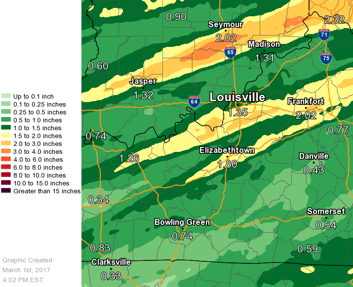 |
| 24 Hour Rainfall Ending 3 PM March 1 |
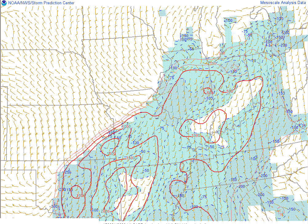
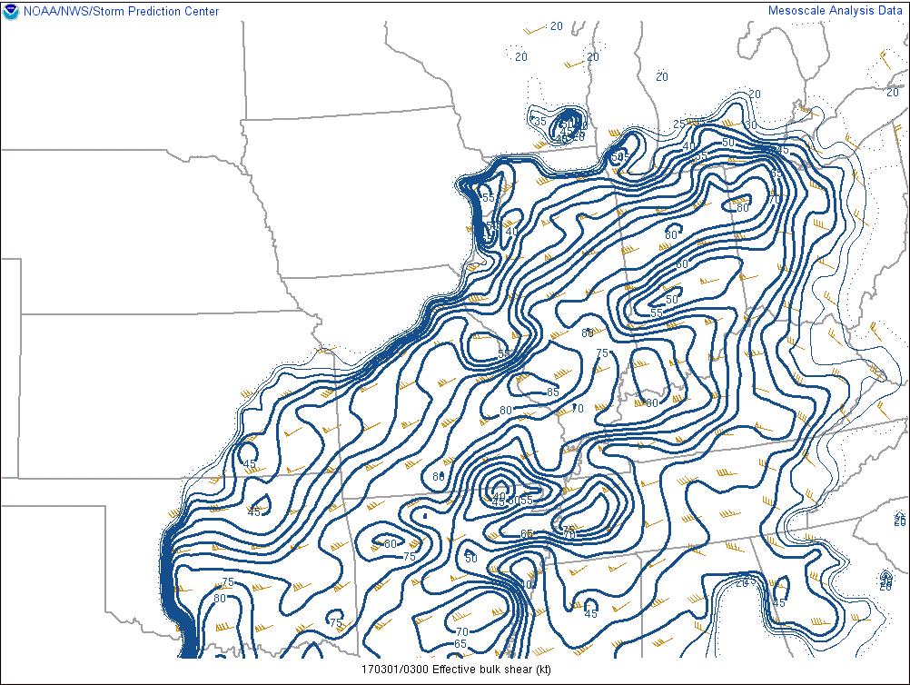
Environment
 |
 |
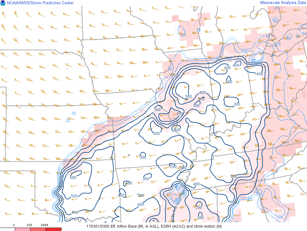 |
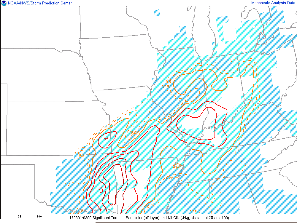
| Figure 1: MLCAPE 11p Feb 28 | Figure 2: Effective Shear 11p Feb 28 | Figure 3: Effective SRH 11p Feb 28 |
 |
 |
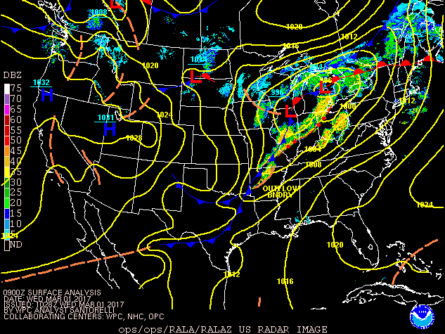 |
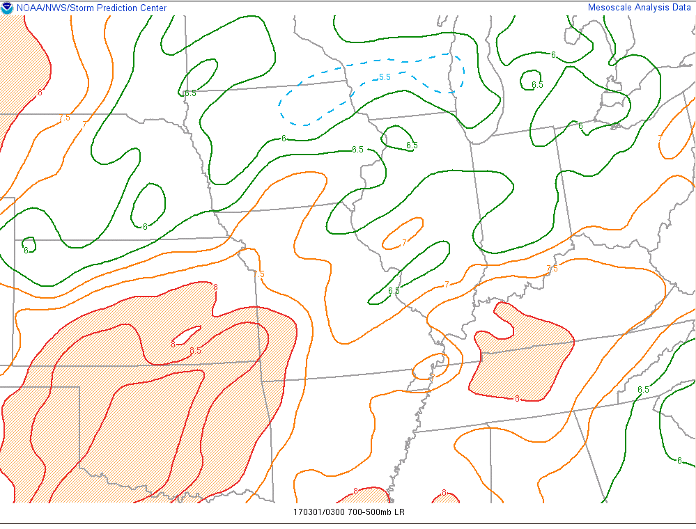
| Figure 4: Mid Level Lapse Rates 11p Feb 28 | Figure 5: Sig Tornado Parameter 11p Feb 28 | Figure 6: Surface map |
 |
Media use of NWS Web News Stories is encouraged! Please acknowledge the NWS as the source of any news information accessed from this site. |
|


 Weather Story
 Weather Map
 Local Radar