...Historic Wind Storm March 3, 2023...
On March 3 a powerful area of extremely strong low pressure traveled from Arkansas to Indiana and brought hurricane force winds to Louisville and Lexington, while Bowling Green saw winds gusting to around 70 mph. The low pressure was so intense that it set new all-time low barometric pressure records at Louisville and Bowling Green (the old record at Louisville was set in 1902)! Record rains also fell, accumulating to 2.79" at Louisville, which was Louisville's 7th wettest day ever seen in the month of March. Rainfall amounts topped three inches in southern Indiana.
After that, things calmed down for a bit before another wet storm system came through the area on the 24th, causing flooding and more record daily rainfall amounts.
March went out like a lion when a major tornado outbreak devastated parts of the Midwest. Southern Indiana and central Kentucky were in between areas of greater storminess to our north and south, but there were still several reports of wind damage here and a small, brief tornado on the far east side of Louisville.
| Average Temperature | Departure from Normal | Precipitation | Departure from Normal | Snow | Departure from Normal | |
| Bowling Green | 50.1° | +0.9° | 5.95" | +1.41" | 0 | -1.4" |
| Frankfort | 46.2° | 0° | 5.24" | +0.52" | ||
| Lexington | 47.9° | +2.0° | 4.47" | -0.01" | 0.2" | -2.6" |
| Louisville Ali | 49.0° | +0.6° | 7.14" | +2.54" | T | -2.1" |
| Louisville Bowman | 46.7° | -0.7° | 6.99" | +2.62" |
Records
1st: High of 81° at Bowling Green, high of 80° at Frankfort, high of 81° at Lexington, high of 83° at Louisville
3rd: Rainfall of 2.79" at Louisville
6th: High of 78° at Louisville
23rd: Warm low of 61° at Bowling Green
24th: Warm low of 59° at Bowling Green, rainfall of 1.98" at Bowling Green, rainfall of 2.17" at Louisville
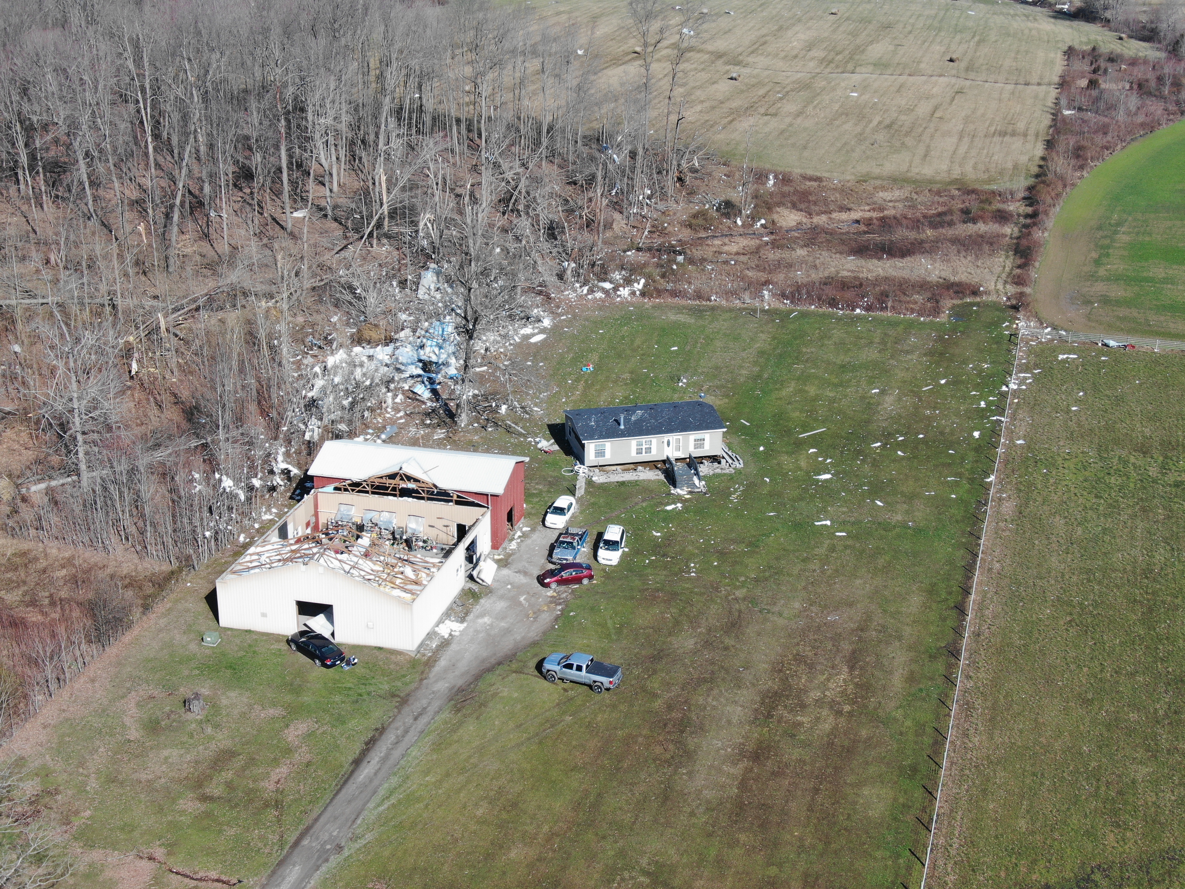
Tornado damage associated with a small tornado west of Hanover, Indiana on March 3. NWS


 Weather Story
 Weather Map
 Local Radar