
Strong to potentially severe thunderstorms with damaging wind gusts are forecast Thursday from parts of New England into the Mid Atlantic and Carolinas. Significant heat will expand across the West and Central Plains through Friday, potentially breaking daily high temperature records. Dangerous heat will then build into the Eastern U.S. this weekend through much of next week. Read More >
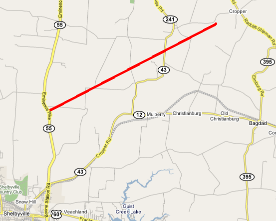
The EF2 tornado touched down near KY 55 and Clear Creek Road and headed to the northeast. In increased in strength as it crossed KY 1899 (Mulberry Pike). It continued to grow stronger and attained EF2 status as it crossed Cropper Road and Flood Road. The tornado continued for another mile to the northeast before dissipating near Dutch Fork.
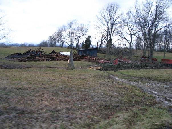
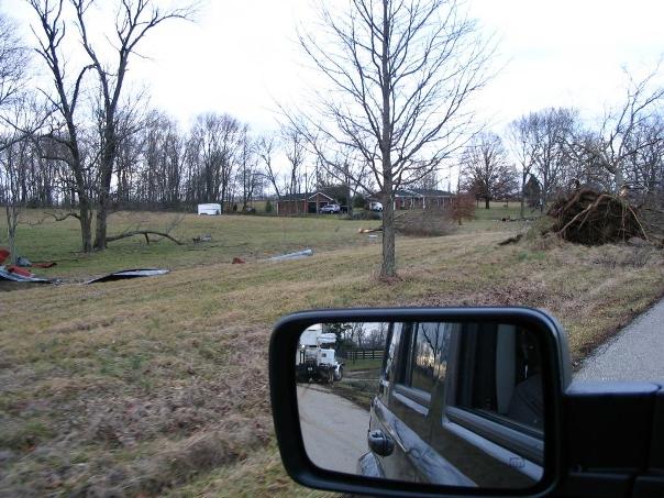
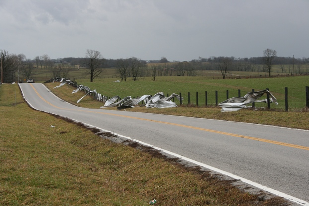
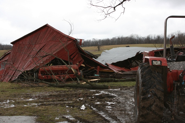
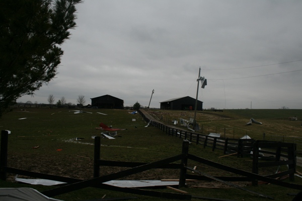
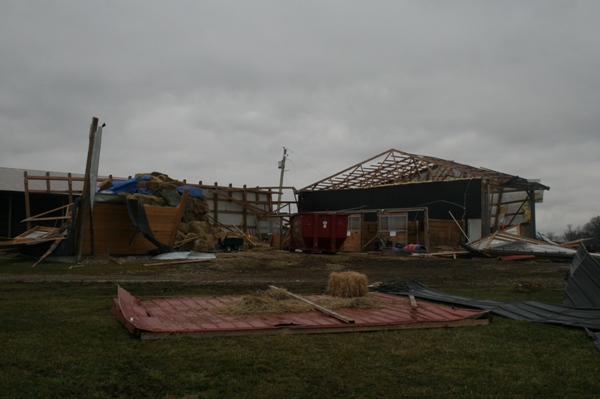
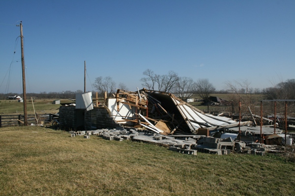
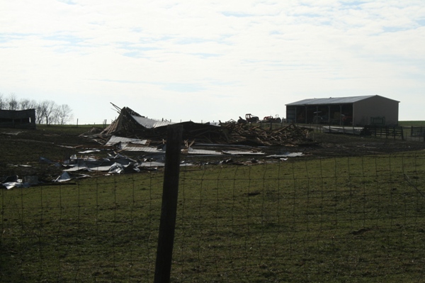
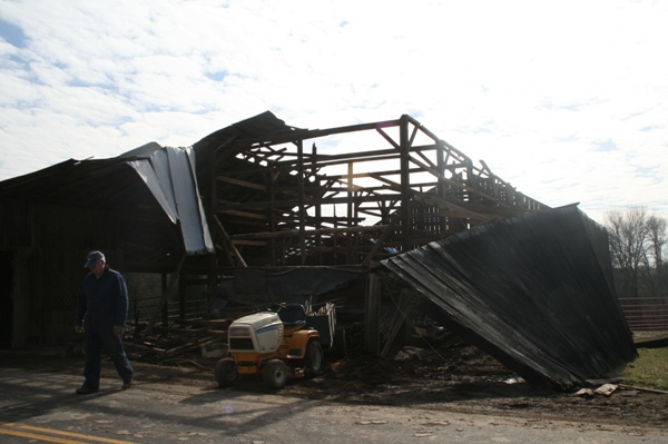
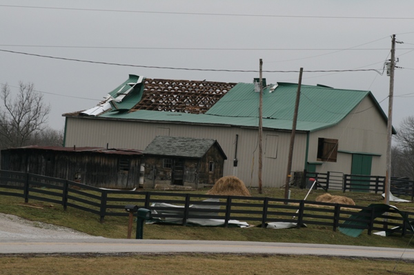
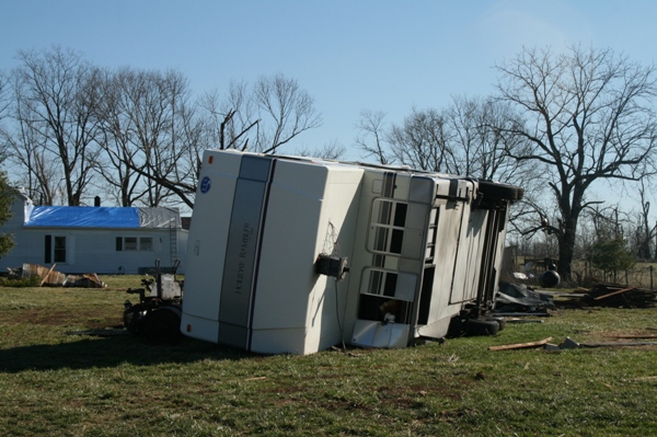
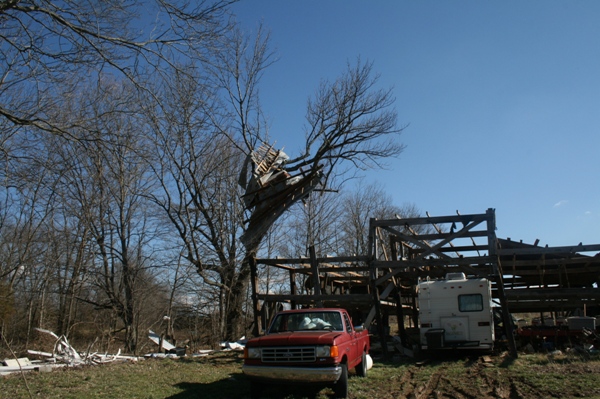
On Flood Road about 40 large hardwood trees were uprooted. A 30 by 60 by 14 barn with 10 by 10 oak supports sunk in concrete was destroyed and thrown 50 yards. A Holiday Rambler Imperial trailer weighing 18,000 pounds was moved four feet and flipped over. A second barn was also destroyed, and a nearby house had every single shingle stripped from its roof.
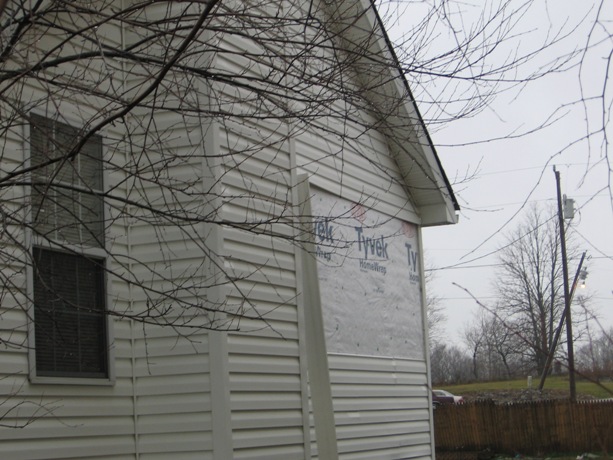
On Christianburg Road trees were uprooted and several homes sustained roof damage.
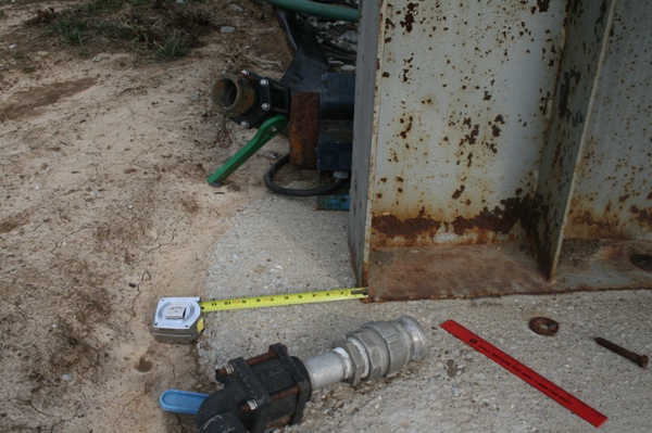
On Cropper Road numerous trees were twisted and snapped and a very large liquid nitrogen tank weighing over 200,000 pounds was shoved about a foot to the east.
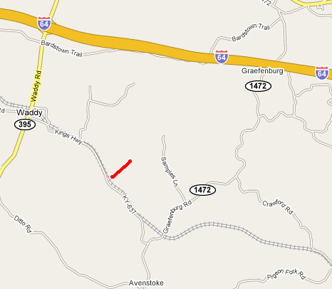
The EF0 tornado touched down about two miles southeast of Waddy near KY 637 (Kings Highway) between KY 395 and KY 1472. A large barn was destroyed with sheet metal thrown 300 yards. A few trees were snapped or uprooted.
(Click on the image for a larger version):
 |
 |
 |
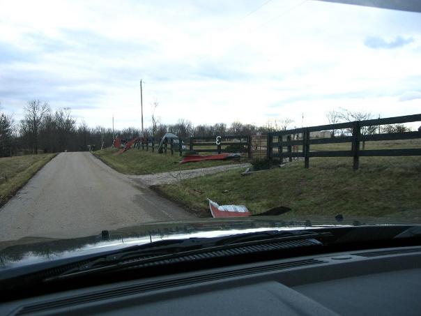
The following photos were sent to us by SFC Karlen Morris and were taken along Flood and Christianburg roads:
 |
 |
 |
 |
These next photos were given to us by Shelby County Deputy Director Emergency Manager Paul Whitman:
 |
 |
 |
 |
 |
 ; ; |
 |
 |
 |
 |
 |
 |
 |
 |
 |
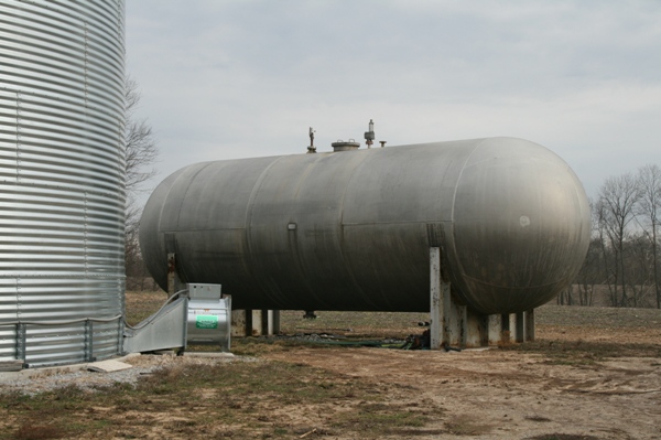 This 200,000 pound liquid nitrogen tank on Cropper Road... |
 ...was shoved over 12 inches by the tornado |
Click here for radar imagery of this event.
Page Updated: 03/16/2008


 Weather Story
 Weather Map
 Local Radar