Louisville, KY
Weather Forecast Office
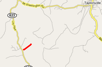
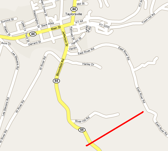
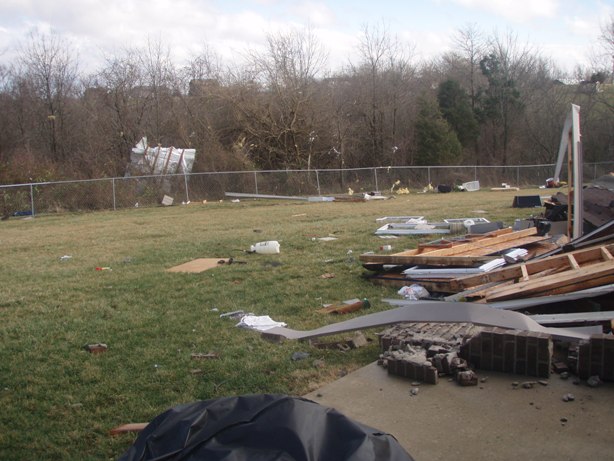
The first tornado touched down five miles southwest of Taylorsville on Lily Pike, and the second tornado touched down one mile south of Taylorsville along KY 55.
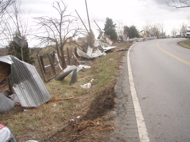
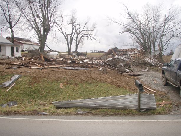
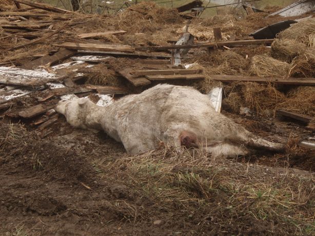
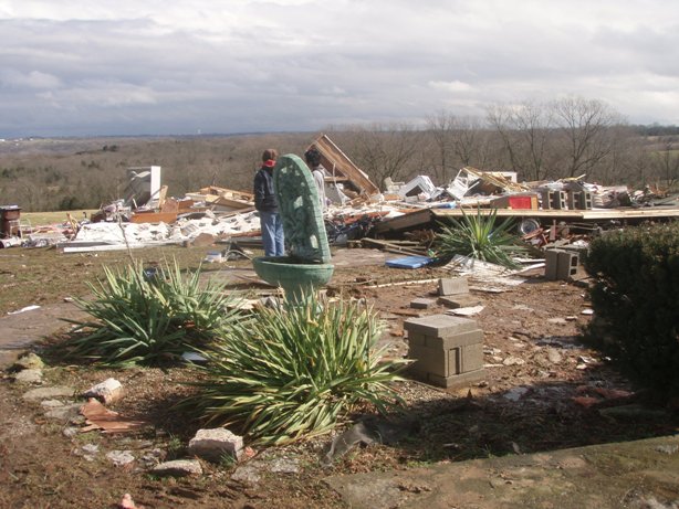
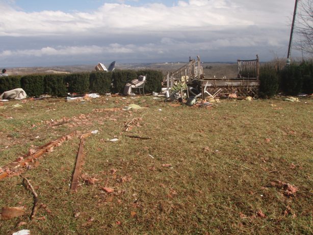
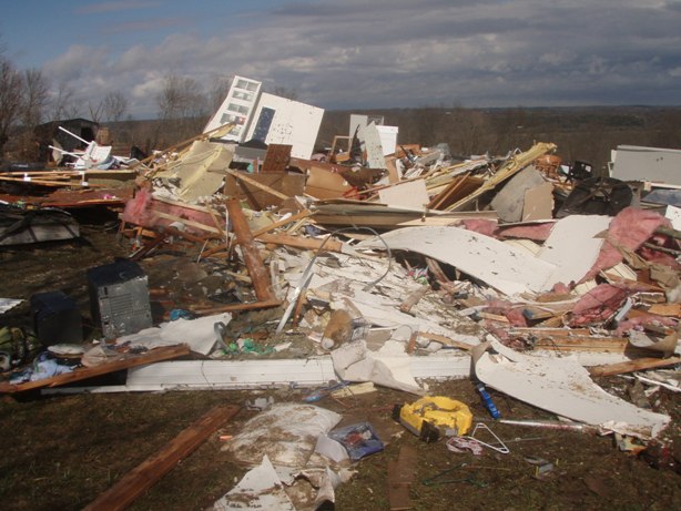
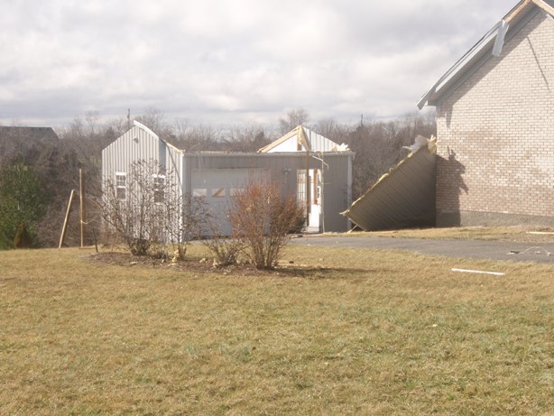
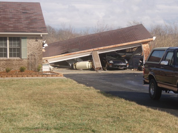
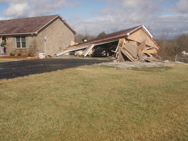
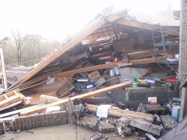
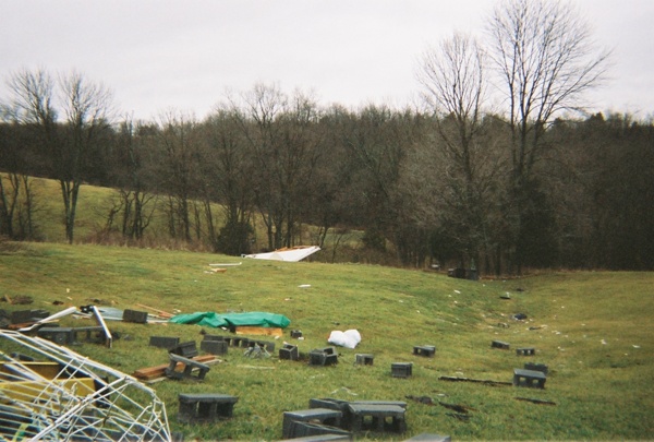
The first tornado destroyed two mobile homes and caused extensive roof and tree damage along its path to the northeast. The second tornado caused major structural damage to several barns and homes, completely leveling two barns.
The two tornado touchdowns were embedded in a fast moving squall line that raced eastward across the region at 50 mph. Extensive straight-line wind damage occurred around and to the northeast of Taylorsville off KY 44.
(Click on the image for a larger version):
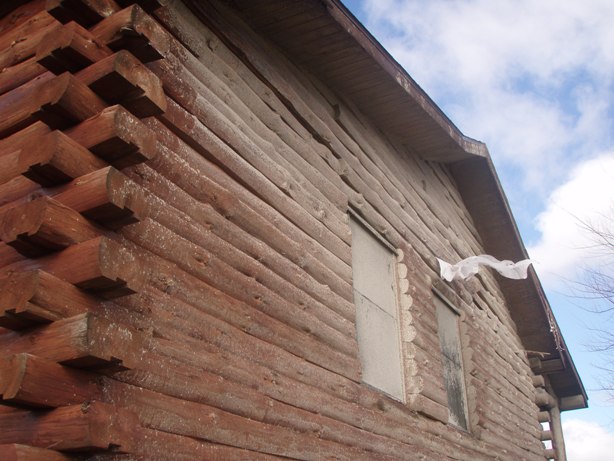
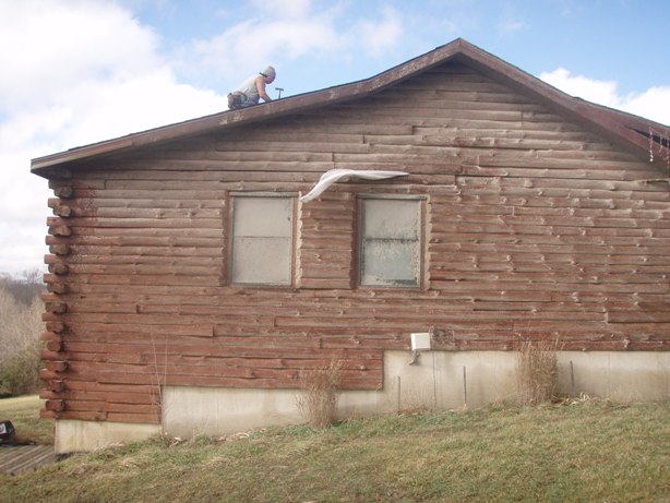
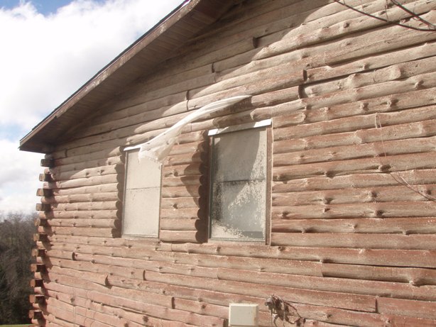
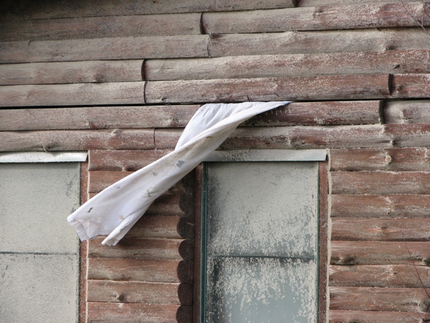
Note the home with the curtains coming out of the wall, waving in the wind. The tornado lifted the roof of the home just enough to pull the curtains out, and then dropped the roof back on to the home, trapping the curtains in the wall. Those curtains are actually still on the rod in the inside of the house.
 |
 |
 |
 |
 |
 |
 |
 |
 |
 |
 |
 |
 |
 |
 |
 |
 |
 |
 |
 |
 |
 |
 |
 |
 |
 |
 |
 |
 |
 |
The following photographs were sent to us by Jo-Ann Brown:
 |
 |
 |
Click here for radar imagery of this event
Page Updated: 03/23/2008 5 AM EST
Current Hazards
Hazardous Weather Outlook
Storm Prediction Center
Submit a Storm Report
Advisory/Warning Criteria
Radar
Fort Knox
Evansville
Fort Campbell
Nashville
Jackson
Wilmington
Latest Forecasts
El Nino and La Nina
Climate Prediction
Central U.S. Weather Stories
1-Stop Winter Forecast
Aviation
Spot Request
Air Quality
Fire Weather
Recreation Forecasts
1-Stop Drought
Event Ready
1-Stop Severe Forecast
Past Weather
Climate Graphs
1-Stop Climate
CoCoRaHS
Local Climate Pages
Tornado History
Past Derby/Oaks/Thunder Weather
Football Weather
Local Information
About the NWS
Forecast Discussion
Items of Interest
Spotter Training
Regional Weather Map
Decision Support Page
Text Products
Science and Technology
Outreach
LMK Warning Area
About Our Office
Station History
Hazardous Weather Outlook
Local Climate Page
Tornado Machine Plans
Weather Enterprise Resources
US Dept of Commerce
National Oceanic and Atmospheric Administration
National Weather Service
Louisville, KY
6201 Theiler Lane
Louisville, KY 40229-1476
502-969-8842
Comments? Questions? Please Contact Us.


 Weather Story
 Weather Map
 Local Radar