
Flash flooding threatens areas from the Tennessee Valley to the Carolinas as storms repeat along a stalled front. Monsoonal storms may trigger flooding in the Southwest. Dangerous heat expands across the Desert Southwest, Plains, mid-Mississippi Valley and Southern Tier. Critical fire weather for interior Pacific Northwest. Cooler, drier air brings brief relief to the Great Lakes and Northeast. Read More >
Lubbock, TX
Weather Forecast Office
Lubbock NWS NOAA Weather Radio SAME/Toning County Map
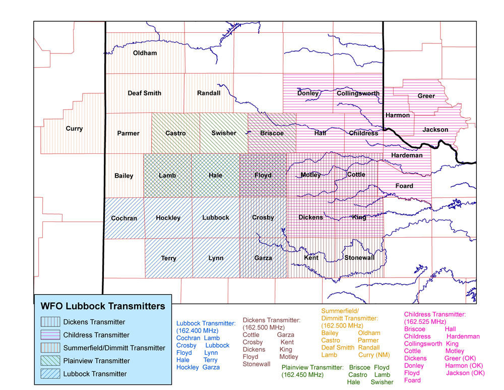
*NOTE: The different patterns/colors represent the various transmitters that are operated out of the Lubbock National Weather Service Forecast Office. The hatched areas represent the counties that each transmitter SAME and tone for. However, the reception of the transmitter signal depends on many factors, and thus, can vary greatly. Thus, just because a particular county falls under a given transmitter, that does not guarantee that a signal will be received. The county names and associated SAME codes that the Lubbock NWS SAME/alert for are also printed on the map in black print. (Click on the map for a larger view)

US Dept of Commerce
National Oceanic and Atmospheric Administration
National Weather Service
Lubbock, TX
2579 S. Loop 289
Suite 100
Lubbock, TX 79423-1400
806-745-4260
Comments? Questions? Please Contact Us.


 Follow us on X
 Follow us on Facebook
 Follow us on YouTube
 LUB RSS Feed


