
Numerous severe thunderstorms are expected across a broad region from the Ohio Valley to the Mid-Atlantic and Northeast States today into tonight. Swaths of damaging wind gusts are expected and some tornadoes are possible. Bertha is expected to bring tropical storm conditions to portions of the Gulf Coast from the Florida Panhandle westward to southeastern Louisiana later today and Wednesday. Read More >
|
9 MAY 2006 SEVERE THUNDERSTORMS and TORNADO EVENT
|
 |
|
SUMMARY AND DAMAGE IMAGES |
|
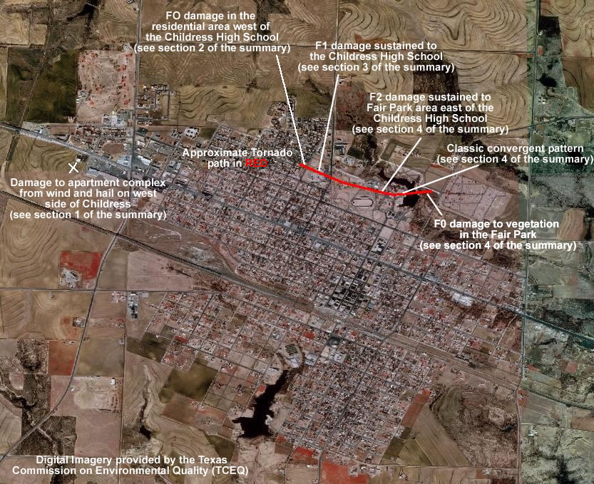
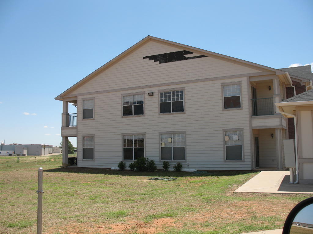
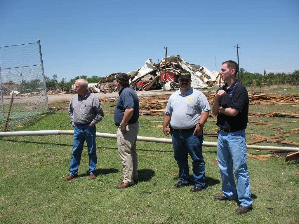
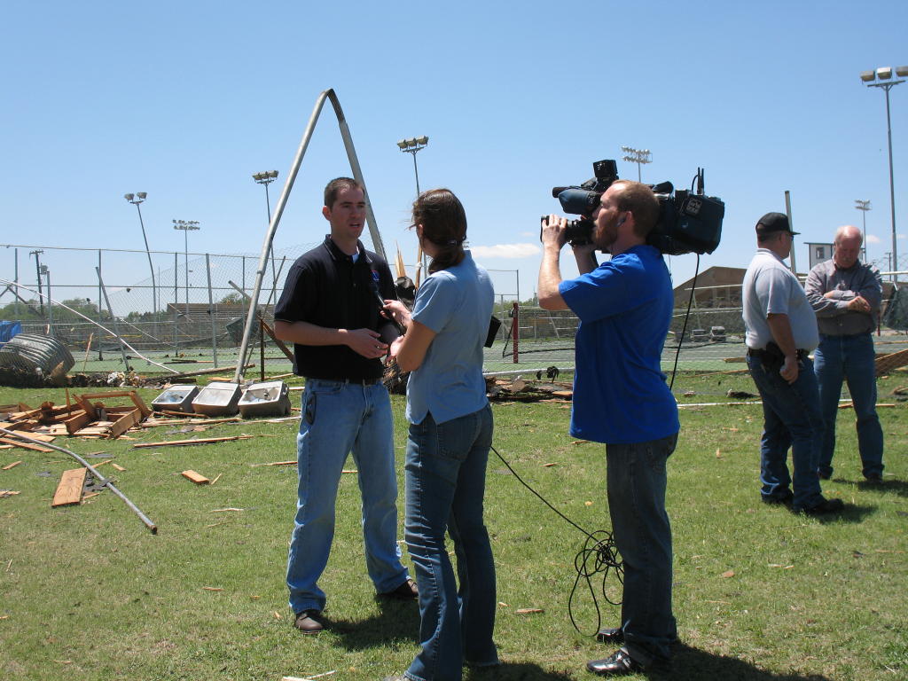
...NWS CONDUCTS DAMAGE SURVEY FOLLOWING MAY 9 2006 SEVERE WEATHER IMPACTS... On Tuesday May 9 2006, thunderstorms developed along and just to the east of the Caprock escarpment and quickly became severe with damaging hail and high winds. In addition, a tornado impacted the city of Childress with extensive damage to trees and significant damage to area structures. To view a listing of the preliminary storm reports for May 9 2006, CLICK HERE. Out of the twenty-four counties serviced by NWS Lubbock, four were impacted by severe thunderstorm activity and included the following... Dickens, Motley, Hall and Childress. On Wednesday May 10 2006, the National Weather Service in Lubbock dispatched an assessment team to investigate the damage reported in the city of Childress. The following report is a summary of the teams findings. The assessment team, comprised of Justin Weaver, NWS Lubbock Meteorologist in Charge, and Brian LaMarre, NWS Lubbock Warning Coordination Meteorologist investigated the damage zones across the city of Childress. Damage survey results indicated a mixture of tornado damage and straight-line wind damage associated with an intense thunderstorm downdraft known as the rear flank downdraft or RFD. The RFD can develop on the back-side of severe thunderstorms and, in addition to damaging winds, can play a critical role in the formation of a tornado. The damage in the Childress area was extensive and stretched along a 2 to 2.5 mile path extending along the northwest, north and northeast sections of the city of Childress. 1. The first indications of damage occurred at an apartment complex about one half mile west of the intersection of highway 83 and 287. Hail and wind damage was evident on mainly the west facing side of the apartments where torn siding and window damage was observed. Just to the north of the intersection of highway 83 and 287, a medium voltage power pole was blown over in a west to east direction. A zone of significant damage was observed in a 1 to 1.5 mile swath stretching from about two tenths of a mile west of the Childress High School and dissipating near the Childress cemetery. The following is an image from the damage to the apartment complex (please click on an image to enlarge it). All photographs were taken by the NWS Lubbock Damage Survey Team.
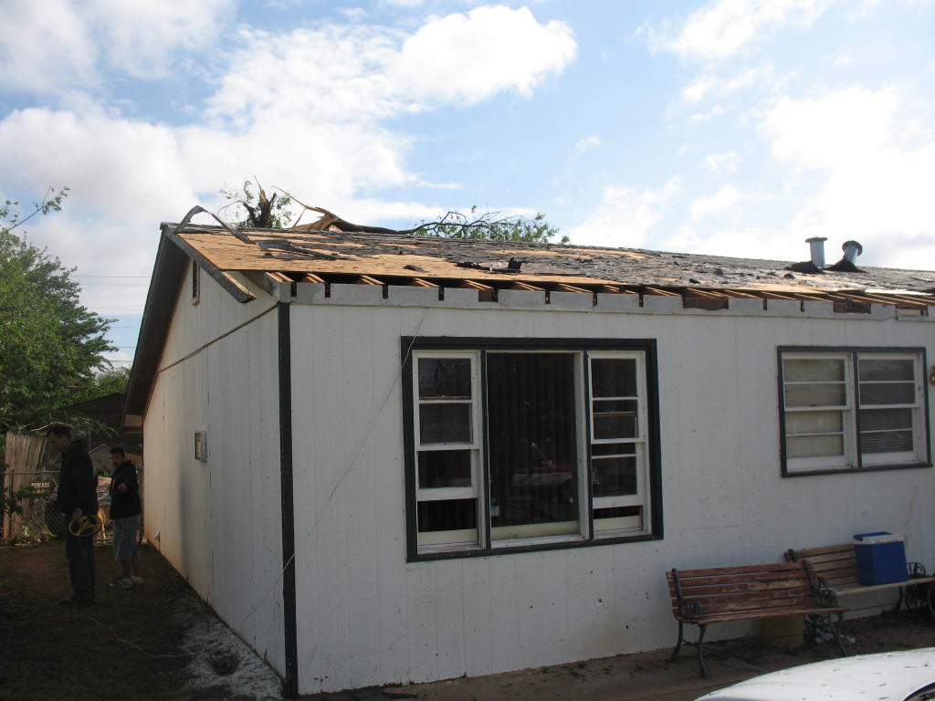
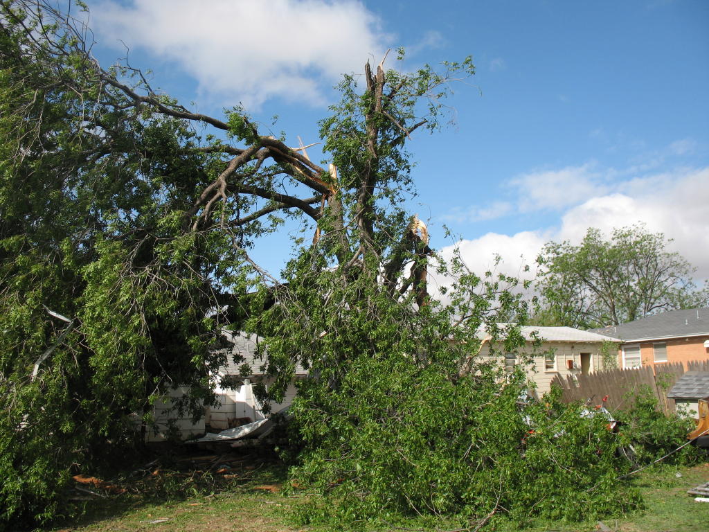
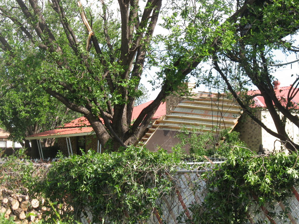
2. A residential area to the west of the Childress High School sustained tree and structural damage associated with severe winds and the formation of a tornado. Large trees were uprooted Tornado rating...F0. Fujita wind speed estimate...40 to 72 mph. The following are some images from the damage to the residential area to the west of the Childress High School (please click on an image to enlarge it). All photographs were taken by the NWS Lubbock Damage Survey Team.
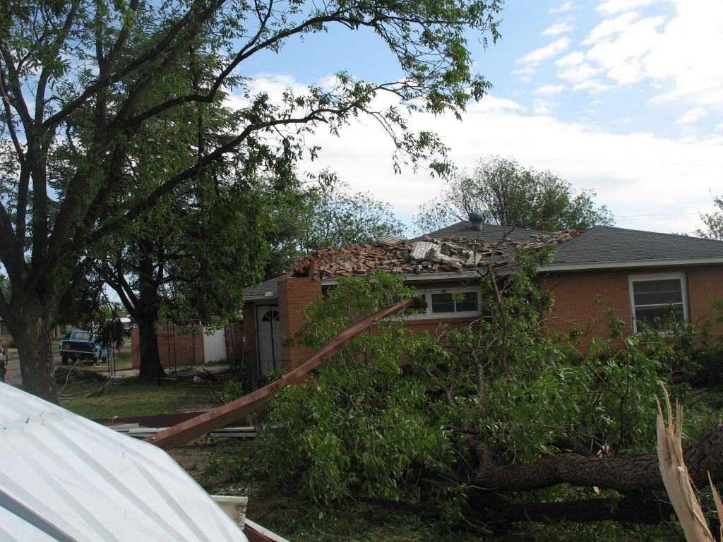
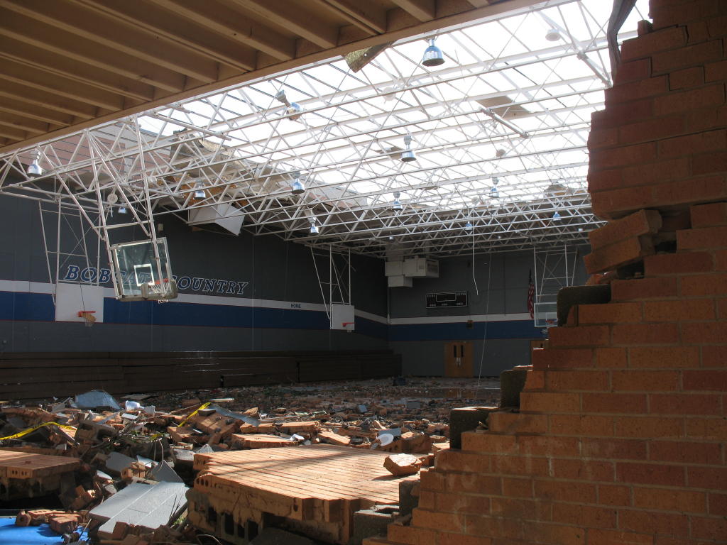
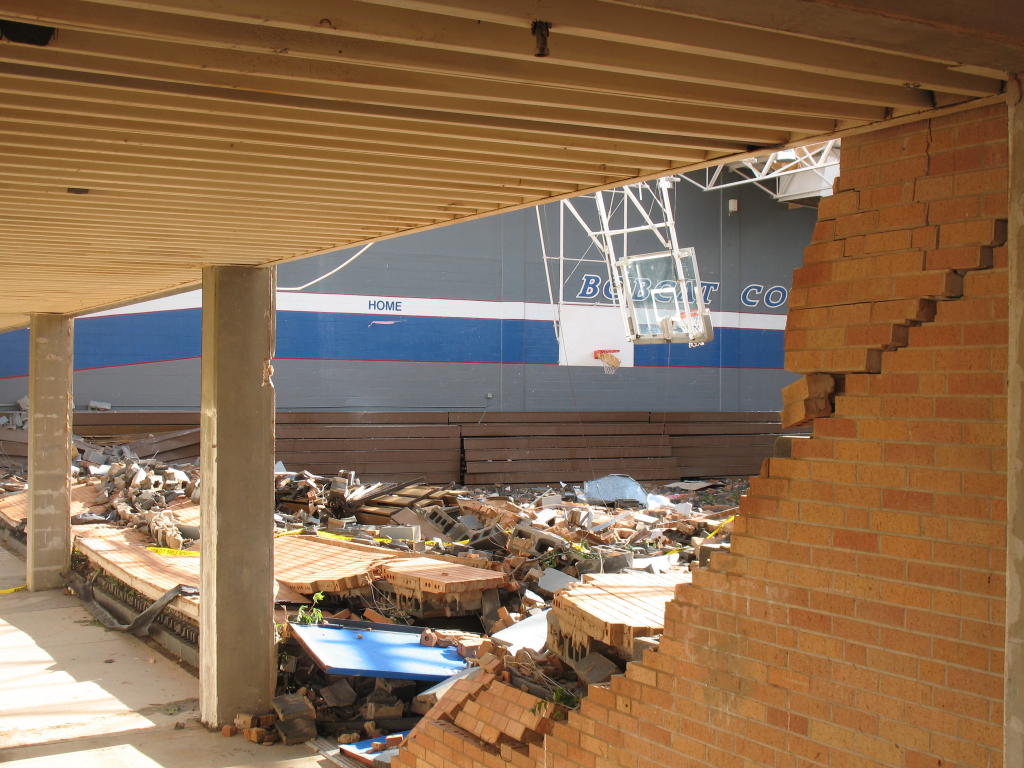
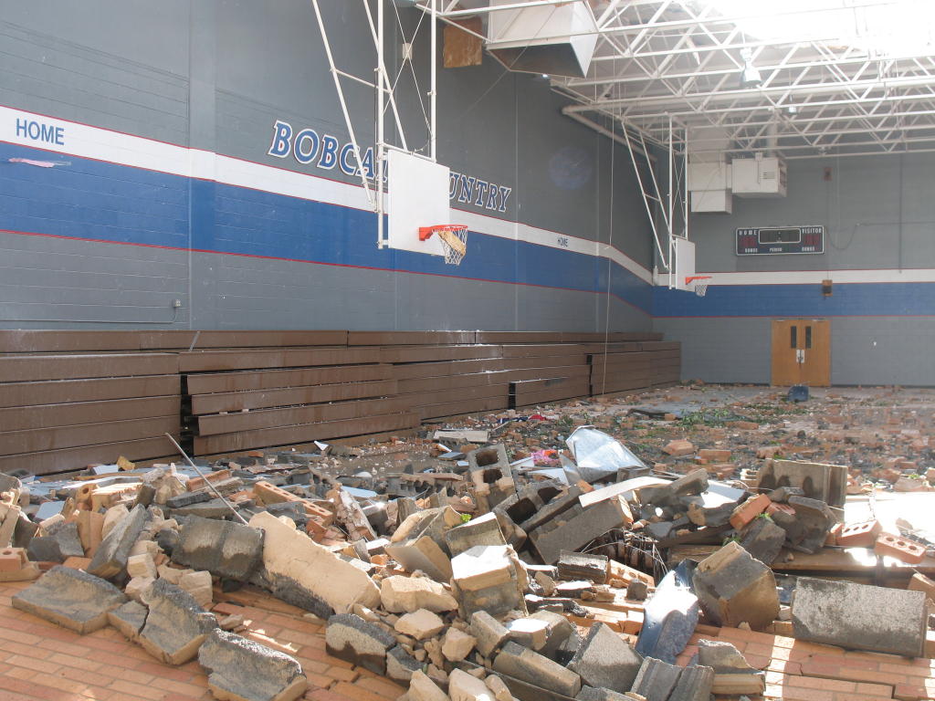
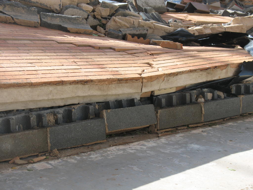
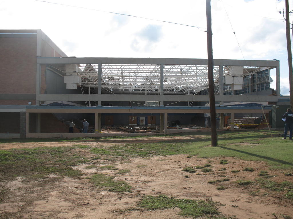
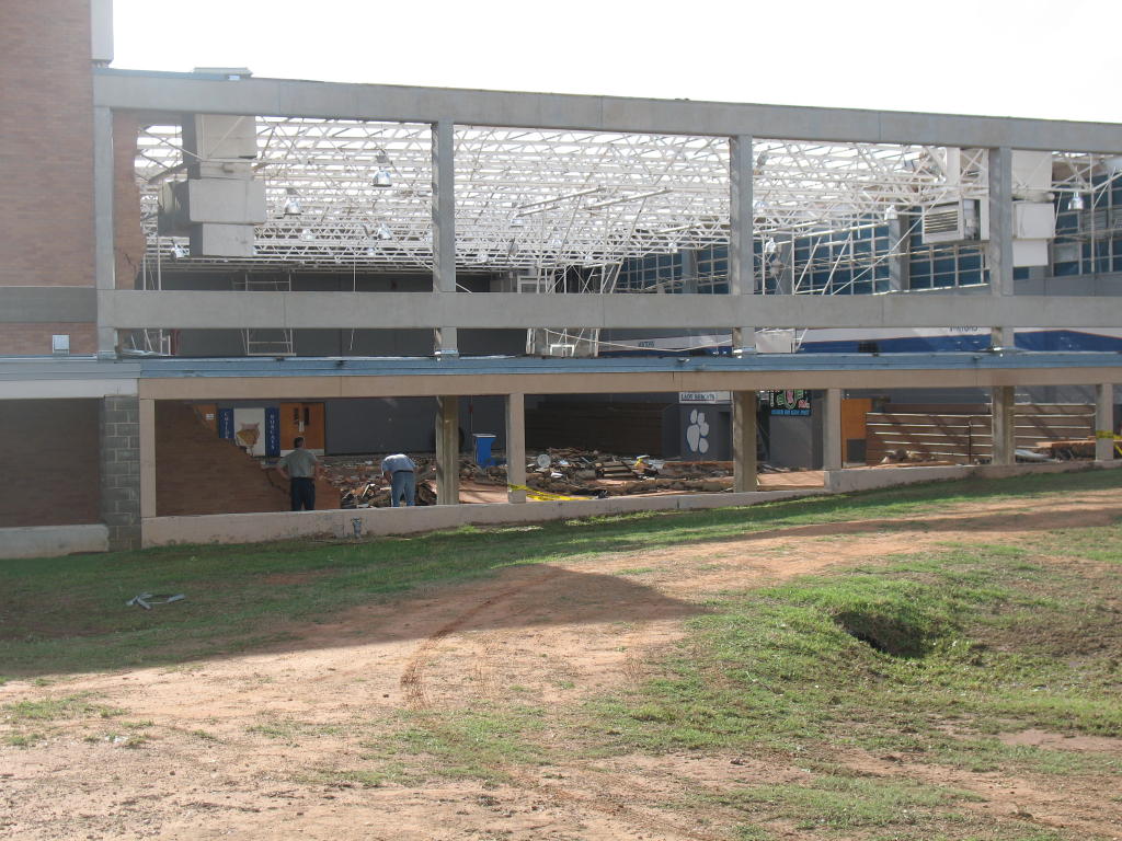
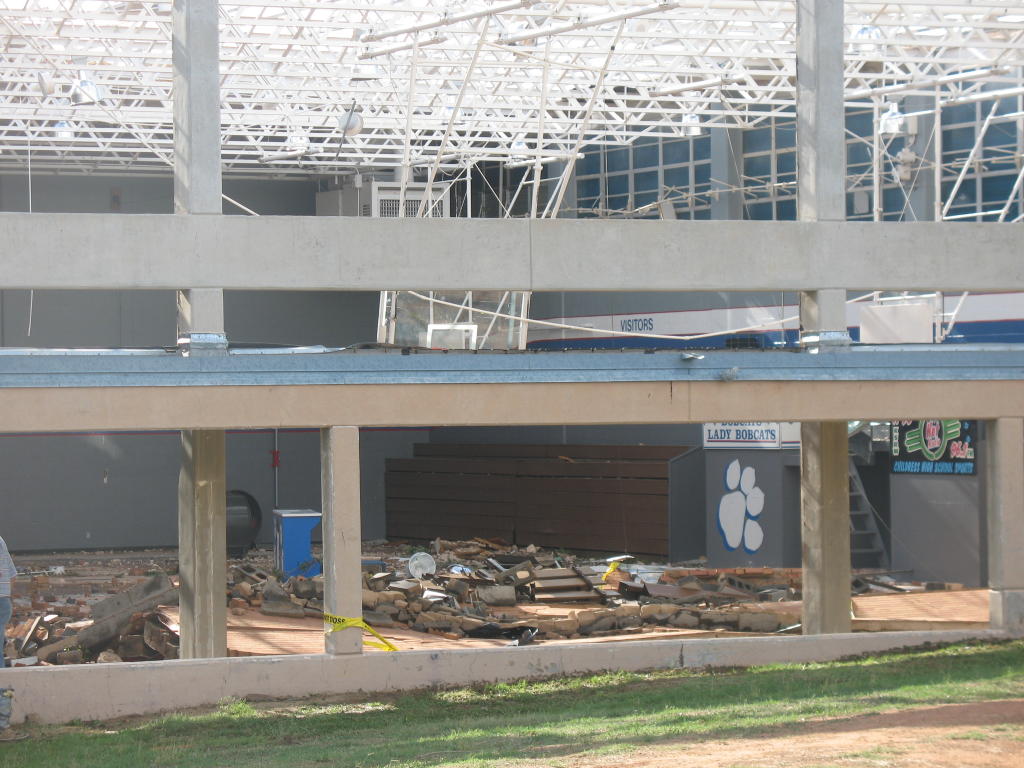
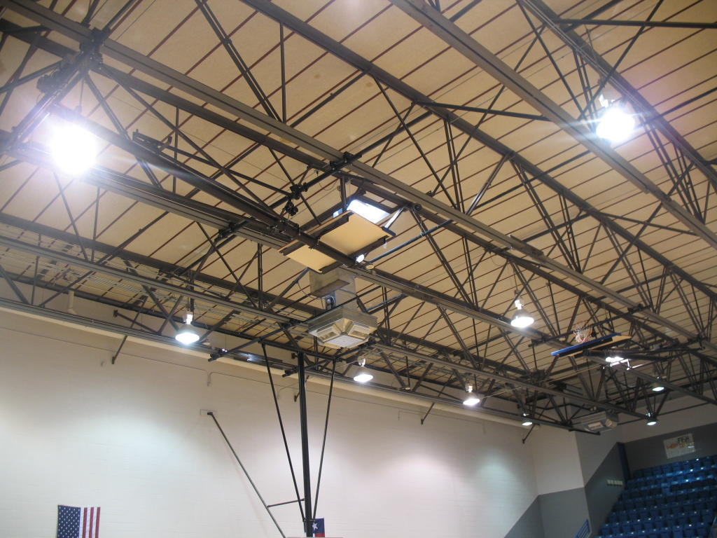
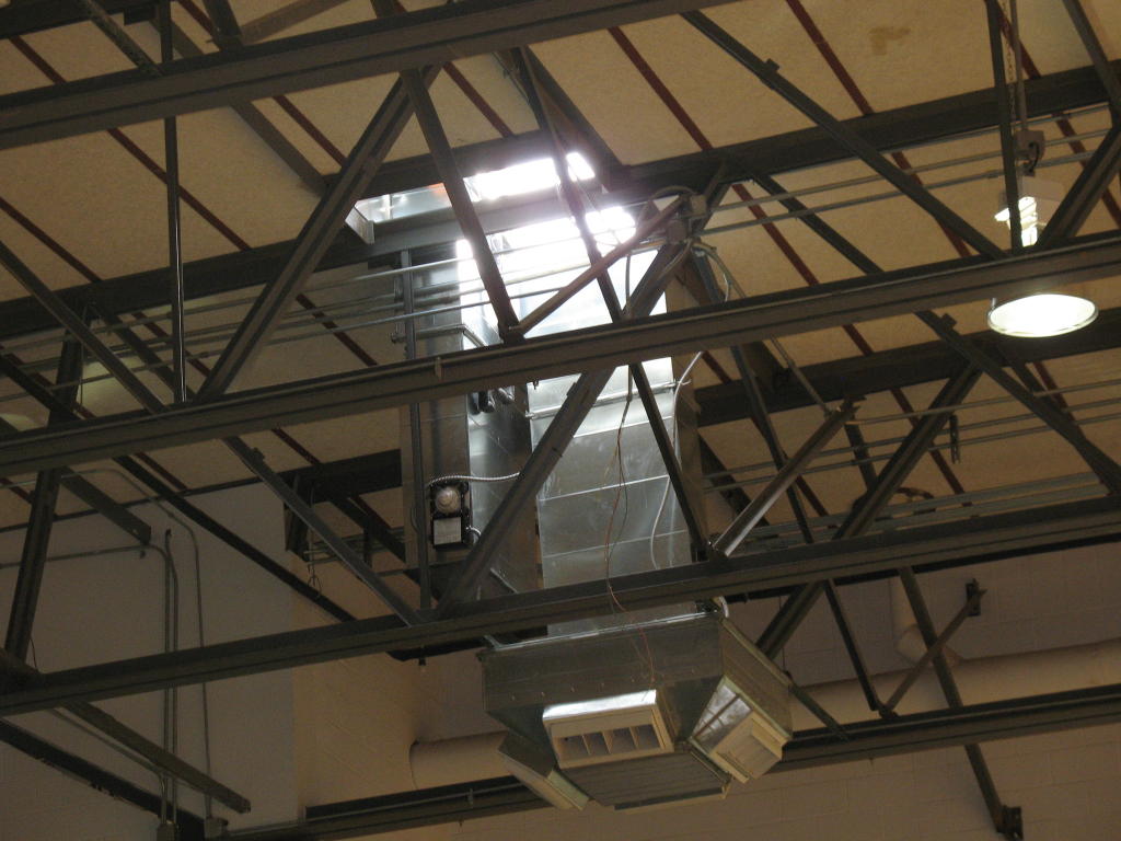
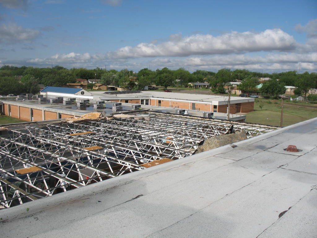
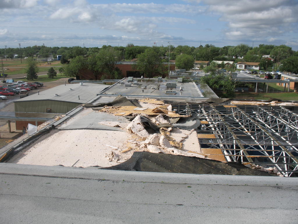
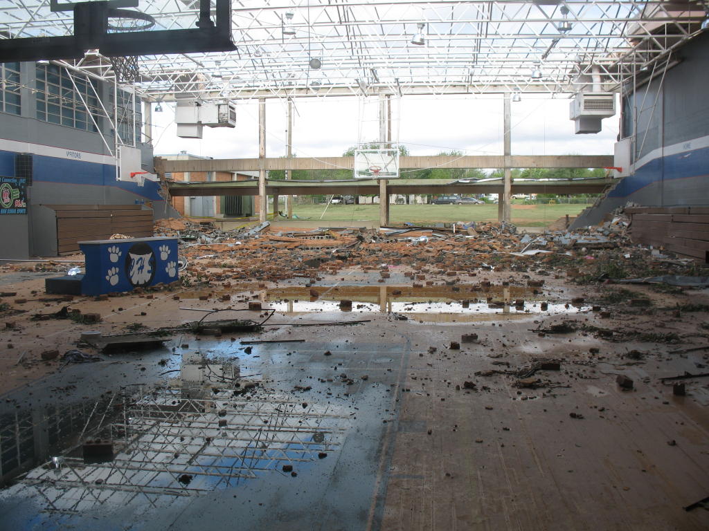
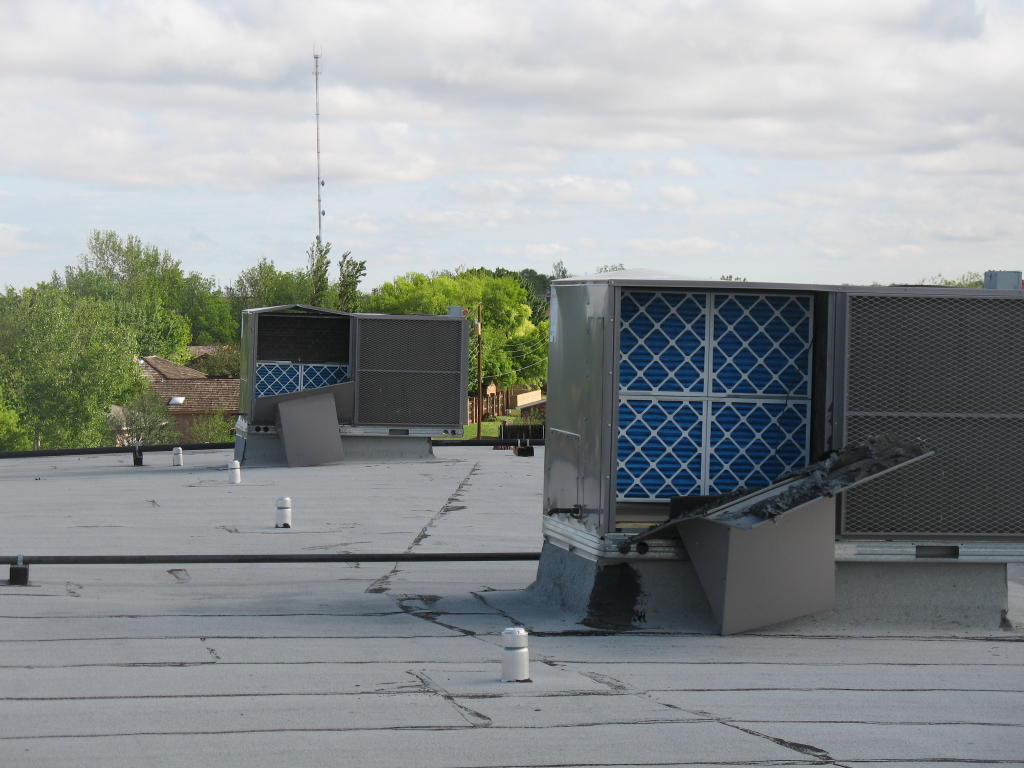
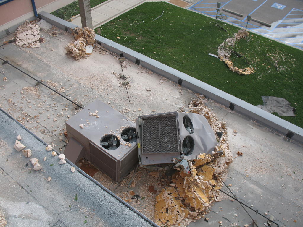
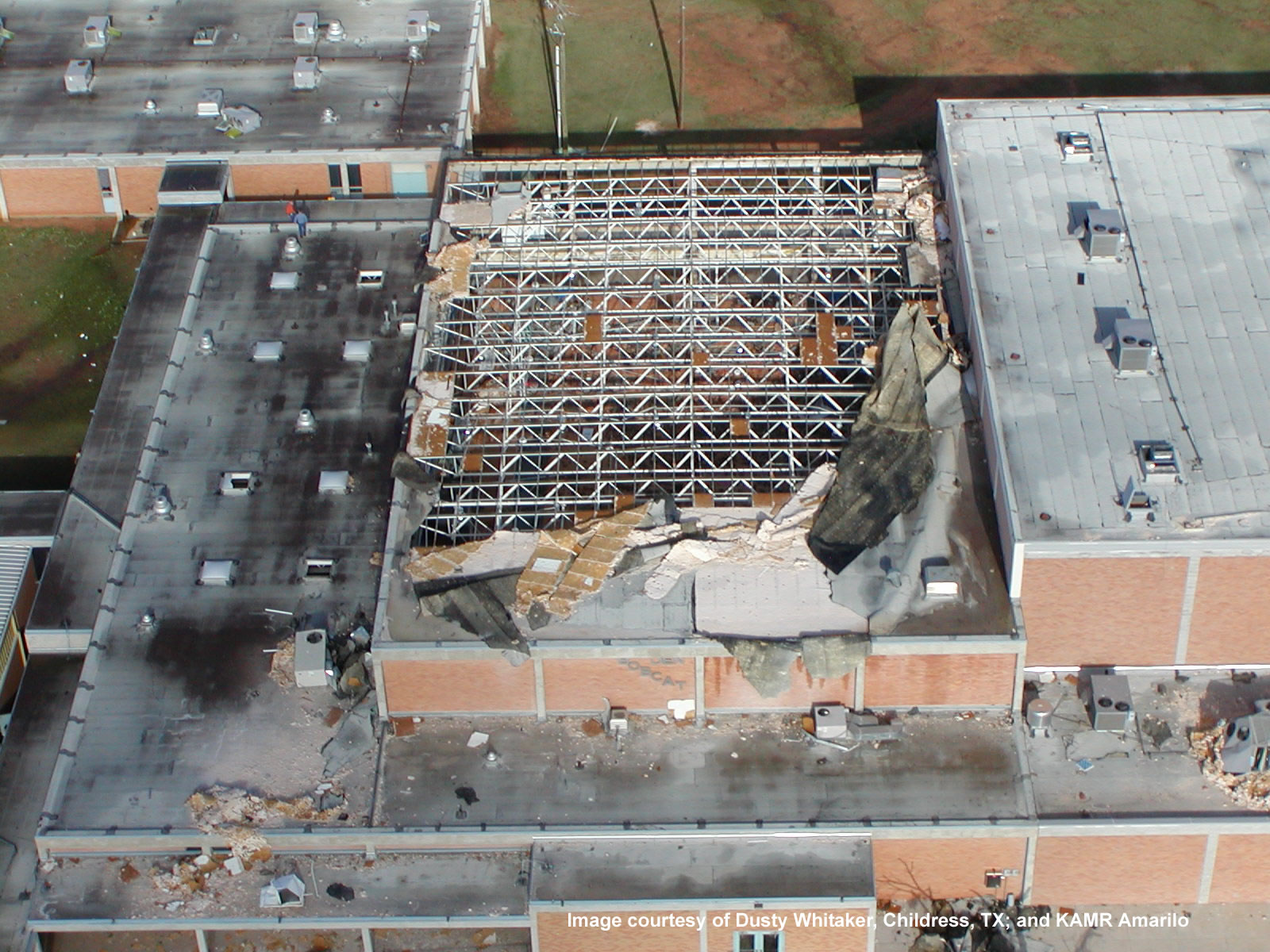
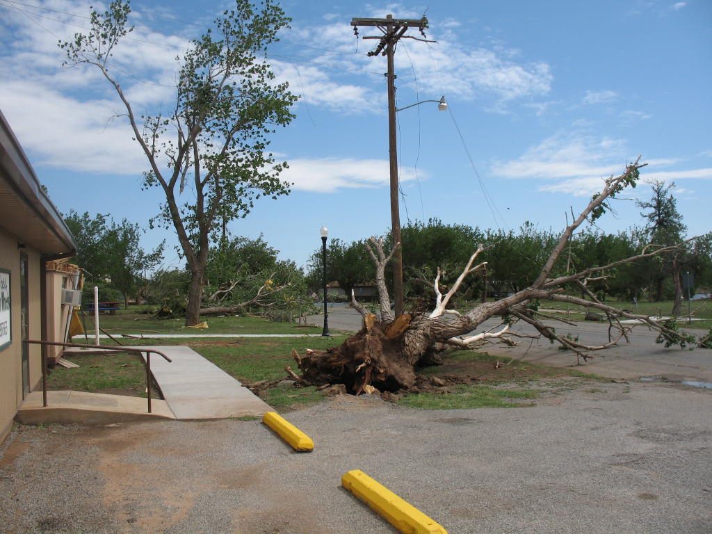
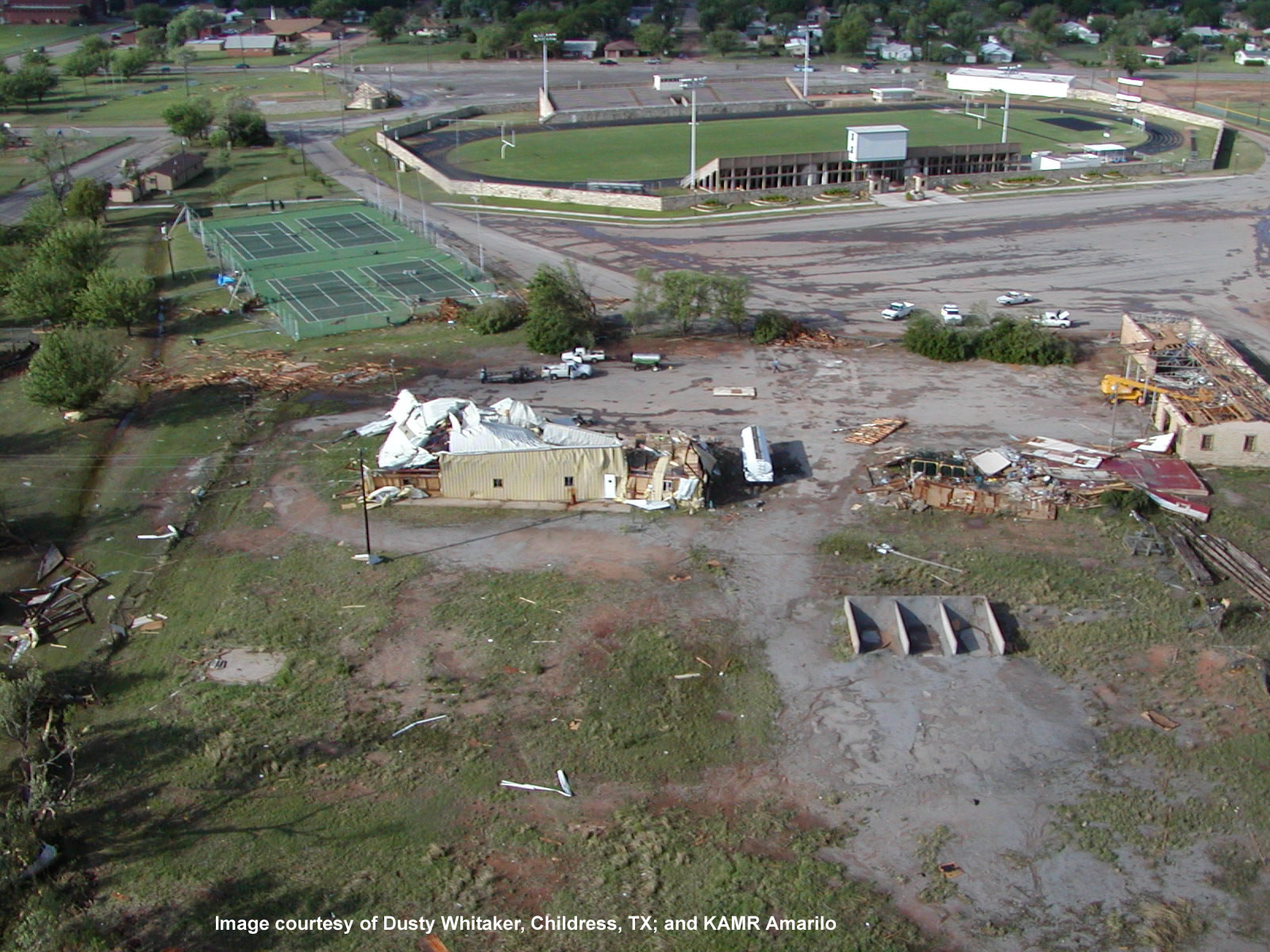
3. The Childress High School sustained significant damage to one of the schools two gymnasiums. The tornado and associated damaging wind and flying debris impacted the school and penetrated the west facing brick wall of the older gym, forcing a 66 foot wide breach. As a Four large air conditioning units were also destroyed. Three of the units were blown off the roof of the school, and two of them were blown from southeast to northwest, landing 90 to 200 feet from the school. The path width of the tornado was measured at one tenth of a mile. Tornado rating...F1. Fujita wind speed estimate...73 to 112 mph. Several large uprooted and/or downed trees were observed in the narrow path of significant damage stretching to the east of the high school, including damage to area roofs. A nursing home facility evacuated patients due to roof and internal damages. There were no injuries. The following are some images from the damage to Childress High School (please click on an image to enlarge it). All photographs were taken by the NWS Lubbock Damage Survey Team.
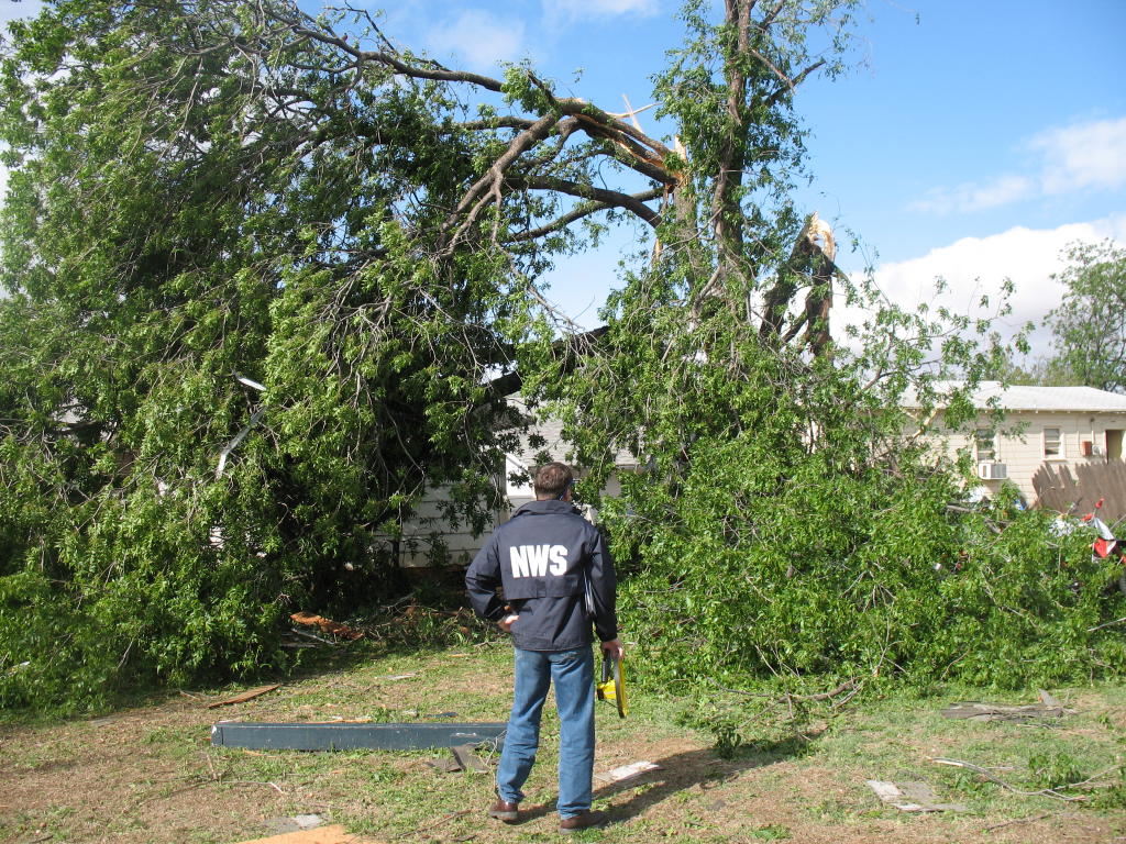
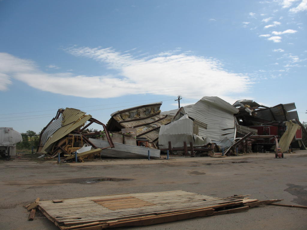
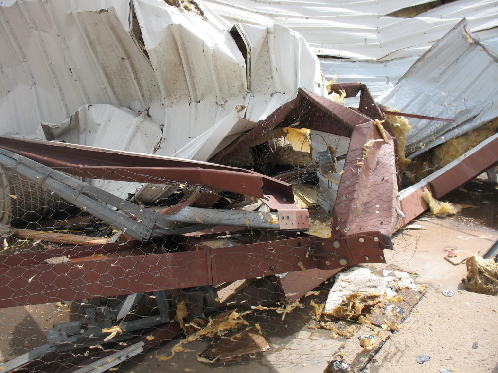
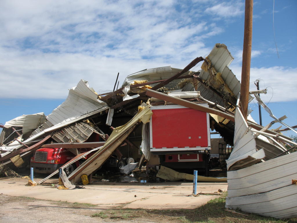
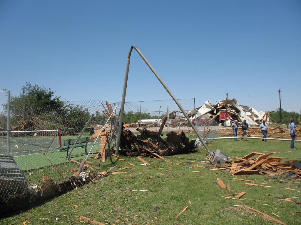
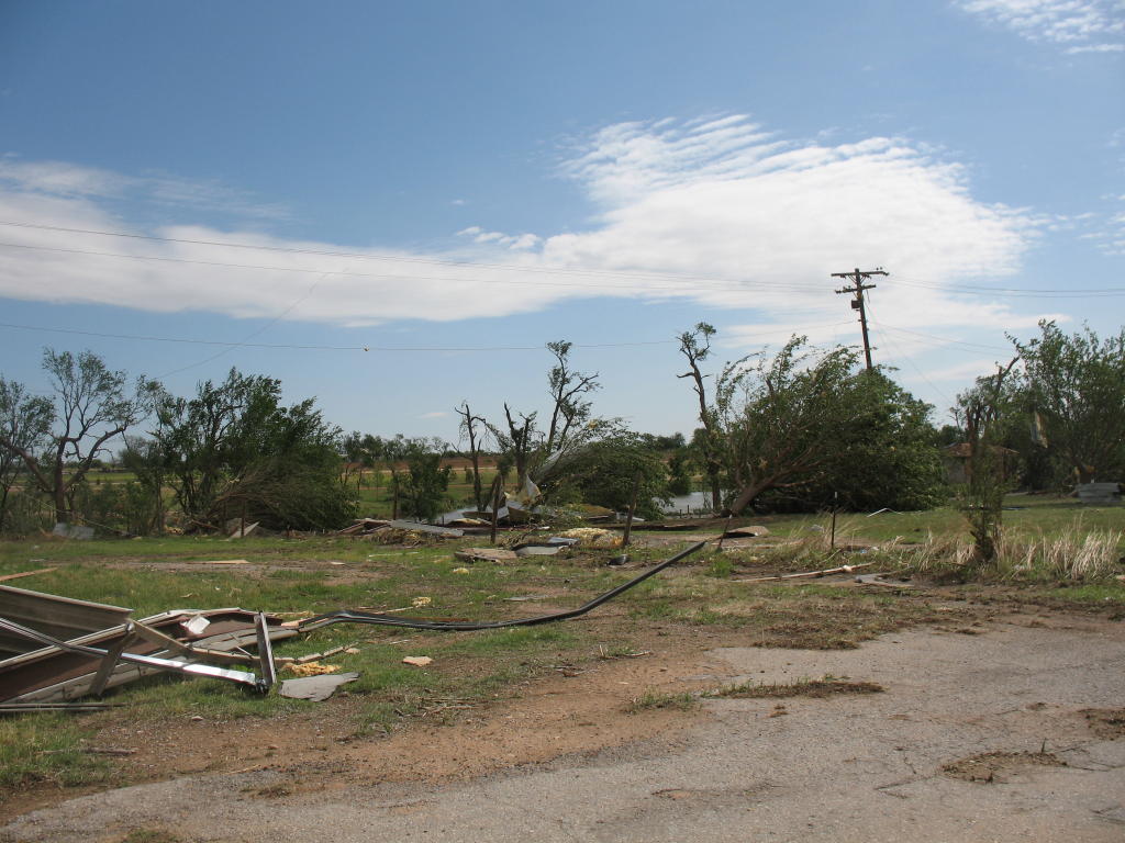
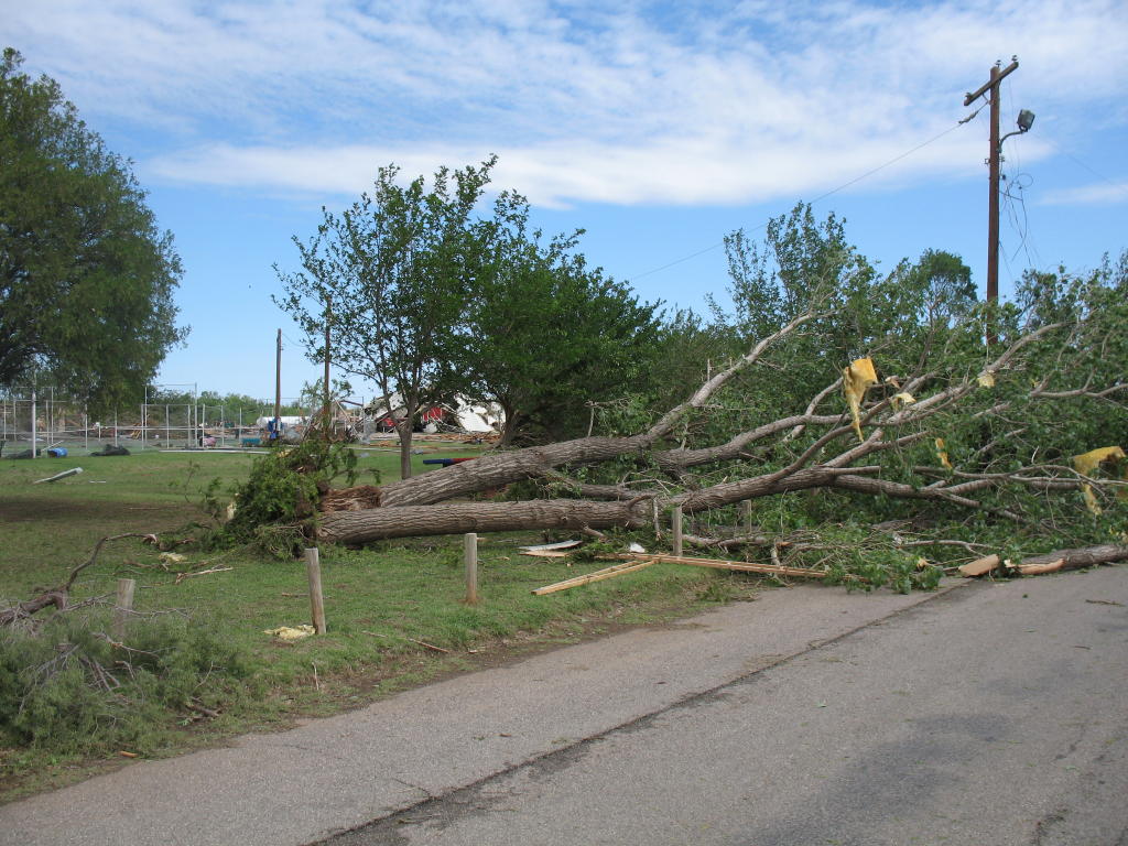
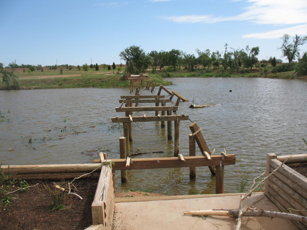
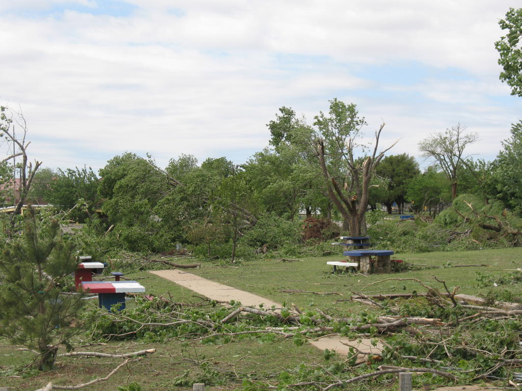
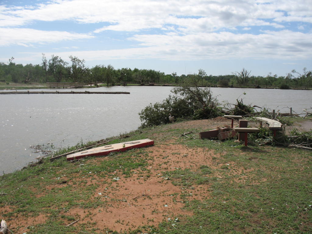
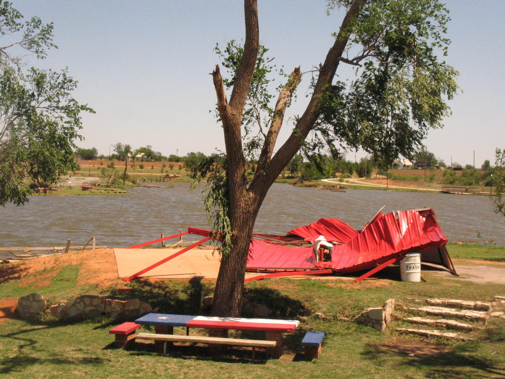
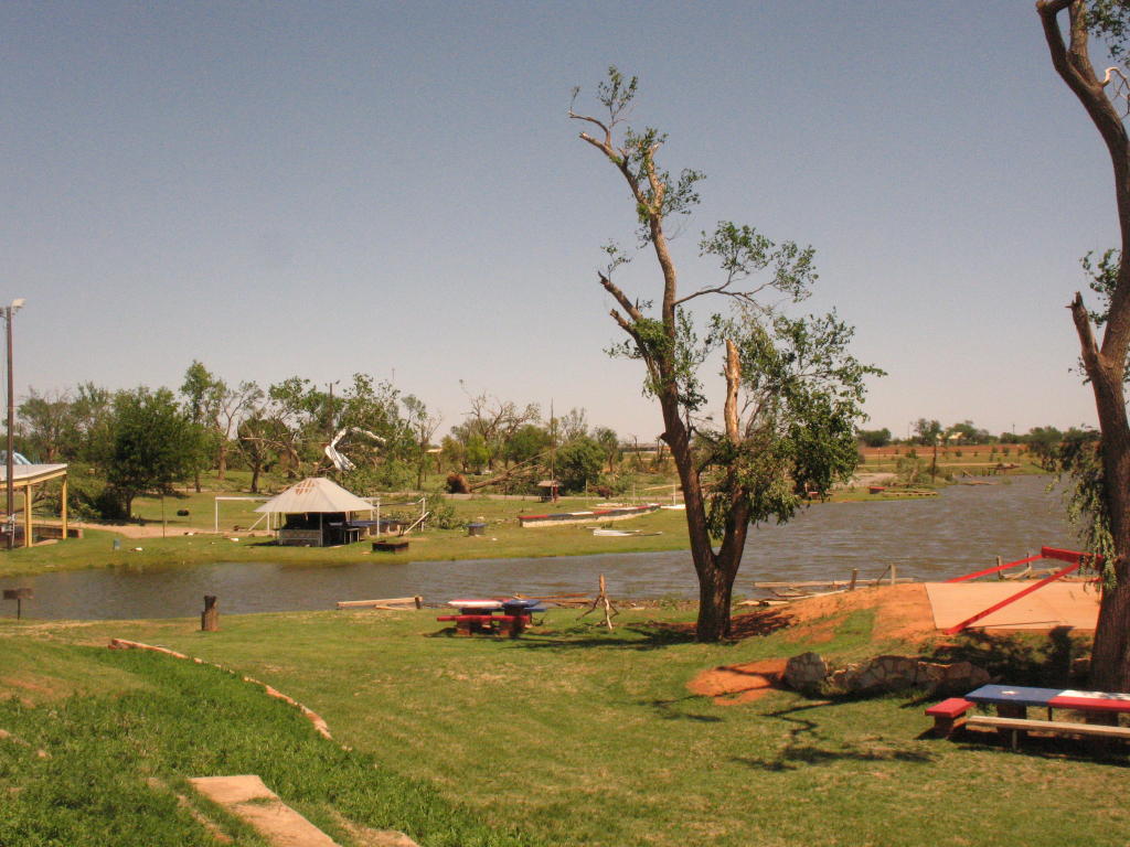
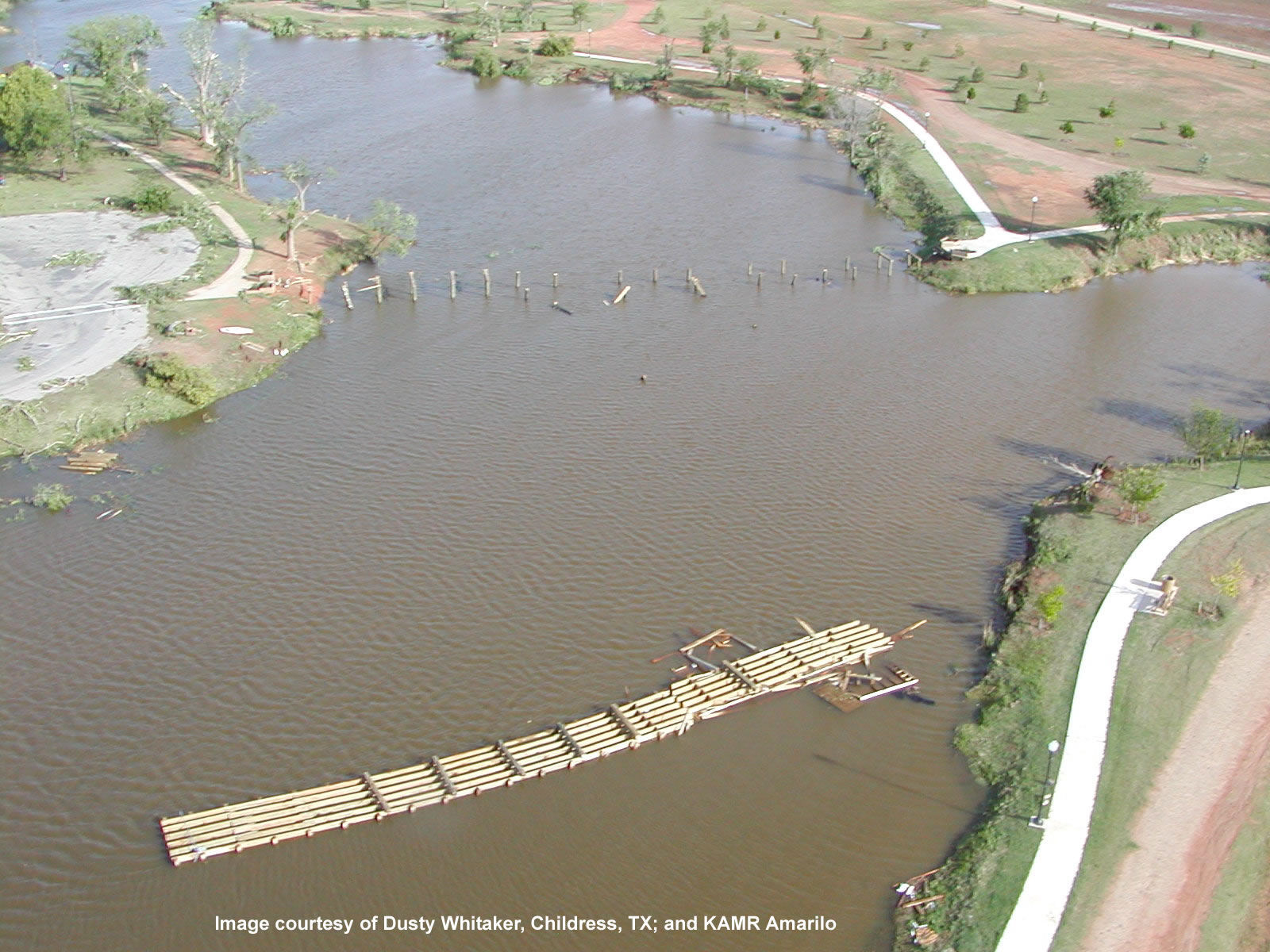
4. The most significant damage associated with the tornado occurred in the Fair Park area, approximately one half mile east of the high school. A tennis court was destroyed with large light poles either blown down at the base or bent at various heights due to severe winds and flying debris. A large metal maintenance structure used to house emergency vehicles was completely Adjacent to this location was an area comprised of numerous large trees uprooted and blown in various directions - representing a classic convergent pattern associated with the tornado at this location. A predominant west to east forward flow was observed, however the orientation of damaged trees also consisted of a southwest to northeast direction, as well as a west to east direction within the tight and narrow tornado circulation. In the immediate area, a bridge extending across Park Lake was ripped from wooden beams and blown to the east. A large stone picnic table top was blown off in a south to north direction. Tornado rating...F2. Fujita wind speed estimate...115 mph. Large tree and weaker structural damage was also noted within one half mile to the south of the high wind and tornado path, including a large tree snapped near the base at the Childress County The following are some images from the damage in and around the Fair Park area (please click on an image to enlarge it). All photographs were taken by the NWS Lubbock Damage Survey Team.
The National Weather Service in Lubbock would like to thank all of the emergency response officials and the Childress County Judge for their help during the NWS Lubbock Damage Survey. In addition, the information provided both during and following the impacts in Childress, as provided by media affiliates in both Amarillo and Lubbock, are greatly appreciated.
|
|||||||||||||||||||||||||||||||||||||||||||||||


