
Dangerous heat will expand from the Gulf Coast into the Southern Plains and Desert Southwest through week's end. Additional extreme heat impacting the Pacific Northwest will shift to the northern Plains by the weekend. Tropical Storm Bertha is expected to continue to impact portions of the northern Gulf Coast from the western Florida Panhandle to southeastern Louisiana through tonight. Read More >
|
Storms Bring Patchy but Welcome Rains Along with Severe Weather 30 - 31 May 2011 |
|
 |
|
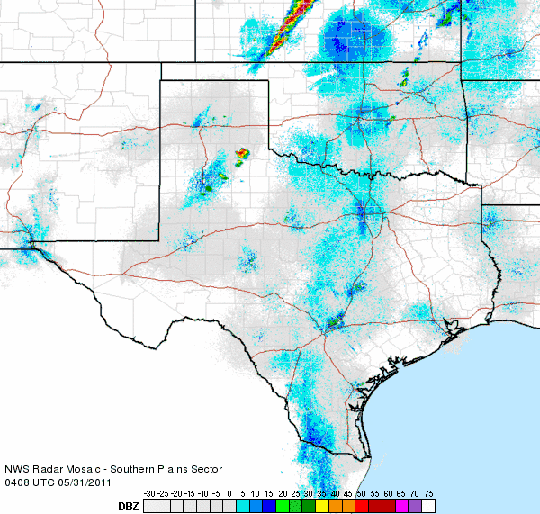
| Radar loop from 11:08 pm on May 30th to 12:18 am on May 31st, 2011. | |
| After a very quiet spring weather season, late May brought a brief burst of activity. Several strong and severe thunderstorms developed during the late evening hours of Monday, May 31st, as an upper level storm system grazed the area and a weak cold front entered the South Plains from the north. This first round of activity really blossomed after 11 pm, and brought large hail to parts of the eastern South Plains into the Rolling Plains and southeast Texas Panhandle. Golf ball sized hail was reported in Matador and near Tell with these storms before they weakened and moved off to the east during the early morning hours of the 31st. | |
 |
|
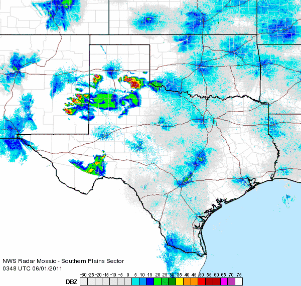
| Radar loop from 10:48 pm to 11:58 pm on May 31st, 2011. | |
|
The cold front that moved through early Tuesday (May 31st) then stalled out and retreated back northward as a warm front during the afternoon and evening hours. This front, coupled with a passing upper level disturbance, led to the development of additional thunderstorms during the evening and overnight hours. The first activity initiated in southeast New Mexico, before developing and spreading into the western South Plains. One slow moving storm produced tennis ball sized hail just south of Morton at 7:46 pm. This storm eventually weakened, but then a larger thunderstorm complex initiated over Hall County. This complex produced large hail and very heavy rain over rural portions of central Hall County and persisted for several hours before finally collapsing. When the storm diminished it sent out an outflow boundary that sparked new activity that persisted well into the early morning hours of the first day of June. |
|
|
|
|
| Pictures of a storm located between Morton and Whiteface during the evening hours of Tuesday, May 31st. This storm moved very little and produced large hail, but also some beneficial rainfall. Click on the images for a larger view. | |
| To view the preliminary local storm reports for the end of May see the below links: | |
 |
|
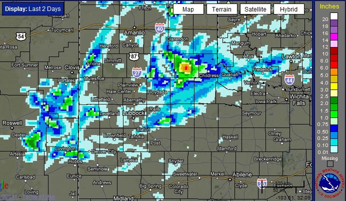
| Bias-corrected radar estimated rainfall that fell over the last two days, ending on 6 am on June 1st, 2011. Click on the image for a larger view. | |
|
Though the thunderstorms did produce severe weather, they also brought some much needed rainfall to parts of the area. The above map shows that several locations received significant rainfall, but the heavier precipitation was rather spotty. At Lubbock, for example, only a trace of precipitation fell and the month of May finished as the fifth driest on record with only 0.26 inches for the entire month. Only May of 1927 (0.00 inches), 1998 (0.04 inches), 1962 (0.10 inches) and 1913 (0.24 inches) were drier than this past May at Lubbock. Needless to say, it will take much more widespread rain to make a palpable dent in the ongoing drought. |
|


