
Scattered thunderstorms with severe gusts, hail and a tornado risk are possible near a cold front from the Ohio Valley to the Mid-Atlantic tonight. Tropical Storm Bertha is expected to bring tropical storm conditions to portions of the Gulf Coast from the panhandle of Florida into Louisiana through Wednesday. Read More >
|
Winter Storm Brings Thunderstorms and Snow |
||
 |
||
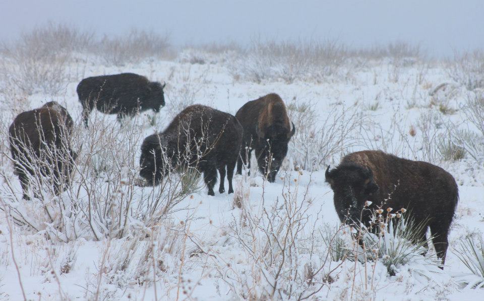
| Bison enjoy the new snow at Caprock Canyons State Park near Quitaque on February 12, 2013. Picture courtesy of Caprock Canyons SP. Click for a larger view. For another view of the Caprock Canyons SP CLICK HERE. | ||
| A strong winter storm moved out of the Desert Southwest and across the South Plains and Texas Panhandle on Tuesday, February 12, 2013. This storm system was able to tap relatively moist air flowing up from the Gulf and brought a variety of weather to West Texas late Monday night (February 11th) into Tuesday. The weather ranged from showers and thunderstorms to sleet, hail and snow. If you have pictures of the weather that greeted you on Tuesday, we would love to see them. Please send them to us at: sr-lub.webmaster@noaa.gov | ||
|
||
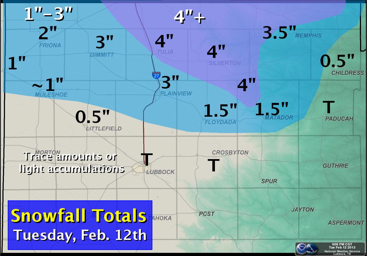
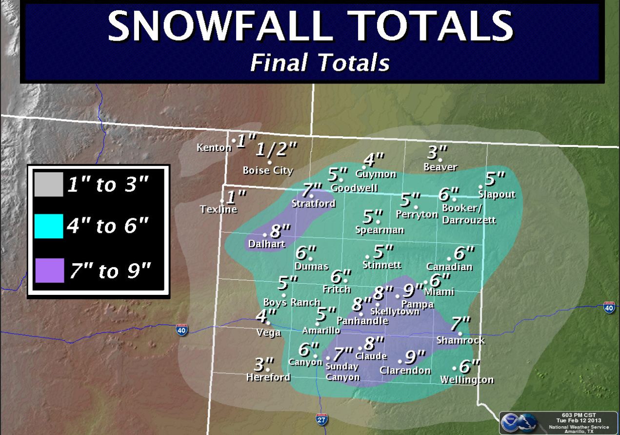
| Late Monday night showers and thunderstorms developed across the Permian Basin and spread northeastward into the South Plains and Rolling Plains. This activity brought early morning lightning and thunder to a good portion of the region, with even sleet and small hail mixing in with the storms. The precipitation quickly mixed with and changed to snow as it encountered slightly colder air residing to the north. Lubbock officially recorded a daily record tying 0.48 inches of rain, with a trace of snow. One to three inches of snow was fairly common further north, with about 4 inches falling around Tulia, Silverton and Flomot. The snow totals were even higher further to the north, where 4 to 8 inches was common. | ||
 |
||
| Snowfall totals for February 12, 2013. To view the snowfall totals that fell to our north CLICK HERE. | ||
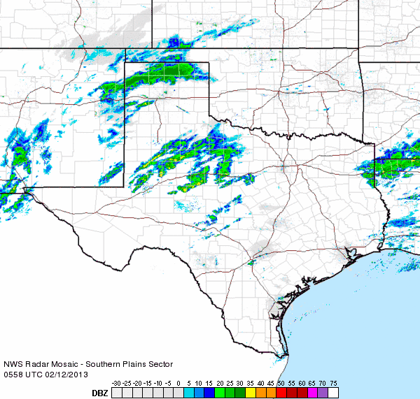
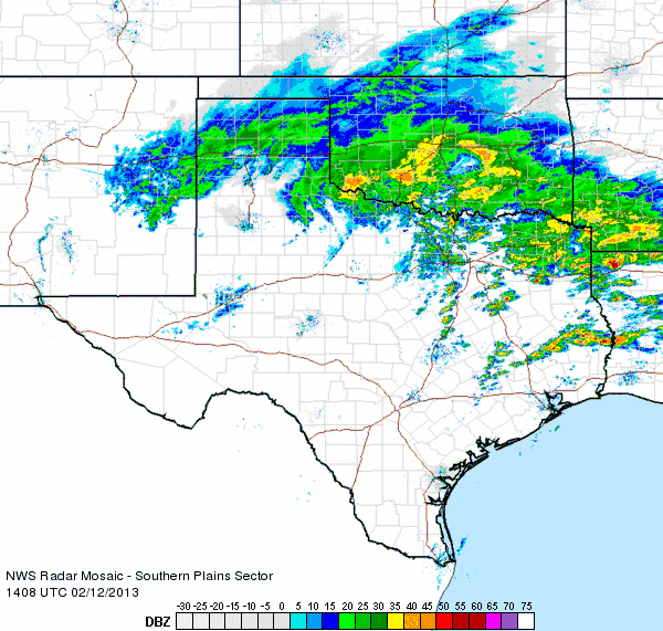
| The below radar animation shows how the precipitation evolved early Tuesday morning. Scattered showers and thunderstorms enveloped a good portion of the Rolling Plains and southeastern South Plains. Also, a well-defined snow band was in place across the northern Texas Panhandle into the Oklahoma Panhandle. | ||
|
|
||
| Regional radar animation valid from 11:58 pm on February 11th to 1:08 am on February 12, 2013. | ||
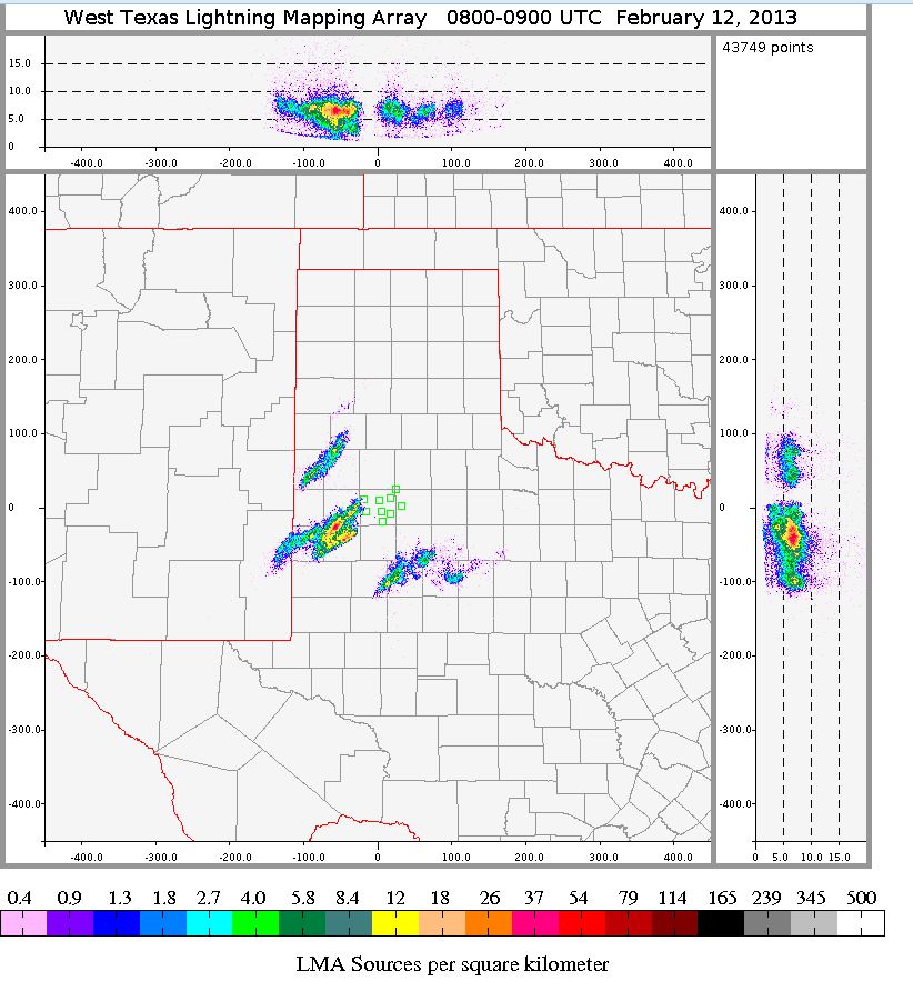
| The below data from the West Texas Lightning Mapping Array (LMA) show lightning point sources for the hour period shortly after the time of the above radar animation. The places where there colors in the view indicate where lightning was detected within the cloud. The image indicates that the precipitation across the southern and western South Plains into the southern Rolling Plains was filled with lightning, as anyone who tried to sleep through the storms may be able to corroborate. The views on the top and right side of the below display plot the approximate height of the lightning with respect to the longitude and latitude, while the center view is a plan view of the lightning source distributions. | ||
|
|
||
| West Texas Lightning Mapping Array (LMA) data captured between 2 and 3 am on February 12, 2013. | ||
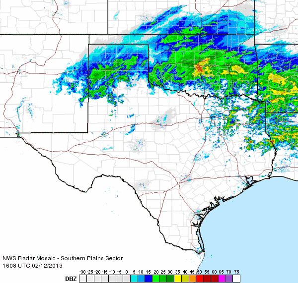
| The following two animations show how the large band of snow across the Texas Panhandle pivoted across the region through the morning hours on Tuesday, the 12th of February. | ||
|
|
||
| Regional radar animation valid from 8:08 to 9:18 am on February 12, 2013. | ||
|
|
||
| Regional radar animation valid from 10:08 to 11:18 am on February 12, 2013. | ||
| Lastly, the below map shows a plot of the liquid precipitation, as recorded by the Texas Tech West Texas Mesonet. Note that some of the totals may not be complete where the snow has yet to melt and be recorded by the rain gage. Also available are the high temperatures, many of which occurred early in the day. In general, the temperatures stayed in the lower to middle 30s where the snow fell throughout much of the day. | ||
| Precipitation and temperature data are courtesy of the Texas Tech West Texas Mesonet. | |
|
24-hour Rain Total from 2/12/2013
|
Toggle High Temperature for 2/12/2013
|


