 |
| |
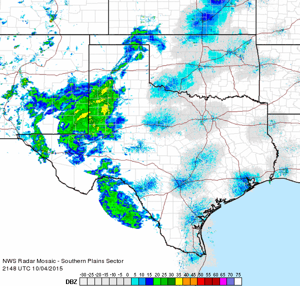
| After a warm and mostly dry September, a storm system brought cool and damp weather for the region in early October. Radar estimates and station reports show the rainfall pattern across the South Plains for the 72 hour period from Saturday morning to Monday morning, October 3rd-5th. The western South Plains fared the best with one to two inches of rain falling across a wide area. The Rolling Plains largely missed out with rainfall mainly less than a tenth of an inch. |
| |
 |
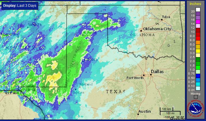
| Radar estimated rainfall and automated reports from the West Texas Mesonet for the 72 period from Saturday morning, October 3rd to Monday morning, October 5th. Click on the image to view a larger version. |
| |
| Initially, on Saturday, the bulk of the rain stayed anchored to locations near the Texas and New Mexico line. Eventually the rain did stray eastward across most of the Caprock, in the form of several rounds of shower, on Sunday and Monday. The rain did struggle to persist far off the Caprock, though at least a little light rain did visit the Rolling Plains before coming to an end Monday afternoon. |
| |
 |
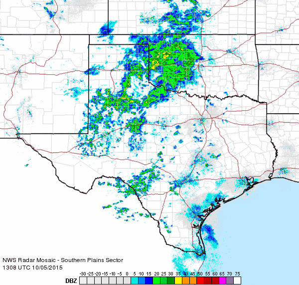
| Regional radar animation valid from 4:48 pm to 5:58 pm on Sunday, 4 October 2015. An additional radar animation valid from 8:08 am to 9:18 am on Monday, 5 October 2015 can be FOUND HERE. |
| |
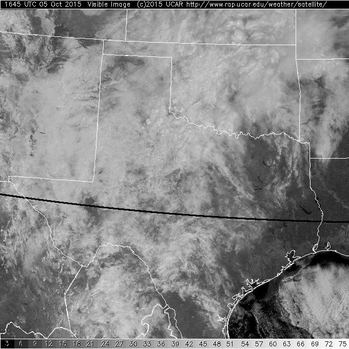
| The rain came in several rounds of showers, with even a few thunderstorms mixing in on Saturday into early Sunday. The rounds of rain were courtesy of several weak impulses moving up and over the region from the southwest. As the below images show, even when it was not raining, plenty of cloud cover lingered, which help provide a cool weekend. Where the clouds and rain were most persistent, afternoon temperatures only made it up into the 50s and 60s. |
| |
|
Visible satellite images captured at 11:45 am on Saturday, 3 October 2015 (left); 11:45 am on Sunday, 4 October 2015 (center); and 11:45 am on Monday, 5 October 2015 (right). Click on the images for a larger view. |
| |
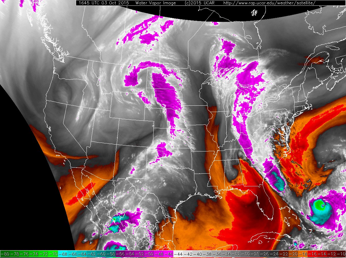
| A large chunk of the moisture that provided the clouds and rain was thanks to a tap off the eastern Pacific Ocean. In fact, moisture from once Hurricane Marty contributed to some of this moisture. However, the eastward extent of the rain was limited by drier low-level air moving in from Oklahoma and North Texas. |
| |
|
|
| Water vapor satellite images captured at 11:45 am on Saturday, 3 October 2015 (left) and 11:45 am on Sunday, 4 October 2015 (right). Click on the images for a larger view. |
| |
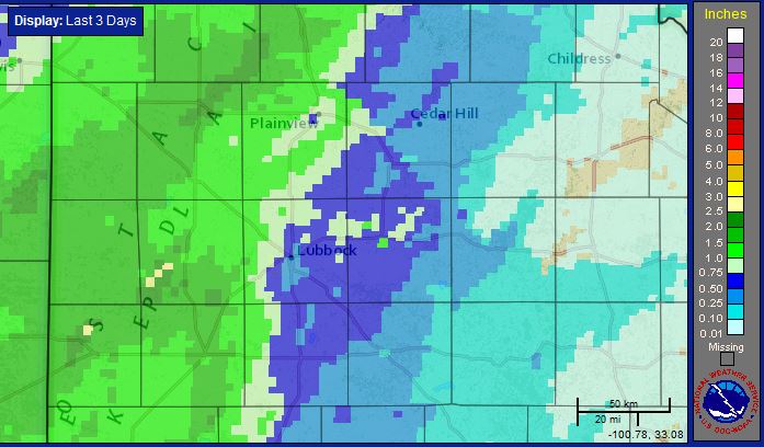
| The dry low-level air to the east, along with the bulk of the rain moving north-northeastward, resulted in a fairly tight gradient of rain. As the below map illustrates, the heaviest rains fell in a swath from southeast New Mexico through the western South Plains and into the central Texas Panhandle. |
| |
 |
| Three-day radar-estimated and bias-corrected rain totals ending at 8 am on Tuesday, 6 October 2015. Click on the image for a closer view of the South Plains region. |
| |
| |


