
Scattered thunderstorms with severe gusts, hail and a tornado risk are possible near a cold front from the Ohio Valley to the Mid-Atlantic tonight. Tropical Storm Bertha is expected to bring tropical storm conditions to portions of the Gulf Coast from the panhandle of Florida into Louisiana through Wednesday. Read More >
| Powerful November Storm Brings Severe Thunderstorms and Strong Winds 16-17 November 2015 |
|||||||
 |
|||||||
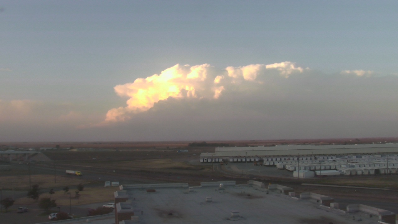
| View of a strong thunderstorm across the south-central Texas Panhandle on Monday evening, 16 November 2015. The picture is looking north from Plainview at 5:26 pm. The image is courtesy of KAMC. | |||||||
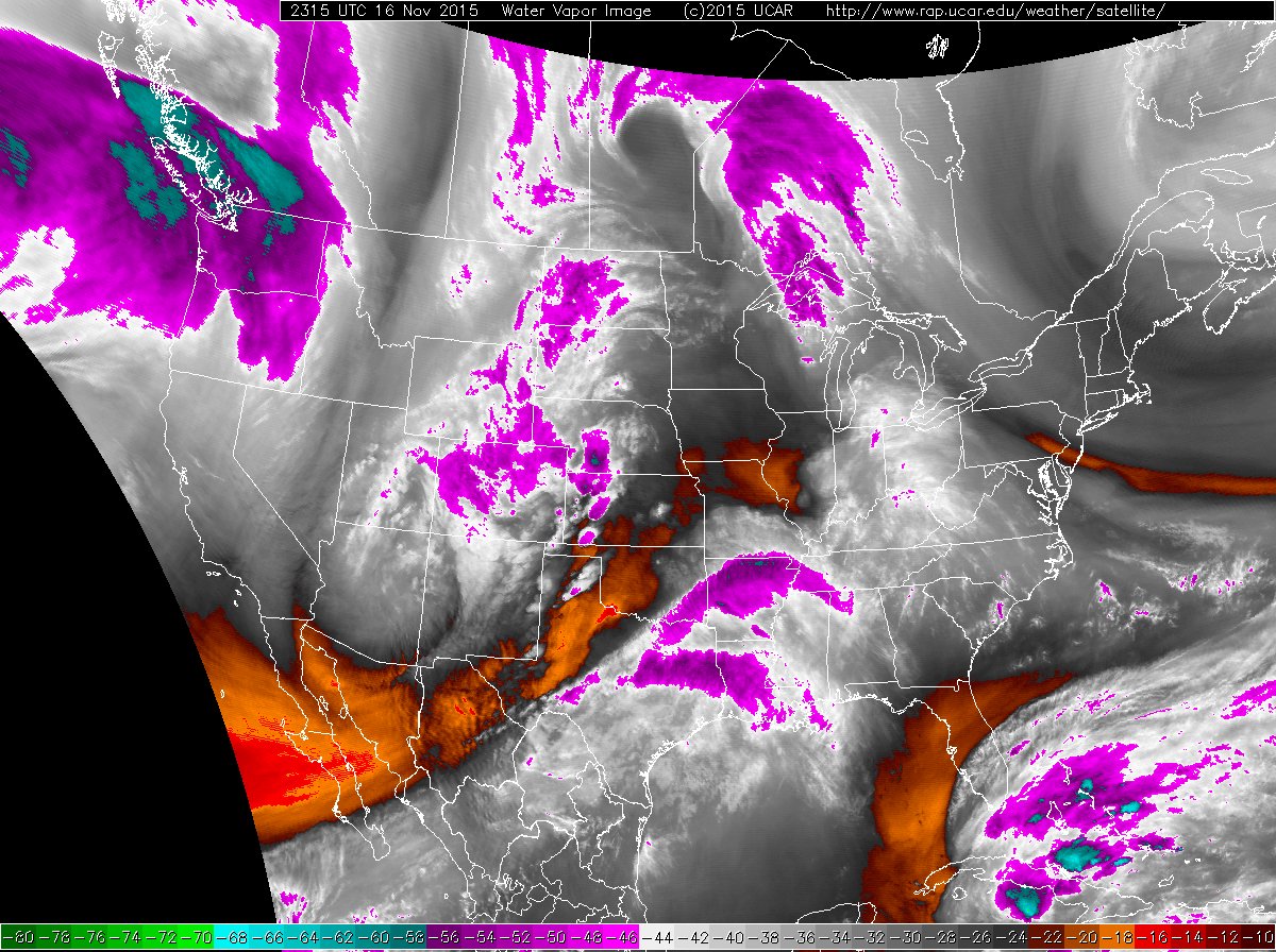
| A potent mid-November upper level storm system approaching through the Four Corners (see the below water vapor image) helped spur gusty winds and a round of severe thunderstorms for West Texas. Out ahead of the storm system mild and moist southerly winds became quite gusty Sunday night into Monday. The winds help transport high amounts of Gulf moisture, at least by November standards, northward into the region. The moisture, coupled with the mild temperatures, provided the energy that fed thunderstorms that developed during the afternoon and evening hours of the 16th as lift from the approaching system spread over the area. | |||||||
 |
 |
||||||
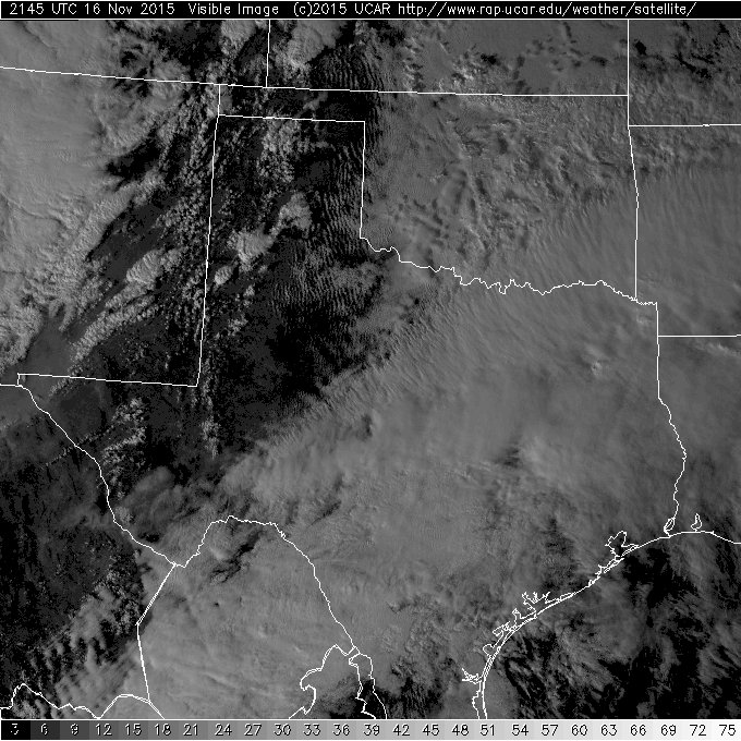
| Water vapor (left) and visible (right) satellite imagery taken at 5:15 pm and 3:45 pm, respectively, on 16 November 2015. | |||||||
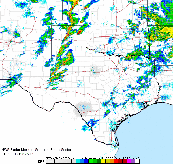
| Initially, the thunderstorms Monday afternoon and early evening were isolated to scattered, as the above visible satellite image and below radar animation show. The most intense storms we able to utilize the strong and turning winds present within the atmosphere and they began to rotate. These rotating supercell storms produced large hail, damaging winds and several tornadoes from the central Texas Panhandle into western Kansas. | |||||||
 |
|||||||
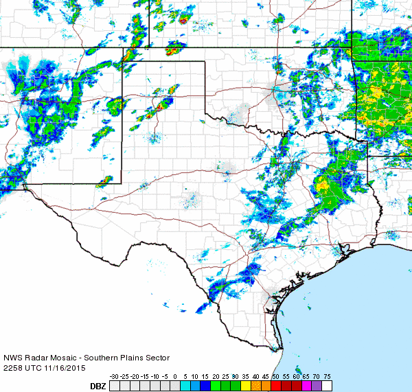
| Regional radar animation valid from 4:58 to 6:08 pm on 16 November 2015. Additional radar animations can be viewed by clicking on the following links: 7:38 to 8:48 pm on 16 November 2015; and 9:28 to 10:38 pm on 16 November 2015. | |||||||
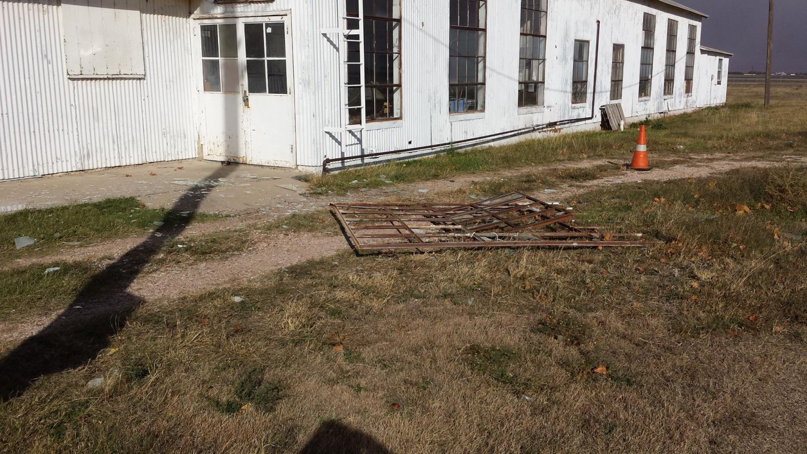
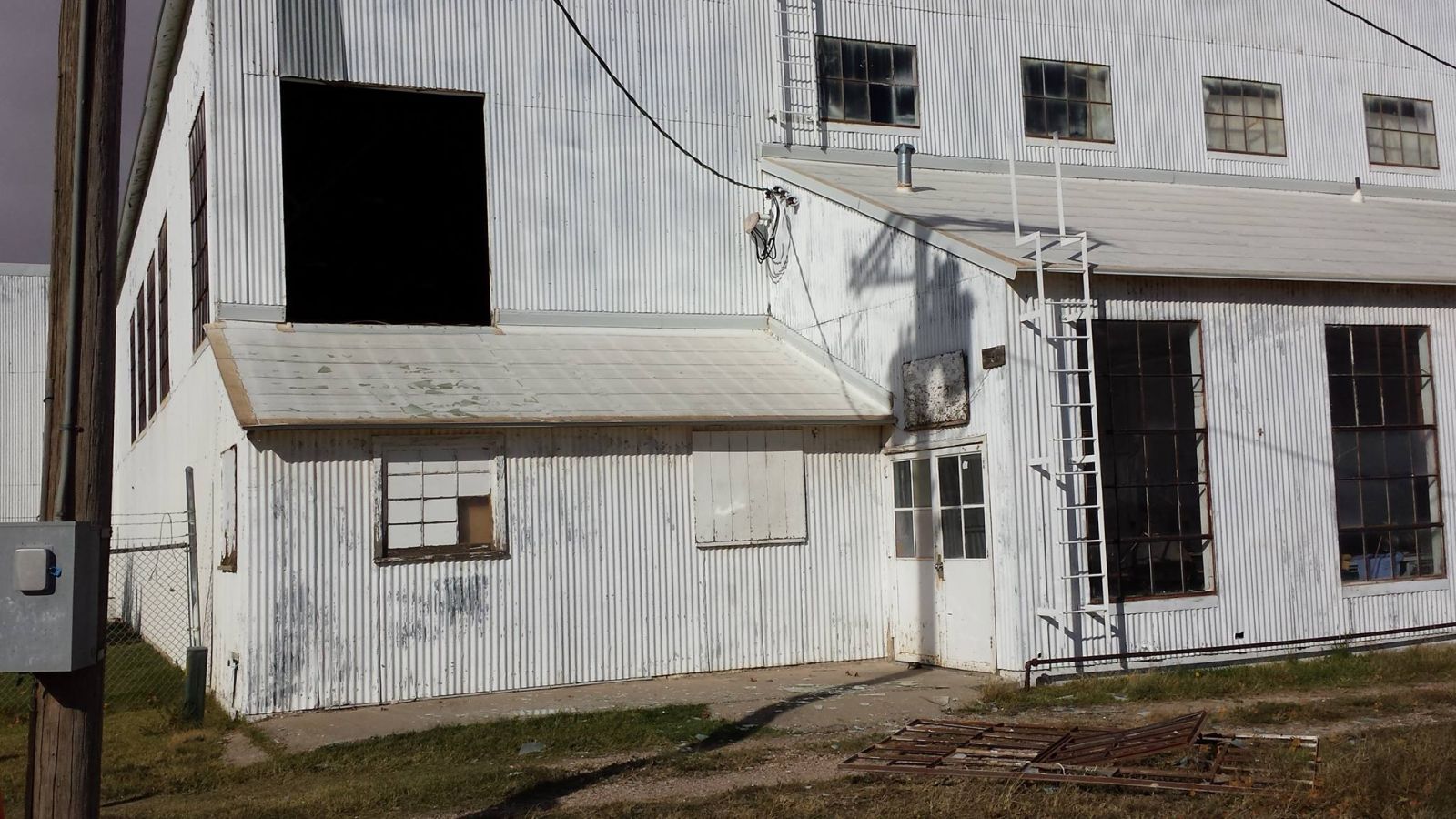
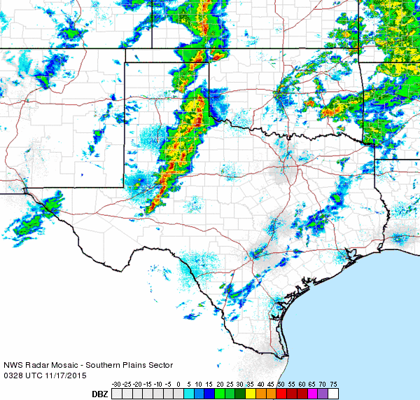
| Further to the south, across the South Plains and Rolling Plains, no tornadoes were observed, but the storms were able to tap into the strong winds. One storm that raced across Lubbock around 7 pm generated winds measured as high as 71 mph as it moved across the airport. The robust winds caused some damage around town, as seen in the images below. The same storm destroyed a horse barn near Abernathy as the winds blew through. Thankfully, no known injuries occurred from the round of intense thunderstorms that impacted the South Plains. A listing of the preliminary storm reports for the event can be READ HERE. | |||||||
|
|||||||
| Wind damage to an empty aircraft hangar on the east side of the Lubbock Airport (left and center).Uprooted tree near University Avenue and Marsha Sharp Freeway in Lubbock (right). The damage was caused by strong thunderstorm winds during the evening of 16 November 2015. | |||||||
| The thunderstorms gradually expanded into a squall line as they moved eastward into the Rolling Plains during the evening hours, producing gusty winds and locally heavy rains, though the rapid speed of the individual storms tended to limit rain totals. | |||||||
 |
|||||||
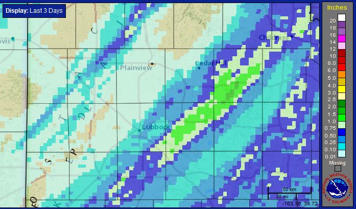
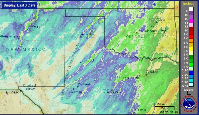
| Three-day radar-estimated precipitation ending at 6 pm on Wednesday, 18 November 2015. A regional view of the same information can be FOUND HERE. | |||||||
| Rain totals of a tenth to half inch were fairly common, though a few spots in a swath from Crosbyton to Childress did receive a quick inch plus. The rain quickly shifted east by early Tuesday as much cooler and drier air moved in behind a cold front. | |||||||
 |
|||||||
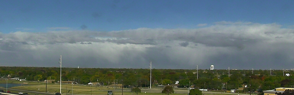
| View looking to the north, from Lubbock, Tuesday afternoon (17 November 2015). | |||||||
| The sky took on a very different look on Tuesday as colder air wrapped around the departing upper level storm system. Several reports of sleet and snow were received as this colder air moved in, but the accumulating snow was limited to northeast New Mexico, southeast Colorado, the western Oklahoma Panhandle and the far northwest Texas Panhandle where several inches to over a foot of snow fell. Instead, the main impact for the South Plains region was northwesterly winds sustained at 30 to 40 mph, with some gusts over 50 mph. The gusty winds combined with temperatures only in the 40s and 50s made for a brisk day. | |||||||
| Local Storm Reports received by our office for November 16th | ||
 |
||


