
Flash flooding threatens areas from the Tennessee Valley to the Carolinas as storms repeat along a stalled front. Monsoonal storms may trigger flooding in the Southwest. Dangerous heat expands across the Desert Southwest, Plains, mid-Mississippi Valley and Southern Tier. Critical fire weather for interior Pacific Northwest. Cooler, drier air brings brief relief to the Great Lakes and Northeast. Read More >
|
National Weather Service Lubbock Significant Weather Events
June 1, 2016: Torrential Rain and Flooding
|
||||
|
||||
|
|
||||
|
||||
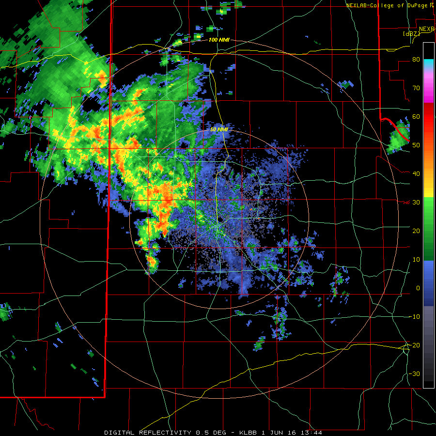
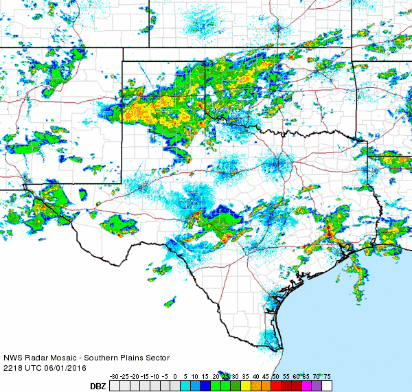
The rain initially flourished along the Highway 84 corridor from near Shallowater through Clovis, but eventually pivoted into Lubbock County during the late morning and early afternoon hours. Many locations to the northwest of Lubbock dealt with street and inundation flooding, though the heaviest rainfall rates generally didn't last very long in any one spot. That changed over the southwest side of Lubbock when newly developed heavy rain producing thunderstorms moving slowly westward and merged with other thunderstorms rotating in from the west to produce a prolonged period of torrential rainfall. |
||||
|
||||
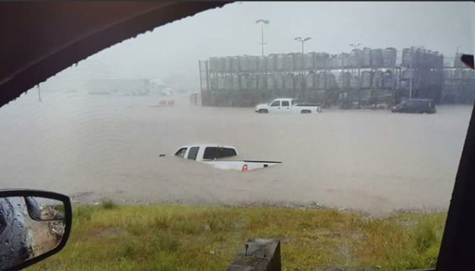
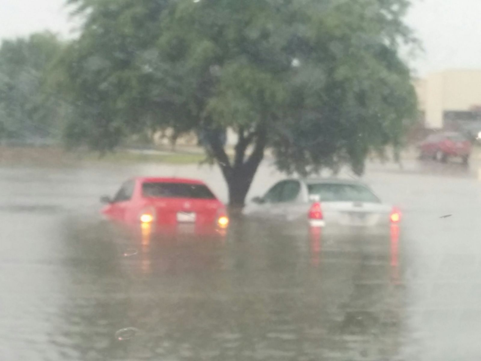
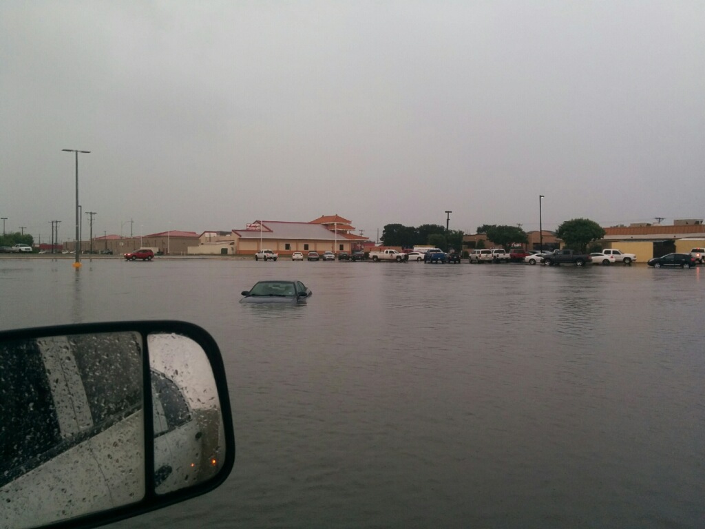
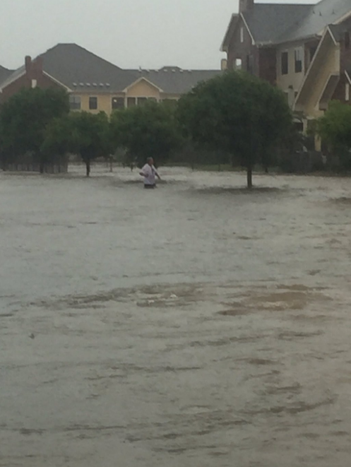
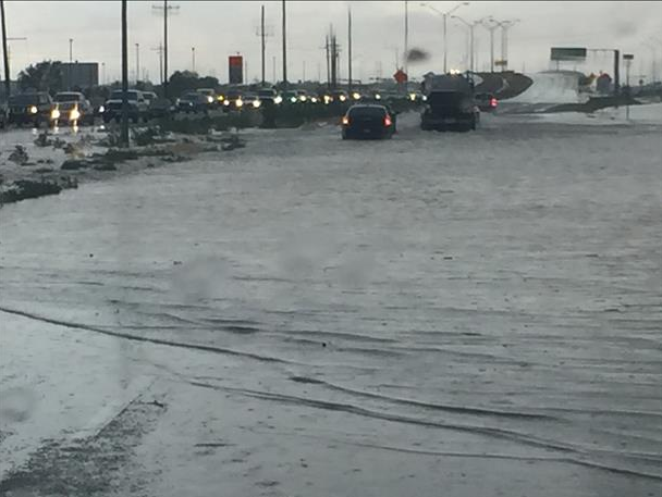
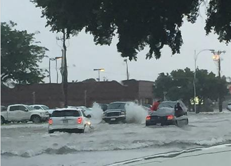
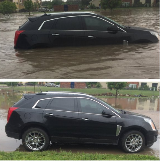
The intense rain rates quickly resulted in massive amounts of runoff which in turn generated widespread flooding and flash flooding. Many car stalled out in the rising waters, while others were trapped where they were as roadways became impassable. |
||||
|
||||
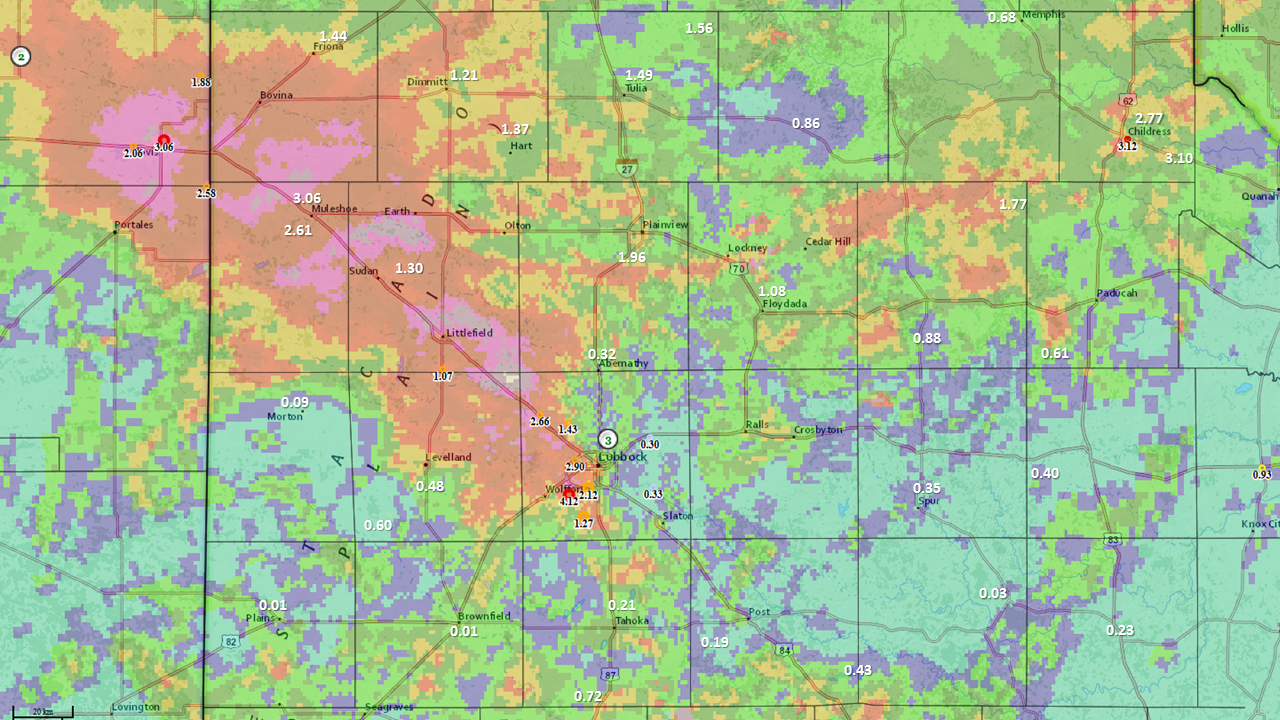
As the above map shows, 24 hour rainfall totals of 1 to 3+ inches were fairly common from the western half of Lubbock County northwestward into eastern Curry County, NM (including Clovis). In many spots northwest of Lubbock the rain was spread out over several hours, but most of the rain that fell in and around Lubbock fell in around 1 hour, which further exacerbated the flooding. A number of other spots across the southern Texas Panhandle into the northern South Plains and northern Rolling Plains did also record 1 to 2 inches of rain which caused some additional flooding at times. |
||||
|
||||
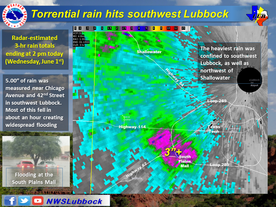
As the below image shows, the heaviest rain in Lubbock County was concentrated across the southwest side of the city where 3 to 5+ inches fell. Most of this rain dropped in about an hour around midday and was focused near the Loop 289, Spur 327 and Marsha Sharp Freeway convergence. One direct measurement of 5.00 inches was observed near Chicago Avenue and 42nd Street, with several other unconfirmed reports in this same area in excess of 5 inches. |
||||
|
||||
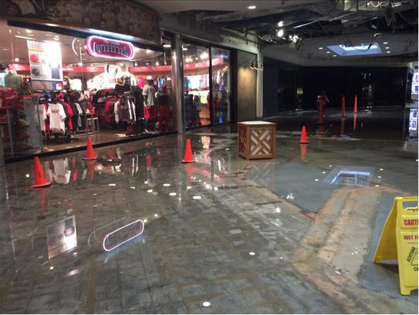
Thankfully, after about an hour, the heavy rain over southwest Lubbock did begin moving and shifted east of the hardest hit area. Even so, water continued to flow over roads for some time and playa lakes swelled well outside of their normal bounds. The water also caused some roofs to collapse and water flooded portions of the South Plains Mall. The after affects lasted through the evening and even into the next day where waters were slowest to recede. |
||||
|
||||
The heaviest rain then pivoted north and eastward through the afternoon and early evening hours (see the below radar animation) before diminishing altogether late in the evening. Thankfully the rain rates were not as high and did not last as long at most locations, though some spots into the southern Texas Panhandle did experience minor flooding. |
||||
|
||||
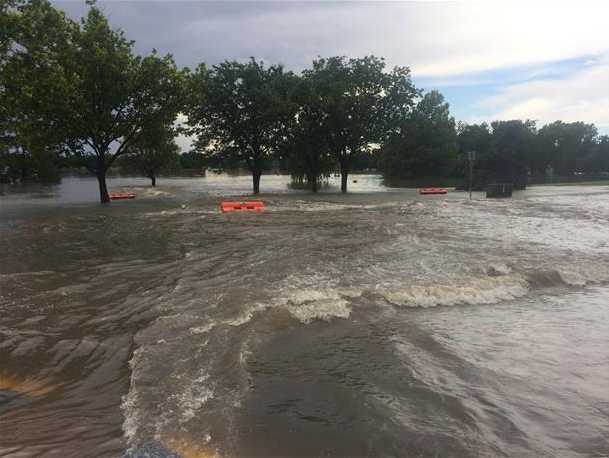
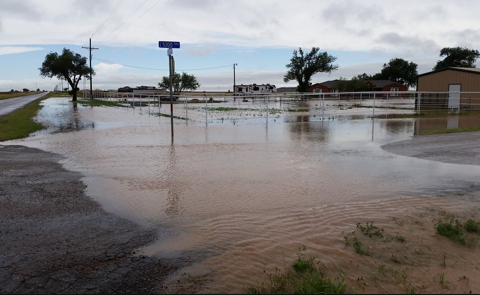
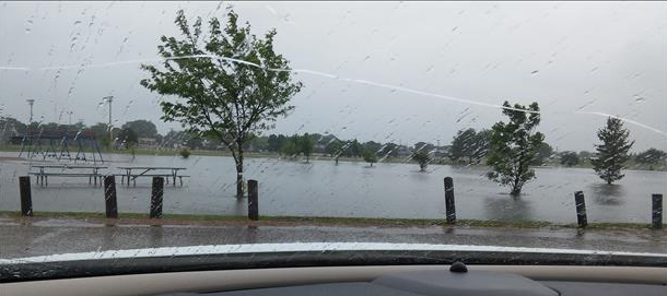
The below images show additional inundation flooding outside of the city of Lubbock, including a swelling playa lake in Muleshoe City Park. |
||||
|
||||
Numerous reports of flooding were observed around southwest Lubbock June 1st. A small (incomplete) list of the preliminary storm reports received by National Weather Service in Lubbock can be FOUND HERE. |
||||

