|
National Weather Service Lubbock Significant Weather Events
Mid-June (June 9th, 11th and 13th-15th) Severe Storms and Heavy Rain
|
||||
|
||||
|
|
||||
|
||||
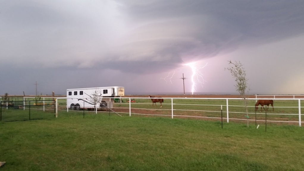
June 10th was fairly quiet, but that changed early on the 11th. Scattered thunderstorms began to develop in the Rolling Plains late Saturday morning, then continued to expand in coverage and intensity through the afternoon hours (see the above radar animation) while gradually building northwestward on outflow boundaries. These storms produced very heavy rain in spots, and also small hail through the afternoon hours. |
||||
|
||||
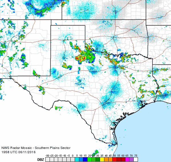
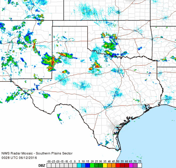
The activity off the Caprock quickly faded by early Saturday evening, but additional storms in New Mexico then moved eastward into the western South Plains. These storms gradually formed into a small complex and merged with a severe storm that moved through Plainview and then turned southward (see the below radar animation). This cluster of storms continued southeastward and produced several severe wind gusts, including a couple of gusts of 70-75 mph in Littlefield and near Denver City. The winds downed four power poles southeast of Littlefield. The storms skirted the southwest side of Lubbock before shifting the bulk of their thrust into the Permian Basin. |
||||
|
||||
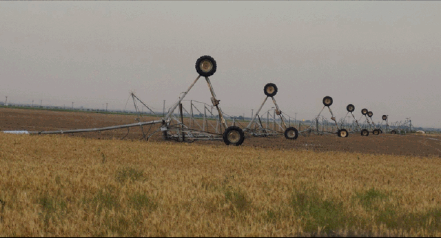
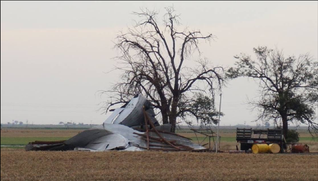
Although the coverage and overall intensity of the thunderstorms preceding the 11th were less, one storm on the 9th (Thursday) did briefly become severe and produce strong outflow winds that damaged/destroyed a pivot irrigation and a small barn/shed a few miles north of Muleshoe (see images below). |
||||
|
||||
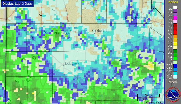
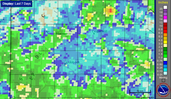
After the two days of storms on the 9th and 11th a good portion of the western and southern South Plains into the central Rolling Plains did record rainfall totals in excess of 1 inch, while such amounts were more spotty further north. The southwest South Plains and portions of King County in the Rolling Plains saw the highest amounts, in excess of 2 inches in places (see the below map). |
||||
|
||||
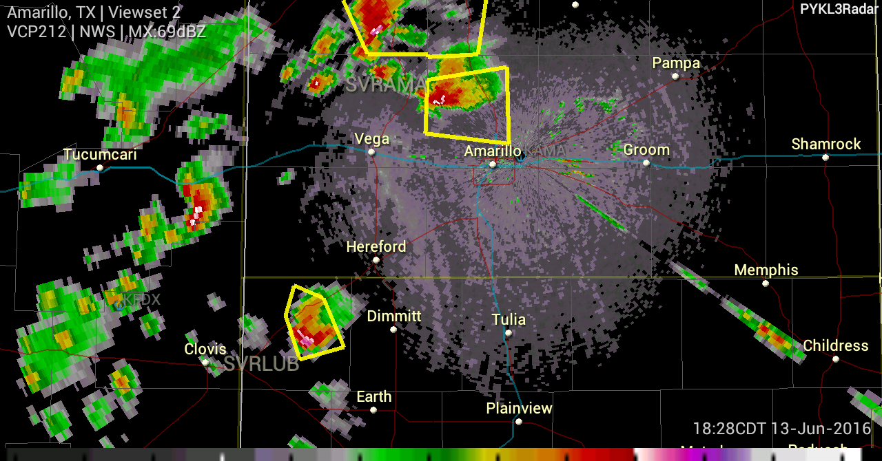
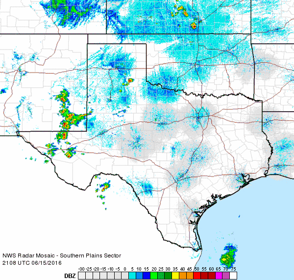
The weather turned quieter on Sunday (12 June 2016) as the slow-moving upper level disturbance gradually exited the region to the east, but the lull didn't last long. Another storm system moving through the southern Rockies skirted by northwest Texas late on the 13th. This system kicked off plenty of storms across the Texas Panhandle and points north, with isolated activity developing southward into the western South Plains during the evening hours. The most intense storm produced an EF-2 tornado 8 miles north-northwest of Pantex in Potter County, while a storm moving through Parmer County dropped golf ball size hail as it passed over Bovina. The below radar image was captured shortly after the large hail fell in Bovina. |
||||
|
||||
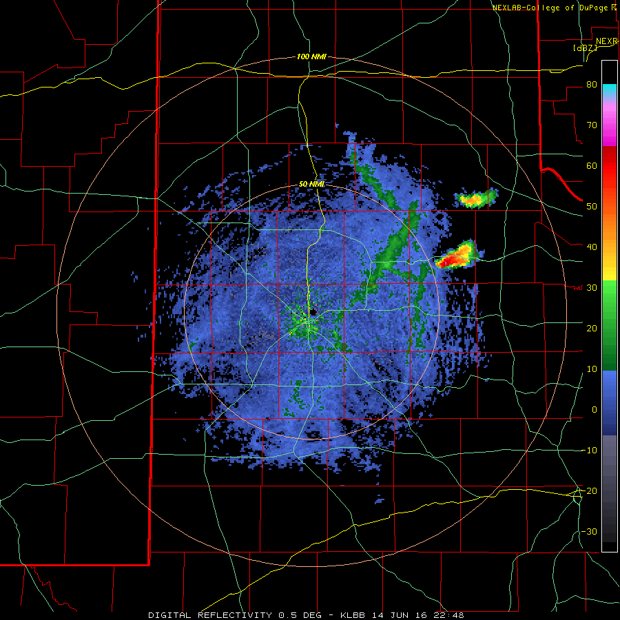
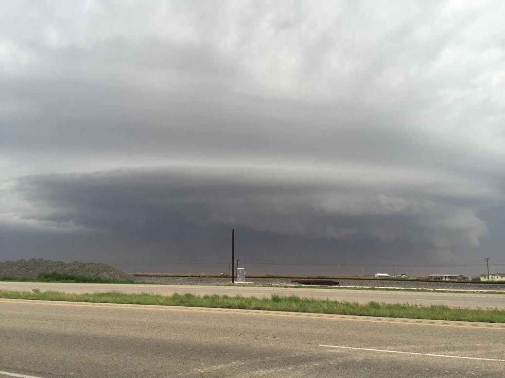
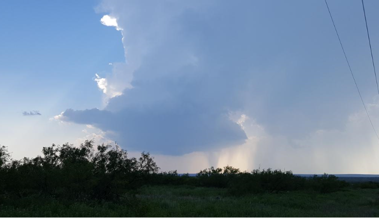
| The storm coverage was much more isolated the next day (Tuesday, 14 June 2016), and the focus shifted into the far southeast Texas Panhandle and Rolling Plains. A couple of intense supercell thunderstorms developed along and just ahead of a dryline during the late afternoon and persisted well into the evening hours. The storms had beautiful structure and occasionally produced low hanging wall clouds while also dropping large hail before weakening after sunset. | ||||
|
||||
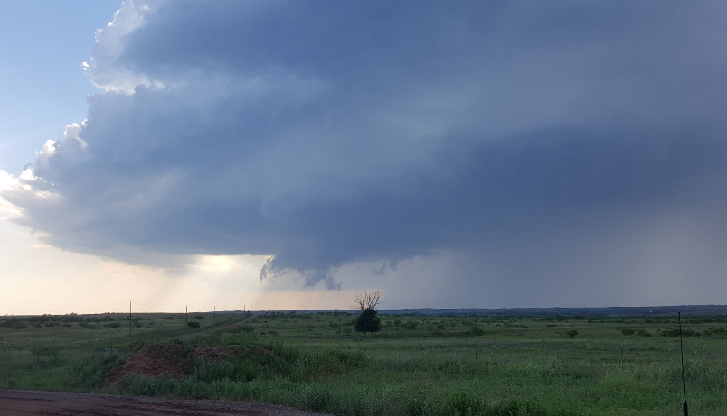
| The below animation shows the progression of the isolated storms during the evening of the 14th. The storms also produced locally heavy rain as they slowly marched eastward across southeast Motley, southern Cottle and northeast King Counties. | ||||
|
||||
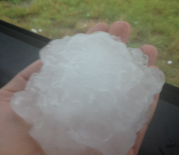
| The next day (Wednesday, 15 June 2016) brought a considerable uptick in thunderstorm coverage as a weak upper-level disturbance approached from the southwest and interacted with the abundant heat and instability. One storm formed around 4 pm and remained nearly station over western Hall County. This rotating storm produced very large hail (see the below picture), torrential rainfall and occasional wall clouds as it sat just north of Turkey, Texas. | ||||
|
||||
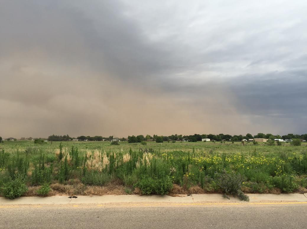
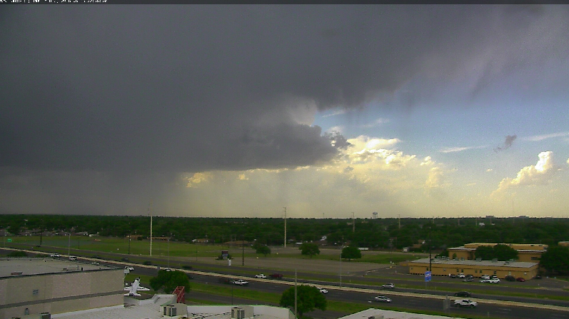
| While the storms over the southern Texas Panhandle moved very little, additional high-based storms that developed in southeastern New Mexico expanded and strengthened as they spread into the South Plains. These storms weren't as organized as their northern counterparts and generally only produced spotty and small hail. However, they had more hot and dry air to utilize and this made them proficient wind producers. Many locations recorded wind gusts from 60 to 70 mph as the storms moved through. One small storm that collapsed near the Lubbock Airport produced a peak wind gust to 79 mph. The intense winds did cause some damage around the South Plains including knocking down power poles near Littlefield and damaging the roof of an elementary school in Cotton Center. | ||||

|
||||
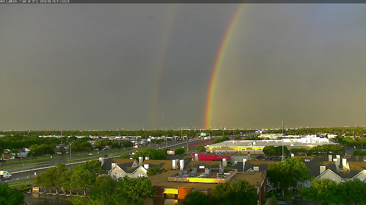
| The thunderstorms and the strong and dusty downburst winds they generated did create some ominous sights, but they also created some beautiful ones including the double rainbow shown below. | ||||
|
||||
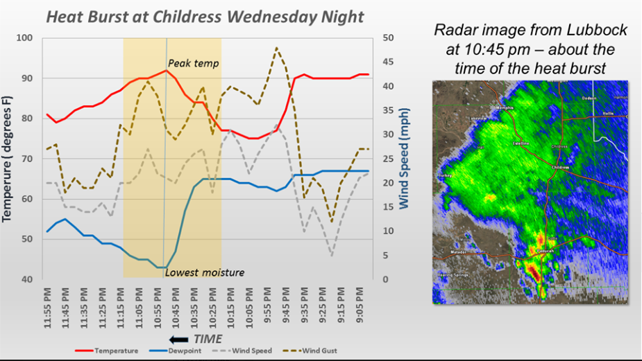
| The storms didn't go quietly as they gradually waned late Wednesday night. Instead, one decaying storm over Childress produced a heat burst. This resulted in a quick temperature rise from the mid-70s to the lower 90s between 10:25 pm and 10:55 pm, along with gusty winds and rapidly drying air (see the below graph for details). Other collapsing showers and thunderstorms generated a wind gust to 64 mph as they passed near Graham in southwest Garza County. | ||||
|
||||
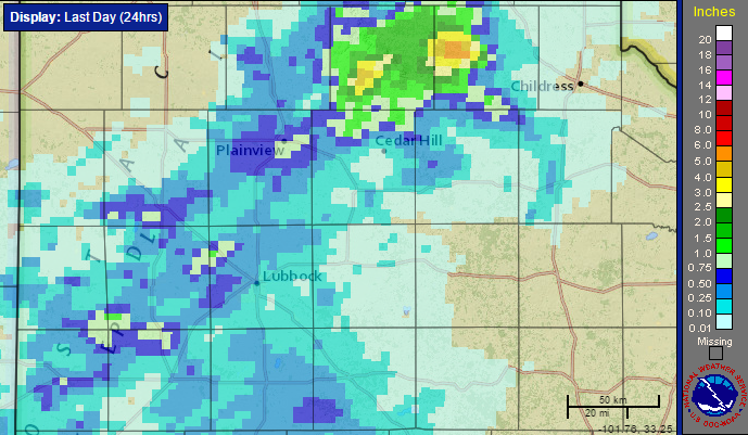
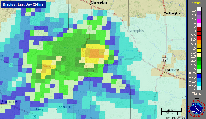
| The thunderstorms of the 15th brought widespread rain to the South Plains and south-central Texas Panhandle, though the southwest Texas Panhandle and southern Rolling Plains largely missed out. Very intense rain, from 3 to 6 inches did fall in western Hall County, largely over the Prairie Dog Town Fork of the Red River, as well as near Silverton. The COOP observer in Silverton officially measured 4.45 inches. The torrential rain did cause some flooding problems in and around Silverton, though further east the flooding was limited since much of the rain fell over relatively unpopulated open river valley. | ||||
|
||||
| Over the course of the active 7-day mid-June stretch (9-15 June 2016) most of West Texas did see at least a little rainfall, with a good portion of the region recording upwards of an inch and locally much higher amounts. The exception to this was central Castro County where they missed out on the rain altogether. | ||||
|
||||
|
Text listings of the Preliminary Storm Reports during the course of the active mid-June stretch can be found at: A plot of the storm reports received from June 15th can also be viewed below. |
||||
| Preliminary Storm Reports from 6/15/2016 | ||
 |
||


