
Scattered thunderstorms with severe gusts, hail and a tornado risk are possible near a cold front from the Ohio Valley to the Mid-Atlantic tonight. Tropical Storm Bertha is expected to bring tropical storm conditions to portions of the Gulf Coast from the panhandle of Florida into Louisiana through Wednesday. Read More >
| Another Round of Fall Rain 24 October 2018 |
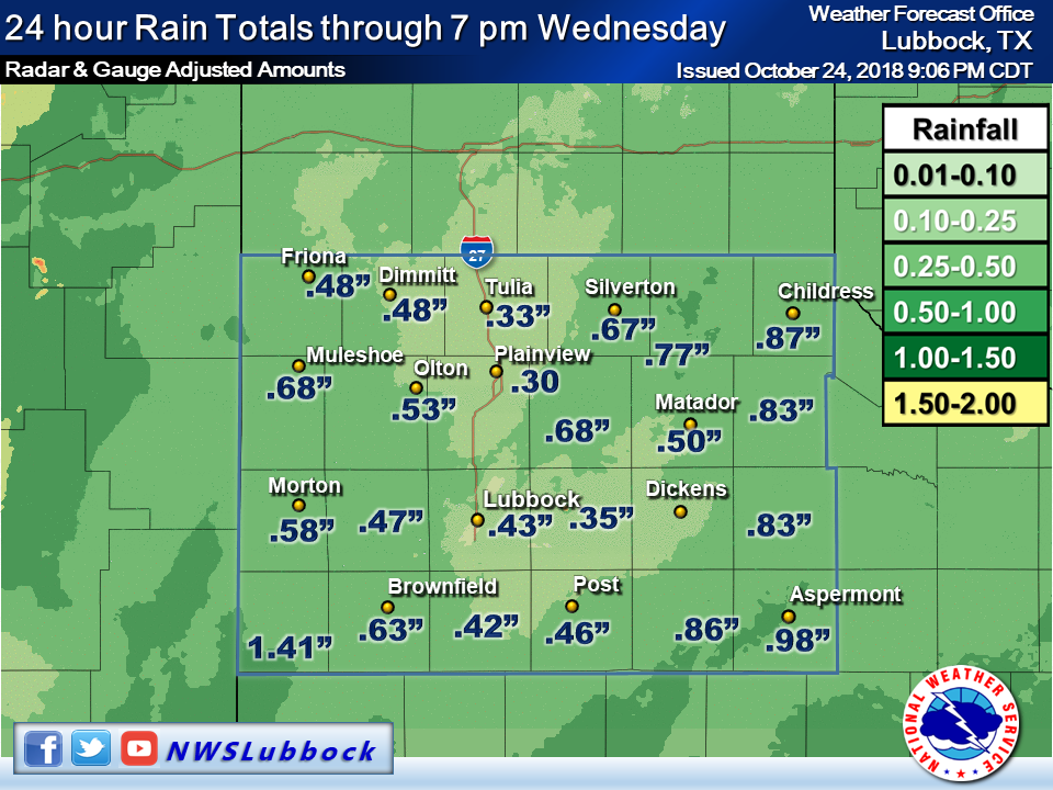 |
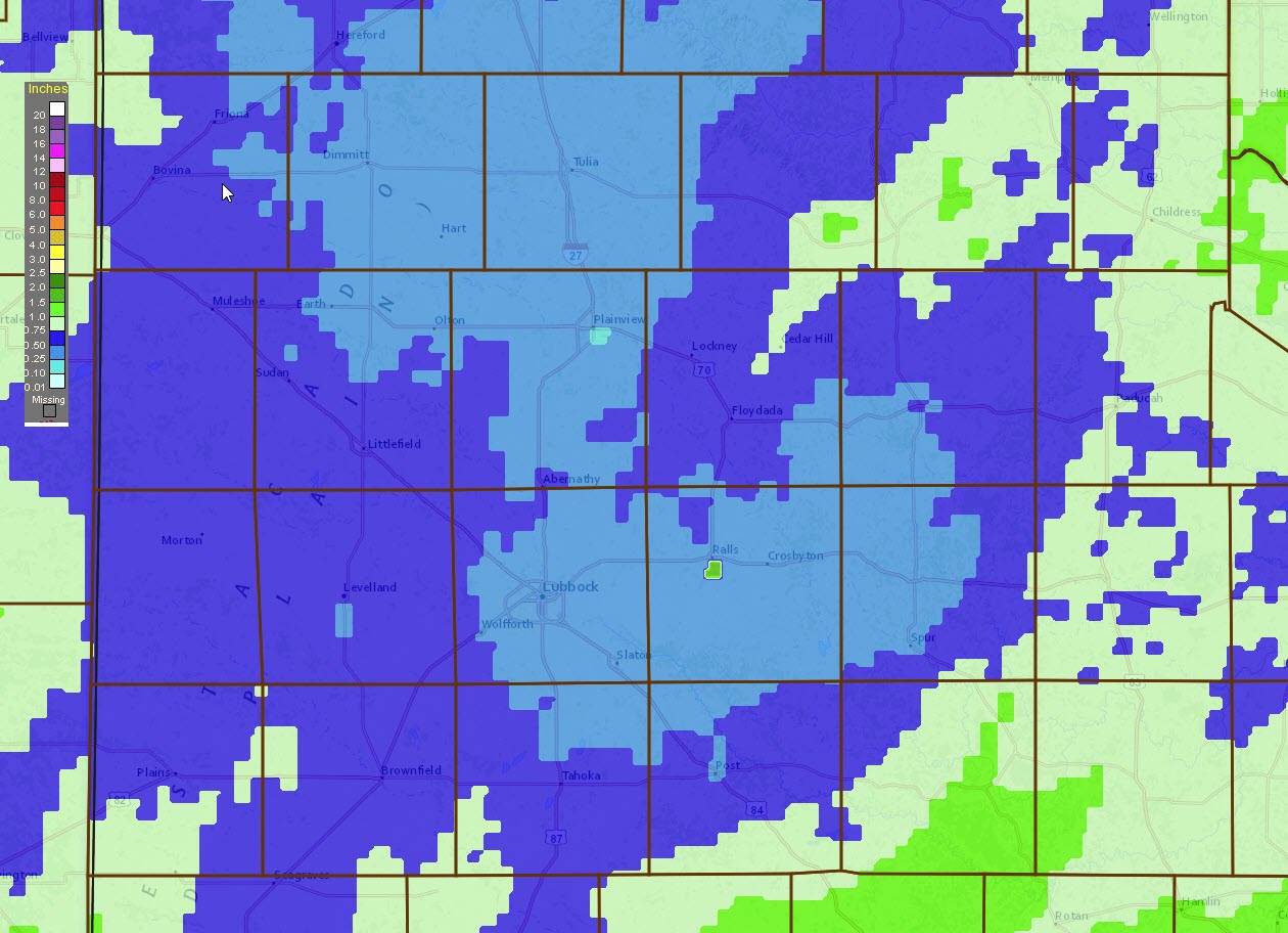
| Observed rainfall that fell on 24 October 2018. The data are courtesy of the West Texas Mesonet and the NWS. |
| The wet fall continued with the latest round of widespread rain traversing the region on Wednesday, October 24th. This rain was partially infused by moisture for Eastern Pacific Hurricane Walla which made landfall near Mazatlan the previous evening. However, the main driver of the rain was a large storm system that emerged from the Desert Southwest late Tuesday night into Wednesday. |
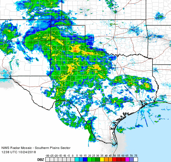 |
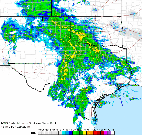
| Regional radar animation valid 7:38 am to 8:48 am on 24 October 2018. An additional animation valid from 11:18 am to 12:28 pm can be FOUND HERE. |
| A large shield of light to moderate rain spread out of New Mexico and Far West Texas, moving across the South Plains region late Tuesday night and much of Wednesday before shifting off to the east during the evening. Most of the South Plains recorded 1/3 and 3/4 of an inch of rain, with locally higher totals across the southwest South Plains as well as portions of the Rolling Plains. |
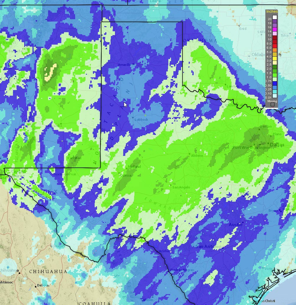 |
| 24-hour radar-estimated and bias-corrected rainfall ending at 7 pm on 24 October 2018. A zoomed in view of the South Plains region can be VIEWED HERE. |
| The rain wasn't confined to West Texas, but covered the entire region. The heaviest rain actually fell from the Permian Basin into North Texas where totals of 1 to 2 inches were common. Officially, the Lubbock Airport recorded 0.43 inches for this event. This brought the yearly total to 13.37 inches, closing the gap to 3.80 inches below normal to date. |

