
Dangerous heat will expand from the Gulf Coast into the Southern Plains and Desert Southwest through week's end. Additional extreme heat impacting the Pacific Northwest will shift to the northern Plains by the weekend. Tropical Storm Bertha is expected to continue to impact portions of the northern Gulf Coast from the western Florida Panhandle to southeastern Louisiana through tonight. Read More >
| Additional rounds of wintry weather for West Texas 10-12 February 2020 |
|||||||||||
 |
|||||||||||
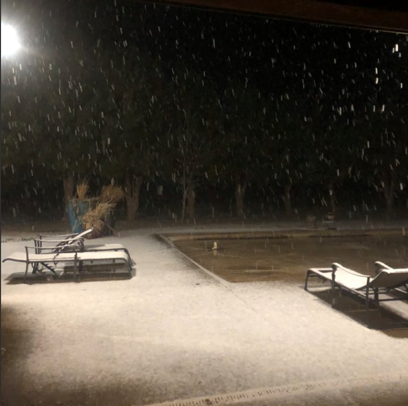
| Snowy scene in Ropes late Tuesday night (11 February 2020). The image is courtesy of Mike Henson. | |||||||||||
|
The second full week of February brought additional rounds of wintry weather for the South Plains region. A cold front moved through late Sunday into Sunday night (9 February), providing the cool air that would linger in the region through the first part of the work week. The initial frontal passage was dry, but that changed the next morning. |
|||||||||||
 |
|||||||||||
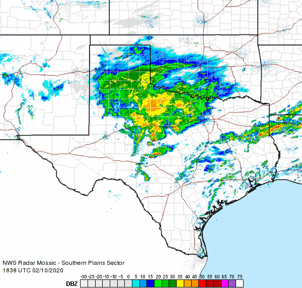
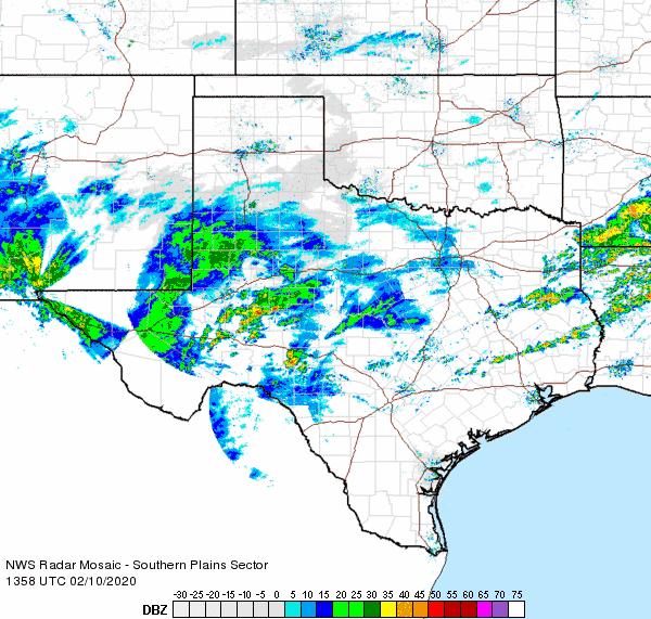
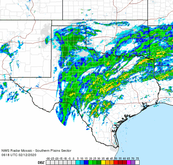
| Regional radar animation valid from 12:38 pm to 1:48 pm on 10 February. An additional radar animation can be found at: 7:58 am to 9:08 am on 10 February. A still radar image overlaid with the temperatures at 9:30 am on the 10th can be VIEWED HERE. | |||||||||||
| A broad area of rain formed across Far West Texas and the Permian Basin early on Monday in response to a disturbance approached off the eastern Pacific. This shield of rain quickly spread northeastward across the South Plains and Rolling Plains through the day before shifting east of the region by late afternoon. Air temperatures fell to right around the freezing mark as this rain moved through, resulting in freezing rain in spots. Thankfully, the marginal temperatures and relatively mild ground kept impacts minimal. Over the course of the day most locations received anywhere from a tenth to over three-tenths of an inch of rain. | |||||||||||
 |
|||||||||||
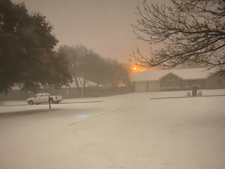
| Snow blanketing Plainview on 12 February 2020. The picture is courtesy of Bobby Johnston. | |||||||||||
|
|||||||||||
| This second round of wintry precipitation diminished by late Tuesday morning, but not before dropping 1 to 3 inches of sleet and snow over much of the southern Texas Panhandle and northwestern South Plains. Even in Lubbock a light coating of sleet did cause some travel difficulties early in the day. | |||||||||||
 |
|||||||||||
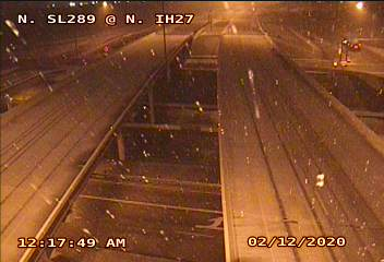
| Snow falling in north Lubbock (Loop 289 and I-27) at 12:17 am on 12 February 2020. The image is courtesy of TXDOT. | |||||||||||
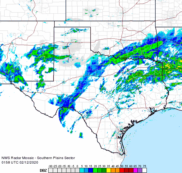
| A final round of sleet and snow raced from west to east across the Caprock Tuesday evening into early Wednesday morning. Many locations on the Caprock received another dusting to an inch of frozen precipitation, with a few spots seeing a bit more. Where temperatures were a few degrees warmer, a cold rain was more common across the southeast Texas Panhandle and the Rolling Plains. The precipitation quickly shifted east of the region by daybreak on Wednesday, though pockets of freezing fog and slick roadways did linger through mid-morning in spots. | |||||||||||
 |
|||||||||||
| Regional radar animation valid from 7:58 pm to 9:08 pm on 12 February 2020. An additional radar animation can be found at: 12:18 am to 1:28 am on 12 February. | |||||||||||
|
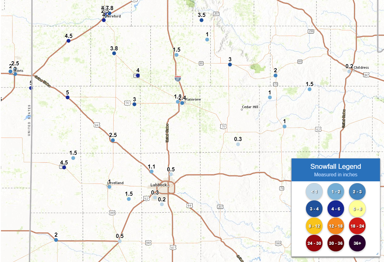
By the time the weather turned more tranquil, many locations on the Caprock had picked up anywhere from a dusting to a few inches or more of sleet and snow between February 10th and 12th. Officially, the Lubbock Airport recorded 0.6 inches of sleet and snow, with 0.3 inches falling on the 11th and another 0.3 inches falling on the 12th. |
|||||||||||
 |
|||||||||||
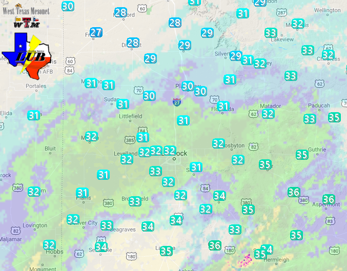
| Snowfall reports collected from around the South Plains region from 10-12 February 2020. | |||||||||||
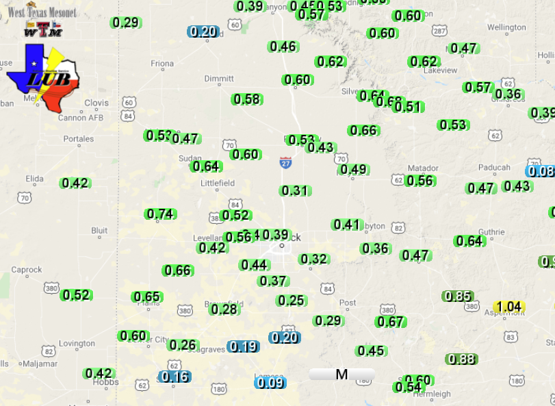
| The entire region picked up beneficial moisture over this wintry stretch. Liquid equivalent totals of a quarter to over a half an inch were common. Lubbock officially measured 0.37 inches and Childress recorded 0.27 inches. | |||||||||||
 |
|||||||||||
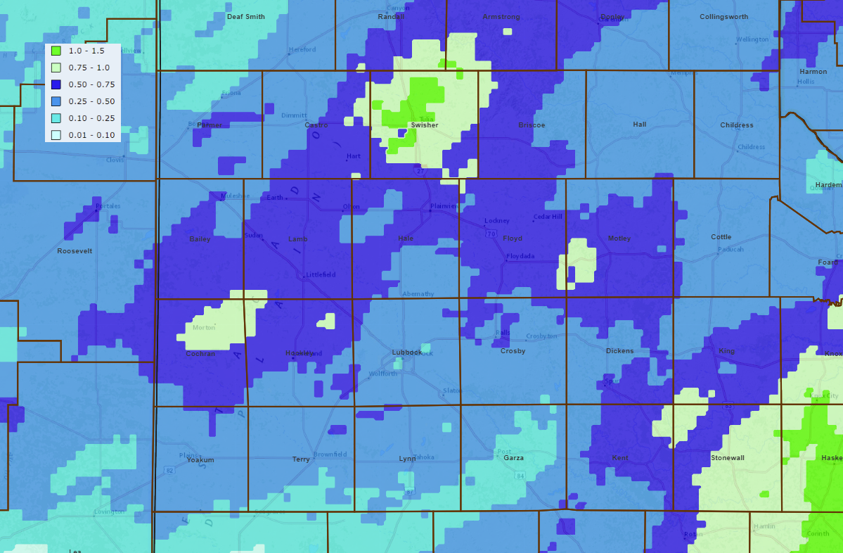
| Three-day radar-estimated and bias-corrected precipitation totals ending at 10 pm on 12 February 2020. The precipitation totals (rain and melted sleet and snow) measured by the West Texas Mesonet over this same time can be VIEWED HERE. | |||||||||||
|
|


