|
Mid-May brings widespread rain to West Texas |
|
 |
|
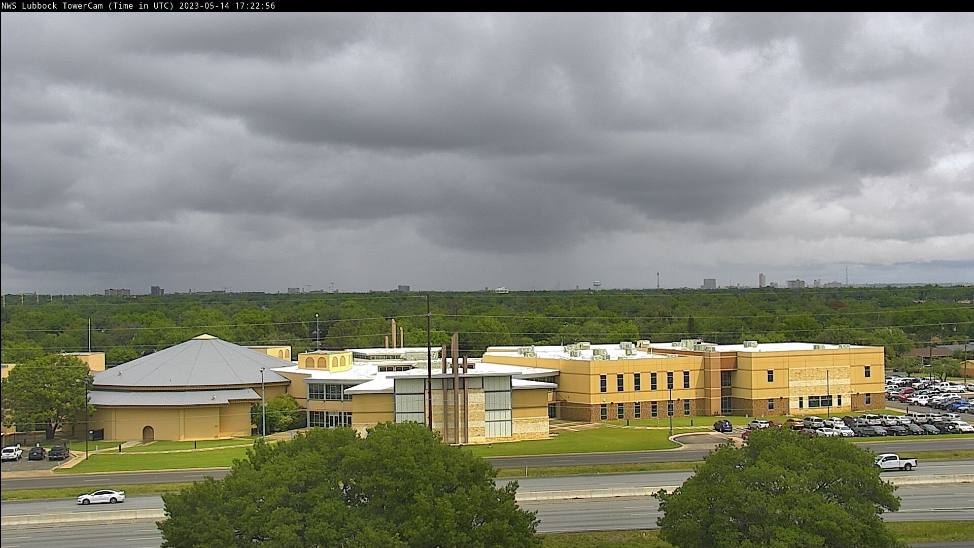
| Cloudy and showery sky, as viewed from southern Lubbock Sunday evening (14 May 2023). | |
|
Hot temperatures, well into the 90s, coupled with a dryline, triggered widespread thunderstorm development Friday afternoon (12 May 2023) from western North Texas, through the Rolling Plains and into the Permian Basin. Strong instability and the relatively hot and dry low levels of the atmosphere promoted strong wind gusts and pockets of small hail with the most intense activity, though relatively weak vertical wind shear kept and severe storms from lasting very long. One storm did manage to generate a 62 mph wind gust southwest of Post Friday evening, though most locations experienced sub-severe (less than 58 mph) wind gusts. |
|
 |
|
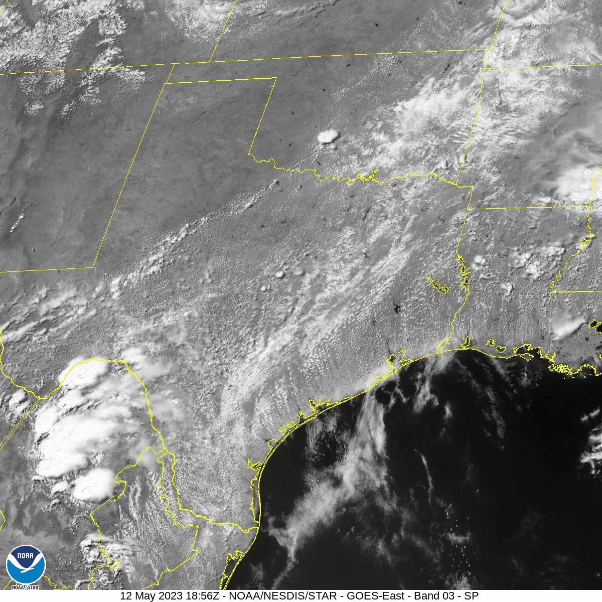
| Visible satellite image (Channel 3) valid from 1:56 pm to 3:51 pm on Friday (12 May 2023). | |
| The thunderstorms quickly grew upscale into a large complex of rain and thunderstorms that expanded south and eastward through much of Central and South Texas through the evening and overnight hours. On the northwest side of the complex, a broad area of light to moderate rain evolved over the southern Rolling Plains Friday evening. | |
 |
|
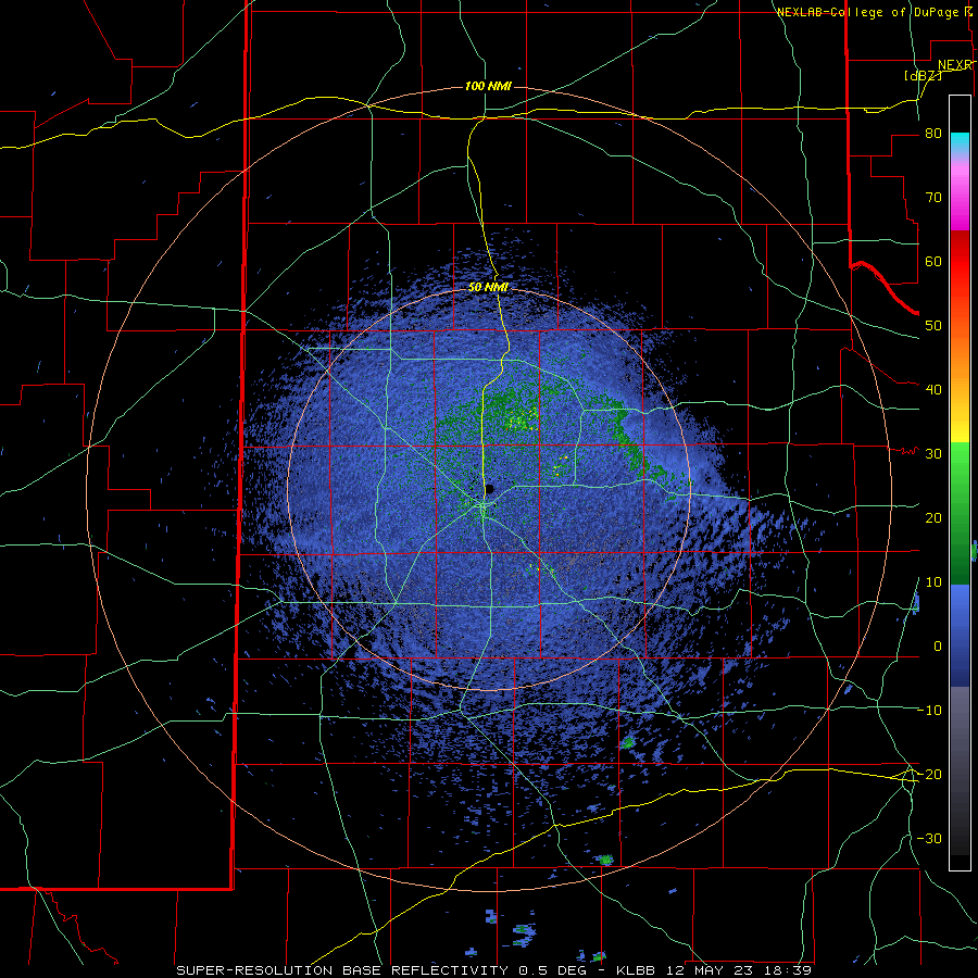
| Lubbock WSR-88D radar animation valid from 2:39 pm to 8:37 pm on Friday (12 May 2023). | |
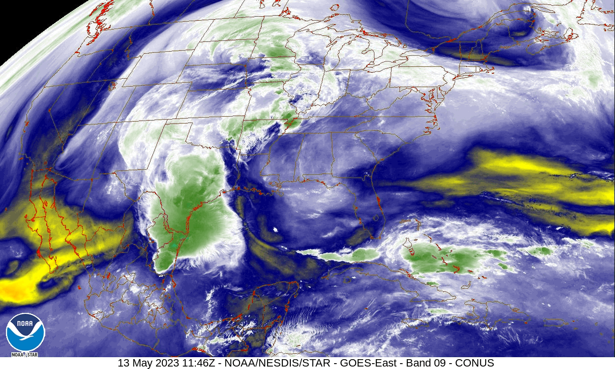
| The Friday afternoon and evening activity was only the beginning, as a large area of deep moisture streamed northward from the northwest Gulf and across much of Texas through the weekend. The below water vapor imagery clearly shows abundant amounts of moisture (whites and greens) being drawn northward over Texas Saturday morning. | |
 |
|
| Water vapor satellite loop (Channel 9) valid from 6:46 am to 8:41 am on Saturday (13 May 2023). | |
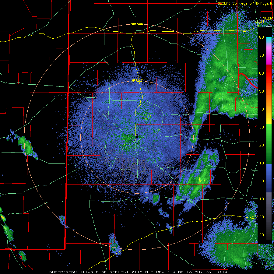
| In response to the returning moisture, a large shield of rain developed and expanded westward across the entire South Plains region Saturday morning. The light to moderate rain, with a few smaller pockets of heavy rain, persisted through much of the day Saturday before diminishing in coverage, but not necessarily intensity, Saturday night. | |
 |
|
| Lubbock WSR-88D radar animation valid from 4:04 am to 2:11 pm on Saturday (13 May 2023). | |
|
After a bit of a lull in precipitation Sunday morning, scattered showers redeveloped during the afternoon hours as warming temperatures interacted with the lingering moist atmosphere. Although coverage of the activity Sunday afternoon and evening was much less than Saturday, those lucky enough to get beneath a shower did receive a brief burst of moderate to heavy rain. |
|
 |
|
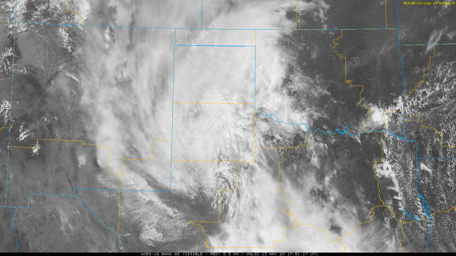
| Visible satellite image (Channel 2) valid from 12:51 pm to 2:21 pm on Saturday (13 May 2023). | |
| Interestingly, since the center of circulation of the nearby storm system moved just south of the area (illustrated clearly in the above satellite animation), the precipitation generally moved from east-to-west, or opposite of what is common here in West Texas...especially in spring. Additional scattered southward moving showers continued into Monday morning as the storm system shifted off to the east of the region. Similar to Sunday, although spotty, those that did get under a shower early Monday experienced efficient rain makers. | |
 |
|
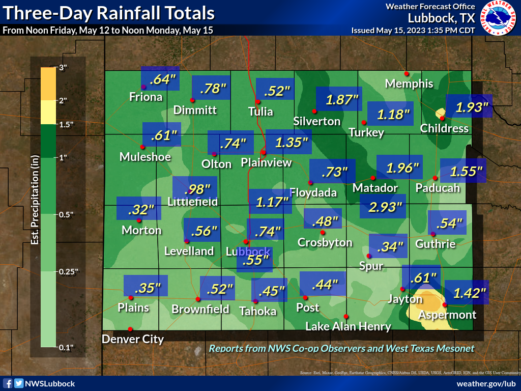
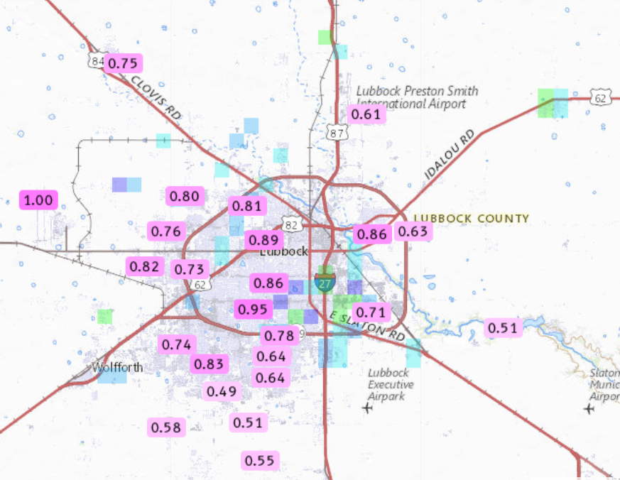
| 3-day rainfall ending at noon on Monday (15 May 2023) measured at various locations around the South Plains region. The data are courtesy of the West Texas Mesonet and the NWS COOP observers. Automated rain totals measured in and around the city of Lubbock over this event can be VIEWED HERE. | |
|
This mid-May Mother's Day Weekend brought welcome rain to the entire region, including pockets where 1 to 2+ inches fell. Oddly, but not necessarily unappreciated, the widespread mid-May precipitation came with a lack of severe weather in what is typically the heart of the severe weather season for West Texas. The heaviest rain was generally confined to locations near and east of the edge of the Caprock, though almost everyone recorded 1/3 to 1/2 inch of rain or more. Officially, the Lubbock Airport measured 0.74 inches over this wet stretch, which boosted the year-to-date (YTD) total to 2.99 inches. Even so, the YTD total remains 1.76 inches below the normal value of 4.75 inches. The Childress Airport fared even better, recording 2.22 inches over this soggy weekend, and boosted their YTD total to 5.94 inches (0.84 inches below the normal of 6.78 inches). Overall, the widespread rain was welcome and will help mitigate the ongoing drought, but additional rain will be needed to eliminate the long-term drought entirely. Preliminary storm reports for Friday afternoon and evening (12 May 2023) can be found below: |
|
PRELIMINARY LOCAL STORM REPORT
NATIONAL WEATHER SERVICE LUBBOCK TX
1009 PM CDT FRI MAY 12 2023

..TIME...   ...EVENT...      ...CITY LOCATION...     ...LAT.LON...
..DATE...   ....MAG....      ..COUNTY LOCATION..ST.. ...SOURCE....
            ..REMARKS..

0626 PM     TSTM WND GST     5 SSW GRAHAM            33.08N 101.52W
05/12/2023  M62 MPH          GARZA              TX   MESONET

            ALSO GUSTED TO 59 MPH AT 627 PM. MEASURED BY
            THE WEST TEXAS MESONET.

0958 PM     NON-TSTM WND GST 10 WSW GUTHRIE          33.57N 100.48W
05/12/2023  M66 MPH          KING               TX   MESONET

            PERIODIC WAKE LOW WIND GUSTS OF 58 TO 66 MPH
            FROM 952 PM TO 10 PM. MEASURED BY THE WEST
            TEXAS MESONET.

