
Tropical Storm Bertha could bring tropical storm conditions to portions of the Florida Panhandle and Alabama coast through Wednesday, where a Tropical Storm Watch and Storm Surge Watch is in effect. Numerous severe thunderstorms with heavy rainfall are expected from the Ohio Valley into the Mid-Atlantic and Northeast Tuesday. Read More >
|
Couple rounds of weekend thunderstorms |
|
 |
|
|
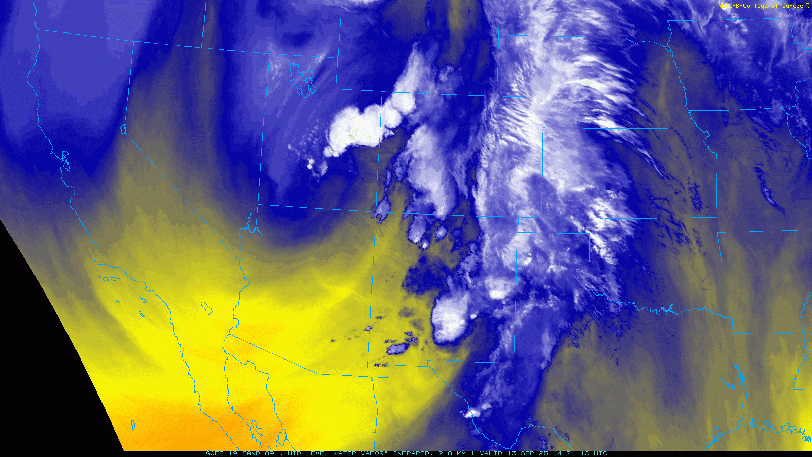
Water vapor loop valid from 9:41 am to 5:01 pm on Saturday (13 September 2025). |
|
|
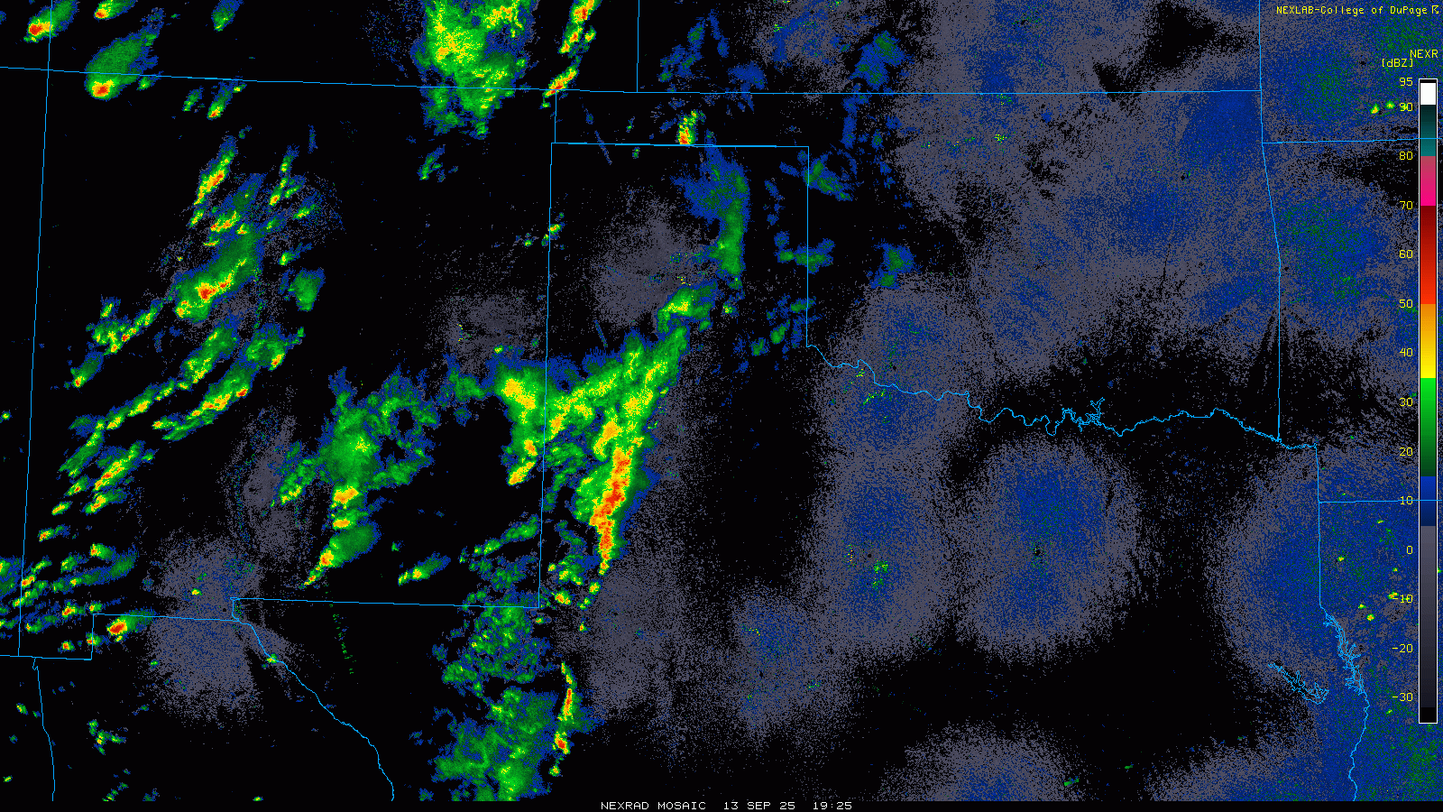
A storm system crossing the central Rockies drew rich mid-level moisture northward, while also providing lift, over much of the central and southern High Plains on Saturday and Sunday (13-14 September). The lift and moisture aloft, in combination with improving low-level moisture, supported rounds of showers and thunderstorms over West Texas on this mid-September weekend. |
|
 |
|
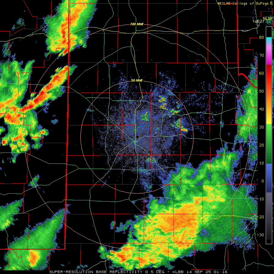
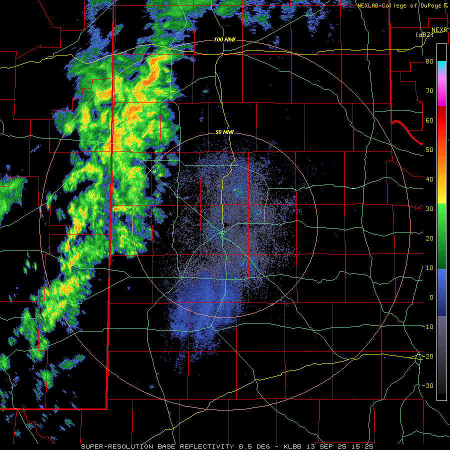
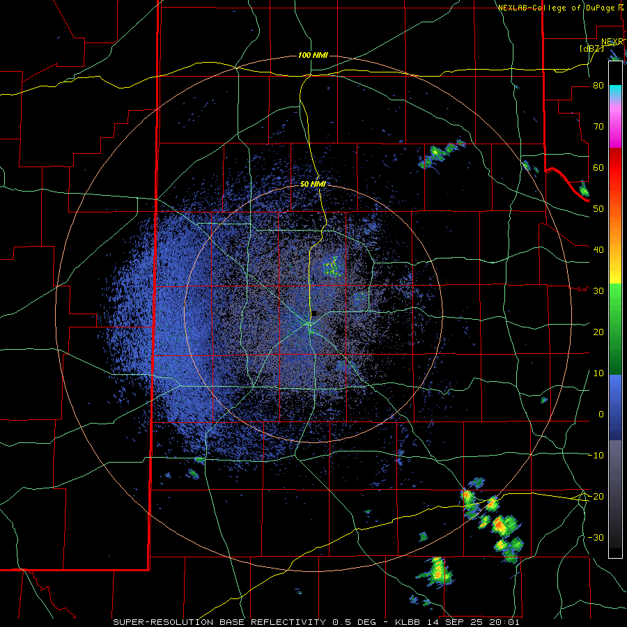
| Lubbock WSR-88D radar animation valid from 8:16 pm on Saturday to 8:45 am on Sunday (13-14 September 2025). Additional radar animations can be found at: 10:29 am to 1:57 pm on Saturday (13 September); and 3:01 pm to 6:22 pm on Saturday (13 September). A regional radar animation, valid from 2:25 pm on Saturday to 8:45 am on Sunday (13-14 September) can be VIEWED HERE. | |
| The first round of activity tracked out of eastern New Mexico and into the western South Plains and southwest Texas Panhandle Saturday morning. These showers grew in intensity as they advanced into the central South Plains Saturday afternoon, and began to produce intermittent lightning along with light to moderate rainfall. Though rain totals weren't particularly heavy with this initial wave, the lightning did cause a significant delay (well over 2 hours) for the Texas Tech versus Oregon State football game. The rain and thunderstorms faded as they moved east into the Rolling Plains by early evening. | |
 |
|
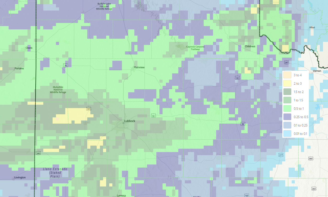
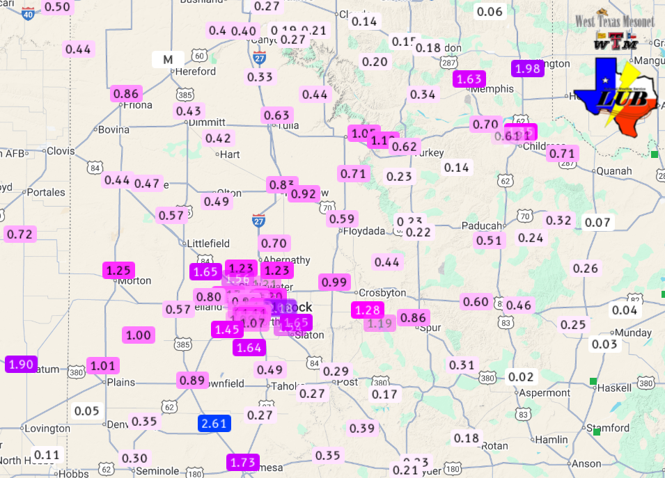
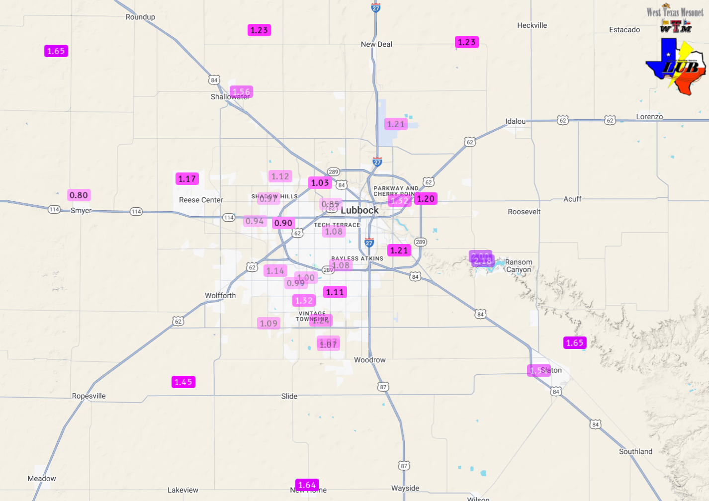
| Radar-estimated and bias-corrected 2-day rainfall ending at 7 am on Monday (15 September 2025). Measured rainfall over this same stretch, courtesy of the West Texas Mesonet (WTM) and the National Weather Service (NWS), can be FOUND HERE. A close up of the Lubbock area can as be VIEWED HERE. | |
|
However, additional thunderstorm activity originating in New Mexico spilled into West Texas late Saturday evening, rolling across most of the South Plains, southern Texas Panhandle and Rolling Plains through early Sunday morning. These thunderstorms were more intense then the first round, generating gusty winds and heavy rain as the moved through. The heaviest rain, from 1 to over 2 inches, targeted the central and southern South Plains, though nearly everyone saw some rain. Sunday afternoon and evening brought more storms, this time scattered over the southeast Texas Panhandle into parts of the Rolling Plains. This activity was spottier, but did bring pockets of heavy rainfall. One intense storm hit Memphis, with the West Texas Mesonet site on the northeast edge of town measuring a peak gust to 74 mph. |
|
 |
|
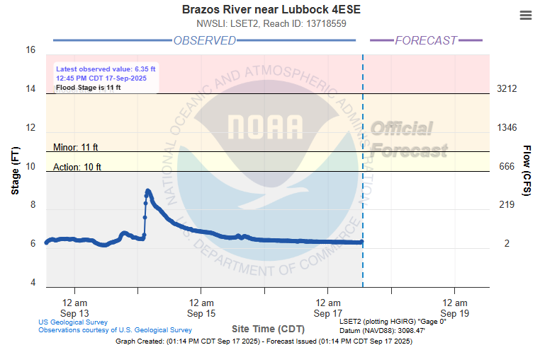
| Plot of the Brazos River on the southeast side of Lubbock in mid-September 2025. | |
|
The heavy rain over the city of Lubbock, around and above an inch, did result in runoff that briefly raised the headwaters of the Brazos a few feet on the southeast side of Lubbock Sunday morning. A list of the preliminary storm reports collected on September 14th can be found below. |
|
Preliminary Local Storm Report
National Weather Service Lubbock TX
440 PM CDT Sun Sep 14 2025

..TIME...   ...EVENT...      ...CITY LOCATION...     ...LAT.LON...
..DATE...   ....MAG....      ..COUNTY LOCATION..ST.. ...SOURCE....
            ..REMARKS..

0427 PM     Tstm Wnd Gst     1 ENE Memphis           34.73N 100.53W
09/14/2025  M74 MPH          Hall               TX   Mesonet

            Also gusted to 73 mph at 428 PM. Mesonet
            station 38 Memphis 1NE.

