|
Heavy rain targets the southern Texas Panhandle & northern South Plains 10 October 2025 |
|
 |
|
|
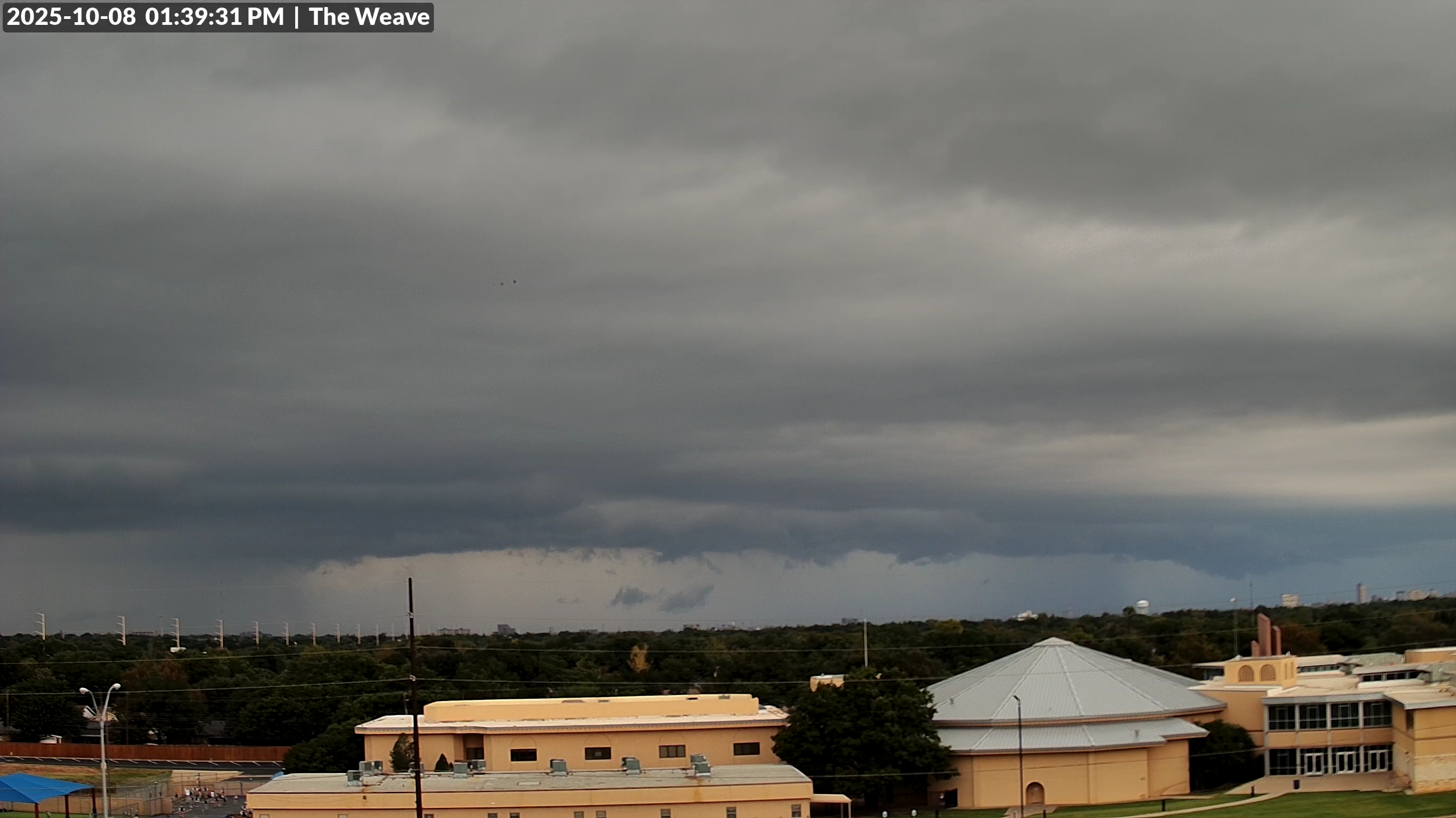
Rain skirting the north side of Lubbock early Wednesday afternoon (8 October 2025). |
|
|
Wednesday, October 8th, brought an unexpected bout of moderate to heavy rain to portions of West Texas. Specifically, a couple of slow-moving complexes of rain and embedded thunderstorms tracked out of eastern New Mexico and across the southern Texas Panhandle and adjacent northern South and Rolling Plains. The rounds of rain were aided by cool and moist air that followed a weak cold front the previous day, as well as a mid-level disturbance approaching from the west. |
|
 |
|
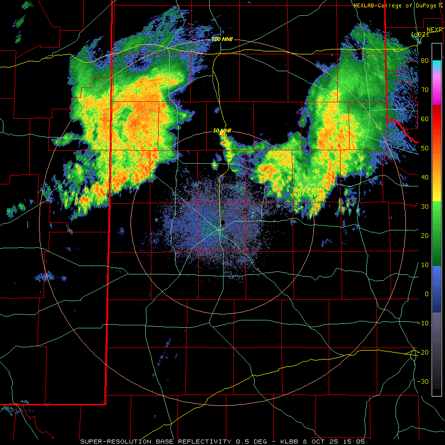
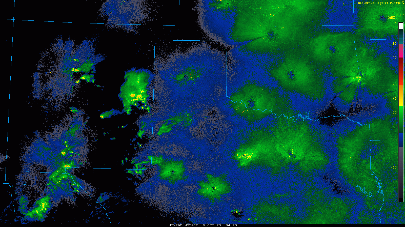
| Lubbock WSR-88D radar animation valid from 10:02 am to 5 pm on Wednesday (8 October 2025). A regional radar animation, valid from 11:25 pm on Tuesday to 7:05 am on Wednesday (7-8 October) can be VIEWED HERE. | |
| The initial cluster of showers and thunderstorms started out in eastern New Mexico the day before. This activity gradually organized into a small complex late Tuesday evening (7 October), before spreading across the Texas state line after midnight. Although not very large, the cluster was persistent as it translated eastward over the southern Texas Panhandle through the overnight hours of Wednesday morning. Relatively cool and moist conditions being ingested into the rainmaker supported efficient precipitation production. | |
 |
|
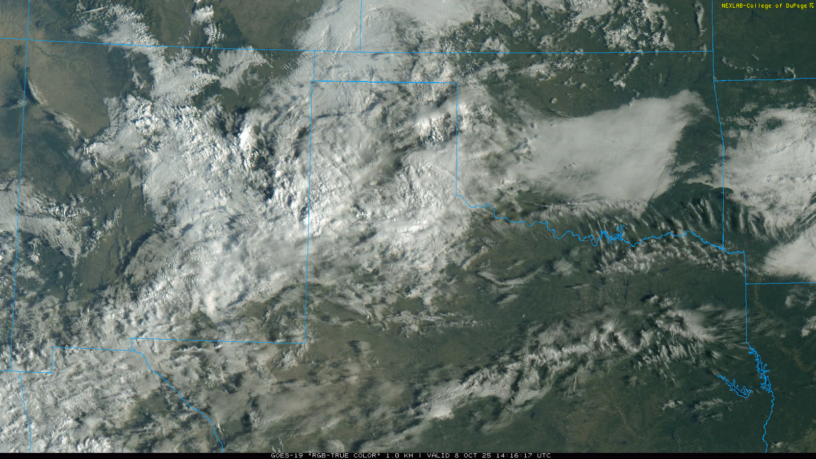
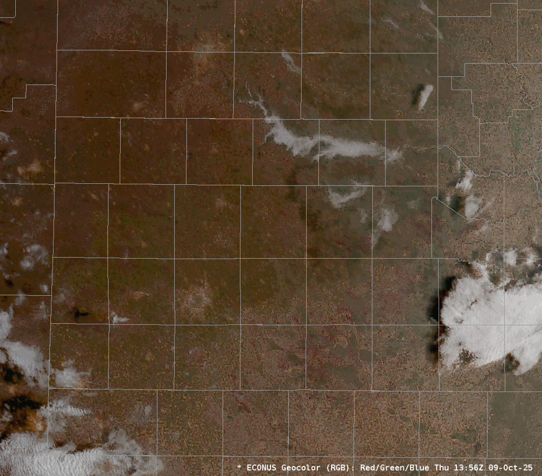
| "RGB True-Color" satellite animation valid from 9:16 am to 3:56 pm on Wednesday (8 October 2025). | |
| Following on the heels of the lead batch of rain, another small complex of showers and thunderstorms organized over east-central New Mexico around daybreak Wednesday. Similar to its predecessor, this cluster of rain/storms was persistent, though its thrust was focused a little farther south, tracking over the northern and central South Plains before fading across the northern Rolling Plains Wednesday evening. | |
 |
|
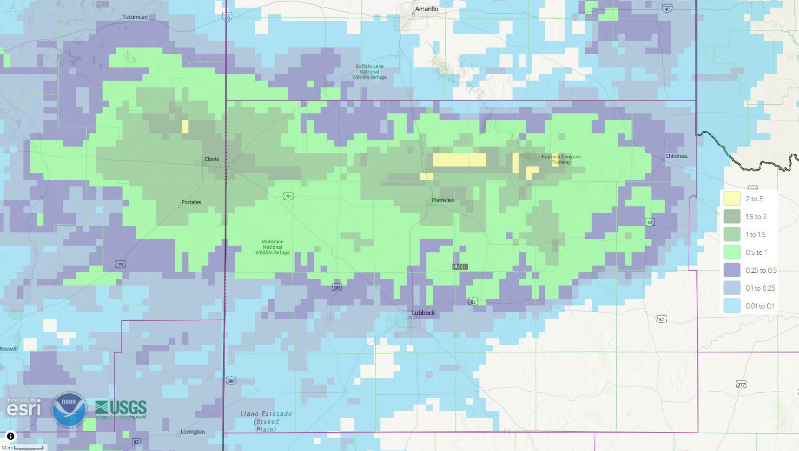
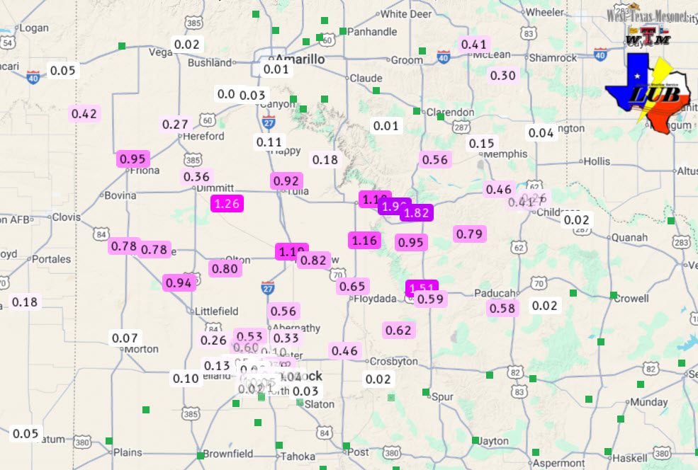
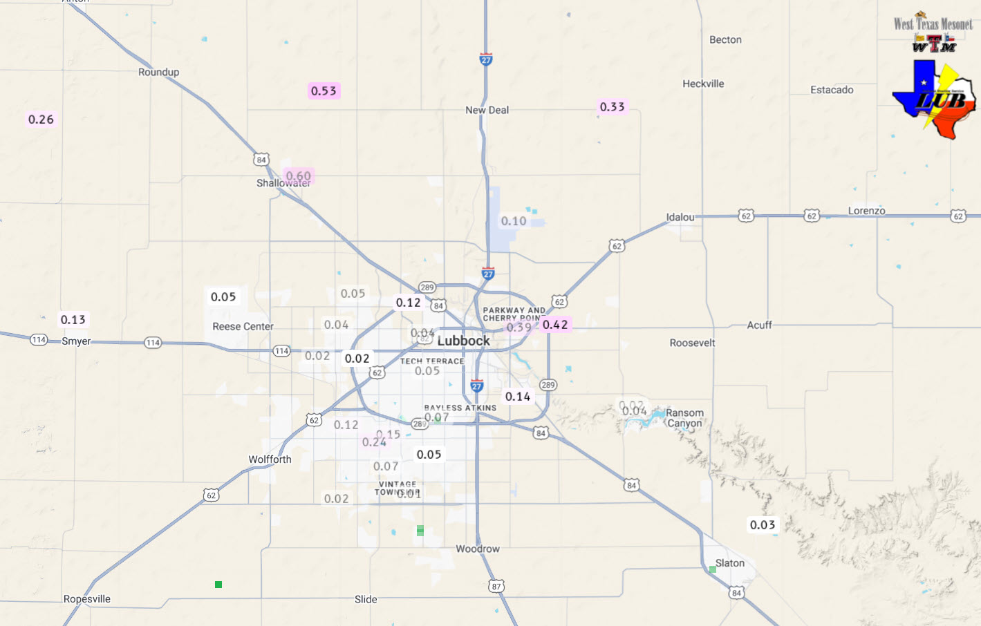
| Radar-estimated and bias-corrected 2-day rainfall ending at 7 am on Thursday (9 October 2025). Measured rainfall over this same stretch, courtesy of the West Texas Mesonet (WTM) and the National Weather Service (NWS), can be FOUND HERE. A close up of the Lubbock area can as be VIEWED HERE. | |
|
Together, the small clusters brought widespread moderate to heavy rain for much of the southern Texas Panhandle and northern South Plains, with lighter amounts farther south, north and east from there. Rain totals of 0.75 to 1.50+ inches were common from around Friona and Muleshoe through Tulia and Plainview, to near Northfield and much of central and southern Hall County. The heaviest rain fell in and around Caprock Canyons State Park and Turkey, where nearly 2 inches was measured. Lubbock didn't fare as well, but still generally saw anywhere from a couple hundredths to a couple tenths of an inch of rain. The far northeast corner of Lubbock did a bit better, receiving about four tenths of an inch, while the Lubbock Airport officially checked in with 0.15 inches. |
|
 |
|
| "GEOCOLOR" satellite animation valid from 8:56 am to 10:06 am on Thursday (9 October 2025). | |
|
Where the rain fell, temperatures stayed cool, only warming into the upper 60s and lower 70s for much of the southern Texas Panhandle and northern South and Rolling Plains. Where the rain and thicker cloud cover avoided, the southern South and Rolling Plains warmed into the upper 70s to middle 80s. Interestingly, the rain cooled air, followed by light winds and mostly clear skies, led to the development of pockets of fog Wednesday night into Thursday morning. The most widespread and dense fog was concentrated over lower elevations of the southeast Texas Panhandle and northern Rolling Plains. The fog was most concentrated across the valley of the Prairie Dog Town Fork of the Red River, with additional fog favoring the Pease River Valley, as the above satellite loop illustrates. |
|
None Reported!

