
Dangerous heat will expand from the Gulf Coast into the Southern Plains and Desert Southwest through week's end. Additional extreme heat impacting the Pacific Northwest will shift to the northern Plains by the weekend. Tropical Storm Bertha is expected to continue to impact portions of the northern Gulf Coast from the western Florida Panhandle to southeastern Louisiana through tonight. Read More >
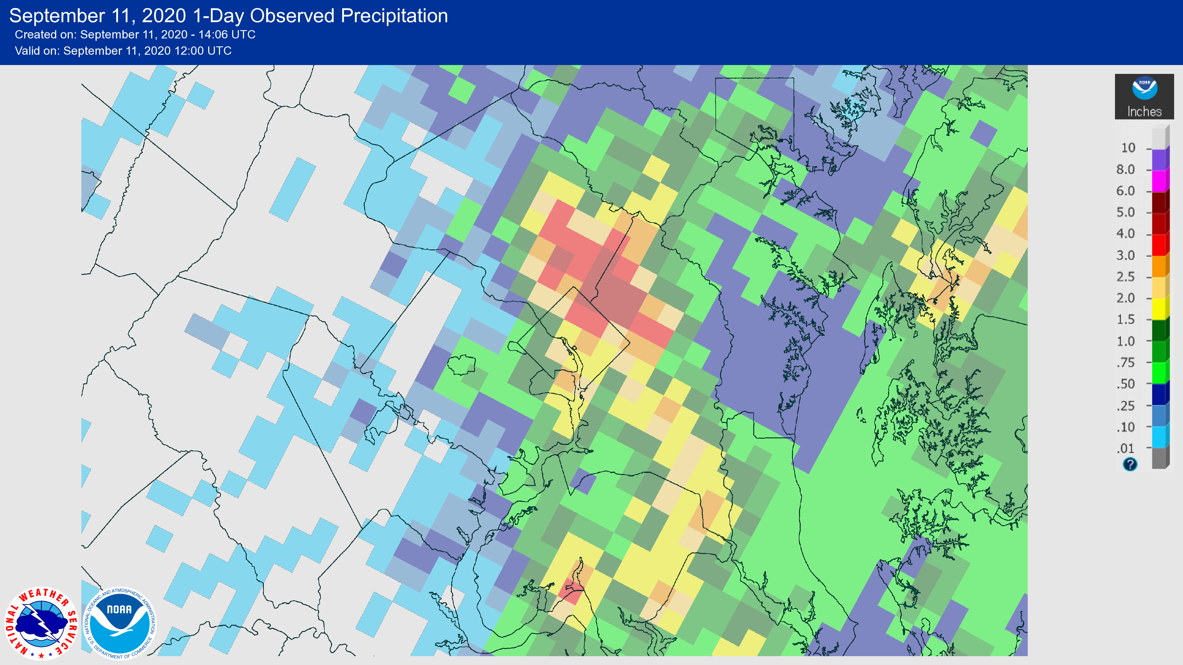
Early on Thursday afternoon, showers and thunderstorms arose along a weak atmospheric boundary oriented north to south across the Washington area. The storms that formed were fed by tropical moisture to our southeast which allowed for heavy rainfall rates. In addition, weak winds in the atmosphere kept the storms moving slowly. That combination of heavy rain and slow movement allowed for 2-5" of rain to fall in a relatively narrow corridor across parts of the Washington metro area. Most of that rain fell within 2 hours.
The heavy rains produced flash flooding of numerous roads and streams and first responders conducted several water rescues. The hardest hit areas were: the District of Columbia, Arlington and Alexandria Virginia, and the Maryland suburbs in Prince Georges and Montgomery Counties.
Listing of rain totals: linked here.
Listing of reports of flooding & flash flooding (received by NWS Baltimore/Washington): linked here.
Map of radar estimated rainfall: (Areas in red are 3"+)
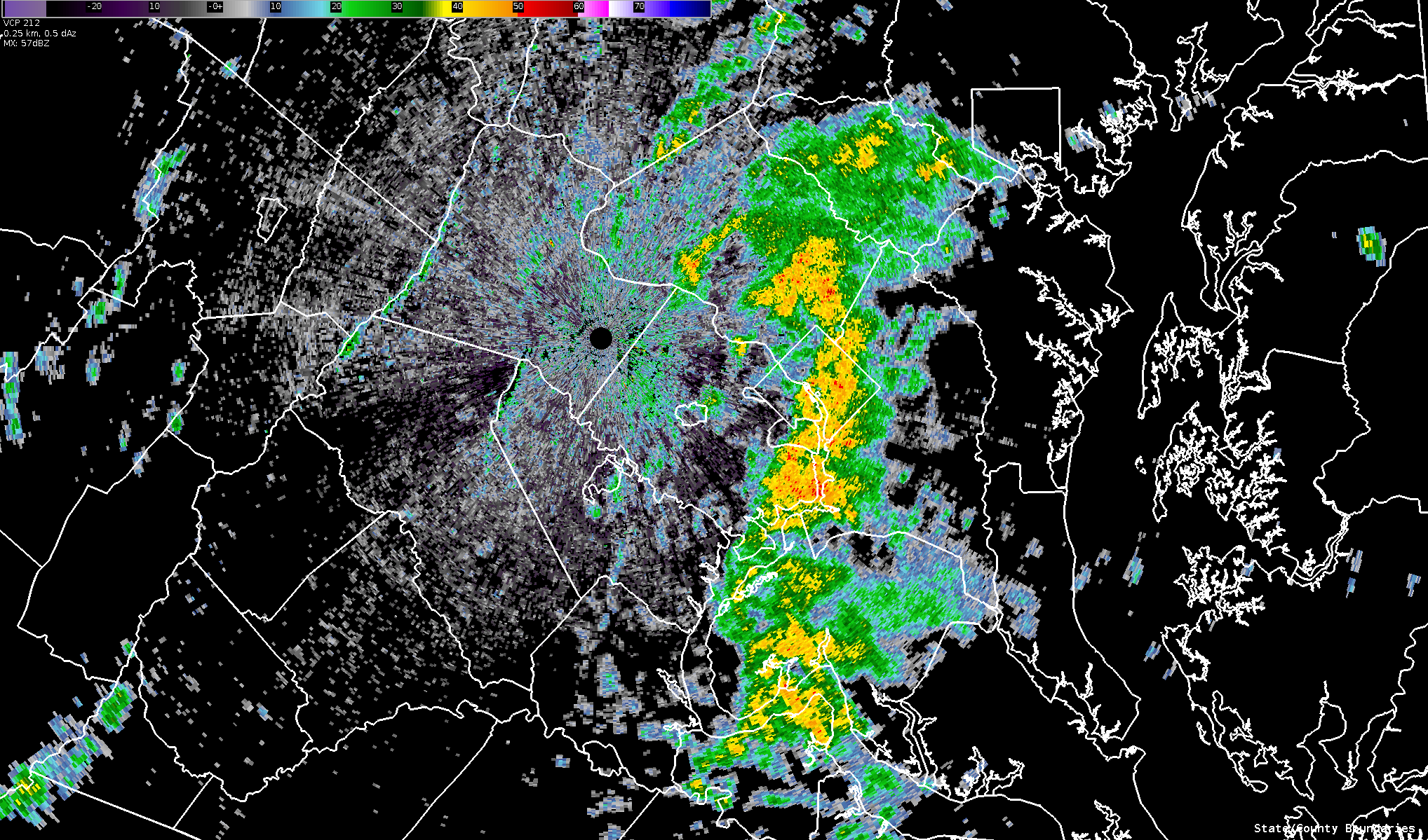
Radar Loop showing the storms from 1:25 - 1:49 P.M.
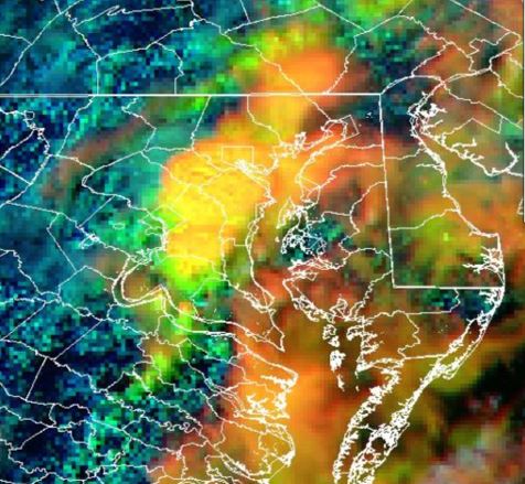
Satellite Image at 2:30 P.M.
Link to images of flooding: (using internet search "DC flooding September 2020")


 Coastal Flood
 FAQ
FAQ