Tropical Depression Two is expected to gradually strengthen and could bring tropical storm conditions to the Florida Panhandle beginning late Monday. Areas of flash flooding will be possible through Thursday along the eastern and central Gulf Coast. Severe thunderstorms will develop and move along a cold front crossing the Upper Midwest Monday, and through the Ohio Valley/Mid-Atlantic on Tuesday. Read More >
Overview
|
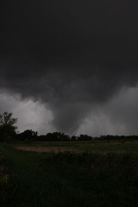
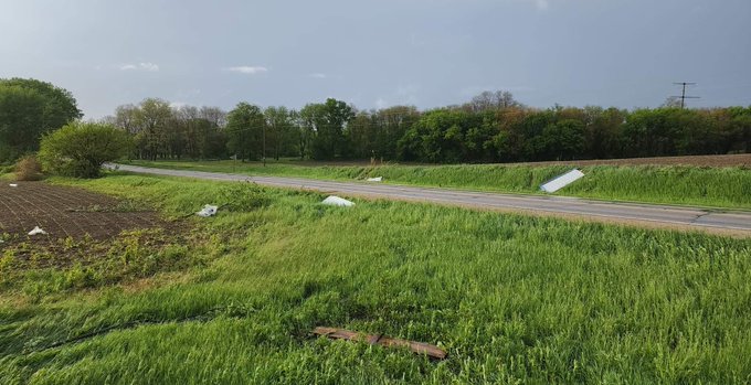
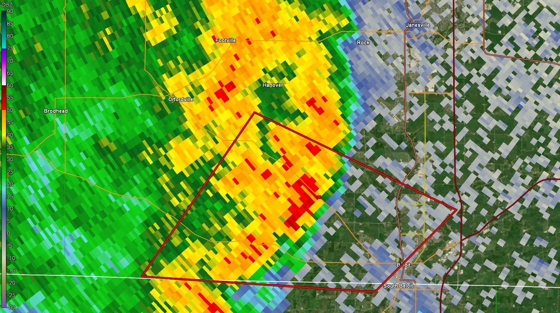
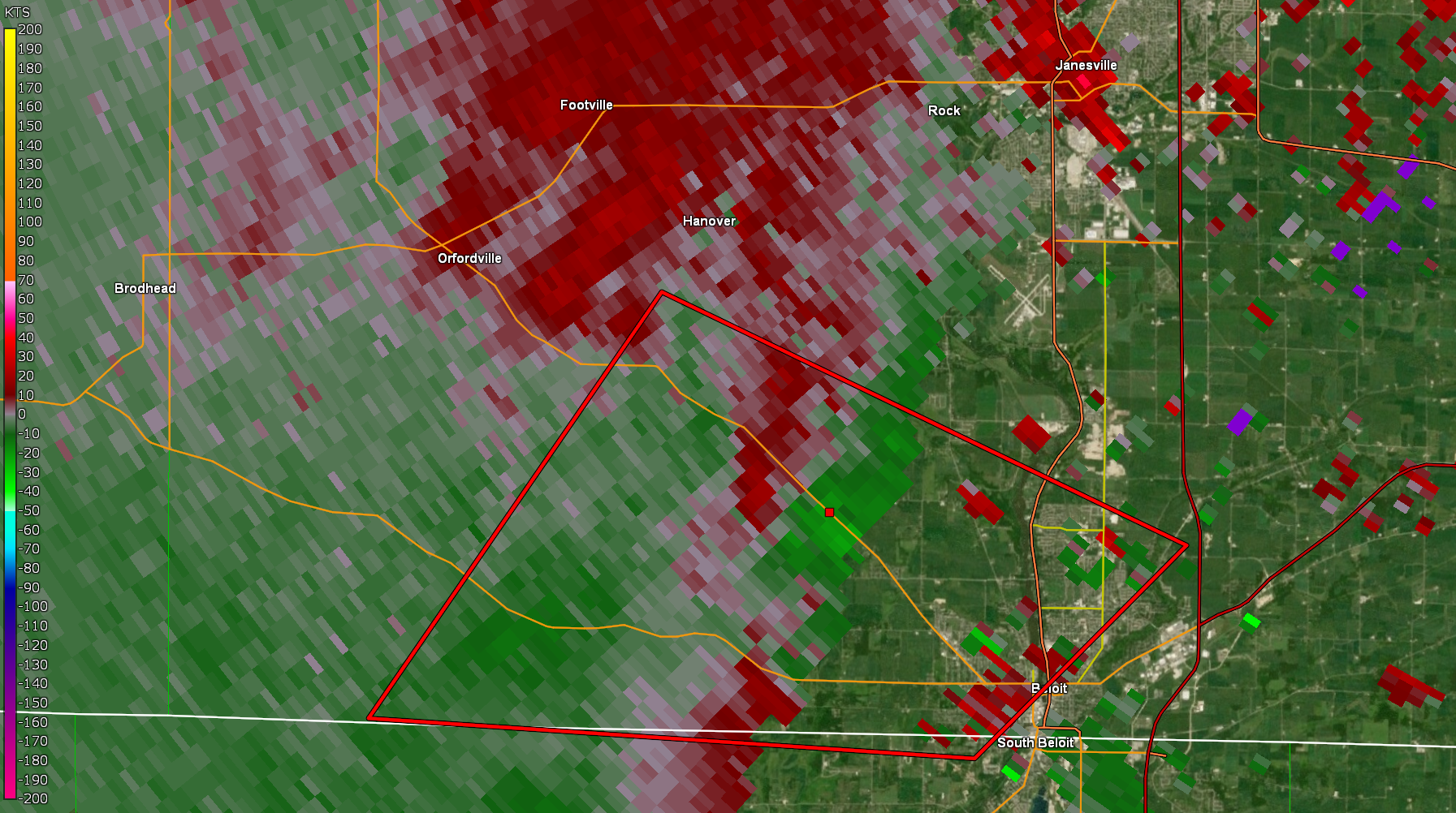
Showers and thunderstorms streamed into southern Wisconsin ahead of and along a warm front during the evening of Wednesday, May 25, 2022. There was just enough turning of the winds (shear) and instability for a few storms to rotate. One storm strengthened and started rotating over Winnebago County in north central Illinois and tracked into southwest Rock County at 6:37 pm. The storm produced a tornado as it tracked northwest of Beloit. |
Photo Credit: Barbara Heath |
Tornadoes
|
Tornado - 6 NW Beloit
Track Map 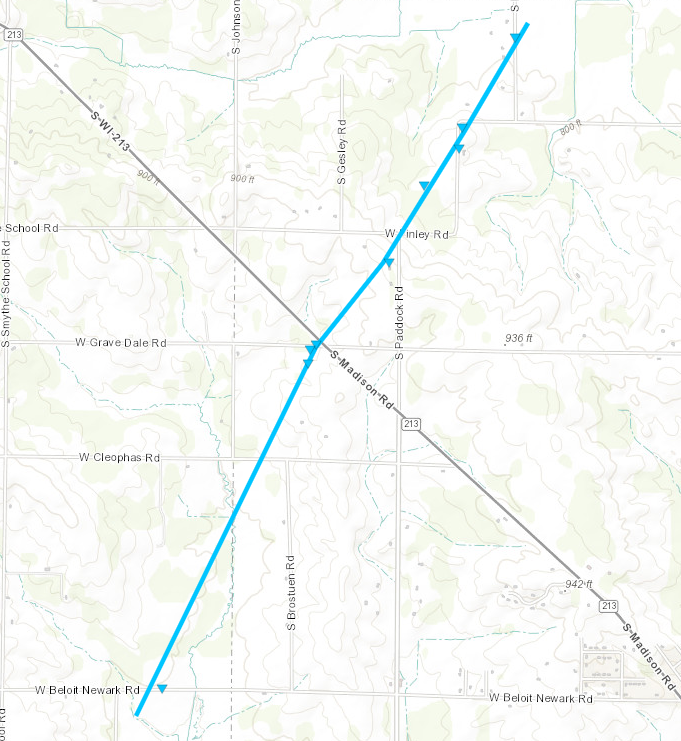 
Downloadable KMZ File |
||||||||||||||||
|
||||||||||||||||
The Enhanced Fujita (EF) Scale classifies tornadoes into the following categories:
| EF0 Weak 65-85 mph |
EF1 Moderate 86-110 mph |
EF2 Significant 111-135 mph |
EF3 Severe 136-165 mph |
EF4 Extreme 166-200 mph |
EF5 Catastrophic 200+ mph |
 |
|||||
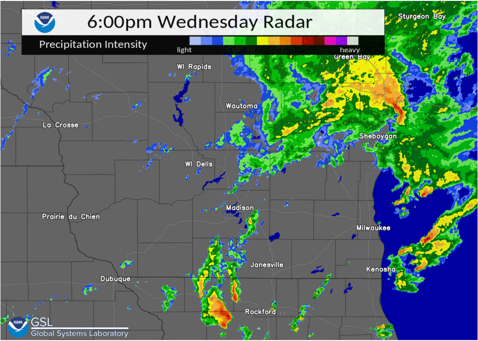
Radar
 |
 |
 |
|
| Radar Reflectivity | 6:49 PM Reflectivity | 6:49 PM Storm Relative Velocity |
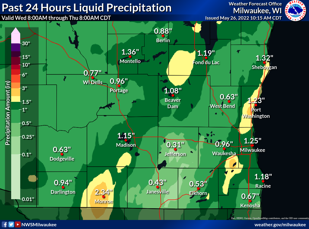
Rain Reports
Here is a map of the estimated rainfall amounts for southern Wisconsin and the state of Wisconsin.
 |
Media use of NWS Web News Stories is encouraged! Please acknowledge the NWS as the source of any news information accessed from this site. |
|