Pacific moisture will continue to bring locally heavy coastal/lower elevation rain and heavy mountain snow to the West Coast and portions of the Intermountain West through Monday. A wintry mix will create hazardous travel across the northern Plains and Upper Midwest into early Monday. Dry, gusty winds are resulting in elevated to critical fire weather in the south/central High Plains. Read More >
What is El Niño?
An El Niño develops when sea surface temperatures in the equatorial Pacific are warmer than average for several months. It is the opposite of a La Niña (sea surface temperatures are cooler than normal). It has an impact on weather patterns in the United States, especially in winter.
What Are The Impacts To Southern Wisconsin for the Winter?
In short, temperatures tend to be warmer or close to average. As a result, there tends to be less snow. The Climate Prediction Center's winter outlook calls for an increased chance for above normal temperatures (bottom left) and below normal precipitation (bottom right). It is important to note that these conditions are for the winter season average, and there will still be days with below normal temperatures and a lot of precipitation.
Also, each El Niño is different and can have different impacts. There have been El Niños with below average winter season temperatures and above average precipitation in this area. In a study by the Midwest Regional Climate Center, southern Wisconsn's winter temperatures were above normal during 3 of the 6 strong El Niños, and near normal or above normal for all 6 strong El Niños. Winter snowfall in southern Wisconsin was near or below average during 5 of 6 strong El Niños. The strongest El Niños were in 1997-98 and 1982-83, while there were strong El Niños in 1957-58, 1965-66, 1972-73, and 2009-10.
Here is a closer look at the numbers:
For the December-January-Februrary season, average temperatures were around 24.0 degrees in Milwaukee, and 21.0 degrees in Madison. In the past 7 strong El Niños (including 1992), temperatures across southern Wisconsin were near average to 6.0 degrees above average.
There is no strong correlation with precipitation. During the past 7 strong El Niños precipitation amounts ranged from 2.00 inches below average, to 2.50 inches above average. Average winter precipitation ranges from 4.00 to 5.00 inches across southern Wisconsin.
Average winter season snowfall is 37.0 inches in Milwaukee, and 32.0 inches in Madison. Of the past 7 strong El Niños, snowfall was near to below average for 6 of the winters. Amounts range from near average to 18.0 inches below average during strong El Niños. However, there was one strong El Niño where snowfall was roughly 18.0 inches above average.
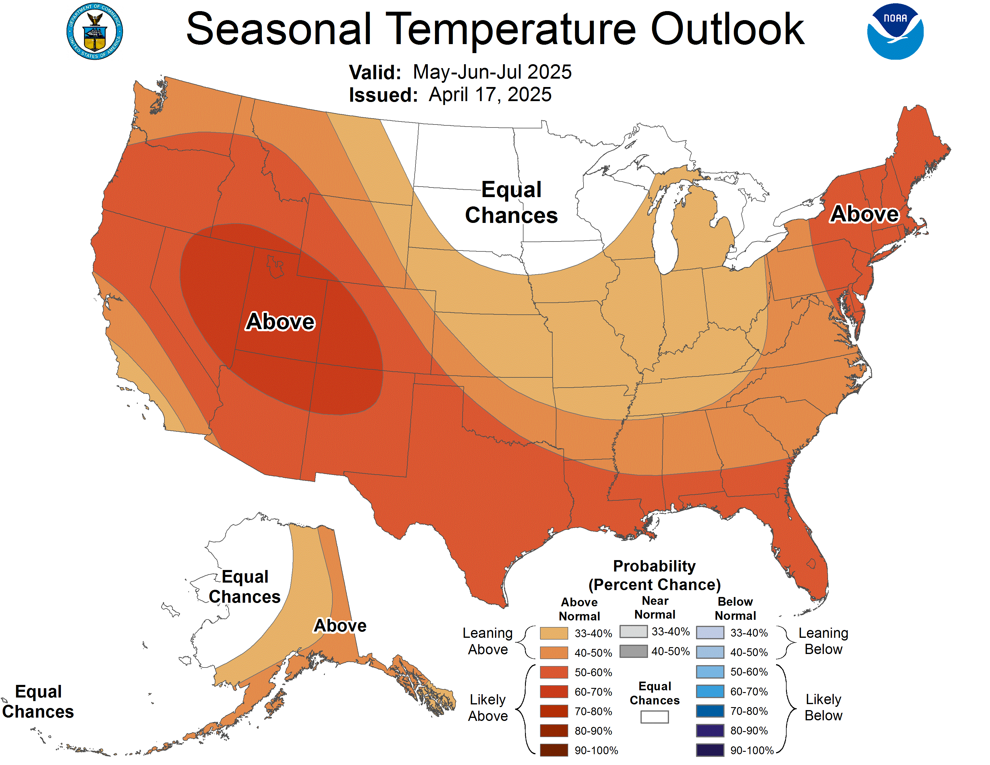
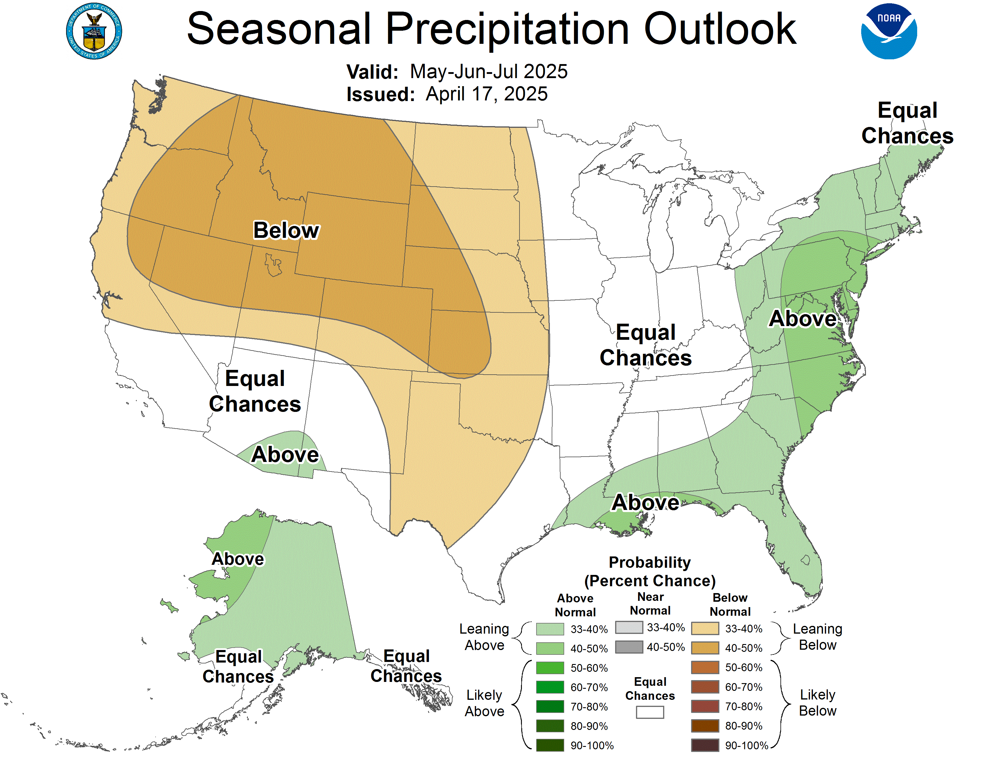
Below are the latest three month temperature and precipitation outlooks from the Climate Prediction Center. Note that southern Wisconsin remains in increased chances for above normal temperatures, as well as increased chances for below normal precipitation, for the January-Februrary-March period.
 |
 |
How Does This Happen?
During an El Niño, the polar jet stream (a river of air) is shifted northward, which limits cold air intrusions from the north. This pattern tends to bring above average temperatures to much of the northern United States, including southern Wisconsin, and below average temperatures to parts of the southern United States.
The Pacific jet stream extends across the southern United States. This helps to bring moisture to parts of the southern United States. El Niño is also associated with below average precipitation over the east-central United States.
How Does This El Niño Compare To Others?
This El Niño is on track to be one of the strongest on record (back to 1950).
What Happened During the Last Strong El Niño?
The winter was very warm during the very strong 1997-98 El Niño. Temperatures were 6.0 to 8.0 degrees above average (bottom left). Precipitation was up to 2.00 inches above average (bottom middle) and snowfall was very close to average (bottom right).
 |
 |
 |
For more information on El Niño see NOAA's ENSO blog.
Marquardt/Wood