
Tropical system in the Gulf expected to gradually strengthen the next couple of days off the Florida Panhandle and Alabama coasts. Instances of flash flooding will be possible through Thursday along the eastern and central Gulf Coast. Severe thunderstorms will develop and move along a cold front crossing the Upper Midwest, and through the Ohio Valley/Mid-Atlantic on Tuesday. Read More >
Milwaukee/Sullivan, WI
Weather Forecast Office
What's New?
1) Starting August 16, 2021 river forecasts will be created for Black Earth Creek at Black Earth. These forecasts will help with planning and situational awareness of river levels and assist recreational interests in the area. These forecasts will be created when the river is forecast to reach or exceed 5 feet. This is called action stage. River flood watches and/or warnings will be issued when water levels are expected to approach or exceed the flood stage of 5.5 feet.
2) Starting August 16, 2021 flood levels will be lowered to better match impacts in the area.
Minor Flood stage will change from 7 feet to 5.5 feet
Moderate flood stage will change from 9 feet to 7 feet
Major flood stage will change from 10 feet to 8 feet
Action stage will change from 6 feet to 5 feet.
How You Find It
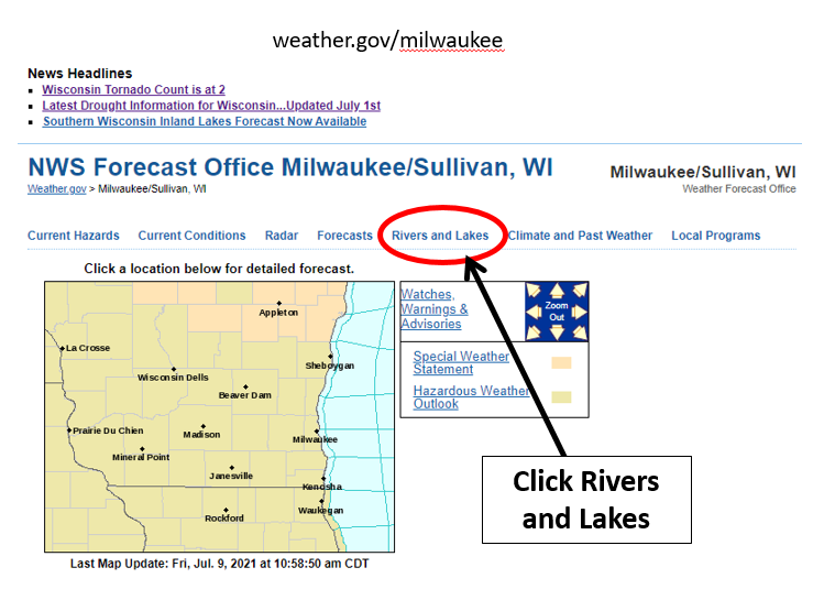
Go to our main webpage and select the Rivers and Lakes tab:
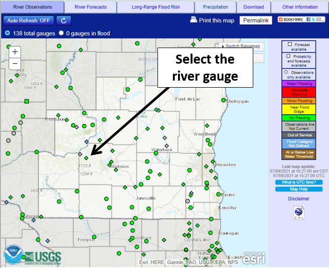
Then select the river gauge you are interested in:
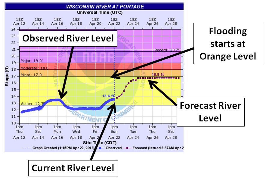
How Do You Interpret River Forecasts?
Note, below is not a current forecast - example only!
The Public information statement has more details.
Contact sarah.marquardt@noaa.gov for questions or more information.
Hazards
National Briefing
Hazardous Weather Outlook
Skywarn
View Local Storm Reports
Submit A Storm Report
Winter Weather
Summer Weather
Beach Hazards
Local Forecasts
Marine
Aviation
Fire
Local Text Products
Local Precip Forecast
Hourly Forecast Graphics
Forecast Discussion
Climate
Historic Events For Srn WI
Lightning Plot Archive
Daily Climate Graphics
Local Climate Products
Normals/Records MKE/MSN
CoCoRaHS
US Dept of Commerce
National Oceanic and Atmospheric Administration
National Weather Service
Milwaukee/Sullivan, WI
N3533 Hardscrabble Road
Dousman, WI 53118
262-965-2074
Comments? Questions? Please Contact Us.

