Overview
|
A line of severe thunderstorms moved east northeast through far southern Wisconsin on Friday evening, March 31, 2023, producing several tornadoes and damaging winds. |
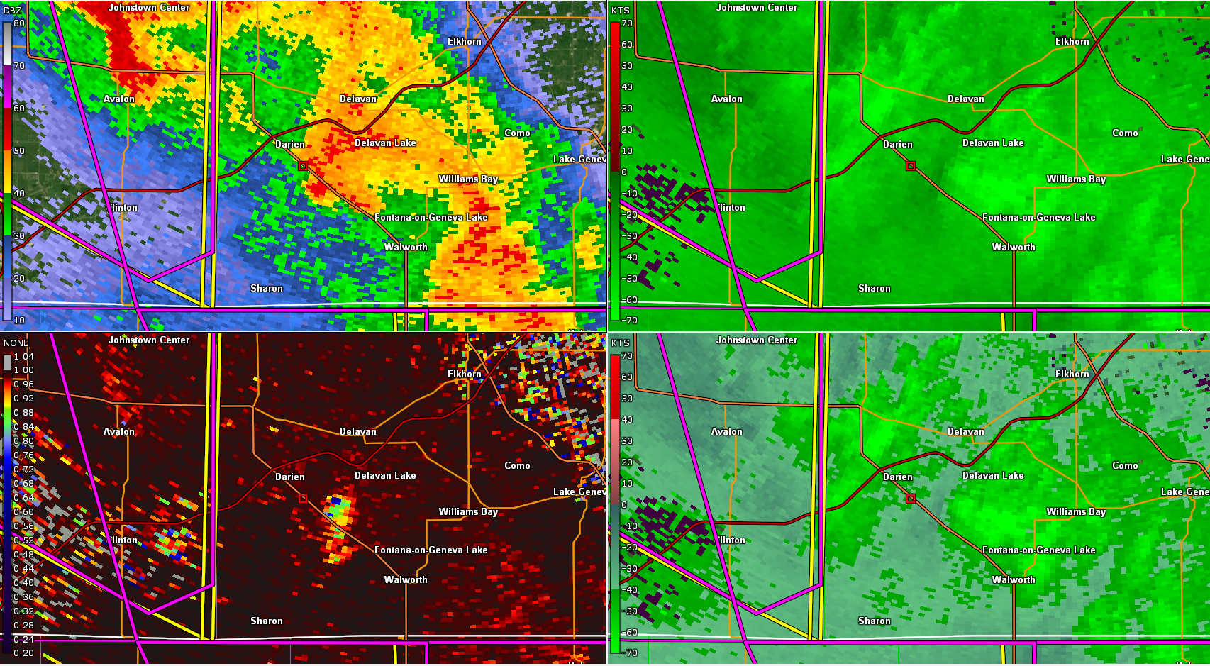 8:05 PM CDT (3/31/23) KMKX radar images showing hook echo (upper left, middle) and Tornado Debris Signature (lower left, middle) southwest of Delavan Lake, where EF0 damage occurred. |
Tornadoes:
|
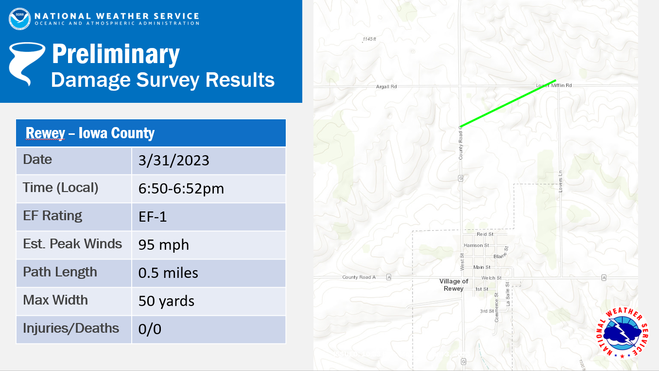
Tornado #1 - Rewey
Track Map  |
||||||||||||||||
|
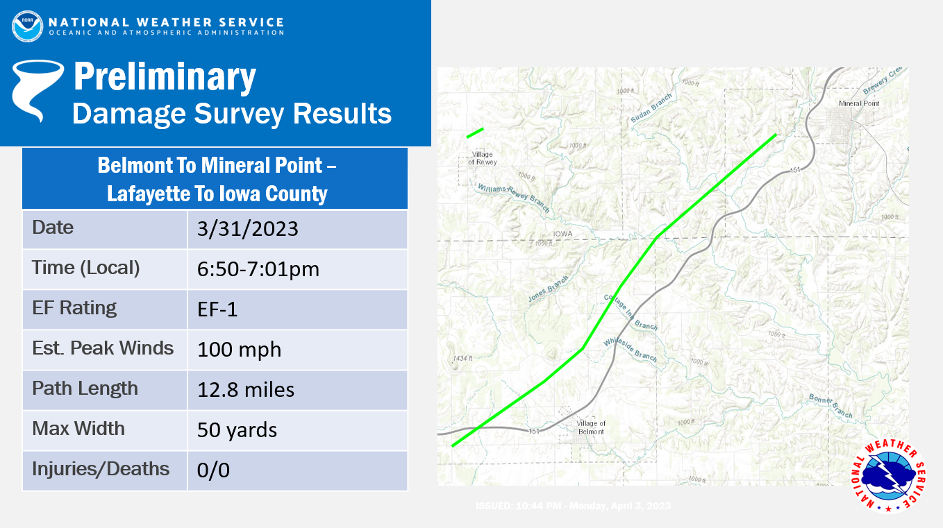
Tornado #2 - Belmont to Mineral Point
Track Map
|
||||||||||||||||
|
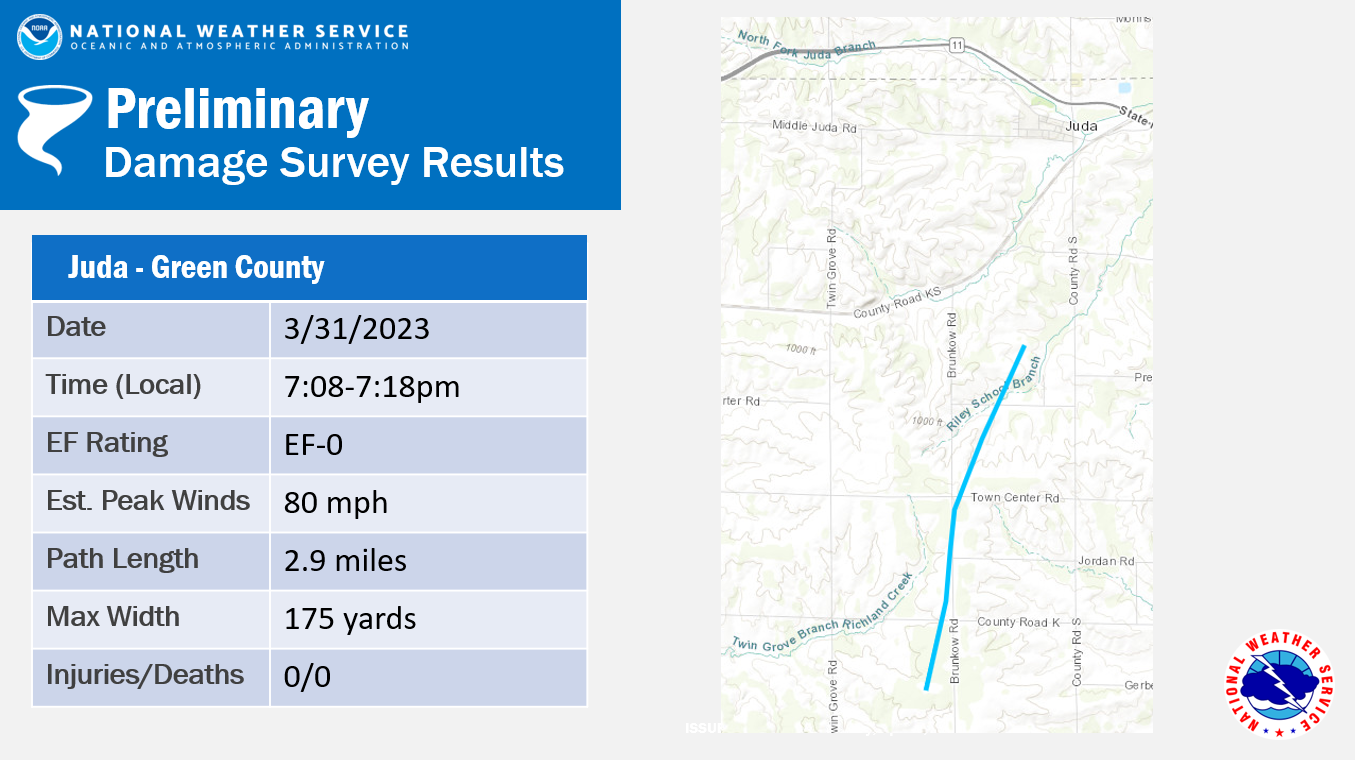
Tornado #3 - Juda
Track Map
|
||||||||||||||||
|
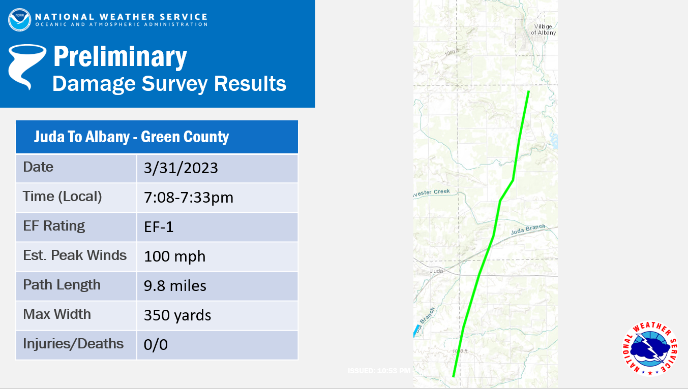
Tornado #4 - Juda to Albany
Track Map |
||||||||||||||||
|
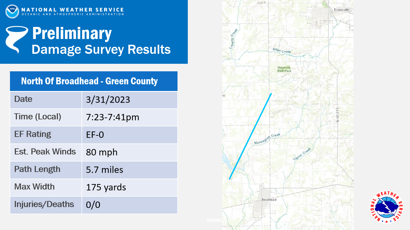
Tornado #5 - North of Brodhead
Track Map |
||||||||||||||||
|
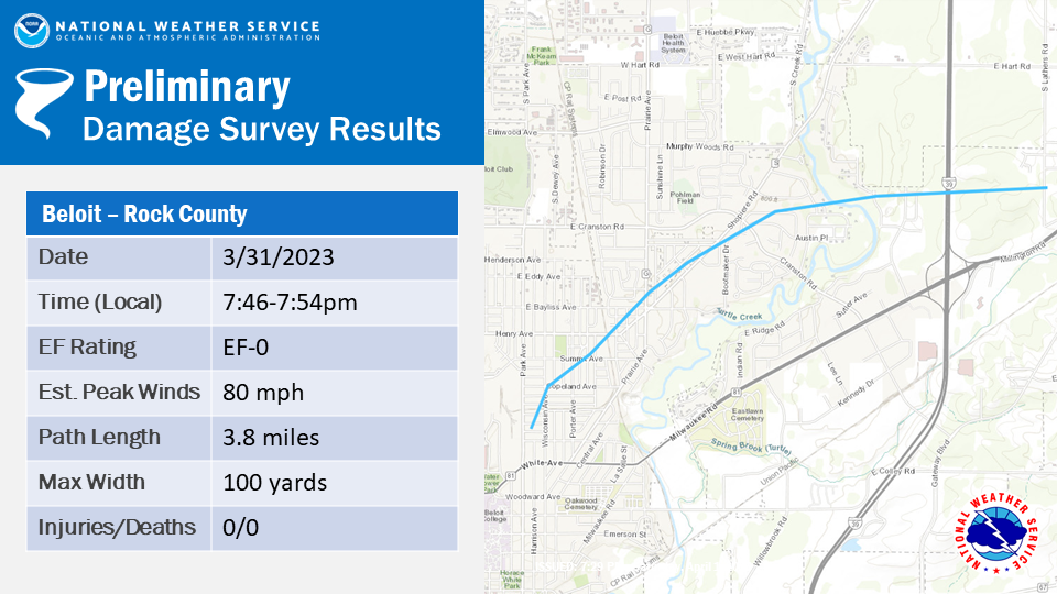
Tornado #6 - Beloit
Track Map |
||||||||||||||||
|
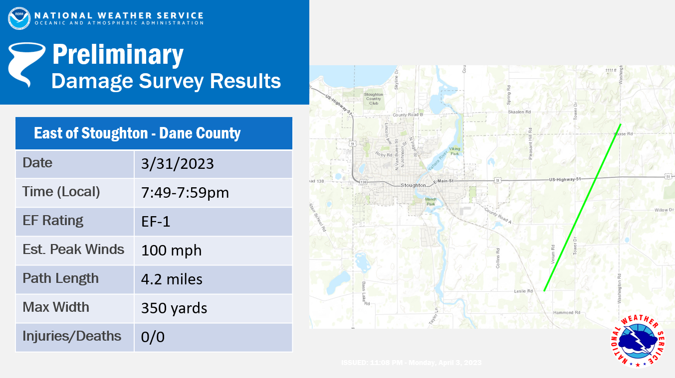
Tornado #7 - East of Stoughton
Track Map |
||||||||||||||||
|
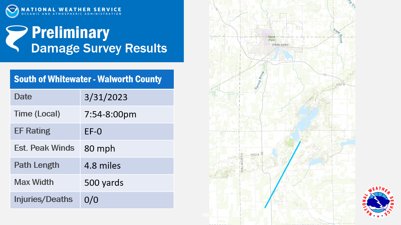
Tornado #8 - South of Whitewater
Track Map |
||||||||||||||||
|
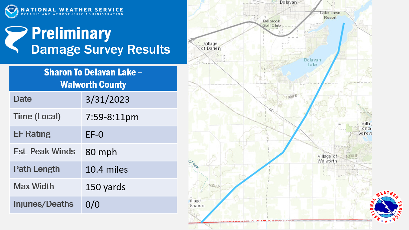
Tornado #9 - Sharon to Delavan Lake
Track Map |
||||||||||||||||
|
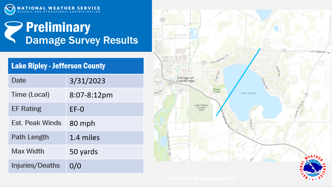
Tornado #10 - Lake Ripley
Track Map
|
||||||||||||||||
|
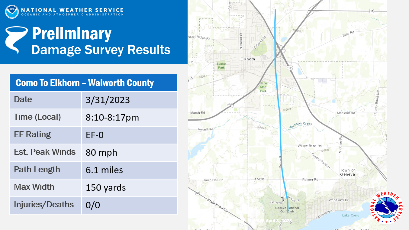
Tornado #11 - Como to Elkhorn
Track Map |
||||||||||||||||
|---|---|---|---|---|---|---|---|---|---|---|---|---|---|---|---|---|
|
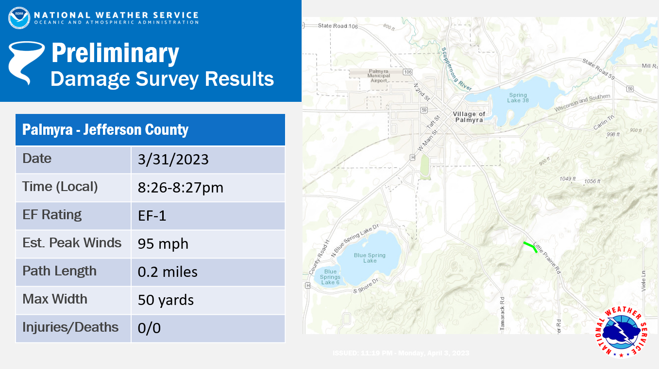
Tornado #12 - Palmyra
Track Map
|
||||||||||||||||
|---|---|---|---|---|---|---|---|---|---|---|---|---|---|---|---|---|
The Enhanced Fujita (EF) Scale classifies tornadoes into the following categories:
| EF0 Weak 65-85 mph |
EF1 Moderate 86-110 mph |
EF2 Significant 111-135 mph |
EF3 Severe 136-165 mph |
EF4 Extreme 166-200 mph |
EF5 Catastrophic 200+ mph |
 |
|||||
Photos
Town of Geneva into Elkhorn - NWS Damage Survey
 |
 |
 |
 |
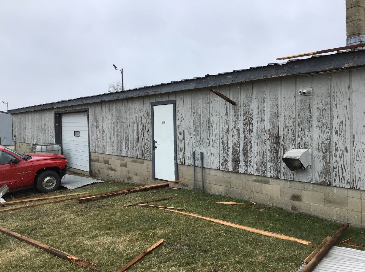
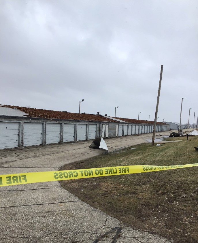
| Plank embedded in wood siding of storage facility south of Elkhorn off Highway H. | Storage Facility lost most of roofing south of Elkhorn off Highway H. | Storage Facility roofing material blown off to the north of the buildings south of Elkhorn off Highway H. | Barn destroyed south of Elkhorn. |
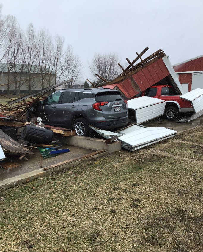
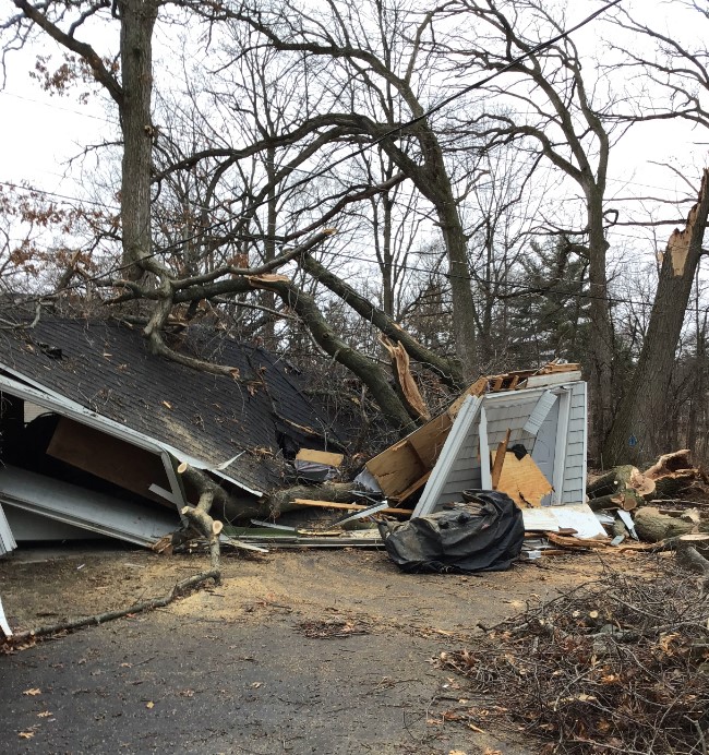
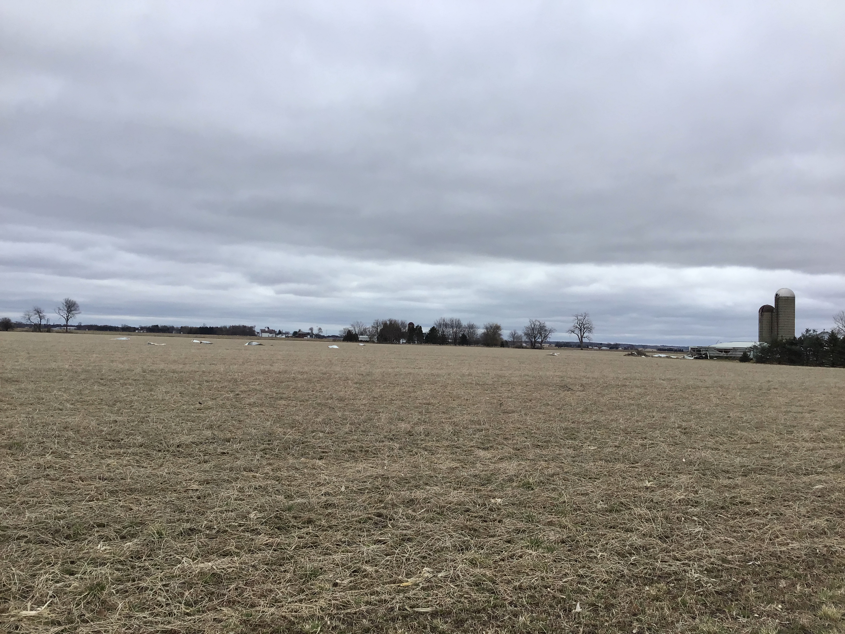
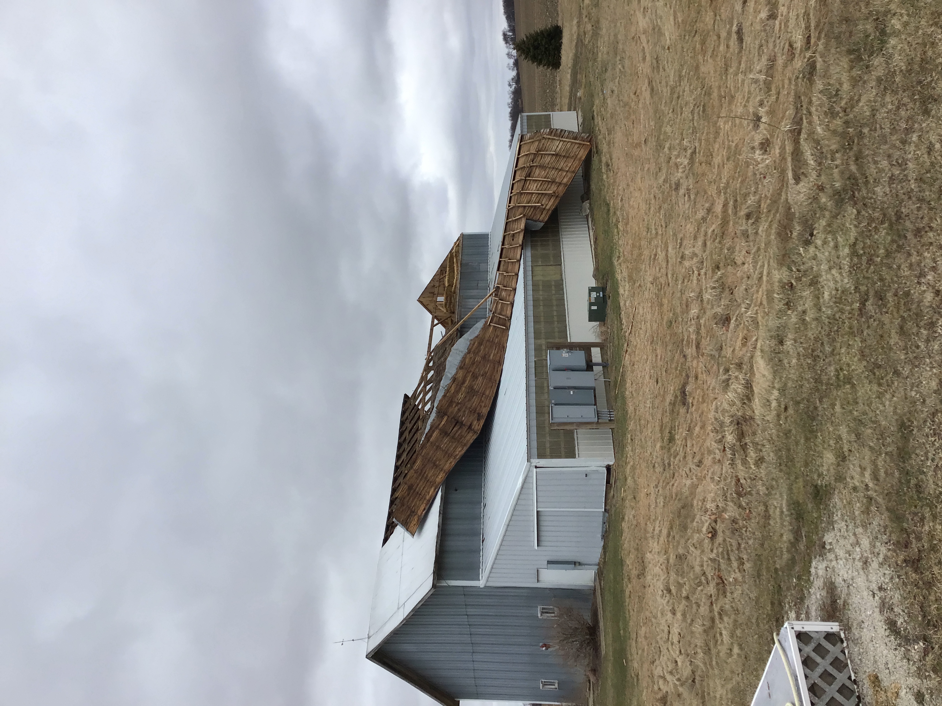
Sharon to Delavan Lake - NWS Damage Survey
 |
 |
 |
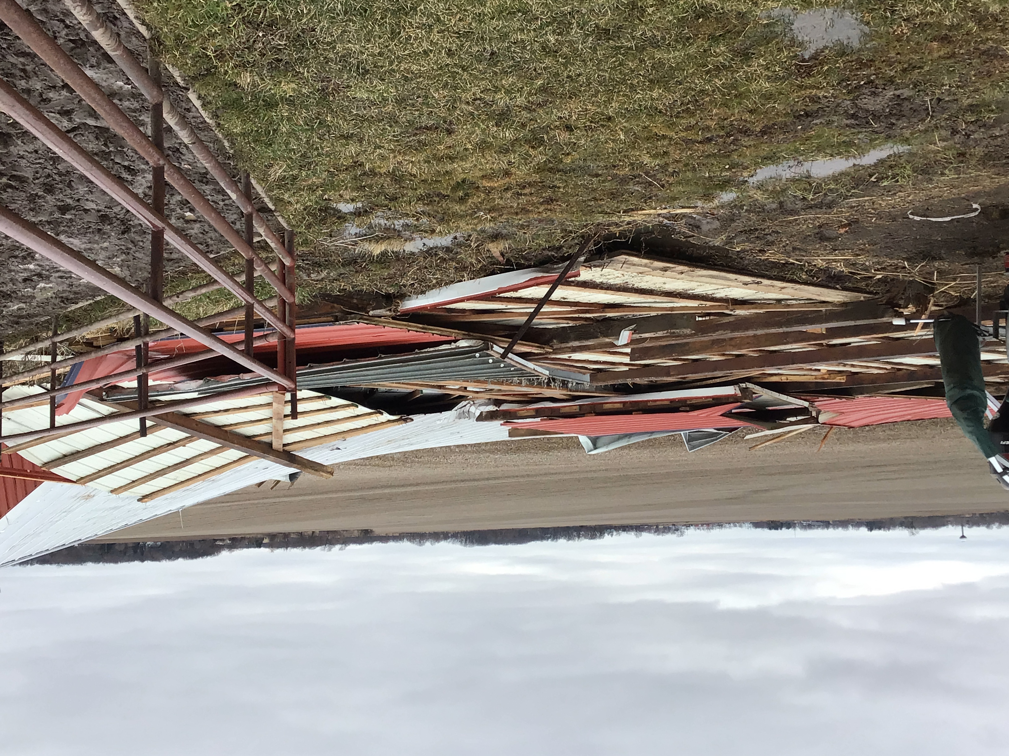 |
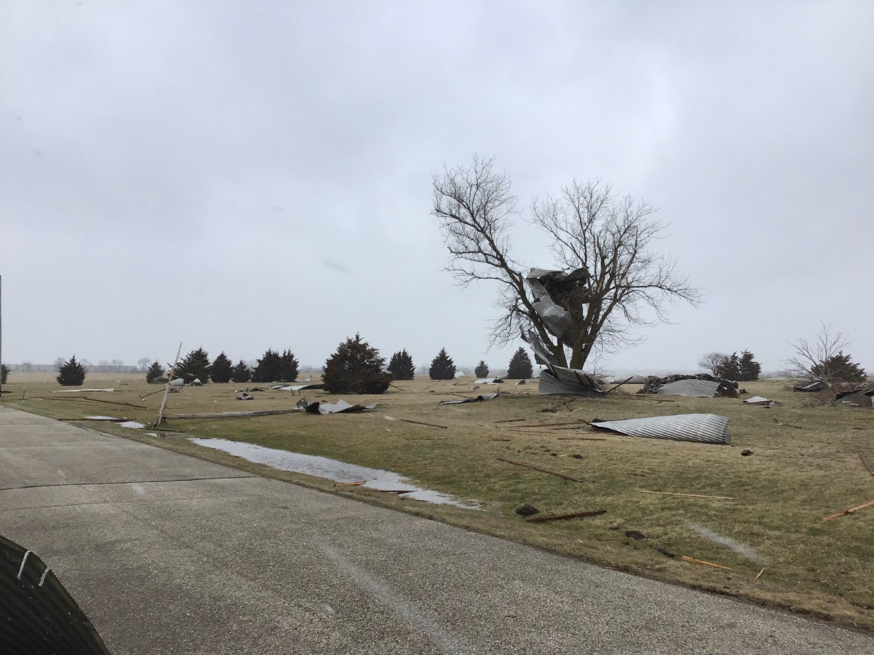
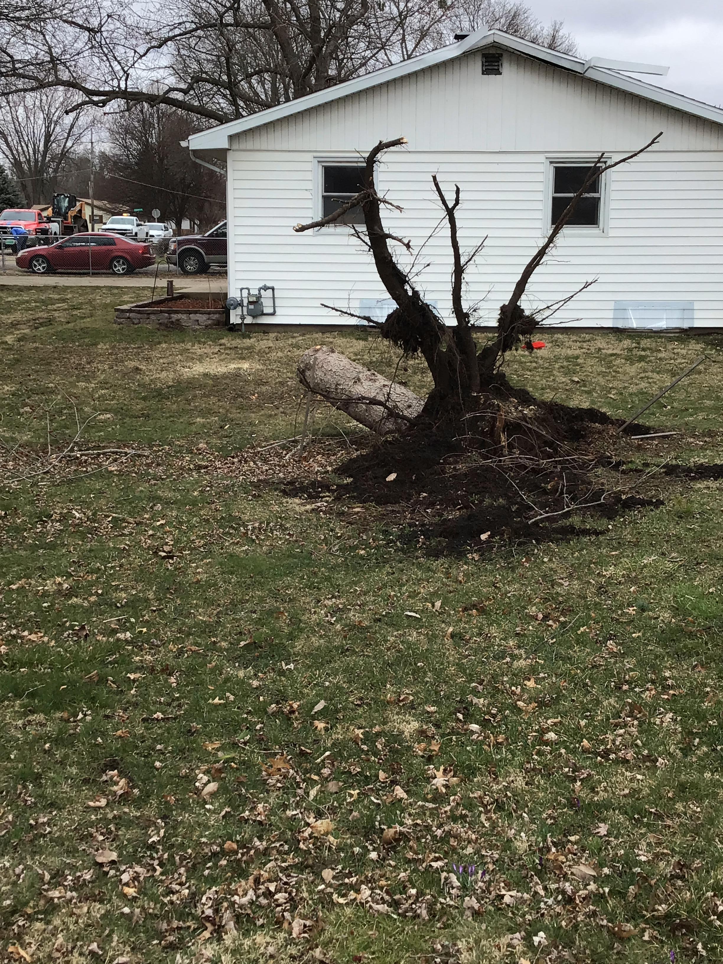
| Uprooted tree and damaged garage south of Lake Delavan. | Debris from nearby barn thrown across the field. | Roof peeled off of a barn. | Barn blown off its foudation. |
 |
 |
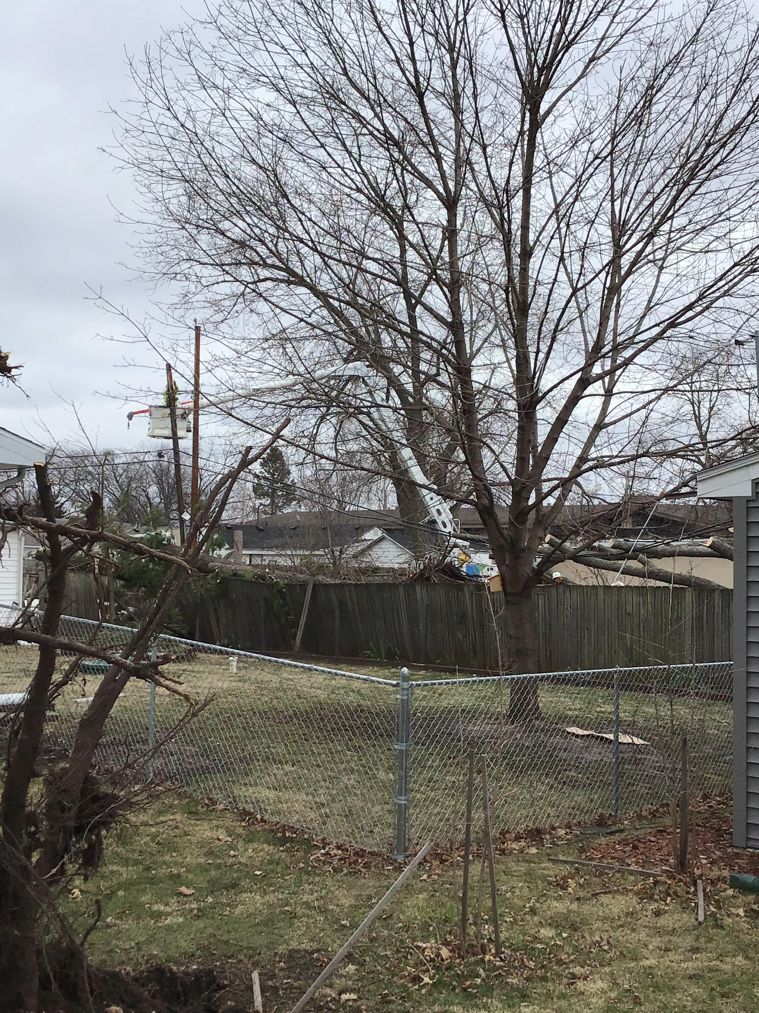 |
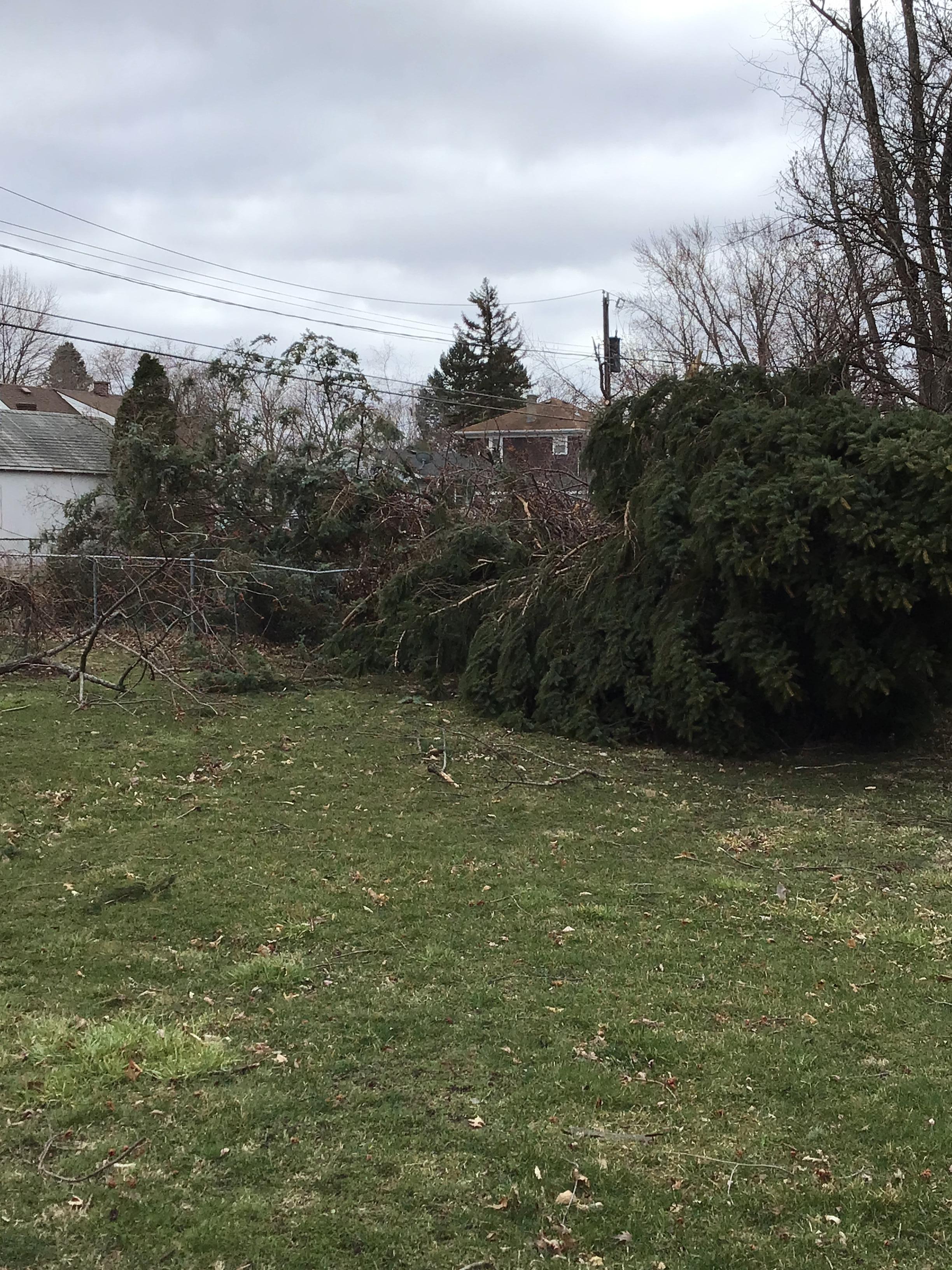
| Tree damage in Beloit. | Tree damage in Beloit. | Tree falling on fence in Beloit. |
Radar
 |
|
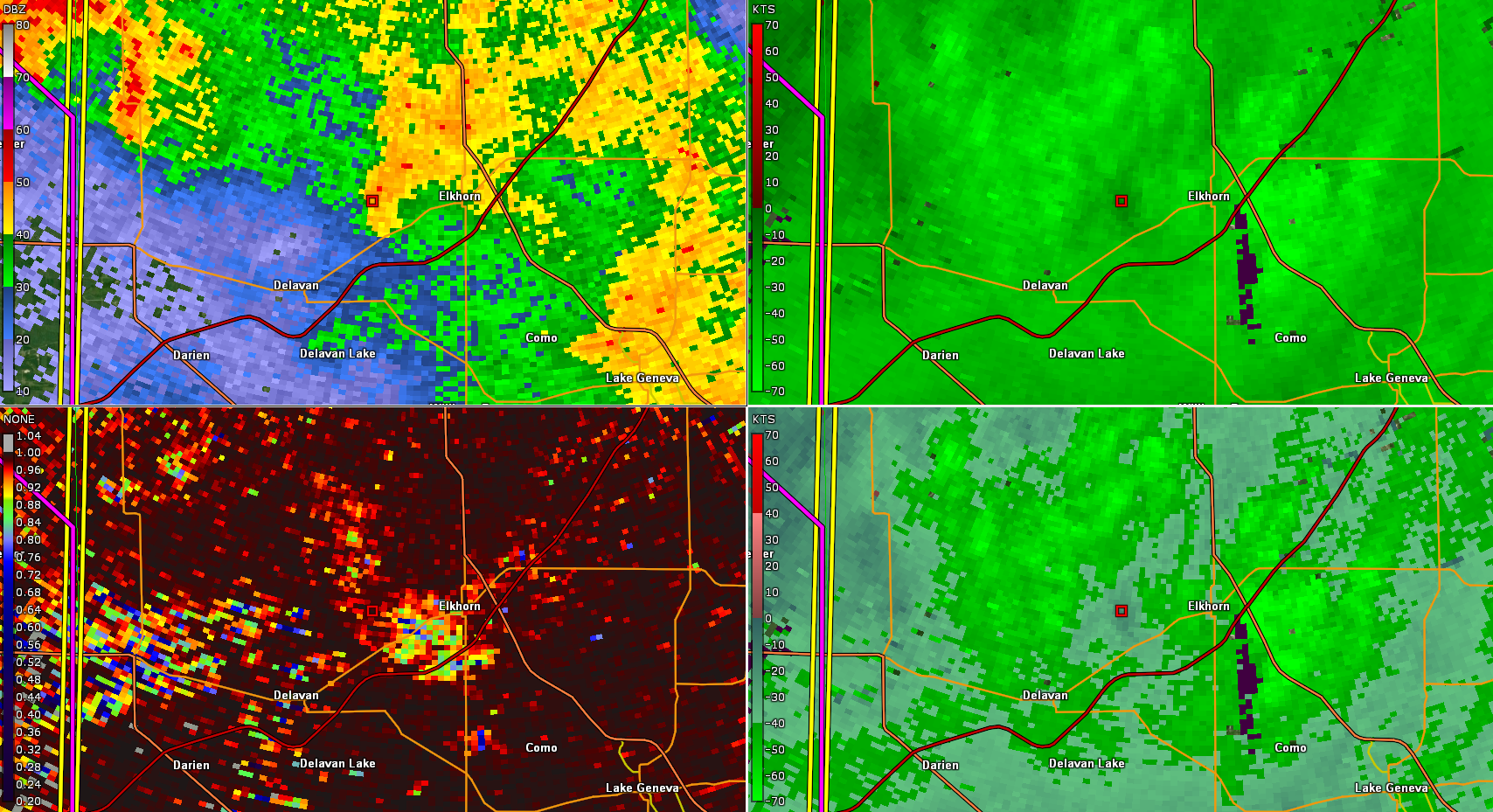 |
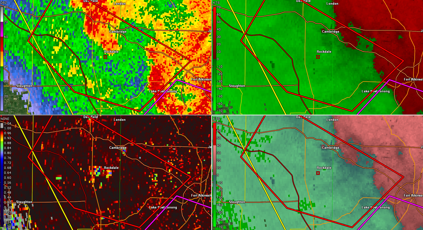
| 8:07 PM CDT (3/31/23) KMKX radar images showing hook echo (upper left, middle) and Tornado Debris Signature (lower left, middle) near Rockdale, WI, where EF0 damage occurred. | 8:05 PM CDT (3/31/23) KMKX radar images showing hook echo (upper left, middle) and Tornado Debris Signature (lower left, middle) southwest of Delavan Lake, where EF0 damage occurred. | 8:13 PM CDT (3/31/23) KMKX radar images showing hook echo (upper left, middle) and Tornado Debris Signature (lower left, middle) just southwest of Elkhorn, where EF0 damage occurred. |
 |
Media use of NWS Web News Stories is encouraged! Please acknowledge the NWS as the source of any news information accessed from this site. |
|