
Persistent onshore flow across the Southeast and portions of the mid-Atlantic will keep the risk of rip currents through the weekend. Rainfall could be locally heavy across Florida, especially along the eastern shoreline. Meanwhile, record warmth for portions of the Plains and Midwest with elevated fire concerns. For the west, a trough will keep the pattern unsettled with wet conditions. Read More >
Milwaukee/Sullivan, WI
Weather Forecast Office
Overview
|
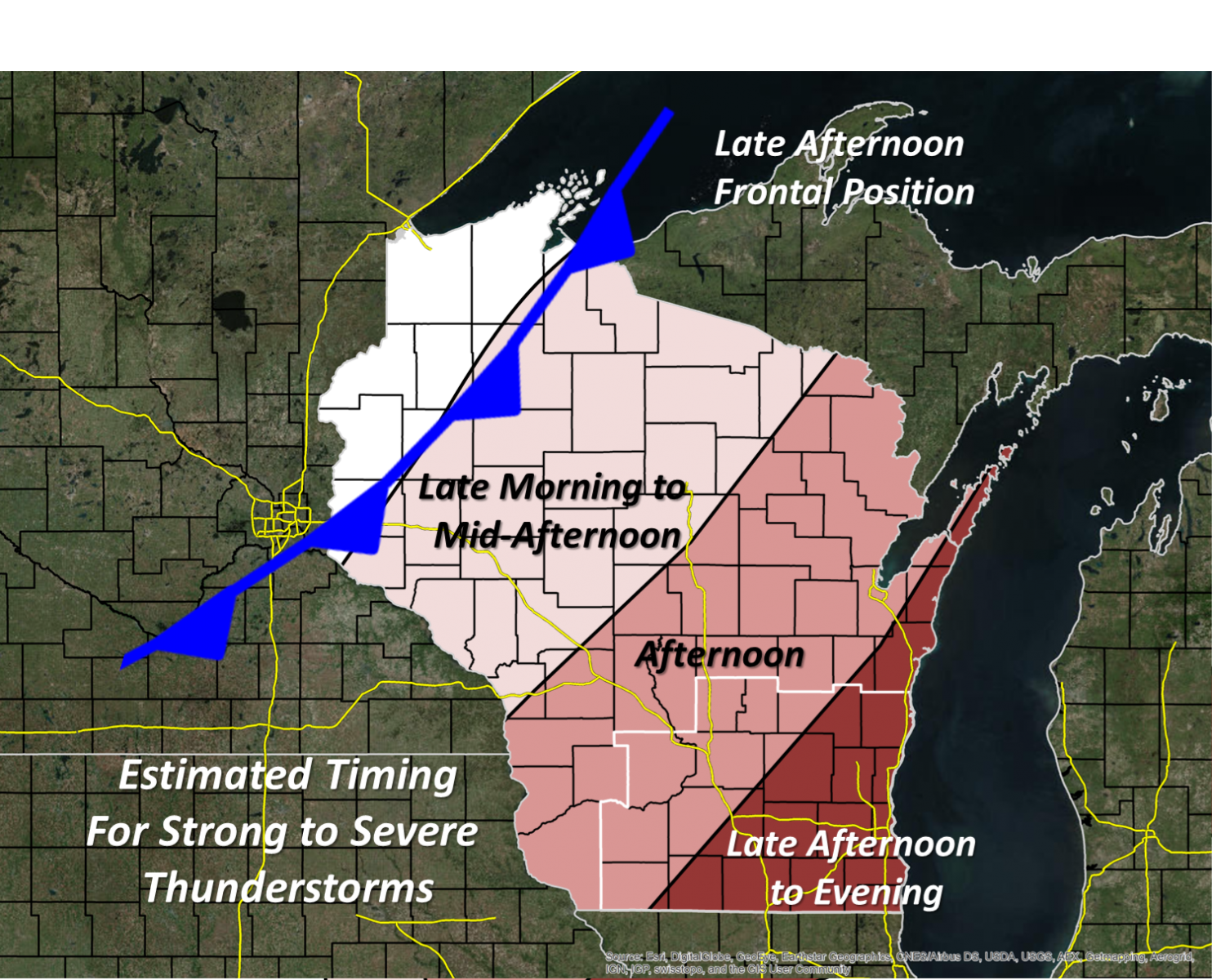
A low pressure system moving across the Great Plains has brought warm and humid air to Wisconsin. These muggy conditions will prime the atmosphere for scattered showers and thunderstorms this afternoon and evening. Some of these thunderstorms could become severe. Check out our latest video briefing here. What: Severe storms possible When: This afternoon and evening Impacts: Damaging wind, large hail, a possible tornado
|
 |
Today
A cold front will approach southern Wisconsin this afternoon and bring a chance of severe weather. The Storm Prediction Center has placed all of southern Wisconsin in a slight risk for severe thunderstorms for this afternoon and evening. It looks like thunderstorms will develop in eastern Minnesota or Eastern Iowa during the morning to early afternoon and evolve into a broken line which will push east towards southern Wisconsin during the afternoon and evening. These storms may be widely scattered, so not everyone will see rain. However, any storms which do develop would have the potential to produce damaging winds, large hail, and possibly even a tornado. Be sure to stay weather aware today in case severe weather develops.
 |
 |
|
 |
 |
Media use of NWS Web News Stories is encouraged! Please acknowledge the NWS as the source of any news information accessed from this site. |
|
Hazards
National Briefing
Hazardous Weather Outlook
Skywarn
View Local Storm Reports
Submit A Storm Report
Winter Weather
Summer Weather
Beach Hazards
Local Forecasts
Marine
Aviation
Fire
Local Text Products
Local Precip Forecast
Hourly Forecast Graphics
Forecast Discussion
Climate
Historic Events For Srn WI
Lightning Plot Archive
Daily Climate Graphics
Local Climate Products
Normals/Records MKE/MSN
CoCoRaHS
US Dept of Commerce
National Oceanic and Atmospheric Administration
National Weather Service
Milwaukee/Sullivan, WI
N3533 Hardscrabble Road
Dousman, WI 53118
262-965-2074
Comments? Questions? Please Contact Us.


