|
Snow Into Tonight
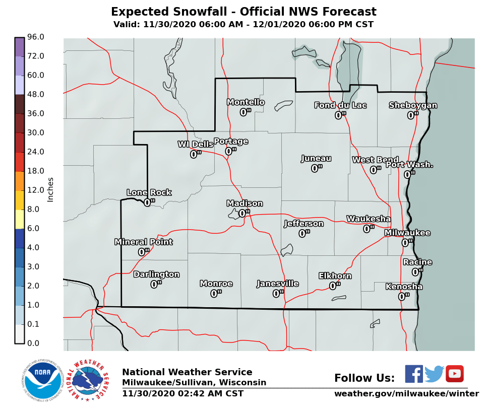
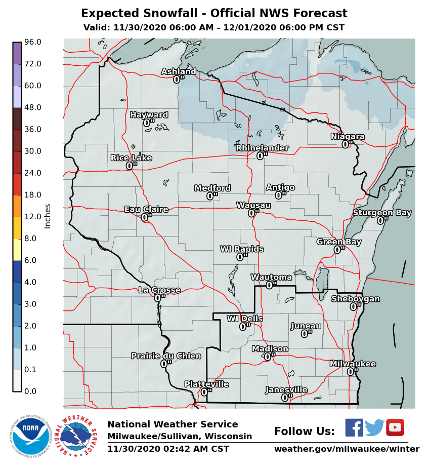
A Winter Weather Advisory is in effect for northeastern portions of our forecast area. This is for accumulating snow into tonight.
Timing: The initial band of snow will continue to linger over Sheboygan, Fond du Lac, West Bend and Port Washington into this evening. More snow is expected this evening into early Tuesday, moving into the area from the northwest. Very light snow may linger through the morning commute.
Amounts: Forecast snowfall totals range from 1/2 to 1 inch in southwest Wisconsin, to around 2 inches in the Milwaukee area, to 3 to 5 inches in the Fond du Lac and Sheboygan areas.
Impacts: Snow will impact the evening commute, and roads may be slippery, especially toward Sheboygan and Fond du Lac. Some roads could remain slick into Tuesday morning.
Forecast Snow Accumulation
Check here for the latest Wisconsin Road Conditions. Submit a snowfall report here! Here's the latest local and regional radar animations:
Davis/BSH/SPM/Wood
|
Submit Report Latest Hazardous Weather Outlook Latest Storm Reports
Weather Story
|