
Dangerous and extreme heat will remain across portions of the central U.S. this week, persisting across the mid to lower Mississippi Valley, Gulf Coast, southern Plains and portions of Texas. A heat wave over the Southwest U.S. will peak this weekend. Heavy to excessive rainfall may produce flash flooding from the Delmarva Peninsula north into the Hudson Valley today and tonight. Read More >
Milwaukee/Sullivan, WI
Weather Forecast Office
A band of higher reflectivity developed on the NWS Milwaukee/Sullivan (KMKX) radar early this morning. It looks like it originated just southeast of Madison. This band was indeed enhanced by Lake Effect processes. Conditions were just right where cold northwest winds flowed across four lakes (Mendota, Monona, Waubesa, and Kegonsa) with relatively warm water temperatures. There were probably light snow showers underneath this band (we would appreciate any reports) that occurred from approximately 1 am through at least 7 am.
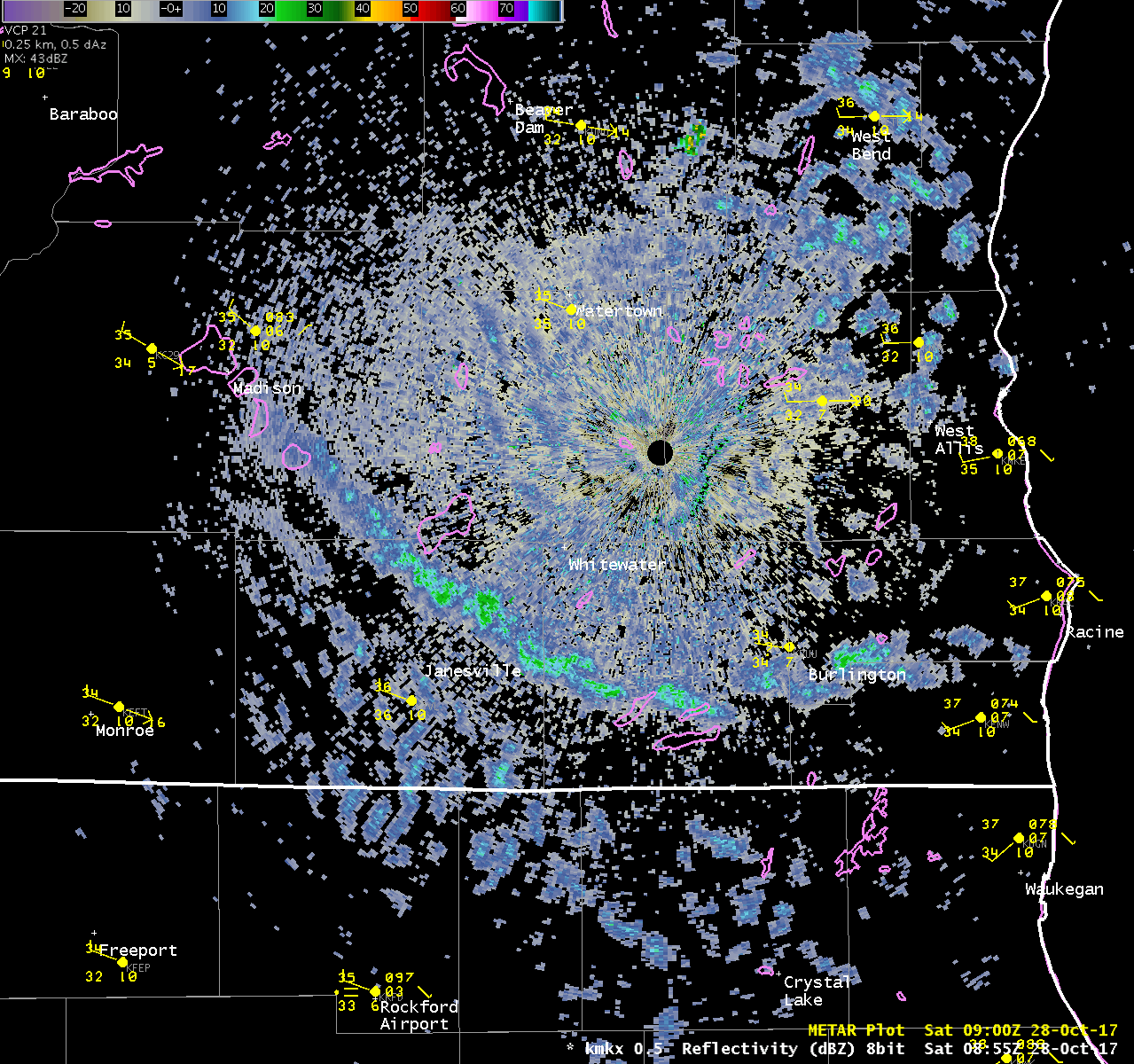
To learn more about the Lake Effect Snow Process, click HERE. The ideal conditions to produce lake effect snow are: a sufficient fetch (distance the air travels across the water), and a lake temperature to 850 mb (around 3500 feet above the ground during that time) temperature difference of at least 13°C. The UW Lake Mendota Buoy water temperature was 56°F (13°C), and the 850 mb temperature was around -5°C. The air temperature at the buoy at this time was 37°F and around 35°F at the Dane County Regional Airport.
National Weather Service
Milwaukee/Sullivan
~Cronce
Hazards
National Briefing
Hazardous Weather Outlook
Skywarn
View Local Storm Reports
Submit A Storm Report
Winter Weather
Summer Weather
Beach Hazards
Local Forecasts
Marine
Aviation
Fire
Local Text Products
Local Precip Forecast
Hourly Forecast Graphics
Forecast Discussion
Climate
Historic Events For Srn WI
Lightning Plot Archive
Daily Climate Graphics
Local Climate Products
Normals/Records MKE/MSN
CoCoRaHS
US Dept of Commerce
National Oceanic and Atmospheric Administration
National Weather Service
Milwaukee/Sullivan, WI
N3533 Hardscrabble Road
Dousman, WI 53118
262-965-2074
Comments? Questions? Please Contact Us.

