Tropical Depression Two is expected to gradually strengthen and could bring tropical storm conditions to the Florida Panhandle beginning late Monday. Areas of flash flooding will be possible through Thursday along the eastern and central Gulf Coast. Severe thunderstorms will develop and move along a cold front crossing the Upper Midwest Monday, and through the Ohio Valley/Mid-Atlantic on Tuesday. Read More >
|
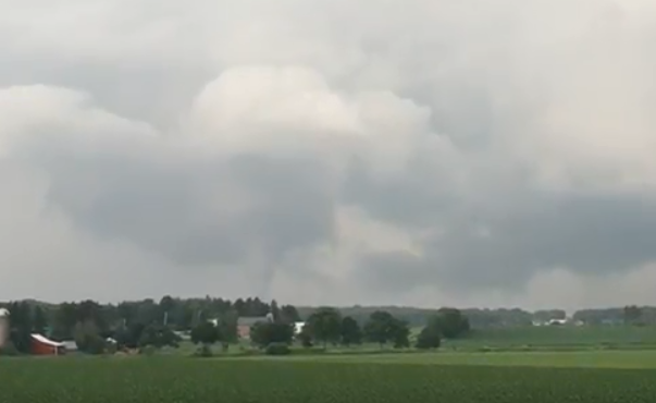
Hot and unstable air over south central Wisconsin interacted with a slow-moving boundary to cause a long-lived cluster of severe thunderstorms over Columbia County during the afternoon of June 16th, mostly between 330 pm and 630 pm CDT. Trees were blown down in the Portage, Poynette and Rio areas. Also, large hail was reported, with hail as large as golf balls near Poynette. Around 5 pm, a weak low level circulation developed in one of the thunderstorms that eventually produced a weak tornado about 4 miles northeast of Poynette near the intersection of Highway B and Dunning Road. |
Tornadoes:
|
Tornado - LOCATION
Track Map 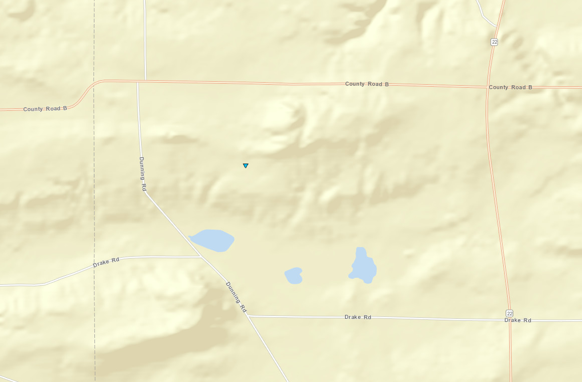 
|
||||||||||||||||
|
||||||||||||||||
The Enhanced Fujita (EF) Scale classifies tornadoes into the following categories:
| EF0 Weak 65-85 mph |
EF1 Moderate 86-110 mph |
EF2 Significant 111-135 mph |
EF3 Severe 136-165 mph |
EF4 Extreme 166-200 mph |
EF5 Catastrophic 200+ mph |
 |
|||||
Radar:
Storm Reports
PRELIMINARY LOCAL STORM REPORT...SUMMARY
NATIONAL WEATHER SERVICE MILWAUKEE/SULLIVAN WI
924 PM CDT SAT JUN 16 2018

..TIME...   ...EVENT...      ...CITY LOCATION...     ...LAT.LON...
..DATE...   ....MAG....      ..COUNTY LOCATION..ST.. ...SOURCE....
            ..REMARKS..

0642 PM     HAIL             5 NNW POYNETTE          43.46N 89.45W
06/16/2018  E1.00 INCH       COLUMBIA           WI   TRAINED SPOTTER

            REPORTED IN DEKORRA.

0611 PM     HAIL             5 NNW POYNETTE          43.46N 89.45W
06/16/2018  E1.00 INCH       COLUMBIA           WI   PUBLIC

            MPING REPORT.

0556 PM     HAIL             5 NW POYNETTE           43.45N 89.47W
06/16/2018  E1.75 INCH       COLUMBIA           WI   LAW ENFORCEMENT


0554 PM     HAIL             6 SSW PORTAGE           43.47N 89.50W
06/16/2018  E1.25 INCH       COLUMBIA           WI   PUBLIC

            MPING REPORT.

0535 PM     HAIL             PORTAGE                 43.54N 89.46W
06/16/2018  E1.00 INCH       COLUMBIA           WI   911 CALL CENTER


0525 PM     TORNADO          4 NE POYNETTE           43.44N 89.36W
06/16/2018                   COLUMBIA           WI   TRAINED SPOTTER

            BRIEF WEAK TORNADO ON THE GROUND FOR APPROX
            3-4 MINS CAUSED TREE DAMAGE NEAR THE
            INTERSECTION OF HIGHWAY B AND DUNNING ROAD.
            REPORT CONFIRMED BY SOCIAL MEDIA PICTURE AND
            DAMAGE REPORT FROM SHERIFF`S OFFICE.

0515 PM     TSTM WND DMG     4 SW RIO                43.42N 89.30W
06/16/2018                   COLUMBIA           WI   PUBLIC

            PICTURES FROM SOCIAL MEDIA SHOW TREES DOWN
            ACROSS TRAUT ROAD WITH POWER LINES DOWN TOO.
            TIME ESTIMATED FROM RADAR.

0450 PM     TSTM WND DMG     5 N POYNETTE            43.46N 89.41W
06/16/2018                   COLUMBIA           WI   911 CALL CENTER

            TREES AND POWER LINES DOWN SOUTH OF PORTAGE.

0400 PM     TSTM WND DMG     1 ESE PORTAGE           43.54N 89.45W
06/16/2018                   COLUMBIA           WI   911 CALL CENTER

            TREES DOWN AROUND PORTAGE.

0335 PM     TSTM WND DMG     BARABOO                 43.47N 89.73W
06/16/2018                   SAUK               WI   911 CALL CENTER

            TREE BLOWN DOWN OVER A DRIVEWAY.
0730 AM     HEAVY RAIN       7 SW PORTAGE            43.48N 89.57W
06/17/2018  M3.58 INCH       COLUMBIA           WI   COCORAHS

            7.2 SW PORTAGE - STATION WI-CB-5.
 |
Media use of NWS Web News Stories is encouraged! Please acknowledge the NWS as the source of any news information accessed from this site. |
|