
Scattered thunderstorms with severe gusts, hail and a tornado risk are possible near a cold front from the Ohio Valley to the Mid-Atlantic tonight. Tropical Storm Bertha is expected to bring tropical storm conditions to portions of the Gulf Coast from the panhandle of Florida into Louisiana through Wednesday. Read More >
Milwaukee/Sullivan, WI
Weather Forecast Office
Low pressure will move northeast along the Wisconsin/Illinois line today, exiting to the east mid afternoon. Look for more showers and possible thunderstorms until that low moves away.
Here is the weather map for 7 am this morning:

And for around sunset this evening:

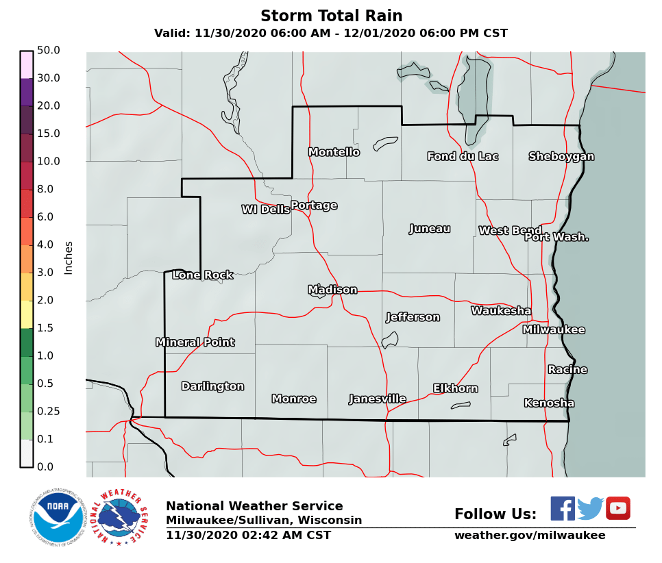
Areas north of Milwaukee and Madison received about 1 to 1.5 inches of rain yesterday and overnight. To the south and southeast of there, it was 1/2 inch or less. Here is the rainfall expected after 7 am this morning.

Regional Radar Views:
 |
 |
Local Radar:

We should see a few thunderstorms across the region. Any organized severe storms should remain south of southern Wisconsin. Here is the Storm Prediction Center's outlook for today:

For information on the current and forecast stage of many of our rivers, go here.
The Wisconsin River at Portage is expected to remain above bankfull but below minor flood stage.
Davis/Kavinsky
Hazards
National Briefing
Hazardous Weather Outlook
Skywarn
View Local Storm Reports
Submit A Storm Report
Winter Weather
Summer Weather
Beach Hazards
Local Forecasts
Marine
Aviation
Fire
Local Text Products
Local Precip Forecast
Hourly Forecast Graphics
Forecast Discussion
Climate
Local Climate Products
Normals/Records MKE/MSN
CoCoRaHS
Historic Events For Srn WI
Lightning Plot Archive
Daily Climate Graphics
US Dept of Commerce
National Oceanic and Atmospheric Administration
National Weather Service
Milwaukee/Sullivan, WI
N3533 Hardscrabble Road
Dousman, WI 53118
262-965-2074
Comments? Questions? Please Contact Us.

