Milwaukee/Sullivan, WI
Weather Forecast Office
|
The Storm Prediction Center's severe weather outlook now shows a Marginal Risk for severe storms across southern Wisconsin overnight (what do the risk categories mean?)
Look for the strong thunderstorms from Iowa to track east northeast through southern Wisconsin during the overnight hours.
Regional Radar Views
Marginal Risk of Severe Weather Overnight
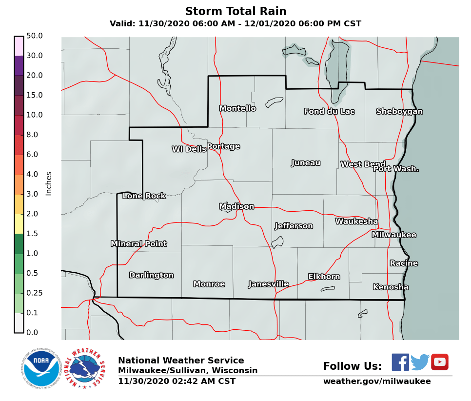
Expected Rainfall Amounts
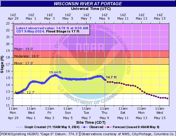
River Monitoring
Additional Information:
Wood/Davis |
Submit Report Hazardous Weather Outlook Latest Storm Reports Latest Reports
Weather Story 
Radar |
Hazards
National Briefing
Hazardous Weather Outlook
Skywarn
View Local Storm Reports
Submit A Storm Report
Winter Weather
Summer Weather
Beach Hazards
Local Forecasts
Marine
Aviation
Fire
Local Text Products
Local Precip Forecast
Hourly Forecast Graphics
Forecast Discussion
Climate
Normals/Records MKE/MSN
CoCoRaHS
Historic Events For Srn WI
Lightning Plot Archive
Daily Climate Graphics
Local Climate Products
US Dept of Commerce
National Oceanic and Atmospheric Administration
National Weather Service
Milwaukee/Sullivan, WI
N3533 Hardscrabble Road
Dousman, WI 53118
262-965-2074
Comments? Questions? Please Contact Us.