 |
 |
 |
 |
 |
 |
![]()
Hurricane experts from the National Oceanic and Atmospheric Administration (NOAA) and the United States Air Force (USAF) will visit three U.S. Gulf Coast cities this spring, flying aboard a USAF Reserve WC-130J hurricane hunter aircraft, a NOAA WP-3D Orion aircraft, and a NOAA King Air.
The purpose of this event is to raise awareness of the impacts of tropical cyclones and the danger of being caught without a personal hurricane plan.
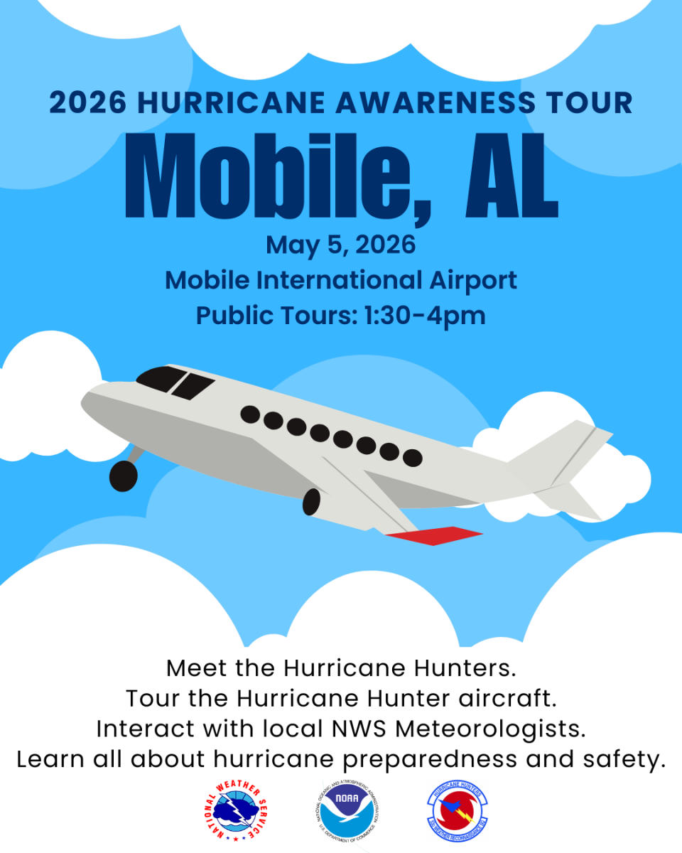
The 2026 Hurricane Awareness Tour is scheduled to stop in Mobile, AL, on Tuesday, May 5th.
What: 2026 Hurricane Awareness Tour
Where: Mobile International Airport - Mobile, AL
2455 Michigan Ave.
Mobile, AL
When: Tuesday, May 5, 2026
1:30 - 4:00pm (Gates will close at 3:30pm to new entries)
Admission: FREE!!
Things To Do:
About the Planes |
 |
WC-130J - "Hercules" The WC-130J is one of ten such aircraft used by the U.S. Air Force Reservists from the 53rd Weather Reconnaissance Squadron, 403rd Wing, located at Keesler AFB in Biloxi, MS. The military air crews fly directly into the core of tropical cyclones to gather data that is critical for forecasting a hurricane’s intensity and landfall. The data are sent in real time via satellite from the aircraft directly to the National Hurricane Center for analysis and use by hurricane forecasters. |
|
| WP-3D - "Orion" The versatile turboprop aircraft is equipped with a variety of scientific instrumentation, radars, and recording systems for both in-situ and remote sensing measurements of the atmosphere, the earth, and its environment. Orion aircraft collects low-altitude data to fill gaps in data not available from ground-based radar or satellite imagery. |
 |
|
 |
King Air NOAA operates two Beechcraft King Air 350 CERs and one King Air 360CER. In the wake of a hurricane, these versatile, twin-engine, extended-range turboprop aircraft conduct emergency response operations that map destruction and guide recovery efforts in the most affected regions. |
|
Schedule |
| 9:00am – 9:30am | Media Briefing |
| 1:30pm – 4:00pm | Public Tours |
| 3:30pm | Gates Close to the Public - must be in line NO LATER than 3:30 pm |
| 4:00pm | Event Closed to the Public |
The address of the Hurricane Awareness Tour is: 2455 Michigan Ave, Mobile, AL 36615.
![]()
Traveling Westbound on I-10 (driving from downtown Mobile or Baldwin County)

Traveling Eastbound on I-10 (driving from west Mobile or south Mississippi)

Parking Map

| Booths and Tables | |
| NWS Mobile/Pensacola | FLASH - Federal Alliance for Safe Homes |
| NOAA Disaster Response Center (DRC) | University of South Alabama Meteorology Club |
| Baldwin County, AL EMA | Mobile County Health Department |
| Santa Rosa County, FL EMA | Mobile County Healthcare Coalition |
| MS/AL Sea Grant | USAA |
| Dauphin Island Sea Lab | Alabama Power |
| Alabama Institute for the Deaf and Blind | AARP |
| Simpson Strong Tie | Segers Aerospace |
| Mobile Police Department Victim Services | |
| Large Vehicles/Boats | |
| Mobile County, AL EMA | Alabama EMA |
| USCG Sector Mobile | NOAA National Data Buoy Center |
| Salvation Army - Coastal Alabama Command | Red Cross - South Alabama Chapter |
| Mobile County Communications District (911) | |
Hurricane Preparedness and Safety |
2026 National Hurricane Preparedness Week is May 3-9, 2026
Be ready for hurricane season. Take action TODAY to be better prepared for when the worst happens. Understand your risk from hurricanes, and begin pre-season preparations now. Make sure you have multiple ways of receiving forecasts and alerts, and know what to do before, during, and after a storm. Learn more at noaa.gov/hurricane-prep.
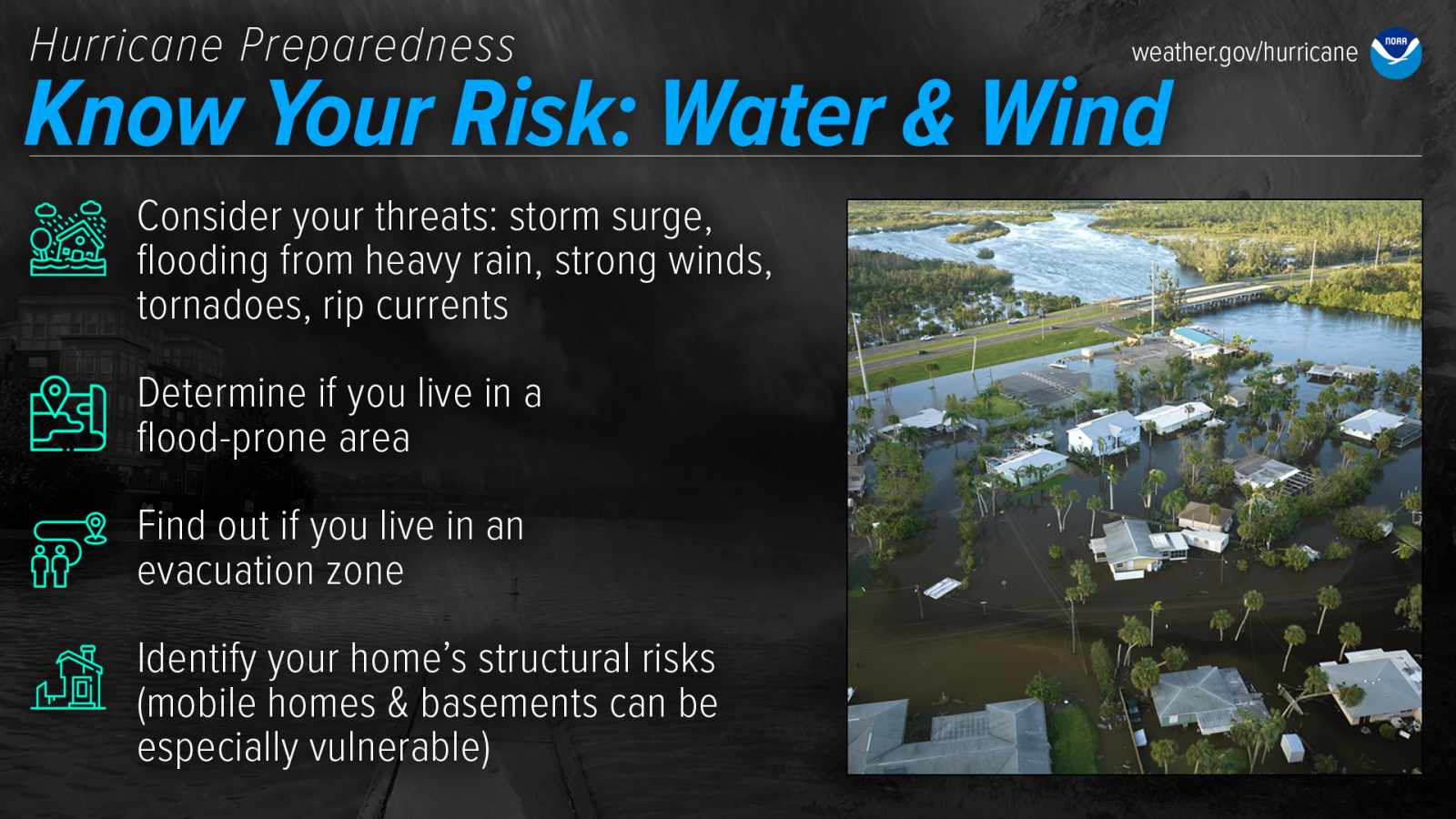
Find out today what types of wind and water hazards could happen where you live. Hurricanes are NOT just a coastal problem. Impacts from wind and water can be felt hundreds of miles inland, and significant impacts can occur regardless of the storm’s strength. Know if you live in an area prone to flooding, if you live in an evacuation zone, and identify any structural weaknesses in your home. Learn more at noaa.gov/know-your-risk-water-wind.

The best time to prepare for hurricanes is WELL BEFORE the official start of Atlantic Hurricane Season. Avoid having to rush through potentially life-saving preparations by waiting until it’s too late. Get your disaster supplies while the shelves are still stocked, and get that insurance checkup early, as flood insurance requires a 30-day waiting period. Learn more at noaa.gov/prepare-before-hurricane-season.
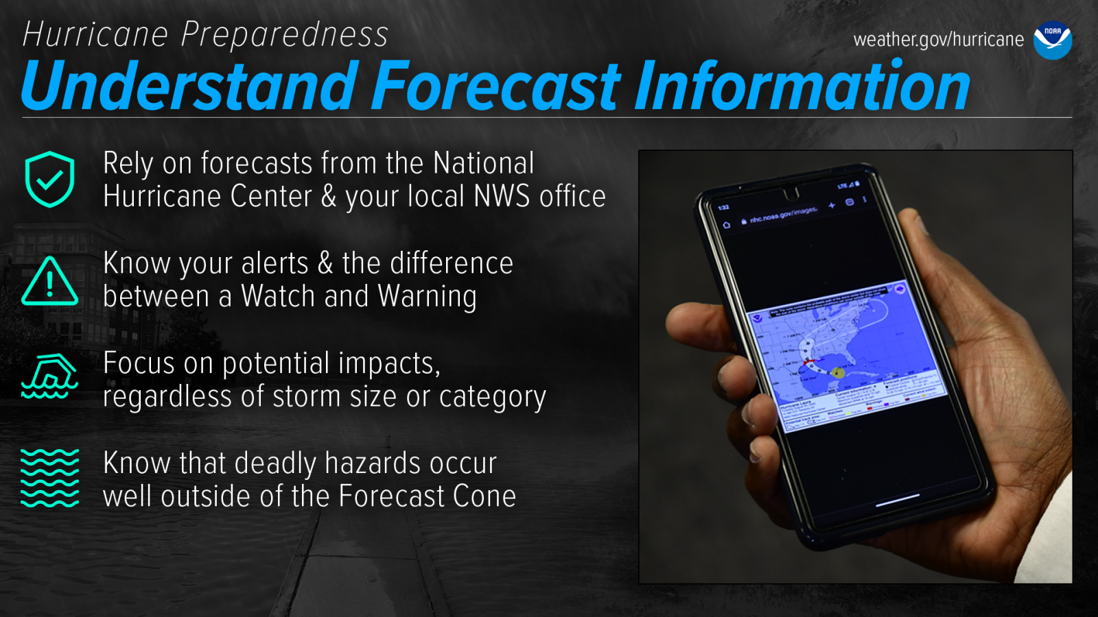
Rely on official forecasts and well-established media partners in the Weather Enterprise. Be cautious of sensational headlines and instead look for reliable sources to determine a storm's potential impacts. Focus on potential impacts regardless of storm size or category and remember...deadly hazard can and do occur well outside of the cone. Learn more at www.noaa.gov/understand-forecast-information.

When a storm is forecast to impact your area, take action immediately to be ready. Protect your home, determine sheltering options (always consider your pets), ready your go-bag, help your neighbors, and follow evacuation orders. Learn more at noaa.gov/get-moving-when-storm-threatens.
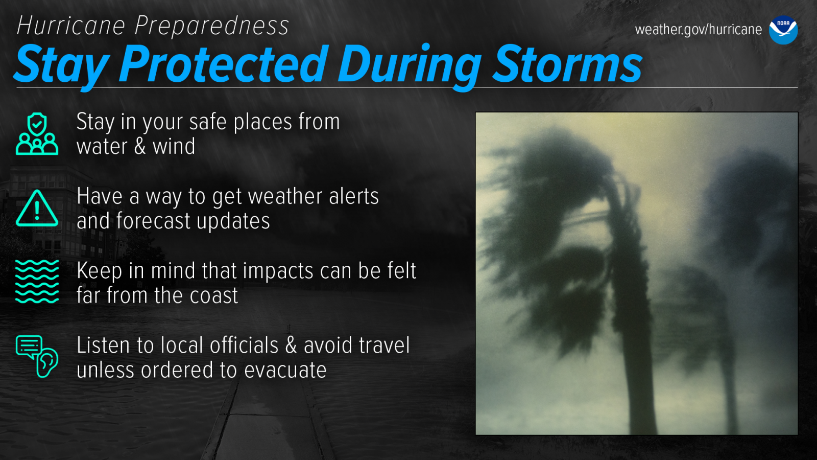
During a storm, whether you’ve evacuated or are sheltering in place, know what to expect from the hazards you may face. Remain vigilant, stay up-to-date with the latest forecasts and alerts, and continue to listen to local officials. Learn more at noaa.gov/stay-protected-during-storms.
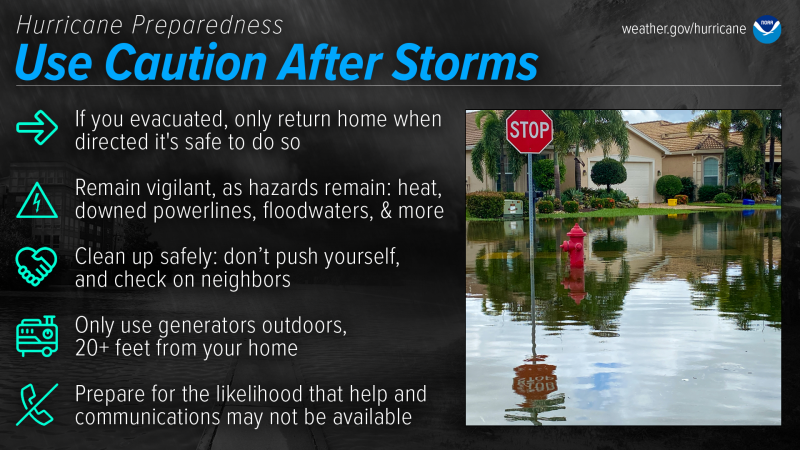
Dangers remain even after the skies turn blue. This is NOT the time to put your guard down. Be very careful with portable generators: carbon monoxide poisoning is one of the leading causes of death in areas dealing with power outages. Never use a generator inside your home or garage, even if doors and windows are open. Only use generators outside, more than 20 feet away from your home, doors, and windows. Learn more at noaa.gov/use-caution-after-storms.
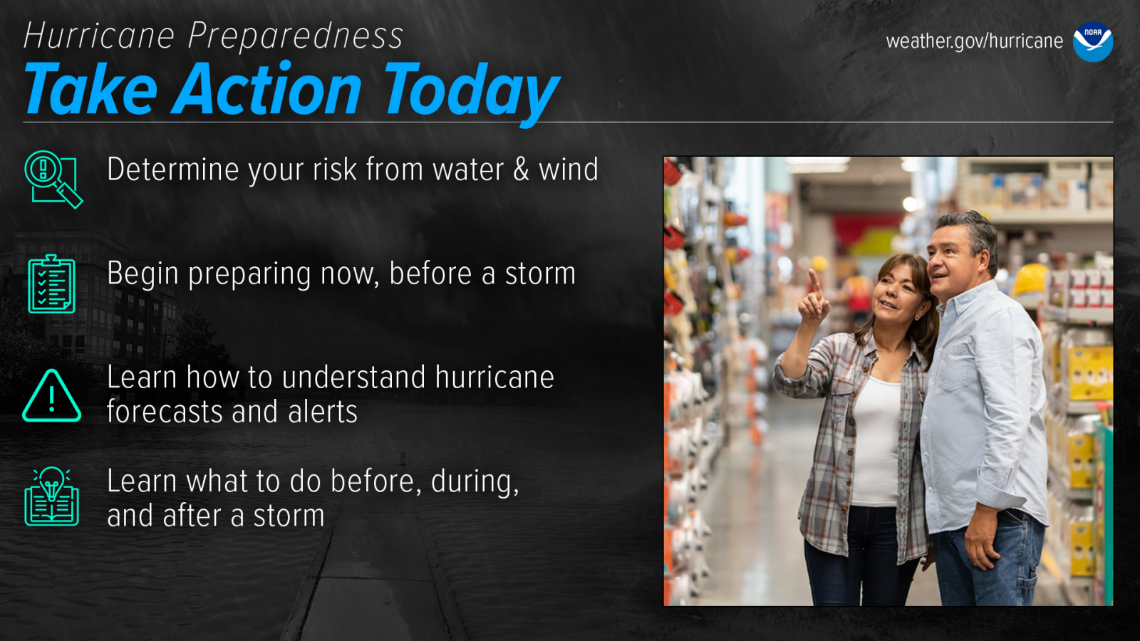
Are you ready for hurricane season? Take action TODAY to be better prepared for when the worst happens. Understand your risk from hurricanes, and begin pre-season preparations now. Make sure you understand how to interpret forecasts and alerts, and know what to do before, during, and after a storm. Even if you are already well-prepared and knowledgeable, there may be additional things you could do or learn to be even more prepared. Learn more at noaa.gov/take-action-today.
Find NHC and the Hurricane Hunters Online!
| NHC on Social Media | ||
| X | ||
| YouTube | Wordpress Blog | |
Northern Gulf Coast Preparedness Resources
| Find Us On Social Media | |
| X | |
| YouTube | |
.png)
| Sarasota-Bradenton, FL | Lake Charles, LA |
| Monday, May 4th | Wednesday, May 6th |

